Contributory members are able to log private notes and comments about each site
Sites Anne T has logged. View this log as a table or view the most recent logs from everyone
Hethpool Stone Circles
Trip No.45 Entry No.1 Date Added: 14th Sep 2017
Site Type: Stone Circle
Country: England (Northumberland)
Visited: Yes on 12th Sep 2017. My rating: Condition 3 Ambience 5 Access 5
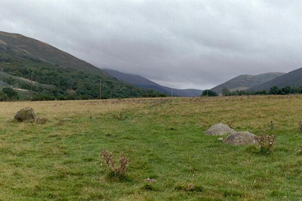
Hethpool Stone Circles submitted by Andy B on 27th Feb 2003. Part of the Burnham family trip to Northumberland, August 2002
(View photo, vote or add a comment)
Log Text: Hethpool Stone Circles, College Valley: We needed to be up really early this morning, but completed what we needed to do by 9am. As there were high winds and rain forecast for this evening/tonight and for the next few days, husband suggested we make the most of the good weather and go up to College Valley. He organised a pass from Saville’s in Wooler (we were one of 8 cars today – usually there are only 1 or 2 the receptionist said).
The last time we were here was over 15 years ago, in the days when I didn’t have a camera, and whilst we saw the stone circle and Little Heatha Fort, didn’t have any evidence of our trip.
Considering this is marked on the map as a (singular) stone circle, it immediately looked (to me) as if there two side-by-side circles – the stones weren’t in one simple circle and they were too widespread. We climbed up to the telegraph pole up the hill to try and get a better look at the circle, but it was still too spread out (and many of the stones too low to the ground) to photograph well.
Given that the small car park at the entrance to the valley was pretty full, and we saw long crocodiles of walkers, we seemed to be the only people interested in the stone circle, which was surprising.
Southernknowe (College Valley)
Trip No.45 Entry No.2 Date Added: 14th Sep 2017
Site Type: Ancient Village or Settlement
Country: England (Northumberland)
Visited: Yes on 12th Sep 2017. My rating: Condition 2 Ambience 4 Access 5
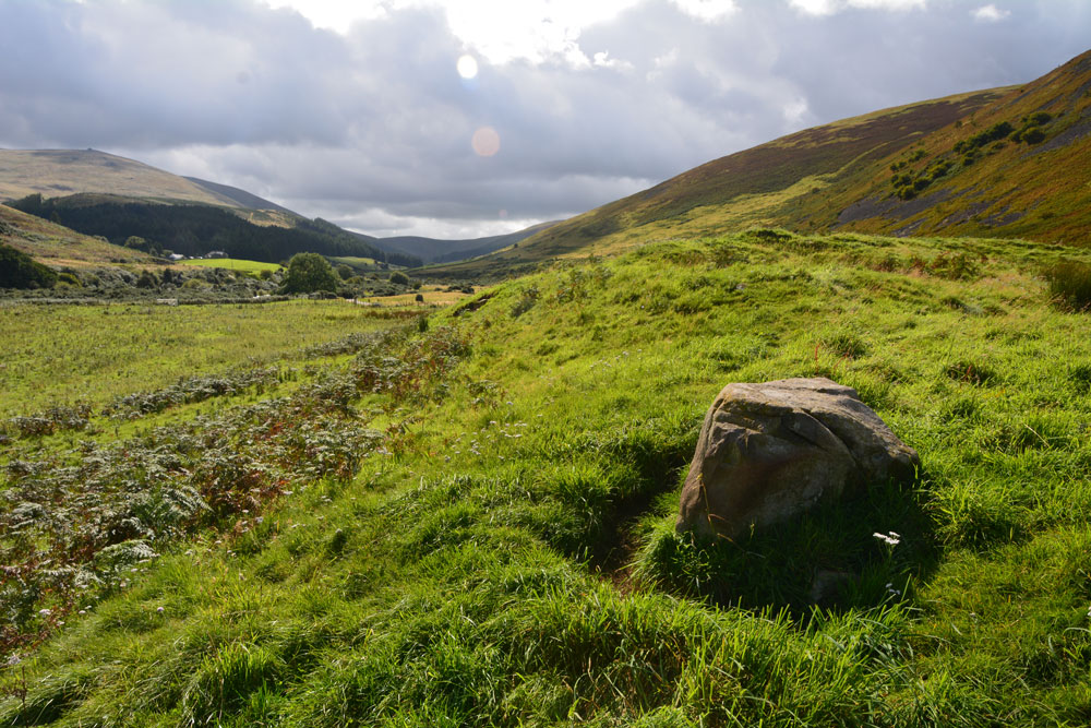
Southernknowe (College Valley) submitted by Anne T on 14th Sep 2017. Standing along the south eastern bank of the settlement, with College Burn to the right hand side in the dip. This large boulder rises up out of the bank. Beyond it, just down the slope, erosion has exposed boulder clay. At this point, the bank is steepest and looks like the settlement has been built on an old river terrace.
(View photo, vote or add a comment)
Log Text: Southernknowe RB Settlement, College Valley: Never having been down so far south in College Valley before, I was fascinated by how beautiful the scenery was, and how many people live here. We saw the sign posts for ‘Wedding This Way’ from Hethpool onwards, and came to the tiny, very white Cuddystone Hall, tucked just behind a small wooded area. Parking on the grassy area with a couple of other cars just north of the hall, we took up the invitation on the College Valley History web page to explore the earthwork remains of the settlement ‘dating from the Roman Iron Age times.’
Just before the road junction and the Airmen’s Memorial (Cheviot Memorial) there is a gate into the field. Letting ourselves in, we wandered round and through this scooped settlement nestled on the west bank of the College Burn, with its scooped hut circles and courtyards. The hut circles were more obvious in the northern (smaller) courtyard. The bank to the south eastern side was steep, dropping down to College Burn. Just past a large boulder on the south eastern bank, erosion left boulder clay clearly visible.
On the hillside to the south west there is another enclosure marked on the OS map, higher up the slopes of Blackhaggs Rigg. We planned to call back here later in the day.
Coldburn (College Valley)
Trip No.45 Entry No.3 Date Added: 14th Sep 2017
Site Type: Ancient Village or Settlement
Country: England (Northumberland)
Visited: Yes on 12th Sep 2017. My rating: Condition 2 Ambience 4 Access 4

Coldburn (College Valley) submitted by Anne T on 14th Sep 2017. Having clambered up the steep(ish) hillside until the land levelled off, this is our first glimpse of the Coldburn Settlement from the north west.
(View photo, vote or add a comment)
Log Text: Coldburn Settlement (College Valley): After visiting the Southernknowe Settlement, the road splits into two. We took the eastern road at this point, travelling over Sutherland Bridge. There is a sign which says to beware as the road is not in very good condition, which is right! It is very narrow and has great potholes in parts.
We managed to pull off the road where a small layby had been created with lots of broken tarmac and stones. From this point, to the west of the settlement, we clambered up the somewhat steep-ish hillside, to where the land levelled off. Heading east, the scoop of the settlement came into view.
There are no obvious internal features within this settlement, but there are certainly views in three directions, with the steep slope of Coldburn Hill on the fourth.
The scoop is deepest to the north of the oval, and there appears to be two terraces cut into the hillside above.
Once in the settlement, we discovered a track cut into the bank of the settlement leading down to Coldburn Farm, so there was a much easier way of accessing this site!
Mounthooly (College Valley)
Trip No.45 Entry No.6 Date Added: 15th Sep 2017
Site Type: Ancient Village or Settlement
Country: England (Northumberland)
Visited: Yes on 12th Sep 2017. My rating: Condition 2 Ambience 4 Access 4

Mounthooly (College Valley) submitted by Anne T on 15th Sep 2017. First view of the Mounthooly Romano-British Enclosed Scooped Settlement from the sheep pens by the footpath.
(View photo, vote or add a comment)
Log Text: Mounthooly Enclosed Scooped Settlement, College Valley: We drove down the road as far as we could go, nearly at Mounthooly Farm and International Hostelry, and there was a big sign saying ‘no cars past this point’. There were two other cars parked on the grass verge, but no signs of other people.
The road had been gated at Fleehope farm, where they were taking out the whole of the forest by Fleehope Burn, to the west of the farmhouse, and there were huge piles of logs and heavy machinery. Whoever had parked the Land Rover on about a 45 degree slope near the forest had to be congratulated for an epic display of 4 wheel driving!
We walked along the track past Mounthooly Farm and the Hostelry (which has a clean toilet block!), past the narrow strip of forest and found the footpath making its way through the sheep pens, through the field, by a hide. Immediately after coming through the sheep folds, the scoop of the settlement came into view.
Standing towards the western end of the settlement, the scoop is cut deep into the hillside and it seemed to loom around 5+ metres above me, although both Pastscape and Historic England say it’s only 3 metres.
The farmer has been using this area as a dump, and there were no end of empty plastic feed supplement bags and bottles.
There was a clear, wide ditch to the west and south of the settlement; it’s northern end had been cut by the forestry plantation and fence.
My eye was drawn across to the eastern side of College Burn, and a large light coloured boulder. When we got home, it turned out that there was another larger settlement, field systems and cairnfields to the east of the burn. There was also another settlement to the south east of the field, but there was a very large herd of bullocks gathered, so we opted out on this occasion.
What a fascinating area. Needs much more investigation.
Bolam Round Cairn (Northumberland)
Trip No.61 Entry No.1 Date Added: 27th Nov 2017
Site Type: Round Cairn
Country: England (Northumberland)
Visited: Yes on 26th Nov 2017. My rating: Condition 2 Ambience 4 Access 4
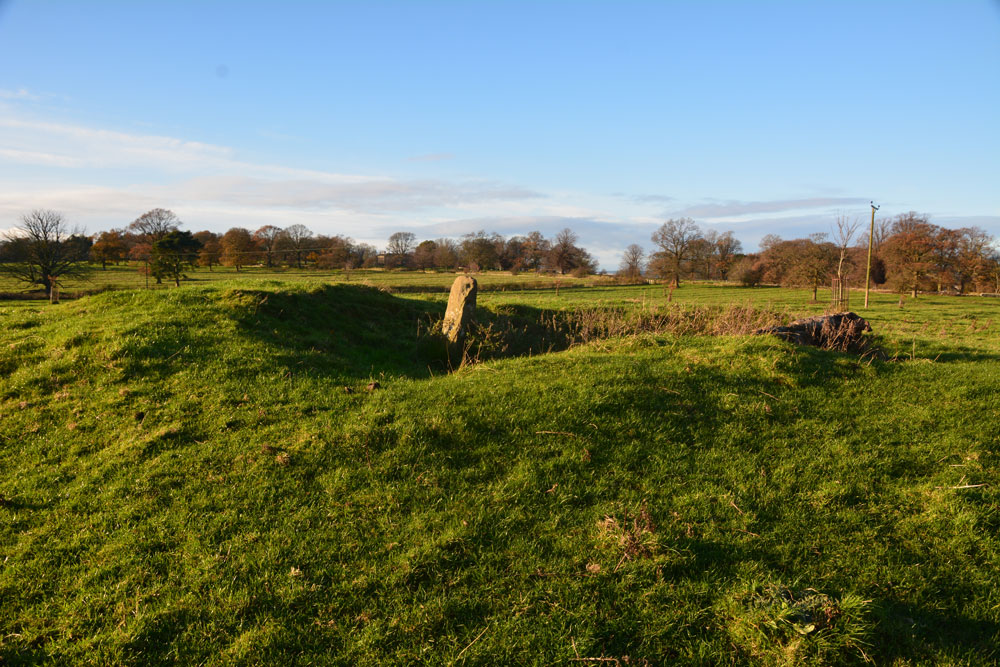
Bolam Round Cairn (Northumberland) submitted by Anne T on 26th Nov 2017. Approaching the cairn from the east-south-east. The old excavations have really removed the centre of the cairn. Was the stone part of the cairn, a gate post (as HE and Pastscape say) or a rubbing stone?
(View photo, vote or add a comment)
Log Text: Bolam Bronze Age Round Cairn, near Belsay, Northumberland: Although the sun was shining and the photos largely make this site look like we’ve seen it on a summer’s day, the temperature was 2 degrees C and removing my glove for a few minutes to take photographs made my normally very warm hands icy cold.
Walking along the footpath (which a notice at the field gate said was blocked at Foulmartlaw), the first thing we noticed was the very prominent ridge and furrow ploughing, which seemed to be the same in all the other fields around the estate.
Approaching the cairn from its eastern side, it seemed like a large bite had been taken out of the middle. A stone was standing in the middle of the ‘bite’. Pastscape and Historic England say this is a gatepost. BUT - if this was a gatepost, there was no evidence of a field system or boundary matching this. And where was it’s matching stone?
There was a second stone at NZ 09356 82201, some 50 metres away, which was lying with its base in a hollow with some packing stones, which indicated it had stood upright at some point. It is not mentioned on either Pastscape or Historic England entries.
A third, smaller boulder, poked its way out of the ground half way between the cairn and this stone. I photographed it just in case it was associated with the cairn.
Belsay Tower Cross (Northumberland)
Trip No.60 Entry No.2 Date Added: 27th Nov 2017
Site Type: Ancient Cross
Country: England (Northumberland)
Visited: Yes. My rating: Condition 3 Ambience 3 Access 4

Belsay Tower Cross (Northumberland) submitted by Anne T on 27th Nov 2017. The cross as seen from its eastern side, with Belsay Castle in the background.
(View photo, vote or add a comment)
Log Text: Belsay Tower Cross, Northumberland: Passing Belsay on the way back from the Bolam Cairn, we decided to try and trace the cross marked on the OS map. Although we’ve been here before, we’d not tried to look for this, as we largely had our small grand daughter with us.
The cross is located (on the map) very close to the Castle, so we walked through the grounds, having received a stern reminder from one of the staff members, that we had to vacate the car park by 4pm, but became thoroughly disorientated. Husband, Andrew, got his compass out and we decided that to reach the cross from the castle, we would have had to jump the ha-ha or scale a fence to get into a field to cross over to it.
In the end, we walked back through the Quarry Gardens to the private road which runs north from the gate at the bottom of the croquet lawn (where the paths from the Hall cross over to Quarry Gardens); after 100 metres it joins the road which runs east-west between the Hall and the Castle. Turning east along this, we walked for around 150 metres, then found a short trackway running through a sparse wooded area, into a field. Through the wooded area, we got our first sight of this cross.
It is on private land, but we took the chance of going through the gate and taking a quick look. It is within 200 metres of the castle, which is to the west, but the land is well fenced off.
In the end, it would have been easier to walk from the car park, past the estate cottages towards the castle, then take the first track on the north side of this minor road into the field with the cross.
It really reminded me of the Shitlington Cross, with its chamfered sides and missing top.
Mill Knock Chalybeate Well (Birtley)
Trip No.63 Entry No.2 Date Added: 8th Jan 2018
Site Type: Holy Well or Sacred Spring
Country: England (Northumberland)
Visited: Yes on 7th Jan 2018. My rating: Condition 3 Ambience 4 Access 5
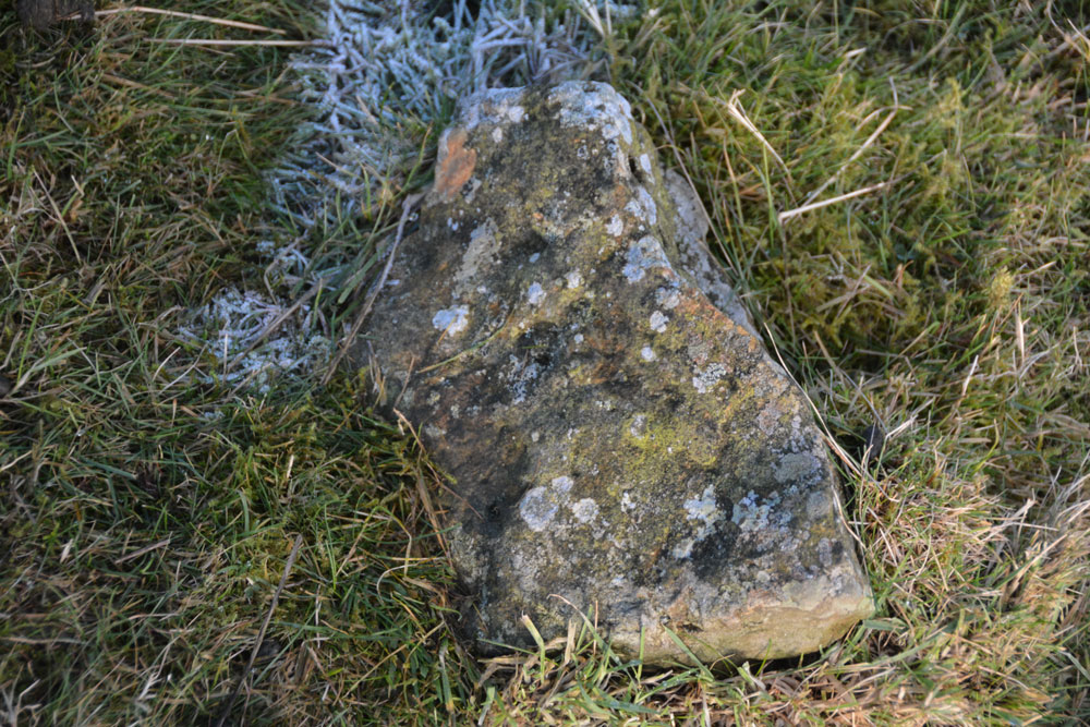
Mill Knock Chalybeate Well (Birtley) submitted by Anne T on 8th Jan 2018. is it my imagination (probably!) but as the sun shone on this stone by my feet, it looked as if there were 3 narrow, partial rings. For a moment I got quite excited at the possibility of a new rock art find, but the sun went in, and I thought 'no'. Curious to see what others think??
(View photo, vote or add a comment)
Log Text: Mill Knock Holy Well: The skies may have been blue and tempting to put on walking boots, but the temperatures were just on freezing and the minor roads around here were just like skating rinks! This well is not marked on the map, but my husband had come across an article on it, and being not too far from our house, decided to drive out to visit.
This is a glorious location (well, if you ignore the quarry). Access into the well field is a bit tricky, as there is no gate near the gorge formed by the gushing spring, but a bit of wooden fence allowed us to hop over to get a closer look.
On the eastern side of the road, the Holywell Burn is just a trickle - like a shallow ditch, but crossing the single track road and looking west over the stone wall, there is a strong gush of clear water which comes tumbling out of the hillside.
From a distance, it looks as if the water comes directly from the face of the large stone which is visible at the head of the gorge, but in fact the water is channelled from the stone wall past the western face of the stone.
Whilst I was waiting at the wooden fence for my husband to do a 'reccy' of the field to see if it was safe to go and look, I glanced down at my feet and what looked like narrow, but well worn rings, shone up at me from a portable stone that looked like it had fallen out of the wall. I photographed it, but am not convinced. However, for a moment, it did look like a new rock art discovery and I was quite excited!
This is another complex landscape, but mixed with lots of rock outcrops, so it was difficult to comprehend exactly what we were seeing until we came back home and looked up the official records on Pastscape (HE had nothing). A site to revisit during warmer weather.
Carry House Enclosure (Birtley Shields)
Trip No.63 Entry No.3 Date Added: 10th Jan 2018
Site Type: Ancient Village or Settlement
Country: England (Northumberland)
Visited: Yes on 7th Jan 2018. My rating: Condition 2 Ambience 4 Access 5
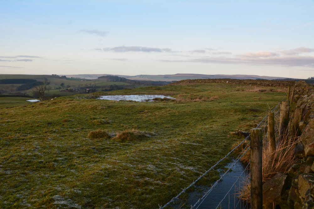
Carry House Enclosure (Birtley Shields) submitted by Anne T on 10th Jan 2018. Leaning right over the stone wall at the east of the settlement, looking northwards over the hut circle(s) trying to locate the cairn mentioned in Pastscape.
(View photo, vote or add a comment)
Log Text: Carry House Settlement, Birtley Shields: Cut by two stone walls and ploughed away at its northern end, but this was a stunning spot, tucked below a hill and with a steep slope down to the River North Tyne Valley below.
In the distance I could hear the farmer on his tractor running animal feed to his Blackies. I said to my husband, "He's going to come over." Five minutes later he drove up on his quad bike and engaged us in conversation, telling how this block of land belonged to the Duke of Northumberland "who didn't like visitors and didn't want them taking photographs" ("What, even though its marked on the OS map and its next to a public highway? Why are there no notices telling us this?" I think he was just winding me up!). Anyway, he was very pleasant and told us about his farm and a brief history of the area.
As the farmer was around, we stuck to walking up to the wall and along the track to take photographs. Shame, as I would have nipped through the gate to look for the cairn.
Mill Knock Settlement (Birtley)
Trip No.63 Entry No.1 Date Added: 10th Jan 2018
Site Type: Ancient Village or Settlement
Country: England (Northumberland)
Visited: Yes on 7th Jan 2018. My rating: Condition 2 Ambience 3 Access 5
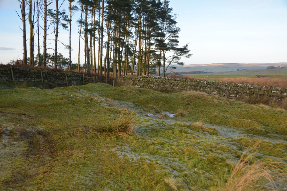
Mill Knock Settlement (Birtley) submitted by Anne T on 9th Jan 2018. Standing in the middle of the settlement, looking at the banks to the north and west (the quarry, which looks as if it has recently been reopened, is behind the trees).
(View photo, vote or add a comment)
Log Text: Mill Knock Enclosure, Birtley: We didn't realise this settlement was here until we pulled up at the quarry entrance and I studied the OS map more closely. At first, it looked like just outcrops of limestone rock, but as I walked up the gentle slope, the outer banks and ditches became more obvious.
The northern part of the enclosure looked as if it had been used for small scale limestone quarrying, although the outer bank and ditches were relatively in tact.
The Holywell Burn runs past the eastern side of the enclosure - just a waterlogged ditch lined by reeds at this point. The eastern side of the site looks as if it had been ploughed or quarried away.
With all the rock outcrops in the area I spent some time looking for cup marks, but found none.
Millstone Burn Standing Stone
Trip No.67 Entry No.4 Date Added: 20th Mar 2018
Site Type: Standing Stone (Menhir)
Country: England (Northumberland)
Visited: Yes on 21st Feb 2018. My rating: Condition 3 Ambience 4 Access 4
Millstone Burn Standing Stone submitted by SolarMegalith on 18th Nov 2013. Millstone burn standing stone - general view (photo taken on November 2013).
(View photo, vote or add a comment)
Log Text: Millstone Burn Standing Stone, Longframlington: After having seen the cross base and some of the rock art on the western side of the road, we crossed the A697 and let ourselves into the field on the eastern side of the road, which is also Open Access land. It was a good job we had a GPS, as there were plenty of other upright and earthfast boulders in this field.
My attention was first caught by what looked like an old hollow way, travelling eastwards across the field, ending in a gorse-covered hollow with a large grey stone within. Judging by the mound of rubbish around here, it looks like a local picnic spot, which was a shame. After having photographed this large, grey stone, I made my way to where my husband was standing by the standing stone, where the ground starts to slope down towards the burn. "Is that really a standing stone?" was my first question, as there were so many other boulders in the field. "Come and look", he replied.
This is a really odd shaped stone, strangely reminiscent of the larger stone at Simonburn/Davy's Lee stone circle, with a 'seat' in its edge. The eastern face of this rock is champfered towards its base, the sloping rock disappearing into the turf.
The 'cup' and 'grooves' at first sight looked like very deep cups and weathered grooves. I remember two different archaeologists at our Davy's Lee and Edges Green surveys telling me similar features were more likely to be solution holes (the rock being dissolved slowly over the years as acidic water accumulates in natural depressions); similarly water channels are formed and widen through natural water action. I would like to think these might have started off as cups and grooves - more romantic, somehow. Pastscape does describe this as "not a typical standing stone" and it is recorded as ERA-558. The ERA record also notes that the path I followed down to the erratic and field boundary "is the line of an old track way, marked by hollow-ways, heading from Millstone Burn onto Longframlington Moor."
Millstone Burn 2c
Trip No.67 Entry No.1 Date Added: 23rd Feb 2018
Site Type: Rock Art
Country: England (Northumberland)
Visited: Yes on 21st Feb 2018. My rating: Condition 3 Ambience 4 Access 4
Millstone Burn 2c submitted by SolarMegalith on 2nd Feb 2013. Cup-marks on Millstone Burn 2c at night (photo taken on January 2013).
(View photo, vote or add a comment)
Log Text: Millstone Burn 2a, Longframlington: Making the most of a bright, sunny day, before the 'Polar Vortex' was supposed to hit the UK, we decided to go looking for the standing stone and the main rock here, before heading off to find Castle Hill Hillfort at nearby Callaly.
Parking alongside the very fast A697 was fun, but there was a small tarmacked area next to a gate and track at NU 11858 05078. As the gate hadn't been used in a long time, judging by the gorse growing around it, we decided to risk it and if the farmer needed access, we could run back to the car to move it.
Heading up the track, we passed a large square boulder standing on smaller stones, that looked like it had been quarried. 36 paces further west, right next to the track was a cup marked stone. I took the grid reference off the GPS and later identified it as Millstone Burn 2c from ERA.
The boulder was heavily covered in moss, but we could make out more cups running along the ridge, and some down its side. Not wanting to cause any damage or erosion, we left the moss, and headed up the slope to the main rock.
I'd spotted ranging poles in the field further to the south west, and a few cars parked nearby, but didn't spot anyone. What a place for rock art. A real treat, and for me really accessible. I could have spent several days here, and ear-marked it to come back to at a later date.
Millstone Burn 2h
Trip No.67 Entry No.3 Date Added: 24th Feb 2018
Site Type: Rock Art
Country: England (Northumberland)
Visited: Yes on 21st Feb 2018. My rating: Condition 3 Ambience 4 Access 4
Millstone Burn 2h submitted by SolarMegalith on 24th Nov 2012. Motifs in southern part of Millstone Burn 2h panel (photo taken on November 2012).
(View photo, vote or add a comment)
Log Text: Millstone Burn 2h, Longframlington: Walking down from the main outcrop, Millstone Burn 4a, back to the car, we had the grid reference for this stone, so decided to detour and find it. From the hollow way near the gate into the field by the A697, a small trackway heads north towards this grid reference. Following this for 150 metres, and having passed some larger, very smooth outcrops, we came upon this apparently unprepossessing stone. "Is that it?" I asked my husband, who, as usual, was a hundred metres of so ahead of me as he's a faster walker. "Yes, come closer and you'll see" was his reply.
As I came up to the stone, these remarkable motifs came into view. "Wow!" was my instinctive reaction.
Fortunately, we had strong sunlight which brought the motifs out beautifully, and I took around 50 or so photographs. Needing to move onto our next stop, we retraced our path to the car, but I wondered what made the carvers of this rock choose this small rock - it there more under the turf? There were much larger, more prominent outcrops around. Curious, but I expect I'll never know.
Knowing there is so much rock art up here, I'll need to study ERA and make another (at least day-long) trip. Brilliant!
Millstone Burn 4a
Trip No.67 Entry No.2 Date Added: 24th Feb 2018
Site Type: Rock Art
Country: England (Northumberland)
Visited: Yes on 21st Feb 2018. My rating: Condition 3 Ambience 5 Access 4
Millstone Burn 4a submitted by SolarMegalith on 18th Nov 2013. Millstone Burn 4a - cup-and-ring mark with a groove leading to another cup (photo taken on November 2013).
(View photo, vote or add a comment)
Log Text: Millstone Burn 4a, Longframlington: Following the hollow way up the hill (wellies or good walking boots were needed, as the ground was very boggy in parts), as we approached the fence at the top of the hill, this moss and grass covered outcrop looked like a large cairn at first sight. Following the fence line north for about 100 metres to the gate giving access into this field and stepping up onto the slope, the motifs immediately came into view.
Initially only having come here to see the cross base carved into the rock (not having done any research into this before I came) I was taken aback by the sheer number of the cups and cups and rings here.
With great views across the moors, I was reluctant to leave. Must come back here with ERA's sketch of the rock to appreciate it more fully. And see the rest of the rock art around here. Brilliant.
Callaly Castle Hillfort
Trip No.67 Entry No.5 Date Added: 20th Mar 2018
Site Type: Hillfort
Country: England (Northumberland)
Visited: Yes on 21st Feb 2018. My rating: Condition 2 Ambience 3 Access 3
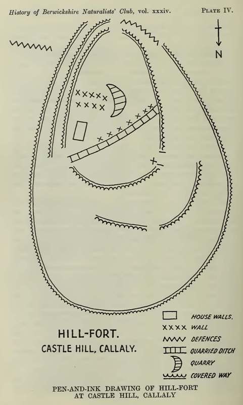
Callaly Castle Hillfort submitted by durhamnature on 10th Sep 2012. Callaly Castle hillfort, from Berwickshire Naturalists via archive.com.
(View photo, vote or add a comment)
Log Text: Castle Hill Hillfort, Callaly: After Millstone Burn Standing stone, there was time for one more visit before dusk. Andrew had marked this site on the map, so we drove round to the permissive footpath which led up through the deciduous wood to the top of the hill.
It was a very good job that we’d worn wellies, as the path was ankle deep in mud in parts. The site was so overgrown that we barely recognised the outer defences as we approached from the north west,
The interior of the hillfort was very rocky. Whilst the plan of the hillfort looks fascinating, much of it is hidden by the tall bracken and trees growing within and without. Some great fungi and a lovely walk, though.
Barcombe Hill Settlement
Trip No.70 Entry No.1 Date Added: 6th May 2018
Site Type: Ancient Village or Settlement
Country: England (Northumberland)
Visited: Yes on 5th May 2018. My rating: Condition 2 Ambience 4 Access 4
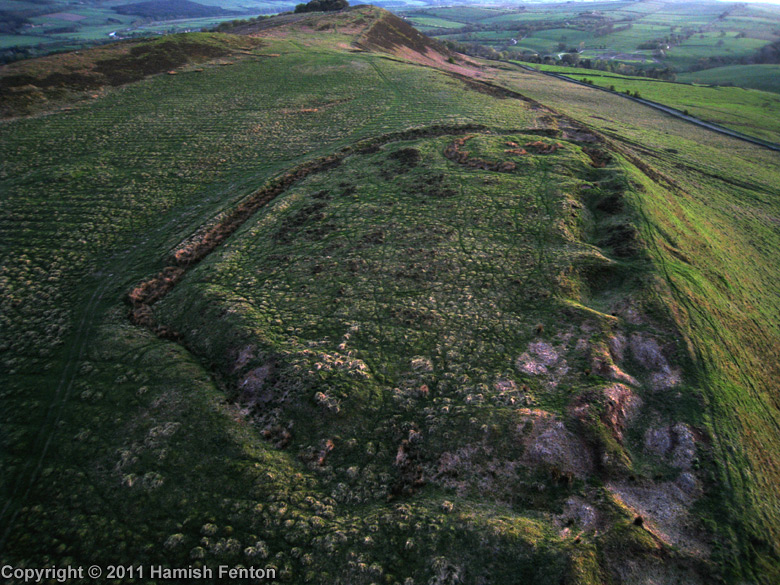
Barcombe Hill Settlement submitted by h_fenton on 22nd Jul 2011. Barcombe Hill Settlement viewed from the northeast with low evening light. The feature at the far end of the settlement is the Roman Signal Station
Kite Aerial Photograph
24 April 2011
(View photo, vote or add a comment)
Log Text: Barcombe Hill Iron Age Defended Settlement and Roman Signal Station: On a very hot bank holiday Saturday, we decided to try and go somewhere a little cooler, so set off towards Bardon Mill (OK, I was born to live in Scandanavia, not hotter climes). We'd previously tried to visit this site but used a route from nearer the Long Stone, on a day when dog races were taking place and there were lots and lots of people, plus when we approached the settlement, there was a huge bull and his ladies (we beat a hasty retreat).
Today we parked by the junction of Stanegate with the minor road running to Bardon Mill through Westend Village. A gate led us into the field and there was a mowed trackway leading up to the settlement (a note on the gate said the Open Access land was closed for the week before and a few days after our visit). We wandered over the settlement - the bank and ditch on the southern side is well preserved, but the northern edge has been quarried and there are some deep holes.
Making our way over to the Roman Signal station, I saw Andrew fall over in slow motion - his foot had gone down a hidden rabbit hole up to his knee. Once we'd spotted these holes, which were everywhere, we kept to the sheep tracks to avoid falling again.
After walking round the settlement, we made our way up to the Trig Point to get a view down.
Millstone Burn 4c
Trip No.71 Entry No.1 Date Added: 8th May 2018
Site Type: Rock Art
Country: England (Northumberland)
Visited: Yes on 7th May 2018. My rating: Condition 3 Ambience 4 Access 3
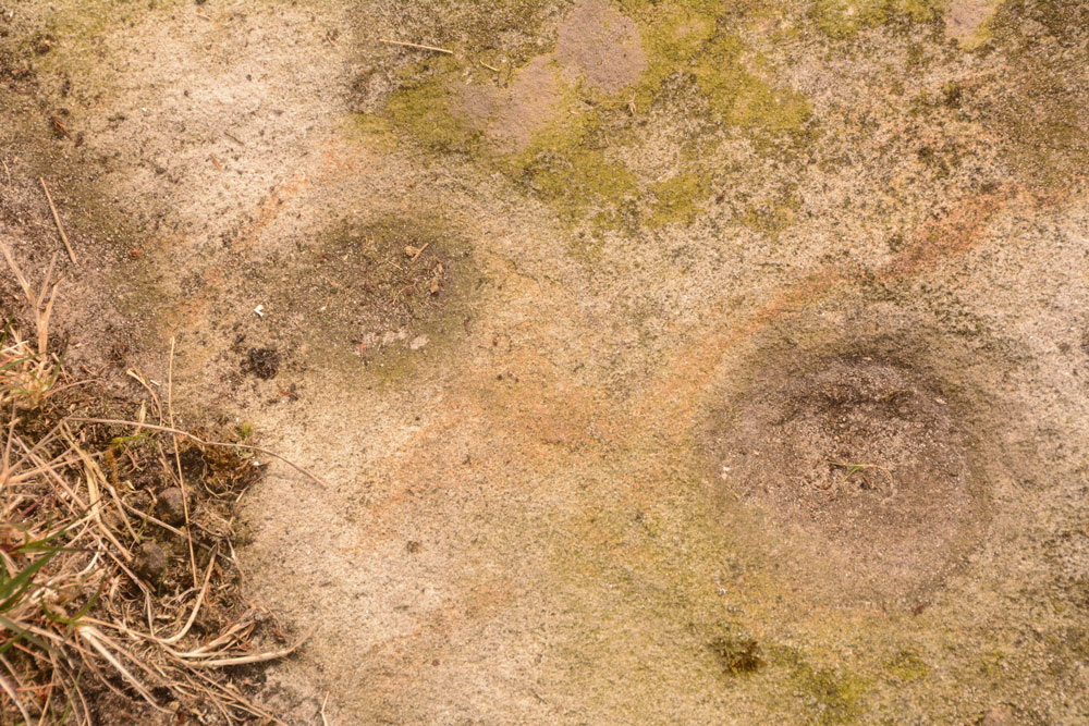
Millstone Burn 4c submitted by Anne T on 8th May 2018. Close up of the two cup marks, with some of the iron containing sandstone showing up red. These two cups appeared linked by a very faint groove, which could be felt with the finger tips.
(View photo, vote or add a comment)
Log Text: Millstone Burn 4c: It was so hot at home this morning that we decided to seek cooler climes. Husband had compiled a list of rock art panels that looked interesting and their grid references. After having found the gps, we set off for Longframlington, this time parking round the bend at a larger entrance to a slightly different field at NU 11525 05542. This meant walking through virtually knee high heather up to the top of the slope, but we found some paths had been mown through the heather. At the top of the hill, we had to clamber over a double barbed wire fence to get to the main outcrop (there wasn’t a gate for some way).
What we actually saw was Millstone Burn 4c at NU 11516 05169, part of the same outcrop as Millstone Burn 4a and 4b (thank heavens for GPS). Two cups were very obvious, together with some of the iron stone banding/staining. These two cups appeared to be joined by a very faint groove, which could be felt with the fingertips. Much of the rest of the panel was under turf, which we left undisturbed to protect the rock art underneath.
Millstone Burn 2e
Trip No.71 Entry No.5 Date Added: 9th May 2018
Site Type: Rock Art
Country: England (Northumberland)
Visited: Yes on 7th May 2018. My rating: Condition 2 Ambience 3 Access 4
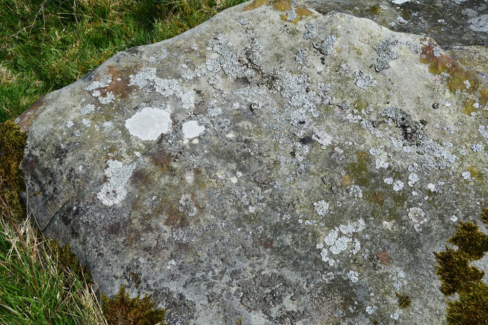
Millstone Burn 2e submitted by Anne T on 9th May 2018. In typical Tate fashion, we didn't remember to take any water along to try and highlight the motifs. We did struggle to find them!
(View photo, vote or add a comment)
Log Text: Millstone Burn 2e: This rock is not far upslope from Millstone Burn 2dd and 2d. Again, without GPS we would have struggled to find this rock, and we did struggle to identify any of the motifs - Beckensall described these as two ringed cups and two other cups, one with a natural groove leading to it and a pecked groove leading away from the ring. By the time of the NADRAP survey, they recorded a cup and very thin ring with groove running to the northern edge of the outcrop.
This stone was very interesting as downslope it had a step in it, and not only was there a channel wearing, but there were green water stains from where rain water had trickled down the slight slope of the rock downhill.
These motifs must have been placed to have been seen as you were coming down or up the slope.
St Hilda's Church (Lucker)
Trip No.75 Entry No.1 Date Added: 21st May 2018
Site Type: Ancient Cross
Country: England (Northumberland)
Visited: Yes on 20th May 2018. My rating: Condition 2 Ambience 3 Access 4
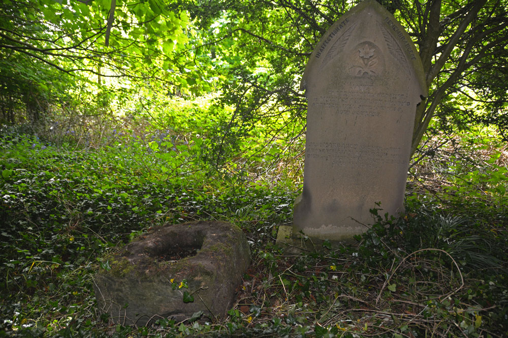
St Hilda's Church (Lucker) submitted by Anne T on 21st May 2018. The cross base is nestled under trees and brambles, next to the grave of a lady called "Janet". This part of the graveyard has been neglected over a number of years. We thought the church might have made more of their socket stone.
(View photo, vote or add a comment)
Log Text: Cross base, St. Hilda's Church, Lucker: We had a walk around the churchyard, but were unable to find a cross base amongst the gravestones. We wandered down as far as the river, Waren Burn, which flowed to the east of the church. Not finding anything, we wandered into the church. There was no guide book, but there were laminated sheets detailing the history of the church and St. Hilda, which I photographed.
Having found the cross base on Pastscape, with the grid reference, I was very reluctant to give up the search. It did indeed take some finding, as it was completely buried under ivy in a very overgrown section of the churchyard. Typically, not having the gps with us when we needed it, common sense said that the cross base should ideally be at the eastern end of the church at the highest point of land before it started to drop down to the river below. I had to clamber over brambles and force my way through trees to get to this part of the churchyard. The cross base was next to the grave of a lady called ‘Janet’.
Long Nanny
Trip No.75 Entry No.2 Date Added: 21st May 2018
Site Type: Standing Stone (Menhir)
Country: England (Northumberland)
Visited: Saw from a distance on 20th May 2018. My rating: Condition 3 Ambience 3 Access 4
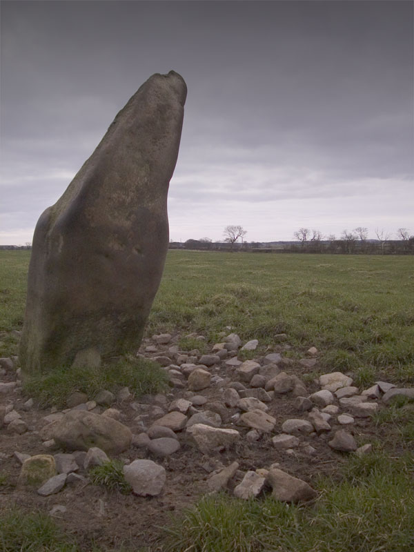
Long Nanny submitted by wayland on 31st Jan 2005. "Long Nanny" Close up showing rubble around base.
(View photo, vote or add a comment)
Log Text: Long Nanny Standing Stone, Tughall: On our way into Beadnell, on the B1340, husband Andrew screeched the car to a halt on the busy road, telling me there was a standing stone in the field that only had a couple of photographs on the Portal. We could only see this from a distance, as there were large cattle and a BIG bull in the field. I took a couple of photographs from the side of the road, although the stone was so far away, even resting the camera on the fence and the window ledge of the car, the shot was hazy.
Like wayland, I can’t find anything on Pastscape or Historic England. Intriguing. Need to go back and have a look when the bull and his ladies have been moved out of the field.
Tughall Chapel
Trip No.75 Entry No.3 Date Added: 22nd May 2018
Site Type: Ancient Cross
Country: England (Northumberland)
Visited: Yes on 20th May 2018. My rating: Condition 2 Ambience 4 Access 4
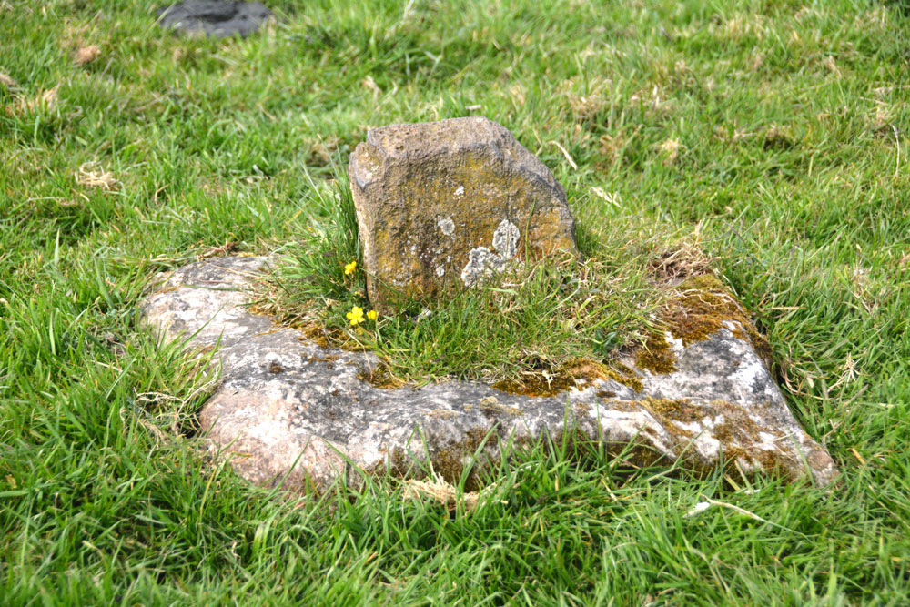
Tughall Chapel submitted by Anne T on 22nd May 2018. The socket stone and fragment of cross shaft from a different angle.
(View photo, vote or add a comment)
Log Text: Socket stone and cross shaft fragment, Tughall: Continuing along the busy B1340 from the Long Nanny standing stone, we turned right off the road towards Tughall Farm. There, the remains of the chapel stood above the road. We parked at a small layby just off the main road at NU 21427 26478, where there was a small gate into the field. This had been wired shut, so we walked round to the main gate at NU 21224 26486. There was absolutely no-one around to ask, and as the cattle were at the far end of the field, we let ourselves in.
The chapel is raised above the surrounding land. Only the tiniest bit of masonry remains (part of the apse, according to HE). The cross base is to the south of the chapel, almost next to what we initially thought might have been a hogback, but is only an old grave stone. I couldn’t see any writing on it.
The portion of cross shaft fragment remaining in the socket stone is very small and thin. I wonder what happened to the rest of it? [Note, this is on private land, but we didn't find anyone around in all the buildings on the farm to ask if we could take a look.]
Next stop, but not recorded on the Portal, was the lime kilns and harbour at Beadnell (too recent in time!)
