Contributory members are able to log private notes and comments about each site
Sites Anne T has logged. View this log as a table or view the most recent logs from everyone
Jedburgh Rock Art
Date Added: 23rd May 2015
Site Type: Rock Art
Country: Scotland (Scottish Borders)
Visited: Visited (still working on) on 23rd May 2015
Log Text: Jedburgh Rock Art: We spotted this site page after our last visit to Jedburgh earlier this month, and having missed this piece of rock art first time round, we decided to stop when we next passed through to see if we could find it. Armed with SolarMegalith's grid reference, we went scouting, but were unable to find any rock or boulders in the vicinity.
I called up this page on my mobile phone and went into the visitor centre to ask if they knew anything about it. Neither of the guides knew anything about this at all, taking my phone to consult each other, and even double-checking the guide book to find out where the courtyard referred to in the earlier reference might be.
In the end, we all had to admit defeat on this occasion, but I'd be interested to find out if this piece of rock art has been moved to a local museum. Curious! I'd now love to found this stone and post a photograph.
Jedburgh Ancient Christian Stones
Date Added: 24th May 2015
Site Type: Ancient Cross
Country: Scotland (Scottish Borders)
Visited: Yes on 4th May 2015. My rating: Condition 3 Ambience 4 Access 5
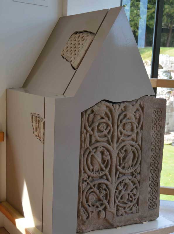
Jedburgh Ancient Christian Stones submitted by Anne T on 8th May 2015. The impressive 8th century shrine with its intricate carvings, displayed on the first floor of the Visitor Centre adjacent to the Jedburgh Comb.
(View photo, vote or add a comment)
Log Text: Jedburgh Early Christian Stones: We've driven past Jedburgh, with the Abbey looming high on the hill to our left, on many an occasion but never stopped to take a closer look.
Turning left into Jedburgh, we were surprised to find that not only was the parking free, but there was free Wi-Fi throughout the town (although the password to connect varies as to the cafe/facility you are using at the time).
Paying the fee to get into the Abbey, we entered the Visitor Centre, and was astonished (and pleased) to find Anglo-Saxon cross fragments displayed on the walls of the stairwell and also on the first floor. These hadn't been mentioned on their website, and were definitely a nice bonus.
Having photographed the early Christian stones (including the wonderful 8th century shrine fragments) we made our way into the Abbey. I love looking at old monasteries and churches and really enjoyed our time here. It was sunny and warm, and we amused ourselves for a little while by trying to re-create a couple of the photographs in the guide book (almost, but not quite - I'm not that talented!).
No refreshments in the Abbey/Visitor Centre but a string of nice cafes opposite.
I would like to come back when the various museums are open. There is a lot to see in and around the town.
We cut the visit reasonably short as we wanted to head out into the hills to look at Standing Stones not too far away.
Would definitely recommend a visit.
Jarrow
Date Added: 22nd Jun 2015
Site Type: Ancient Cross
Country: England (Tyne and Wear)
Visited: Yes on 10th Jun 2015. My rating: Condition 3 Ambience 4 Access 5
Jarrow submitted by Thorgrim on 25th Oct 2004. Cross fragments
(View photo, vote or add a comment)
Log Text: Anglo Saxon Fragments, St Paul's Church and St Bede's Monastery, Jarrow: We parked at Bede’s World (a couple of hundred yards away from the church and the monastery) and having decided to start off at St Paul’s Church, we followed (or tried to follow) the signs, which took us across the busy main road to another car park. All the paths seemed to lead into the middle of no-where. After 10 minutes wandering around in circles with granddaughter in pushchair, I finally went inside to ask. The girls at the Bede’s World reception had to go and ask. “It’s straight through the park”, they told me. All the posters up in the reception area said the church was open until 15:30 so we thought we had plenty of time.
Not being able to get the pushchair down the ramp into the park (too overgrown) we followed the pavement along the main road down to the church, where we had to manoeuvre round tree cutters to follow the path up to the west porch. We were greeted by the ruins of St Bede’s Monastery on our right hand side – such an ancient building incongruously topped by modern pylons rising up behind.
It turned out the church was only open until 3pm so we only had 10 minutes to go in, wander round, take photographs and try and appreciate the history of what we were seeing. A volunteer came up to us and I waved the Corpus of Anglo Saxon stone sculpture pages that I’d printed off and explained I was on a ‘treasure hunt for Anglo Saxon cross pieces’. Instead, we got drawn into the old monastery chapel for a guided tour. The rest of the church seems, and feels, pretty ordinary, but this old chapel, dating from AD681 with its dedication plaque above the entry arch, was very moody and special. The lady pointed out the two pieces of original Anglo-Saxon glass in the south windows.
It also turns out that the fragments are now in display cases, rather than being displayed in the porches, which made them incredibly difficult to photograph, as the light coming through the church windows reflected in the glass, as did the flash when I tried to use it. By this point, they were turning the lights off in the church to go home, although they very kindly let us stay an extra 10 minutes so I could photograph some of the artefacts. Definitely a second trip needed when there’s more time to wander round the old church and the ruins of the monastery outside.
Irton Cross
Date Added: 27th Oct 2014
Site Type: Ancient Cross
Country: England (Cumbria)
Visited: Yes on 24th Oct 2014. My rating: Condition 4 Ambience 4 Access 5
Irton Cross submitted by Thorgrim on 27th Mar 2004. In the churchyard at Irton is the ancient Irton Cross, which stands 10 feet high and was erected in the early 9th Century, before the Viking invasions. Pevsner declares that this is one of the most important crosses in Cumbria, and unlike the one at Gosforth, bears no figures either human or animal. It contains vine scrolls and rosettes of Irish origin.
(View photo, vote or add a comment)
Log Text: Ancient cross shaft, head and base, St Paul’s, Irto, Cumbria: This cross, apart from the Gosforth Cross, is perhaps the most complete of all those we saw during our day in this part of Cumbria. From the Ordnance Survey map, we weren’t sure if we could drive most of the way, or if we needed to walk some distance along a footpath, but with a school and a church marked in close proximity, we decided to drive as far as we could. From Gosforth, we drove down the A595 through Holmrook, then took a left hand turn onto a minor road, past Gubbergill. A left hand turn is signposted towards ‘church’ and we drove down a single lane road past what had been a school, then through the narrow stone gates to the church, where after a couple of hundred yards, the lane widens out into a reasonably large car park. As we came closer to the church, there were surprisingly spectacular views over Lake District, which loomed impressively gray and large in the near distance.
St. Paul’s church is surprisingly large for its remote location, and obviously well used.
We found this complete cross shaft, head and base in the churchyard south of the church rising high above us. Dating from the first half of the 9th century, the head is edged by fine double roll mouldings. I was fascinated by the head of the cross, which on its west face has a cabled circle enclosing five pellets arranged in a cruciform pattern.
The cross shaft, head and base are referenced as Irton 01. The ASCorpus notes told me that Irton 02, a 10th century cross head, is actually at Muncaster in the churchyard of St. Michael’s and All Angels, cemented onto a plinth in front of Muncaster 01.
Irthington Motte
Trip No.40 Entry No.3 Date Added: 24th Aug 2017
Site Type: Misc. Earthwork
Country: England (Cumbria)
Visited: Yes on 20th Aug 2017. My rating: Condition 2 Ambience 3 Access 5
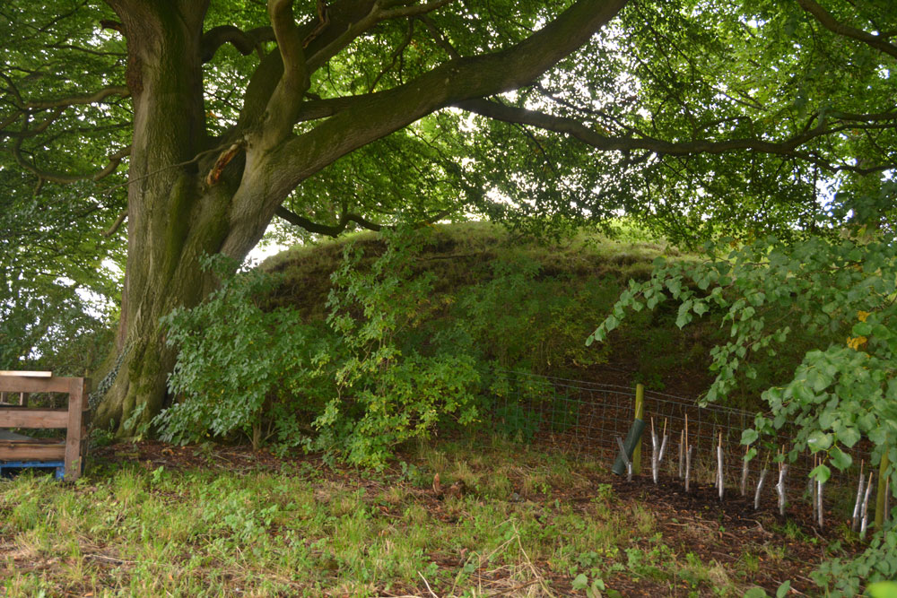
Irthington Motte submitted by Anne T on 24th Aug 2017. Leaning over the fence from the builder's yard, the oval of this earthwork was more obvious. I would have liked to have gone in to the yard for a closer look, but there was a lot of rubble, heavy equipment and a padlocked gate.
(View photo, vote or add a comment)
Log Text: Irthington Motte, Cumbria: We continued walking down the lane which leads to the River Irthing. At first, nothing appeared to stand out as a motte, then I realised that the mound behind the fence, sitting between the farm and the builder’s yard was actually the motte.
Walking down nearer to the entrance to the builder’s yard, the shrubbery was less intrusive and the oval shape of the motte became more apparent.
I would have liked to have gone into the builder’s yard but there was so much rubble, heavy equipment and a padlocked gate. No-one in the farm yard to ask, despite several cars being around.
Irthington Mill
Trip No.40 Entry No.4 Date Added: 25th Aug 2017
Site Type: Misc. Earthwork
Country: England (Cumbria)
Visited: Yes on 20th Aug 2017. My rating: Condition 2 Ambience 3 Access 5
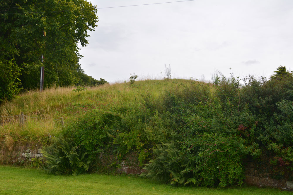
Irthington Mill submitted by Anne T on 25th Aug 2017. The 'motte' from near the driveway to Irthington Mill house. Fancy having part of your garden growing on such an old feature, especially if it is a motte!
(View photo, vote or add a comment)
Log Text: Irthington Mill 'motte or not?': Having spotted two mottes and a holy well just off the road we were travelling on to Carlisle, I asked to take a detour to find these. Whilst this is marked as a motte on the OS map, and certainly looked like one, I got home to find there is some debate about whether this is a motte or a natural feature (it is not recorded on Historic England’s listings).
Situated between a farm with some very old buildings and Irthington Mill house, with part of the Mill’s garden growing up its western slope, and not far from Irthington Bridge, it seemed to me that this motte was in a much more strategic defensible position near the modern day river crossing. Perhaps the course of the river moved over the years and the site of the motte was changed? This is me not wanting to belive its just a natural feature!
Iron Hill South
Date Added: 9th Sep 2014
Site Type: Stone Circle
Country: England (Cumbria)
Visited: Yes on 7th Sep 2014. My rating: Condition 3 Ambience 4 Access 4
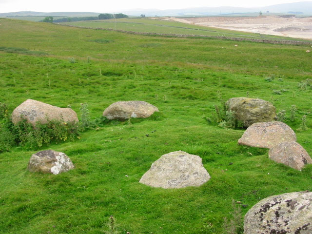
Iron Hill South submitted by stu on 16th Jul 2004. NY596 148.
The small, slightly odd circle of Iron Hill South.
(View photo, vote or add a comment)
Log Text: Iron Hill South Cairn/Stone Circle, near Oddendale, Cumbria: Just 50 metres south of Iron Hill North Cairn/Stone Circle there is another monument, not far from a limestone scar (small modern quarry or crag?). It can be easily seen from Iron Hill North.
Whilst we were looking at this monument, we could hear a party of walkers were coming down the hill towards us. With loud voices, one of the men was proclaiming ‘there’s a stone circle just over here’. Waving his GPS device as he approached us, we were quizzed about which was the cairn and which was the stone circle (both are marked as a cairn and a cairn circle on our OS map), then the walkers left without really taking a look. This amused me greatly, although I wished I had his GPS device.
I couldn’t make up my mind as to whether this was a cairn or another stone circle; instinct said ‘cairn circle’ as there was a grouping of stones in the centre.
After soaking in the atmosphere of this place, we left to go onto Oddendale hamlet, further south along the single track road, and effectively a dead end, to see Seal Howe cairn and the cairn circle nearby.
Iron Hill North
Date Added: 9th Sep 2014
Site Type: Stone Circle
Country: England (Cumbria)
Visited: Yes on 7th Sep 2014. My rating: Condition 3 Ambience 4 Access 4
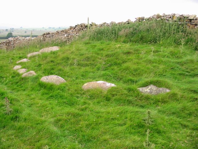
Iron Hill North submitted by stu on 21st Jul 2002. 596147 NE Lakes Sheet.
10 stones remain on one side of a wall.
First stone on right is limestone the rest granite, this is found also at the Gamelands circle, Gunnerkeld and Iron Hill south a few metres away.
(View photo, vote or add a comment)
Log Text: Iron Hill North Cairn/Stone Circle: From Castlehowe Scar Stone Circle, we drove down the single track road towards Hardendale Quarry, with Castlehouse Scar wood on our left hand side. Where the wood ends, the road turns a sharp left and right. Just where the road turns right, there is a marked footpath, walled on both sides, running uphill towards Harberwain Rigg. It is an easy walk despite the path being a little overgrown.
There is a cairn and a cairn circle marked on the Ordnance Survey map. At first all we could see was a limestone scar running to our right, then the first of the stones poked their heads above the grass in front of us, forming a semi-circle around slight mound against a stone wall above us. The stones shone pink in the bright sunlight. If I’m allowed to use the word, this was another ‘cute’ circle and I felt privileged to see it. In the background, the bright water of the lake at the bottom of Hardendale Quarry with its muddy gray ramps and walls contrasted sharply, horribly and incongruously with this wonderful little monument.
Out of interest, we walked a little way up the footpath to where it dissects another running northwards and peered over the gate to see the other side of the circle. I saw one stone peeping (just) above the grass, but couldn’t be sure it was part of the circle.
With a party of walkers making their way down hill towards us, we ventured south to find the other stone circle or cairn at Iron Hill South.
Ireby Old Church
Date Added: 9th May 2015
Site Type: Ancient Cross
Country: England (Cumbria)
Visited: Yes on 1st May 2015. My rating: Condition 3 Ambience 4 Access 4
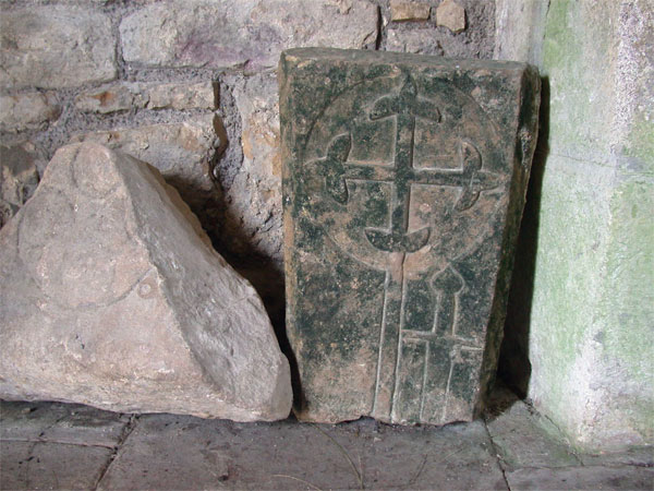
Ireby Old Church submitted by nicoladidsbury on 11th Feb 2005. Carvings inside the church
(View photo, vote or add a comment)
Log Text: Anglo Saxon Cross, Old Chancel, Ireby: Travelling from Bridekirk back towards Carlisle, we took the minor road through Torpenhow (couldn’t spot the pub marked on the map, which would have been a welcome stop at this time of day). Just leaving the village a sign told us the road wasn’t suitable for HGV’s – it was very narrow in parts but not that bad. Funny that the church, although in the care of the Churches Conservation Trust, wasn’t signposted, although it was easily visible across the field to our right hand side. We ended up turning right down the track to New Park farm and parked about 100 yards down on the right hand side at by a gate just past the stream called ‘Church Strand’.
With 5 month old granddaughter in arms (no chance of taking her pushchair) we opened the gate rather than climb over the stile, and walked across the little wooden footbridge over the stream and the 100 yards or so across the picturesque field to the church. Also funny that we had to navigate the paved drain to the south side of the church to enter at the west door as there wasn’t a footpath!
It was cold and damp inside the church, although the internal features more than made up for this. Just made up of the one room, rows of narrow wooden trestles (how uncomfortable to sit on during long sermons) lined either side of the aisle. A narrow table served as the altar. Windows in the south side of the church had been blocked up, although there was no sign of these in the external wall of the church. The pillars which had been relocated in the churchyard were odd and interesting, as was the incised tynpanum over the west door.
We searched for the various bits in the church. There was no church guide to bring away – we took photographs of the CCT sheet left for visitors to use.
As usual, I poked around the overgrown graveyard for unusual grave stones. We didn’t find the two cross bases mentioned in the Portal notes.
A very unusual little church, well worth the visit. I'm keen to revisit without infants and in the autumn when the grass and nettles will have died back so we might be able to find those cross bases.
At the time of writing the Corpus of Anglo Saxon Stone Sculpture website appears to be down so I haven’t been able to check any details of the crosses - I'm keen to find out more. [Note: I've since found this church is not included on their web-site].
Inveraray Castle
Trip No.86 Entry No.1 Date Added: 27th Jul 2018
Site Type: Standing Stone (Menhir)
Country: Scotland (Argyll)
Visited: Yes on 16th Jul 2018. My rating: Condition 3 Ambience 4 Access 5
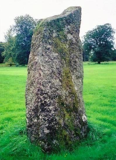
Inveraray Castle submitted by Bladup on 31st Dec 2013. Inveraray Castle standing stone.
(View photo, vote or add a comment)
Log Text: Inveraray Castle Standing Stone: On our way from our daughter’s house to Craignish peninsula (having had the trauma of catching their cat and taking her to the cattery first!) we decided to stop of in Invarary to see our first standing stone of this part of the trip. Mistake.
We arrived the day before the Highland Games at the castle started, so the town was heaving, both with coach tours of largely American tourists, and people attending the games. There was a large funfair on the grass by the harbour, which didn’t aid the flow of traffic through the town.
We managed to turn up the entrance into the castle, only Andrew had to stay in the car whilst I ran out onto the grassy show-ground area to take photographs of the stone. I chuckled to think what the delivery drivers and people putting up the marquees and stands must have thought of this woman running around the stone with a camera must have thought!
Inner Golden Pot (Otterburn)
Trip No.28 Entry No.2 Date Added: 29th May 2017
Site Type: Marker Stone
Country: England (Northumberland)
Visited: Yes on 28th May 2017. My rating: Condition -1 Ambience 4 Access 5
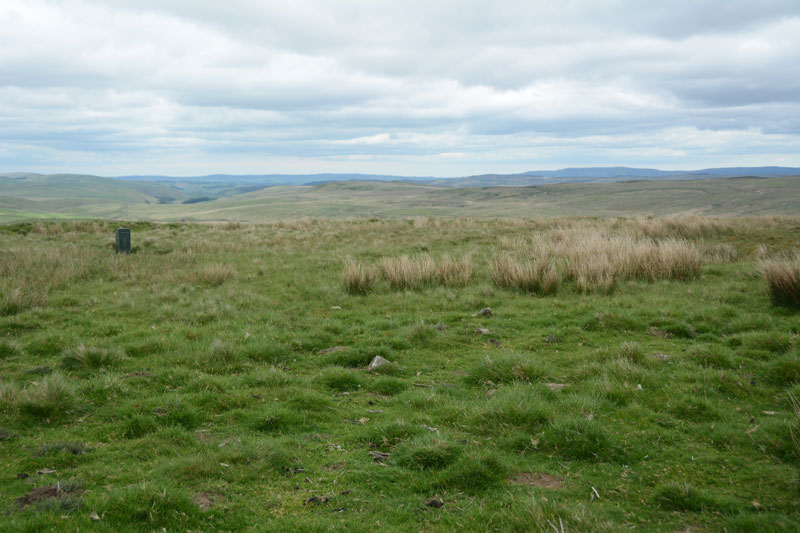
Inner Golden Pot (Otterburn) submitted by Anne T on 29th May 2017. At the site of the Inner Golden Pot there were only broken sandstone pieces and modern army equipment. I thought it was worth stopping to look to see if anything remained, especially as it was a nice viewpoint.
(View photo, vote or add a comment)
Log Text: Inner Golden Pot, Otterburn Ranges: No trace of this cross base can be found, but I couldn't resist having a look. There were some small sandstone pieces around the grid reference point, together with a funny green box - presumably some military equipment. A great viewpoint across to Upper Coquetdale.
Ings Well (Mickley)
Trip No.161 Entry No.7 Date Added: 9th Jun 2021
Site Type: Holy Well or Sacred Spring
Country: England (Yorkshire (West))
Visited: Yes on 31st May 2021. My rating: Condition 3 Ambience 4 Access 4
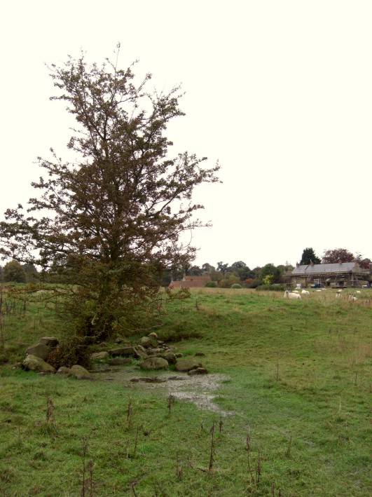
Ings Well (Mickley) submitted by jamesrattue on 23rd Oct 2008. Ings Well at Mickley, photographed 15th October 2008.
(View photo, vote or add a comment)
Log Text: Ings Well & Spring, Mickley (North Yorkshire): Our last stop of the day, and what a pretty site, with an easy walk down the Ripon Rowel Way from Mickley village. Note: there was a very rickety stile to cross as you entered the field at SE 25833 77052 (the top step was like a see-saw, although climbing the gate might have been easier!).
Sited under a lone hawthorn tree to the left hand side of the footpath, water flows freely out of the ground and spreads out into the field.
At SE 25954 77141 a large wooden post marks the location of a spring, the waters of which appear to flow south-east to north-west along a drainage channel. I wanted to investigate further, and also walk to another well (marked 'W' on the HE map search) at SE 26090 77149, but the field was far too wet and boggy and I was sinking up to my ankles in water. So wish I'd taken a pair of wellies!
Ingram Hill
Trip No.34 Entry No.1 Date Added: 21st Jul 2017
Site Type: Ancient Village or Settlement
Country: England (Northumberland)
Visited: Yes on 18th Jul 2017. My rating: Condition 2 Ambience 4 Access 4
Ingram Hill submitted by SolarMegalith on 18th Mar 2013. Course of the rampart in the eastern part of Ingram Hill settlement (photo taken on March 2013).
(View photo, vote or add a comment)
Log Text: Ingram Hill Settlement, Breamish Valley: Making the most of a warm, sunny day we set off to the Ingram in the Beamish Valley, not to walk the Hillfort Trail this time, but to look at some settlements marked on the OS map. Taking supposedly ‘the shortest route’ the roads were so twisty and windy that it took forever, and I ended up feeling travel sick for most of the afternoon.
I had forgotten how beautiful and calm this little valley is. There were a dozen or so cars parked on the grass by the river, with people picnicking. Passing the car park just outside Ingram, there was only one car – in Northumberland I expect to see more sheep than people on a day out. Setting off west out of Ingram, we parked just outside the village on a wide grass verge that people had obviously used before us. Walking the 100 metres or so to where the stony footpath climbed gently up to Turf Knowe, we had the old field boundary and modern wire fence to our left. Where the footpath meets the access land at the south western corner of the field, another permission footpath/stone covered track branched off to the south east towards Wether Hill. Typically, we didn’t use the path but tramped through the knee high grass and bracken, surprising the sheep who’d sought shade.
The circular banks of this settlement rose gently out of the turf. Some of the sheep were grazing on top. I walked all the way round the bank, which is 160 feet in diameter. There is a clear two roomed rectangular house on the interior northern bank, looking down to the River Breamish below.
Another circular feature, which I thought was a small roundhouse, was to be found towards the middle of the settlement. Pastscape says this is the remains of some shielings.
After taking a short break to make the most of the sunshine, we took the permissive path and headed up towards Haystack Hill.
Hyssop Holme Well (Carlisle)
Trip No.176 Entry No.1 Date Added: 6th Jun 2022
Site Type: Holy Well or Sacred Spring
Country: England (Cumbria)
Visited: Yes on 4th Jun 2022. My rating: Condition 4 Ambience 3 Access 4
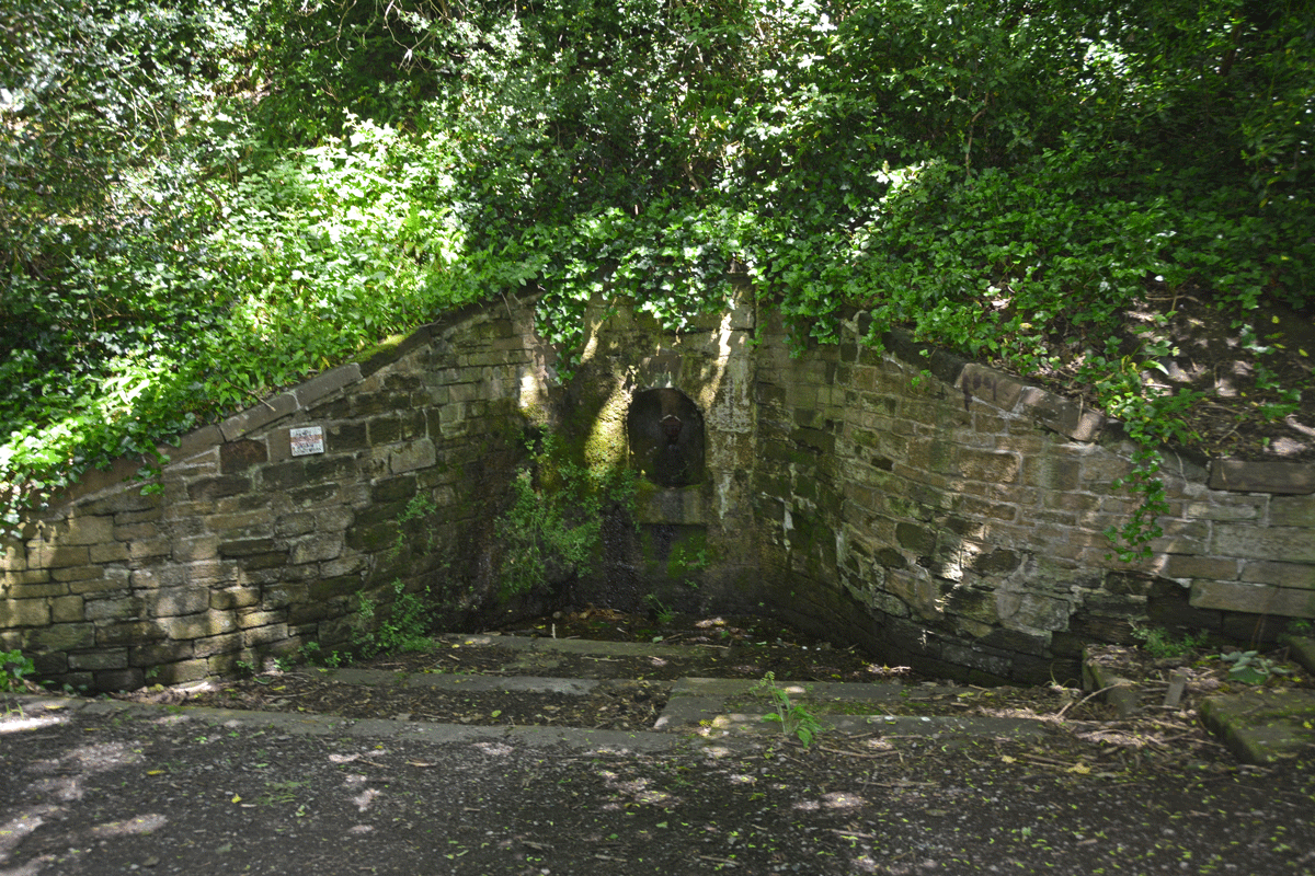
Hyssop Holme Well (Carlisle) submitted by Anne T on 5th Jun 2022. The well was in deep shade at the time of our visit. A slow, steady trickle of water emerged from the pipe at the back of the well, trickling down the moss into the small well basin, then out to modern drains to a small pond/water feature.
(View photo, vote or add a comment)
Log Text: Hyssop Holme Well (Carlisle): A very pleasant, short walk down slope to this well house, the sound of wood on willow from the nearby Cricket Ground accompanying our steps. Am trying to trace the Antiquarian history books which mention this site, as I'm trying to ascertain if the well predates the 1817 date on the keystone, and why the water was regarded as a spa in days gone by, and what properties the water had.
Hurl Stone
Date Added: 31st May 2017
Site Type: Standing Stone (Menhir)
Country: England (Northumberland)
Visited: Yes on 30th Aug 2014. My rating: Condition 2 Ambience 3 Access 4
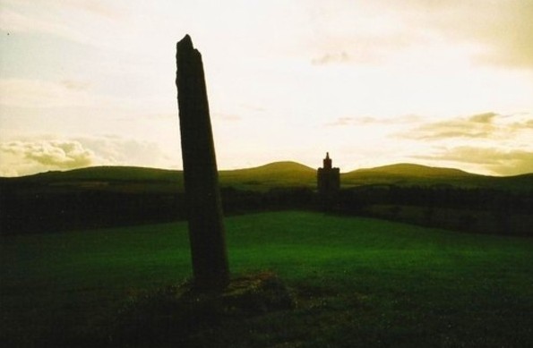
Hurl Stone submitted by Bladup on 30th Dec 2013. The Hurl stone, In the background is a folly built in 2000.
(View photo, vote or add a comment)
Log Text: The Hurl Stone, Newtown, Northumberland. Second visit: Saturday, 30th August 2014. Armed with a letter from the landowner allowing us access, we set off back to the Hurl Stone before the weather turned.
The farmer was busy herding sheep down the road to the field next to the Newtown Mill standing stone. He was using an army style buggy and 4 sheep dogs, which was fascinating in itself. Having watched this, we drove the 100 yards further up to farm at Newtown and bumped up onto the grass verge next to the gate leading into the Hurl Stone field.
It was a longer walk than it looked, through lush ankle high grass to the top of the slight hill. The tall Hurl Stone commandeered the horizon, but I was only about 20 yards away when I realised it had been concreted in. It looked as if at some time it had toppled and been recently re-erected (but if they’d done this, why let the stone lean, unless it was to give the impression it had indeed been hurled? Sorry, this is me being sceptical). This took a little of the shine off seeing the Hurl Stone, but my goodness, what a 360 degree view, which I’ve tried to represent in the photographs submitted to the Portal.
The face of the stone facing the recently built tower (I’m told this is used as a conference centre, but haven’t been able to verify this yet) looks as if it has broken at some time in the past. The quartz crystals within the stone sparkled in the sunlight. There was some, but not much, graffiti carved into it.
The landowner, who resides nearby, opens his gardens under the National Garden Scheme, and according to an archived article in the Hexham Courant, our local paper, has a 14th century chapel, a crusader tomb and two grave slabs belonging to Knights Templar, so I’ll be looking out for dates to go and see these other treasures.
I’m going to write to thank the landowner for allowing us access.
First visit, August 17th 2014: Driving down the road southwards past the hamlet of Newton, we at first only saw the recently built tower in the field to our right. Driving a little further on, we stopped at the standing stone on the opposite side of the road, just below Ewe Hill, to take photographs. When we turned the car and drove back up the road, the Hurl Stone appeared like a sharp needle, just below the top of the hill.
It’s proximity to the modern tower seems suspicious (we immediately asked ourselves if the stone had been moved to provide a good view of it from Liliburn Tower, the landowner’s house, as from the maps, the modern tower and the stone seem to be in direct alignment?).
There were no public footpaths to the stone, so I stopped at the field gateway and took a photograph. I have since written to the landowner to ask for permission to walk to the stone across the field.
Hunterian Museum
Trip No.145 Entry No.1 Date Added: 29th Aug 2019
Site Type: Museum
Country: Scotland (North Lanarkshire)
Visited: Yes on 21st Aug 2019. My rating: Condition 4 Ambience 3 Access 4
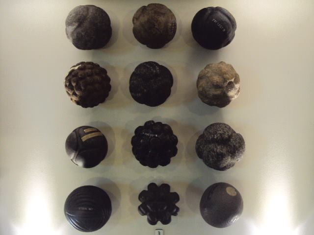
Hunterian Museum submitted by cosmic on 9th Jul 2013. The Hunterian Museum has one of the largest collections of carved stone balls in the country.
(View photo, vote or add a comment)
Log Text: Hunterian Museum: A (very) rainy day in Glasgow stopped us from going out on my 'well hunt', so we found our way to the Hunterian Museum, which I've always wanted to visit. The displays were nicely done, although the museum as a whole was a lot smaller than I anticipated.
I found the display on the Antonine Wall fascinating, along with some of the medical and scientific items on the first floor. At the time of our visit, the Royal College of Surgeon's building was closed (the website said until 2021, for redevelopment).
Unlike most museums, where you need to seek approval to post photographs, the Hunterian says: Photograph Policy: Our visitors are welcome to take photographs and video for personal, non-commercial use. We hope you will share them on your social networks! #hunterian (note: see their copyright statement on the line re works of art).
Note: the stone balls were not on display at the time of our visit.
Hunter's Tor Fort
Trip No.131 Entry No.6 Date Added: 4th Jun 2019
Site Type: Hillfort
Country: England (Devon)
Visited: Yes on 12th May 2019. My rating: Condition 2 Ambience 4 Access 3

Hunter's Tor Fort submitted by Creative Commons on 8th Feb 2012. The gorse bushes are on the degraded bank of the hilltop fort above the northern end of Lustleigh Cleave. Beyond the wall and gate can be seen Moretonhampstead.
Copyright Derek Harper and licensed for reuse under the Creative Commons Licence
(View photo, vote or add a comment)
Log Text: Hunter's Tor Iron Age Hillfort: A very pleasant walk from the end of the lane at SX 75702 83203, up a public bridlepath, the path cutting through a farmyard higher up the hill. Continuing up the hill, we eventually reached a long stone wall with a gate leading into the fort. At its northern end (SX 76043 82474) there was a large rocky outcrop with a balanced rock.
Most of the ramparts and banks, whilst ruined, are still visible, and there are glorious views over to the west from most of the hillfort.
To its south eastern side, there appear to be rows of stones/banks which might be the remains of old field systems.
Some of the outer banks are cut by a long dry stone wall on its eastern side; looking over these continue in the field behind. We let ourselves out of the gate into the fort at its north eastern side then let ourselves into the gate into the field to take a quick photo of the continuing banks.
There were lots of walkers and mountain bikers walking through the fort. Only one other couple we saw actually appeared to be looking for the features within the fort; others either sat and picnicked by the outcrop, or simply rode through.
Hunstanworth Moor south
Trip No.42 Entry No.3 Date Added: 29th Aug 2017
Site Type: Standing Stone (Menhir)
Country: England (County Durham)
Visited: Yes on 28th Aug 2017. My rating: Condition 3 Ambience 3 Access 5
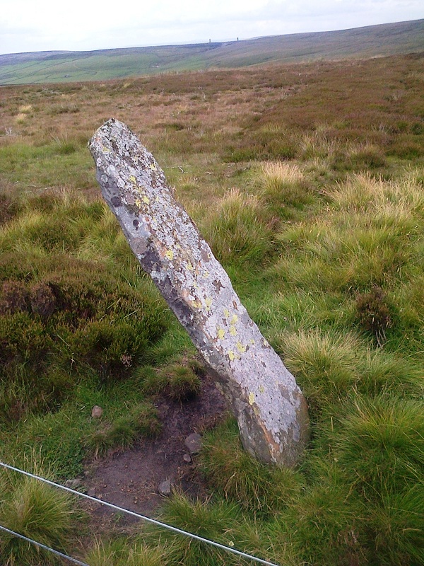
Hunstanworth Moor south submitted by HarperFox on 20th Jul 2014. This is the southernmost of the two roadside stones on the road between Townfield and Rookhope. The other is similar in shape and dimensions but upright.
(View photo, vote or add a comment)
Log Text: Hunstanworth Moor South, Near Townhead: This stone is marked on the OS Map as ‘stone’, and was easily found, although it seems like a tall boundary marker along the road from Townhead to Rookhope. As we drove along the road, we passed the northern boundary stone (see below), which isn’t marked on the map and was unexpected.
Haven’t been able to find out anything about these – not even a photograph on Geograph, as Andy Curtis has usually been out and about photographing all these places before us.
We backtracked to photograph the northern boundary stone on our way back to see the remains of the Edmundbyers Cross. I was impressed by all the now disused lead mining buildings and spoil heaps around here. It must have really busy in the not so distant past.
Hunstanworth Moor north
Trip No.42 Entry No.4 Date Added: 29th Aug 2017
Site Type: Standing Stone (Menhir)
Country: England (County Durham)
Visited: Yes on 28th Aug 2017. My rating: Condition 3 Ambience 3 Access 5

Hunstanworth Moor north submitted by HarperFox on 20th Jul 2014. This is the northernmost of the two stones.
(View photo, vote or add a comment)
Log Text: Hunstanworth Moor North, Townhead: Being the day of the Blanchland and Hunstanworth Show, this road was very busy, and it was difficult to stop as the road was narrow and there were no obvious lay-bys or pull-off points (there being a nice ditch at the western side of the road and a steep bank up to the field on the east).
Spotted this stone as we were passing by on the way to the stone approx. 575m south and retraced our steps to photograph it.
Again, after having done searches on the internet, not been able to find out anything about it, like it’s ‘partner’ further up the hill.
Howe Hill (Felixkirk)
Date Added: 29th Sep 2014
Site Type: Round Barrow(s)
Country: England (Yorkshire (North))
Visited: Yes on 26th Sep 2014. My rating: Condition 2 Ambience 4 Access 5
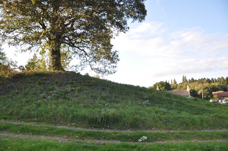
Howe Hill (Felixkirk) submitted by Anne T on 29th Sep 2014. Standing between the minor roads (leading north and north east from the base of the mound) and the metalled driveway, looking back towards the Carpenters Arms (the church is just off shot to the top right hand side).
(View photo, vote or add a comment)
Log Text: Howe Hill Round Barrow, Felixkirk: After having been to Pudding Pie Hill Round Barrow in Sowerby, we drove to the village of Felixkirk from the A170, up the first minor road leading north east. There is no doubt that Howe Hill is something ancient – but what? My initial impression, driving up the hill into the village was that it was a motte, but then it’s too small for a castle.
Howe Hill is immediately opposite the Carpenter’s Arms public house, which has a large car park, and the Howe Hill mound rises up above you. As it is topped by a very large tree, the mound seems to dominate everything around it (in a nice sort of way).
It is possible to sit outside the pub to have a meal and a drink and admire Howe Hill. It being now early evening and getting chilly, we sat inside and had a drink, looking out onto the mound, waiting for the angle of the sun to dip below the mound so I could get some photographs.
However – the monument has sort of been developed around in a somewhat insensitive manner - someone’s driveway (the Old Vicarage? Now up for sale) up its left hand side (facing from the pub), also someone has used the southern side of the mound to burn old tree trunks, which has left a mess. There’s also a road junction with numerous signposts to the northern end of the barrow and the right hand side been landscaped into edge of someone’s drive, but it is still recognisable as an ancient site.
The English Heritage record (not to be confused with How Hill, west of Richmond, North Yorkshire) says that this is a bowl barrow, dating from the Late Neolithic to the Late Bronze Age.
St Felix Church is only a short distance away (different web sites vary between 130 and 200 yards!). Apart from the sheep keeping the grass short in the church yard (this did keep the graveyard looking very neat) and the remains of the Norman windows in the chancel, this church had been extensively modernised, and I was disappointed.
In my opinion, Howe Hill is only worth stopping to look at if you are passing by. Sorry!
