Contributory members are able to log private notes and comments about each site
Sites Anne T has logged. View this log as a table or view the most recent logs from everyone
White Castle Fort
Trip No.52 Entry No.7 Date Added: 10th Oct 2017
Site Type: Hillfort
Country: Scotland (East Lothian)
Visited: Yes on 27th Sep 2017. My rating: Condition 3 Ambience 4 Access 5
White Castle Fort submitted by cosmic on 30th May 2008. Site in West Lothian:
Janet in first ditch
(View photo, vote or add a comment)
Log Text: White Castle Hillfort, East Lothian: This is in a wild and lonely spot. As we approached the hillfort, the mist started to roll in over the Thorter Burn Valley, the wind got up and whipped spots of rain across our faces.
I was amazed to be able to park right by the gate, where there were interpretation boards. Mind you, someone had left a pile of rubbish just inside the gate, which was horrible.
The ramparts to the south/west side of the fort are so crisp and clear, they could have been dug yesterday. The views down Thorter Burn valley were great, and to some extent the fort was protected by the hillside to the south.
We did see some evidence of disturbance on the top of the hillfort, together with what looked like an not-very defined house/structure to the northern side of the oval top of the fort. After being almost blown off the top of the hill, we decided on one last stop before heading back to Armadale for the night.
The Chesters
Trip No.52 Entry No.8 Date Added: 10th Oct 2017
Site Type: Hillfort
Country: Scotland (East Lothian)
Visited: Yes on 27th Sep 2017. My rating: Condition 3 Ambience 4 Access 4

The Chesters submitted by uisdean on 1st May 2008. Southerly ramparts of The Chesters. The hill overlooking the fort can be seen rising to the left of the picture.
(View photo, vote or add a comment)
Log Text: The Chesters Hillfort, East Lothian: Most places we drove past today had signposts to The Chesters, so reluctant to go back to the house before dark, we decided to stop off and look at this hillfort, which I thought must have been visited by many other Portal users/members, but only uisdean has submitted photographs – I was very surprised.
There is a small car park near Dalvreck Farm House, with a signposted walk through (at this time of the evening) a dark wood. This opens out into a meadow, which has tall wire fences all around it, “to prevent rabbit damage”, and to my horror, a very tall stile leading over another fence into the fort itself.
Actually, this stile was one of the easiest I’ve ever used to get over, as it had supports at the top to let me stand upright and feel balanced and secure, before clambering down the other side.
This is certainly a complex site. I was fascinated by a large boulder to the east of the site, and there is also an unknown part of the meadow to the north.
We tramped around, enjoying the quiet and the complexity of the site, until dusk fell really heavily and we decided it was time to go back and have something to eat.
Airthrey Stone
Trip No.51 Entry No.1 Date Added: 9th Oct 2017
Site Type: Standing Stone (Menhir)
Country: Scotland (Stirling)
Visited: Yes on 26th Sep 2017. My rating: Condition 4 Ambience 4 Access 3
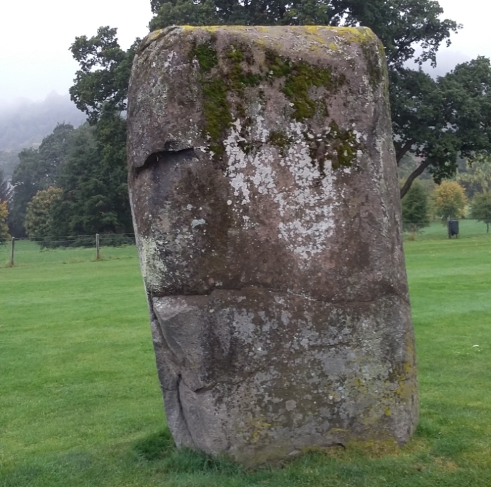
Airthrey Stone submitted by rogerkread on 16th Oct 2015. The Northern face of the Airthrey Stone.
(View photo, vote or add a comment)
Log Text: Airthrey Castle Standing Stone, Stirling University: I have visited the University of Stirling on a number of occasions over the years, visiting an organisation at the Beta Innovation Park, but not known (until I saw them on the Portal) that there were standing stones within the grounds.
We parked at the Wallace Monument, thinking it would be quick half hour walk around Stirling University Campus. Wrong! From the car park, we walked east up Hillfoots Road (the B989) cutting into the Alpha Centre Innovation Park, then walking round the east side of the lake to the University Sports Ground.
As soon as we reached the fence into this area, this huge standing stone stood out. I found the stiles a little too high for my dodgy knees, so it was interesting getting over them!
The surrounding hills, and the view back to the Wallace Monument make this an interesting spot. There were lots of dog walkers and students around, but none seemed to take any notice of the stone – presumably they are all familiar with it. By the time we’d visited Logie Old Church and the Pathfoot Standing Stone, my feet were aching! But no time to relax – Stirling Castle called with a loud, clear voice!
Pathfoot Stone
Trip No.51 Entry No.3 Date Added: 9th Oct 2017
Site Type: Standing Stone (Menhir)
Country: Scotland (Stirling)
Visited: Yes on 26th Sep 2017. My rating: Condition 2 Ambience 3 Access 5
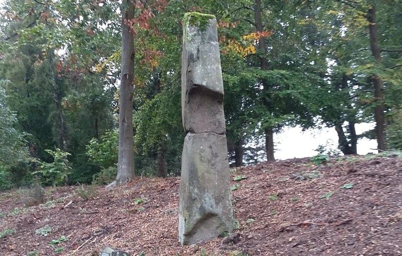
Pathfoot Stone submitted by rogerkread on 14th Oct 2015. Side view.
(View photo, vote or add a comment)
Log Text: Pathfoot Standing Stone, University of Stirling: Walking back across the campus from Logie Old Church, we got caught in a very heavy shower of rain and had to shelter by the student residences at the western side of the campus.
When I caught sight of this, I thought this was a sculpture, not a real standing stone at first. It is at the side of Armitage Road, just north of its’ (busy) junction with Grange Road at the north western side of the campus. We clambered up the wet, slippery slope to take some photos, stared at by the passing students.
By this time, my feet were aching, as we’d spent the best part of 2 hours walking round and round the campus. With Stirling Castle still to come, I welcomed getting back into the car.
Logie Old Kirk (Stirling)
Trip No.51 Entry No.2 Date Added: 9th Oct 2017
Site Type: Early Christian Sculptured Stone
Country: Scotland (Stirling)
Visited: Yes on 26th Sep 2017. My rating: Condition 3 Ambience 4 Access 4
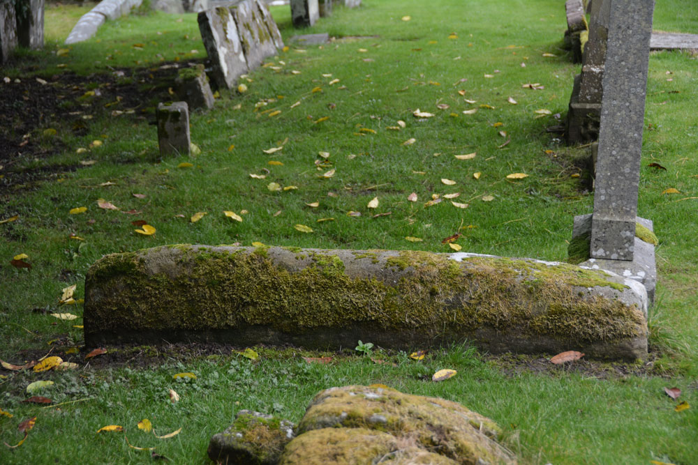
Logie Old Kirk (Stirling) submitted by Anne T on 9th Oct 2017. The hogback as seen from its northern side. Just to its north of this stone is a collection of broken stones, orientated north-south which look like another broken up hogback, but nothing is mentioned by Canmore.
(View photo, vote or add a comment)
Log Text: Hogbacks at Logie Old Kirk, Stirling: To reach the church from the University Halls of Residence, we had to walk through the gardener’s compound/offices. The top two gates around the churchyard were locked; the actual entrance was next to the small stone building to the south of the churchyard, near the stream, with an information board by a small car park, so there is access from the main road.
The churchyard is full of wonderful (morbid!) tombstones. Could have spent the day photographing them. It was also a lovely location with a small stream trickling along the eastern side of the churchyard.
Found one hogback SE of the church, the second is just a lump at the end (by the church) of the 6th row of graves, counting from the stream at the east end of the churchyard. A wonderful location. Really could have spent hours here.
St Mary's Well (Rothsay)
Trip No.51 Entry No.1 Date Added: 8th Oct 2017
Site Type: Holy Well or Sacred Spring
Country: Scotland (Isle of Bute)
Visited: Yes on 25th Sep 2017. My rating: Condition 2 Ambience 3 Access 5
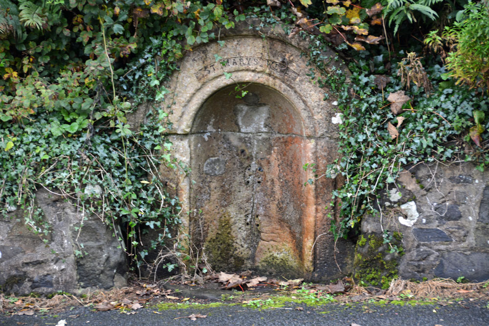
St Mary's Well (Rothsay) submitted by Anne T on 8th Oct 2017. St Mary's Well, showing it's sadly disused, dry state.
(View photo, vote or add a comment)
Log Text: St. Mary's Well, Rothsay: Almost immediately across the road from St Mary's Chapel, set into a dry stone wall and very sadly neglected. There is no outlet but the remains of a metal tethering ring for a cup or ladle is still embedded in the arch. Worth a walk across from the chapel to take a look.
St Blane's Well
Trip No.51 Entry No.2 Date Added: 8th Oct 2017
Site Type: Ancient Cross
Country: Scotland (Isle of Bute)
Visited: Yes on 25th Sep 2017. My rating: Condition 3 Ambience 4 Access 4
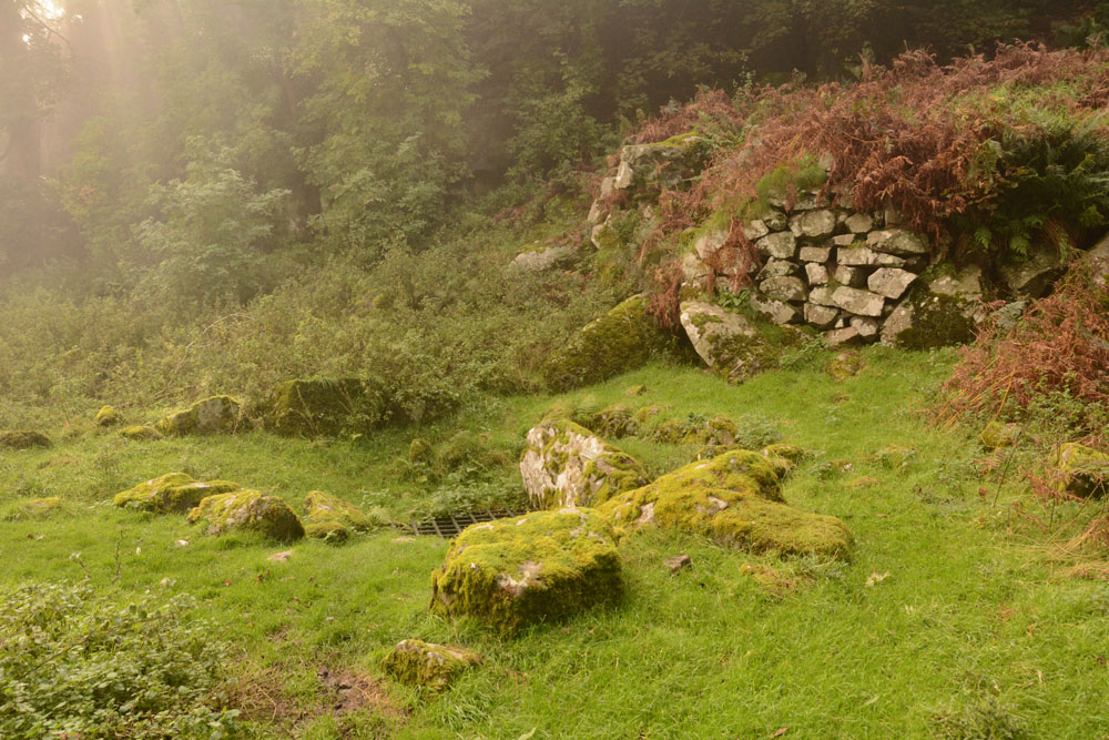
St Blane's Well submitted by Anne T on 8th Oct 2017. View of this well from the north. By this time of the afternoon, the sea haar was coming in with a vengeance, and with the last of the sun's rays coming through, this site was very atmospheric.
(View photo, vote or add a comment)
Log Text: St. Blane's Well, Isle of Bute: After St. Mary’s Chapel and Well, we made our way to the south end of the island, by which time the mist was starting to come in from the sea. There is a layby at NS 09299 53076 for around 6 cars at the start of the path uphill to the chapel. I was very disappointed to find quite a few other visitors there. They must have done what we did, and made their way straight to the south end of the island to work their way back. Should have timed it better.
At this site, as well as the chapel, there is a holy well, a hogback and a cross shaft. This whole place is very ancient and it was atmospheric in the mist.
Blackpark
Trip No.50 Entry No.4 Date Added: 9th Oct 2017
Site Type: Stone Circle
Country: Scotland (Isle of Bute)
Visited: Yes on 25th Sep 2017. My rating: Condition 3 Ambience 4 Access 4

Blackpark Stone Circle submitted by saille on 14th Jan 2004. At NS 091556, the stone circle in Blackpark Plantation has only three stones left standing, the remains of a larger complex of seven stones.
Now surrounded by forestry plantation.
Towards the west of the road, between Kingarth and Largizean farm, there are three more standing stones which are more in-line with each other than Blackpark.
(View photo, vote or add a comment)
Log Text: Blackpart Standing Stone, Isle of Bute: About 2.3 km north of St. Blane’s Chapel, still on Plan Road. There is a small car park just off the road, north of the stones, at NS 09160 55716. The ground was very boggy, with large pools of water both on the path to them and in between, so we had to pick our way very careful.
These three stones are some of the most mis-matched I’ve seen. The northern and southern most stones are made of a reddish conglomerate, a little like cement. The third stone looks like whinstone, which has split down the middle, and is the oddest of shapes, morphing what it looks like completely as you walk around it.
Thankfully the mist had thinned by the time we arrived here, and the sun was just starting to show throw the pine trees of the surrounding forest.
I was very intrigued by the southernmost stone, on a mound – is this a cairn? No mention of this on Canmore, although as I was walking around it I spotted graffiti, including what looked like a misshapen cross.
Scalpsie Barrow
Trip No.50 Entry No.5 Date Added: 9th Oct 2017
Site Type: Round Cairn
Country: Scotland (Isle of Bute)
Visited: Yes on 25th Sep 2017. My rating: Condition 3 Ambience 3 Access 5

Scalpsie Barrow submitted by durhamnature on 23rd Sep 2012. Photo of barrow, from "The book of Arran" by J A Balfour 1910 via archive.org
Site in Isle of Bute Scotland
(View photo, vote or add a comment)
Log Text: Scalpsie Barrow, Isle of Bute: We didn’t plan to stop here, but there was a car park and information board by the field alongside the A844 past Ambrismore on the way to Ardscalpsie, signposted to the beach, so we screeched to a halt to explore. The information board differentiated between the barrow and another cairn, also somewhere in the field, but the fog was so bad, we couldn’t see it, and it was very difficult to photograph the main barrow.!
Worth stopping to see. The gate into the field was about 100 metres further west along the road from the small car park. Walking back to the barrow, my feet got completely drenched. A shame the fog was so bad, as I’d have loved to have found the second cairn.
Acholter
Trip No.50 Entry No.6 Date Added: 9th Oct 2017
Site Type: Standing Stone (Menhir)
Country: Scotland (Isle of Bute)
Visited: Yes on 25th Sep 2017. My rating: Condition 3 Ambience 3 Access 4

Acholter submitted by Anne T on 9th Oct 2017. This was about as close as we could get to this standing stone (about 8-10 metres). The field was absolutely sodden in water and the cow pats were ankle deep. We cut our losses and took photographs as best we could through the thickening mist.
(View photo, vote or add a comment)
Log Text: Acholter Standing Stone, Isle of Bute: From the Scalpsie Bronze Age Barrow, we headed north up the A844 towards Colmac and East Colmac to see the stone circle, a standing stone with incised cross and an earthwork. By this time, we were starting to run out of time as we needed to get back to Rounsay for the ferry.
There had just been an accident at the southern end of Ettrick Bay – a camper van and a car had gone head on into each other at low speed. All the occupants of the vehicles were out on the roadside and others had stopped to help. I can imagine turning the corner of the A844 and coming onto this lovely stretch of sand and sea, not looking where you were going properly. We followed the line of cars past them. I spotted this standing stone on the map. We weren’t going to stop, but the stone was visible through the mist in the field, so we pulled up by the side of the road.
My goodness, the entrances to the fields were ankle deep in water, so we walked further south to another field gate and used an alternative route. The whole field was so very wet and absolutely covered in damp, smelly cow pats, that we could only get within about 10 metres of the stone. By this time, the mist really was so bad we could hardly see the stone.
Picking our way back to the road, me with very wet socks and shoes, I turned back to the field only to see a herd of large cows making their way towards us. Where had they come from? We didn’t see them in the field, and they made an eerie sight through the mist!
St Colmac's Cross
Trip No.50 Entry No.8 Date Added: 9th Oct 2017
Site Type: Standing Stone (Menhir)
Country: Scotland (Isle of Bute)
Visited: Couldn't find on 25th Sep 2017
Log Text: St Colmac's Cross, Isle of Bute: I really, really wanted to find this standing stone with incised Latin Cross, but we couldn't work out a way to get behind the barn at East St. Colmac Farm to view it. The Canmore records show this intriguing stone in a wooden enclosure, which was built round it after it was damaged in recent times (the top was knocked off).
By the time we'd had several attempts to find this stone, we were seriously running out of time to get back for our ferry back to Wemyss Bay. We needn't have worried, however, as the ferries were suspended because of the heavy fog. This necessitated a drive up to Rhubodach to get a shorter ferry ride across to Colintraive, then a very hairy mountain drive on a single track road with dense fog back to Dunoon. A not to be forgotten trip!
Dods Corse Stone (Boon)
Trip No.50 Entry No.1 Date Added: 6th Oct 2017
Site Type: Ancient Cross
Country: Scotland (Scottish Borders)
Visited: Yes on 24th Sep 2017. My rating: Condition 2 Ambience 3 Access 4
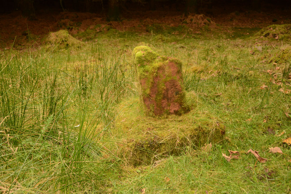
Dods Corse Stone (Boon) submitted by Anne T on 6th Oct 2017. On the mossy covered northern face, the (thin) incised cross can just be made out.
(View photo, vote or add a comment)
Log Text: Dods Corse Stone (Cross shaft and base): We pulled over in field entrance opposite wood the stone stands within, at NT 58395 46267. There was another huge bull with his ladies in this field, standing staring at us very menacingly, as if he was about the charge at us. As we were getting out of the car, we were overtaken by 3 army land rovers on exercise, the driver of the first vehicle waved.
The step on the stile into the wood was very tall, so my knees needed a bit of help getting up on it. There was a very narrow path leading to the north of the small wood. There is a fence line running east-west and another small section of wood (a narrow section of field is shown on the map). Following this inner fenceline some 200 metres to the west, we eventually came across the cross and base almost buried under moss and debris from the surrounding trees.
The incised cross on the northern face could just be made out, but the cross in relief on the southern face remained buried under the moss. All under foot around the cross were other bright red sandstone stones, but with all the forestry work, and debris from it, made it difficult to tell what archaeology there might be around us.
Purveshaugh
Trip No.50 Entry No.2 Date Added: 6th Oct 2017
Site Type: Standing Stone (Menhir)
Country: Scotland (Scottish Borders)
Visited: Yes on 24th Sep 2017. My rating: Condition 3 Ambience 3 Access 5
Purveshaugh submitted by mafenty on 18th Sep 2006. Good views of Eildon Hills and Black Hill of Earlston in background
(View photo, vote or add a comment)
Log Text: Purveshaugh (Earlston) Standing Stone, Scottish Borders: Our second stop of the day. Although the B6105 is supposed to be a minor road, it is still very busy and traffic rushes along it at a pace of knots. We managed to pull into the ungated field entrance without causing too much chaos.
A few steps into the field, we realised it was planted with wheat. We managed to navigate the 10 metres or so from the field entrance to the stone by following the empty ground where the tractor wheels had run, so didn’t cause any damage.
I was really amused to see the stone had its own name sign ‘Standing Stone’. It really is the most oddly shaped stone, like a small chair. Canmore says it is unsculptured, and it looks as if it has been quarried before being located here. I was surprised to find Canmore had two other records for this site, within a few tens of metres of the stone – a post medieval farmstead (Canmore ID 343237) and a well (Canmore ID 343240), neither of which we saw evidence for on the day.
Not a great location in modern times, with power lines running almost overhead, and the busy road.
Maxton Burgh (St Boswells)
Trip No.50 Entry No.3 Date Added: 6th Oct 2017
Site Type: Ancient Cross
Country: Scotland (Scottish Borders)
Visited: Yes on 24th Sep 2017. My rating: Condition 3 Ambience 3 Access 5
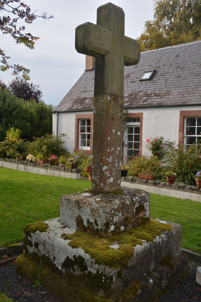
Maxton Burgh (St Boswells) submitted by Anne T on 6th Oct 2017. The cross from about 10 meters south east of it, trying to eliminate the view of the land rover parked immediately next to it.
(View photo, vote or add a comment)
Log Text: Maxton Burgh Cross, Scottish Borders: We stopped off at a garden centre café in Newton St. Boswell’s for refreshments, then carried on eastwards towards the small village of Maxton. We didn’t have precise grid references for this cross at the time, and with no mobile signal, we were a little lost as to where to find it. Eventually I managed to pull up the website for Maxton village, which described the location of the cross as being just off the main street, in front of what was the smiddy, “on what remains of the village green”. They state that “Parts of the cross are probably original 13th century, but the main part was replaced in 1881 by Sir William Ramsay Fairfax, Bart.”
We drove up and down the A699 through the village trying to find the old village green, even driving down St. Cuthbert’s Way to the church. Eventually, we decided to park on the main road and walk around. From here, the cross was easy to spot. The old village green is now someone’s private garden. The man who lived in the cottage immediately behind the cross said it was OK to go and look. Photographing the cross was somewhat hampered by the land rover parked immediately next to it. Fancy having the old village green for your private garden!
St Boswell's Old Church
Trip No.50 Entry No.4 Date Added: 7th Oct 2017
Site Type: Ancient Cross
Country: Scotland (Scottish Borders)
Visited: Yes on 24th Sep 2017. My rating: Condition 2 Ambience 3 Access 4
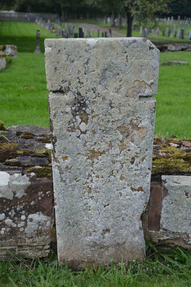
St Boswell's Old Church submitted by Anne T on 7th Oct 2017. Close up of the slab, which is supposed to bear an incised, equal limbed, cross within a circle. It is very worn. The other artefacts associated with the church of pre-1153 are built into the fabric of the present St. Boswell's church, located in the village.
(View photo, vote or add a comment)
Log Text: St Boswell's Old Church, Incised Cross Slab: I was expecting much more from this site, lying in a corner tucked between the River Tween to the east and Boswell Burn to the south. The ruins of the old church have been taken down to only a couple of courses, whilst the graveyard is still in use today.
Not very atmospheric. It turns out, pulling the Canmore record up on site, that there was only 1 tombstone with incised cross standing against the south wall of the church, which is supposed to have: “A tombstone, measuring 5ft 8in in length and tapering in width from 1ft 7 1/2in to 1ft 2in, is attached to the S wall of the church. It bears a slightly incised, equal-limbed cross within a circle.” No date is given for this. The rest of the interesting old stones have been built into the modern church, which we didn’t bother to find, as it presumably would be locked, and we had a lot more sites we particularly wanted to see.
Mertoun Kirk (St Boswells)
Trip No.50 Entry No.5 Date Added: 7th Oct 2017
Site Type: Sculptured Stone
Country: Scotland (Scottish Borders)
Visited: Yes on 24th Sep 2017. My rating: Condition 3 Ambience 3 Access 5

Mertoun Kirk (St Boswells) submitted by Anne T on 7th Oct 2017. This stone, just over 1 ft long and 6 ins deep is built into the east wall of the modern extension to the north east side of the church. To find it, stand behind the large green oil tank located at this side of the church and look up.
(View photo, vote or add a comment)
Log Text: Mertoun Kirk, incised stone: The church lies in the grounds of Mertoun House, which lies almost directly north, across a bend in the River Tweed, from Maxton with its Burgh Cross. To approach the church, we had to follow the signs up the single track road to the house; the church is just before you reach the house. There were other Roman fragments built into seats in the gardens just outside the house, but we needed to pay to get in the house, and there was only half an hour before it shut for the evening. Fortunately, we were able to park outside the church, next to the mounting block, and walked around this very hidden, almost secretive church.
The church itself was locked, and we couldn’t get in. Whilst Canmore gives no date for the stone, the fragment looks older than the church which was built in 1658 and restored in 1820 and 1898.
Font Stone (Dryburgh)
Trip No.50 Entry No.6 Date Added: 7th Oct 2017
Site Type: Ancient Cross
Country: Scotland (Scottish Borders)
Visited: Yes on 24th Sep 2017. My rating: Condition 3 Ambience 3 Access 5
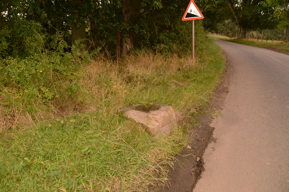
Font Stone (Dryburgh) submitted by Anne T on 7th Oct 2017. The Dryburgh Font Stone, showing its very close location to the side of the road.
(View photo, vote or add a comment)
Log Text: The Font Stone, Dyburgh (Cross Base): Sited on a corner of the B6356, it is a miracle that this cross base is still in one piece, being located so close to the road.
From Mertoun Kirk, we followed the B6356, turning right before reaching Dryburgh along a minor road signposted to Bemersyde, where the stone is located some 270 metres along the road on a slight right hand bend.
It is largely hidden by grass at the right hand side of the road as you head up to Bemersyde. There is a layby just before the stone, where we pulled in to photograph the stone. Note: this is a busy road, so be careful of traffic.
As we were very near the Scott’s View Geological Indicator and the Wallace Monument, whilst there was still light, we decided to go on and take a look.
Rhymer's Stone (Melrose)
Trip No.50 Entry No.7 Date Added: 7th Oct 2017
Site Type: Marker Stone
Country: Scotland (Scottish Borders)
Visited: Yes on 24th Sep 2017. My rating: Condition 3 Ambience 3 Access 4
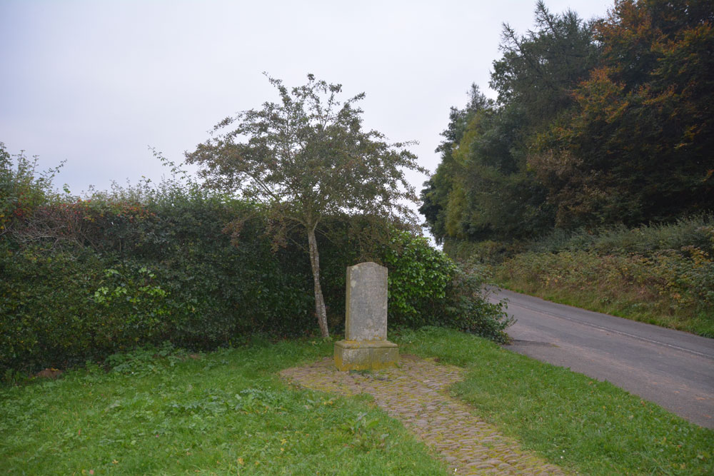
Rhymer's Stone (Melrose) submitted by Anne T on 7th Oct 2017. Contrary to first appearances, not a grave stone, but a modern marker stone! First view of the Rhymer Stone, erected in 1929 by the Melrose Literary Society.
(View photo, vote or add a comment)
Log Text: Eildontree Stone/Rhymer Stone, Melrose: After our failed attempt to find St. Dunstan’s Well in Melrose, we wanted to end the day on a positive note, so asked to come here, particularly because of the Steeleye Span song. The sign from the road said ‘Rhymer’s Stone’ ½ mile. It was more like a good mile, then a walk of about 300 metres from the layby by the gate closing the road. Loved the view up to Eildon Hillfort, but far too late in the day to go exploring.
Galabraes
Trip No.49 Entry No.1 Date Added: 5th Oct 2017
Site Type: Standing Stone (Menhir)
Country: Scotland (West Lothian)
Visited: Yes on 22nd Sep 2017. My rating: Condition 3 Ambience 4 Access 4
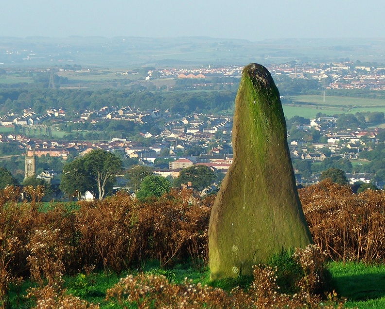
Galabraes submitted by postman on 11th Nov 2012. Site in West Lothian Scotland
Galabraes standing stone, it's not far from Cairnpapple and very close to the road, how com no-ones posted on here before
(View photo, vote or add a comment)
Log Text: Gala Braes Standing Stones, Bathgate: We drove up and down the road, but couldn’t see a gate into the field along either from the ‘main’ road (Drumcross Road) or the side road running north-south up to Cairnpapple Hill, so we ended up clambering over an almost demolished stone wall and squeezing through the wire fencing. There was a big (very unfriendly looking) bull in the field just below the western end of the ridge, who stood his ground and kept looking at us, so we didn’t dare approach the other small knoll where the other stone (B) should have been located.
As we were leaving, I spotted some old boundary features to the south of the standing stone so was photographing these, when I heard some cawing behind me. Looking up, a large crow was sitting on the standing stone, bobbing up and down. Eerie!
Lower Craigmailing (Torphichen)
Trip No.49 Entry No.2 Date Added: 5th Oct 2017
Site Type: Ancient Cross
Country: Scotland (West Lothian)
Visited: Yes on 22nd Sep 2017. My rating: Condition 2 Ambience 1 Access 5
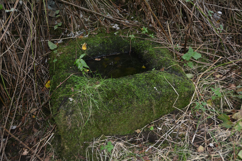
Lower Craigmailing (Torphichen) submitted by Anne T on 5th Oct 2017. In the bottom right hand corner, the shallow channel formed into the corner can be seen, suggesting it might have been used as a trough at some point in its past.
(View photo, vote or add a comment)
Log Text: Lower Craigmailing Socketed Stone: This socketed stone was well hidden under shrubbery at the start of a footpath running from Cathlaw Lane to Witch Craig/Crag. I would have walked right by it, had husband, Andrew, not pushed his way through the shrubbery to find it.
What a sad fate for this socketed stone. Being located so close to Torphichen, I assume it had something to do with marking the way to/from the Abbey, possibly up to Cairnpapple Hill.
