Contributory members are able to log private notes and comments about each site
Sites Anne T has logged. View this log as a table or view the most recent logs from everyone
Axwell Park Barrow
Trip No.18 Entry No.3 Date Added: 24th Apr 2017
Site Type: Round Barrow(s)
Country: England (Tyne and Wear)
Visited: Couldn't find on 23rd Apr 2017. My rating: Ambience 2 Access 5
Axwell Park Barrow submitted by durhamnature on 7th Aug 2012. Axwell Park Barrow
(View photo, vote or add a comment)
Log Text: Axwell Park Tumulus, Gateshead: OK, even with the grid reference, we couldn't find any trace of this - not surprising, since checking the Pastscape records this morning (24th April), they say no trace of the mound exists! There were lots and lots of humps and hollows on the slope to the left of the path as you walk up the hill. The area seems to be part of an estate and has been heavily modified, with an artificial waterfall and stone-lined channels for water visible in the undergrowth.
This area today is on the edge of a modern housing estate, which is still being constructed. The only thing I can say about this is that it is an easy walk up through the park on tarmacked road.
St. Mary's Well (Jesmond)
Trip No.18 Entry No.4 Date Added: 24th Apr 2017
Site Type: Holy Well or Sacred Spring
Country: England (Tyne and Wear)
Visited: Yes on 23rd Apr 2017. My rating: Condition 4 Ambience 4 Access 4
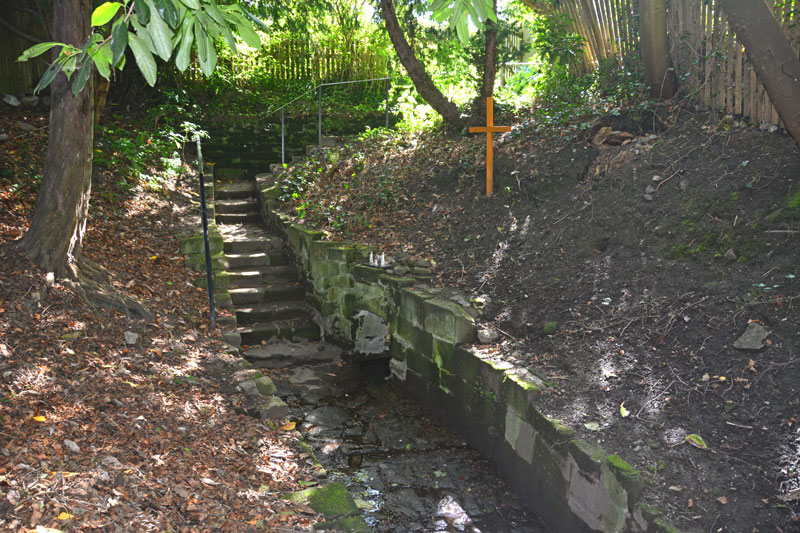
St. Mary's Well (Jesmond) submitted by Anne T on 24th Apr 2017. Standing on the slope above the well pool, looking back at the stone steps leading down to the well.
(View photo, vote or add a comment)
Log Text: St. Mary's Well, Jesmond: From the elusive (non-existent!) Axwell Park Tumulus, we headed off down the Coast Road to Jesmond to find this well. It was a delight – an oasis in the midst of the city.
Parking on Jesmond Dene Road where it meet Grosvenor Avenue, we headed west up The Grove – a shady footpath that runs between The Grove and Red Park Road, in between the back gardens of the houses.
We found the gate to this well to our right hand side, several hundred metres up the path, highlighted by the blue signpost.
Descending into this shady nook, down the stone steps, the first view of the well was of the small statues, tea-lights and mementos left on top of the well covering. As my eyes adapted to the shade, the pool of the well came into view.
The well was full of water, with a steady flow over the cobbles towards the pool. There was a cute copper jug left attached to the side of the well, which I took off and dunked into the water. Andrew and I both tasted the water, and it was completely tasteless, which was a surprise.
After enjoying the peace and calm, we headed off to find St. Mary’s Chapel, now ruined, just down the road. Really enjoyed this visit.
North View enclosure
Trip No.21 Entry No.1 Date Added: 5th May 2017
Site Type: Ancient Village or Settlement
Country: England (Tyne and Wear)
Visited: Yes on 4th May 2017. My rating: Condition 1 Ambience 3 Access 4
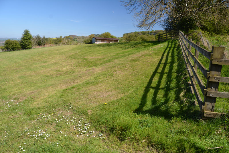
North View enclosure submitted by Anne T on 5th May 2017. The northern corner of the boundary seems to cut across the corner of the field, where the footpath moves from the wooded area to the west of North View Farm to the field (with stables) immediately behind the house. The footpath continues in a narrow, overgrown lane, between a fence to the left and an old stone wall/hedge line to your right.
(View photo, vote or add a comment)
Log Text: North View/Bucks Nook Enclosure, Gateshead: Whilst this site is literally within sight of the eastern end of Prudhoe, to drive to it, we needed to go through Greenside and take the Rockwood Hill/Bradley Fell road until we reached the point where the road divided,travelling south/wout-west towards Guard’s Farm, and north to join Kyo Bog Lane.
We parked at the fork in the road, just west of North View Farm at NZ 11320 61603. The footpath going to this site running south east through a wooded area from NZ 11320 61597 (the stile into the wood is barely visible from the road), where it runs to the west of North Farm to open pasture. The trees bordering the farm were strewn with ‘Dogs run free/keep out signs’, which were quite off-putting. Nevertheless, there was a clear path running up through the wood to a second and third stiles at NZ 11412 61533 and NZ 11418 61531.
Just before this second stile, there is a corner and definite change of slope which runs at an angle to the footpath (which now runs in a narrow between a fence to the north and an old stone wall/hedge line to the south) and, in the field immediately behind the garden of North View Farm (field contains a stable). At the time of our visit, this boundaryfeature was quite clear, due to the difference in the colour of the grass. From here, it was a little difficult to know where the boundary ran. Where it appeared to cross the footpath, there was a clear ‘hump’ in the ground. Where it disappeared into the field, it was difficult to tell where it ran.
Continuing along the footpath several hundred metres, there is a 6ft fence at NZ 11557 61447, with a stile over it, and more ‘dogs run free/keep out’ signs. It is possible to squeeze between the trees at this point and have a closer look at any possible earthworks. There was a difference in colour in the pasture about 10 metres before the hedge-line at the south-eastern corner, but without a definite plan, it was impossible to tell.
I found the Sitelines Tyne & Wear HER 172 record, but despite it saying the monument is scheduled, I’ve been unable to find anything (having done searches on the various names, grid references, postcodes, farm names). I have emailed T&W archives to see if it’s possible to get some more information. The feature is not visible on UK Grid Finder, although it is possible to pick out the northern corner (photographed).
This place has lovely views over the Tyne Valley to the north. It was worth coming here just to see the views back over Prudhoe and Crawcrook.
Ceoppa's Barrow
Trip No.21 Entry No.2 Date Added: 5th May 2017
Site Type: Round Barrow(s)
Country: England (Tyne and Wear)
Visited: Yes on 4th May 2017. My rating: Condition 3 Ambience 4 Access 4
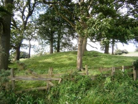
Ceoppa's Barrow submitted by durhamnature on 18th Jul 2012. View from south.
(View photo, vote or add a comment)
Log Text: Ceoppa's Barrow, Tyne & Wear: From Bucks Nook/North View, we headed off eastwards along Bradley Fell Road, taking the second right ((Kyo Lane), then dog-legging right/left along the Lead Road then down Horsegate Bank to Claython Terrace Road. Pulling in in the small layby next to the forestry track just before Heavygate Farm at NZ 12710 59129 we walked down the farmtrack running immediately to the west of Heavygate Farm.
Walking by the farmyard was an education in old farm equipment – old tractors, dumper trucks, old cars, pumps. The official grid reference for this barrow is NZ12605890, although I found it to be NZ12605890. Surprisingly, this barrow doesn’t seem to be scheduled.
The barrow is located not quite at the top of the hill, which seems to be at Broomfield Farm, but has brilliant views down to the Derwent Valley to the south.
The gates to the fields were wired shut, but we managed to get photographs from opposite the main entrance to the farm and the gates into the field at NZ 12775 58928. There was definite evidence of a surrounding ditch.
Holy Stone (North Tyneside)
Trip No.65 Entry No.1 Date Added: 4th Feb 2018
Site Type: Ancient Cross
Country: England (Tyne and Wear)
Visited: Yes on 3rd Feb 2018. My rating: Condition -1 Ambience 2 Access 4
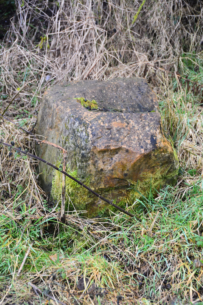
Holy Stone (North Tyneside) submitted by Anne T on 4th Feb 2018. Is this the socket stone that has been moved? Looks convincing from the side .....
(View photo, vote or add a comment)
Log Text: Holy Stone Cross Base, North Tyneside: Having been to the industrial estate nearby, we decided to try and track down this stone. Donning wellies, as there had been torrential rain the night before, we followed the footpath from the Holystone Pub/Premier Inn (where there is a car park almost next to the A19, just north east of the pub) towards Holystone Farm, crossing the bridge above a busy railway line. At the recently built Holystone Cottage, another footpath runs north east across the fields towards the A19. The stone is supposed to be located at the junction of the footpath and the front wall of Holystone Cottage.
By chance we met a couple of dog walkers, and I asked them if they knew of this stone. The man said he was brought up locally and remembered playing in the fields at the back of the cottage, where there a three foot high stone they used to gather around. He said the stone had been destroyed some years ago, but the cross base might remain.
He walked us to the spot where he remembered the stone being, but nothing. He did say that there had been recent site investigation in the field, prior to building new houses.
We did find what looked very much like a cross base in the corner of a neighbouring field at NZ 30210 70783. This looked very convincing from the side, but from the top, there was what might have been a long, thin, damaged slot, very unlike the carved slots we've seen in other cross bases.
Great North Museum
Trip No.72 Entry No.1 Date Added: 10th May 2018
Site Type: Museum
Country: England (Tyne and Wear)
Visited: Yes on 4th May 2018. My rating: Condition 4 Ambience 4 Access 5
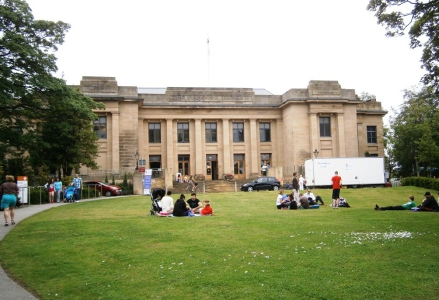
Great North Museum submitted by durhamnature on 25th Jul 2012. The Great North Museum, formerly the Hancock. The best museum in the north east.
(View photo, vote or add a comment)
Log Text: Great North Museum, Newcastle: The last time I visited here was some 8 or 9 years ago, with some police officers from York. We spent most of our time at the Hadrian's Wall exhibit, with them comparing Roman soldier's battle kit to their modern day riot gear. I found the layout of the galleries confusing, and the signs not terribly clear, but we spent a good couple of hours looking at Anglo Saxon artefacts and rock art. I also enjoyed the Ancient Egyptian gallery, and found the Mouse House for under 5's - definitely a place to return to with my grand-daughter.
I'd love to come back to their library sometime, which is open to all. The coffee shop on the first floor was also good.
White Cross (Newcastle)
Trip No.148 Entry No.1 Date Added: 9th Sep 2019
Site Type: Ancient Cross
Country: England (Tyne and Wear)
Visited: Yes on 7th Sep 2019. My rating: Condition -1 Ambience 3 Access 4
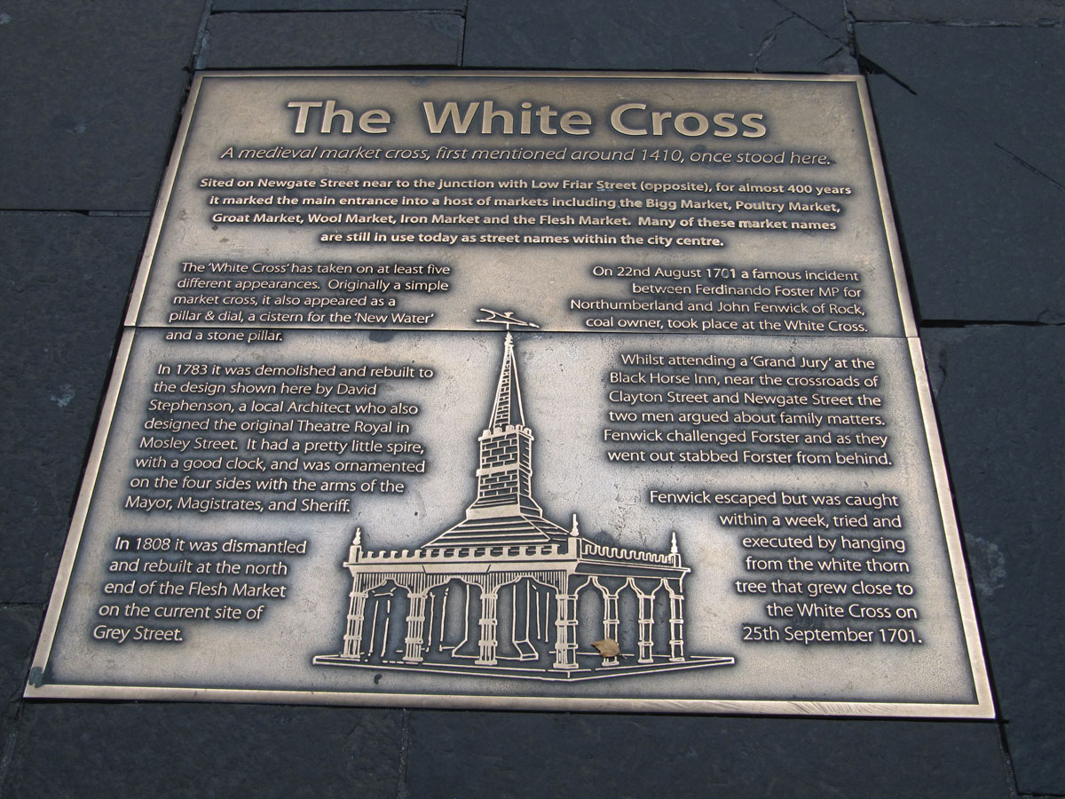
White Cross (Newcastle) submitted by Anne T on 9th Sep 2019. The metal plaque set into the pavement showing the location of the White Cross, first recorded in local history in 1410. The image shows how was rebuilt in 1783, having been a simple market cross, then a pillar and dial, then a cistern for water, then a stone pillar. We know in 1701 a white thorn tree grew nearby, as a man named John Fenwick was hanged from this tree after murdering a local MP called Fernando Forster.
(View photo, vote or add a comment)
Log Text: Site of the White Cross (Newcastle): Having typed 'Cross' and 'Newcastle' into Pastscape, I was surprised to find two crosses come up. So, armed with my GPS I set off to try and find these sites.
This cross used to be located at the corner of Newgate Street and Low Friar Street, north west of the junction of Clayton Street and Newgate Street.
I cross the road regularly here to walk through the lane to the side of the Gate, down towards West Walls and Akhbar’s, but this is a part of the pavement I’ve never been on. About 30m to the south east (following the pavement), outside what is now Debenham’s, a large metal plaque is set into the pavement.
The plaque reads: The White Cross. A medieval market cross, first mentioned around 1410, once stood here. / Sited on Newgate Street near to the junction with Low Friar Street (opposite), for almost 400 years, it marked the main entrance into a host of markets including the Bigg Market, Poultry Market, Groat Market, Wool Market, Iron Market and the Flesh Market. Many of the market names are still in use today as street names within the city centre. / The ‘White Cross’ has taken on at least five different appearances. Originally a simple market cross, it also appeared as a pillar & dial, a cistern for the ‘New Water’ and a stone pillar. / In 1783 it was demolished and rebuilt to the design shown here by David Stephenson, a local Architect who also designed the original Theatre Royal in Mosley Street. It had a pretty little spire, with a good clock, and was ornamented on the four sides with the arms of the Mayor, Magistrates and Sheriff. / In 1808 it was dismantled and rebuilt at the north end of the Flesh Market on the current site of Grey Street. / On 22nd August 1701 a famous incident between Ferdinando Forster MP for Northumberland and John Fenwick of Rock, coal owner, took place at the White Cross. / Whilst attending a ‘Grand Jury’ at the Black Horse Inn, near the crossroads of Clayton Street and Newgate Street the two men argued about family matters. Fenwick challenged Forster and as they went out stabbed Forster from behind. Fenwick escaped but was caught within a week, tried and executed by hanging from the white thorn tree that grew close to the White Cross on 25th September 1701.”
Cale Cross (Newcastle)
Trip No.148 Entry No.2 Date Added: 9th Sep 2019
Site Type: Ancient Cross
Country: England (Tyne and Wear)
Visited: Yes on 7th Sep 2019. My rating: Condition -1 Ambience 3 Access 5
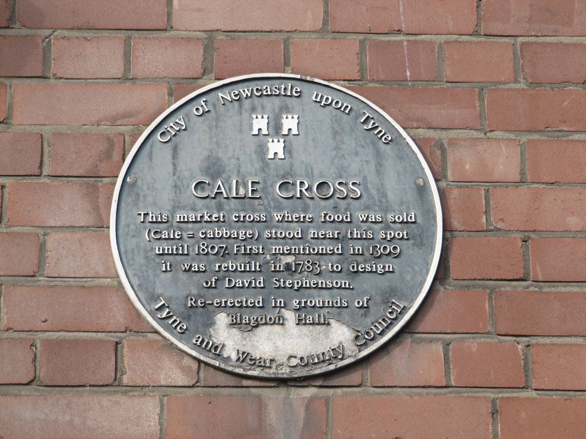
Cale Cross (Newcastle) submitted by Anne T on 9th Sep 2019. The blue plaque is currently the only sign that the Cale (or Cabbage) cross stood at or near this location.
(View photo, vote or add a comment)
Log Text: Site of Cale Cross (Newcastle): The plaque commemorating this cross is attached the eastern wall of what I think is 3, Akenside Hill (or possibly Akenside House), on the Quayside, just to the west of the A167 where it is about to go south over the Tyne Bridge, and just north-north-east of the Swing Bridge.
The building sits at the junction of Dean Street and Queen Street, just before Dean Street meets Sandhill (the B1600) and Quayside. I imagine in olden times, this would have been the ideal place for a market.
It was the afternoon before the main Great North Run and Quayside was hugely busy with other races starting and finishing. What a crowd, but a lively, friendly atmosphere. I had great fun finding my way back up the hill through tiny lanes I didn’t know existed, passing the Church of All Saints, a huge viaduct, some of the old city walls and Castle Keep.
The plaque reads: “City of Newcastle upon Tyne. Cale Cross. This market cross where food was sold (cale = cabbage) stood near this spot until 1807. First mentioned in 1309 it was rebuilt in 1783 to design of David Stephenson. Re-erected in the grounds of Blagdon Hall Tyne and Wear County Council”.
If the original cross had gone to Blagdon Hall, I would have set off in search of it, but this is only the 1783 re-design.
St Peter's Church (Monkwearmouth)
Trip No.152 Entry No.1 Date Added: 25th Sep 2019
Site Type: Early Christian Sculptured Stone
Country: England (Tyne and Wear)
Visited: Yes on 20th Sep 2019. My rating: Condition 3 Ambience 5 Access 4

St Peter's Church (Monkwearmouth) submitted by Anne T on 25th Sep 2019. Displayed at the top of the case in the 'Exhibition Centre' at the eastern end of the north aisle, this is one of a pair of Consecration Crosses, recorded as Monkwearmouth 29 and Monkwearmouth 28. The latter is still in situ in the west gable of the nave, some 42ft above ground, visible only from the interior of the tower, partly beneath a beam. They are both dated to either the 7th century (original date of consecration) or the 11th century (for the rededication of the monastery after its dest...
(View photo, vote or add a comment)
Log Text: St Peter's Church (Monkwearmouth): This trip was made largely thanks to coming across Guy Points' "Gazetteer of Anglo Saxon and Viking Sites: County Durham and Northumberland" (2012), as we hadn't really appreciated what was here. Our intention was to visit St Peter's, go to Sunderland Minster, then walk round Sunderland Museum, although we spent so much time here, we will need to visit the Minster another time.
We were made extremely welcome as soon as we walked through the door, and given a personal tour of the church. Imagine our surprise towards the end, when the guide revealed himself as none other than Guy Points! I was astonished.
Would love to go back and find some of the stones he mentions in his book that we missed on the day, and also have a closer look at the glass and plaster fragments, and sit and enjoy the ambience of the church. Brilliant afternoon!
Sunderland Museum and Winter Gardens
Trip No.152 Entry No.2 Date Added: 26th Sep 2019
Site Type: Museum
Country: England (Tyne and Wear)
Visited: Yes on 20th Sep 2019. My rating: Condition 4 Ambience 4 Access 5
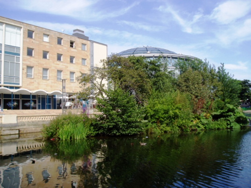
Sunderland Museum and Winter Gardens submitted by durhamnature on 21st Aug 2012. Sunderland Museum, in Mowbray Park
(View photo, vote or add a comment)
Log Text: Sunderland Museum: Despite having been here for many meetings and conferences over the years, I've never wandered around this museum - a series of permanent and special displays in themed rooms off the main corridor leading from the main entrance/gift shop to the cafeteria.
Having spent longer than we thought (well, it was VERY interesting!) at St. Peter's, we knew we didn't have time to go the Minster to see their stones collection before shutting to visitors at 2.30pm, so came here instead (it was supposed to be our third, and last, stop of the afternoon).
We focused mainly on the Secrets of the Past Exhibition on the ground floor, which has some of the Anglo Saxon stone fragments recorded by the Corpus of Anglo Saxon Stone Sculpture. Not all of them (mostly the smallest) fragments were on display, so I have asked if it's possible for us to see, and photograph, these.
There were also prehistoric cists with grave goods, stone axes, jewellery, and other artefacts on display.
The museum seemed largely deserted at this time of day, apart from a few people coming down the staircase at the rear of this exhibition hall.
We enjoyed a rather large, and tasty, lunch in the cafeteria before leaving.
St Nicholas's Cathedral (Newcastle)
Trip No.154 Entry No.2 Date Added: 21st Oct 2019
Site Type: Ancient Cross
Country: England (Tyne and Wear)
Visited: Yes on 16th Oct 2019. My rating: Condition 2 Ambience 2 Access 4
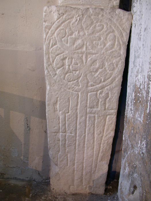
St Nicholas's Cathedral (Newcastle) submitted by nicoladidsbury on 13th Aug 2005. Elaborate Cross Slab, featuring two vertical sword shafts, similar to much smaller cross slabs found built into the fabric of the Norman wall in the ancient church at Old Ireby
(View photo, vote or add a comment)
Log Text: St Nicholas's Cathedral, Newcastle: I'd arranged with one of the vergers, James, to meet him at noon on 16th October to be allowed down into the vault below the south transept to see the cross slabs now stored down there.
The space is now used as a chair store, with a scissor lift at its southern end, and a larger trap door which comes up underneath the piano in the south transept.
Access was through a trap door, with a vertical ladder which started a couple of feet below the floor of the transept, so I bottled out of climbing down, and sent Andrew down with the camera.
He reported that it was really interesting seeing this space, with its barrel vaulted ceiling, but the slabs had all been stored against a wall underneath a pile of tables and other general items. What he could see looked very worn, which is presumably why they were stored down here in the first place. The stones must have deteriorated alarmingly in the 100 years or so since they were drawn by C.C. Hodges.
Disappointing. They were tuning the organ whilst we were there, which was interesting. The open trap door caused interest from other visitors to the Cathedral who wanted to look down. I volunteered to stop anyone falling down the trapdoor, so got to talk to quite a few people who were interesting in seeing this space.
St Laurence's Church (Bradford on Avon)
Trip No.136 Entry No.4 Date Added: 12th Jun 2019
Site Type: Early Christian Sculptured Stone
Country: England (Wiltshire)
Visited: Yes on 17th May 2019. My rating: Condition 3 Ambience 5 Access 4
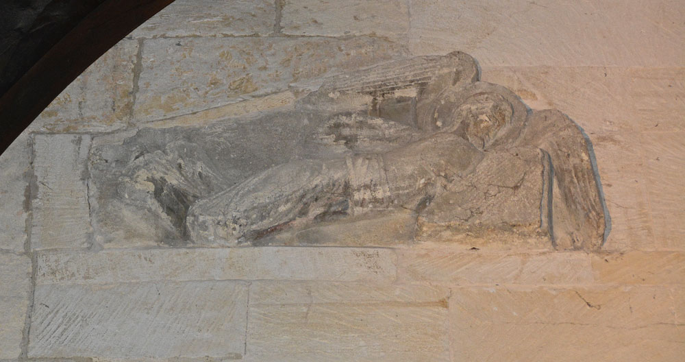
St Laurence's Church (Bradford on Avon) submitted by Anne T on 11th Jun 2019. The right hand facing angel, recorded as AS Corpus Bradford on Avon 5b. They were discovered embedded in a wall above the western side of the chancel arch around 1850, later used in a flue in 1856-1857, then placed over the porch leading to the modern house attached to the south side of the building. Both angels are carved from single blocks of stone, which taper from head to feet, with the angels facing each other. Dated to AD1000.
(View photo, vote or add a comment)
Log Text: St Laurence's Church, Bradford on Avon: From Wells, we had to decide which church was going to be the very last visit of our Dartmoor Expedition, as we were rapidly running out of time – Deerhurst or Bradford-On-Avon. In the end, the decision was down to knowing that St. Laurence’s Church would be open, although only until about 5pm or 5.30pm, so the race was on to battle the traffic to get here in time. Eventually we made it with about 45 minutes to spare, managing to park just round the corner from both St. Laurence’s and Holy Trinity.
What a treasure! I’d read that it was as complete as Escombe Saxon Church, but it felt so different – more doorways and very, very dark. The only spotlights were on the angels over the chancel archway, a small light in the sanctuary, then the rest through the narrow doorways and tiny windows.
The church was a real tourist magnet and I had to wait several times to get a shot without people in the photo. I’m sure I annoyed everyone with my flash, but that was the only way I could photograph the stone fragments.
I’m really pleased I’d printed of the Corpus of Anglo Saxon Stone Sculpture pages before we went, as I understood what I saw at the time. I put my papers down to take a photograph of the altar, coming out of the sanctuary to find someone had picked them up and was reading them. I had to ask nicely for them back and explain these were mine, but there was a leaflet in a box on the south wall of the nave.
I was really sad we couldn’t get this little church to ourselves for ten minutes or so. We ended up having 15 minutes to look into Holy Trinity Church opposite, only to almost get locked in, although we spent 10 minutes or so talking to the very knowledgeable church warden. Then we walked around the town after to avoid the queues of traffic that had built up.
Thornborough Central
Date Added: 14th Jul 2014
Site Type: Henge
Country: England (Yorkshire (North))
Visited: Yes on 11th Jul 2014. My rating: Condition 3 Ambience 4 Access 4
Thornborough Central submitted by DavidRaven on 28th Nov 2003. Thornborough central, by the southern gap in the henge banks. November 2003.
(View photo, vote or add a comment)
Log Text: I was completely taken back by the sheer scale of Thornborough Henges. Wow. My husband had managed to get the afternoon off, so I picked him up at Thirsk, and we followed the A61 then the B6267 through Ainderby Quernhow, under the A1, until we got to Nosterfield - a distance of just over 9 miles. It didn't help that Thornborough Henges are one third on one Ordnance Survey map (302) and two thirds on another, which I didn't have with me. However .... Turning left at Nosterfield, we drove past the Northern Henge, but there was nowhere to park, so we decided to carry onto West Tanfield, where we turned left at the mini roundabout, then the next left, towards Thorborough. Back Lane, as I think this is called, goes right past the quarries and immediately to the southern end of Thornborough Central. We bumped up onto the grass verge about 100 yards away and walked back to the Henge. Up and over the very rickety style (one leg was at 45 degrees to vertical) and over into the field.
The scale of this henge was too big to take in - certainly almost too big for the camera. The outer banks of the henge are largely still in place, although it looks as though people have been digging on top of them, although with the rough grass in the middle of the banks, it wasn't possible to see any of the internal ditches.
After having walked all around the banks, we tried to walk down the side of the farm to the northern edge of the henge, which we thought was a bridlepath coming down from Moor Road, close to the Northern Henge, but the field was full of lively cattle, so we gave up and walked back to Back Lane.
There was a bridlepath heading off left about 50 yards up the road towards West Tanfield, so we decided to walk to the southern henge.
After the first 200 yards, the bridlepath went through a field of very ripe oil seed rape plants, and it was hard going getting through this.
We were almost at the place where we thought the southern henge was located when someone starting shooting very close to the bridlepath; they were shooting at birds, and one came down very near me. Whoever it was didn't respond to our (loud) voices asking if it was safe to continue, so sadly, we had to retreat.
We went back to the car and drove round to Thorborough North, where we found a place to bump up onto the side of the road, where we weren't blocking traffic down this relatively narrow lane.
Thornborough N
Date Added: 14th Jul 2014
Site Type: Henge
Country: England (Yorkshire (North))
Visited: Yes on 14th Jul 2014. My rating: Condition 3 Ambience 4 Access 4
Thornborough N henge submitted by MarionBenham on 4th Nov 2003. N henge Thornborough, despite the trees its easy to see the form of the henge, this pic was taken looking South toward the central henge through the opening in the henge bank.SE281801
(View photo, vote or add a comment)
Log Text: After visiting Thorborough Central (and having tried to see where Thornborough South was), we went back to the Northern Henge. Having driven past the first time and failed to find somewhere to park, this time we spotted where other people had parked, complete with a gap in the trees to nip through.
The henge is completely covered in trees, although the outer banks, berm and inner ditch are visible, although not conducive to good photography. There is a footpath which leads all the way round the berm.
We managed to get to the southern entrance of the henge and looked out to central henge. I've submitted a photograph of the view from one henge to another on the 'Thornborough Central' page.
With the sun coming through the trees and no-one else around, this was a very atmospheric spot.
West Agra
Date Added: 15th Jul 2014
Site Type: Rock Art
Country: England (Yorkshire (North))
Visited: Yes on 11th Jul 2014. My rating: Condition 4 Ambience 4 Access 3
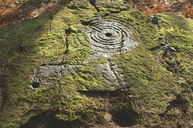
West Agra submitted by rich32 on 9th Jan 2006. West Agra, nr Masham, N Yorks - SE1424681758
(View photo, vote or add a comment)
Log Text: Google maps showed it was only just over 10 miles between Thornborough Henges, which we had just visited, and West Agra. Stopping off in Masham for a cup of tea, we need to take a minor road passing through the small villages of Fearby and Healey. We took a wrong turn which lead us down over the River Burn and to a reservoir, so we had to turn back and take the higher road past High Barn and Gollinglith Foot. Just after the road had done a sharp right/left about 1km past Gollinglith Foot, the entrance track to West Agra Farm appeared on the right hand side; there is room for 2 or 3 cars to park at the bottom. We then walked along the road for about half a kilometre to where the footpath heads off right up the hill (note coming back there is another footpath which is not marked on the map but passes about 100 yards in front of the farmhouse and leads back to the road). The footpath appears steep, but it’s on a soft, well kept grassy path, and is easy to climb. After the second gate, the area becomes a Site of Special Scientific Interest, with many different types of bird nesting in the area around.
We followed the trackway up to the junction of the drystone wall with the plantation, to our right hand side. Just before the end of the wall there is a gate into the field, then another gate to the north which leads into the plantation. We did go into the fields and the plantation, only later finding out we should have asked permission from Swinton Estates to walk across their land and through the plantation.
The West Agra site has at least 9 prehistoric carved rocks in 7 different areas on the southern side of West Agra Plantation and in the fields around West Agra Farm. They are significant because of the number of different carvings in the same area. 6 of the carvings are on individual rocks; the seventh is in a group of closely spaced rocks on the westerly side of the field system around the farm, which show heavily weathered cup marks. During the summer, the rocks within the plantation are covered by heavy bracken and mossy growth; it would be interesting to return in the winter months to find the rest of the stones.
We walked past the group of rocks in the field immediately to the east of the footpath, but couldn’t see any rock art; on our way back down to the car, we looked again, and because the light had changed, cup marks became very apparent and we wondered why we’d missed them in the first place.
Easiest to spot was the rock lying underneath the drystone wall – there is a great hump in the wall where it travels over the stone, which appears to be bedrock. The ground round the stone is very marshy, particularly on the eastern side of the stone on the other side of the wall, which also has a cup mark. The cup and groove marks on this stone were quite remarkable; the grooves appear to surround groups of cup marks . On the southern side of the stone there were other cup and worn groove marks which looked vaguely like a man, but it was difficult to tell. English Heritage say there are over 40 cup marks with grooved lines on this stone.
Since coming home, we’ve found the map showing the seven different areas, and we’ll definitely go back to see this site again nearer to Christmas.
Maiden Castle (N Yorks)
Date Added: 4th Aug 2014
Site Type: Ancient Village or Settlement
Country: England (Yorkshire (North))
Visited: Yes on 30th Jul 2014. My rating: Condition 4 Ambience 4 Access 3
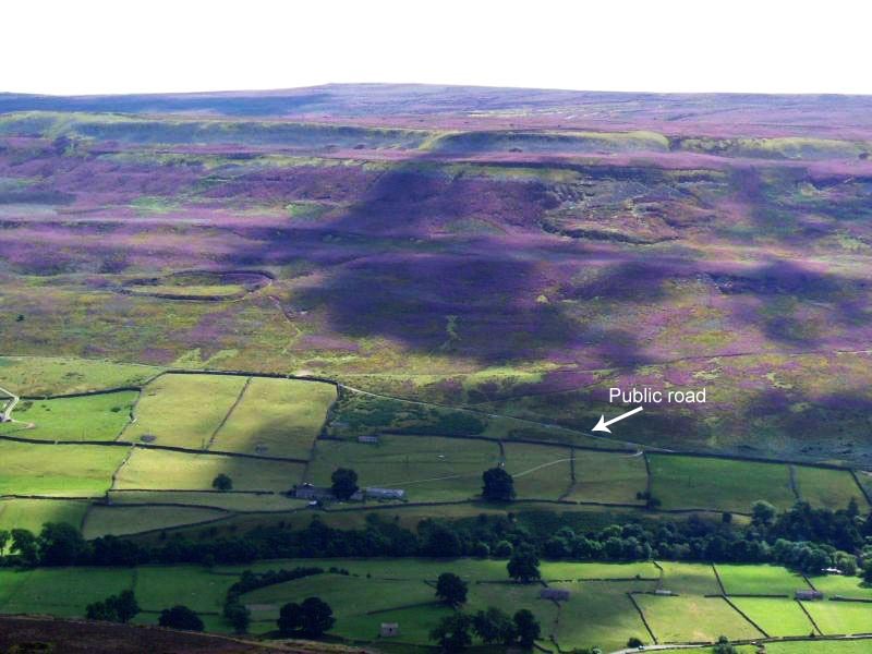
Maiden Castle (N Yorks) submitted by NeilD on 8th Sep 2005. SE 022981
Maiden Castle
(View photo, vote or add a comment)
Log Text: We ran out of time to see this site on 11th July, when we visited Thorborough Henges and West Agra (we got thoroughly distracted by the tremendous rock art at the latter), so took advantage of a trip down to Nottingham to detour via North Yorkshire and Swaledale to visit Maiden Castle.
Signs of the recent Tour de France were everywhere in this area (lots of yellow bunting and yellow bicycles, and spray-painted signs of encouragement to the riders on the roads). We stopped off in picturesque Reeth for lunch, then headed off southwards through the village of Grinton, turning west down a small narrow road with views of the river Swale to the north. This single track road runs for about 2km past ‘Bleak House’ and Harkerside Place. There are a number of footpaths and bridleways which run past Maiden Castle, but we picked the westernmost one, just past the fort, where there is a small parking area, sufficient for 4 or 5 cars.
From the car park, there is clearly marked path which runs (quite steeply) up past the western edge of the fort. As we were putting on our walking boots, two walkers were coming down and commented that the fort was ‘very well preserved; well worth seeing’.
I don’t like steep slopes or drops, but the path was relatively easy, and I needed a helping hand in only one or two rocky parts.
The fort was virtually invisible from the path, and is strangely situated part-way up the hillside. About 200 metres up the slope, the wsestern ditches of the fort suddenly come into view, then a few more paces open up a vista across the whole of the fort area. Turning to look back down the path, there are stunning views across the Swale valley and to the villages of Healaugh and Reeth across the valley.
There is a clear ditch and bank surrounding the fort; from the footpath to the west of the fort, it’s relatively easy to negotiate the ditch and bank easily (husband like a mountain goat, me picking my way gingerly), and ended up in a quiet, gentle spot, out of the wind and spotting rain. The brush underfoot wasn’t like other sites I’ve visited – the interior of the fort had what appeared to be low growing box plants with ferns, and we used sheep tracks to navigate from one point to the next within the fort area to avoid prickled ankles. At the southern end of the fort, where the slope drops steeply into the valley, there are quite a few tumbled stones, as if the fort had an outer wall at some point.
Before we visited, I had come across, and downloaded, the Durham University Archaeological Services report on Maiden Castle and West Hagg (geophysical surveys, report 2631, May 2011), which is available on the web when typing in ‘Maiden Castle Yorkshire’ on my web browser, so were able to largely identify the features they found within the fort, which was a real help in understanding what we were looking at.
Where their report had indicated a probable roundhouse, we found a circular area with very different vegetation, with low lying stones popping up through the grass to indicate where the foundation walls had been.
The walled approaches on the eastern side of the fort were impressive, giving the fort a ‘banjo’ shape. There is also a cairn/round barrow immediately adjacent to the northern end of the northern wall approach road to the fort.
Whilst exploring the fort, we saw other walkers pass by on the footpaths above and below, but very few people actually came into the fort, which was surprising. Definitely worth a visit.
Ramsdale
Date Added: 18th Aug 2014
Site Type: Standing Stones
Country: England (Yorkshire (North))
Visited: Yes on 15th Aug 2014. My rating: Condition 3 Ambience 4 Access 3
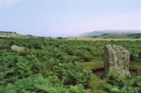
Ramsdale submitted by kelpie on 28th Sep 2002. A small circle overlooking the coast and cliffs at Ravenscar.
NZ 92057 03770
(View photo, vote or add a comment)
Log Text: Having escaped the rain and wind in our part of Northumberland, we headed for the east coast, where it was sunny and warm (although windy). However, it was a real relief to escape the sheer numbers of people in Whitby and head for the relative peace of the moors. Heading out of town on the A171, we followed the directions on the Portal site for the Ramsdale Stone Circle, which were spot on, thanks! Driving down the A171, we spotted the footpath we needed about 400 yards north of the junction of the A171 with the B1416, so turned round at the B1416 junction and parked on the grass verge at the edge of the entrance gateway to the track/footpath leading to Ramsdale House/Ramsdale Holiday Cottages.
We then followed the metalled track down towards Robin Hoods’ Bay; once over the brow of the hill, the views across to Robin Hood’s Bay were spectacular - we could see the waves breaking on the shore of the bay below.
Avoiding being mowed down by the four-wheel drive vehicles which came up and down the track at regular intervals, we missed the track off to the right mentioned in the directions on the Portal (but spotted it on the way back, as it dog-leg’s across the metalled track, rather than going straight across), and ended up following another track down to the gate in the next field boundary. It was then easy to turn and follow the sheep tracks back up the small hill to where the stones where located. The Ramsdale Stones appeared quietly, but suddenly, out of the heather. What a place to build a monument.
It was odd that there were only three stones, and we wondered (like many others) if there had been a fourth. We wandered around looking for stones under the grass, but only found a number of small, loose stones.
There were clear cup marks on the western most stone, and some possible ones on the northern stone.
The A171, which wasn’t far away, was very busy with Friday afternoon traffic, which spoiled the ambience a little, but the site itself is a lovely place to be. It is only a short walk from the main road, and worth stopping to visit, should you be passing.
White Cross (Three Howes Rigg)
Trip No.15 Entry No.1 Date Added: 10th Apr 2017
Site Type: Marker Stone
Country: England (Yorkshire (North))
Visited: Yes on 9th Apr 2017. My rating: Condition 2 Ambience 2 Access 5
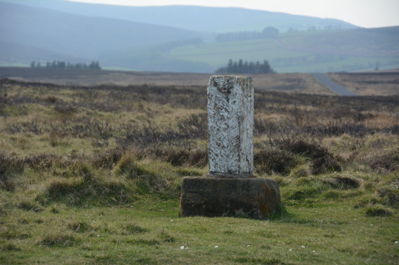
White Cross (Three Howes Rigg) submitted by Anne T on 10th Apr 2017. Standing on Smeathorns Road looking across to the stone and its earlier cross base, with the moors of the National Park in the distance to the west.
(View photo, vote or add a comment)
Log Text: White Cross, Three Howes Rigg, North Yorkshire: Approaching the Three Howes Tumuli on Smeathorns Road, we spotted this "White Cross" marked on the map at the road junction with Commondale Village. Stopping and running across the road in between the fast moving traffic, I took some photographs. This cross is listed by Historic England as entry 1250385, and is described as an "early to mid-C19 boundary stone on medieval base of wayside cross." The views across the National Park to the west would have been spectacular but for mist.
Wades Stone (South)
Date Added: 18th Aug 2014
Site Type: Standing Stone (Menhir)
Country: England (Yorkshire (North))
Visited: Yes on 15th Aug 2014. My rating: Condition 3 Ambience 3
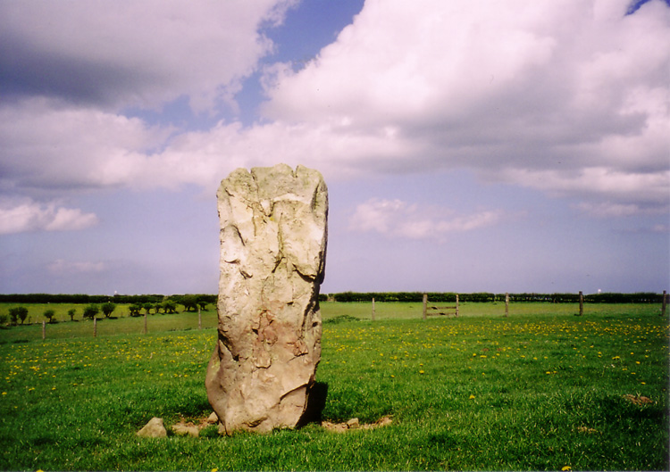
Wades Stone (South) submitted by DavidRaven on 13th May 2005. The southern Wade's Stone, looking north.
(View photo, vote or add a comment)
Log Text: From Wade’s Stone North, we drove back down Goldsborough Lane to the junction with the A174 and crossed straight over to East Barnby. Immediately over the road junction, there is a view of Wade’s Stone South from the first field gate (about 50 yards south of the junction), to the right hand side of the road.
There are no public footpaths leading to the stone, so we contemplated asking the Outdoor Centre next door if we could walk to the back of their site and hop over the hedge to take a photograph. However, this place was very forbidding, with many notices requesting ‘visitors to report to reception’ and a strong, metal barrier across the entrance gate, it had more of a feeling of a strict army camp rather than an outdoor activity centre. There was no-one wandering around, so we bottled out.
Bumping up onto the verge opposite the Centre, we walked back to the field gate by the road junction and looked over. There was a clear track used by a tractor from the field gate diagonally across the field to the Wade’s Stone South field. I later regretted not being brave enough to walk across the field to get a closer photograph, but the part of me that obeys the code/rules baulked at trespassing. We used my 300 mm lens to take a photograph of this stone; however, as this lens doesn’t have any vibration correction, the shots were fuzzy.
I’m going to try and track down the farmer/landowner, and next time we head back (hopefully to see the Old Wife’s Neck), we can include this in our list of sites to visit.
Money Hill (Pickhill)
Trip No.23 Entry No.3 Date Added: 16th May 2017
Site Type: Artificial Mound
Country: England (Yorkshire (North))
Visited: Yes on 11th May 2017. My rating: Condition 2 Ambience 3 Access 5
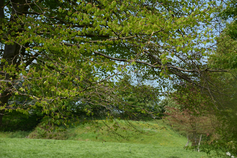
Money Hill (Pickhill) submitted by Anne T on 16th May 2017. The south eastern side of the motte rises about 3 metres high. Without the mentions on the OS map and the All Saints church guide, I would have driven straight past this scheduled ancient monument!
(View photo, vote or add a comment)
Log Text: Money Hill Motte, Pickhill: Leaving All Saints, going back down Money Hill to Street Lane, we stopped to look at the remains of the motte. I confess that without the grid reference and the OS map, I would have mistaken this for just another earthwork.
This is in fact a scheduled ancient monument, which was cut be the old railway line and the building of a bungalow. It is unusual in that it is square in shape.
Didn’t stop to wander round, as we were late for our appointment at St. Thomas’s, Brompton.
