Contributory members are able to log private notes and comments about each site
Sites Anne T has logged. View this log as a table or view the most recent logs from everyone
National Museum of Scotland (Pictish Stones)
Trip No.74 Entry No.2 Date Added: 20th May 2018
Site Type: Museum
Country: Scotland (Midlothian)
Visited: Yes on 17th May 2018. My rating: Condition 4 Ambience 4 Access 5
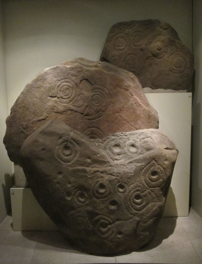
National Museum of Scotland (Pictish Stones) submitted by Anne T on 18th Jan 2018. A collection of 3 Pictish stones on display behind glass in Level -1 of the Tower. From front to back these are: Boulder from Letham Grange, Angus; Slab reused in a burial cist from West Yardhouse (?); and a slab from Lamancha.
(View photo, vote or add a comment)
Log Text: Pictish Stones at the National Museum of Scotland: See visit report for the National Museum of Scotland (Early Christian stones). Also went to the Research Library and came away with some great information on all the Pictish Symbol Stones held by the museum, and the names/details of various reference books.
National Museum of Scotland (Early Christian Stones)
Trip No.74 Entry No.1 Date Added: 20th May 2018
Site Type: Ancient Cross
Country: Scotland (Midlothian)
Visited: Yes on 17th May 2018. My rating: Condition 4 Ambience 4 Access 5
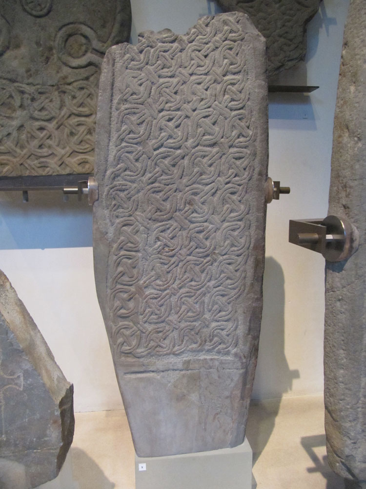
National Museum of Scotland (Early Christian Stones) submitted by Anne T on 18th Jan 2018. This Whithorn Style Cross Shaft is on display in the 'Early People's Exhibition on Level -1. It comes from Craiglemine, Glasserton, Wigtownshire near Whithorn, Dumfries and Galloway. Submitted with the kind consent of National Museums of Scotland. Exhibit X.IB 122. Dates from 900-100 AD.
(View photo, vote or add a comment)
Log Text: Early Christian Stones at the National Museum of Scotland: We returned to go to the Research Library to find out more about the Pictish Stones, and to photograph some more exhibits, only to find Tim Peake's Spacecraft had arrived that morning, with a PR exercise in full swing and the gallery we needed to get to had been closed off until 2pm (didn't say anything about this on the web site, until we dug deeper into the events schedule). Fortunately, by the time we'd been and looked at some casts of grave slabs in part of the Kingdom of the Scots exhibit, the gallery we wanted to go to was temporarily re-opened and we managed to get in and out in between the various waves of visitors and school children. The space craft was minute, and like a cross between something out of Dr. Who and The Clangers. Apparently, Tim Peake had attended earlier that morning, but we'd missed him.
I spent an hour in the research library, coming away with some photocopies and the names/details of a number of reference books.
We also managed to go into the 'Early People's Exhibit' which had been closed during our last visit - more Pictish Symbol stones and Early Christian stones, which more than made up for the disappointment of having arrived at 10.30am and being told we'd have to wait until 2pm to get in because of Tim Peake!
Carby Hill
Trip No.73 Entry No.1 Date Added: 14th May 2018
Site Type: Ancient Village or Settlement
Country: Scotland (Scottish Borders)
Visited: Yes on 13th May 2018. My rating: Condition 3 Ambience 5 Access 4
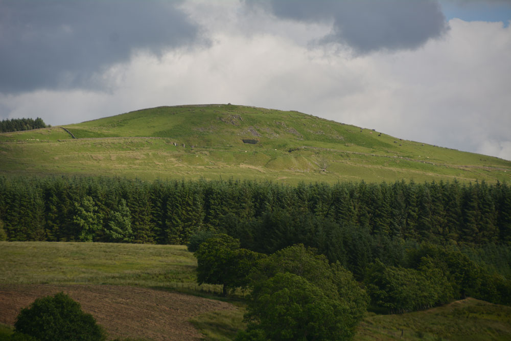
Carby Hill submitted by Anne T on 25th Jun 2017. We only saw Carby Hill Settlement from the Milnholm Cross just south of Newcastleton, then again from the track by the quarry just below the fort/settlement. When we arrived, we saw some enormous cattle grazing the site. Even my husband balked, and he was brought up on a farm and is used to these beasts. Looking forward to a return trip in the not too distant future - it looks amazing.
(View photo, vote or add a comment)
Log Text: Carby Hill Hillfort/Settlement, Scottish Borders: Literally just across the border from England, we parked by the cattle grid at NY 48834 83744, opposite the bungalow/farm. Just to our south east, there was (unusually for Scotland) a footpath sign which led up to the hillfort, so we decided to follow it. A mistake. The gate into the field of sheep was wired shut, so we had to duck under the electric fence. Following the slope uphill, we had to tackle three or four deep field drains, full of running water.
It wasn’t until we got towards the top of the slope that the walls of the settlement came into view. And what walls.
This is a really brilliant site. The last time we tried to get up here, there was an absolutely monumentally huge bull and cattle on top of the hill. This time, there were only sheep and their lambs. With 360 degree views, it was superb.
The interior of the hillfort is not large, but we made out four, if not five, hut circles, still with their banks intact, plus a watchtower in the north eastern corner.
Not much of the walls remains on the north/north eastern side, but there are lower banks of stones. We walked round the outer edge of the wall, to where stones have been piled up to form a modern cairn, overlooking the Liddel Water valley below. We descended the hill from the western side of the hillfort, which avoided the field drains, and a much easier walk.
Great North Museum (Rock Art)
Trip No.72 Entry No.3 Date Added: 13th May 2018
Site Type: Museum
Country: England (Tyne and Wear)
Visited: Yes on 4th May 2018. My rating: Condition 3 Ambience 4 Access 5
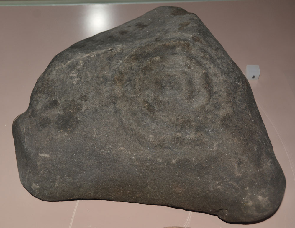
Great North Museum (Rock Art) submitted by Anne T on 10th May 2018. On display in a case in the Prehistoric display on the ground floor. Comparing photographs, I think this is Fowberry Moor Farm, Island/Deershed Plantation Panel, ERA-1842, Beckensall 179. The panel is stained dark red due to peat staining.
Submitted with the kind permission of the Great North Museum.
(View photo, vote or add a comment)
Log Text: Great North Museum (Rock Art): in the 'Prehistoric' Exhibition on the ground floor (see the general Great North Museum page for full visit report). A real shame that most of the exhibits were behind glass, and very close together, which made them difficult to photograph. It was nice to see some of the Beckensall RA stones which had been donated to the museum - but I wonder where the rest are, and there are quite a few. These seemed relatively poor examples given the photos I've seen on the ERA website. Much enjoyed seeing these.
Great North Museum (Anglo Saxon Stones)
Trip No.72 Entry No.2 Date Added: 13th May 2018
Site Type: Museum
Country: England (Tyne and Wear)
Visited: Yes on 4th May 2018. My rating: Condition 3 Ambience 4 Access 5

Great North Museum (Anglo Saxon Stones) submitted by Anne T on 11th May 2018. This is the front of the Rothbury Cross head, described as one of the finest pieces of Anglo-Saxon sculpture from the Kingdom of Northumbria. It is carved with scenes of the crucifixion and other motifs. The museum sign says it was made about 100 years after the Lindisfarne Gospels but "clearly belongs to the same artistic tradition." From the collection of the Society of Antiquities of Newcastle upon Tyne. Submitted with the kind permission of the Great North Museum.
(View photo, vote or add a comment)
Log Text: Great North Museum, Anglo Saxon Exhibit: A small but nicely presented collection of Anglo Saxon cross fragments and grave goods. Ground floor. See general SID page for Great North Museum for main visit report.
Great North Museum
Trip No.72 Entry No.1 Date Added: 10th May 2018
Site Type: Museum
Country: England (Tyne and Wear)
Visited: Yes on 4th May 2018. My rating: Condition 4 Ambience 4 Access 5
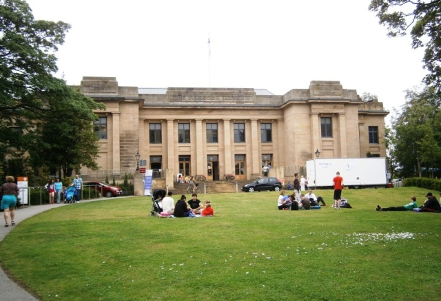
Great North Museum submitted by durhamnature on 25th Jul 2012. The Great North Museum, formerly the Hancock. The best museum in the north east.
(View photo, vote or add a comment)
Log Text: Great North Museum, Newcastle: The last time I visited here was some 8 or 9 years ago, with some police officers from York. We spent most of our time at the Hadrian's Wall exhibit, with them comparing Roman soldier's battle kit to their modern day riot gear. I found the layout of the galleries confusing, and the signs not terribly clear, but we spent a good couple of hours looking at Anglo Saxon artefacts and rock art. I also enjoyed the Ancient Egyptian gallery, and found the Mouse House for under 5's - definitely a place to return to with my grand-daughter.
I'd love to come back to their library sometime, which is open to all. The coffee shop on the first floor was also good.
Millstone Burn 1c
Trip No.71 Entry No.8 Date Added: 9th May 2018
Site Type: Rock Art
Country: England (Northumberland)
Visited: Yes on 7th May 2018. My rating: Condition 2 Ambience 3 Access 4
Millstone Burn 1c submitted by SolarMegalith on 7th Jun 2013. General view of the cup-marked boulder as seen from the east (photo taken on June 2013).
(View photo, vote or add a comment)
Log Text: Millstone Burn 1c: This panel was very near the road (some motorists tooted their horns as they went past) and parts of it were under turf and moss. Part of the line of cups visible on the ERA photographs were covered by moss, which we left undisturbed. It was difficult to distinguish any other cups on the rock, despite having the ERA images on my phone to compare it to.
Millstone Burn 1e
Trip No.71 Entry No.6 Date Added: 9th May 2018
Site Type: Rock Art
Country: England (Northumberland)
Visited: Yes on 7th May 2018. My rating: Condition 2 Ambience 3 Access 4
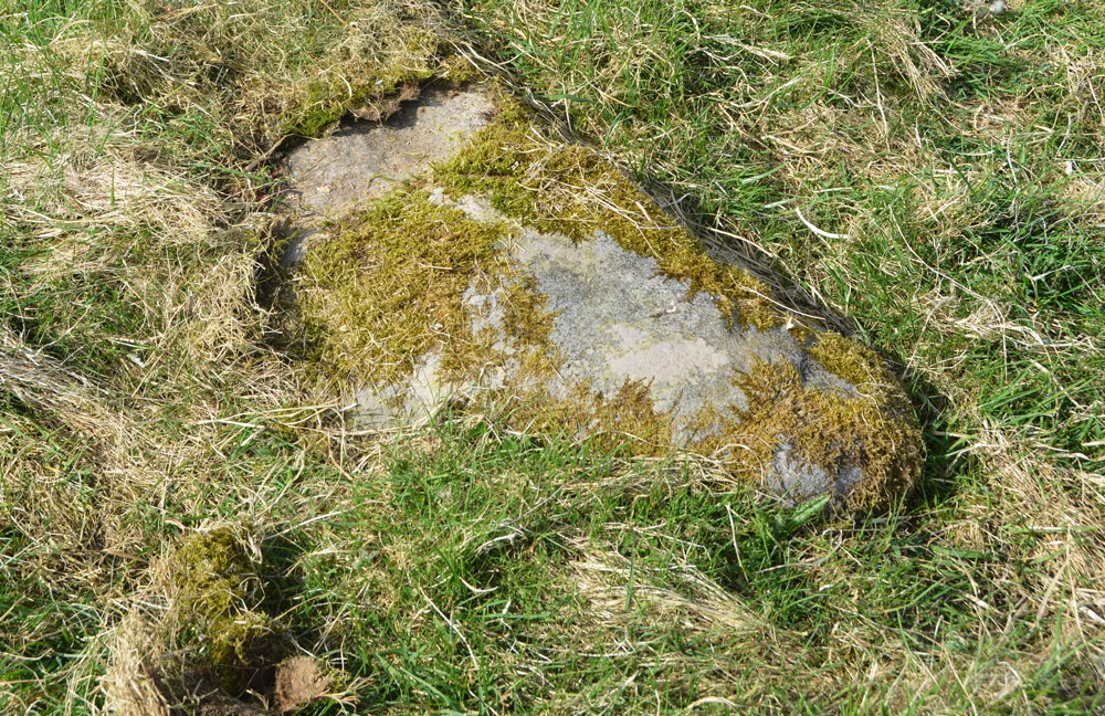
Millstone Burn 1e submitted by Anne T on 9th May 2018. Millstone Burn 1e was too heavily under moss to make out any motifs at all. We didn't want to move any moss, so left the panel as it was.
(View photo, vote or add a comment)
Log Text: Millstone Burn 1e: On the eastern side of the A697, not far from the gate into the field. This was the stone at the grid reference given, but was almost completely buried under moss/turf, with one end of it seeming to have been grazed by farm machinery, which had taken off the moss and a shallow layer of stone. We left the moss as it was, not wanting to harm the motifs (but then NADRAP said they didn't observe anything).
Millstone Burn 2e
Trip No.71 Entry No.5 Date Added: 9th May 2018
Site Type: Rock Art
Country: England (Northumberland)
Visited: Yes on 7th May 2018. My rating: Condition 2 Ambience 3 Access 4
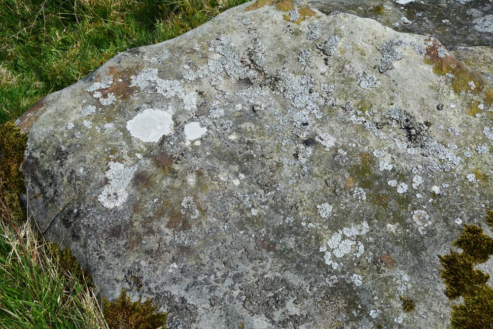
Millstone Burn 2e submitted by Anne T on 9th May 2018. In typical Tate fashion, we didn't remember to take any water along to try and highlight the motifs. We did struggle to find them!
(View photo, vote or add a comment)
Log Text: Millstone Burn 2e: This rock is not far upslope from Millstone Burn 2dd and 2d. Again, without GPS we would have struggled to find this rock, and we did struggle to identify any of the motifs - Beckensall described these as two ringed cups and two other cups, one with a natural groove leading to it and a pecked groove leading away from the ring. By the time of the NADRAP survey, they recorded a cup and very thin ring with groove running to the northern edge of the outcrop.
This stone was very interesting as downslope it had a step in it, and not only was there a channel wearing, but there were green water stains from where rain water had trickled down the slight slope of the rock downhill.
These motifs must have been placed to have been seen as you were coming down or up the slope.
Millstone Burn 2dd
Trip No.71 Entry No.4 Date Added: 8th May 2018
Site Type: Rock Art
Country: England (Northumberland)
Visited: Yes on 7th May 2018. My rating: Condition 2 Ambience 3 Access 4
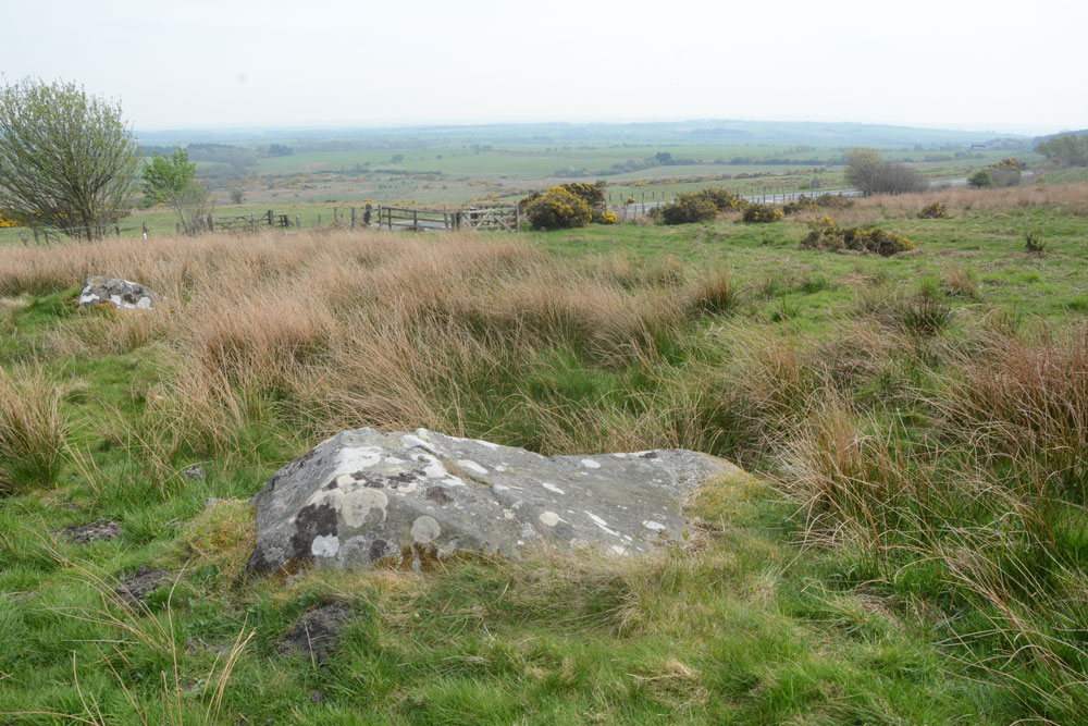
Millstone Burn 2dd submitted by Anne T on 8th May 2018. Millstone Burn 2dd panel, looking east across the A687.
(View photo, vote or add a comment)
Log Text: Millstone Burn 2dd: only 15m away from Millstone Burn 2d, and relatively easy to find amongst all the other boulders in the field. As these motifs are on top of the rock, they must have been designed to have been seen as you were coming down the hillside.
This rock looks very different shapes depending on what angle you view it at. We had huge difficulty making out any cup marks at all beneath the lichen and moss, although there are some grooves, which look as if they have been created (enhanced?) by rainwater trickling down and over the side of the rock over the years.
Not the best example of rock art we've seen, but one to tick off the list.
Millstone Burn 2d.
Trip No.71 Entry No.3 Date Added: 8th May 2018
Site Type: Rock Art
Country: England (Northumberland)
Visited: Yes on 7th May 2018. My rating: Condition 3 Ambience 3 Access 4
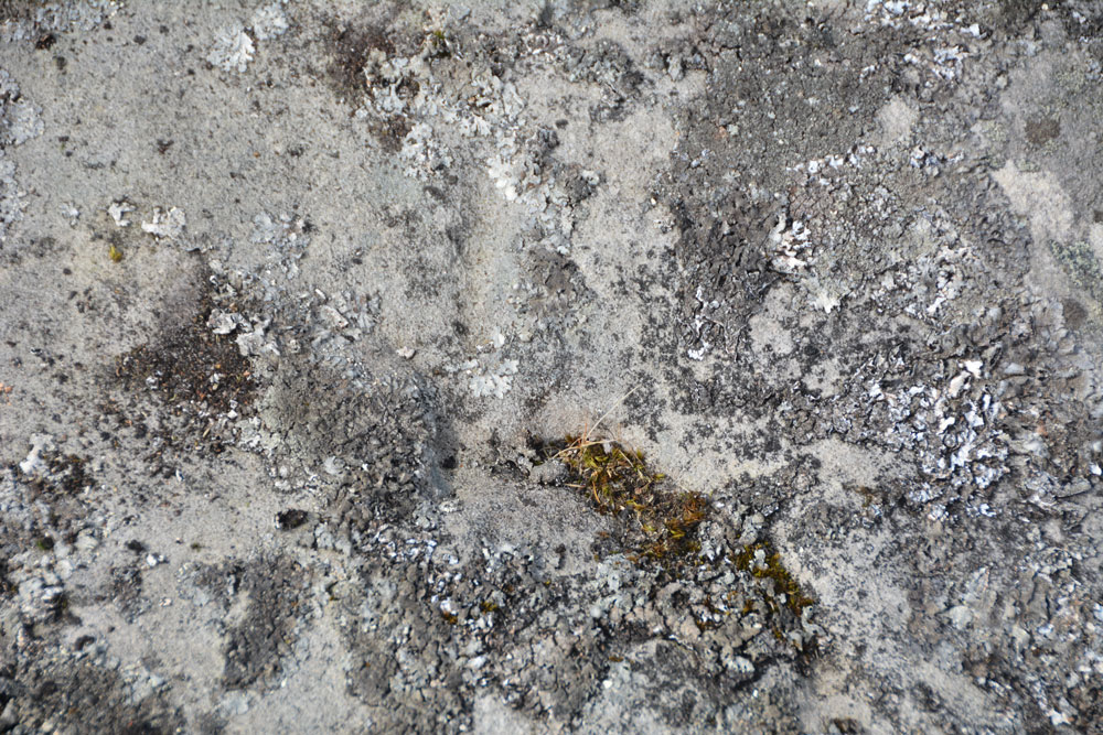
Millstone Burn 2d. submitted by Anne T on 8th May 2018. The area of mechanical damage towards the centre of the rock.
(View photo, vote or add a comment)
Log Text: Millstone Burn 2d: Closer to the A697, it's a good job we had the GPS to find this panel. In usual Tate style, we'd brought everything but a bottle of water to bring out the motifs. I had to call up the ERA media (photos and sketch) on my phone to ensure we understood what we were seeing. There really are cups beneath the lichen and moss, easier to feel with the fingers and see with the naked eye.
Millstone Burn 2bb
Trip No.71 Entry No.2 Date Added: 8th May 2018
Site Type: Rock Art
Country: England (Northumberland)
Visited: Yes on 7th May 2018. My rating: Condition 3 Ambience 3 Access 4
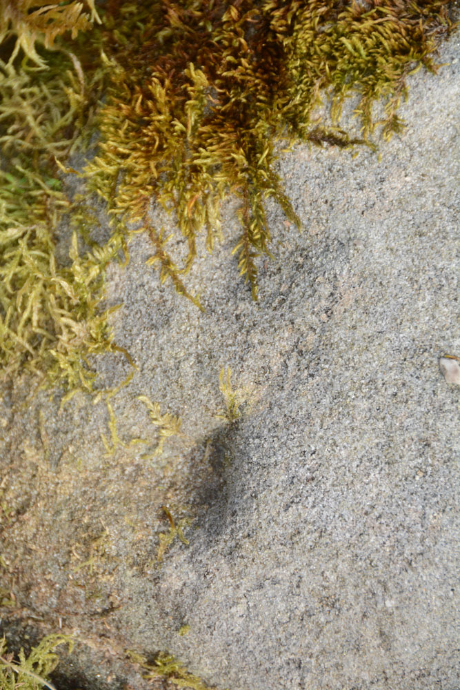
Millstone Burn 2bb submitted by Anne T on 8th May 2018. The oval and groove, as shown on the ERA drawing for Millstone Burn 2bb.
(View photo, vote or add a comment)
Log Text: Millstone Burn 2bb: This would be a 'short walk on a footpath' if we'd come in through the gate we used at our last visit. This time we approached it from Millstone Burn 2c, walking down the hill towards the start of the bend in the A697 from Longframlington. The rock was instantly recognisable from ERA's description, as was finding the two indentations at its apex and the oval and groove on ERA's drawing. The three cup marks in a line were there, but underneath a heavy covering of moss and lichen. They could be felt by running your fingertips over the rock.
Millstone Burn 4c
Trip No.71 Entry No.1 Date Added: 8th May 2018
Site Type: Rock Art
Country: England (Northumberland)
Visited: Yes on 7th May 2018. My rating: Condition 3 Ambience 4 Access 3
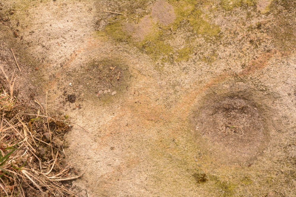
Millstone Burn 4c submitted by Anne T on 8th May 2018. Close up of the two cup marks, with some of the iron containing sandstone showing up red. These two cups appeared linked by a very faint groove, which could be felt with the finger tips.
(View photo, vote or add a comment)
Log Text: Millstone Burn 4c: It was so hot at home this morning that we decided to seek cooler climes. Husband had compiled a list of rock art panels that looked interesting and their grid references. After having found the gps, we set off for Longframlington, this time parking round the bend at a larger entrance to a slightly different field at NU 11525 05542. This meant walking through virtually knee high heather up to the top of the slope, but we found some paths had been mown through the heather. At the top of the hill, we had to clamber over a double barbed wire fence to get to the main outcrop (there wasn’t a gate for some way).
What we actually saw was Millstone Burn 4c at NU 11516 05169, part of the same outcrop as Millstone Burn 4a and 4b (thank heavens for GPS). Two cups were very obvious, together with some of the iron stone banding/staining. These two cups appeared to be joined by a very faint groove, which could be felt with the fingertips. Much of the rest of the panel was under turf, which we left undisturbed to protect the rock art underneath.
Millstone Burn 1d
Trip No.71 Entry No.6 Date Added: 7th May 2018
Site Type: Rock Art
Country: England (Northumberland)
Visited: Yes on 7th May 2018. My rating: Condition 2 Ambience 4 Access 4
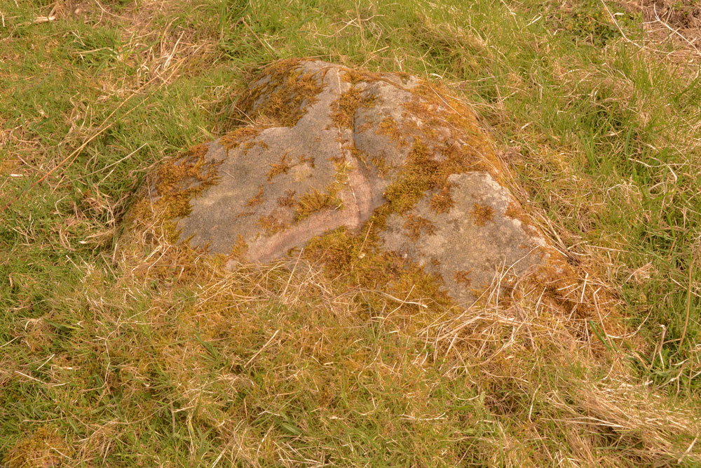
Millstone Burn 1d submitted by Anne T on 7th May 2018. Millstone Burn 1d from a different angle, showing the 'scar' across the middle of the rock, which looks relatively recent.
(View photo, vote or add a comment)
Log Text: Millstone Burn 1d: This rock art panel is just to the east of the A697 and largely covered in turf. There is a deep scar in the rock which looks relatively recent. It also has a curious vein of quartz which runs through the rock.
Long Stone (Barcombe Hill)
Trip No.70 Entry No.2 Date Added: 6th May 2018
Site Type: Ancient Cross
Country: England (Cumbria)
Visited: Yes on 5th May 2018. My rating: Condition 3 Ambience 4 Access 4
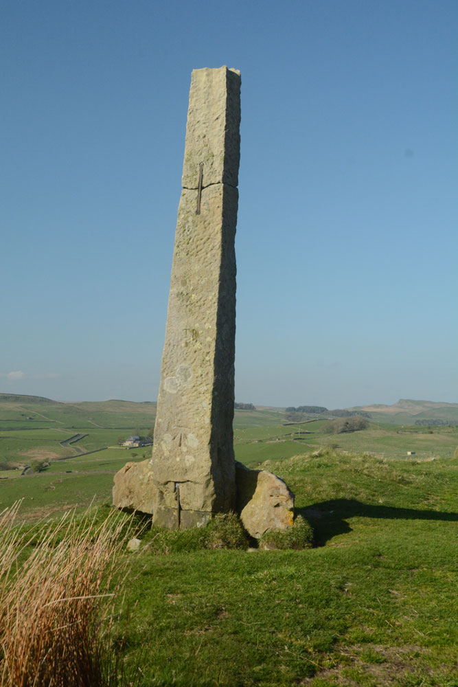
Long Stone (Barcombe Hill) submitted by Anne T on 6th May 2018. The Long Stone from the west, looking back towards Barcombe Iron Age defended settlement.
(View photo, vote or add a comment)
Log Text: The Long Stone, Barcombe Hill: we always thought this was a modern marker stone, sitting high above Stane Way. We also thought it was difficult to get to. Not so. There are well mown grass trackways that lead from Barcombe Iron Age Defended Settlement/Roman Signal Station, as well as from the Trig Point on Barcombe Hill. We approached from the trig point, which is higher than this stone and the settlement.
The whole stone and base are held together with large metal/iron rivets. The base looks as if it has been broken into two, and one half has been taken away. The top of the cross appears rounded upwards at the four corners, as if a cross head (or similar) was mounted on top.
The more time I spent here, the more I was convinced this was an old cross. What a location! With Vindolanda below, it is certainly a very prominent spot.
Barcombe Hill Settlement
Trip No.70 Entry No.1 Date Added: 6th May 2018
Site Type: Ancient Village or Settlement
Country: England (Northumberland)
Visited: Yes on 5th May 2018. My rating: Condition 2 Ambience 4 Access 4
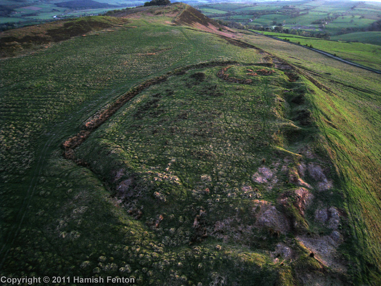
Barcombe Hill Settlement submitted by h_fenton on 22nd Jul 2011. Barcombe Hill Settlement viewed from the northeast with low evening light. The feature at the far end of the settlement is the Roman Signal Station
Kite Aerial Photograph
24 April 2011
(View photo, vote or add a comment)
Log Text: Barcombe Hill Iron Age Defended Settlement and Roman Signal Station: On a very hot bank holiday Saturday, we decided to try and go somewhere a little cooler, so set off towards Bardon Mill (OK, I was born to live in Scandanavia, not hotter climes). We'd previously tried to visit this site but used a route from nearer the Long Stone, on a day when dog races were taking place and there were lots and lots of people, plus when we approached the settlement, there was a huge bull and his ladies (we beat a hasty retreat).
Today we parked by the junction of Stanegate with the minor road running to Bardon Mill through Westend Village. A gate led us into the field and there was a mowed trackway leading up to the settlement (a note on the gate said the Open Access land was closed for the week before and a few days after our visit). We wandered over the settlement - the bank and ditch on the southern side is well preserved, but the northern edge has been quarried and there are some deep holes.
Making our way over to the Roman Signal station, I saw Andrew fall over in slow motion - his foot had gone down a hidden rabbit hole up to his knee. Once we'd spotted these holes, which were everywhere, we kept to the sheep tracks to avoid falling again.
After walking round the settlement, we made our way up to the Trig Point to get a view down.
Priest's Well (Bewcastle)
Trip No.69 Entry No.3 Date Added: 6th May 2018
Site Type: Holy Well or Sacred Spring
Country: England (Cumbria)
Visited: Yes on 23rd Apr 2018. My rating: Condition -1 Ambience 3 Access 4
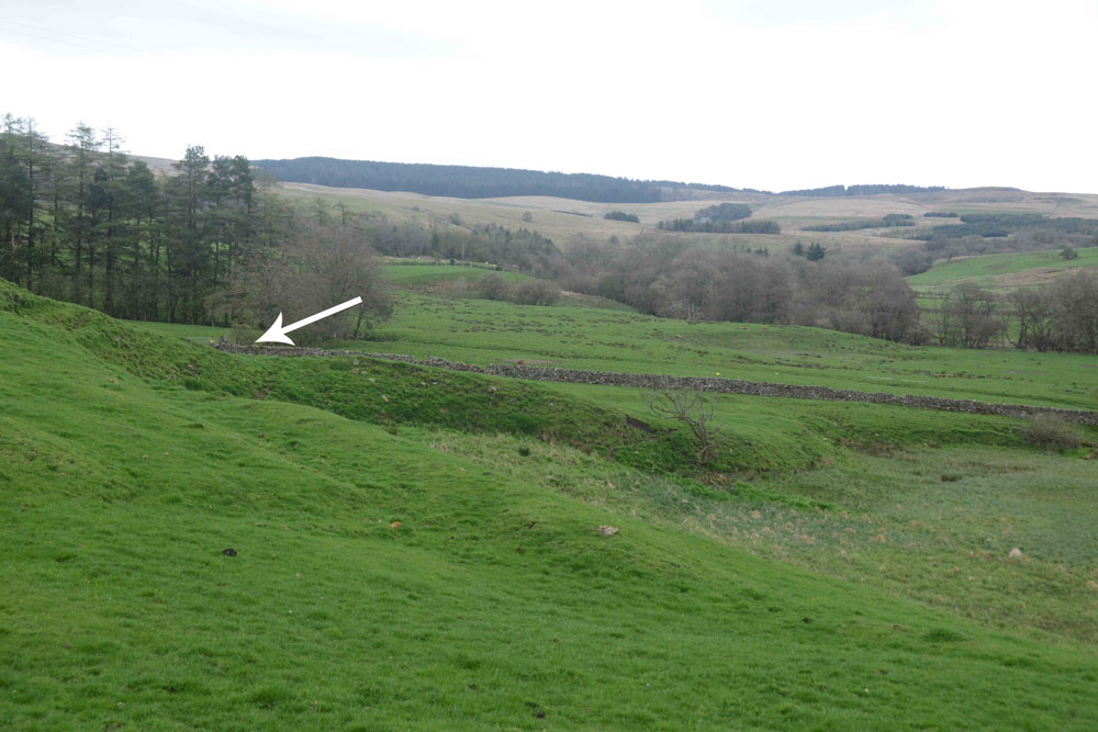
Priest's Well (Bewcastle) submitted by Anne T on 6th May 2018. This photograph was taken from the south eastern corner of the churchyard, the current landforms seeming to indicate that a spring once issued from here, disappearing into the Kirk Beck below.
(View photo, vote or add a comment)
Log Text: Priest's Well, Bewcastle (site of): As the ground was far too boggy to go and see the three cairns to the west of Parkgate Bridge, I found this well marked on the OS map, so we decided to go and see it. Arriving at St. Cuthbert’s and the Bewcastle Cross, we orientated ourselves with the map to find the well is actually on private farmland. The farmer was busy driving around the field in his tractor, so we decided we could probably see the well from the eastern end of the churchyard.
We did see some indication of where the site of the well was, but there was no well housing or water flowing. I could find very little information on this well, apart from the mention in the Old Cumbria Gazetteer, which says it is a spring. As I finished photographing the site of where the well probably was, drizzle started to hurtle down.
Askerton Park
Trip No.69 Entry No.1 Date Added: 5th May 2018
Site Type: Ancient Village or Settlement
Country: England (Cumbria)
Visited: Yes on 23rd Apr 2018. My rating: Condition 2 Ambience 3 Access 4
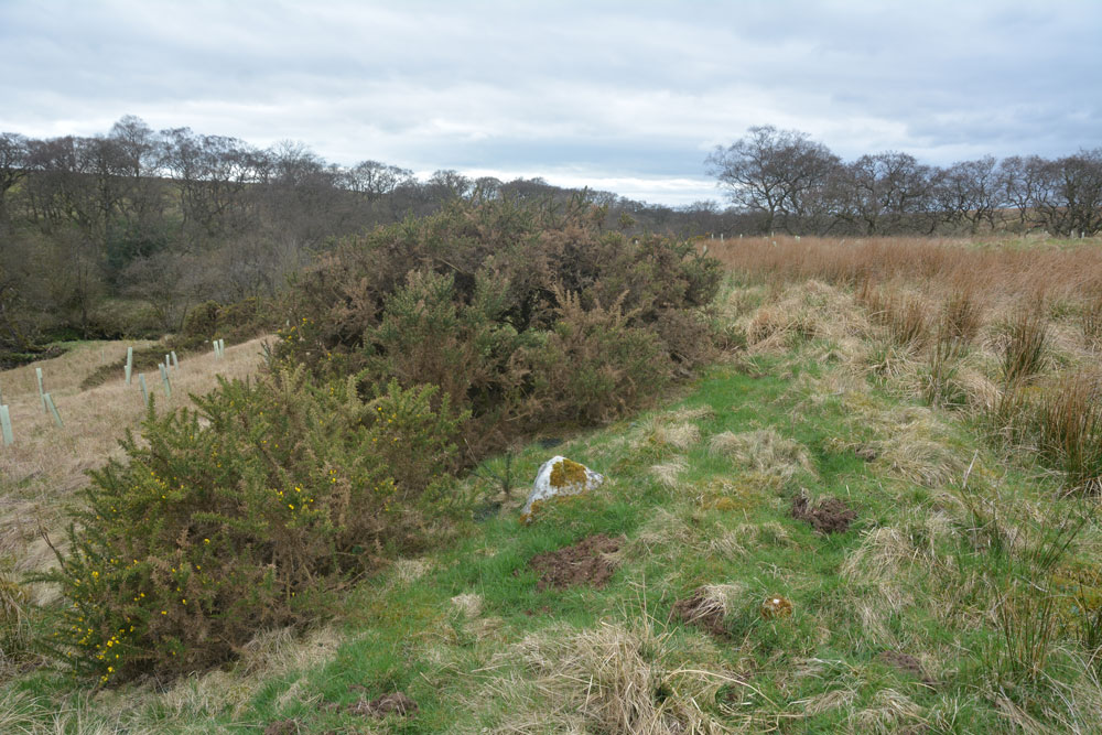
Askerton Park submitted by Anne T on 5th May 2018. Right in the middle of the settlement and just a little to its eastern side, there is a wide stoney bank which looks as if this may have been part of the main dwelling described in the Pastscape record. All around here the moles had been very active, and many shards of pottery had come to the surface.
(View photo, vote or add a comment)
Log Text: Askerton Park Settlement: This is marked on the OS map, so we stopped at the northern end of Parkgate Bridge, where there is room to pull off the road and put on our wellies. We let ourselves in through the gate and tramped over the fields, entering the settlement from its north eastern side.
This settlement is fascinating, as its basically on a promontory between the Cam Back and Melefarm beck. Hollow ways run from the eastern part of the settlement to the Cam Beck, and there is another hollow way which picks up almost half way across the settlement, leading to Cam Beck. Following the latter trackway to the burn, there are the obvious remains of a cairn.
It was really interesting walking across the tops of the enclosure banks, which stood out a brighter green with shorter grass than the surrounding wheat-coloured taller stalks. There were lots of stones in the banks. The moles had had a field day, and I picked up a couple of the many pieces of pottery that had come to the surface of a mole hill (I wasn't certain they were pots until I got home and saw the inclusions and felt the lightness of the pot as opposed to some odd shaped stones).
Tullie House Museum
Date Added: 29th Apr 2018
Site Type: Museum
Country: England (Cumbria)
Visited: Yes on 20th Apr 2018. My rating: Condition 4 Ambience 4 Access 5
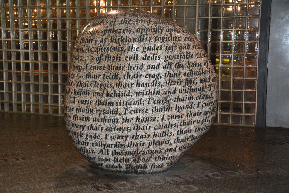
Tullie House Museum submitted by Anne T on 19th Sep 2017. Walking around the Cursing Stone - a bit difficult to photograph in what is largely a dimly lit pedestrian underpass with bright lights illuminating a few spots and shining off the stone.
(View photo, vote or add a comment)
Log Text: Tullie House Museum, Carlisle: We went to see the copy of the Bewcastle Cross and the Anglo Saxon cross fragments I'd seen photos of some years ago. The Bewcastle Cross copy no longer stands in the main entrance lobby, but is now in storage, and there are only a couple of rock art panels on display, along with Celtic gods (all displayed behind glass).
There was a very interesting video, and a display of associated artefacts, of the Langdale Axe factory.
A small museum, but interesting, even the Roman gallery in the basement, which has lots of interactive displays for children.
We bought a year pass for £10 each, which means we can return at any time for free until the end of April 2019. I've asked permission to go back to use their learning resource to find out more about the Celtic god sculptures.
Castlesteads (Lowther)
Trip No.68 Entry No.6 Date Added: 10th Apr 2018
Site Type: Misc. Earthwork
Country: England (Cumbria)
Visited: Yes on 5th Apr 2018. My rating: Condition 2 Ambience 4 Access 4
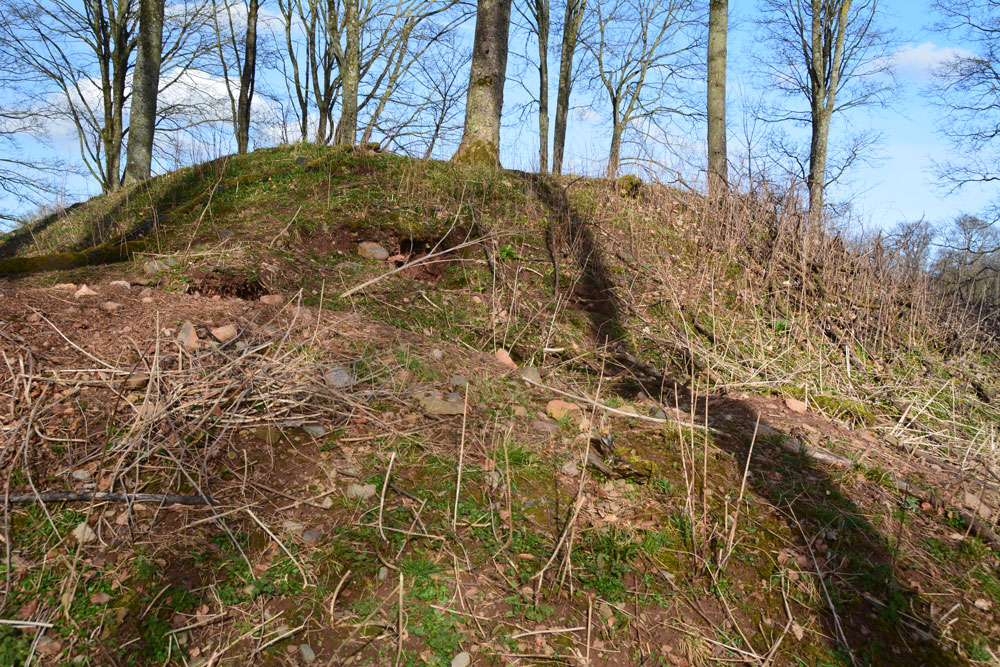
Castlesteads (Lowther) submitted by Anne T on 10th Apr 2018. Approaching the earthworks from its north western side. The bank rises rapidly from the River Lowther below. It's a very strategic spot on a curve of the river.
(View photo, vote or add a comment)
Log Text: Castlesteads Earthworks, Lowther Castle: This Castlesteads (as opposed to the Iron Age settlement we visited next) is just over 220 metres south of the gate into St. Michael’s Churchyard.
Being on a high spot above a bend in the River Lowther, it looks like a very strategic spot to build a defensive structure. In fact, Pastscape says it’s the remains of an old Pele Tower or other medieval building.
Hidden in the woods, but with a footpath leading to it, it is an intriguing ruin, with high banks on all four sides of a rectangle and remnants of the masonry on its western edge.
