Contributory members are able to log private notes and comments about each site
Sites Anne T has logged. View this log as a table or view the most recent logs from everyone
Little John's Well (Hampole)
Trip No.64 Entry No.2 Date Added: 16th Jan 2018
Site Type: Holy Well or Sacred Spring
Country: England (Yorkshire (South))
Visited: Yes on 15th Jan 2018. My rating: Condition 2 Ambience 2 Access 5

Little John's Well (Hampole) submitted by Creative Commons on 8th Feb 2013. Little John's Well. Located in woodland just off the A638 North of the road to Skelbrooke.
Copyright Gerald England and licensed for reuse under the Creative Commons Licence.
(View photo, vote or add a comment)
Log Text: Little John's Well, Hampole: Please note, when I say disabled access - the site is visible (just) from the road, but there are a few steps up the brambled covered slope (not enough to say 'short walk on a footpath' because there is none). For what seemed to be like a country area with a few little villages around, there was an endless stream of traffic, including huge lorries, but then I guess there is a huge quarry immediately adjacent to this site, plus it sits by the side of the A638, a main road into Doncaster.
With parked on the wide entrance to Hazel Lane (made so because the huge lorries need to be able to swing round) and walked round the corner to the A638 and found the well hidden behind a large clump of brambles.
Not having expected to come here (it wasn’t far off the route and we had half an hour to kill) I wasn’t dressed for clambering up slippery, bramble covered slopes (being attired in long skirt and shoes for scattering my step father’s ashes), but with the help of my husband, I made it up the short slope anyway. There was a further stone structure higher up the slope, and from the Pastscape entry, this appears to be the main spring, which feeds into the well trough below.
There were also stone facings higher up the hill, but Andrew said these were more likely to be there to support the slope. From reading the Pastscape entry this morning, these stone may have been part of the enclosure for the well.
Robin Hood's Well (Burghwallis)
Trip No.64 Entry No.1 Date Added: 16th Jan 2018
Site Type: Holy Well or Sacred Spring
Country: England (Yorkshire (South))
Visited: Yes on 15th Jan 2018. My rating: Condition 2 Ambience 2 Access 5
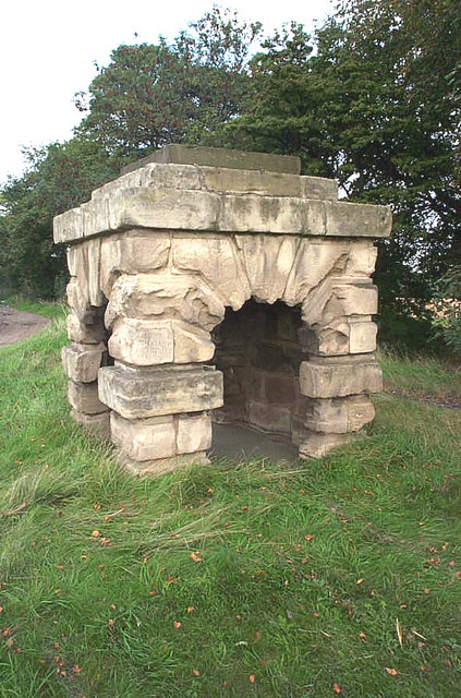
Robin Hood's Well (Burghwallis) submitted by Andy B on 18th Oct 2010. The old well has now been capped with concrete.
(View photo, vote or add a comment)
Log Text: Robin Hood's Well, just off the A1 near Burghwallis: With the rain pounding down on the car and a warning light just appeared on the car dashboard, we were glad to pull off the A1 near Burghwallis. It was easy enough to pull onto the layby (it was a busy place), but difficult to get back onto the A1 and we had to wait quite a long time for a big enough gap in the traffic to appear.
I pulled my coat on and headed off the few metres from the car to the well housing, getting soaked on the way. Having wanted to stop off here for years, but never having succeeded, I confess to being really disappointed. This really is just a recently constructed stone 'well house', with a bit of graffiti inside and a vague hollow for where the well pipe might have been situated. Still, I achieved it and got a few photos, having to wipe the camera down well once I huddled back in the car to warm up.
Piper Lane Standing Stone (Birtley)
Trip No.63 Entry No.4 Date Added: 10th Jan 2018
Site Type: Standing Stone (Menhir)
Country: England (Northumberland)
Visited: Yes on 7th Jan 2018. My rating: Condition 2 Ambience 3 Access 5
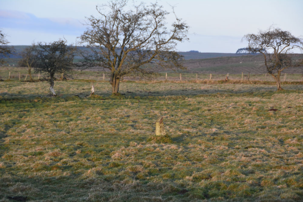
Piper Lane Standing Stone (Birtley) submitted by Anne T on 10th Jan 2018. The stone, in the middle of a water logged field. A rubbing stone, marker stone or a standing stone? It looks as if its been in the ground for some time and stands to the north of cultivation terraces.
(View photo, vote or add a comment)
Log Text: Piper Lane Stone, Birtley Shields: Spotted this on the way back from Birtley Shields, standing in the middle of the field. There was no easy access into the field and the ground was waterlogged, so passed up on climbing over the stone wall to get a closer look.
It's location is intriguing, as it stands north of the cultivation terraces marked on the OS maps. There are no other rubbing stones in the surrounding fields. Couldn't find anything about it on Pastscape, HE or by doing a general web search.
Carry House Enclosure (Birtley Shields)
Trip No.63 Entry No.3 Date Added: 10th Jan 2018
Site Type: Ancient Village or Settlement
Country: England (Northumberland)
Visited: Yes on 7th Jan 2018. My rating: Condition 2 Ambience 4 Access 5
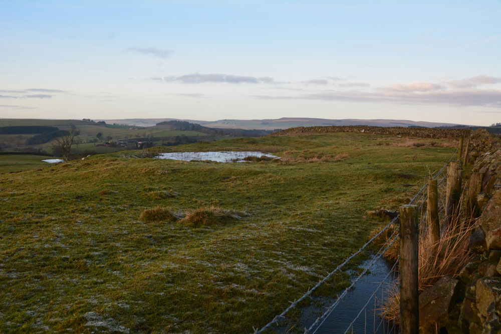
Carry House Enclosure (Birtley Shields) submitted by Anne T on 10th Jan 2018. Leaning right over the stone wall at the east of the settlement, looking northwards over the hut circle(s) trying to locate the cairn mentioned in Pastscape.
(View photo, vote or add a comment)
Log Text: Carry House Settlement, Birtley Shields: Cut by two stone walls and ploughed away at its northern end, but this was a stunning spot, tucked below a hill and with a steep slope down to the River North Tyne Valley below.
In the distance I could hear the farmer on his tractor running animal feed to his Blackies. I said to my husband, "He's going to come over." Five minutes later he drove up on his quad bike and engaged us in conversation, telling how this block of land belonged to the Duke of Northumberland "who didn't like visitors and didn't want them taking photographs" ("What, even though its marked on the OS map and its next to a public highway? Why are there no notices telling us this?" I think he was just winding me up!). Anyway, he was very pleasant and told us about his farm and a brief history of the area.
As the farmer was around, we stuck to walking up to the wall and along the track to take photographs. Shame, as I would have nipped through the gate to look for the cairn.
Mill Knock Chalybeate Well (Birtley)
Trip No.63 Entry No.2 Date Added: 8th Jan 2018
Site Type: Holy Well or Sacred Spring
Country: England (Northumberland)
Visited: Yes on 7th Jan 2018. My rating: Condition 3 Ambience 4 Access 5
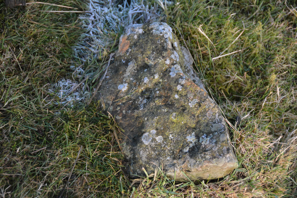
Mill Knock Chalybeate Well (Birtley) submitted by Anne T on 8th Jan 2018. is it my imagination (probably!) but as the sun shone on this stone by my feet, it looked as if there were 3 narrow, partial rings. For a moment I got quite excited at the possibility of a new rock art find, but the sun went in, and I thought 'no'. Curious to see what others think??
(View photo, vote or add a comment)
Log Text: Mill Knock Holy Well: The skies may have been blue and tempting to put on walking boots, but the temperatures were just on freezing and the minor roads around here were just like skating rinks! This well is not marked on the map, but my husband had come across an article on it, and being not too far from our house, decided to drive out to visit.
This is a glorious location (well, if you ignore the quarry). Access into the well field is a bit tricky, as there is no gate near the gorge formed by the gushing spring, but a bit of wooden fence allowed us to hop over to get a closer look.
On the eastern side of the road, the Holywell Burn is just a trickle - like a shallow ditch, but crossing the single track road and looking west over the stone wall, there is a strong gush of clear water which comes tumbling out of the hillside.
From a distance, it looks as if the water comes directly from the face of the large stone which is visible at the head of the gorge, but in fact the water is channelled from the stone wall past the western face of the stone.
Whilst I was waiting at the wooden fence for my husband to do a 'reccy' of the field to see if it was safe to go and look, I glanced down at my feet and what looked like narrow, but well worn rings, shone up at me from a portable stone that looked like it had fallen out of the wall. I photographed it, but am not convinced. However, for a moment, it did look like a new rock art discovery and I was quite excited!
This is another complex landscape, but mixed with lots of rock outcrops, so it was difficult to comprehend exactly what we were seeing until we came back home and looked up the official records on Pastscape (HE had nothing). A site to revisit during warmer weather.
Mill Knock Settlement (Birtley)
Trip No.63 Entry No.1 Date Added: 10th Jan 2018
Site Type: Ancient Village or Settlement
Country: England (Northumberland)
Visited: Yes on 7th Jan 2018. My rating: Condition 2 Ambience 3 Access 5
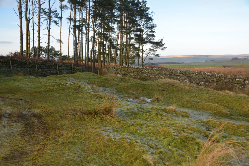
Mill Knock Settlement (Birtley) submitted by Anne T on 9th Jan 2018. Standing in the middle of the settlement, looking at the banks to the north and west (the quarry, which looks as if it has recently been reopened, is behind the trees).
(View photo, vote or add a comment)
Log Text: Mill Knock Enclosure, Birtley: We didn't realise this settlement was here until we pulled up at the quarry entrance and I studied the OS map more closely. At first, it looked like just outcrops of limestone rock, but as I walked up the gentle slope, the outer banks and ditches became more obvious.
The northern part of the enclosure looked as if it had been used for small scale limestone quarrying, although the outer bank and ditches were relatively in tact.
The Holywell Burn runs past the eastern side of the enclosure - just a waterlogged ditch lined by reeds at this point. The eastern side of the site looks as if it had been ploughed or quarried away.
With all the rock outcrops in the area I spent some time looking for cup marks, but found none.
Edinburgh Runestone
Trip No.62 Entry No.2 Date Added: 8th Jan 2018
Site Type: Carving
Country: Scotland (Midlothian)
Visited: Yes on 19th Dec 2017. My rating: Condition 3 Ambience 2 Access 4
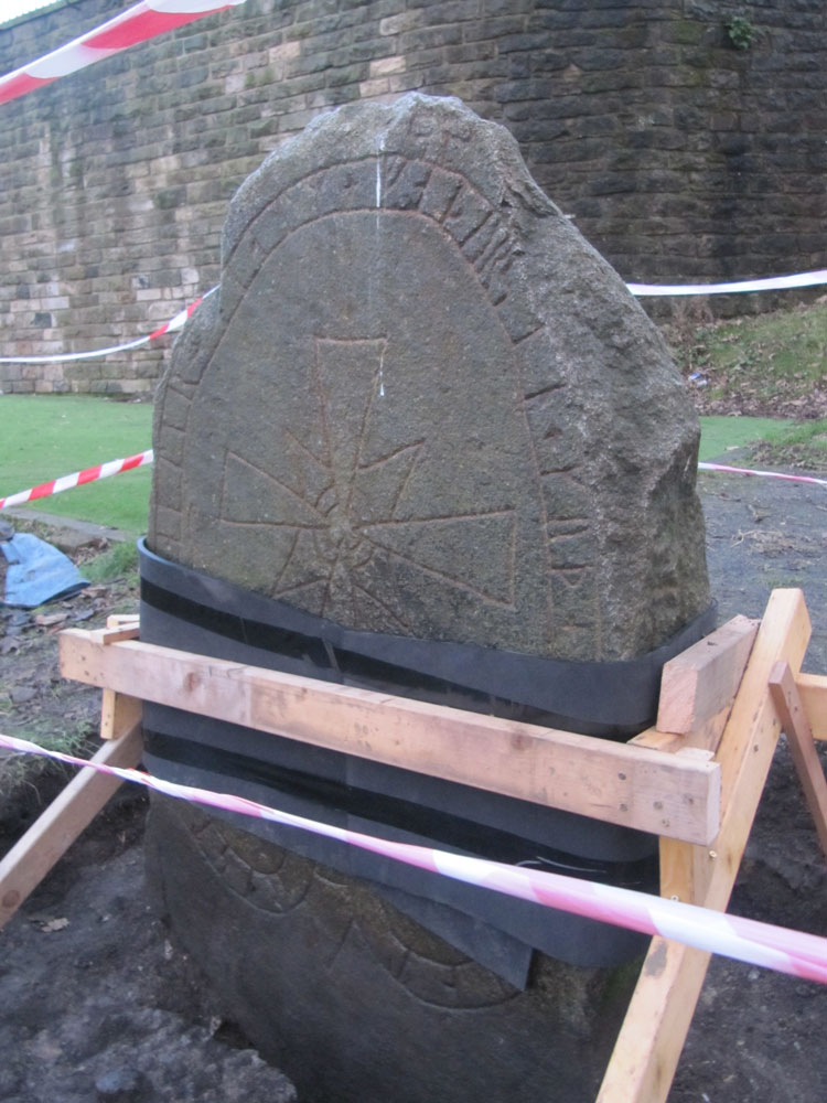
Edinburgh Runestone submitted by Anne T on 7th Jan 2018. The Runestone seen by clambering up the steep muddy track from Princes Street Gardens, just below the Castle Esplanade. The runes read: ""Ari engraved this stone in memory of Hialm his father. God help his soul."
(View photo, vote or add a comment)
Log Text: The Edinburgh Runestone: Getting to this stone was rather precarious! It was easy to walk up the 40 degree slope by clutching onto the nearby railings around the stone. Getting down was more difficult and left my friend with mud all over his walking boots. The stone is obviously in the middle of being moved - it has been strapped up and well protected. I'm glad its going to a much more accessible site. On my next trip up to Edinburgh I'll make a point of going to see this stone in its new location.
National Museum of Scotland
Trip No.62 Entry No.1 Date Added: 8th Jan 2018
Site Type: Museum
Country: Scotland (Midlothian)
Visited: Yes on 19th Dec 2017. My rating: Condition 4 Ambience 5 Access 5

National Museum of Scotland submitted by dodomad on 10th Jul 2016. The Greenlaw axehead
Photo Credit: National Museum of Scotland
(View photo, vote or add a comment)
Log Text: Pictish and Early Christian Stones, NMS: The weather prohibited my friends and I from doing much outside, so the National Museum of Scotland seemed like a good place to visits. Neither of us had been before, and as neither of us knew where we were going, asked the lady at the reception desk for the Pictish Stones. She was very helpful, pulling out a guide of the museum and telling us that some of them were in the basement, other in the Kingdom of the Scots exhibition on the first/part floor. She said she would contact one of her colleagues.
She pointed us in the direction of the stairs to the next floor down, and by the time we reached the bottom, a colleague was already waiting to greet us. He walked us round to the start of the exhibition and round to the pod to the side of the ‘early people exhibition’ on the lower ground floor. I spent a very happy couple of hours wandering around the exhibitions and photographing the stones.
The one downside was that not all the signs telling us what the exhibits were could be found. I did try and find someone to ask later in the afternoon, but could find no-one on the museum floor that we were on. I will email or revisit to find out more about the exhibits I'm really interested in.
Bolam Round Cairn (Northumberland)
Trip No.61 Entry No.1 Date Added: 27th Nov 2017
Site Type: Round Cairn
Country: England (Northumberland)
Visited: Yes on 26th Nov 2017. My rating: Condition 2 Ambience 4 Access 4
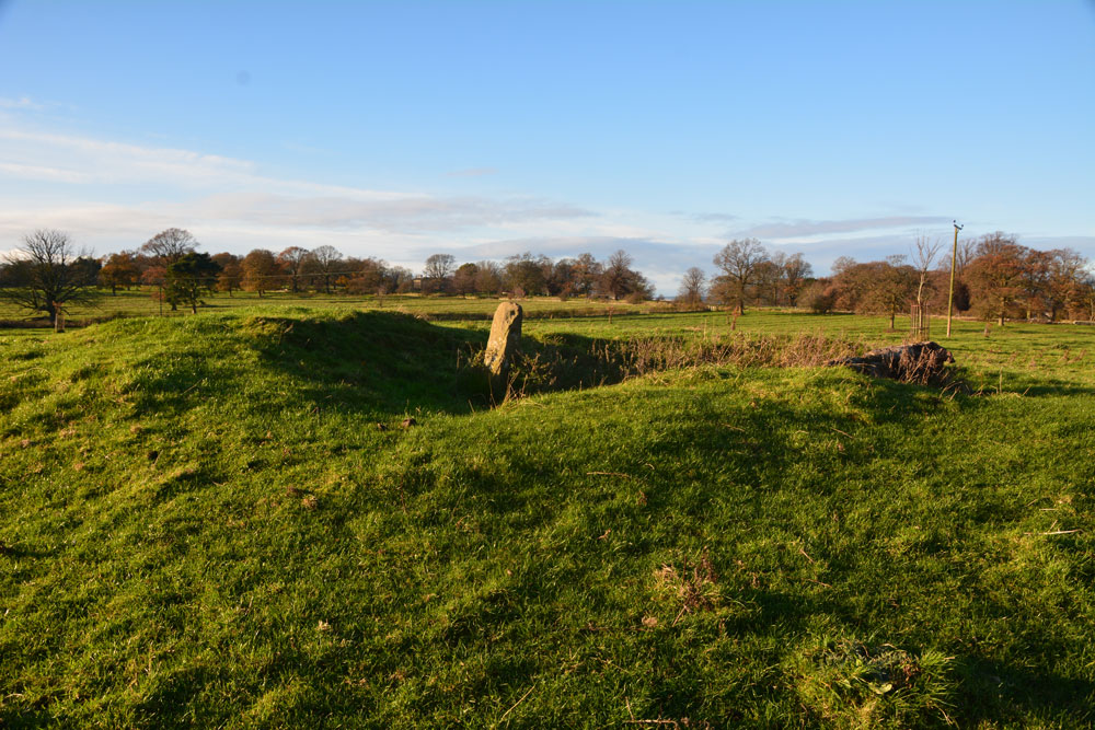
Bolam Round Cairn (Northumberland) submitted by Anne T on 26th Nov 2017. Approaching the cairn from the east-south-east. The old excavations have really removed the centre of the cairn. Was the stone part of the cairn, a gate post (as HE and Pastscape say) or a rubbing stone?
(View photo, vote or add a comment)
Log Text: Bolam Bronze Age Round Cairn, near Belsay, Northumberland: Although the sun was shining and the photos largely make this site look like we’ve seen it on a summer’s day, the temperature was 2 degrees C and removing my glove for a few minutes to take photographs made my normally very warm hands icy cold.
Walking along the footpath (which a notice at the field gate said was blocked at Foulmartlaw), the first thing we noticed was the very prominent ridge and furrow ploughing, which seemed to be the same in all the other fields around the estate.
Approaching the cairn from its eastern side, it seemed like a large bite had been taken out of the middle. A stone was standing in the middle of the ‘bite’. Pastscape and Historic England say this is a gatepost. BUT - if this was a gatepost, there was no evidence of a field system or boundary matching this. And where was it’s matching stone?
There was a second stone at NZ 09356 82201, some 50 metres away, which was lying with its base in a hollow with some packing stones, which indicated it had stood upright at some point. It is not mentioned on either Pastscape or Historic England entries.
A third, smaller boulder, poked its way out of the ground half way between the cairn and this stone. I photographed it just in case it was associated with the cairn.
Mossthorn Long Cairn 2
Trip No.60 Entry No.4 Date Added: 24th Nov 2017
Site Type: Cairn
Country: England (Cumbria)
Visited: Saw from a distance on 20th Nov 2017. My rating: Condition 2 Ambience 3 Access 3
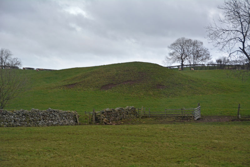
Mossthorn Long Cairn 2 submitted by Anne T on 13th Feb 2017. The long cairn at grid reference NY 48289 30440, taken from the layby outside The Wreays on the minor road from the A66 to Greystoke.
(View photo, vote or add a comment)
Log Text: Mossthorn Long Cairn 2, Copt Howe, Newton Reigny: See the visit report for Mossthorn Long Cairn 1 for more details. This is the side of the long cairn (or natural feature, as Pastscape says?) we couldn’t see from the road on our last visit on 12th February 2017. This time, we could only see it from the field boundary near the southern end of Mossthorn Long Cairn 1. From this angle, it does look like a natural hummock, although more like a cairn from the main road.
Mossthorn Long Cairn 1
Trip No.60 Entry No.3 Date Added: 24th Nov 2017
Site Type: Cairn
Country: England (Cumbria)
Visited: Yes on 20th Nov 2017. My rating: Condition 2 Ambience 4 Access 3

Mossthorn Long Cairn 1 submitted by Anne T on 24th Nov 2017. Approaching the northern end of the this long, rectangular cairn, which was made up of small to medium sized stones and earth.
(View photo, vote or add a comment)
Log Text: Mossthorn Long Cairn, Copt Howe, Newton Reigny: We wrote to Mossthorn Farm immediately after our last visit here in February 2017, but our letter was ignored and we didn’t get a reply. A local historian, who we’d made contact with to find out more about the standing stones / stone row said he had contacts who would give permission for us to visit, but nothing.
In our latest visit to Newbeggin, we went armed with wellington boots and socks and trudged down the lanes from the southern side of Newton Reigny. Whilst the lane is gated, it looks to be frequently used by walkers, so we followed the footpath to Copt Howe at NY 48258 30770. The gate into the field was wide open and a large dung heap had been placed near the field gate. As the rest of the field was pasture, we decided to walk quickly over to the long cairn and take a closer look. The field was very boggy and I was glad of my wellies.
Strangely, I noticed lots of quartz stones scattered around the perimeter of the cairn, shining white in the drizzle amongst the brown-red earth. This cairn had plenty of stones down its length.
We saw the side of Mossthorn Long Cairn 2 that we hadn’t seen before from the eastern hedge line of the field but didn’t want to incur the wrath of the farmer, who was working on his tractor in the field nearby.
Newton Reigny Enclosure
Trip No.60 Entry No.2 Date Added: 26th Nov 2017
Site Type: Misc. Earthwork
Country: England (Cumbria)
Visited: Yes on 20th Nov 2017. My rating: Condition 2 Ambience 3 Access 5
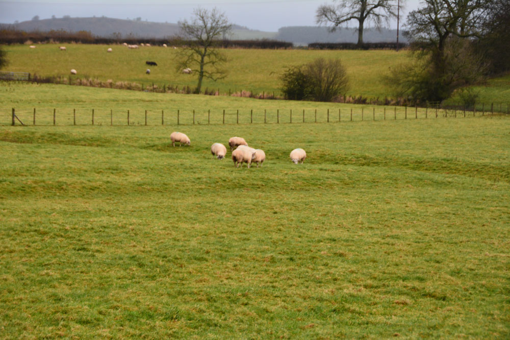
Newton Reigny Enclosure submitted by Anne T on 26th Nov 2017. Standing at the gate to the field containing part of this enclosure, looking north. A series of low banks and ditches can be seen, largely to the left hand side of the small cluster of sheep. Not a huge amount to be seen, but this site is believed to be of Dark Ages origin, according to the Curator of Carlisle Museum.
(View photo, vote or add a comment)
Log Text: Newton Reigny Enclosure: Having put the wellies in the back of the car, we decided to try and walk along the lanes from the south of Newton Reigny, where traditionally one of the stone rows ran towards Newbeggin. On our last visit, back in February 2017, the lane was ankle deep in water and mud.
I spotted this enclosure on the map, and keen to see something other than possible (non-existent) standing stones, was keen to see something of historic value. There were road works immediately opposite the field this enclosure was in, and the workmen, who were partly blocking the road waved us through. We, however, didn't want to be waved on, so my husband drove just past where they were working and I hopped out with the camera, much to the amusement of the workmen who must have wondered what we were looking at.
There were the outlines of low banks and a deeper ditch criss-crossing the field. Not a huge amount to look at, but worth stopping to look at. On looking at the information available on Pastscape and Historic England, this is a scheduled site. It is just to the east of the church of St. John in the village
Belsay Tower Cross (Northumberland)
Trip No.60 Entry No.2 Date Added: 27th Nov 2017
Site Type: Ancient Cross
Country: England (Northumberland)
Visited: Yes. My rating: Condition 3 Ambience 3 Access 4

Belsay Tower Cross (Northumberland) submitted by Anne T on 27th Nov 2017. The cross as seen from its eastern side, with Belsay Castle in the background.
(View photo, vote or add a comment)
Log Text: Belsay Tower Cross, Northumberland: Passing Belsay on the way back from the Bolam Cairn, we decided to try and trace the cross marked on the OS map. Although we’ve been here before, we’d not tried to look for this, as we largely had our small grand daughter with us.
The cross is located (on the map) very close to the Castle, so we walked through the grounds, having received a stern reminder from one of the staff members, that we had to vacate the car park by 4pm, but became thoroughly disorientated. Husband, Andrew, got his compass out and we decided that to reach the cross from the castle, we would have had to jump the ha-ha or scale a fence to get into a field to cross over to it.
In the end, we walked back through the Quarry Gardens to the private road which runs north from the gate at the bottom of the croquet lawn (where the paths from the Hall cross over to Quarry Gardens); after 100 metres it joins the road which runs east-west between the Hall and the Castle. Turning east along this, we walked for around 150 metres, then found a short trackway running through a sparse wooded area, into a field. Through the wooded area, we got our first sight of this cross.
It is on private land, but we took the chance of going through the gate and taking a quick look. It is within 200 metres of the castle, which is to the west, but the land is well fenced off.
In the end, it would have been easier to walk from the car park, past the estate cottages towards the castle, then take the first track on the north side of this minor road into the field with the cross.
It really reminded me of the Shitlington Cross, with its chamfered sides and missing top.
Snuff Mill (Stainton)
Trip No.60 Entry No.1 Date Added: 24th Nov 2017
Site Type: Standing Stone (Menhir)
Country: England (Cumbria)
Visited: Yes on 20th Nov 2017. My rating: Condition 3 Ambience 3 Access 5

Snuff Mill (Stainton) submitted by Anne T on 24th Nov 2017. First view of the stone from across the road. The dry stone wall behind and to the north eastern side of the stone has been dog-legged around it, indicating the stone was here well before the wall.
(View photo, vote or add a comment)
Log Text: Snuff Mill Standing (?) Stone: On the way back from Pooley Bridge to Stainton and Newbeggin, I saw a standing stone by the side of the road (A592) so Andrew turned around and we parked in the driveway of Snuff Mill Water Treatment Centre. The stone was just passed a corner of this busy little road, and it felt quite dangerous as none of the cars moved very far out of the way for us walkers.
The dry stone wall had been ‘kinked’ to go around the stone. It was heavily covered in moss.
I can’t find anything about it on Pastscape or Historic England, so will email Mark Brennand at Cumbria County Council.
Thompson's Rock
Trip No.59 Entry No.2 Date Added: 19th Nov 2017
Site Type: Holed Stone
Country: England (Northumberland)
Visited: Yes on 12th Nov 2017. My rating: Condition 3 Ambience 4 Access 4
Thompson's Rock submitted by Bolddubhglas on 14th Jun 2008. Thompson's Rock Simonside Beacon
(View photo, vote or add a comment)
Log Text: Thompson's Rock, Simonside: This was the coldest, windiest day of the year so far,, and I thought we were going to a much more sheltered spot, so I wasn't dressed for the weather. Ashamed to say I sent husband off with the camera, as he was fully equipped for this moorland. He reported the rock was well worth going to see.
St Edwin's (High Coniscliffe)
Trip No.58 Entry No.3 Date Added: 10th Nov 2017
Site Type: Ancient Cross
Country: England (County Durham)
Visited: Yes on 8th Nov 2017. My rating: Condition 3 Ambience 4 Access 5
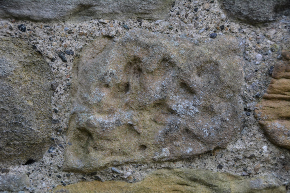
St Edwin's (High Coniscliffe) submitted by Anne T on 9th Nov 2017. This stone is recorded as AS Corpus Coniscliffe 01 and is to be found in the exterior north wall of the tower. It dates from the 10th century.
(View photo, vote or add a comment)
Log Text: Anglo Saxon Fragments, High Coniscliffe: This was a most unexpected location, as my perception was that the church should be within a quiet little village, but the reality was it was just off the main road, the A67 to Bishop Auckland. We parked by the footpath at NZ 22567 15316, and had to walk past the front of the Old Rectory to get to the lych gate.
There were so many stones in the walls of this church. So many of them were greatly weathered sandstone, and looked like any of them could have been carved then worn down. The walls of the church were a real patchwork of colours – light, medium, dark and red sandstone.
We couldn’t get into the porch. A notice on the gate of the church said keys were available at houses nearby, but none of them had lights on, so we headed home, but not before I’d spotted the view from the south western end of the churchyard down to the River Tees below. Great!
All Saints (Crathorne)
Trip No.58 Entry No.2 Date Added: 9th Nov 2017
Site Type: Ancient Cross
Country: England (Yorkshire (North))
Visited: Yes on 8th Nov 2017. My rating: Condition 3 Ambience 4 Access 5

All Saints (Crathorne) submitted by majick123 on 15th Jun 2013. Plinth where cross may have stood. at the East end of the chutch
(View photo, vote or add a comment)
Log Text: Anglo Saxon Fragments and Hogbacks, All Saints, Crathorne: We’d arranged to meet Robert, the curate, at 2pm. He was a few minutes late but by the time I’d walked round the back of the church, he’d opened up the door and turned the lights on. He seemed really shy, asked us how long we’d be, could we turn the lights off when we left and shut the door; he was going for a little walk.
Whilst not huge, this is a very pleasant little church, with the delightful smell of lilies greeting us as we walked through the door.
Most of the fragments are in the south and north walls of the tower, apart from one cemented onto a window sill in the north wall of the nave, and two broken pieces being used to prop up an effigy behind the font. Naturally, we moved the candles and chairs out of the way to try and get photographs of the pieces.
Behind the stone on the window-sill is a mirror. I stood on the nearest pew to try and get photos of the man carved on its rear side. This was an unusual shape – described as a ‘collared shaft’
St Cuthbert's Church (Billingham)
Trip No.58 Entry No.1 Date Added: 9th Nov 2017
Site Type: Ancient Cross
Country: England (County Durham)
Visited: Yes on 8th Nov 2017. My rating: Condition 3 Ambience 4 Access 5
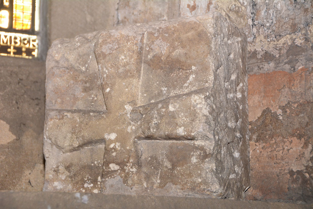
St Cuthbert's Church (Billingham) submitted by Anne T on 9th Nov 2017. AS Corpus Billingham 15, which dates from the late tenth to early eleventh century.
(View photo, vote or add a comment)
Log Text: Anglo Saxon Stones, St. Cuthbert's Billingham: We’d arranged to meet the verger, at the church at 12 noon. We arrived 10 minutes early, and found the south door didn’t have a keyhole, so wondered how we’d get in. It turns out there’s an entrance from the north side of the church. We wandered around the tower looking for the Anglo Saxon cross pieces built into the church tower. Some of these took some spotting, then we heard the verger calling us in.
The church is large, a fusion of 11th century and 1930s extension. The churchyard is huge – a surprise for somewhere so industrial as Billingham, but then this is Billingham Green.
I much enjoyed this visit. The verger spent over an hour taking us round, and took delight in showing us the stones, even one hidden behind a noticeboard against the west wall.
St Cuthbert's Church (Darlington)
Trip No.57 Entry No.1 Date Added: 25th Oct 2017
Site Type: Ancient Cross
Country: England (County Durham)
Visited: Yes on 25th Oct 2017. My rating: Condition 3 Ambience 4 Access 5

St Cuthbert's Church (Darlington) submitted by Anne T on 25th Oct 2017. AS Corpus Darlington 1 and Darlington 2, displayed in the nave, against the second pier of the south arcade.
(View photo, vote or add a comment)
Log Text: Ancient crosses, Saxon sundials and a hogback in Darlington: Originally due to go out for the whole day, we suddenly found ourselves having to rush back for an engineer arriving at our house after lunch. As we had an appointment to be at the church for 10.30am, to look round whilst there was a service in the chancel, we decided there was time enough to get to Darlington and back.
We met the church wardens we'd been liaising with very briefly to say ‘hello and thanks’ to. It was amusing as at least 3 people came into the church wanting to know where the church office was, so I pointed them in the general direction. It was odd wandering around the church with a communion service taking place in the chancel and sanctuary, and I was careful not to use the flash on the camera, although parts of the church were very dark, especially around the hogback.
We couldn’t find a couple of the catalogued items from the Corpus, and I struggled to identify which of the three cross heads we were seeing against those the Corpus lists. I looked through the Information for Guides folder and found an Architectural Assessment by Petr F. Ryder, Historic Buildings Consultant, dated 1997, part of which read:
“Pre Conquest Sculpture: Six pieces of Pre-Conquest sculpture are listed by Cramp (1984, 62-3). Of these one cross head, with the top of the shaft, dated to the late 10th or early 11th century, and an incomplete cross head of the early 11th century, are displayed in the nave, against the second pier of the south arcade; in a corresponding position on the opposite side of the nave is a supposedly Saxon sundial. In the north transept aumbry is part of a hogback, seen as a ‘crude copying of a type more elegantly represented at Brompton, Yorkshire’, and dated to the second quarter of the 10th century. Another fragment, seen as part of a large recumbent slab of the second half of the 10th century, lies in the south transept along with medieval cross slabs. A fifth stone which formerly lay outside the south transept, seen as possibly part of a dedication or ‘station’ slab from within the church, is now lost.”
All Saints (Rudby-in-Cleveland)
Trip No.56 Entry No.3 Date Added: 16th Oct 2017
Site Type: Early Christian Sculptured Stone
Country: England (Yorkshire (North))
Visited: Yes on 15th Oct 2017. My rating: Condition 3 Ambience 4 Access 5
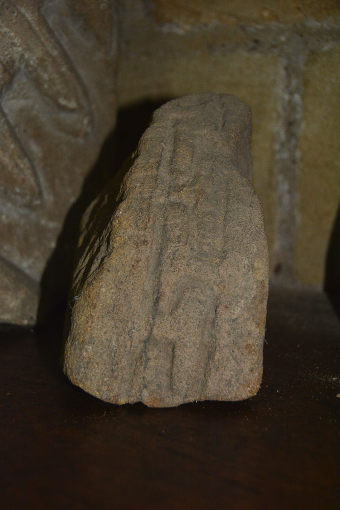
All Saints (Rudby-in-Cleveland) submitted by Anne T on 16th Oct 2017. The outer edge of AS Corpus Rudby 01, which shows a 'grooved meander' pattern. This stone fragment could date from the 11th century, and is possibly earlier.
(View photo, vote or add a comment)
Log Text: All Saints Church, Rudby-in-Cleveland: We’d spent so much time walking round Castle Hill, that by this time of day the sun was very low in the sky and dusk was going to fall pretty quickly, pretty soon.
Parking opposite the church at NZ 47133 06667, just off Rudby Bank in a small paved area which apparently used to be used for the main benefactor’s horse and carriage, we walked into the churchyard.
Much to our surprise, the church was open, so we let ourselves in. Parts of this building are really old. There is also an Elizabethan pulpit and a memorial slab to a 14th century monk holding a chalice.
We also found some old pieces of stone, not mentioned in the church guide, but one portion of which was on the AS Corpus.
Whilst I explored the church, Andrew went in search of the moat, and found it running round the northern part of the churchyard. It is very weird – just a large ditch, most of which is largely dry.
The eastern (modern) part of the graveyard contains the grave of Sir Rex Hunt, Governor of the Falkland Islands when Argentina invaded in 1982.
In the west wall of the vestry, this is also a very strange headless statue, which has been inserted into the wall using part of an old tombstone as a shelf.
