Contributory members are able to log private notes and comments about each site
Sites Anne T has logged. View this log as a table or view the most recent logs from everyone
Merrivale circle
Trip No.133 Entry No.7 Date Added: 7th Jul 2019
Site Type: Stone Circle
Country: England (Devon)
Visited: Yes on 14th May 2019. My rating: Condition 3 Ambience 3 Access 4

Merrivale circle submitted by AngieLake on 9th Feb 2008. Merrivale Circle and menhir looking south towards King's Tor, at about 6.15pm on 10.10.07
(View photo, vote or add a comment)
Log Text: Merrivale Stone Circle: Will you forgive me for saying I wasn't hugely impressed by this stone circle. For some reason I was expecting the stones to be larger and for it to sit more dramatically in the landscape.
On walking to the circle from the western end of Row 2, we came across an impressively large, black coloured boulder buried in the grass, which does not appear to be marked by Butler. I estimated its grid reference to be SX 55304 74704, or just south of this.
The group walked round the circle and the menhir, looking at the pits in the ground, wondering if these could possibly be the remains of holes for other stones. Dave Parks said he had read somewhere that there was thought to have been a double stone circle here, but no proof had yet been found. He later came back to tell me that Butler has marked the pits on his diagrams of Merrivale, see pages 29-31 inclusive of Volume 3 of "Dartmoor Atlas of Antiquities".
I do like Butler's description of the circle: "Their arrangement is markedly eccentric, perhaps deliberately so, with the majority of stones up to a metre off a true circle 19m across and with very variable intervals between" and his notes that the numbers of stones seem to vary across the ages: "several detailed nineteenth century accounts of the site show that the number of stones has actually increased, a most unusual phenomenon, from 9 in the early part of the century, 9 in 1828 (Smith), 10 (1827, Rowe, 1829 Kempe), and 9 (1859 Wilkinson), before reaching the present total of 11 in Worth’s 1895 plan. It seems at least 2 stones have been added, probably by some of the early investigators who were not always particular in recording their restorations, which in any case were often somewhat arbitrary".
Merrivale Cists
Trip No.133 Entry No.5 Date Added: 6th Jul 2019
Site Type: Burial Chamber or Dolmen
Country: England (Devon)
Visited: Yes on 14th May 2019. My rating: Condition 3 Ambience 4 Access 4
Merrivale Cists submitted by ernar on 13th Oct 2004. Burial Cist with a fragmented capstone. The main Merrivale Stone row can be seen behind it.
(View photo, vote or add a comment)
Log Text: Merrivale Cist: I've seen quite a few cists, largely in Northumberland, and none this large. Impressive. I tried to persuade Janet to get into the cist to model it, but she politely declined (it would have made a nice refuge for the wind).
At this point, Angie got her dowsing rods out and was meandering around the cist and the stones. Very interesting to watch.
Merrivale Menhir
Trip No.133 Entry No.11 Date Added: 17th Jul 2019
Site Type: Standing Stone (Menhir)
Country: England (Devon)
Visited: Yes on 14th May 2019. My rating: Condition 3 Ambience 4 Access 4
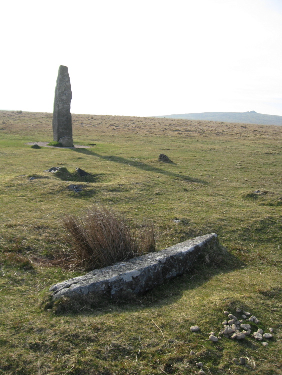
Merrivale Menhir submitted by AngieLake on 10th Apr 2015. This shot shows the "smaller pillar" that Butler describes, in relation to the menhir and the cairn 6 pit. He says: "The menhir, 3.1 m high, still stands in its original position, 42 m almost due south from the centre of the stone circle. There is no evidence that the smaller pillar, 2 m long, lying a few meters away ever stood upright, but it was erected in 1895 in the pit alongside, toppling again a few years later. Between these two stones cairn C6 (3.0 x 0.3 m) has a central pit. Three st...
(View photo, vote or add a comment)
Log Text: Merrivale Menhir: This tall stone made up for the small size of the stones of the stone circle, and I enjoyed visiting here. My goodness, with the three stone rows, the fallen menhirs, the cairn and the pits, it was certainly interesting here. I'd taken my notes for this site with me, but the wind was so strong I was unable to get them out and read them! Now having the Butler series of "Dartmoor Atlas of Antiquities" has made it much easier to understand the layout and complexities of the site, as far as I'm able.
Merrivale North Row
Trip No.133 Entry No.2 Date Added: 3rd Jul 2019
Site Type: Multiple Stone Rows / Avenue
Country: England (Devon)
Visited: Yes on 14th May 2019. My rating: Condition 3 Ambience 4 Access 4
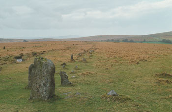
Merrivale North Row submitted by stewart on 12th Oct 2003. Grid Ref SX 555 747
There are two, main, rows at Merrivale - North and South.
The north row consists of two lines of stones, aligned east -west and nearly 200m long.
However, the two lines of stones are only about 1m apart so you can only just walk between them. It has larger stones at the west end and a blocking stone at the east.
The southern row doesn't start or finish on the same alignment, is not parallel to the northern one and was, probably, not built at the same time.
...
(View photo, vote or add a comment)
Log Text: Merrivale North Row (Merrivale 1): Between the prehistoric settlement and the first of our stone rows for the day, Sandy G had stopped to point out some of the stones of the Great Western Reave.
Continuing on, these stones could be seen from down slope at the Prehistoric Settlement, and proved a tantalising glimpse of what was in store for the rest of the morning. Sandy was amazing at explaining all the different features along the row, including part of which had recently been restored.
But my goodness, the wind was blowing, and blowing hard. At some points, it was a little tricky to stand upright – thank heavens for my walking poles!
Merrivale row 4
Trip No.133 Entry No.8 Date Added: 17th Jul 2019
Site Type: Stone Row / Alignment
Country: England (Devon)
Visited: Yes on 14th May 2019. My rating: Condition 2 Ambience 3 Access 4
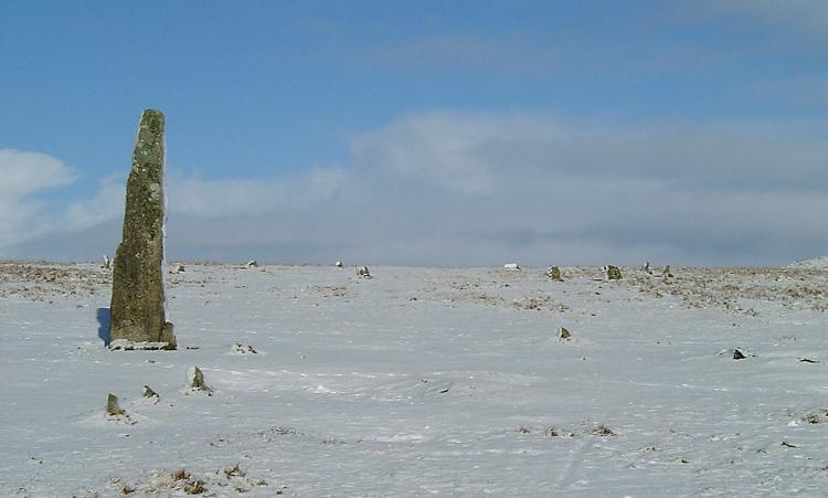
Merrivale row 4 submitted by Brian Byng on 7th Feb 2002. Row 4 azimuth 6 length 7m GR 5535 7458 Burl calls this E
A short row of 4 small stones next to the single standing stone.
It shows up rather well in this winter photo taken a few days ago.
(View photo, vote or add a comment)
Log Text: Merrivale 4 stone row: Without Sandy G and Dave P’s guidance on this, I would probably have looked at these stones and not thought much about them, but in association with the other two short rows (5 and 6), the tall, impressive menhirs and the fallen stone and cairn nearby, it was a jumble to unpick, so I was very grateful for the explanations!
Merrivale Second Menhir and Cairn
Trip No.133 Entry No.12 Date Added: 17th Jul 2019
Site Type: Standing Stone (Menhir)
Country: England (Devon)
Visited: Yes on 14th May 2019. My rating: Condition 3 Ambience 4 Access 4
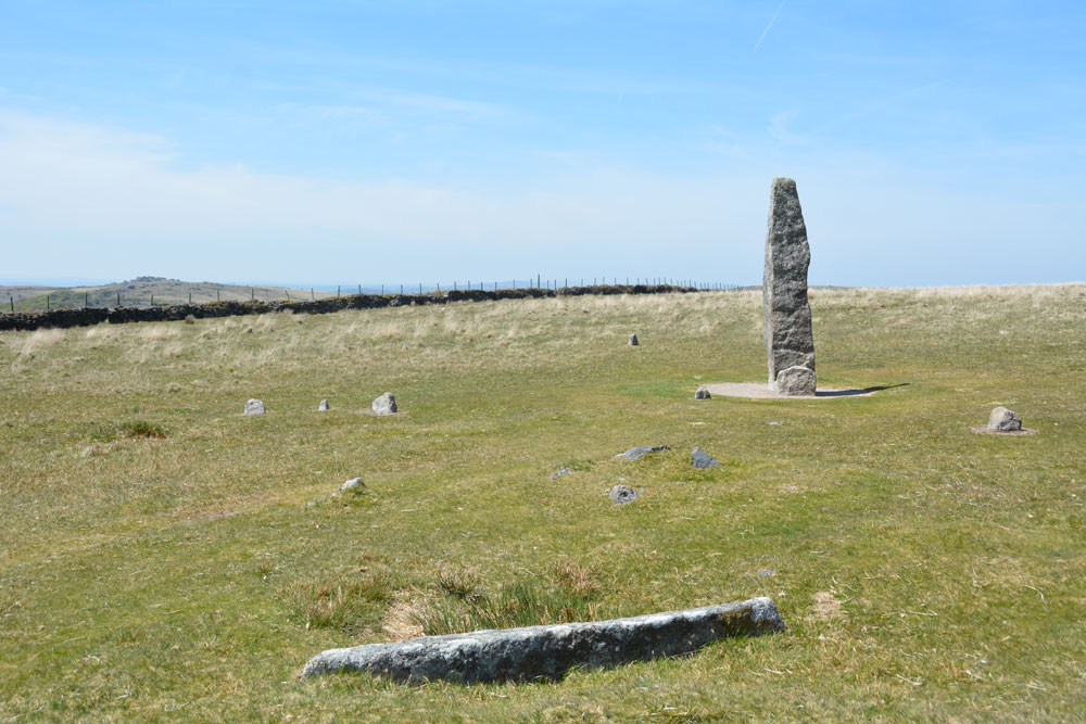
Merrivale Second Menhir and Cairn submitted by Anne T on 9th Jul 2019. To show the relationship of these monuments with the tall Merrivale Menhir, the recumbent granite pillar is in the foreground, with its pit immediately behind it; the cairn is visible as a low mound behind it (just right of centre) The tall menhir is in the background. The cairn is 5.5m from the menhirs and the granite slab 2m from the cairn. Row 4 runs from the centre to the middle left of the photo; the western stone of row 6 is to the left hand side of the menhir.
(View photo, vote or add a comment)
Log Text: Merrivale Second Menhir, pit and cairn: All these monuments were so close together, it was a bit mind-boggling. I made sure I wrote down the monuments and the photo numbers so I didn't mix them up when I processed the photos later (the wind was still gusting strongly so we didn't get my folder with pre-printed notes out in case they blew away).
As a group, we were fascinating with all the pits around here and spent some time exploring them and taking grid references. Dave P later contacted me to tell me these had been documented by Butler in his Volume 3 of "Dartmoor Atlas of Antiquities".
Merrivale settlement
Trip No.133 Entry No.1 Date Added: 22nd Jun 2019
Site Type: Ancient Village or Settlement
Country: England (Devon)
Visited: Yes on 14th May 2019. My rating: Condition 3 Ambience 4 Access 4
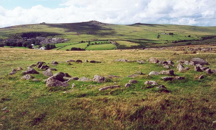
Merrivale settlement submitted by Brian Byng on 7th Feb 2002.
(View photo, vote or add a comment)
Log Text: Merrivale Prehistoric Settlement: This was our first stop of the day as part of a three day guided tour by Sandy G, who certainly knew his way around this site, and all the others in this Bronze Age complex.
We parked in the small car park at SX 55311 75018 and, having introduced ourselves to the rest of Sandy's small Expeditionary Force, we walked the short distance onto the moor to start at this site. With the nearer stone rows within site just at the top of the hill, expectations for an exciting rest of the day rose rapidly.
The only downside was the absolutely howling wind that blew throughout the day, sometimes makingit difficult to stand upright. However, it was a cheap way of exfoliating!
I found out when copying photos from the memory card of my camera to my computer that the external GPS device on my camera had stopped working, so I was unable to identify the precise locations of the hut circles I photographed.
Merrivale SW row 3
Trip No.133 Entry No.6 Date Added: 7th Jul 2019
Site Type: Stone Row / Alignment
Country: England (Devon)
Visited: Yes on 14th May 2019. My rating: Condition 2 Ambience 3 Access 4
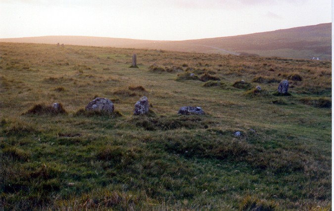
Merrivale SW row 3 submitted by AngieLake on 29th Oct 2004. In the foreground, Merrivale Single Row 3 (see thecaptain's overview plan) at sunset on 21st September, the day before the Autumn Equinox, 2004. In the distance, in the glare of the setting sun, can be seen the two west end stones of the southern row. Two other taller stones on the south side of that southern row are also visible above centre, and to right of pic. ('Thecaptain' has a theory that these, and other taller stones in the rows, align with the menhir at certain times of the year.) T...
(View photo, vote or add a comment)
Log Text: Merrivale Row 3/C: Without Sandy G being there to tell us, I would have struggled to identify this as a stone row in its own right, but with Sandy pointing out where it joining up at an angle with Merrivale 2/B and with the cairn at its head, it became more obvious. The cairn is recorded as a separate site page here, so I'm adding the same visit report number, as I've recorded them both together, as the Pastscape record (440357).
Mertoun Kirk (St Boswells)
Trip No.50 Entry No.5 Date Added: 7th Oct 2017
Site Type: Sculptured Stone
Country: Scotland (Scottish Borders)
Visited: Yes on 24th Sep 2017. My rating: Condition 3 Ambience 3 Access 5

Mertoun Kirk (St Boswells) submitted by Anne T on 7th Oct 2017. This stone, just over 1 ft long and 6 ins deep is built into the east wall of the modern extension to the north east side of the church. To find it, stand behind the large green oil tank located at this side of the church and look up.
(View photo, vote or add a comment)
Log Text: Mertoun Kirk, incised stone: The church lies in the grounds of Mertoun House, which lies almost directly north, across a bend in the River Tweed, from Maxton with its Burgh Cross. To approach the church, we had to follow the signs up the single track road to the house; the church is just before you reach the house. There were other Roman fragments built into seats in the gardens just outside the house, but we needed to pay to get in the house, and there was only half an hour before it shut for the evening. Fortunately, we were able to park outside the church, next to the mounting block, and walked around this very hidden, almost secretive church.
The church itself was locked, and we couldn’t get in. Whilst Canmore gives no date for the stone, the fragment looks older than the church which was built in 1658 and restored in 1820 and 1898.
Mid Gleniron 1
Trip No.137 Entry No.8 Date Added: 28th Jun 2019
Site Type: Chambered Cairn
Country: Scotland (Dumfries and Galloway)
Visited: Yes on 18th Jun 2019. My rating: Condition 3 Ambience 4 Access 3
Mid Gleniron 1 submitted by rogerkread on 1st May 2013. The cairn with the most visible internal structure at Mid Gleniron, the one furthest west.
(View photo, vote or add a comment)
Log Text: Mid Gleniron 1: I was really impressed with this now oval-shaped cairn with its burial chambers and spent ages walking round it and over it. The photographs don’t really do it justice.
Mid Gleniron 2
Trip No.137 Entry No.5 Date Added: 28th Jun 2019
Site Type: Chambered Cairn
Country: Scotland (Dumfries and Galloway)
Visited: Yes on 18th Jun 2019. My rating: Condition 2 Ambience 3 Access 3
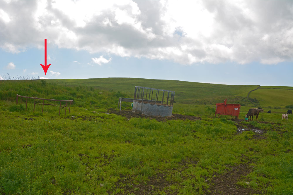
Mid Gleniron 2 submitted by Anne T on 28th Jun 2019. Only cairn is only just north of Mid Gleniron 3, this is all that appears to be left of this chambered cairn, now used as an animal feeding station for the numerous cows and their calves that were in the field at the time of our visit.
(View photo, vote or add a comment)
Log Text: Mid Gleniron 2: Photos taken from NX 18753 60931, I photographed a mound approximately 20 metres to east (right) of track as walked uphill, with a cattle feeder virtually on top.
I wasn’t sure that this was a cairn at all, although Andrew was certain. In fact Canmore shows there are the remains of two cairns here, one at NX 1877 6093,the other at NX 1876 6092. With the cattle feeder placed virtually on top of the cairn at NX 1876 6092 and numerous, very curious cattle in the field, I photographed these from the gate into the field.
Mid Gleniron 3
Trip No.137 Entry No.4 Date Added: 28th Jun 2019
Site Type: Cairn
Country: Scotland (Dumfries and Galloway)
Visited: Yes on 18th Jun 2019. My rating: Condition 2 Ambience 3 Access 3

Mid Gleniron 3 submitted by Anne T on 28th Jun 2019. This mound of stones, the slight mound rising from the centre left of the photo running to the centre middle, and the slight circular mound behind are all that seems to remain of the Mid Gleniron 3 cairn. I managed to get this photograph when the cattle had moved away from the mound, but we didn't want to aggrevate the cows and their calves, so didn't venture into the field.
(View photo, vote or add a comment)
Log Text: Mid Gleniron 3: OK, the GPS led me to this spot, but there wasn’t much to see. Had it not been for the sheer number of cows and their calves in the field, I would have gone for a closer look, but bottled out. I photographed this feature by leaning over the dry stone wall.
Mid Gleniron 4
Trip No.137 Entry No.6 Date Added: 28th Jun 2019
Site Type: Cairn
Country: Scotland (Dumfries and Galloway)
Visited: Yes on 18th Jun 2019. My rating: Condition 3 Ambience 4 Access 3
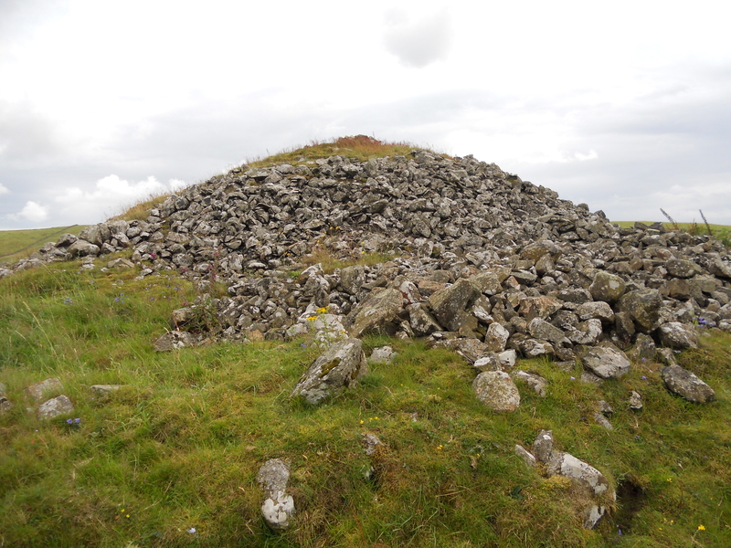
Mid Gleniron 4 submitted by markj99 on 10th Oct 2018. Mid Gleniron 4, looking S
(View photo, vote or add a comment)
Log Text: Mid Gleniron 4: This is the large bell cairn at the top of the hill, near the farmhouse, which dominates the view as you walk up the track towards the farmhouse.
Access into the field is easy, and it’s possible to walk all the way round the cairn to see its structure and enjoy the views.
Mid Gleniron 5
Trip No.137 Entry No.7 Date Added: 28th Jun 2019
Site Type: Cairn
Country: Scotland (Dumfries and Galloway)
Visited: Yes on 18th Jun 2019. My rating: Condition 2 Ambience 4 Access 3
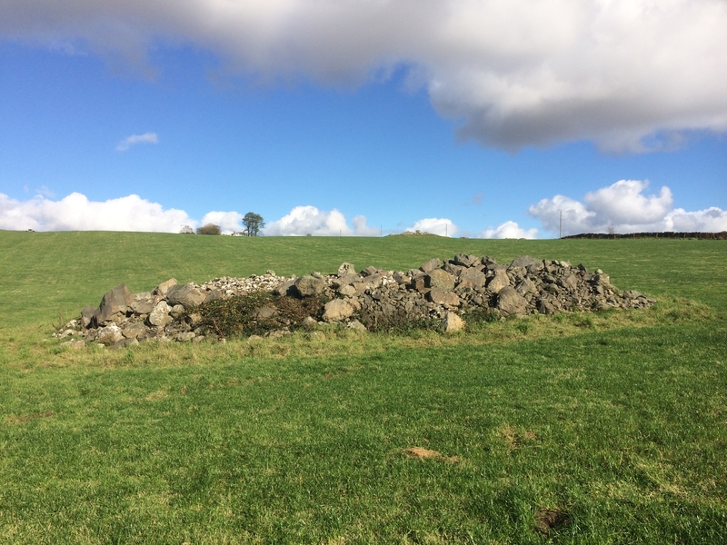
Mid Gleniron 5 submitted by markj99 on 21st Oct 2018. A candidate for Mid Gleniron 5?
(View photo, vote or add a comment)
Log Text: Mid Gleniron 5: This cairn lies west of track to the farmhouse, south east of the oval cairn, and is very distinct in the field and on the aerial photographs.
The mound of the cairn stood out particularly today as the farmer was spreading the lines of harvested grass to dry as we walked across the field, and he had gone round this cairn with the tractor.
Mid Gleniron Stony Mounds
Trip No.137 Entry No.3 Date Added: 28th Jun 2019
Site Type: Cairn
Country: Scotland (Dumfries and Galloway)
Visited: Yes on 18th Jun 2019. My rating: Condition 2 Ambience 3 Access 3
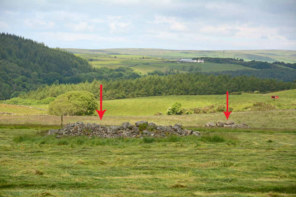
Mid Gleniron Stony Mounds submitted by Anne T on 28th Jun 2019. These two stony mounds are to the west of the farm track leading up to Mid Gleniron Farmhouse. They are at NX 18601 60877 and NX 18579 60986.
(View photo, vote or add a comment)
Log Text: Mid Gleniron Stony Mounds: I found these stony mounds as fascinating as the chambered cairns just north of these mounds, so took a few photographs (just in case they were recorded cairns) and grid references. If they are field clearance stones, why place them in different mounds in the same field? And why so many smaller stones? The larger stones are most likely field clearance, but the make up of the mounds is similar to Gleniron 1 to Gleniron 5 inclusive.
There are two mounds on the eastern side of the farm track and another four on the western side.
Middle Golden Pot (Otterburn)
Trip No.28 Entry No.3 Date Added: 29th May 2017
Site Type: Marker Stone
Country: England (Northumberland)
Visited: Yes on 28th May 2017. My rating: Condition 2 Ambience 4 Access 5
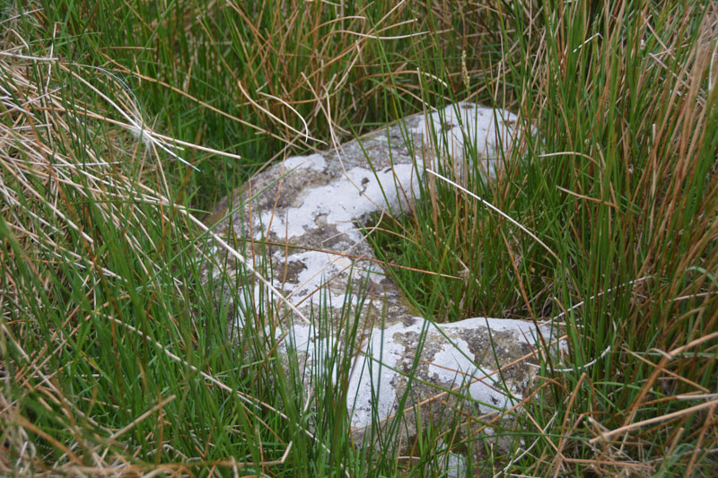
Middle Golden Pot (Otterburn) submitted by Anne T on 29th May 2017. The Middle Golden Pot from a different angle.
(View photo, vote or add a comment)
Log Text: Middle Golden Pot (Otterburn): Fenced off behind a nice, neat fence with a label “Do not feed the cross base” – no seriously, “Archaeological Area”. This stone was mostly hidden under the marsh grass and I struggled to get decent photographs as the camera kept focusing on the grass rather than the stone. Whilst I snapped away, Andrew went off wandering along the top of Dere Street off to the east – very well defined with a visible ditch on either side. The modern metalled road (imaginatively called ‘Roman Road’ turns a left-handed right angle here, as the course of Dere Street changes. Being just below the brow of a hill, I wondered why the stone was placed here, but looking at the change of direction of the road, it made sense. Stepping behind the stone and looking north-west, Dere Street could be seen running up hill, joining with the section to the east of the stone.
Middleton Crosses
Date Added: 13th Oct 2014
Site Type: Ancient Cross
Country: England (Yorkshire (North))
Visited: Yes on 10th Oct 2014. My rating: Condition 3 Access 5
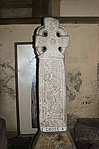
Middleton Crosses submitted by kelpie on 6th Mar 2004. These five Viking crosses are housed in Middleton Church (SE 78193 85438).
Cross A is a Jellinge type cross and shows a hunter with spear and scramasax, the other side shows a serpent type of animal.
(View photo, vote or add a comment)
Log Text: Middleton Crosses, St. Andrew’s Church, Church Lane, Middleton, North Yorkshire: From St. Gregory’s Minster, the A170 took us right through Middleton, and it was easy to spot the church on the left hand side of the road. I’d tried to phone beforehand to check if the church was open during the day, but the number published on the ‘achurchnearyou’ website was for a private house; I sent an email to Reverend Stephen Gamble but didn’t receive a reply until we were actually inside the church, saying the church is usually left open during the day.
Turning into Church Lane, it is long and narrow. There was just room to bump the car up onto the kerb opposite a gateway to a farm. At first glance, this church looks modern and not particularly interesting, but the more we looked, the more ancient and interesting the building became.
Apart from the crosses (crosses A and B kept against the base of the tower on the west wall, C, D and E kept in the north transept). It’s a shame that the area that C, D and E are kept in is used for general storage (we had to clamber over stacked chairs and other items) as it did spoil the ambience a little. Crosses A and B had clearly been whitewashed at some point in their lives, which made them look somewhat ‘unreal’.
The south entrance door has a wonderful 13th century trefoil and the door itself is from the 15th century (much repaired internally). The north aisle and tower date from the 12th and 13th centuries, although the base of the tower is Saxon. In the west wall, there is a blocked up doorway from the 11th century with an 8th century cross head and part of a shaft above it (we didn’t find the one in the south wall of the nave, as described on the visitor boards inside the church).
There is a sundial above the entrance to the porch, and an interesting ‘vow cross’, similar to the one at Escomb on a pillar in the north aisle.
Notes from the hand-held boards in the church:
The Crosses: The crosses and fragments in the North Aisle have been dated to the 10th century, perhaps related to the Viking kingdom of York c 876 to 954 AD. Cross A and Cross B are described as Jellinge crosses, after the cross of a similar type at Jellinge in Denmark. The stone types are all of a kind found on the North Yorkshire moors.
Cross A:A ring-head cross, typical of the area, depicts a hunter with spear, sword, shield and scramasax (a short sword), two dogs and a stag. On the reverse is a ‘Jellinge’ animal. The crossed has formerly been built into the tower, and was first recorded in 1911 and was removed in 1948.
Cross B: Depicts a warrior with a pointed helmet, spear, swod, shield, axe and scramasax. Again, on the reverse can be seen a ‘Jellinge’ animal. This cross also was discovered in the tower wall and ‘liberated’ in 1948. Celtic influences are mixed with Anglo-Scandinavian work, and it is supposed, by reason of the local stone (some is exposed 2km north of the church) and inferior workmanship, to be local in origin.
Cross C: First recorded at the east end of this aisle, in 1907, and is interesting in that it seems to combine both pagan, animal heads and a degenerate form of Christian vine scroll. It is unlike the others here, and has some Irish influences on an Anglian design, possibly representing an Anglian ‘Revival’.
Cross D:A fragment showing a warrior’s helmeted head, together with forked beard. A similar beard appears on the Kirkdale crucifix, although the example here is much cruder. A knife is slung from his belt, and a scramasax is to the right of his legs. This is very similar to Cross B, and it is thought that the same template was used. The contoured plait is unusual for this area.
Cross E:Formed of two fragments. The top part is a part of a ring-head cross. The bottom part has the head and shoulders of a man with a pointed helmet. The two fragments may have belonged together originally, but it is not possible to be sure.
There is another cross-head and shaft still built into the tower on the south wall against the nave wall. One arm of the cross has been dressed off, in order to use the monument as a quoin, but it seems that the full length survives."
Middleton Standing Stone (Northumberland)
Date Added: 20th Jun 2014
Site Type: Standing Stone (Menhir)
Country: England (Northumberland)
Visited: Yes on 27th May 2014
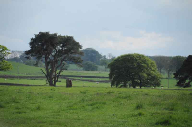
Middleton Standing Stone (Northumberland) submitted by Anne T on 27th May 2014. Middleton Standing Stone in the context of the landscape, looking towards the south west.
(View photo, vote or add a comment)
Log Text: None
Midshiels Cairn
Trip No.29 Entry No.8 Date Added: 31st Jul 2017
Site Type: Cairn
Country: Scotland (Scottish Borders)
Visited: Saw from a distance on 3rd Jun 2017. My rating: Condition 3 Ambience 4 Access 4
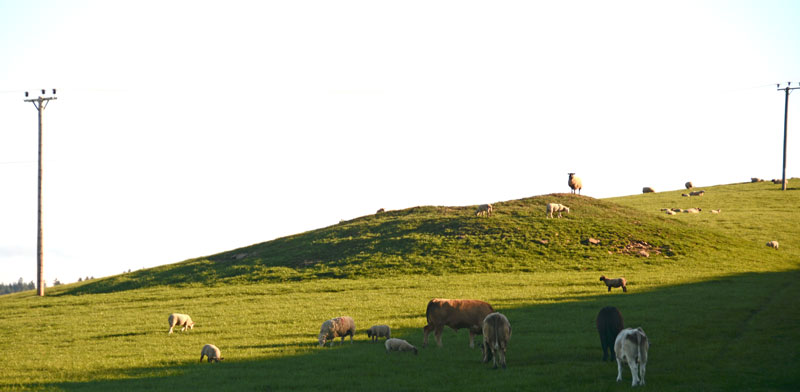
Midshiels Cairn submitted by Anne T on 4th Jun 2017. This is the closest we could get to the cairn on this visit - most of the young bullocks that had been on the right hand slope of the cairn were running (fast!) towards where we were standing at the gate to the field.
(View photo, vote or add a comment)
Log Text: Midshiels Cairn, Hawick: See visit report for Midshiels Standing Stone (the two are 90 metres apart), sites entered separately as Canmore lists them individually. Couldn't get really close to the cairn - would have loved to have walked up to it, but there was a really big bull and lots of over-friendly and very lively bullocks in the field. Must revisit at a different time of year!
There are plenty of other forts and settlements around here. The problem with another visit, is which sites to pick?
Midshiels Cairn
Trip No.93 Entry No.7 Date Added: 31st Aug 2018
Site Type: Cairn
Country: Scotland (Scottish Borders)
Visited: Yes on 29th Aug 2018. My rating: Condition 3 Ambience 4 Access 4

Midshiels Cairn submitted by Anne T on 4th Jun 2017. This is the closest we could get to the cairn on this visit - most of the young bullocks that had been on the right hand slope of the cairn were running (fast!) towards where we were standing at the gate to the field.
(View photo, vote or add a comment)
Log Text: Midshiels Cairn: Having been warned about the large cattle who might "go for us if they saw us", I was cautious about walking the additional 100m from the standing stone to the cairn. Andrew decided that as the cattle were at the far end of the field, and though large, looked relatively docile. “If they come for me I can always leap over the fence (to the railway embankment)”, he said, so I gave him the camera and left to explore the cairn, which seemed much further away than the standing stone, but in reality was only around 90m away.
The Canmore entry of 1948 says the cairn was ‘planted with trees’, although it is now only covered in grass.
