Contributory members are able to log private notes and comments about each site
Sites Anne T has logged. View this log as a table or view the most recent logs from everyone
Goatstones O
Date Added: 23rd Sep 2014
Site Type: Rock Art
Country: England (Northumberland)
Visited: Yes on 21st Sep 2014. My rating: Condition 3 Ambience 3 Access 3
Goatstones O submitted by SolarMegalith on 10th Jul 2013. General view of Goatstones O panel (photo taken on June 2013).
(View photo, vote or add a comment)
Log Text: Goatstones O, Simonburn, Northumberland: See visit report for Goatstones A (14 rock art stones/boulders within a couple of hundred metres).
Davy's Lee Enclosure
Date Added: 21st Jul 2014
Site Type: Misc. Earthwork
Country: England (Northumberland)
Visited: Yes on 20th Jul 2014. My rating: Condition 2 Ambience 4 Access 2
Davy's Lee Enclosure submitted by SolarMegalith on 28th Mar 2014. A bank in the northern part of Davy's Lee enclosure - view from the east (photo taken on March 2014).
(View photo, vote or add a comment)
Log Text: Continuing south on the footpaths from Standingstone Rigg at Great Lonbrough would have brought us to Davy's Lee Settlement and Davy's Lee Stone Circle and tumuli, but on this walk we elected to park at the Old Repeater Station, just off the B6318 (old military road), and follow the footpath to Sewingshields Crags, on the opposite side of the road.
We've done this walk before, but only to see the Roman Loughs (fishing ponds) in 2011, and couldn't do this bit of the walk due to the boggy ground. Note: I wouldn't like to follow this footpath after a period of wet weather - too wet, wellies would be needed!
We followed the footpath through Hadrian's Wall Vallum, up the hill past Sewingshields Farm, then turned round the back to the northern side of Sewingsheilds Crags. At the bottom of the hill, just past the cattle grid, there is a track that leads off to the left hand side which leads to both Davy's Lee Settlement and Davy's Lee Stone Circle.
At the top of the first ridge we came to, there were what appeared to be a row of standing stones, and possibly another small stone circle, but my inexperienced eyes thought I might be confusing these with quarried rocks left lying on the ground. However, we came across some blue posts hammered into the ground and some blue spray-painted crosses; the farmer we met shortly afterwards confirmed that archaeologists had been to do an initial survey of this area.
The footpath disappears for a while, but can be picked up at the western end of this first ridge. After walking up and down another ridge (with another rocky outcrop with a possible empty cairn at the top), it was necessary to cross another boggy piece of land, with a small, bubbling stream at the bottom, then it was an easy walk up to the settlement.
The entrance and the outer banks of the settlement are easily identifiable, and is in a fantastic landscape.
Davy's Lee Stone Circle is about 50 yards to the east of the entrance to the settlement, with other tumuli further to the east.
West Shank Enclosure
Date Added: 1st Aug 2015
Site Type: Misc. Earthwork
Country: England (Northumberland)
Visited: Yes on 15th Jul 2015. My rating: Condition 2 Ambience 3 Access 3
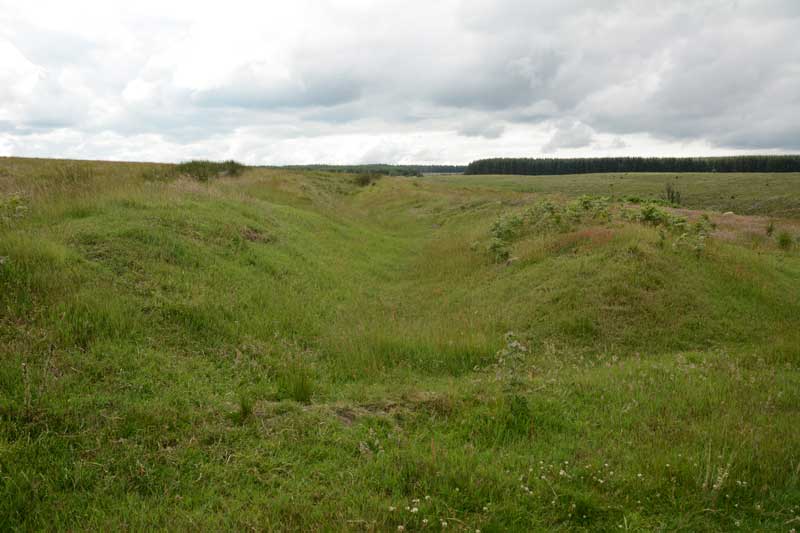
West Shank Enclosure submitted by Anne T on 18th Jul 2015. Standing in the boundary ditch where the footpath cuts the enclosure looking east back towards Hollinghill Enclosure. The banks rise gently up on either side. The vegetation here is short grass, cropped by sheep, so are more obvious than the banks and ditches of the neighbouring Hollinghill Enclosure.
(View photo, vote or add a comment)
Log Text: West Shank Enclosure, near Fontburn Reservoir, Northumberland: See visit report for Hollinghill Enclosure.
Fontburn a(i)
Date Added: 1st Aug 2015
Site Type: Rock Art
Country: England (Northumberland)
Visited: Yes on 15th Jul 2015. My rating: Condition 3 Ambience 4 Access 3
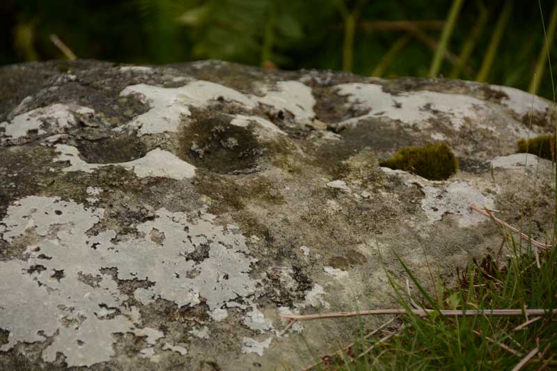
Fontburn a(i) submitted by Anne T on 20th Jul 2015. A close up of some of the cups and weathering marks on the top surface of Fontburn a(i). I counted 6 cups; the rest seemed to be caused by either natural weathering or were heavily eroded cups.
(View photo, vote or add a comment)
Log Text: Fontburn a(i), just off the National Trust Greenleighton Walk, Northumberland: See visit report for Hollinghill Enclosure.
Fontburn a(ii)
Date Added: 1st Aug 2015
Site Type: Rock Art
Country: England (Northumberland)
Visited: Yes on 15th Jul 2015. My rating: Condition 3 Ambience 4 Access 3
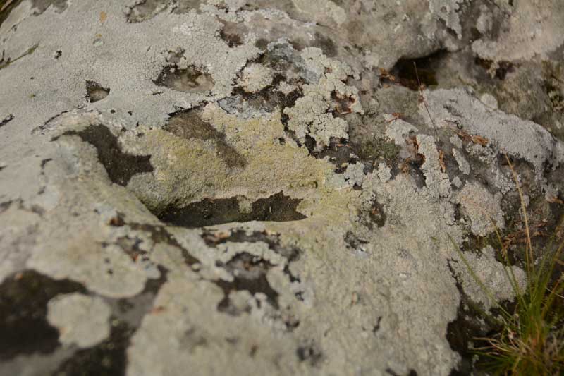
Fontburn a(ii) submitted by Anne T on 20th Jul 2015. There is one large oval shaped cup mark on top of this boulder. The rest of the marks appear to be natural weathering of the sandstone.
(View photo, vote or add a comment)
Log Text: Fontburn a(ii), just off the National Trust Greenleighton Walk, Northumberland: See visit report for Hollinghill Enclosure.
Fontburn a(iii)
Date Added: 1st Aug 2015
Site Type: Rock Art
Country: England (Northumberland)
Visited: Yes on 1st Jan 2015. My rating: Condition 3 Ambience 4 Access 3
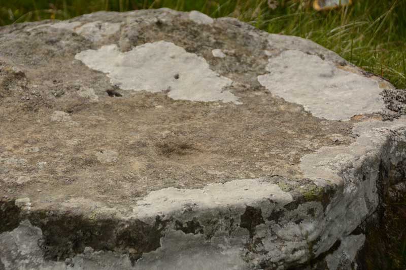
Fontburn a(iii) submitted by Anne T on 20th Jul 2015. We could only make out one cup mark on this boulder, although the Beckensall Archive says there is a line of 5, 12 others and two lightly peck marked areas. The ERA-1351 record identies three possible cups, although we were unable to see these.
(View photo, vote or add a comment)
Log Text: Fontburn a(iii), just off the National Trust Greenleighton Walk, Northumberland: See visit report for Hollinghill Enclosure.
Standingstone Rigg
Date Added: 18th Jul 2014
Site Type: Stone Row / Alignment
Country: England (Northumberland)
Visited: Yes on 13th Jul 2014. My rating: Condition 4 Ambience 4 Access 2
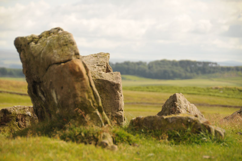
Standingstone Rigg submitted by Anne T on 15th Jul 2014. This photograph is taken from the top of Standingstone Rigg looking south east. The pairing of the stones is identifiable.
(View photo, vote or add a comment)
Log Text: Having first visited Goatstones Four Poster stone circle on 30th June, the farmer from Great Lonbrough Farm further up the track (whom we met on the track as he was coming down from the farm in his Landrover) had mentioned some other standing stones, but was mysterious about the location – we thought it was because they were on his land. I was intrigued.
The quickest route up to Standingstone Rigg is from Ward Lane, using the Bridleway at NY 81632 75077, but the verges had very deep furrows so no parking here, and also the crop had just been harvested, so there was grassy stubble which would have made walking up the hill a little heavy. We decided to turn back to the Manor House, opposite Ravensheugh Crags and use the small layby next to the footpath which led past Goatstones Four Poster stone circle. This meant a slightly longer, but easier, walk past Goatstones and up past Great Lonbrough Farm – a walk of around 7km in all, but easy on a gated farm track. You would have needed a four-wheel drive or a quad bike to drive up this lane, but the walk was across very pleasant countryside, with views of the Cheviots in the far distance, and when we got past the farmhouse, to Hadrian’s Wall country and beyond.
We first came across what looked like a large barrow at the first sheepfold past the farmhouse, about 1km from the farmhouse, at grid reference NY 81783 73355, having had to cross some very boggy ground to reach the tumbled stones. We walked up the ‘barrow’ and turned left, seeing other stones lying the other side of Standingstone Rigg (Ridge), on Harvest Green. This also looked like another barrow, with very definite shaped stones lying around, although these were largely covered by turf and marsh grass.
I confess we struggled to find the stone row, and I was disappointed. We tried to orientate ourselves with a map I’d found on my phone from the Tynedale Archaeology Group, who had carried out a volunteer survey on the site in 2013. We spotted what looked like two gate posts on top of the ridge, so Andrew ploughed his way through the boggy dip and came running back: “Those are the stones, and there a long row, they just go on and on”. There were absolutely beautiful views over towards Hadrian’s Wall, with Halleypike Lough shining in the distance, so we sat back and had a snack and a drink in the sunshine and the warm wind before exploring further.
Once we’d navigated the marshy bits and climbed halfway back up Standingstone Rigg hill, the first stones became apparent. There was a very clear double row of stones climbing up to the ridge, just poking their tops above the turf. Once we’d walked up to the top, the stones just carried on going, down the scarp and turning right round what looks like it might have been a spring or a pond, and back towards what the first ‘barrow’. They looked at first glance to be a single row leading back down the hill.
We probably walked this monument backwards – working from the Harvest Green up to Standingstone Rigg, back towards Great Lonbrough Farm. I felt very much like I’d been on a journey – from death at the first barrow (if it was indeed), up to the ridge, to see over the amazing countryside for miles and miles to look over the Moors and what became Hadrian’s Wall country.
The first double stones we first saw were only about 1 metre apart, so if it was meant to be walked as an avenue, it would have to be done in single file.
On the way back, we stopped at the first ‘barrow’ and looked at the rocks more closely. Some had very definite cup marks in them, and I’ve recorded them in the photographs submitted to the Portal.
The Tynedale Archaeology website states that the stone row has a north-north-east to south-south-west double alignment, which runs for 134 metres north-south up over the scarp of Standingstone Rigg. They also record a cairn on the top of the ridge, which we also saw, but which I didn’t photograph.
On the way back, I managed to turn my ankle by falling between two stones hidden in the grass, and had to hobble 3km back to the car. But I am still amazed by this little known spot, and feel privileged to have been there.
Davy's Lee 1
Date Added: 21st Jul 2014
Site Type: Rock Art
Country: England (Northumberland)
Visited: Yes on 20th Jul 2014. My rating: Condition 4 Ambience 4 Access 2
Davy's Lee 1 submitted by SolarMegalith on 28th Mar 2014. Cup-marks and an arc or groove on Davy's Lee panel (photo taken on March 2014).
(View photo, vote or add a comment)
Log Text: Having visited Davy's Lee Settlement and Davy's Lee Stone Circle, rather than walk directly southwards across the boggy ground and the stream, we headed eastwards back to the main footpath between Halleypike Lough/Folly Lake. We lost the footpath, but continued as best we could, trying to keep on the access land (there was no delineation between access land and non-access land) and stumbled across this stone lying in the grass.
It definitely looked as if it had been shaped, so we stopped to look some more, and as our eyes adjusted, clusters of cup marks appeared. We weren't sure if the grooves had been deliberately made, or if they had been carved in antiquity (rival sites say they are natural grooves which determine the position of the cup marks).
We thought this stone rivalled the stones in the group of rocks in West Agra Farm Fields (although not the West Agra Plantation).
Not being aware this stone existed before our visit, this came as a real treat, especially with the lovely landscape around - it was a very special afternoon for us, in glorious sunshine.
Fontburn a(vi)
Date Added: 1st Aug 2015
Site Type: Rock Art
Country: England (Northumberland)
Visited: Yes on 1st Aug 2015. My rating: Condition 3 Ambience 4 Access 3

Fontburn a(vi) submitted by Anne T on 20th Jul 2015. Close up of the two deepest cups on the southern/top side of Fontburn a(vi). It was amazing how smooth and well definted these were, even after all these centuries.
(View photo, vote or add a comment)
Log Text: Fontburn a(vi), just off the National Trust Greenleighton Walk, Northumberland: See visit report for Hollinghill Enclosure.
Fontburn a(vii)
Date Added: 1st Aug 2015
Site Type: Rock Art
Country: England (Northumberland)
Visited: Yes on 15th Jul 2015. My rating: Condition 3 Ambience 4 Access 3
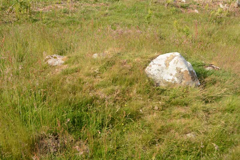
Fontburn a(vii) submitted by Anne T on 20th Jul 2015. Close up of the Fontburn a(vii) boulder, but even now the sun is out, the photo doesn't manage to highlight the two cup marks which are on it. I've posted this so other visitors can identify the right stone.
(View photo, vote or add a comment)
Log Text: Fontburn a(vii), just off the National Trust Greenleighton Walk, Northumberland: See visit report for Hollinghill Enclosure.
Fontburn a(viii)
Date Added: 1st Aug 2015
Site Type: Rock Art
Country: England (Northumberland)
Visited: Yes on 15th Jul 2015. My rating: Condition 3 Ambience 4 Access 3
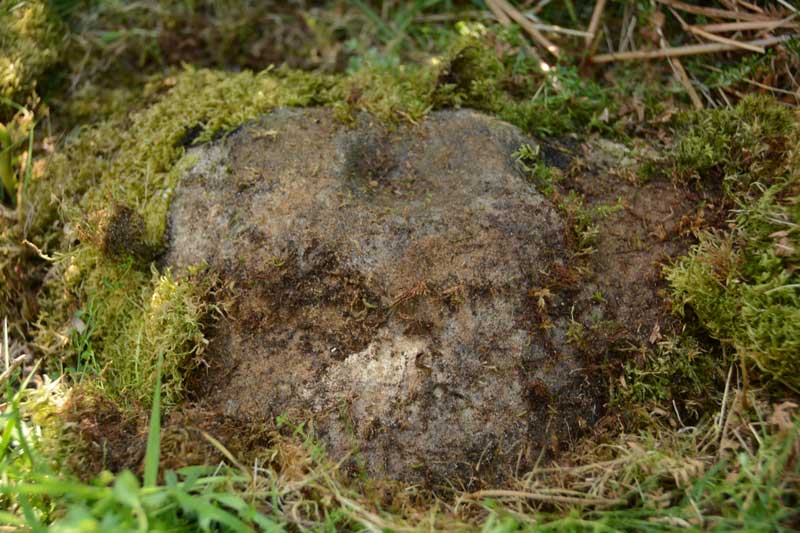
Fontburn a(viii) submitted by Anne T on 20th Jul 2015. This is one good photograph I managed to get of Fontburn a(viii). The ERA-1356 record tells me that the cup mark on the top of the rock is almost certainly artificial, the 'cup' on its lower edge is probably weathering.
(View photo, vote or add a comment)
Log Text: Fontburn a(viii), just off the National Trust Greenleighton Walk, Northumberland: See visit report for Hollinghill Enclosure.
Midstead 3
Trip No.1 Entry No.4 Date Added: 14th May 2016
Site Type: Rock Art
Country: England (Northumberland)
Visited: Yes on 8th May 2016. My rating: Condition 3 Ambience 4 Access 3
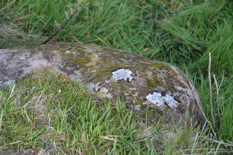
Midstead 3 submitted by Anne T on 11th May 2016. Midstead 3 showing some more of the cups on the far side of this boulder. When the NADRAP survey was done they uncovered parts of the stone buried under turf, so they were able to see all 13 cup marks.
(View photo, vote or add a comment)
Log Text: Midstead 3, Rock Art near Edlingham, Northumberland: Also see visit report for Jenny's Lantern Hill Fort and Settlement, Midstead 1 and Midstead 2. This stone is about 3 metres to the west of Midstead 2, although the cups are more difficult to spot. Beautiful views over the Aln Valley and to the listening/radar station at Cloudy Crags across the valley.
Simonburn
Date Added: 21st Jul 2014
Site Type: Stone Circle
Country: England (Northumberland)
Visited: Yes on 20th Jul 2014. My rating: Condition 4 Ambience 4 Access 2
Simonburn submitted by TheWhiteRider on 2nd Jul 2006. Simonburn Stone Circle.
The circle stands near a cairn and the remains of an Iron Age homestead.
(View photo, vote or add a comment)
Log Text: We know this stone circle as either: Davy's Lee Stone Circle, King's Crag Stone Circle or Haughton Common Stone Circle, rather than Simonburn Stone Circle, although the Grid Reference is the same.
Having spotted a group of features that looked interesting: Davy's Lee Settlement, Davy's Lee Stone Circle and various tumuli, we decided to take advantage of the sunshine and walk to this area.
The previous weekend, we'd visited Standingstone Rigg, near Great Lonbrough Farm. If we had continued south along the footpath for a couple of kilometres from Standingstone Rigg, we would have reached Davy’s Lee from the north. Instead, we took the opposite approach, from the south, from the old military road (B6318).
My husband parked the car by the Old Repeater Station (parking on the Old Military Road being sparse and difficult, with soft verges, lay-by's virtually non-existent and fast-flying cars driving up and down) having dropped me off at the farmhouse 100 yards west from this road junction, on the opposite side of the road, by the footpath up to Sewingshields and Sewingshields Crags. We’ve done this walk before, to see the Roman fishing loughs, but with this walk, we needed to follow the path nortwards past the farmhouses, round the back of Sewingshields Crags to the bottom of the hill, then turn off a track to the left hand side (approx. Grid reference: NY 80653 70820). The track disappears for a while, so we headed left up a bank with what looked like quarried stone at the top, running in a double row running approximately east to west (approx. Grid ref: NY 80393 70793), plus what looked like a low lying stone circle with a blue ‘x’ in the middle of it. We wondered whether or not this was just the results of quarrying, but then spotted blue crosses sprayed onto the grass and a blue painted peg in the middle of what I thought might be the low lying stone circle.
Just after this, I got sight of a huge bull about 100 yards away; walking further along, we realised there was no fence between the marked field boundaries, and I suddenly got worried the bull was going to charge as we were walking between him and 'his ladies'. We were at the edge of a boggy area, and had just started picking a way through. At this point, the farmer appeared on his quad bike to look at his ‘beasts’, and he stopped to talk to us. I said we were heading up to the Stone Circle and asked if this was OK. He told me the bull was alright, and confirmed that the archaeologists had indeed just been up to do a survey of the rocks/stones we’d just seen. He asked us if we knew where the stone circle was, and pointed out the direction of the tree in the distance to head for; we’d then see the stones poking up out of the grass.
He then said he’d give us a lift part of the way, and we hopped on the side of the quad bike, and went about quarter of a mile. Neat! A very powerful machine – not sure I’d make a good motorcycle pillion rider, though. He dropped us off at the top of a ridge of rocks, and we made our way over, stumbling into what looked like an open cairn. I took some photographs, and we headed down the slope to another wide area of boggy ground with a small stream bubbling along the bottom. I wouldn’t have liked to have done this walk after a period of wet weather – wellies would have been required – me being me, I still managed to get wet feet!
We stumbled first upon the Davy’s Lee settlement – perched on the end of King’s Crags, which dropped steeply into the valley below. What a view. Wandering eastwards, we came upon two small standing stones (or one with a forked top, buried in the grass), then the stone circle poked it’s head up to the right hand side of the track, towards Folly Lake.
There were some clear cup marks on two of the stones within the circle. The grass and marsh grass was so tall, it hid most of the stones, and it was quite difficult to photograph, but the circle was clearly there – about 9 metres in diameter. I thought at one point that there might be an outer circle, but the grass was too overgrown to really tell (a winter visit will be needed!).
The main stone in the circle was a funny ‘chair’ shape with cups in the top. Someone had been there recently and left a tea-light in one of the cups.
The views south and east to Sewingshields Crags was magnificent; looking south-west towards Greenlee Lough, we could see a large erratic rock, Gwenhyfar's Chair, standing proud of Queen’s Crags. This stone is connected with Arthurian legends, although I’ve yet to explore this. We decided it was too far away to walk to this today, so headed back to the footpath. I could hear voices, and Andrew identified they were from climbers on the crags immediately opposite Gwenhyfar’s Chair.
Leaving the stone circle, we headed off eastwards, but lost the footpath. Some of the land here is not access land, although the boundary isn’t de-lineated. Heading down the slope, we came across a large, apparently shaped rock, just lying on the ground at grid reference: NY 80670 71319, so I've recorded my visit and submitted images to the separate page on the Portal (Davy's Lee Rock Art). I would put this rock on a par with the rocks in the fields at West Agra Farm.
Ketley Crag Rock Shelter 1
Date Added: 28th Jul 2014
Site Type: Rock Art
Country: England (Northumberland)
Visited: Couldn't find on 27th Jul 2014. My rating: Access 1
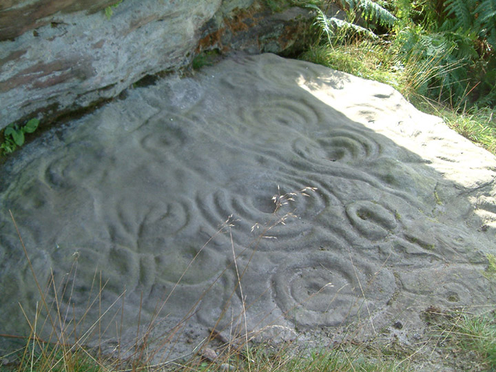
Ketley Crag Rock Shelter 1 submitted by stu on 11th Oct 2003. NU0743 2978. Is there anything better looking? I'd say not.....lots of other impressive cup and ring carvings on the walk over from Chatton Hill.
(View photo, vote or add a comment)
Log Text: We went to seek this magnificent example of rock art, well armed with map, compass and camera, and parked outside South Lyham farm. At the adjacent cottages, one of the residents came out to speak to us, and pointed out the way to the permissive footpath across to Ketley Crag and Chattonpark Hill, telling us how to find the Ketley Stone. It had rained heavily the night before, and following the footpath across the first field from the farm, we remained undeterred by boggy ground and wet feet in the dip where the permissive path splits off right from the farm track. After a search, we found the wooden footbridge across the stream and the permissive footpath sign.
The bracken was shoulder high, and 50 feet further up the path, we were confronted by a high wall of bracken, which proved impossible to get through. So sadly we retraced our steps. Apparently we missed a sheep track through the bracken, which the resident, talking to us on our way back, told us had been there a month before.
We then tried again from the access track from the B6349, at grid reference NU 06362 30614. This was easy walking for the first kilometre or so, but just past the ford, the trackway became very overgrown, with deep ruts and it was very hard work to make progress through the weeds, and despite waterproofs, we were soggy. We did try walking along the edges of the fields rather than on the trackway, but there were no gates between fields, so sadly we had to give up.
I had been really looking forward to seeing this rocky crag; there is a third option, which is from this same trackway, but from Chatton Park Farm, which takes us up over the top of Chattonpark Hill, so we'll try this another day.
We then went in search of some rock art at Doddington, to see if this was more accessible
Dod Law Main Rock A
Date Added: 28th Jul 2014
Site Type: Rock Art
Country: England (Northumberland)
Visited: Yes on 27th Jul 2014. My rating: Condition 4 Ambience 4 Access 3
Dod Law Main Rock A submitted by DrewParsons on 3rd Oct 2011. Dod Law Main Rock. September 2011.
(View photo, vote or add a comment)
Log Text: Access to Dod Law Main Rock is exactly as DrewAndrews describes. It is a relatively easy walk up hill, following the path up hill, southwards, through Wooler Golf Course (one of the golfers told us it was alright to leave our car parked in their car park).
Immediately opposite the fenced boundary of the upper end of the golf course, there is Newcastle University Rock Art poster, indicating where the main rock is, although as DrewAndrews says, it is out of scale. We missed the rock on the way up, being hidden by bracken, and ended up walking up to the Trig Point. Had it not been raining so hard, the views from the settlements and enclosures above Shepherd's House would have been spectacular; indeed, when the rain stopped about 20 minutes later, and the sun came out, the almost 360 degree views (complete with rainbow) were wonderful.
We spotted the main rock on the way back down the path (it's actually only about 4 metres east of the footpath, which turns left up to the trig point, just above the top end of the Golf Course), and were rewarded by these wonderful rock art motifs.
Someone had been there not long before us, and literally ripped and torn the turf and moss away from the rock surface, to be able to view the whole of the motifs.
The rain made the markings stand out beautifully.
By the time we'd taken photographs, we realised how wet we were, having been caught in heavy rain for some time, and made our way back to the car.
My next trip to this area will be to see the remains of the stone circle, but I think we'll plan a longer circular walk, parking near Weetwood Hall, to take in more cup and ring marked rocks shown on the Ordnance Survey Map, with the furthest point being The Ringses Hill Fort.
Paines Bridge, Wallington A
Date Added: 4th Aug 2014
Site Type: Rock Art
Country: England (Northumberland)
Visited: Yes on 29th Jul 2014. My rating: Condition 3 Ambience 3 Access 4
Paines Bridge, Wallington A submitted by SolarMegalith on 22nd Jun 2013. Cup with three rings, the outer one incomplete (photo taken on June 2013).
(View photo, vote or add a comment)
Log Text: “Just for some fun, how about going to Wallington to try and spot the three rock art portable stones that Stan Beckensall says are near the bridge?” my husband said. “The web site says they are set into concrete, so they should be easy to find.” It was a beautiful sunny afternoon, so I said “why not”. Wallington isn’t far from our house, and we managed to park at the small lay-by off the B6342, just 20 metres south east of Paine’s Bridge, where the road turns sharp left hand to go over the River Wansbeck.
Immediately across the road from the lay-by was the gate and footpath leading down to the river and the bridge, then carries on further eastwards to the stepping stones which form part of the walks around the Wallington Estate. Following the path under the bridge, there is a stile (with a doggy gate) at the far side. Climbing over this, we turned immediately round to the bridge parapet and walked onto the bridge pier. The river was only a trickle after all the dry weather we’ve been having, and Wallington A was easily identifiable at the far end of the bridge pier.
The bridge being so narrow, I then took my life in my hands (particularly when a large lorry with large wing mirrors went by) and leaned over the western side of the bridge to look down at Wallington A from a different angle.
We struggled to identify the other two stones mentioned in the Beckensall Archive, and I wished we’d brought photographs. After hunting for some time, and exploring the parapets at the northern side of the river and beyond, we were at a loss. There being no service on my mobile to access the Portal, we drove to the cafe in Belsay, and over tea and cake looked again at the images on both the Portal and the Northumberland Rock Art web site, before setting off again back to the bridge.
This time, it was easy to spot Wallington B – we knew it was 80 cm east of Wallington C. The light had also changed, as it was early evening, and we wondered how we could have missed the markings the first time.
Wallington C, 95 cm east of Wallington B, was trickier, and I photographed several more of the stones, and we ended up comparing them to the Beckensall archive images once we’d arrived back home. If I hadn’t had these images to compare, and the photo with the stones marked by SolarMegalith, I never would have known this was a piece of rock art.
I would have loved to have seen these portable rocks in their original locations. If the river is high, and covers the bridge piers, it will be impossible to see these pieces of rock art.
[As an aside: We found it amusing that there are large signs either side of the bridge saying to “sound your horn” (before crossing); hence the peace of the countryside was endlessly shattered by the cars having to cross Paine’s bridge in single file. My husband commented that we were lucky not to have seen two cars meet in the middle!]
Inner Golden Pot (Otterburn)
Trip No.28 Entry No.2 Date Added: 29th May 2017
Site Type: Marker Stone
Country: England (Northumberland)
Visited: Yes on 28th May 2017. My rating: Condition -1 Ambience 4 Access 5
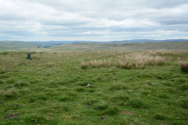
Inner Golden Pot (Otterburn) submitted by Anne T on 29th May 2017. At the site of the Inner Golden Pot there were only broken sandstone pieces and modern army equipment. I thought it was worth stopping to look to see if anything remained, especially as it was a nice viewpoint.
(View photo, vote or add a comment)
Log Text: Inner Golden Pot, Otterburn Ranges: No trace of this cross base can be found, but I couldn't resist having a look. There were some small sandstone pieces around the grid reference point, together with a funny green box - presumably some military equipment. A great viewpoint across to Upper Coquetdale.
Ros Castle hillfort
Date Added: 19th Aug 2014
Site Type: Hillfort
Country: England (Northumberland)
Visited: Saw from a distance on 17th Aug 2014. My rating: Condition 4 Ambience 5 Access 3
Ros Castle hillfort submitted by SolarMegalith on 25th Jun 2014. Well-preserved rampart in the southern part of Ros Castle hillfort (photo taken on May 2014).
(View photo, vote or add a comment)
Log Text: Driving back across Hepburn Moor towards the A1, the purple heather spreading in front of us was truly impressive. Although early evening with looming black clouds, we were going to stop off and look at this really impressive ancient monument, but when I opened the car door, it was torn from my hand by the wind and the map I'd been using was whipped across the dashboard to the far side of the car. We'd also had difficulty standing upright in the wind at Fowberry Moor only an hour before, so despite seeing an intrepid family with backpacks and young children in tow make their way across the moor, we decided to leave walking to the top of this Iron Age Hill Fort until another day.
I wasn’t aware that there was any rock art in this area, but thanks to SolarMegalith’s photographs, we’ll look forward to seeing this on our next visit.
Newtown Mill
Date Added: 19th Aug 2014
Site Type: Standing Stone (Menhir)
Country: England (Northumberland)
Visited: Yes on 17th Aug 2014. My rating: Condition 4 Ambience 4 Access 5
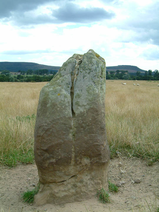
Newtown Mill submitted by stu on 11th Oct 2003. NU043243. East side of the road as you pass through Newtown Mill.
A gate into field so access is easy.
(View photo, vote or add a comment)
Log Text: Driving southwards from Fowberry Park rock art site, through the small hamlet of Newtown, this standing stone appeared on the map to be very near the road, so we drove past hoping to see it. And there it was – about 50 yards inside the field to our left hand side, easily accessible by a metal gate. There were no footpaths to the stone, but having been disappointed at not seeing the Wade Stone South on 15th August, I was somewhat reckless, and entered the field to take some photographs, sincerely hoping the farmer wouldn’t object and I would explain if I saw him/her.
Astonishingly, the Devil’s Causeway (Roman road) runs almost immediately to the eastern side of this stone, although there was no sign of this road whatsoever (we’ve usually seen some signs of old Roman roads in the form of traces of the ditches at each side, but in this instance, all evidence seemed to have disappeared. We looked for further signs of this road at the modern road junction leading up to Newtown, but there were no traces here, either).
The rounded form of 80m high Ewe Hill seemed to loom above this standing stone, although the stone sits in the valley, well sheltered from the wind, and appears to be in its original position. We thought we spotted some cup marks on the stone, but these could be the results of weathering, as the stone has deep vertical fluting (like many of the standing stones in the area).
The road next to the standing stone is single track, with few passing places, although it is possible to park on the grass verge next to the gate next to the standing stone.
Once I'd taken photographs, we turned the car around and headed back up the hill towards Newtown, to locate the Hurl Stone.
Chatton 2
Trip No.30 Entry No.2 Date Added: 14th Jun 2017
Site Type: Rock Art
Country: England (Northumberland)
Visited: Yes on 11th Jun 2017. My rating: Condition 2 Ambience 4 Access 4
Chatton 2 submitted by SolarMegalith on 18th Mar 2013. Close-up of the "television set" motif (photo taken on March 2013).
(View photo, vote or add a comment)
Log Text: Chatton 2, Rock Art, Northumberland: See visit report for Chatton 1a.
