Contributory members are able to log private notes and comments about each site
Sites Anne T has logged. View this log as a table or view the most recent logs from everyone
Millstone Burn 2h
Trip No.67 Entry No.3 Date Added: 24th Feb 2018
Site Type: Rock Art
Country: England (Northumberland)
Visited: Yes on 21st Feb 2018. My rating: Condition 3 Ambience 4 Access 4
Millstone Burn 2h submitted by SolarMegalith on 24th Nov 2012. Motifs in southern part of Millstone Burn 2h panel (photo taken on November 2012).
(View photo, vote or add a comment)
Log Text: Millstone Burn 2h, Longframlington: Walking down from the main outcrop, Millstone Burn 4a, back to the car, we had the grid reference for this stone, so decided to detour and find it. From the hollow way near the gate into the field by the A697, a small trackway heads north towards this grid reference. Following this for 150 metres, and having passed some larger, very smooth outcrops, we came upon this apparently unprepossessing stone. "Is that it?" I asked my husband, who, as usual, was a hundred metres of so ahead of me as he's a faster walker. "Yes, come closer and you'll see" was his reply.
As I came up to the stone, these remarkable motifs came into view. "Wow!" was my instinctive reaction.
Fortunately, we had strong sunlight which brought the motifs out beautifully, and I took around 50 or so photographs. Needing to move onto our next stop, we retraced our path to the car, but I wondered what made the carvers of this rock choose this small rock - it there more under the turf? There were much larger, more prominent outcrops around. Curious, but I expect I'll never know.
Knowing there is so much rock art up here, I'll need to study ERA and make another (at least day-long) trip. Brilliant!
Millstone Burn 2e
Trip No.71 Entry No.5 Date Added: 9th May 2018
Site Type: Rock Art
Country: England (Northumberland)
Visited: Yes on 7th May 2018. My rating: Condition 2 Ambience 3 Access 4
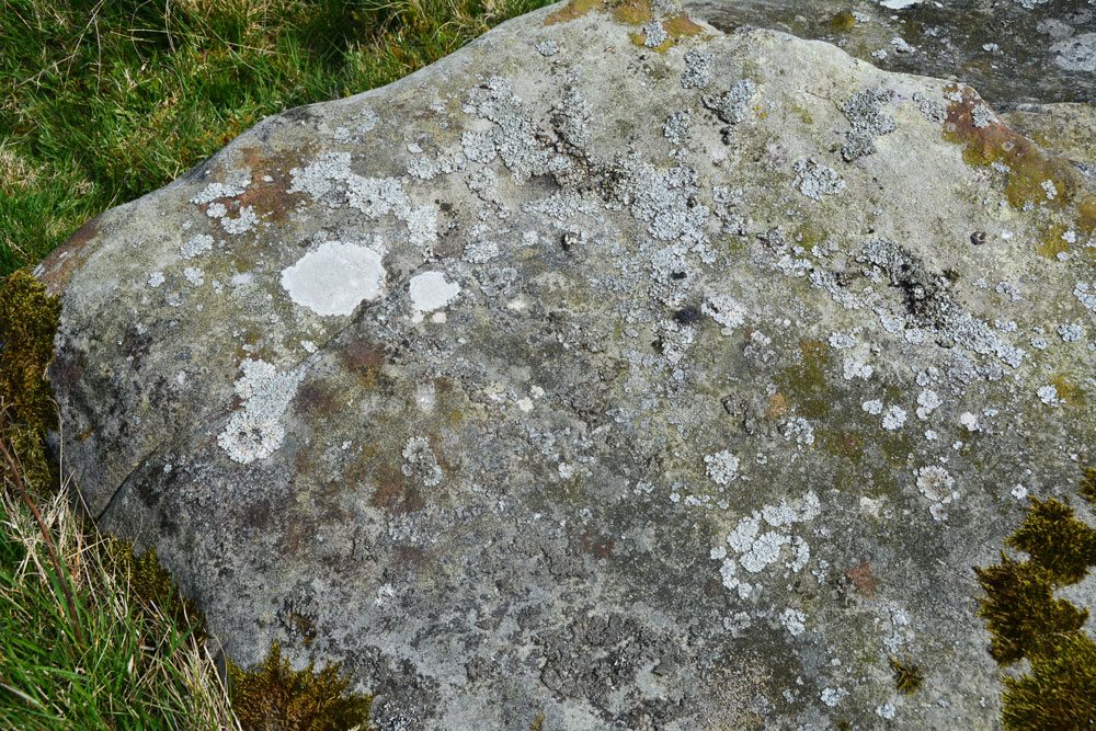
Millstone Burn 2e submitted by Anne T on 9th May 2018. In typical Tate fashion, we didn't remember to take any water along to try and highlight the motifs. We did struggle to find them!
(View photo, vote or add a comment)
Log Text: Millstone Burn 2e: This rock is not far upslope from Millstone Burn 2dd and 2d. Again, without GPS we would have struggled to find this rock, and we did struggle to identify any of the motifs - Beckensall described these as two ringed cups and two other cups, one with a natural groove leading to it and a pecked groove leading away from the ring. By the time of the NADRAP survey, they recorded a cup and very thin ring with groove running to the northern edge of the outcrop.
This stone was very interesting as downslope it had a step in it, and not only was there a channel wearing, but there were green water stains from where rain water had trickled down the slight slope of the rock downhill.
These motifs must have been placed to have been seen as you were coming down or up the slope.
Millstone Burn 2dd
Trip No.71 Entry No.4 Date Added: 8th May 2018
Site Type: Rock Art
Country: England (Northumberland)
Visited: Yes on 7th May 2018. My rating: Condition 2 Ambience 3 Access 4
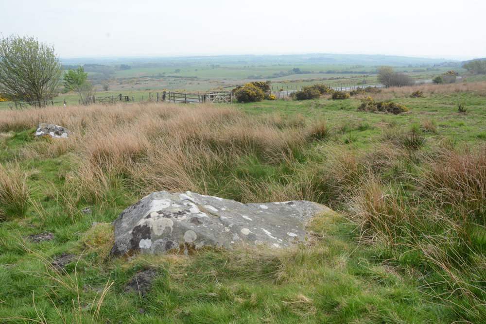
Millstone Burn 2dd submitted by Anne T on 8th May 2018. Millstone Burn 2dd panel, looking east across the A687.
(View photo, vote or add a comment)
Log Text: Millstone Burn 2dd: only 15m away from Millstone Burn 2d, and relatively easy to find amongst all the other boulders in the field. As these motifs are on top of the rock, they must have been designed to have been seen as you were coming down the hillside.
This rock looks very different shapes depending on what angle you view it at. We had huge difficulty making out any cup marks at all beneath the lichen and moss, although there are some grooves, which look as if they have been created (enhanced?) by rainwater trickling down and over the side of the rock over the years.
Not the best example of rock art we've seen, but one to tick off the list.
Millstone Burn 2d.
Trip No.71 Entry No.3 Date Added: 8th May 2018
Site Type: Rock Art
Country: England (Northumberland)
Visited: Yes on 7th May 2018. My rating: Condition 3 Ambience 3 Access 4
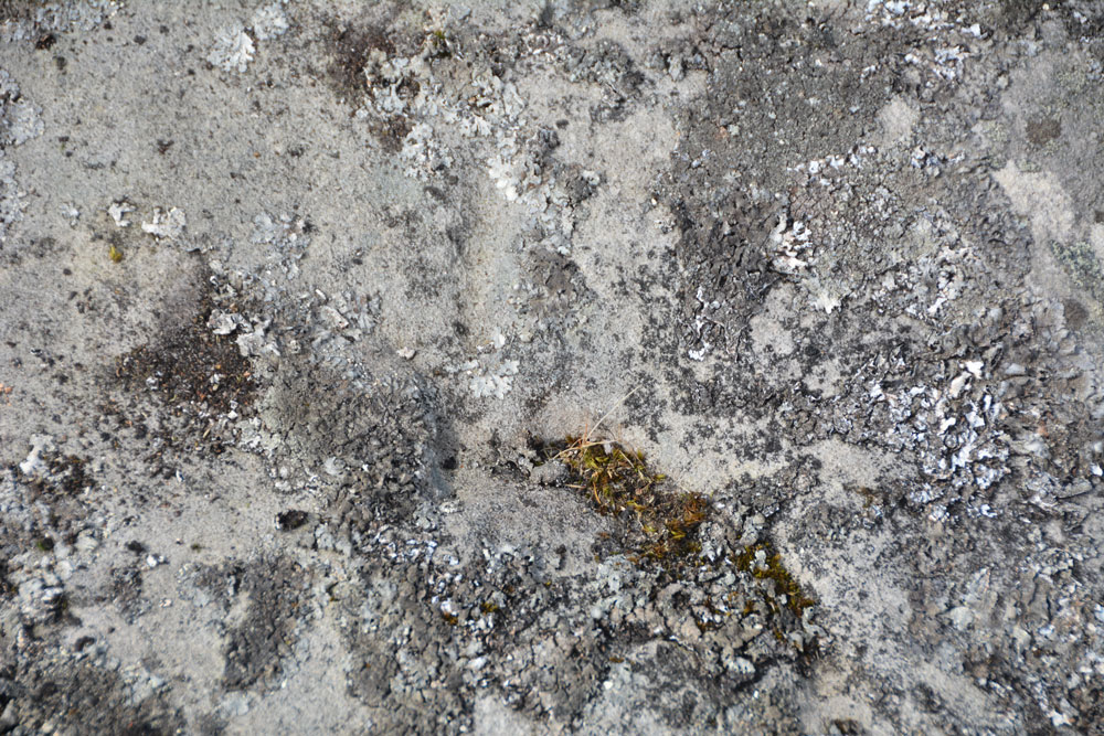
Millstone Burn 2d. submitted by Anne T on 8th May 2018. The area of mechanical damage towards the centre of the rock.
(View photo, vote or add a comment)
Log Text: Millstone Burn 2d: Closer to the A697, it's a good job we had the GPS to find this panel. In usual Tate style, we'd brought everything but a bottle of water to bring out the motifs. I had to call up the ERA media (photos and sketch) on my phone to ensure we understood what we were seeing. There really are cups beneath the lichen and moss, easier to feel with the fingers and see with the naked eye.
Millstone Burn 2c
Trip No.67 Entry No.1 Date Added: 23rd Feb 2018
Site Type: Rock Art
Country: England (Northumberland)
Visited: Yes on 21st Feb 2018. My rating: Condition 3 Ambience 4 Access 4
Millstone Burn 2c submitted by SolarMegalith on 2nd Feb 2013. Cup-marks on Millstone Burn 2c at night (photo taken on January 2013).
(View photo, vote or add a comment)
Log Text: Millstone Burn 2a, Longframlington: Making the most of a bright, sunny day, before the 'Polar Vortex' was supposed to hit the UK, we decided to go looking for the standing stone and the main rock here, before heading off to find Castle Hill Hillfort at nearby Callaly.
Parking alongside the very fast A697 was fun, but there was a small tarmacked area next to a gate and track at NU 11858 05078. As the gate hadn't been used in a long time, judging by the gorse growing around it, we decided to risk it and if the farmer needed access, we could run back to the car to move it.
Heading up the track, we passed a large square boulder standing on smaller stones, that looked like it had been quarried. 36 paces further west, right next to the track was a cup marked stone. I took the grid reference off the GPS and later identified it as Millstone Burn 2c from ERA.
The boulder was heavily covered in moss, but we could make out more cups running along the ridge, and some down its side. Not wanting to cause any damage or erosion, we left the moss, and headed up the slope to the main rock.
I'd spotted ranging poles in the field further to the south west, and a few cars parked nearby, but didn't spot anyone. What a place for rock art. A real treat, and for me really accessible. I could have spent several days here, and ear-marked it to come back to at a later date.
Millstone Burn 2bb
Trip No.71 Entry No.2 Date Added: 8th May 2018
Site Type: Rock Art
Country: England (Northumberland)
Visited: Yes on 7th May 2018. My rating: Condition 3 Ambience 3 Access 4
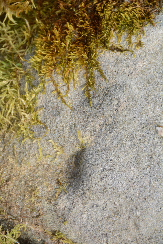
Millstone Burn 2bb submitted by Anne T on 8th May 2018. The oval and groove, as shown on the ERA drawing for Millstone Burn 2bb.
(View photo, vote or add a comment)
Log Text: Millstone Burn 2bb: This would be a 'short walk on a footpath' if we'd come in through the gate we used at our last visit. This time we approached it from Millstone Burn 2c, walking down the hill towards the start of the bend in the A697 from Longframlington. The rock was instantly recognisable from ERA's description, as was finding the two indentations at its apex and the oval and groove on ERA's drawing. The three cup marks in a line were there, but underneath a heavy covering of moss and lichen. They could be felt by running your fingertips over the rock.
Millstone Burn 1e
Trip No.71 Entry No.6 Date Added: 9th May 2018
Site Type: Rock Art
Country: England (Northumberland)
Visited: Yes on 7th May 2018. My rating: Condition 2 Ambience 3 Access 4
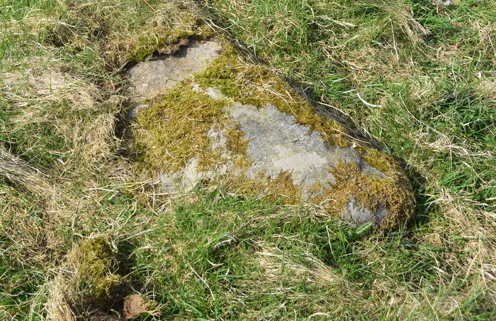
Millstone Burn 1e submitted by Anne T on 9th May 2018. Millstone Burn 1e was too heavily under moss to make out any motifs at all. We didn't want to move any moss, so left the panel as it was.
(View photo, vote or add a comment)
Log Text: Millstone Burn 1e: On the eastern side of the A697, not far from the gate into the field. This was the stone at the grid reference given, but was almost completely buried under moss/turf, with one end of it seeming to have been grazed by farm machinery, which had taken off the moss and a shallow layer of stone. We left the moss as it was, not wanting to harm the motifs (but then NADRAP said they didn't observe anything).
Millstone Burn 1d
Trip No.71 Entry No.6 Date Added: 7th May 2018
Site Type: Rock Art
Country: England (Northumberland)
Visited: Yes on 7th May 2018. My rating: Condition 2 Ambience 4 Access 4
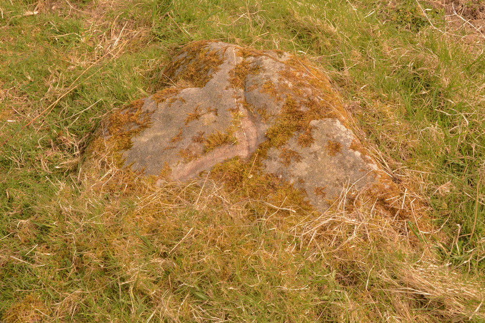
Millstone Burn 1d submitted by Anne T on 7th May 2018. Millstone Burn 1d from a different angle, showing the 'scar' across the middle of the rock, which looks relatively recent.
(View photo, vote or add a comment)
Log Text: Millstone Burn 1d: This rock art panel is just to the east of the A697 and largely covered in turf. There is a deep scar in the rock which looks relatively recent. It also has a curious vein of quartz which runs through the rock.
Millstone Burn 1c
Trip No.71 Entry No.8 Date Added: 9th May 2018
Site Type: Rock Art
Country: England (Northumberland)
Visited: Yes on 7th May 2018. My rating: Condition 2 Ambience 3 Access 4
Millstone Burn 1c submitted by SolarMegalith on 7th Jun 2013. General view of the cup-marked boulder as seen from the east (photo taken on June 2013).
(View photo, vote or add a comment)
Log Text: Millstone Burn 1c: This panel was very near the road (some motorists tooted their horns as they went past) and parts of it were under turf and moss. Part of the line of cups visible on the ERA photographs were covered by moss, which we left undisturbed. It was difficult to distinguish any other cups on the rock, despite having the ERA images on my phone to compare it to.
Millennium Stone Danby High Moor
Trip No.15 Entry No.3 Date Added: 10th Apr 2017
Site Type: Modern Stone Circle etc
Country: England (Yorkshire (North))
Visited: Yes on 9th Apr 2017. My rating: Condition 3 Ambience 3 Access 5
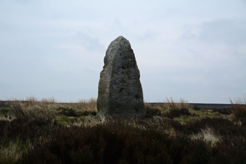
Millennium Stone Danby High Moor submitted by Anne T on 10th Apr 2017. Standing at the road junction of the moorland road from Ainthorpe and Knott Road, this stone sits over a metre above you.
(View photo, vote or add a comment)
Log Text: The Millennium Stone, Danby High Moor, North Yorkshire: Driving at a sedate pace along the moorland road from Wolf Pit Tumulus (which I realised as we got a phone signal back, that we’d picked up the wrong monument), I was really surprised to see what looked like a large standing stone at the junction of Knott Road. Immediately to our left was a small car park with an interpretation board (which didn’t mention this stone), and I spent a good half hour on the internet at home trying to find anything at all about it, which was a brief mention on the Hidden Teesside web site.
Getting out of the car to look more closely at this stone, my fleece and camera were almost blown away by the wind. The temperature had dropped from high teens to single figures in a very short while. I was glad to get back into the car, but pleased to have 'discovered' a stone not (yet) on the map! Next stop was the second 'White Cross' of the day - later discovered to be called 'Fat Betty'.
Mill Knock Settlement (Birtley)
Trip No.63 Entry No.1 Date Added: 10th Jan 2018
Site Type: Ancient Village or Settlement
Country: England (Northumberland)
Visited: Yes on 7th Jan 2018. My rating: Condition 2 Ambience 3 Access 5
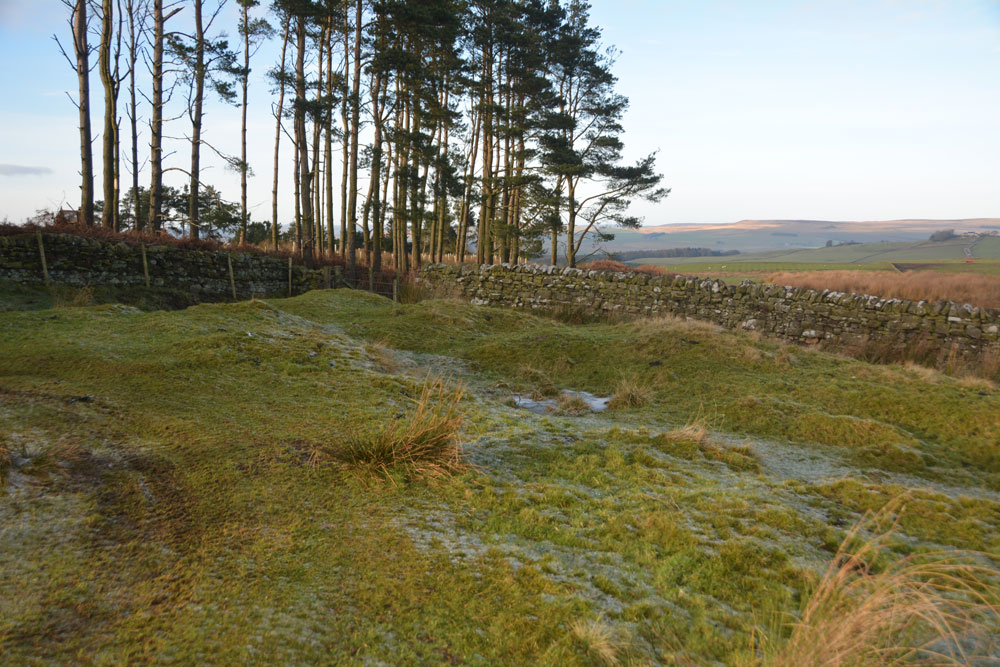
Mill Knock Settlement (Birtley) submitted by Anne T on 9th Jan 2018. Standing in the middle of the settlement, looking at the banks to the north and west (the quarry, which looks as if it has recently been reopened, is behind the trees).
(View photo, vote or add a comment)
Log Text: Mill Knock Enclosure, Birtley: We didn't realise this settlement was here until we pulled up at the quarry entrance and I studied the OS map more closely. At first, it looked like just outcrops of limestone rock, but as I walked up the gentle slope, the outer banks and ditches became more obvious.
The northern part of the enclosure looked as if it had been used for small scale limestone quarrying, although the outer bank and ditches were relatively in tact.
The Holywell Burn runs past the eastern side of the enclosure - just a waterlogged ditch lined by reeds at this point. The eastern side of the site looks as if it had been ploughed or quarried away.
With all the rock outcrops in the area I spent some time looking for cup marks, but found none.
Mill Knock Chalybeate Well (Birtley)
Trip No.63 Entry No.2 Date Added: 8th Jan 2018
Site Type: Holy Well or Sacred Spring
Country: England (Northumberland)
Visited: Yes on 7th Jan 2018. My rating: Condition 3 Ambience 4 Access 5
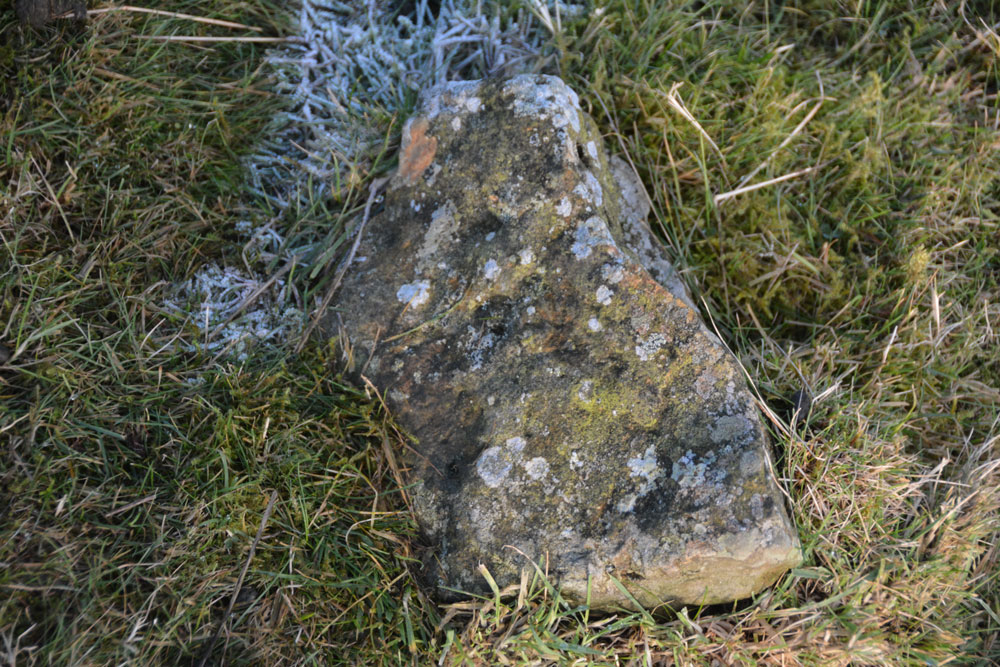
Mill Knock Chalybeate Well (Birtley) submitted by Anne T on 8th Jan 2018. is it my imagination (probably!) but as the sun shone on this stone by my feet, it looked as if there were 3 narrow, partial rings. For a moment I got quite excited at the possibility of a new rock art find, but the sun went in, and I thought 'no'. Curious to see what others think??
(View photo, vote or add a comment)
Log Text: Mill Knock Holy Well: The skies may have been blue and tempting to put on walking boots, but the temperatures were just on freezing and the minor roads around here were just like skating rinks! This well is not marked on the map, but my husband had come across an article on it, and being not too far from our house, decided to drive out to visit.
This is a glorious location (well, if you ignore the quarry). Access into the well field is a bit tricky, as there is no gate near the gorge formed by the gushing spring, but a bit of wooden fence allowed us to hop over to get a closer look.
On the eastern side of the road, the Holywell Burn is just a trickle - like a shallow ditch, but crossing the single track road and looking west over the stone wall, there is a strong gush of clear water which comes tumbling out of the hillside.
From a distance, it looks as if the water comes directly from the face of the large stone which is visible at the head of the gorge, but in fact the water is channelled from the stone wall past the western face of the stone.
Whilst I was waiting at the wooden fence for my husband to do a 'reccy' of the field to see if it was safe to go and look, I glanced down at my feet and what looked like narrow, but well worn rings, shone up at me from a portable stone that looked like it had fallen out of the wall. I photographed it, but am not convinced. However, for a moment, it did look like a new rock art discovery and I was quite excited!
This is another complex landscape, but mixed with lots of rock outcrops, so it was difficult to comprehend exactly what we were seeing until we came back home and looked up the official records on Pastscape (HE had nothing). A site to revisit during warmer weather.
Milfield Reconstructed Henge at Maelmin Heritage Centre
Trip No.77 Entry No.1 Date Added: 1st Jun 2018
Site Type: Henge
Country: England (Northumberland)
Visited: Yes on 31st May 2018. My rating: Condition 4 Ambience 4 Access 4
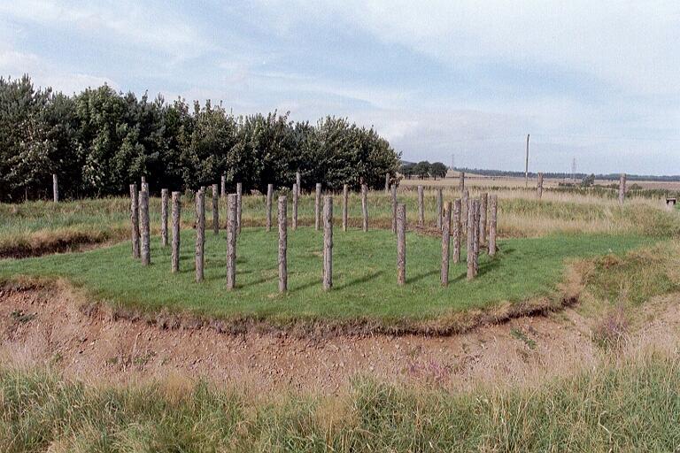
Milfield Reconstructed Henge at Maelmin Heritage Centre submitted by Andy B on 27th Feb 2003. Part of the Burnham family trip to Northumberland, August 2002
(View photo, vote or add a comment)
Log Text: Maelmin Recreated Henge, Milfield: We had a bit of a tortuous journey to get here, having been stuck in roadworks on the A1 northbound, so instead of the hour and a half it would have taken us, it was almost two and a half, so we were eager to get out of the car and walk.
Having found the ‘Archaeological Guide’ by Clive Waddington in a local charity shop about 10 days ago, I had read it from cover to cover and was really keen to see this site. I’d shown the booklet to our three year (going on 63) old grand-daughter and we’d talked through the photos on the journey here. As we walked into the centre of the henge from the car park, she turned to me and, pulling a face, said; “It’s just a ‘thing’ with a deep hole”.
Having spotted all the information boards round the site and running through the woods, she ran from one to the other. On getting to the Dark Age hut at the far side of the site, she was fascinated by this, and we had to go inside. Opening the door was amusing, at the wood had swollen in the rain and it took a while to get it to swing open gently without trapping fingers.
We walked back around to the henge following the circular path around the field, taking in the airfield. We found a sign saying ‘Mesolithic hut’ but there was only a hollow in the ground with a few poles laid inside.
No totem poles, or none that we could spot, anyway. It looks like these have now been replaced with two taller plain tree trunks.
After reading the story of the recreation of the henge, I did enjoy seeing it but had expected more from the heritage trail, which was essentially a ‘trail’ of information boards but without any real specific context or associated feature to look at. Would go again, without dearly loved child, to soak in the atmosphere. We went onto the Heatherslaw Light Railway - a great 15in gauge railway, ideal for small children and grandparents!
Midstead 3
Trip No.1 Entry No.4 Date Added: 14th May 2016
Site Type: Rock Art
Country: England (Northumberland)
Visited: Yes on 8th May 2016. My rating: Condition 3 Ambience 4 Access 3
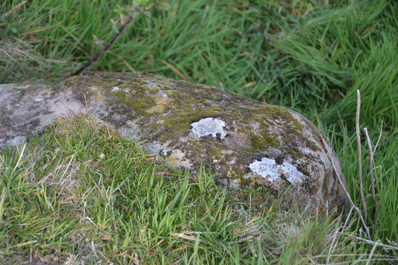
Midstead 3 submitted by Anne T on 11th May 2016. Midstead 3 showing some more of the cups on the far side of this boulder. When the NADRAP survey was done they uncovered parts of the stone buried under turf, so they were able to see all 13 cup marks.
(View photo, vote or add a comment)
Log Text: Midstead 3, Rock Art near Edlingham, Northumberland: Also see visit report for Jenny's Lantern Hill Fort and Settlement, Midstead 1 and Midstead 2. This stone is about 3 metres to the west of Midstead 2, although the cups are more difficult to spot. Beautiful views over the Aln Valley and to the listening/radar station at Cloudy Crags across the valley.
Midstead 2
Trip No.1 Entry No.3 Date Added: 14th May 2016
Site Type: Rock Art
Country: England (Northumberland)
Visited: Yes on 8th May 2016. My rating: Condition 3 Ambience 4 Access 3
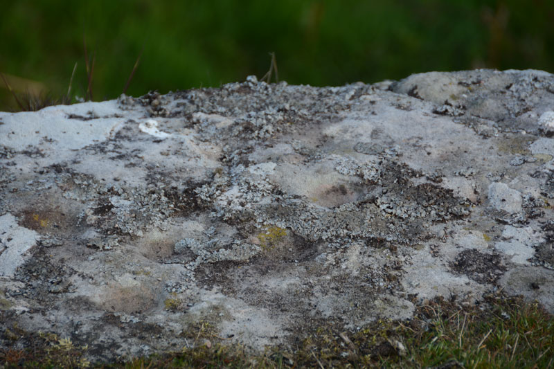
Midstead 2 submitted by Anne T on 11th May 2016. Close up of some of the cup marks on this rock. The ERA-599 record for this stone says there are 35 possible cup marks, but we didn't spot that many. I would have liked to have tried a rubbing of this rock to see how many there were.
(View photo, vote or add a comment)
Log Text: Midstead 2, Rock Art near Edlingham, Northumberland: Having visited Jenny's Lantern Hill Fort and Settlement, we headed back east with the GPS to find the rock art stones we'd failed to find on our visit back in 2014 (our first trip out to find rock art, without a GPS). This rock sits right on the edge of the crag with great views over the Aln Valley below. The cup marks are a little difficult to spot until your eyes adjust to the lumps and bumps on the rock. The cups are inter-disbursed with natural hollows. There are some cup marks on the vertical face of the rock although it was difficult to get too close because of the 'killer' brambles. Note to self: take garden shears/machete on next visit!
Midstead 1
Trip No.1 Entry No.5 Date Added: 14th May 2016
Site Type: Rock Art
Country: England (Northumberland)
Visited: Yes on 8th May 2016. My rating: Condition 3 Ambience 4 Access 4
Midstead 1 submitted by SolarMegalith on 11th May 2013. Cup-and-ring mark with a gutter in the NE corner of Midstead 1 panel (photo taken on May 2013).
(View photo, vote or add a comment)
Log Text: After visiting Jenny's Lantern Hill fort and settlement and Midstead 2 and 3 to the west, we walked eastwards along the top of the crag to find the rock art we'd failed to find on our first trip in 2014. Thank goodness for GPS otherwise we never would have found these. The ground in this rocky field had obviously been very wet at some time in the recent past and been home to some large cattle. Not having rained for some time the ground had hardened, making walking over the tussocks difficult. This stone is the most impressive on the hillside with numerous motifs. Well worth seeing. I'm glad we returned. About 3 metres to the south west of this stone we found another with a cup mark at grid reference NU 12424 15448. Having been sent the HER records for Jenny's Lantern, the Historic England map for this entry (1008839) shows a homestead just above the site of this stone - not marked on the OS maps and not clear on the ground (although not being aware it was there we didn't hunt around).
Midshiels Standing Stone
Trip No.29 Entry No.7 Date Added: 31st Jul 2017
Site Type: Standing Stone (Menhir)
Country: Scotland (Scottish Borders)
Visited: Yes on 3rd Jun 2017. My rating: Condition 3 Ambience 4 Access 4
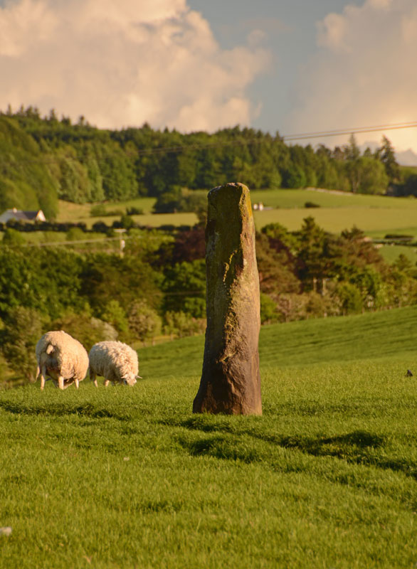
Midshiels Standing Stone submitted by Anne T on 4th Jun 2017. This is the nearest we could get to the standing stone on the evening of our visit. The field was full of quietly grazing sheep but many lively, curious young bullocks. The minute we started to open the gate, they were racing towards us.
(View photo, vote or add a comment)
Log Text: Midshiels Standing Stone, Hawick: We'd arrived (unknowingly) in Hawick on their Riding of the Marches day. The shops were shut and the town was almost deserted. Having visited some other sites on the southern side of Hawick, we decided to stop off to see this standing stone and cairn on the way back home. Following the curious one-way system though Hawick, we ended up on the Borders Abbey Way heading north-east out of the town. At Bucklands, we found where the entire town was - at a community centre at the edge of the town. A marshall stopped us and told us we wouldn't be able to get any further up the road as the procession of horses was coming through. Doubling back through the industrial estate, we took the A698 out of town, turning left over the picturesque Hornshole Bridge, rejoining Borders Abbey Way a few hundred yards before the entrance to Midshiels Farm.
A couple of hundred yards further north-east along the road, there was a large passing place, so we hugged the car into the hedgerow and hopped out. About 50 metres further back, on the other side of the road, a gate let us into the field leading to the dismantled railway embankment to the west. Following the left hand hedge-line along, we came to another gate, just before a tall brick bridge leading under the railway line. This gate gave access to the field with the standing stone and cairn.
However, the field was full of gently grazing sheep and lots of lively, curious bullocks along with what looked like a very large bull. My hand went onto the gate and they were running towards us. I elected to use the zoom lens on the camera, and was really disappointed not to have seen this standing stone closer up. But there is lots to see in this area, so undoubtedly a return visit will be in the offing at some point in the not too distant future.
Midshiels Standing Stone
Trip No.93 Entry No.6 Date Added: 31st Aug 2018
Site Type: Standing Stone (Menhir)
Country: Scotland (Scottish Borders)
Visited: Yes on 29th Aug 2018. My rating: Condition 3 Ambience 4 Access 4

Midshiels Standing Stone submitted by Anne T on 4th Jun 2017. This is the nearest we could get to the standing stone on the evening of our visit. The field was full of quietly grazing sheep but many lively, curious young bullocks. The minute we started to open the gate, they were racing towards us.
(View photo, vote or add a comment)
Log Text: Midshiels Standing Stone, near Hawick: At our last visit, we were put off from entering the field because of a very large bull and his ladies. The bull stood guard near the stone, and any approach made him stand tall, with splayed legs, looking menacingly at us – I contented myself with taking photos from near the gate in the field.
At this visit we parked near the entrance to Midshiels farm, at NT 53459 17603, where we made sure we weren’t blocking the entrance into field. Immediately opposite, at NT 53461 17624 is a metal gate into the field, with the top of the stone just visible.
Husband, Andrew, opened the gate and was in the field, and I was just about to follow when a loud voice behind me stopped me going an further. There was a large, but friendly, farmer and his lad in a very large pickup truck. “There are bullocks in that field – if they see you, they’ll go for you. Drive into the next field and go up to the tunnel – you can turn round there. You can see the stone from there.” I thanked him for the ‘heads up’.
Andrew moved the car, but rather than drive the car up to the tunnel, the ground was a bit too uneven to risk the bottom of the car, so we left it at the edge of the field at NT 53518 17745 and walked to the gate near the tunnel at NT 53388 17830. From here, it looked as if all the cattle were at the far end of the field, with many of them lying down, although the hump in the middle of the field made it difficult to really see. We decided to take the chance and walk to the stone, as we could have got back to the gate quickly.
This stone was glorious in the sunshine, with a most peculiar small ‘hook’ to the top. I tried to capture the shadow in the strong sunshine.
Midshiels Cairn
Trip No.29 Entry No.8 Date Added: 31st Jul 2017
Site Type: Cairn
Country: Scotland (Scottish Borders)
Visited: Saw from a distance on 3rd Jun 2017. My rating: Condition 3 Ambience 4 Access 4
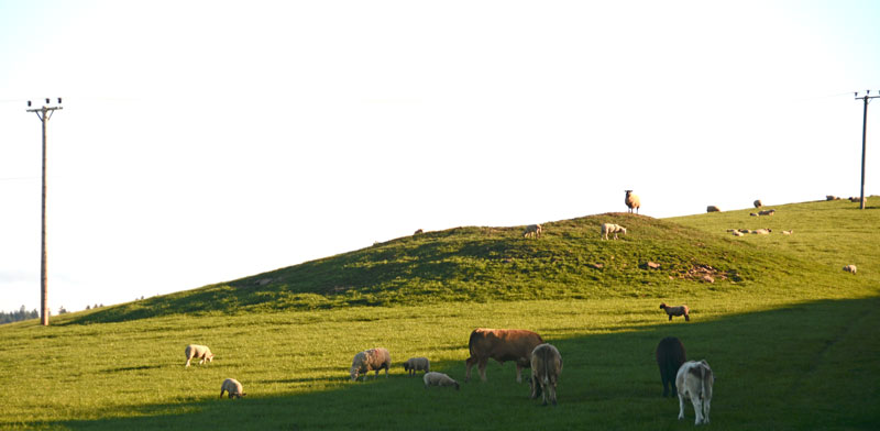
Midshiels Cairn submitted by Anne T on 4th Jun 2017. This is the closest we could get to the cairn on this visit - most of the young bullocks that had been on the right hand slope of the cairn were running (fast!) towards where we were standing at the gate to the field.
(View photo, vote or add a comment)
Log Text: Midshiels Cairn, Hawick: See visit report for Midshiels Standing Stone (the two are 90 metres apart), sites entered separately as Canmore lists them individually. Couldn't get really close to the cairn - would have loved to have walked up to it, but there was a really big bull and lots of over-friendly and very lively bullocks in the field. Must revisit at a different time of year!
There are plenty of other forts and settlements around here. The problem with another visit, is which sites to pick?
Midshiels Cairn
Trip No.93 Entry No.7 Date Added: 31st Aug 2018
Site Type: Cairn
Country: Scotland (Scottish Borders)
Visited: Yes on 29th Aug 2018. My rating: Condition 3 Ambience 4 Access 4

Midshiels Cairn submitted by Anne T on 4th Jun 2017. This is the closest we could get to the cairn on this visit - most of the young bullocks that had been on the right hand slope of the cairn were running (fast!) towards where we were standing at the gate to the field.
(View photo, vote or add a comment)
Log Text: Midshiels Cairn: Having been warned about the large cattle who might "go for us if they saw us", I was cautious about walking the additional 100m from the standing stone to the cairn. Andrew decided that as the cattle were at the far end of the field, and though large, looked relatively docile. “If they come for me I can always leap over the fence (to the railway embankment)”, he said, so I gave him the camera and left to explore the cairn, which seemed much further away than the standing stone, but in reality was only around 90m away.
The Canmore entry of 1948 says the cairn was ‘planted with trees’, although it is now only covered in grass.
