Contributory members are able to log private notes and comments about each site
Sites Anne T has logged. View this log as a table or view the most recent logs from everyone
Lady Well (Sticklepath)
Trip No.132 Entry No.10 Date Added: 8th Jun 2019
Site Type: Holy Well or Sacred Spring
Country: England (Devon)
Visited: Yes on 13th May 2019. My rating: Condition 4 Ambience 2 Access 5
Lady Well (Sticklepath) submitted by KiwiBetsy on 29th Aug 2006. The Lady Well invites visitors to 'Drink and be thankful.'
(View photo, vote or add a comment)
Log Text: Lady Well, Sticklepath: This well is right beside the road. The grid reference given by Pastscape must be the original site of the well, as it actually is at SX 63904 94124.
The ambience of the well was dreadful at the time of our visit, as it sat immediately next to a set of roadworks, and also in deep shade at the time of our visit. Pleased to have seen it, and ticked it off our list, but that’s about all.
The boundary marker is nearby, just up hill, literally on the other side of the road junction.
Ladye Well (Terregles)
Trip No.177 Entry No.2 Date Added: 8th Jun 2022
Site Type: Holy Well or Sacred Spring
Country: Scotland (Dumfries and Galloway)
Visited: Couldn't find on 6th Jun 2022. My rating: Condition 1
Log Text: Ladye Well, Terregles: Armed with the OS map and a description from “Saints in Scottish Place-Names”, we went back (after many, many years) to Terregles. This well is on private ground, so I found myself chatting to a lady who was gardening just opposite the village hall about how we might be able to ask for access.
She was very cagey about giving us any information at all, telling us in order to see it, we’d have to walk half-way down someone’s driveway. I did explain the purpose of our visit – my ‘holy well’ project, and that we used to live in the area - which didn’t seem to convince her.
I did try and knock on the door of the house at the very end of the village, at NX 92749 77497, but no-one was at home, apart from the dogs. Just to the west of this house there was an access road into a building plot, and with no-one around to ask, we ventured down this track to the back of the "garden". All was derelict ground with weeds galore.
Finding nothing, we made our way back to the road, and I was going to walk down to Ladywell House, which was some distance down a long driveway, with the house not visible, only for a second lady who drove out of Ladywell House and parked up just down the road, to speak to the Gardening Lady (presumably waiting for us to walk up). I went up to them and told the Gardening Lady we couldn’t find the well, found myself telling them we used to live around here years ago, and my kids went to Shawhead School (only 4 miles away). The New Lady said “there’s nothing to see – it’s all weeds. Even the site of the old chapel is just a lump at the end of the field, covered in weeds. Nothing to see at all”. So that was us told!
We felt really unwelcome, which was very sad.
We went onto see a named well (not a holy well or sacred spring) at Kingholm, and our reception was completely different. Two of the residents were enormously helpful, even giving us a guided walk of the field with possible locations of the well and associated spring.
Laigh Hill (Tweeddale)
Trip No.82 Entry No.5 Date Added: 24th Jul 2018
Site Type: Ancient Village or Settlement
Country: Scotland (Scottish Borders)
Visited: Yes on 12th Jul 2018. My rating: Condition 2 Ambience 3 Access 3
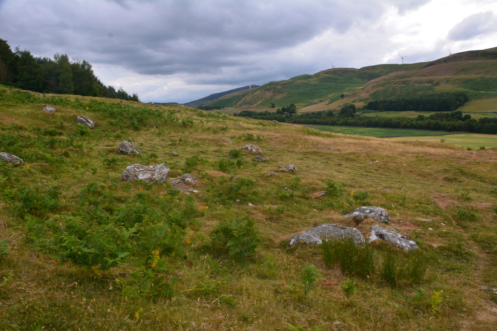
Laigh Hill (Tweeddale) submitted by Anne T on 24th Jul 2018. Standing just north west of the middle of the settlement, looking over both what we think are the remains of the foundations of an internal structure, plus boulders which emerge from the hillside. We found it a little tricky to pick out any particular features within this settlement. According to Canmore, just east of the entrance, a semi-circular stony bank marks what may have been a round stone-walled house. This may very well be this feature!
(View photo, vote or add a comment)
Log Text: Laigh Hill Settlement, below Norman's Castle, Scottish Borders: I was really looking forward to seeing this large settlement on the slopes of Laigh Hill, with the River Tweed to the south below.
The walk was easy, along a track, and only 400m past the Patervan Mound. Leaving the track and following the well-worn sheep tracks up the slope, through the low outer banks at the south west of the settlement, we arrived amongst a confusing array of circular flat areas, stony structures and boulders. Even though we'd seen a number of settlements, with our somewhat inexperienced eyes, we had difficulty trying to trace any particular structures to photograph. I called up the Canmore record on my phone, but there was no plan to orientate ourselves to, so we contented ourselves with trying our own interpretations, trying to match what we were seeing with the written description.
Norman's Castle was impressive, on the rocky knoll high above us. This really dominated the scene. Making our way over to the gate in the fence which led up to the rocks, I realised that I wouldn't be able to scramble up to the Dun, so left mountain-goat Andrew to climb up with the camera, hoping the camera would return in one piece!
Langdale Axe Factory
Date Added: 4th Jun 2017
Site Type: Ancient Mine, Quarry or other Industry
Country: England (Cumbria)
Visited: Yes on 11th Aug 2015. My rating: Condition 3 Ambience 5 Access 3
Langdale Axe Factory submitted by Thorgrim on 15th Nov 2003. The Langdale Pikes in Great Langdale.
(see article on Langdale Axes)
(View photo, vote or add a comment)
Log Text: Mickleden Way, finding pointers to the Pike O'Stickle Axe Factory: I was lucky enough to win a copy of Gabriel Blamires book in a Portal photographic competition. It arrived just in time for our trip over to the Lakes on 10th/11th August. We followed Chapter 4: The Mickleden Way, having parked at the National Trust pay and display car park next to the Old Dungeon Ghyll Hotel, and headed up behind the pub onto the stoney footpath into the hills.
This is a beautiful and easy walk with Mickleden Beck in the valley to the left hand side and Langdale Fell with Pike O’Stickle to our right. We were passed by a number of small climbing parties coming back the other way.
We found boulders 4.1 to 4.7. We had intended finding more but dusk stopped us in our tracks and had us retracing our steps back to the Hiker's Bar at the hotel The Pike O’Stickle Pentagon was perhaps the most dominant and impressive stone. To be found at NY 2738 0640 it stands out proudly on the hillside and is one of the more convincing markers/pointers. There has been some recent activity around both sides of the stone, with gullies being made to channel water off the hillside around it, hence it’s a bit tricky to get up to. From the banks of one of these gullies I picked up a lump of shiny black stone (now dried it is a dull green-grey with light brown inclusions) which was incredibly sharp. We later identified it as a piece of stone used for the axes, so it now sits proudly on my window ledge.
As our walk continued there were so many stones and stony outcrops that we started to wonder how Gabriel Blamires had chosen the pointers he did, as there were others which equally stood out in the landscape. He has obviously done an immense amount of research to check everything out. I did get excited at boulder 4.4 as bending down to retrieve the lens cap for my camera, I noticed that the top profile of the boulder seemed to echo the pattern of the peaks above.
Following the book to the letter, and thankful for our GPS, we got to boulder 4.7 before spotting what looked like an area of cairns.
There are many more boulders detailed in Gabriel's book, along with some stunning walks/ways and I really look forward to finding out more.
I do agree with rich32 that you would have needed ropes and parachutes to attempt to get up to the axe factory!
Langholm Market Cross
Trip No.190 Entry No.1 Date Added: 18th Sep 2024
Site Type: Ancient Cross
Country: Scotland (Dumfries and Galloway)
Visited: Yes on 13th Sep 2024. My rating: Condition 3 Ambience 3 Access 5
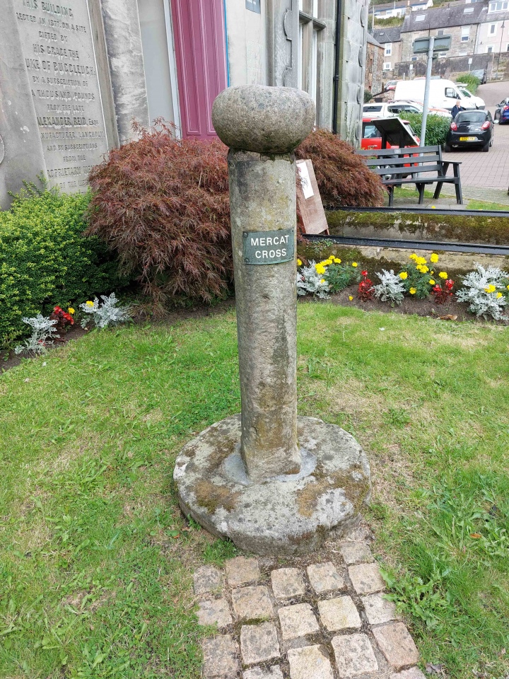
Langholm Market Cross submitted by Anne T on 17th Sep 2024. The cross, looking back towards the parking area in Parliament Square/Jouker's Close, showing the 'modern' sign attached to it explaining its purpose.
(View photo, vote or add a comment)
Log Text: Langholm Market Cross: It's odd to think we've driven past this cross many times, but never noticed it. A curiously small cross with a round boulder on top inscribed with a cross. Also an odd location, sited next to a statue, an information board about astronaut and first man on the moon, Neil Armstrong (now a freeman of the town) and an archway created by Thomas Telford.
The heavy traffic whizzing by on the main road made it difficult to take some of the photos without risking getting knocked over by the huge lorries driving through the narrow high street.
Lawers
Trip No.53 Entry No.6 Date Added: 11th Oct 2017
Site Type: Standing Stone (Menhir)
Country: Scotland (Perth and Kinross)
Visited: Saw from a distance on 28th Sep 2017. My rating: Condition 3 Ambience 3 Access 4

Lawers submitted by BigSweetie on 19th May 2004. Perthshire stones photo by Andy Sweet
(View photo, vote or add a comment)
Log Text: Lawers Standing Stone, East of Comrie: From St Fillan’s Chapel, we headed back towards Comrie, this time continuing east along the A85 until we reached the gatehouse at the northern side of the road, just before Comrie Croft Caravan Park.
The landowner had padlocked all the gates, but being within site of the stone, we ended up scrambling over the low stone wall by the small stream running parallel with the eastern side of the field, and separated from the field by a tree lined footpath/track.
On getting level with the stone, I tried (very hard) to photograph it, but was constantly head-butted by a very friendly ginger horse! He was to friendly to contemplate climbing the wooden fence into the field without a bag of apples or pony nuts, so I had to content myself with having my sleeves chewed whilst I tried to photograph the standing stone.
We walked back along the footpath and along the northern side of the field, but the stone was too far away to get a good image of, even with maximum zoom on the camera lens. Having reached the western side of the field, the gates were padlocked. Andrew could squeeze between the wooden rails of the fence, but I was a bit too plump, so clambered unceremoniously over the somewhat higher stone wall at this end of the field.
Lazonby Ancient Cross
Date Added: 12th Mar 2015
Site Type: Ancient Cross
Country: England (Cumbria)
Visited: Yes on 30th Nov 2014. My rating: Condition 3 Ambience 3 Access 4
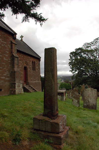
Lazonby Ancient Cross submitted by nicoladidsbury on 13th Oct 2007. A cross in Lazonby churchyard, supposed to date from the 8th centuary - please see Steve Bulmans pages for detail dated 1901
http://www.stevebulman.f9.co.uk/cumbria/1901/lazonby1901_f.html
(View photo, vote or add a comment)
Log Text: Lazonby Cross, Cumbria: At first glance this seems the most unlikely church to have the shaft of a cross, thought to be preaching cross dating from the 8th century, as at first glance it appears to be thoroughly Victorian in origin.
From Kirkoswald, travelling on the B6413 over the Eden Bridge into Lazonby, the church looms on a steep hill on the right hand side of the road and looks very Victorian (the church guide says the foundation stone was laid in 1864, and that "three places of Christian worship have been on this site. Before the Normans came to Cumbria a preaching-cross faced across the River Eden towards the Pennines").
It was hard to spot the cross shaft at first at it lies in the shadow of a tall tree and is the same red colour as the sandstone of the south wall of the church against which it sits near.
There are no discernable markings or carvings on it. The views over the River Eden and the Pennines beyond are impressive.
If you are passing by and are interested in Anglo Saxon crosses, it is worth stopping off for a few minutes to appreciate this ancient spot.
Leckuary Dolmen
Trip No.88 Entry No.16 Date Added: 2nd Aug 2018
Site Type: Burial Chamber or Dolmen
Country: Scotland (Argyll)
Visited: Yes on 18th Jul 2018. My rating: Condition 3 Ambience 5 Access 3
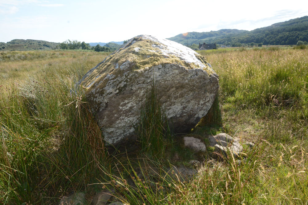
Leckuary Dolmen submitted by Anne T on 2nd Aug 2018. This quartz covered rock sits on a bed of smaller stones, on top of an almost circular mound, with great views almost 360 degrees. A burial chamber, yet to be recorded, or just a figment of my imagination? The stone was certainly visible from quite a way away in the sunshine.
(View photo, vote or add a comment)
Log Text: Leckuary Dolmen or just a quartz covered stone? This stone protruded from the surrounding pasture like a gleaming white, stubby standing stone. We walked over to it and photographed it. It appears to sit on a low, almost circular mound with this stone in the middle, which in turn sits on a bed of smaller stones. Having seen quartz on The Boat Stone and the Glenagles Symbol Stone, the importance of quartz in picking a rock for a monument seems both important and symbolic. Whilst not recorded on Canmore, will this site be included in the survey of Kilmichael Glen that is due to start in August 2018? I'd love to know more about this site, and have it confirmed as a burial mound or just a figment of my imagination.
Leckuary Rock Art
Trip No.88 Entry No.15 Date Added: 2nd Aug 2018
Site Type: Rock Art
Country: Scotland (Argyll)
Visited: Yes on 18th Jul 2018. My rating: Condition 3 Ambience 5 Access 3
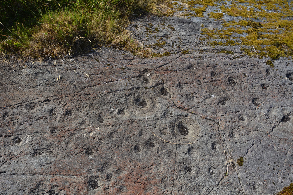
Leckuary Rock Art submitted by Anne T on 2nd Aug 2018. …. all these motifs became visible in the strong sunlight.
(View photo, vote or add a comment)
Log Text: Luckuary Rock Art Panel: A new find, some three years ago, and about to be included in a survey of Kilmichael Glen, which sounds similar to the England's Rock Art project. This was most definitely one of the highlights of our trip, thanks to the farmer who is very interested in archaeology and works very closely with Historic Scotland and Kilmartin Museum.
Leeden Tor
Trip No.133 Entry No.13 Date Added: 9th Jul 2019
Site Type: Stone Row / Alignment
Country: England (Devon)
Visited: Yes on 14th May 2019. My rating: Condition 2 Ambience 3 Access 5
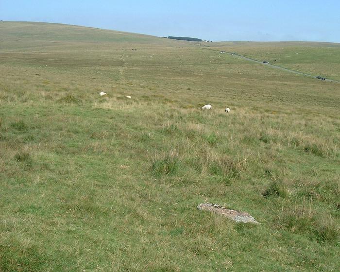
Leeden Tor submitted by Brian Byng on 7th Feb 2002. Leeden Tor - Cairn at upper end SX 5653 7147.
A scrappy row 107 m long but with only 4 stones still upright. Cairn 6m dia
with large central pit. Runs NW - SE with cairn at uphill N W end. The cairn
Has a reeve cutting across it and the row has another reeve cutting across.
Reeve - local word for a prehitoric field boundary maade from roughly
assembled granite blocks now sometimes only traces exist as here. Reeve
building on Dartmoor circa 1400 BC. Seems likely that the rows pred...
(View photo, vote or add a comment)
Log Text: Leeden Tor Stone Row: It was now the afternoon of 14th May. Having driven from Merrivale to the small car park nearest this site at SX 56725 71397, we had 10-15 minutes to spare before everyone arrived. In the meantime, Sandy led us up the hill to look at this stone row. By this time the wind was howling around us, with strong gusts that threatened to blow me over - thank goodness for my walking poles! I took a little satisfaction in watching the small group of soldiers out on exercise also being pummelled by the wind.
When the stones in the row and the cairn at its head were pointed out to me, I could see the alignment and also its relationship to the reave.
Whilst this stone row is near the car park, the tussocky grass made walking a little tricky.
Leeper Cross
Trip No.130 Entry No.2 Date Added: 24th May 2019
Site Type: Ancient Cross
Country: England (Devon)
Visited: Yes on 11th May 2019. My rating: Condition 2 Ambience 3 Access 4
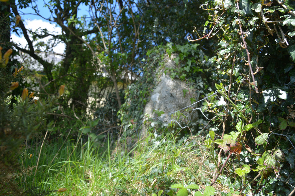
Leeper Cross submitted by Anne T on 24th May 2019. Trying to get a good close up of the south face of the Leeper/Leapra Cross, although it was deep in shade at this time, and I used the flash.
(View photo, vote or add a comment)
Log Text: The Leeper/Leapra Wayside Cross: We had problems locating this cross, so I ended up walking up the driveway up to Moorgate Farm. Just to the right hand side of the gate, I thought I identified an ivy covered cross head shape. Andrew didn’t believe me, so I let myself through the gate and had a closer look. Now I wasn’t convinced.
I heard voices through the hedge, so went in search of the voices, and ended up speaking to a young man who lived in the cottage. He said he knew where the cross was, and took us to the corner of the wall where my ivy covered shape was. This was indeed the Leeper Cross.
He told me that the cross had been moved from where it had been found at Moorgate Farm to Bovey Castle (“which isn’t a castle”), but there had been dissention so it had been moved back to this spot. His family had tried to get the cross located back to its original spot (at Moorgate Farm?) but “there doesn’t seem to be an appetite for it”.
He was happy to leave me to photograph the very ivy covered cross whilst he went back to erecting his new greenhouse.
Lemmington Wood
Trip No.1 Entry No.1 Date Added: 14th May 2016
Site Type: Rock Art
Country: England (Northumberland)
Visited: Yes on 8th May 2016. My rating: Condition 3 Ambience 4 Access 4
Lemmington Wood submitted by SolarMegalith on 28th Feb 2013. Cup-and-ring marks in artificial lighting (photo taken on February 2013).
(View photo, vote or add a comment)
Log Text: Lemmington Wood Rock Art/Rune Stone, Northumberland: We'd been told about this rock by a member of the Tynedale North of the Wall Archaeology Group who is renowned for visiting many and various rock art sites in Northumberland.
From the A1 North, we turned up on the A697 and drove the almost 16 miles to Edlingham (not to be confused with the nearby village of Eglingham to the north). We arrived in this quiet spot to the sound of a cuckoo in the fields nearby – a sound rarely heard up here these days. Just north of Corby’s Crags, an impressive settlement and rock shelter to the right hand side of the road, there is a turn to the left leading to Lemmington Hall. Just as this side road turns off, there is a small parking area and a memorial bench which looks out over to Edlingham Burn and the Aln Valley.
Whilst these are marked as private woods, there are three trails leading from the entrance gate to the wood. Various signposts say “No Bikes” but doesn’t discourage walkers. The ERA record (see below) says there is open access to this stone. These woods have obviously been decimated by the storms over Christmas and New Year and there are fallen trunks and branches everywhere. The trunks blocking the pathways have largely been chain-sawed to allow access.
A GPS is really needed to find this rock, which sits on the top of a slope, which, if the trees hadn’t been there, would have given great views over the valley beyond. The rock is really hidden in a dip and surrounded by conifers so is difficult to spot.
Someone had been there recently and scrapped off the moss in order to see the rock art and runes more clearly. This was good for us, but not so great for the preservation of these features.
According to the HER records (HER 4471), the runes were only found in 1991 by Ian and Irene Hewitt as they prepared the rock for wax rubbing and photography. The runes and rock art are on the edge and upper face of a 6ft outcrop. Described on the England’s Rock Art site ERA 579.
There is clear evidence on the stone of attempts to quarry it, so what else might have been on a more complete rock?
Leper's Well (Bamburgh)
Trip No.102 Entry No.5 Date Added: 13th Oct 2018
Site Type: Holy Well or Sacred Spring
Country: England (Northumberland)
Visited: Yes on 9th Oct 2018. My rating: Condition -1 Ambience 3 Access 4

Leper's Well (Bamburgh) submitted by Anne T on 12th Oct 2018. We tracked down the grid reference/location of the leper's well from the 1860 OS map, but there is nothing here now apart from a modern manhole cover. Does anyone else know anything about this well? In 1955, Pastscape record an entry that says "the well here is modern". I wondered when it disappeared.
(View photo, vote or add a comment)
Log Text: Leper's Well, Bamburgh: Guided by the grid reference given on Pastscape, we walked down Doctor's Lane from St Aidan's Well. Some of the old stone walls around properties, and at the sides of the lanes running off here are ancient, and we thought they could well belong to the old leper hospital.
The grid reference took us to the corner of a row of cottages, where there was a modern manhole cover. The well was last recorded in 1955, so it looks as if it has now been destroyed. I took a few photos of the site, just in case.
Andrew called up the 1860 OS map on his phone and we were confident we had the right location. When I got home, I used the Pastscape and HE entries which gave distances (the dovecot is 140 NE of leper hospital) to triangulate the location of the well, and it agrees with the spot on the old OS map and the spot I photographed.
Leven's Park ringcairn
Date Added: 9th Jun 2015
Site Type: Ring Cairn
Country: England (Cumbria)
Visited: Yes on 4th Jun 2015. My rating: Condition 2 Ambience 4 Access 4
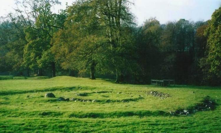
Leven's Park ringcairn submitted by Bladup on 11th Nov 2014. Leven's park (Archers hill) ringcairn.
(View photo, vote or add a comment)
Log Text: Leven's Park/Archer's Hill Ringcairn, Cumbria: This cairn is close to the roundabout where the A590 meets the A591 and A6 just south of Sizergh Castle. My map reading failed, as the junctions were complicated – no proper roundabouts, just adjoining roads with ‘give way’ signs to transfer from one carriageway to the other, which was fun at 5pm with traffic whizzing everywhere as everyone escaped from work to home. After a few wrong turns, eventually we made it onto the minor (brown) road which runs between Sedgwick and Hincaster, stopping at a small car park (enough room for 3-4 cars) outside a stile over a stone wall leading into Leven’s Park. By the stile, a small stream joining the River Kent tumbled over stones downhill and the trees provided welcome shade.
Walking along the dirt track for a couple of hundred yards, the cairn is to your right hand side, not in view from the path, but in a very pleasant spot, next to the River Kent. Between the dirt track and the actual cairn there is a series of four smaller mounds – possibly either cairns in their own right? -but I could find no mention of these anywhere on Pastcape or any other source. We did look for the mentioned field system around the ring cairn, but could find no evidence of it.
Walking round this ring cairn, there are clearly two different rings, which originally intersected, but give the appearance of now being joined into one larger cairn. Trying to capture the two different rings, we headed up the hill to the south west.
Limestone Brae (West Allen)
Trip No.112 Entry No.1 Date Added: 13th Dec 2018
Site Type: Ancient Cross
Country: England (Northumberland)
Visited: Yes on 9th Dec 2018. My rating: Condition 3 Ambience 4 Access 4
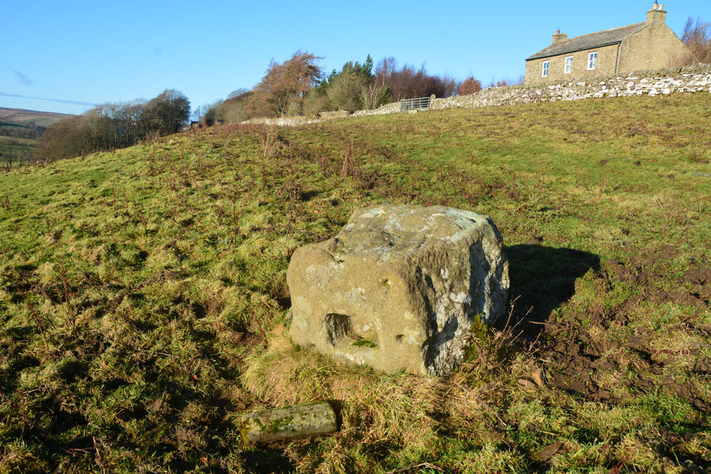
Limestone Brae (West Allen) submitted by Anne T on 13th Dec 2018. Standing just south west of the cross base, looking back towards the road and Glengarrif House. As it's such a large stone, we wondered how it became overturned, and when.
(View photo, vote or add a comment)
Log Text: Limestone Brae Overturned Cross Base: We parked next to the chapel, just before the lane to Throssel Hole Buddhist Abbey. At first sight this stone just seemed like a boulder in the field. “Are you sure that’s it?” I asked my husband. We let ourselves in through the gate into the field and walked along the tussocky grass to the stone. As soon as we saw the other side, it was obvious this is an old cross base which has been overturned.
Looking to the gate to the south of the cross base, there looks as if there is an old hollow way, somewhat obscured by its use as a quad bike route, but there is a definite dip in the ground. The cross has superb views west/north west over the River West Allen Valley.
Lindisfarne Priory
Date Added: 31st Oct 2015
Site Type: Museum
Country: England (Northumberland)
Visited: Yes on 18th Oct 2015. My rating: Condition 3 Ambience 4 Access 3
Lindisfarne Priory submitted by Thorgrim on 17th Nov 2004. Lindisfarne Priory has a fascinating museum of early carved stones and crosses. With a distant view of the Castle, Holy Island is a wonderful place to get in touch with the past.
(View photo, vote or add a comment)
Log Text: Anglo Saxon and Viking Stones on Lindisfarne, Northumberland. Sunday dawned dull and drizzly; looking up the weather forecast and the tide times for Lindisfarne strangely we were able to cross over (there and back) in the afternoon just when we wanted to.
In haste, I turned on my computer and printed off the AS Corpus sheets for Lindisfarne – there were over 50 stones listed, although some are now lost. We managed to see less than half of them.
I’ve never been to Lindisfarne at the weekend, so was amazed at the hoards of people wandering around. As parking is restricted on the island, we needed to park in the visitors car park and walk the rest of the way, but this was enjoyable in the sunshine. Fortunately we had our English Heritage membership cards to get free access to the priory and the museum. We only had to show our passes; we weren’t given tickets to count visitor numbers – just waved through.
We started off at the market place, only to find the old market cross had been replaced by a hideous concrete version; the original is now in the museum. In the museum, there were hoards and hoards of people all reading the descriptions of objects very carefully, and I got frustrated trying to photograph things without shadows and the strong museum lights in the way, so we went to the church to try and find a grave marker but couldn’t find it. We then went to the priory where we were the only people around for the first 20 minutes of so. Armed with the sheets, the guide was really interested in what we were trying to find, although we only found the cross base and what might have been the grave cover (AS Corpus Lindisfarne 48).
Going back to the museum half an hour before closing we were the only ones in besides the staff. I tried to get good photos of the marker stones but the lights were really strong and they were giving me a headache. I asked the lady at the desk if, as they were closing, I might be permitted to turn off the lights, but was given short shrift and told that someone else had managed. Then a staff member came and asked to turn off the light in the shop, and that was done, so I felt a bit put out!
Anyway, it was an enjoyable afternoon out, although its going to take me a while to process and label all the photographs.
Little Balsmith
Trip No.137 Entry No.14 Date Added: 28th Jun 2019
Site Type: Standing Stone (Menhir)
Country: Scotland (Dumfries and Galloway)
Visited: Yes on 18th Jun 2019. My rating: Condition 3 Ambience 4 Access 5
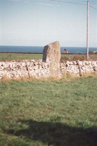
Little Balsmith submitted by cosmic on 23rd Oct 2004. View fromup farm road to West
(View photo, vote or add a comment)
Log Text: Little Balsmith/Stairfield Standing Stone: I was very reluctant to tear myself away from Whithorn Museum and Priory, but with it closing at 5pm, we didn’t really have a choice. I popped back into the visitor centre to buy some postcards, then we headed off down the street to buy an Italian Ice Cream, complete with chocolate flake – delicious!
This standing stone is not far out of Whithorn; take the road which heads east past the school, the B7063, and continue for 2.7km.
We had a very strange encounter driving towards the stone, as we came across a car parked across a farm entrance, with one man sprawled across the bonnet with his hands behind his head, the other was leaning up against the passenger side of the car. There was something really odd about this car – it was missing its rear driver side wheel! We waved at each other as we drove past – they didn’t flag us down and ask for help.
On the way back, another car had joined them and the men were talking animatedly. Wonder what had happened for them to lose the wheel.
The standing stone is in a flat plane here, with Wigtown Bay to the east. The road running past the stone continues to the Isle of Whithorn. Again, this stone is ‘a big boy’. Luckily the crop in the field had just been harvested, so I went in to get some photographs from all sides of the stone.
Little Hill (Craig)
Trip No.35 Entry No.2 Date Added: 26th Jul 2017
Site Type: Hillfort
Country: Scotland (Scottish Borders)
Visited: Yes on 24th Jul 2017. My rating: Condition 2 Ambience 4 Access 4

Little Hill (Craig) submitted by Anne T on 26th Jul 2017. Standing in the middle of the entrance to the northern side of the hillfort looking more or less north over the Esk Valley below. There is an old hollow way which curves down to the modern road below.
(View photo, vote or add a comment)
Log Text: Little Hill Hillfort, Craig, Scottish Borders: This might be a 'short walk on a footpath', but it was a steady climb! After visiting Barntalloch Castle, we could see no way of getting into the old churchyard nearby, as it looked as if the building had been converted into a house. Mistake not to try, as Canmore said there was an inscribed stone.
We drove onto Little Hill, stopping to take a photograph of Barntalloch from a layby on the B709. The River Esk looks glorious sparkling in the sunshine with its loops and cobble banks.
There is a footpath/track leading up to Little Hill hillfort from just before the bend at Craig at NY 33656 88271, where there was room to tuck the car in at its junction with the road. There has been lots of activity with telegraph poles in this area, with lots of spare ones lying around; in fact climbing up the hill they got in the way of the view over to the west until we got above them. Craig Hill to the south of Little Hill looms large and dominates the scenery; there is also a settlement on its lower slopes south of Little Hill, although we didn’t spot this on the climb up.
We left the stony track up the hill and followed what seemed to be a hollow way up to the fort, approaching this from its north western side where I spotted the well at NY 33858 88237, next to a cattle feeder.
This is a lovely spot with its flower meadows and virtually 360 degree views. There don’t seem to be any features in the interior, or at least we didn’t see them as the grass was so lush. Andrew thought he saw a couple of roundhouses, due to the change in vegetation, but I thought it was a bit of a stretch, but there were two circular areas that were slightly scooped and had less wild flowers within them.
I walked down to the south western (stem end of the pear) end of the fort, which is slightly separated from the rest of the fort by a dip, effectively splitting the fort in two.
On the way back down we stopped to photograph the entrance at the northern end of the fort. From here we could see the racing tracks of the race horse training stables in the valley below. There was also a line of stones running from approx.. NY 33920 88223 to NY 33978 88200 near the road also seems to follow the line of a water course. If you plot the points of the well and these stones, they seem to follow a straight line. Some of the taller stones also hide springs.
A lovely walk and well worth stopping. The views on a sunny, warm day like today were lovely. As I keep repeating, our ancestors chose some very nice places to live.
Little John's Well (Hampole)
Trip No.64 Entry No.2 Date Added: 16th Jan 2018
Site Type: Holy Well or Sacred Spring
Country: England (Yorkshire (South))
Visited: Yes on 15th Jan 2018. My rating: Condition 2 Ambience 2 Access 5

Little John's Well (Hampole) submitted by Creative Commons on 8th Feb 2013. Little John's Well. Located in woodland just off the A638 North of the road to Skelbrooke.
Copyright Gerald England and licensed for reuse under the Creative Commons Licence.
(View photo, vote or add a comment)
Log Text: Little John's Well, Hampole: Please note, when I say disabled access - the site is visible (just) from the road, but there are a few steps up the brambled covered slope (not enough to say 'short walk on a footpath' because there is none). For what seemed to be like a country area with a few little villages around, there was an endless stream of traffic, including huge lorries, but then I guess there is a huge quarry immediately adjacent to this site, plus it sits by the side of the A638, a main road into Doncaster.
With parked on the wide entrance to Hazel Lane (made so because the huge lorries need to be able to swing round) and walked round the corner to the A638 and found the well hidden behind a large clump of brambles.
Not having expected to come here (it wasn’t far off the route and we had half an hour to kill) I wasn’t dressed for clambering up slippery, bramble covered slopes (being attired in long skirt and shoes for scattering my step father’s ashes), but with the help of my husband, I made it up the short slope anyway. There was a further stone structure higher up the slope, and from the Pastscape entry, this appears to be the main spring, which feeds into the well trough below.
There were also stone facings higher up the hill, but Andrew said these were more likely to be there to support the slope. From reading the Pastscape entry this morning, these stone may have been part of the enclosure for the well.
Little Meg
Date Added: 10th Dec 2014
Site Type: Stone Circle
Country: England (Cumbria)
Visited: Yes on 30th Nov 2014. My rating: Condition 2 Ambience 4 Access 4

Little Meg submitted by Bladup on 9th Apr 2013. Showing the rock art at Little Meg.
(View photo, vote or add a comment)
Log Text: Little Meg, Little Salkeld, Cumbria: After visiting the Addingham Cross, which is within walking distance, we went in search of Little Meg. Strange, as we've visited Long Meg and Her Daughters on a number of occasions, but somehow managed to overlook this little gem.
Located just to the west of the minor road from Little Salkeld to Glassonby, just north of Tarn House, there is actually no footpath to the stone circle, which can be seen from the gate to the field. There was a local family who were walking along the edge of the field to the stone circle, so we followed them. Their children enjoyed climbing onto the stones and jumping off, and we wondered how many other children in times gone by had done the same!
A few of the stones might be in their original positions, but it looks as if the farmer has re-located the majority to the field edge so he can plough the field, which is a huge shame. However, the stones are welcoming and still worth a visit. One stone has impressive spiral marks on it (I understand there is a second stone with rock art but we couldn't find it).
There is a footpath running from the minor road towards Maughandy Moo, and just inside the car there are some more large stones which look as if they might have been part of this ancient monument at some point.
