Contributory members are able to log private notes and comments about each site
Sites Anne T has logged. View this log as a table or view the most recent logs from everyone
Easington Cross
Trip No.160 Entry No.2 Date Added: 20th Mar 2020
Site Type: Ancient Cross
Country: England (Yorkshire (North))
Visited: Yes on 19th Mar 2020. My rating: Condition 3 Ambience 3 Access 4
Easington Cross submitted by johndhunter on 31st Jan 2020. Easington Cross at NZ 74427 18004 – Closer view, the possible shaft next to the broken medieval base looks like it has a sword carved on it, January 2012.
(View photo, vote or add a comment)
Log Text: Easington Hogbacks and A-S stone fragments: We had already seen the cross base in the churchyard, but arranged with the Reverend Danny Walker to revisit when the church was open. He was there with a very knowledgeable churchwarden (with his two wonderful dogs) to move some furniture around so they could leave the church open for parishioners and visitors at this current time of crisis.
The churchwarden took us into the tower to see a Norman arch that had been rebuilt on the first floor to preserve it. He also showed us St Hilda’s Cross base, and what he said was part of the cross shaft, but I said I thought was a medieval cross-slab as it clearly had a sword on it in the sunlight.
The vicar had cleared the steps to the basement boiler room, where we were allowed to move the old screens and debris to find any pieces we could. We found all but one of the pieces listed on the Corpus (the other may have been under debris, but with dead birds in the corner, we were reluctant to explore this part of the room). A real treat, and thanks to the vicar for opening the church up for us.
St Michael's Well (Well)
Trip No.161 Entry No.3 Date Added: 7th Jun 2021
Site Type: Holy Well or Sacred Spring
Country: England (Yorkshire (North))
Visited: Yes on 31st May 2021. My rating: Condition 3 Ambience 4 Access 5
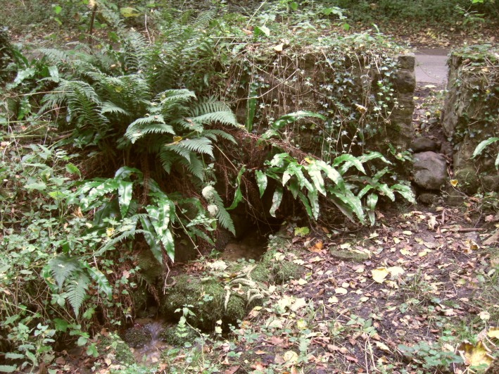
St Michael's Well (Well) submitted by jamesrattue on 20th Oct 2008. St Michael's Well, Well, North Yorkshire, photographed October 2008.
(View photo, vote or add a comment)
Log Text: St Michael's Well, Well: Our third stop of the day, driving west out of Well village, up a shady, pretty single track road with trees on either side. With little/no traffic on this road, we pulled into the passing place/small layby immediately opposite the well. At first, I didn't think anything was here, but behind the stone wall and wooden fence to the northern side of the road, there was the very distinct sound of running water.
Behind the small stone wall are some steps which lead down to the well itself, through which copious amounts of very clear water are running. This water then leads into a small stream which runs into Well Beck.
We didn't realise until later that the actual source of the water was from the southern side of the road, which also has a stone wall structure, fronted by what is now a muddy patch (once the well pool?). The water looks as if it originally emerged from by a large tree now growing in the wall. This area of ground has been heavily churned by cattle and the small gap/stile in the wall at this point has been wired off.
A very lovely spot, well worth the visit.
St Michael's Church (Well)
Trip No.161 Entry No.2 Date Added: 7th Jun 2021
Site Type: Ancient Cross
Country: England (Yorkshire (North))
Visited: Yes on 31st May 2021. My rating: Condition 3 Ambience 4 Access 4
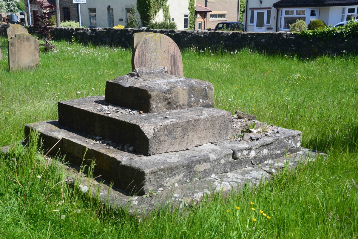
St Michael's Church (Well) submitted by Anne T on 7th Jun 2021. The cross base from the external south wall of the nave, looking eastwards down Church Street.
(View photo, vote or add a comment)
Log Text: Cross Base, St Michael's Church, Well: Our second stop of the day, arriving in glorious sunshine. Parking is available immediately outside the lych gate, and along Church Street. The HE record led me expect a 3m tall cross shaft, but this had been broken off, with no sign of it lying anywhere close to the cross base.
Understandably, the church remains locked to visitors due to pandemic restrictions, but we wandered round the outside of the church, photographing the few medieval grave slabs built into the fabric of the old building, and the sundial (very, very worn) over the south porch door.
The lower part of the tower is clearly early - 12th century in date at the bottom, the western side containing a very old wooden door which looks like it leads up to the belfry. I would be very interested to go back, as the church contains part of a Roman mosaic found locally, along with some interesting tombs and effigies
Skew Skell Well
Trip No.161 Entry No.5 Date Added: 8th Jun 2021
Site Type: Holy Well or Sacred Spring
Country: England (Yorkshire (North))
Visited: Yes on 31st May 2021. My rating: Condition 2 Access 4
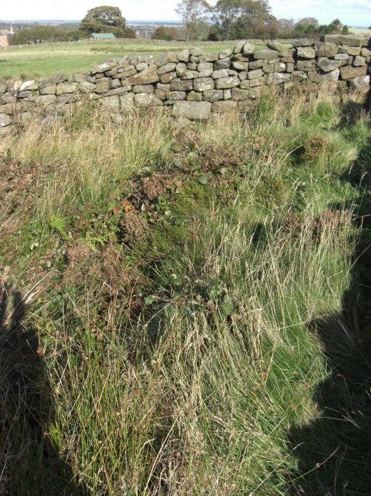
Skew Skell Well submitted by jamesrattue on 23rd Oct 2008. Skew Skell Well at Ilton, photographed 16th October 2008.
(View photo, vote or add a comment)
Log Text: Skew Skell Well, Ilton: We parked at SE 18823 78010, and walked NW down the slope with GPS in hand to find this well. It is in a small, rectangular area (to our right hand side) defined by a the stone walls forming an enclosure open at its south-western side, presumably to accommodate, and allow access to the well and a spring.
The ground was very heavily covered with foliage and nettles. The sound of running water could be clearly heard. Skew Skell Well could be made out by standing in the NE of the enclosure (there was a deep dip, filled with water). The spring appeared to be on the NW edge of the enclosure, with water now appearing to rise just over the stone wall, in the adjacent field. This flow of water could be followed downhill by a line of reeds.
On the opposite side of the road, there was another large pool of water. Other springs rise in the area. Water from Skew Skell Well must be piped under the road and run down the drainage ditch at the other side of the lane.
St Peter's Church (Croft-on-Tees)
Trip No.186 Entry No.1 Date Added: 12th Aug 2022
Site Type: Ancient Cross
Country: England (Yorkshire (North))
Visited: Yes on 10th Aug 2022. My rating: Condition 3 Ambience 4 Access 4
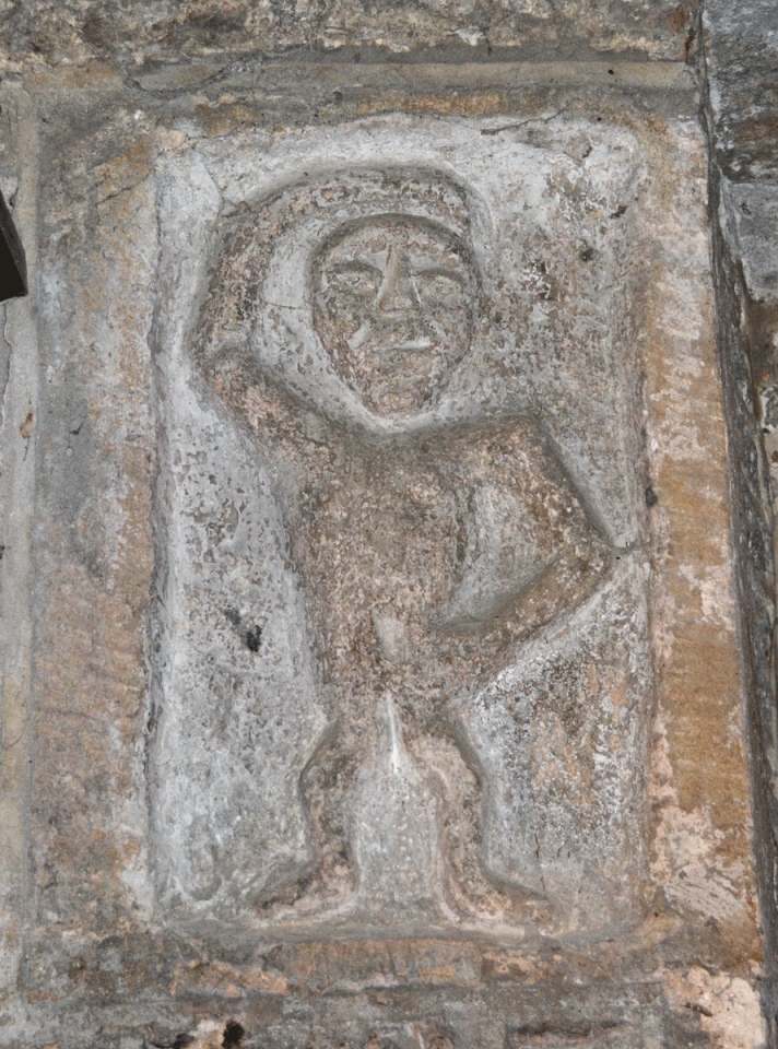
St Peter's Church (Croft-on-Tees) submitted by Anne T on 11th Aug 2022. Whilst I would class this carving, which is built into the wall just to the west of the south door, as a sheela-na-gig, the church guide (and our guide for the day) says this is "a small human figure with right arm raised over his head and left arm down across the body. One authority claims it to be a local water deity of Romano-British origin, circa 1-5 century AD. However this may be a piece of Victorian piety for it is possible to see that a part of the anatomy has been chipped out of the na...
(View photo, vote or add a comment)
Log Text: St Peter's Church, Croft on Tees: The church's wedding co-ordinator kindly opened the church for us at very short notice, and acted as our guide for our brief visit. A very lovely church, right next to the River Tees. Sadly, the stone recorded on the Corpus of Anglo Saxon Stone Sculpture as Croft on Tees 01 had been moved to the Bowes Museum, and was about to be transferred to Newcastle as part of the celebrations of the Lindisfarne Gospels returning to that part of the world. This was disappointing, as this was the stone I most wanted to see.
A couple of bonuses were the additional stones built into the external fabric of the building, which we walked around to see what we could spot.
Our grand-daughter, Alice, was partly named after 'Alice in Wonderland', so it was good to be able to take a photograph of the sculpture which is said to have inspired Lewis Carroll's Cheshire Cat.
Preston Park Museum (Stockton on Tees)
Trip No.186 Entry No.2 Date Added: 12th Aug 2022
Site Type: Museum
Country: England (Yorkshire (North))
Visited: Yes on 10th Aug 2022. My rating: Condition 4 Ambience 4 Access 4
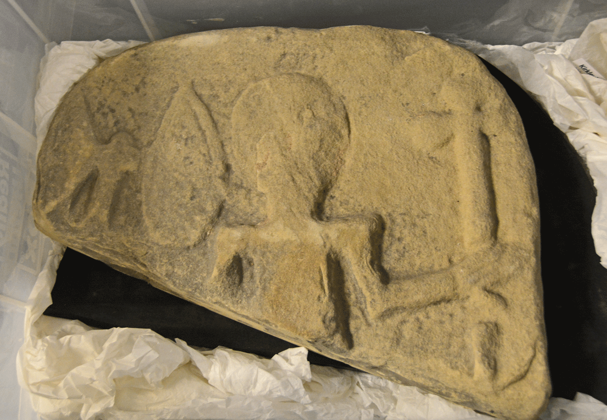
Preston Park Museum (Stockton on Tees) submitted by Anne T on 12th Aug 2022. This is part of an Anglo-Scandinavian marker stone. Not recorded on the Corpus of Anglo Saxon Stone Sculpture, notes from a presentation on the Kirklevington Stones by Craig Beckham and the Collections Team at the Museum, tell us: "the face of the stone depicts a soldier with an axe, shield and spear. This example may in fact be later than the Kirklevington crosses, but commemorates a Viking warrior in the same manner. The kite shaped shield and the axe are also typical of the time period".
(View photo, vote or add a comment)
Log Text: Preston Park Museum (Kirklevington Stones): I'd tried to arrange a visit here a couple of months before the first pandemic lockdown hit, but the museum closed early, and it's been well over two years until I was able to rearrange the visit.
Some of the Kirklevington Stones are one display (some of the more important ones behind glass), some in the museum store. A small archaeology section, but with impressive exhibits.
Got to see the museum store, but the stones were stored on the floor under a very deep shelf, so some of them were impossible to photograph properly, which was disappointing.
I personally preferred this museum to Beamish, as there were more shops to go into in their Victorian Street, a small cafe, which wasn't too busy (most people were queued up in the cafe in the park), and small, but interesting exhibits.
St Laurence's Church (Bradford on Avon)
Trip No.136 Entry No.4 Date Added: 12th Jun 2019
Site Type: Early Christian Sculptured Stone
Country: England (Wiltshire)
Visited: Yes on 17th May 2019. My rating: Condition 3 Ambience 5 Access 4
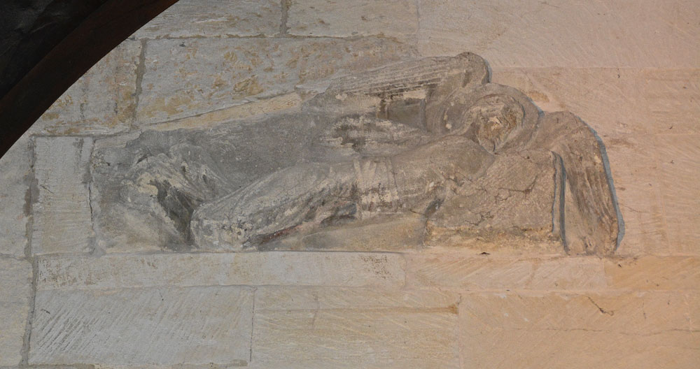
St Laurence's Church (Bradford on Avon) submitted by Anne T on 11th Jun 2019. The right hand facing angel, recorded as AS Corpus Bradford on Avon 5b. They were discovered embedded in a wall above the western side of the chancel arch around 1850, later used in a flue in 1856-1857, then placed over the porch leading to the modern house attached to the south side of the building. Both angels are carved from single blocks of stone, which taper from head to feet, with the angels facing each other. Dated to AD1000.
(View photo, vote or add a comment)
Log Text: St Laurence's Church, Bradford on Avon: From Wells, we had to decide which church was going to be the very last visit of our Dartmoor Expedition, as we were rapidly running out of time – Deerhurst or Bradford-On-Avon. In the end, the decision was down to knowing that St. Laurence’s Church would be open, although only until about 5pm or 5.30pm, so the race was on to battle the traffic to get here in time. Eventually we made it with about 45 minutes to spare, managing to park just round the corner from both St. Laurence’s and Holy Trinity.
What a treasure! I’d read that it was as complete as Escombe Saxon Church, but it felt so different – more doorways and very, very dark. The only spotlights were on the angels over the chancel archway, a small light in the sanctuary, then the rest through the narrow doorways and tiny windows.
The church was a real tourist magnet and I had to wait several times to get a shot without people in the photo. I’m sure I annoyed everyone with my flash, but that was the only way I could photograph the stone fragments.
I’m really pleased I’d printed of the Corpus of Anglo Saxon Stone Sculpture pages before we went, as I understood what I saw at the time. I put my papers down to take a photograph of the altar, coming out of the sanctuary to find someone had picked them up and was reading them. I had to ask nicely for them back and explain these were mine, but there was a leaflet in a box on the south wall of the nave.
I was really sad we couldn’t get this little church to ourselves for ten minutes or so. We ended up having 15 minutes to look into Holy Trinity Church opposite, only to almost get locked in, although we spent 10 minutes or so talking to the very knowledgeable church warden. Then we walked around the town after to avoid the queues of traffic that had built up.
Great North Museum (Anglo Saxon Stones)
Trip No.72 Entry No.2 Date Added: 13th May 2018
Site Type: Museum
Country: England (Tyne and Wear)
Visited: Yes on 4th May 2018. My rating: Condition 3 Ambience 4 Access 5

Great North Museum (Anglo Saxon Stones) submitted by Anne T on 11th May 2018. This is the front of the Rothbury Cross head, described as one of the finest pieces of Anglo-Saxon sculpture from the Kingdom of Northumbria. It is carved with scenes of the crucifixion and other motifs. The museum sign says it was made about 100 years after the Lindisfarne Gospels but "clearly belongs to the same artistic tradition." From the collection of the Society of Antiquities of Newcastle upon Tyne. Submitted with the kind permission of the Great North Museum.
(View photo, vote or add a comment)
Log Text: Great North Museum, Anglo Saxon Exhibit: A small but nicely presented collection of Anglo Saxon cross fragments and grave goods. Ground floor. See general SID page for Great North Museum for main visit report.
Great North Museum (Rock Art)
Trip No.72 Entry No.3 Date Added: 13th May 2018
Site Type: Museum
Country: England (Tyne and Wear)
Visited: Yes on 4th May 2018. My rating: Condition 3 Ambience 4 Access 5
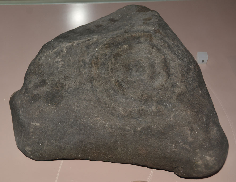
Great North Museum (Rock Art) submitted by Anne T on 10th May 2018. On display in a case in the Prehistoric display on the ground floor. Comparing photographs, I think this is Fowberry Moor Farm, Island/Deershed Plantation Panel, ERA-1842, Beckensall 179. The panel is stained dark red due to peat staining.
Submitted with the kind permission of the Great North Museum.
(View photo, vote or add a comment)
Log Text: Great North Museum (Rock Art): in the 'Prehistoric' Exhibition on the ground floor (see the general Great North Museum page for full visit report). A real shame that most of the exhibits were behind glass, and very close together, which made them difficult to photograph. It was nice to see some of the Beckensall RA stones which had been donated to the museum - but I wonder where the rest are, and there are quite a few. These seemed relatively poor examples given the photos I've seen on the ERA website. Much enjoyed seeing these.
The Ponteland Boulder
Date Added: 24th May 2015
Site Type: Rock Art
Country: England (Tyne and Wear)
Visited: Yes on 17th May 2015. My rating: Condition 3 Ambience 3 Access 5

The Ponteland Boulder submitted by Anne T on 18th May 2015. This recently discovered boulder sits in the gardens of the Great North Museum, to the right hand side of the access road which leads to the bank of bins at the rear door of the museum.
(View photo, vote or add a comment)
Log Text: The Ponteland Boulder, The Great North Museum, Newcastle-upon-Tyne: We'd been told about this boulder in March by one of guys at the Archaeological Group who is a very keen tracker of any new rock art found in the region. Then, strangely, it came up in Rock Articles which was emailled to me by Dr. Kate Sharpe at the University of Durham. Having been asked to look after our very young granddaughter for the day, plans for a long day out walking were truncated so we decided to head off into Newcastle and go searching for this boulder.
Walking through the University of Newcastle campus, we crossed Claremont Road and walked almost right round the museum and back again without spotting this stone. I was just about to head off into the museum to ask when my husband dived off into a small garden area fronting onto the main road, towards the bins. He came rushing back to tell me he'd found it.
Sited almost opposite the bank of big blue wheelie bins on the access road to the rear/delivery entrance to the museum wasn't maybe the best spot for this boulder, but here it was never-the-less.
There is obvious plough damage to the edges of the stone and it has been quarried at some point, making it originally much larger than it currently is.
The cup and ring motifs, particularly those at the edges of the boulder, had peck marks (like at Fowberry Park) next to them.
Definitely worth a visit if passing by. Note to those of you with families: at the far side of the museum, next to the car park, there is a large stone rhinoceros which is interesting to be photographed next to (but definitely not megalithic!).
Jarrow
Date Added: 22nd Jun 2015
Site Type: Ancient Cross
Country: England (Tyne and Wear)
Visited: Yes on 10th Jun 2015. My rating: Condition 3 Ambience 4 Access 5
Jarrow submitted by Thorgrim on 25th Oct 2004. Cross fragments
(View photo, vote or add a comment)
Log Text: Anglo Saxon Fragments, St Paul's Church and St Bede's Monastery, Jarrow: We parked at Bede’s World (a couple of hundred yards away from the church and the monastery) and having decided to start off at St Paul’s Church, we followed (or tried to follow) the signs, which took us across the busy main road to another car park. All the paths seemed to lead into the middle of no-where. After 10 minutes wandering around in circles with granddaughter in pushchair, I finally went inside to ask. The girls at the Bede’s World reception had to go and ask. “It’s straight through the park”, they told me. All the posters up in the reception area said the church was open until 15:30 so we thought we had plenty of time.
Not being able to get the pushchair down the ramp into the park (too overgrown) we followed the pavement along the main road down to the church, where we had to manoeuvre round tree cutters to follow the path up to the west porch. We were greeted by the ruins of St Bede’s Monastery on our right hand side – such an ancient building incongruously topped by modern pylons rising up behind.
It turned out the church was only open until 3pm so we only had 10 minutes to go in, wander round, take photographs and try and appreciate the history of what we were seeing. A volunteer came up to us and I waved the Corpus of Anglo Saxon stone sculpture pages that I’d printed off and explained I was on a ‘treasure hunt for Anglo Saxon cross pieces’. Instead, we got drawn into the old monastery chapel for a guided tour. The rest of the church seems, and feels, pretty ordinary, but this old chapel, dating from AD681 with its dedication plaque above the entry arch, was very moody and special. The lady pointed out the two pieces of original Anglo-Saxon glass in the south windows.
It also turns out that the fragments are now in display cases, rather than being displayed in the porches, which made them incredibly difficult to photograph, as the light coming through the church windows reflected in the glass, as did the flash when I tried to use it. By this point, they were turning the lights off in the church to go home, although they very kindly let us stay an extra 10 minutes so I could photograph some of the artefacts. Definitely a second trip needed when there’s more time to wander round the old church and the ruins of the monastery outside.
St Nicholas's Cathedral (Newcastle)
Date Added: 21st Oct 2019
Site Type: Ancient Cross
Country: England (Tyne and Wear)
Visited: Yes on 6th Oct 2019. My rating: Condition 3 Ambience 4 Access 4
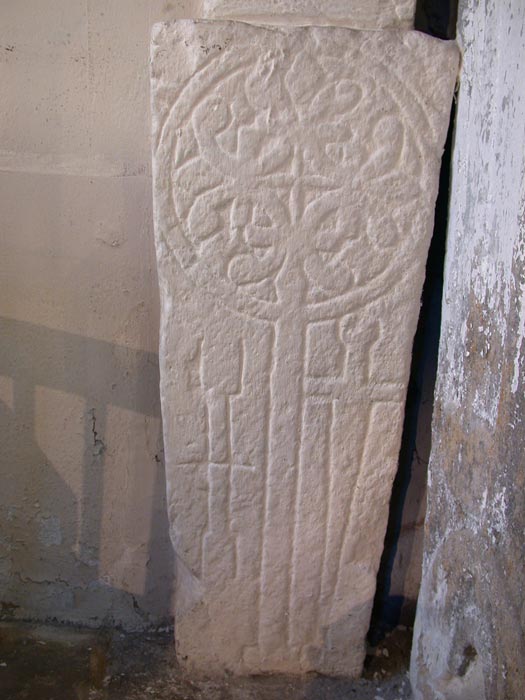
St Nicholas's Cathedral (Newcastle) submitted by nicoladidsbury on 13th Aug 2005. Elaborate Cross Slab, featuring two vertical sword shafts, similar to much smaller cross slabs found built into the fabric of the Norman wall in the ancient church at Old Ireby
(View photo, vote or add a comment)
Log Text: St Nicholas's Cathedral, Newcastle: We went to photograph the four cross slabs recorded by Ryder in St Margaret's Chapel, plus two others - one in the western of the three tomb recesses in the south wall of the south aisle; the other in the south wall of the south transept, at its eastern end.
I've since arranged to return on 16th October to photograph the slabs now stored in the vault under the south transept, although access is through a trapdoor and down a ladder!
Exhibition Park Circle
Trip No.18 Entry No.5 Date Added: 24th Apr 2017
Site Type: Modern Stone Circle etc
Country: England (Tyne and Wear)
Visited: Yes on 23rd Apr 2017. My rating: Condition 4 Ambience 1 Access 4

Exhibition Park Circle submitted by Anne T on 24th Apr 2017. Standing at the bandstand side of the mound, looking northwards at the five stones.
(View photo, vote or add a comment)
Log Text: As we’d failed to find the Axwell Park Tumulus, we sat in Café Nero in Fenwicks and I was looked up details of sites we were going to on the mobile version of the Portal. I came across an entry for ‘Leazes Park Circle’ which mentioned a modern stone circle. This took me by surprise, as we’ve been parking our car by Leazes Park when we come into Newcastle, at least once a week, and not come across any mention of this before. Bringing the map up on my phone, we sat puzzling where this was, and decided to head off and look for it.
'Modern Stone Circle', Newcastle: In actual fact, it is in Exhibition Park, not Leazes Park, although I’ve spent a while trying to find more about this on the web. Not finding anything, I’ve emailed the Parks and Countryside Department at Newcastle City Council, simply out of curiosity.
Having stumbled upon the ‘circle’ (the grid reference on the Portal was also a bit off), I’m convinced it’s part of the children’s play park. However, I might yet be proved wrong. When we arrived, a student was walking over the tree trunk to the mound and generally walking around the ditch surrounding this tiny ‘monument’. Disappointing, but pleased to have found it and been able to contribute a photograph to the Portal.
Ryton Motte or Tumulus
Trip No.18 Entry No.1 Date Added: 24th Apr 2017
Site Type: Artificial Mound
Country: England (Tyne and Wear)
Visited: Yes on 23rd Apr 2017. My rating: Condition 3 Ambience 4 Access 4
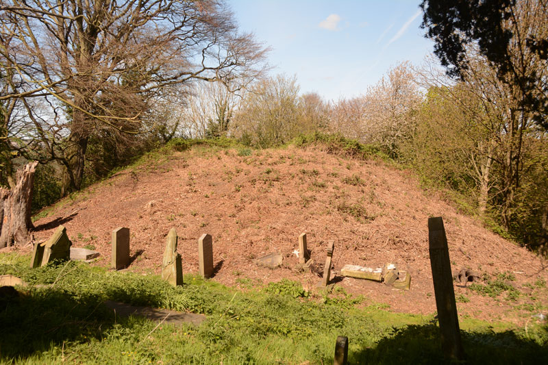
Ryton Motte or Tumulus submitted by Anne T on 24th Apr 2017. The motte seen from its eastern side. Graves had been cut into most sides of the bottom of the motte.
(View photo, vote or add a comment)
Log Text: Ryton Motte, Gateshead: Parking on the main road opposite The Old Cross pub and Holy Cross church on Barnmoor Lane, as there was an event on at the church, the first surprise was to see the old cross located on the village green.
Pastscape reveals this is relatively modern, having been erected in 1765, but the base looks much, much older. Historic England say in list entry 1018642 that there was evidence of an earlier cross on this site.
A stream of very well dressed people were exiting the church yard, indicating a service had just finished. I spent a few minutes photographing the cross, then we sauntered in the churchyard. The name board on the gate to the churchyard says that the church was founded in 1220, and whilst there appears to be old stones in the fabric of the church, popping our head into the church itself, it looks very Victorian. There were people inside, so we didn’t linger.
Walking round the tower at the west end of the church, and round to the north wall, we came across a man digging up brambles and dock plants around the graves. He told us he wasn’t’ associated with the church, but had got fed up of the graveyard looking as it did. He also said he’d just removed shrubbery and brambles off the motte, which looked bare and brown in the warm sunlight. He also told us to look out for the grave of a woman to the north-west of the motte, which had inscribed on the headstone about the grave also containing her husband, who’d lost his arm at Trafalgar.
The motte is certainly a significant structure (I thought it was only small, but it’s not, measuring 3.30 metres with a diameter of 30 metres, according to Pastscape. The mound certainly appears much higher when viewed from the river side, where it looms high above you.
These days, the river is largely hidden by trees, but glimpses of silver water appear as you follow the path round the motte and back up to the east side of the church. It would have had a very commanding spot above the river when it was built.
Holy Well, Greenside
Trip No.18 Entry No.2 Date Added: 24th Apr 2017
Site Type: Holy Well or Sacred Spring
Country: England (Tyne and Wear)
Visited: Yes on 23rd Apr 2017. My rating: Condition 4 Ambience 4 Access 5
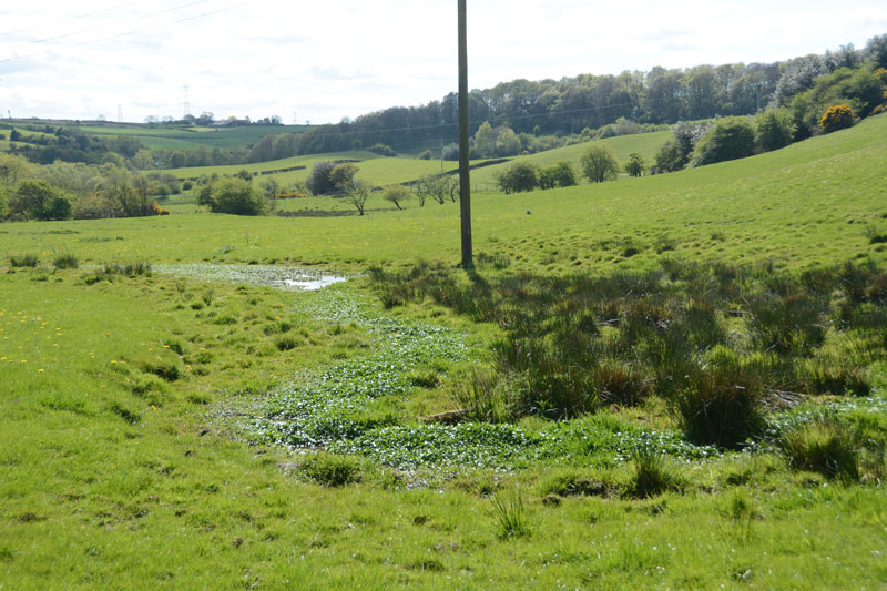
Holy Well, Greenside submitted by Anne T on 24th Apr 2017. Holy Well, Greenside from the gate in the field on Barlow Lane.
(View photo, vote or add a comment)
Log Text: Holy Well, Greenside: From Ryton Motte, we headed off south towards Greenside through the back lanes. Considering how close were are to Winlanton, Blaydon, Gateshead and Newcastle, you could be forgiven for thinking you were in the depths of the countryside at this site. Disappearing down a small road leading from Greenside to Barlow (Barlow Lane on UK Grid Finder) we parked where the lane met a tarmacked path leading to Reeley Mires Farm. It was then a question of walking a couple of hundred yards south-east down Barlow Lane, where the well is located at the base of the Drumlin.
To your right hand side, as you walk down the lane, there is a red metal gate into the field, although this is heavily overgrown by hawthorn and brambles, and is impossible to open. The central pool of the well can be seen at near the base of a telegraph pole, although the whole feature forms an attractive long ‘s-shape’ in the pasture.
It is a really pretty spot here. I was impressed there was so much water here, as it has been little rain here for weeks.
Have as yet been unable to find any notes/further information about this well. Thanks to durhamnature for his original entry.
Axwell Park Barrow
Trip No.18 Entry No.3 Date Added: 24th Apr 2017
Site Type: Round Barrow(s)
Country: England (Tyne and Wear)
Visited: Couldn't find on 23rd Apr 2017. My rating: Ambience 2 Access 5
Axwell Park Barrow submitted by durhamnature on 7th Aug 2012. Axwell Park Barrow
(View photo, vote or add a comment)
Log Text: Axwell Park Tumulus, Gateshead: OK, even with the grid reference, we couldn't find any trace of this - not surprising, since checking the Pastscape records this morning (24th April), they say no trace of the mound exists! There were lots and lots of humps and hollows on the slope to the left of the path as you walk up the hill. The area seems to be part of an estate and has been heavily modified, with an artificial waterfall and stone-lined channels for water visible in the undergrowth.
This area today is on the edge of a modern housing estate, which is still being constructed. The only thing I can say about this is that it is an easy walk up through the park on tarmacked road.
St. Mary's Well (Jesmond)
Trip No.18 Entry No.4 Date Added: 24th Apr 2017
Site Type: Holy Well or Sacred Spring
Country: England (Tyne and Wear)
Visited: Yes on 23rd Apr 2017. My rating: Condition 4 Ambience 4 Access 4
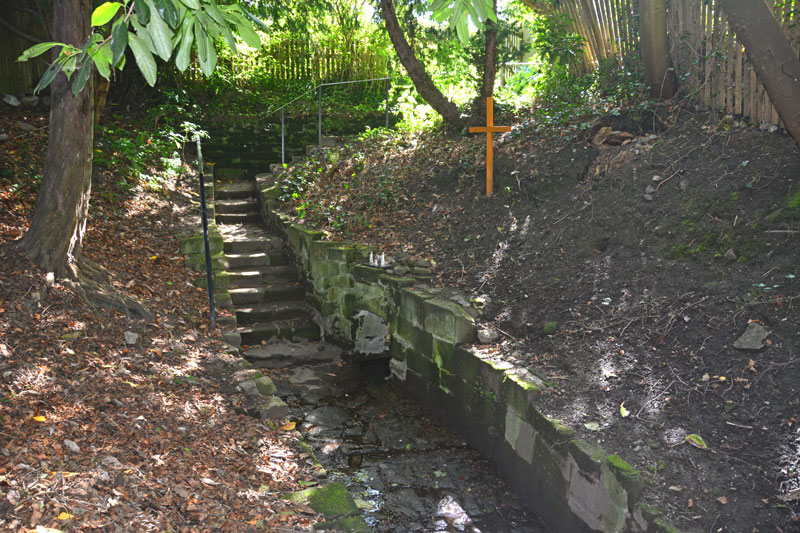
St. Mary's Well (Jesmond) submitted by Anne T on 24th Apr 2017. Standing on the slope above the well pool, looking back at the stone steps leading down to the well.
(View photo, vote or add a comment)
Log Text: St. Mary's Well, Jesmond: From the elusive (non-existent!) Axwell Park Tumulus, we headed off down the Coast Road to Jesmond to find this well. It was a delight – an oasis in the midst of the city.
Parking on Jesmond Dene Road where it meet Grosvenor Avenue, we headed west up The Grove – a shady footpath that runs between The Grove and Red Park Road, in between the back gardens of the houses.
We found the gate to this well to our right hand side, several hundred metres up the path, highlighted by the blue signpost.
Descending into this shady nook, down the stone steps, the first view of the well was of the small statues, tea-lights and mementos left on top of the well covering. As my eyes adapted to the shade, the pool of the well came into view.
The well was full of water, with a steady flow over the cobbles towards the pool. There was a cute copper jug left attached to the side of the well, which I took off and dunked into the water. Andrew and I both tasted the water, and it was completely tasteless, which was a surprise.
After enjoying the peace and calm, we headed off to find St. Mary’s Chapel, now ruined, just down the road. Really enjoyed this visit.
North View enclosure
Trip No.21 Entry No.1 Date Added: 5th May 2017
Site Type: Ancient Village or Settlement
Country: England (Tyne and Wear)
Visited: Yes on 4th May 2017. My rating: Condition 1 Ambience 3 Access 4
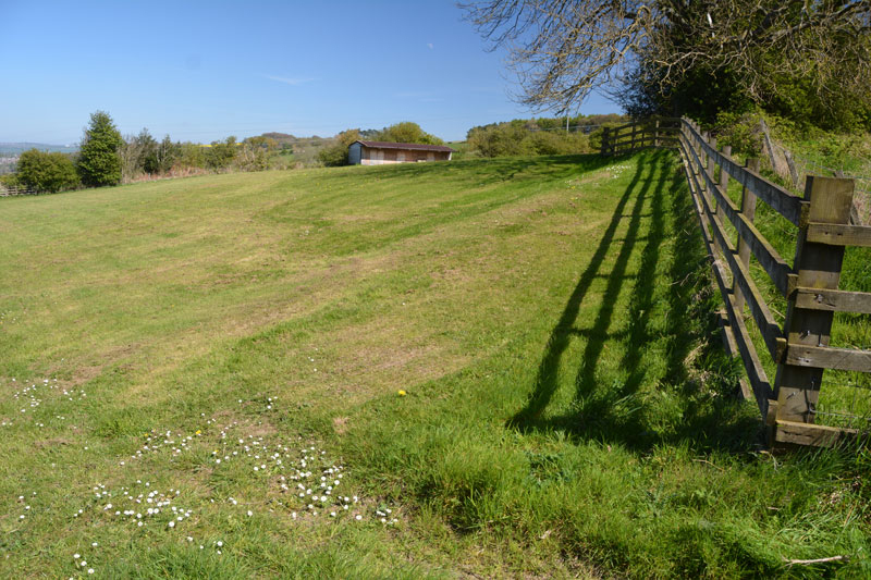
North View enclosure submitted by Anne T on 5th May 2017. The northern corner of the boundary seems to cut across the corner of the field, where the footpath moves from the wooded area to the west of North View Farm to the field (with stables) immediately behind the house. The footpath continues in a narrow, overgrown lane, between a fence to the left and an old stone wall/hedge line to your right.
(View photo, vote or add a comment)
Log Text: North View/Bucks Nook Enclosure, Gateshead: Whilst this site is literally within sight of the eastern end of Prudhoe, to drive to it, we needed to go through Greenside and take the Rockwood Hill/Bradley Fell road until we reached the point where the road divided,travelling south/wout-west towards Guard’s Farm, and north to join Kyo Bog Lane.
We parked at the fork in the road, just west of North View Farm at NZ 11320 61603. The footpath going to this site running south east through a wooded area from NZ 11320 61597 (the stile into the wood is barely visible from the road), where it runs to the west of North Farm to open pasture. The trees bordering the farm were strewn with ‘Dogs run free/keep out signs’, which were quite off-putting. Nevertheless, there was a clear path running up through the wood to a second and third stiles at NZ 11412 61533 and NZ 11418 61531.
Just before this second stile, there is a corner and definite change of slope which runs at an angle to the footpath (which now runs in a narrow between a fence to the north and an old stone wall/hedge line to the south) and, in the field immediately behind the garden of North View Farm (field contains a stable). At the time of our visit, this boundaryfeature was quite clear, due to the difference in the colour of the grass. From here, it was a little difficult to know where the boundary ran. Where it appeared to cross the footpath, there was a clear ‘hump’ in the ground. Where it disappeared into the field, it was difficult to tell where it ran.
Continuing along the footpath several hundred metres, there is a 6ft fence at NZ 11557 61447, with a stile over it, and more ‘dogs run free/keep out’ signs. It is possible to squeeze between the trees at this point and have a closer look at any possible earthworks. There was a difference in colour in the pasture about 10 metres before the hedge-line at the south-eastern corner, but without a definite plan, it was impossible to tell.
I found the Sitelines Tyne & Wear HER 172 record, but despite it saying the monument is scheduled, I’ve been unable to find anything (having done searches on the various names, grid references, postcodes, farm names). I have emailed T&W archives to see if it’s possible to get some more information. The feature is not visible on UK Grid Finder, although it is possible to pick out the northern corner (photographed).
This place has lovely views over the Tyne Valley to the north. It was worth coming here just to see the views back over Prudhoe and Crawcrook.
Ceoppa's Barrow
Trip No.21 Entry No.2 Date Added: 5th May 2017
Site Type: Round Barrow(s)
Country: England (Tyne and Wear)
Visited: Yes on 4th May 2017. My rating: Condition 3 Ambience 4 Access 4
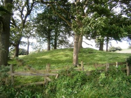
Ceoppa's Barrow submitted by durhamnature on 18th Jul 2012. View from south.
(View photo, vote or add a comment)
Log Text: Ceoppa's Barrow, Tyne & Wear: From Bucks Nook/North View, we headed off eastwards along Bradley Fell Road, taking the second right ((Kyo Lane), then dog-legging right/left along the Lead Road then down Horsegate Bank to Claython Terrace Road. Pulling in in the small layby next to the forestry track just before Heavygate Farm at NZ 12710 59129 we walked down the farmtrack running immediately to the west of Heavygate Farm.
Walking by the farmyard was an education in old farm equipment – old tractors, dumper trucks, old cars, pumps. The official grid reference for this barrow is NZ12605890, although I found it to be NZ12605890. Surprisingly, this barrow doesn’t seem to be scheduled.
The barrow is located not quite at the top of the hill, which seems to be at Broomfield Farm, but has brilliant views down to the Derwent Valley to the south.
The gates to the fields were wired shut, but we managed to get photographs from opposite the main entrance to the farm and the gates into the field at NZ 12775 58928. There was definite evidence of a surrounding ditch.
Holy Stone (North Tyneside)
Trip No.65 Entry No.1 Date Added: 4th Feb 2018
Site Type: Ancient Cross
Country: England (Tyne and Wear)
Visited: Yes on 3rd Feb 2018. My rating: Condition -1 Ambience 2 Access 4
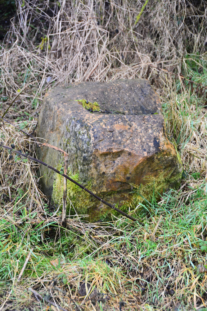
Holy Stone (North Tyneside) submitted by Anne T on 4th Feb 2018. Is this the socket stone that has been moved? Looks convincing from the side .....
(View photo, vote or add a comment)
Log Text: Holy Stone Cross Base, North Tyneside: Having been to the industrial estate nearby, we decided to try and track down this stone. Donning wellies, as there had been torrential rain the night before, we followed the footpath from the Holystone Pub/Premier Inn (where there is a car park almost next to the A19, just north east of the pub) towards Holystone Farm, crossing the bridge above a busy railway line. At the recently built Holystone Cottage, another footpath runs north east across the fields towards the A19. The stone is supposed to be located at the junction of the footpath and the front wall of Holystone Cottage.
By chance we met a couple of dog walkers, and I asked them if they knew of this stone. The man said he was brought up locally and remembered playing in the fields at the back of the cottage, where there a three foot high stone they used to gather around. He said the stone had been destroyed some years ago, but the cross base might remain.
He walked us to the spot where he remembered the stone being, but nothing. He did say that there had been recent site investigation in the field, prior to building new houses.
We did find what looked very much like a cross base in the corner of a neighbouring field at NZ 30210 70783. This looked very convincing from the side, but from the top, there was what might have been a long, thin, damaged slot, very unlike the carved slots we've seen in other cross bases.
