Contributory members are able to log private notes and comments about each site
Sites Anne T has logged. View this log as a table or view the most recent logs from everyone
Danby Rigg (Slate Hill)
Trip No.32 Entry No.1 Date Added: 5th Jul 2017
Site Type: Marker Stone
Country: England (Yorkshire (North))
Visited: Yes on 2nd Jul 2017. My rating: Condition 4 Ambience 4 Access 4
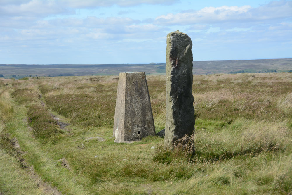
Danby Rigg (Slate Hill) submitted by Anne T on 4th Jul 2017. First view of this marker stone and the trig point (TP2728 at NZ 70788 05869) on the eastern edge of Danby Rigg.
(View photo, vote or add a comment)
Log Text: Marker/Standing Stone & Trig Point, Danby Rigg, North Yorkshire: Not marked on the OS map, this stone sits within a couple of metres of Trig Point TP2728 (Danby Moor). It is sited almost on the eastern edge of Danby Rigg, where the ridge starts to slope sharply down to Little Fryup Dale. There is no information recorded about it on Pastscape, although their information for the area indicates a number of way markers, some scheduled, which mark the route of a medieval footpath which runs from Slate Head to Ainthorpe. Other way markers (such as this) mark out two separate footpaths from Little Fryup Dale in the east to Danby Dale at the western most side of the ridge. This sits at the side of the western most track, continuing the farm track east-west over the ridge.
The area has a long history and plays host to many features, including cairn cemeteries, cross dykes, cairn circles and round cairns, many dating to the Bronze Age and possibly Neolithic.
The easiest way to reach this stone and trig point is to walk from (or park at) the cross roads just to the south of Slate Hill House (where Castle Lane, New Way and Slate Hill meet). There is a farm track and a footpath starting almost from the same point up to the top of Danby Rigg. The footpath is somewhat overgrown and steep towards the top, so we followed the well used farm track which heads almost directly west then tracks north east up the slope. Almost as soon as the path levels out, you see the stone and the trig point. The views back towards where Little Fryup Dale meets Great Fryup Dale. The views across these valleys and northwards back towards Ainthorpe are stunning.
Danby Rigg (Crossley Gate)
Trip No.32 Entry No.4 Date Added: 5th Jul 2017
Site Type: Cairn
Country: England (Yorkshire (North))
Visited: Yes on 2nd Jul 2017. My rating: Condition 2 Ambience 4 Access 4
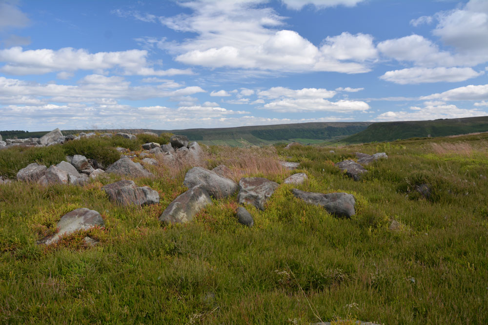
Danby Rigg (Crossley Gate) submitted by Anne T on 4th Jul 2017. Standing on the western side of the cairn looking towards Little Fryup Dale.
(View photo, vote or add a comment)
Log Text: Round cairn overlooking Crossley Gate, Danby Rigg, North Yorkshire: From the other marker stones along the track between Little Fryup Dale and Danby Dale, we walked back to the trig point, then took the footpath (mountain bike track) headed north east along the path that runs along the eastern edge of Danby Rigg. There are great views down to Lower Fryup Dale below. Even I managed this path. There was a steady breeze, which got stronger as the afternoon progressed, but it was warm and relatively easy walking until we headed off into the heather.
We first saw the long, low cross dyke just before the cairn. This mound was largely hidden in the tall heather, which had just started to flower, attracting the steady buzz of the worker bees. I could make out the stones in the mound.
This cairn is just to the north of this cross dyke and is prominent with its stoney mound surrounded by bright green growth which shows up the circular nature of the feature. On the horizon to the west it looks as if other low cairns pop up out of the heather.
Black Hill Cross (Glaisdale Rigg)
Trip No.32 Entry No.7 Date Added: 5th Jul 2017
Site Type: Ancient Cross
Country: England (Yorkshire (North))
Visited: Yes on 2nd Jul 2017. My rating: Condition 3 Ambience 4 Access 5
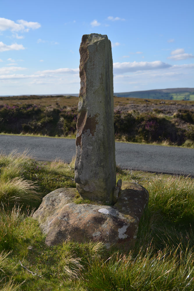
Black Hill Cross (Glaisdale Rigg) submitted by Anne T on 5th Jul 2017. This wayside cross must have been a welcome sight in the middle of this isolated (but beautiful) moorland, especially in the winter months. The base is crudely carved; the shaft looks like a modern addition.
(View photo, vote or add a comment)
Log Text: Black Hill Cross, Glaisdale Rigg: From Danby Rigg, we made our way to Glaisdale Rigg. I’ve been to some surprisingly beautiful parts of England before, but this was Pretty with a capital ‘P’. We needed the map to follow the surprisingly windy (and hilly) roads through Street village to Glaisdale Rigg.
Whilst described as a standing stone on the OS map this is clearly an old cross base with a more recent cross shaft wedged in. It must have been a very welcome sight to travellers, especially during winter months, in this very isolated piece of moorland. Well worth stopping to appreciate the views, especially as it was on our way to Hart Leap.
Danby Rigg Cross Dyke (Crossley Side)
Trip No.32 Entry No.3 Date Added: 5th Jul 2017
Site Type: Misc. Earthwork
Country: England (Yorkshire (North))
Visited: Yes on 2nd Jul 2017. My rating: Condition 2 Ambience 4 Access 4
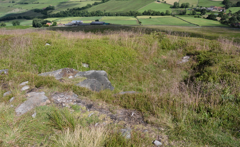
Danby Rigg Cross Dyke (Crossley Side) submitted by Anne T on 5th Jul 2017. Standing some 10 metres from the footpath in the middle of the cross dyke looking down into Little Fryup Dale with Crossley House Farm below.
(View photo, vote or add a comment)
Log Text: Danby Rigg Cross Dyke (Crossley Side), North Yorkshire: From the standing stone (marker stone) and trig point, we walked along the footpath leading approx. north east along the eastern side of the ridge towards the large round cairn. I confess to having walked past this at first, almost reaching the round cairn, but turned round and spotted the long, low hump rising out of the heather.
Walking along the earthwork, it is made of earth and stones and feels substantial under the feet. What a view down to Lower Fryup Dale and Crossley House Farm below.
I was keen to photograph this and the cairn and move onto the 'stone circle'. So much to see on this ridge - it's a very complex Bronze Age landscape. I had no idea how much was here until we started walking. A very beautiful part of the world.
Danby Rigg Cairn With Standing Stone
Trip No.32 Entry No.6 Date Added: 5th Jul 2017
Site Type: Ring Cairn
Country: England (Yorkshire (North))
Visited: Yes on 2nd Jul 2017. My rating: Condition 2 Ambience 4 Access 3
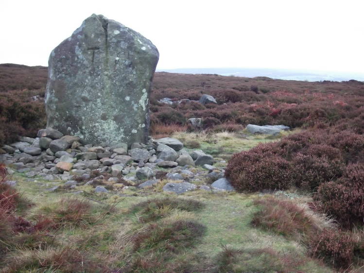
Danby Rigg submitted by tlgreen on 11th Sep 2011. Standing stone on Ainthope Rigg, remnant of a former stone circle.
(View photo, vote or add a comment)
Log Text: Danby Rigg Ring Cairn with Standing Stone, North Yorkshire: Of all the sites on Danby Rigg, this was the one I wanted to see most of all, especially after seeing the photos on the Portal, and I wasn't disappointed, although rather than a stone circle, I found a ring cairn with standing stone. The views to the west to Danby Dale and Little Fryup Dale were lovely on this cloudy, but warm, afternoon.
I was very aware of being in a very ancient landscape and there appeared to be many cairns popping out of the ground (where the heather had been burnt away) and vegetation covered low mounds everywhere.
The cairn is recorded on Pastscape (Monument ID 28809) and also Historic England, where the whole Danby Rigg landscape is recorded 'en masse'. The latter says: "The northernmost, which incorporates a standing stone, was excavated by Atkinson in 1863 and re-excavated in 1986-89. At the centre of the ring cairn there was a 1.7m by 1.1m pit containing two Bronze Age cremation urns and a large quantity of burnt bone. The stones of the ring bank were uncovered but not removed during the excavation and further archaeological remains are expected to survive underneath."
There was a further way marker along the track to the west towards Danby Dale.
Glaisdale Rigg (Hill Top)
Trip No.32 Entry No.10 Date Added: 6th Jul 2017
Site Type: Marker Stone
Country: England (Yorkshire (North))
Visited: Yes on 2nd Jul 2017. My rating: Condition 3 Ambience 4 Access 5
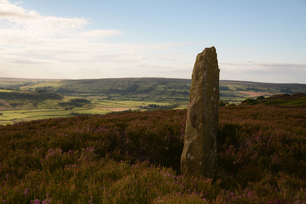
Glaisdale Rigg (Hill Top) submitted by Anne T on 6th Jul 2017. This stone stands proudly at the western side of the moorland road running northwards along Glaisdale Rigg. It is not far from the trig point and about 700 metres from Black Hill Cross. There are splendid views westwards across Great Fryup Dale.
(View photo, vote or add a comment)
Log Text: Glaisdale Rigg Standing Stone: From Hart Leap, we were making our way home. Spotting this, I got my husband to virtually do an emergency stop as I spotted this stone at the side of the road. There is nothing on Pastscape or Historic England about this stone, but it lies just under 700 metres north north east of Black Hill Cross/Standing Stone.
It stands proudly at the western side of Glaisdale Rigg, about a metre or so from the western side of the moorland road, virtually in line with Hill Top Farm in the valley below. It has great views over Great Fryup Dale, and looking south west to where Great and Little Fryup Dales meet.
It was a nice find to end the evening with.
Hart Leap Stones
Trip No.32 Entry No.9 Date Added: 6th Jul 2017
Site Type: Misc. Earthwork
Country: England (Yorkshire (North))
Visited: Yes on 2nd Jul 2017. My rating: Condition 2 Ambience 4 Access 5
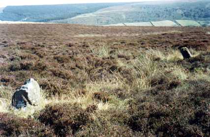
Hart Leap Stones submitted by kelpie on 7th Jul 2002. Said to mark the dying leap of a hunted hart these are probably the remains of a stone row. NZ 73476 03555
(View photo, vote or add a comment)
Log Text: Hart Leap, Glaisdale Rigg: From the Black Hill Cross/Standing Stone, despite having the grid references for this site, we drove past it twice and had to park up and get out and explore. Fortunately there was a moorland track heading eastwards across the moor with room to pull up in. In driving further north along the road, there is another trig point, TP3365 (Glaisdale Rigg).
Exploring first to the east of the road, we spotted two stones lying low in the grass. The earthwork is barely discernible on the eastern side of the road, but is much clearer on the west. We walked the bank on the western side. The Historic England entry mentions a third stone on the eastern side of the road, but we didn’t spot this.
I’m certainly pleased to have been ‘out and about’ with the archaeology group, as at least I could start to interpret what I was seeing on the ground. The site has superb views over Great Fryup Dale.
Danby Rigg Marker Stone (Crossley Gate)
Trip No.32 Entry No.5 Date Added: 10th Jul 2017
Site Type: Marker Stone
Country: England (Yorkshire (North))
Visited: Yes on 2nd Jul 2017. My rating: Condition 3 Ambience 4 Access 3
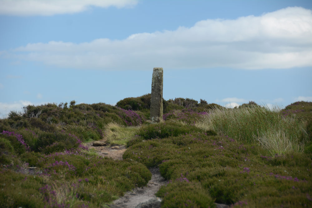
Danby Rigg Marker Stone (Crossley Gate) submitted by Anne T on 9th Jul 2017. Having walked about 100 metres down the track towards the ring cairn with standing stone, I turned back to look at this marker/standing stone, which is very visible to walkers on the horizon.
(View photo, vote or add a comment)
Log Text: Danby Rigg Marker Stone (Crossley Gate), North Yorkshire: this isn't marked on the OS map, but it is scheduled and listed on Pastscape. It is in a beautiful spot looking east to Lower Fryup Dale and marks the junction of two paths - one which comes up from the valley to the east, the track that runs along the eastern side of the rigg, and the northern most track that leads across the rigg from Lower Fryup Dale to Danby Dale, leading past the ring cairn with standing stone.
The stone working markings on the stone make it look like a modern replica, although Pastscape says it's medieval. Being so close to the nearby cross-dyke and round cairn, it is very much like walking in the footsteps of the people who lived on the ridge all those many years ago.
All Saints (Rudby-in-Cleveland)
Trip No.56 Entry No.3 Date Added: 16th Oct 2017
Site Type: Early Christian Sculptured Stone
Country: England (Yorkshire (North))
Visited: Yes on 15th Oct 2017. My rating: Condition 3 Ambience 4 Access 5
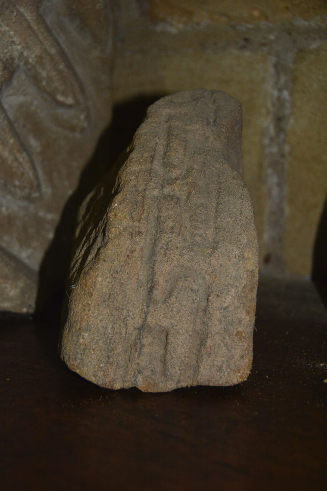
All Saints (Rudby-in-Cleveland) submitted by Anne T on 16th Oct 2017. The outer edge of AS Corpus Rudby 01, which shows a 'grooved meander' pattern. This stone fragment could date from the 11th century, and is possibly earlier.
(View photo, vote or add a comment)
Log Text: All Saints Church, Rudby-in-Cleveland: We’d spent so much time walking round Castle Hill, that by this time of day the sun was very low in the sky and dusk was going to fall pretty quickly, pretty soon.
Parking opposite the church at NZ 47133 06667, just off Rudby Bank in a small paved area which apparently used to be used for the main benefactor’s horse and carriage, we walked into the churchyard.
Much to our surprise, the church was open, so we let ourselves in. Parts of this building are really old. There is also an Elizabethan pulpit and a memorial slab to a 14th century monk holding a chalice.
We also found some old pieces of stone, not mentioned in the church guide, but one portion of which was on the AS Corpus.
Whilst I explored the church, Andrew went in search of the moat, and found it running round the northern part of the churchyard. It is very weird – just a large ditch, most of which is largely dry.
The eastern (modern) part of the graveyard contains the grave of Sir Rex Hunt, Governor of the Falkland Islands when Argentina invaded in 1982.
In the west wall of the vestry, this is also a very strange headless statue, which has been inserted into the wall using part of an old tombstone as a shelf.
All Saints (Crathorne)
Trip No.58 Entry No.2 Date Added: 9th Nov 2017
Site Type: Ancient Cross
Country: England (Yorkshire (North))
Visited: Yes on 8th Nov 2017. My rating: Condition 3 Ambience 4 Access 5

All Saints (Crathorne) submitted by majick123 on 15th Jun 2013. Plinth where cross may have stood. at the East end of the chutch
(View photo, vote or add a comment)
Log Text: Anglo Saxon Fragments and Hogbacks, All Saints, Crathorne: We’d arranged to meet Robert, the curate, at 2pm. He was a few minutes late but by the time I’d walked round the back of the church, he’d opened up the door and turned the lights on. He seemed really shy, asked us how long we’d be, could we turn the lights off when we left and shut the door; he was going for a little walk.
Whilst not huge, this is a very pleasant little church, with the delightful smell of lilies greeting us as we walked through the door.
Most of the fragments are in the south and north walls of the tower, apart from one cemented onto a window sill in the north wall of the nave, and two broken pieces being used to prop up an effigy behind the font. Naturally, we moved the candles and chairs out of the way to try and get photographs of the pieces.
Behind the stone on the window-sill is a mirror. I stood on the nearest pew to try and get photos of the man carved on its rear side. This was an unusual shape – described as a ‘collared shaft’
Carperby Cross
Trip No.144 Entry No.1 Date Added: 13th Aug 2019
Site Type: Ancient Cross
Country: England (Yorkshire (North))
Visited: Yes on 8th Aug 2019. My rating: Condition 3 Ambience 4 Access 5
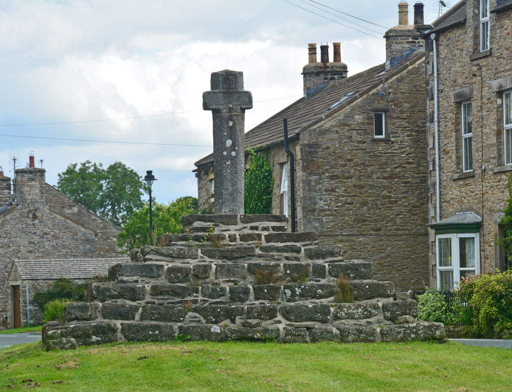
Carperby Cross submitted by Anne T on 13th Aug 2019. The cross from the village green, just to its western side, looking up the road through the village towards Redmire and Leyburn
(View photo, vote or add a comment)
Log Text: Carperby Cross: Not on our original schedule, we drove past this market cross and just had to turn back to take a closer look. Located on the village green in Carperby, which is a long, narrow, triangular strip of grass orientated SW-NE, the base or steps of the cross looked ancient, whereas the shaft of the cross looks modern, although it is dated 1674. The top of the cross has been broken off and re-cemented in at some stage. There are some interesting carved faces at the ends of the short, horizontal arms.
The information sign reads: “Carperby (West End). ‘Kerperbi’ is found in the Domesday Book of 1086. The name probably comes from early Scandinavian settlers, with ‘-by’ meaning farmstead and ‘kjarr’ meaning a bushy, boggy area, in old Danish.
Carperby has been designated as a Conservation Area because of its important historic character. The village is unusual in that it has two distinct centres, one at this end around the 17th century market cross and one at the east end where the original medieval manor house may have been.
The Market
The Market Cross suggests that Carperby’s medieval markets were held here but research shows otherwise. The original site at the far end of the village seems to have fallen into disuse after 1587 when Askrigg began to corner trade in the upper dale. It was briefly revived again in the 17th century, but this time at this end of the village. The date of 1674 carved on the cross supports this theory.
Religion
From the mid-17th century, non-conformism began to sweep through the Yorkshire Dales. The first converts worshipped in each other’s houses but eventually they built their own chapels.
West Lea Cottage was the first Methodist chapel, built in 1826. A little further east is its 1890 replacement (Greygarth), a simple Gothic building.
The Grade II listed Friends Meeting House of 1864 is the most sophisticated looking building in the village, with its heavily carved stonework. It seems to have replaced an earlier meeting house (Quaker Cottages) licensed in 1828 but later converted into cottages.
Education
Formal education in Carperby was provided by the school (Quarter House). It looks to be of 19th century date and the school records go back to 1870. A shaped tablet between the windows is inscribed ‘Carperby School’ but the rest is hidden by the later porch roof. The school closed in 1962.”
Sleights Pasture Propped Stone
Trip No.144 Entry No.2 Date Added: 13th Aug 2019
Site Type: Rock Outcrop
Country: England (Yorkshire (North))
Visited: Yes on 8th Aug 2019. My rating: Condition 3 Ambience 4 Access 4
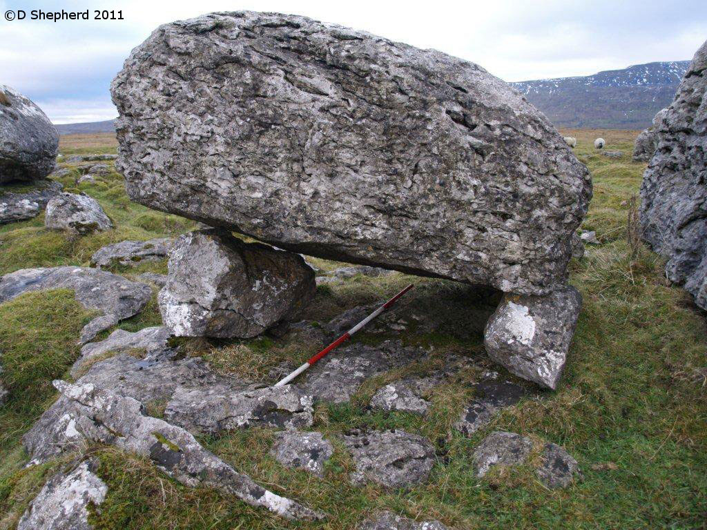
Sleights Pasture Propped Stone submitted by DavidShepherd on 10th May 2018. Sleights Pasture Propped Stone, photo by David Shepherd
(View photo, vote or add a comment)
Log Text: Sleights Pasture Propped Stone: We parked at SD 75081 78117, just beyond the cattle grid on this single-tracked public road (there is room for a couple of cars between the road and the stone wall) then along the very busy, and fast, B6255 Low Sleights Road, walking NE towards the Ribblehead Viaduct, then crossing the road to the footpath leading to this limestone scar, then heading SE along another minor footpath, marked on the map, but barely visible on the ground.
As there were several possibilities of which this propped stone might be, I made doubly sure I had the correct GPS and we were within 1m of the reading. We also compared it with the photograph on the Portal and the diagram (figure 7, in David’s paper “Propped Stones: The Modification of Natural Features and the Construction of Place” (Time and Mind, November 2013)) - I'd taken a copy with me, just in case.
Sorry, but I’m really sceptical about this being a propped stone. I would have been convinced if the propping stones were of a different material to the top stone. It looked like a ‘happy accident’ of glacial deposits and erosion. Another large boulder to its west was placed almost symmetrically on top of a ‘base pad’ of bed rock, and we spotted another couple of stones that also might have been taken as being propped. It reminded me very much of the ‘Guide Stones to the Great Langdale Axe Factory’, where it was difficult to pick one guide stone out of so many on the ground.
I also wasn’t convinced about the double propping, unless I have misinterpreted what David means about this. The boulder at the western end of the stone appeared to be cracked through, viewed from the north, rather than being two separate boulders on top of each other. Both propping stones were placed/located onto top of a bed of limestone.
There was also a very mysterious wall at SD 75748 78030, which Andrew pointed out, partly built with limestone pavement blocks for its ends. Looked like a sheep shelter to me.
Keld Bank (Ingleborough)
Trip No.144 Entry No.3 Date Added: 13th Aug 2019
Site Type: Rock Art
Country: England (Yorkshire (North))
Visited: Yes on 8th Aug 2019. My rating: Condition 3 Ambience 4 Access 3
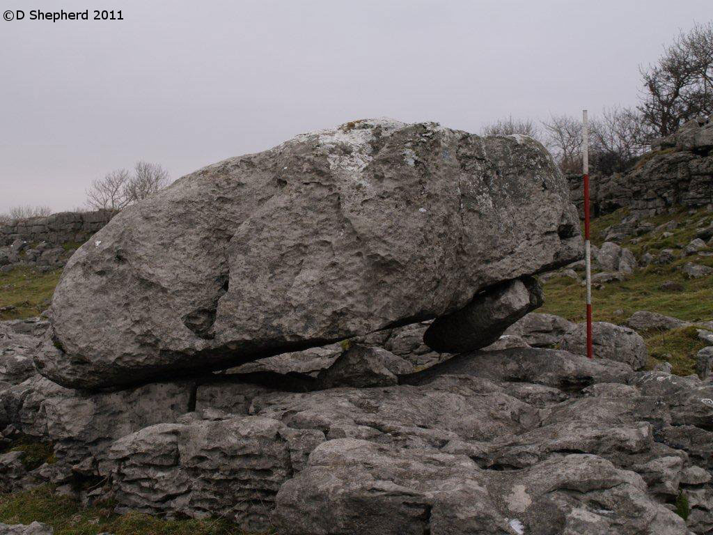
Keld Bank (Ingleborough) submitted by DavidShepherd on 10th May 2018. Keld Bank Propped Stone, photo taken by David Shepherd.
Top stone seems to have come from the adjacent collapse feature on the scar. There is an enlarged joint beneath blocked with a flake.
(View photo, vote or add a comment)
Log Text: Keld Bank Propped Stone: We parked in the small car park for Great Douk Caves on the northern side of the B6255, Low Sleights Road, and began by following the footpath up to the caves, passing the lime kiln on the way. We then largely followed a quad bike track SSE up the slope to the first limestone scar, then headed north east towards the grid reference given by David Shepherd.
The piece of land this propped stone sits on is a nature reserve, managed by Natural England, so we assumed we were safe to walk up over the limestone ridges or scars, of which I counted three. There were easy routes up over each raised section of scar, so I made the walk to the stone easily. Again, we needed to use the GPS and David’s photograph to confirm we were looking at the correct stone, as there were a number of possibilities in the area, including one nicely ‘balanced’ stone nearby.
My comments about this propped stone as the same as above. Even Andrew was less convinced this time, given there were so many other stones around that could also have been counted as ‘propped’ or ‘balanced’.
We ‘called off’ the walk for the third stone as a result of this visit, opting to go and find the stone circle at Casterton.
Keld Bank Settlement
Trip No.144 Entry No.4 Date Added: 13th Aug 2019
Site Type: Ancient Village or Settlement
Country: England (Yorkshire (North))
Visited: Yes on 8th Aug 2019. My rating: Condition 2 Ambience 4 Access 3
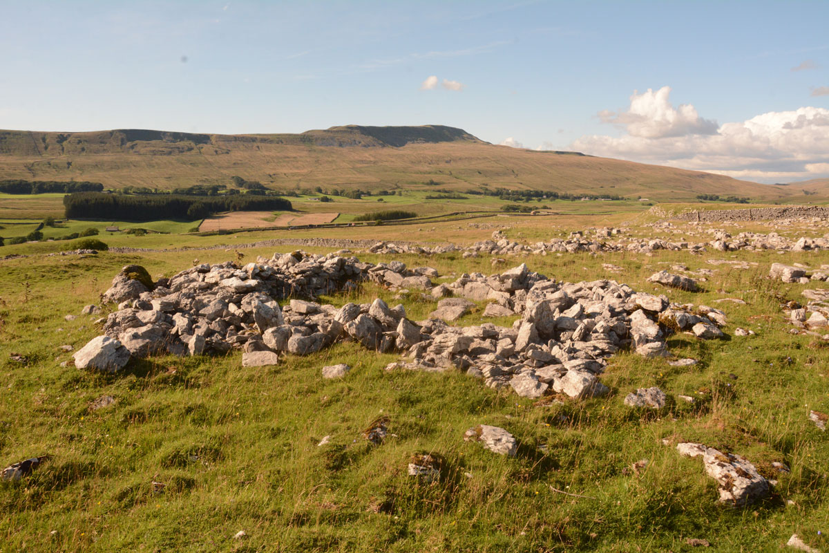
Keld Bank Settlement submitted by Anne T on 13th Aug 2019. The remains of the roundhouse, with an attached enclosure, on the western edge of the settlement. This view looks NW. On the terrace below, there are the remains of clearance cairns and the low banks of field systems
(View photo, vote or add a comment)
Log Text: Keld Bank Settlement: Sitting down in the sunshine, recording the photographs I’d taken for the Keld Bank Propped Stone, I picked up the OS map and realised there was a settlement here. In fact, where I’d chosen to sit, on the edge of a scar, was right on the eastern edge of it.
This settlement is marked on the HE map of the area, but not recorded or scheduled. It was very reminiscent of the Whittenknowles Rocks settlement on Dartmoor, where the walls and hut circles had been built round the natural stones/boulders. Built on the terrace just below the propped stone, extending to the terrace below. The sharp ‘edges’ of the terrace by the hut circle made it look a little like a hill fort – natural defences.
Towards the northern side, I identified a clear hut circle with an enclosure attached; this is clearly visible on UK Grid Reference Finder. There were other clearance cairns and the remains of old buildings and field systems in the terrace below the propped stones.
St Hilda's Well
Trip No.159 Entry No.4 Date Added: 6th Mar 2020
Site Type: Holy Well or Sacred Spring
Country: England (Yorkshire (North))
Visited: Yes on 4th Mar 2020. My rating: Condition 3 Ambience 4 Access 4
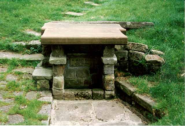
St Hilda's Well submitted by kelpie on 21st Feb 2004. NZ 7911 1706
This well which lies in the churchyard at Hinderwell is said to have curative properties for the eyes.
Restored in 1912.
(View photo, vote or add a comment)
Log Text: St Hilda's Well, Hinderwell: We parked just past the church in a small layby next to the A174 Hinderwell Lane, at NZ 79018 17137, as the road running past the church was very narrow. Having driven past the church to find somewhere to park, we came across a gated access with a plaque saying ‘St Hilda’s Well’, so parked and walked back to it.
The gate led onto a grassy path which led towards the well at the northern side of the church. As we walked up the path, we disturbed a very large parliament of rooks who had settled in the trees nearby; Andrew commented it was like walking into Hitchcock's 'The Birds', especially with the church dark and looming above us, with dark grey skies beyond.
Reaching the well, the well basin had clear water in it, although the large pool in front was dry and full of leaves. However, there was a steady stream of water which flowed downhill from the church, having presumably been piped away underground a short distance.
There appeared to be the top of an Anglo Saxon window head piled on top of stones at one side of the well; at the other, there was part of a very small stone coffin.
Inside the church there was also a leaflet about the church and the well. This is what is says about the well:
“We learn from Bede that S Hilda was born in 614. She was the second daughter of Hereric, great nephew of King Edwin of Northumbria. Her elder sister, Hereswith, married the King of East Anglia. Hilda was baptised in 627, along with King Edwin and some of his nobles and courtiers. In 647, Hilda decides to live as a nun in Northumbria. Aidan appointed Hilda second Abbess of Hartlepool. In 657 Hilda became the founding abbess of a new monastery at Whitby (then known as Streonshalh).
According to legend, St Hilda was asked to intercede in a drought whilst travelling throughout the parish. Her prayers were answered and the spring which appeared has continued to bubble from the hillside in the grounds of St Hilda’s Church, Hinderwell to this day. The waters were said to have healing properties particularly for eye diseases, and the Well became a place of pilgrimage during the Middle Ages. The Well is the only Scheduled Ancient Monument in the parish and was renovated in the early 1900s by the Palmer family.
St Hilda is also said to be responsible for the ammonites or fossilised mollusca shells often found along this coastal stretch, as they resembled curled-up headless snakes. Again according to legend, she had prayed for all the snakes of the neighbourhood to lose their heads and turn to stone. For this reason ammonites are known locally as St Hilda’s Snakes. 19th November is St Hilda’s Day.
Hilda suffered from fever for the last six years of her life, but she continued to work until her death in 680, aged sixty-six. In her last year, she set up another monastery, fourteen miles from Whitby, at Hackness, where there is also a St. Hilda Spring. The church now standing in the village of Hinderwell (see below), is dedicated to St Hilda, but the Holy Well in the churchyard has much earlier origins and almost certainly gave its name to the village. A service to celebrate the Well is held on the first Sunday of July."
Wades Stone (North)
Trip No.159 Entry No.2 Date Added: 6th Mar 2020
Site Type: Standing Stone (Menhir)
Country: England (Yorkshire (North))
Visited: Yes on 4th Mar 2020. My rating: Condition 3 Ambience 3 Access 4
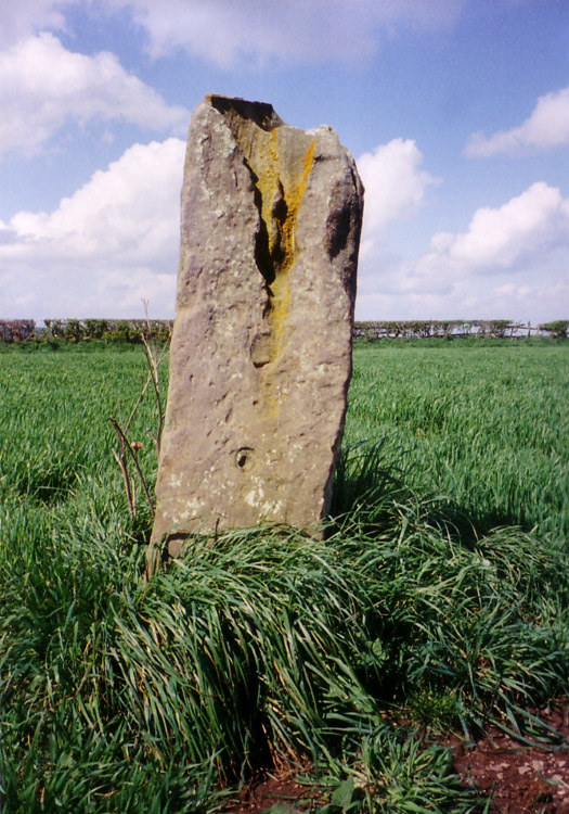
Wades Stone (North) submitted by DavidRaven on 10th May 2005. Showing the large groove on the northern Wade's Stone.
(View photo, vote or add a comment)
Log Text: Wade's Standing Stone (North), Brockrigg: We must have completely forgotten we'd visited this stone before, as neither of us recognised either the road or the lane leading up to the stone. However, we walked up the lane towards the farm, and followed the tractor tyre tracks up to the stone to avoid damaging the seedling plants in the field (the field was planted with small cabbage plants which had recently sprouted). The Pastscape entry says this was originally one of two stones, and we tried to look for possible signs of where the second stone may have stood, but could see nothing.
The deep erosion on the stone was interesting. I looked for the graffiti but only spotted the letters JS on its southern face. The OS map shows this stone to be placed near the Parish boundary line.
Hinderwell Cross Head
Trip No.159 Entry No.5 Date Added: 7th Mar 2020
Site Type: Ancient Cross
Country: England (Yorkshire (North))
Visited: Yes on 4th Mar 2020. My rating: Condition 2 Ambience 3 Access 4
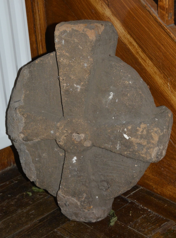
Hinderwell Cross Head submitted by Anne T on 7th Mar 2020. We very carefully moved the flower arrangement next to the stone to photograph it. The mastic repair to the lower arm can be clearly seen on this side.
(View photo, vote or add a comment)
Log Text: The Hinderwell Cross Head, St Hilda's Church: Whilst the church itself is well kept and nicely presented, this cross head is tucked away in the foyer of the church, at the bottom of the stairwell leading to the gallery/organ.
After photographing the well, we wandered up to the church, finding it open. Just inside, to the left hand side of the lobby, next to the stairs ascending to the gallery, was a cross head, which I photographed. Inside was a leaflet describing local heritage, and I found a short section about both Lythe and the Hinderwell Cross in there.
Just outside the south door, about 3m to the south west, is part of either a cross base or a column, which I also photographed.
Guy Points, in his Gazetteer of Anglo Saxon and Viking Sites: Yorkshire, only mentions the well (pages 161/162).
Easington Cross
Trip No.159 Entry No.6 Date Added: 7th Mar 2020
Site Type: Ancient Cross
Country: England (Yorkshire (North))
Visited: Yes on 4th Mar 2020. My rating: Condition 3 Ambience 3 Access 4
Easington Cross submitted by johndhunter on 31st Jan 2020. Easington Cross at NZ 74427 18004 – Closer view, the possible shaft next to the broken medieval base looks like it has a sword carved on it, January 2012.
(View photo, vote or add a comment)
Log Text: Easington Cross Base: The cross base is recorded as HE 1011970 and as Pastscape 1583425. Pastscape 29031 tells us there are "nine Saxon stone fragments [in the basement] at (the) Church of All Saints", although my attempts to contact the vicar by telephone and email have not been successful. I did speak to a gentleman who I thought was the church warden, but he told me "he no longer holds an official position within the church".
As we were passing through the village anyway, we stopped to see the cross base, although the church was well and truly locked.
As well as the cross base, there is also a sundial towards the western end of the churchyard, and a drinking fountain at NZ 74521 18036, at the side of the main Loftus-Whitby Road.
Three Crosses Well (Boulby)
Trip No.159 Entry No.7 Date Added: 7th Mar 2020
Site Type: Holy Well or Sacred Spring
Country: England (Yorkshire (North))
Visited: Yes on 4th Mar 2020. My rating: Condition 3 Ambience 4 Access 4
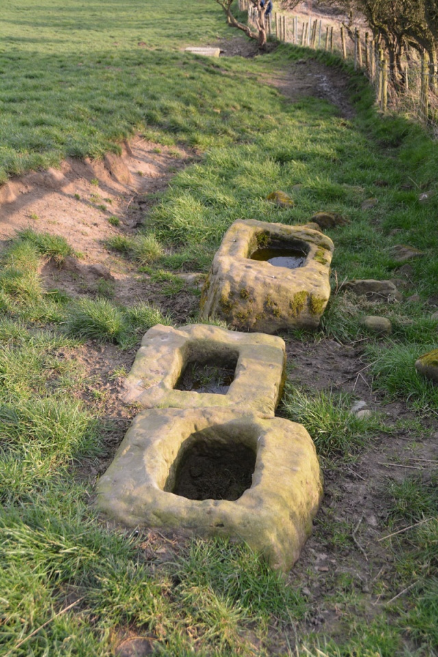
Three Crosses Well (Boulby) submitted by Anne T on 7th Mar 2020. The three cross bases, with the top of the well house just visible down slope.
(View photo, vote or add a comment)
Log Text: Three Crosses Well, Boulby: Parked outside the holiday cottages (there was a large layby just down the road). Originally followed the footpath sign, which took us down a steep bank, but Andrew found a farm track a little further along the south side of the A174, laid through a new area planted with saplings. Despite looking for someone to ask permission from at the farm and the holiday cottages, we were unable to find anyone, so were very carful to stick to the footpath/track.
At the end of this track, three cross bases came into view, and we peered over the fence line to see the well. The well house itself is a little down slope from the cross bases. We were curious as to the connection between the cross bases and the well.
The view of the sea from the cross bases is hidden by a natural small hill/mound. This is a magnificent site, despite the proximity to the potash mine.
St Oswald's Church (Lythe)
Trip No.159 Entry No.1 Date Added: 8th Mar 2020
Site Type: Ancient Cross
Country: England (Yorkshire (North))
Visited: Yes on 4th Mar 2020. My rating: Condition 3 Ambience 5 Access 4
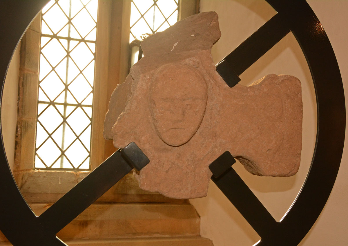
St Oswald's Church (Lythe) submitted by Anne T on 8th Mar 2020. The cross head fragment with its human head in the centre. As displayed in the south window at the west end of the nave.
(View photo, vote or add a comment)
Log Text: St Oswald's Church, Lythe: Our first stop of the day, and one I was very much looking forward to. Parking is available in the small lane to the west of the church (just off the A174 Lythe Lane). A notice put up by the farmer asked cars to park on one side of the lane only, so they had continuous access to their fields behind the church.
I was concerned about if I'd be able to make it down the 'windy stone steps' to the basement, where many of the Anglo Scandinavian and medieval stones were displayed. I needn't have worried, as the steps were modern, and whilst there was no hand-rail, they were easy enough to descend (although I did manage to dislodge small chunks of stone from the south wall as I descended).
We spent an hour and a half here, then needed to move on. I would have liked to have spent another hour (at least) here, with the notes printed from the Corpus of Anglo Saxon Stone Sculpture, and better lighting to take better photos of the stones in the basement.
