Contributory members are able to log private notes and comments about each site
Sites Anne T has logged. View this log as a table or view the most recent logs from everyone
Alnham
Trip No.12 Entry No.1 Date Added: 7th Mar 2017
Site Type: Ancient Cross
Country: England (Northumberland)
Visited: Yes on 5th Mar 2017. My rating: Condition 3 Ambience 4 Access 5
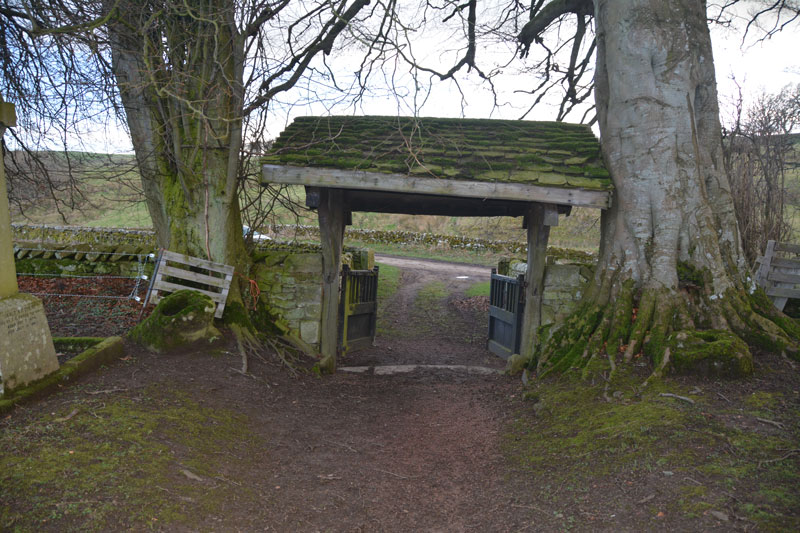
Alnham submitted by Anne T on 7th Mar 2017. Two cross bases lie either side of the lych gate. The church website describes the lych gate as being modern, but it leans/has settled into the trees next to it!
(View photo, vote or add a comment)
Log Text: Alnham, Northumberland. Ancient cross bases: From the A697, we turned left through the pretty little village of Whittingham. The road to the west of the village runs by the meandering course of the (at this point small) River Aln. Just past the village, we turned right onto the minor road leading through Eslington Park and Unthank, the road meandering through minor, muddy single track lanes to Alnham village. Taking the right hand fork (signposted as a dead end road, which it is – eventually), we drove up to the pretty little church.
This is a very remote spot indeed. Opposite the church, you can see the lumps and bumps of the deserted medieval village and the hump of what used to be Alnham Castle. Next to the church is a pele house/tower house, which is lived in. To the far side (from the church) is a footpath which runs up the side of the tower house; this is unusual in that the footpath runs through a small ford.
We had missed the monthly service, which had taken place that morning, but there were signs that other cars had parked on the grass verge outside the church. The lych gate leans into the tall trees either side of it, and the church has a long-deserted air, although candles were still burning on the window ledges inside.
Walking round the churchyard (with its electrified fence to keep any sheep from rubbing against the stone walls) we searched for the cross bases, but found none until we turned to go out of the church, and there they were – one on either side of the lych gate, with a third to the west by the wall.
This church is Grade 1 listed. There were many leaflets about the local countryside and walks, but no church guide. The British Listed Buildings and Wikipedia mention that the church was built on the site of a Roman fortlet, and originally dates from 1135, although because of the ancient cross bases, they think an earlier church existed on this site. Within the porch there is a carved fragment of a rectangular cross shaft, but the carving looks modern.
From the church, we headed further up the hillside to Castlehill Fort and Settlement.
St Peter's (Bywell)
Trip No.151 Entry No.1 Date Added: 27th Sep 2019
Site Type: Early Christian Sculptured Stone
Country: England (Northumberland)
Visited: Yes on 14th Sep 2019. My rating: Condition 3 Ambience 4 Access 5
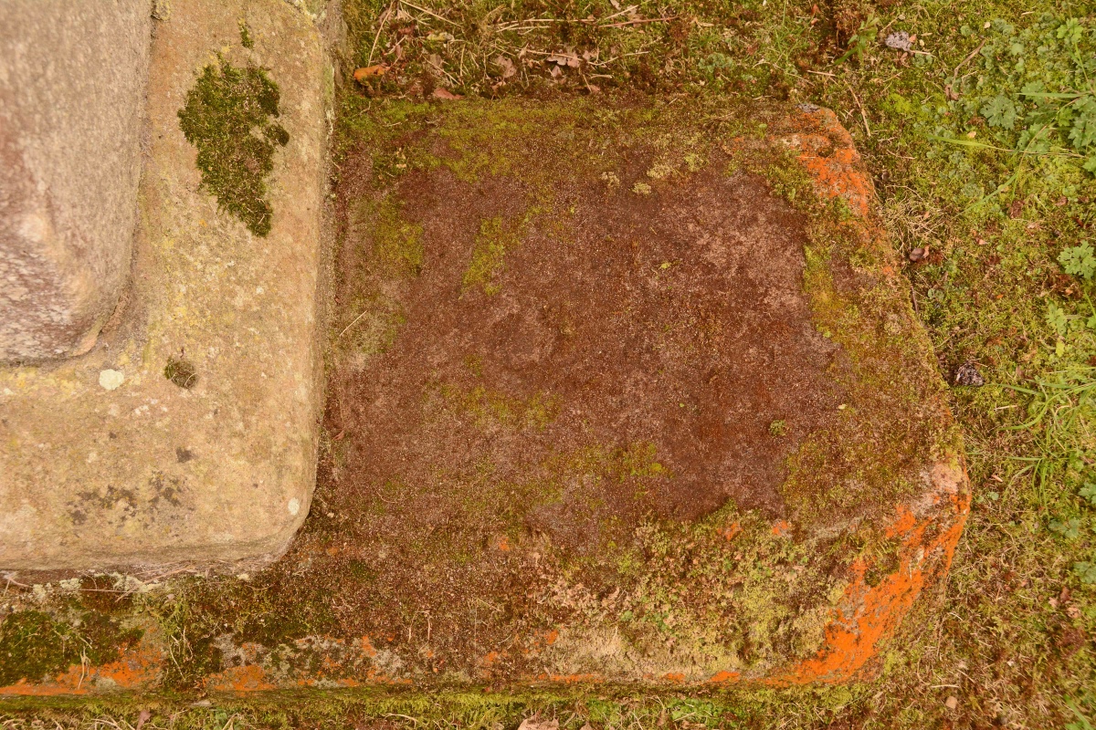
St Peter's (Bywell) submitted by Anne T on 27th Sep 2019. The visible portion of Ryder's Bywell (St Peter's) 13, with a "cross head set within a circle, with sunk lenticular segments between the arms, and a circle at the centre" on the visible section. The small circle can be seen just left of centre of the photograph; the rest of the design is hidden by moss.
(View photo, vote or add a comment)
Log Text: St Peter's, Bywell: Having photographed the cross slabs at St. Andrew's on 10th September 2019, we walked down to St Peter's to try and photograph the slabs Peter Ryder has recorded here. Unfortunately, the church was locked, so we photographed the few slabs on the outside of the building, returning on 14th September, after having ascertained from the vicar the church's opening hours.
This is a really lovely spot, right next to the River Tyne, with the Bywell Village/Market cross and St Andrew's Church, Bywell, with its significant collection of medieval cross slabs and its Anglo Saxon sculptured stones.
St Andrew's Church (Bywell)
Trip No.150 Entry No.2 Date Added: 27th Sep 2019
Site Type: Ancient Cross
Country: England (Northumberland)
Visited: Yes on 10th Sep 2019. My rating: Condition 3 Ambience 4 Access 4
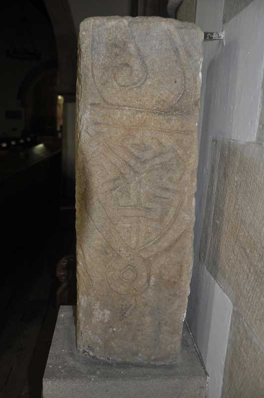
St Andrew's Church (Bywell) submitted by Anne T on 30th Sep 2014. Close up of the second decorated side of the larger fragment, which is the lower part of a cross shaft (Corpus of Anglo-Saxon Stone Sculpture reference: Bywell 01). This face shows the remains of a ring knot and shield shaped pendant.
(View photo, vote or add a comment)
Log Text: St Andrew's Church, Bywell: Living only a few miles from here and having visited, and taken friends there, many times over the years, it seemed remiss not to go down and photograph the wonderful collection of medieval cross slabs built into the fabric of this ancient church. Armed with Peter Ryder's "Medieval Cross Slab Grave Covers in Northumberland, 1: South West Northumberland" from Archaeologia Aeliana, Series 5, XXVIII, we were able to find all the slabs on his list - 27 in total. Brilliant! Really enjoyed this visit.
Castle Hill (Whittonstall)
Trip No.16 Entry No.1 Date Added: 13th Apr 2017
Site Type: Ancient Village or Settlement
Country: England (Northumberland)
Visited: Yes on 12th Apr 2017. My rating: Condition 2 Ambience 3 Access 5
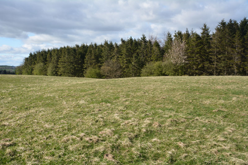
Castle Hill (Whittonstall) submitted by Anne T on 12th Apr 2017. Standing in the slight ditch at the south-western side of the settlement. Much easier to see with the eye than in the photograph.
(View photo, vote or add a comment)
Log Text: Castle Hill, between New Ridley and Whittonstall, Northumberland: This is only a couple of miles from our house, and being a lovely sunny evening, decided to try and find some of the earthworks on the OS map.
This site has the advantage of being close to Wheelbirks Farm with its café, unpasteurised milk and wonderful ice cream. Parking in the layby almost at the junction of the B6309 and the Lead Road, we walked along the busy main road for a couple of hundred yards until we reached the far end of the Castle Hill plantation. Here, the stone wall falls back from the road, and you can walk through to the brambles to the wall. An old gate (?) has been placed so the bars act as a ladder to climb over either into the plantation or the pastureland.
Standing at the stone wall, its possible to see the hump of the settlement with one accompanying outer ditch in front of you. Clambering over into the grassy field (didn't see anyone to ask - sorry), a quick walk along this corner of the field brought the whole of the settlement platform into view. It was much easier to see with the naked eye, rather than try and capture with the camera. Logging onto Pastscape when I got home, I was fascinated to read the history and interpretation of this very ordinary site. Obviously a lot more interesting in the past!
We did go on to Whittonstall to try to find the manorial earthworks not far from The Anchor pub, but these have all been ploughed out. We did carry on to Ebchester, near Newlands, where the line of Dere Street can be seen in the fields to the north east of the B6309. From the gate in the field near the layby almost opposite the junction with the road to Newlands, you can see a cross-section of the road. Interesting.
Horsley Hill Homestead
Trip No.18 Entry No.6 Date Added: 25th Apr 2017
Site Type: Ancient Village or Settlement
Country: England (Northumberland)
Visited: Yes on 23rd Apr 2017. My rating: Condition 2 Ambience 3 Access 4
Horsley Hill Homestead submitted by durhamnature on 16th Aug 2012. Meter-wide field stones, part of a collapsed dry stone wall, but perhaps of older provenance.
(View photo, vote or add a comment)
Log Text: Horsley Hill Homestead, Northumberland: Well, this site got the adrenalin racing, if only for the crossing of the footpath across the A69 dual carriageway, at a very fast spot! We parked in Horsley Village on the B6528, outside the Hearth café, and walked up Lead Lane, which runs just to the west of the Hearth, and to the side of the (now) antiques shop. Running past some houses, the tarmacked road quickly becomes a glorious grassy lane. It was very tranquil here, but for the wooden fence and footpath sign at it’s northern end, with the A69 just ahead.
I have to say I’d been worrying about going to this site for some days. We’d tried walking the long way round, from the north of the site, but it was a very long way round. In all fairness, there is a pedestrian sign on both sides of the A69, a tarmacked pavement and gap in the central barrier does aid a crossing. But, with traffic whizzing past a very high speed and heart in mouth, we waited until there was a sufficient gap in the traffic and RAN to the central reservation. It was very odd standing in the middle of such high speed cars and vans on a Sunday evening.
Eventually making it to the other side, the footpath takes a tranquil stroll up to a grassy meadow complete with mobile phone mast with all its electrics. Great views to the north, west and east from here. No wonder our ancestors built a homestead here.
The top of the hill is a large, long oval shape, aligned north-south with slopes down to the surrounding land on the north and eastern side, and signs of ridge and furrow ploughing to the north-east, although Pastscape tells us that this homestead was only 60 metres in length and 47 metres wide.
I’m glad I’d been out with the archaeology group, looking at different banks and features in other areas, as it was a little tricky to make out the low banks which defined this settlement, combined with the more modern trackways from the field gate to the east up to the mobile mast mounds. There are what appear to be very old boundary walls, together with many large stones in an old wall system just to the east of where the northern part of the footpath meets the field, but we concluded this just might be part of the old field system before it was cut by the A69.
The banks were easier to see with the naked eye rather than with the camera. Andrew thought he detected the low, round shape of a roundhouse, but I wasn’t convinced.
A second dash back across the A69 meant I could finally relax. Onto Croft’s Well in the centre of Horsley.
Entry Well (Ovington)
Trip No.162 Entry No.1 Date Added: 9th Jun 2021
Site Type: Holy Well or Sacred Spring
Country: England (Northumberland)
Visited: Yes on 6th Jun 2021. My rating: Condition 3 Ambience 4 Access 4
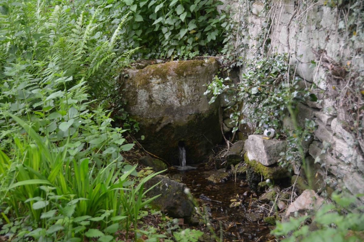
Entry Well (Ovington) submitted by Anne T on 9th Jun 2021. People still visit Entry Well, as there is an overgrown path a few metres to its eastern side. This leads down to the small stream taking water from the well.
(View photo, vote or add a comment)
Log Text: Entry Well, Ovington: A pleasant walk on a warm, sunny Sunday evening, trying to destress before the builders arrive next door tomorrow. Not expecting to find anything at this site, we were surprised by the remaining, and still visible structure here. Not been able to find out anything much about this well, apart from the fact it forms the western boundary of the parish of Ovington. Have appealed for further information until I can get hold of some local history books/journals.
St Andrew's Well (Ovington)
Trip No.163 Entry No.1 Date Added: 11th Jun 2021
Site Type: Holy Well or Sacred Spring
Country: England (Northumberland)
Visited: Yes on 8th Jun 2021. My rating: Condition 2 Ambience 2 Access 4
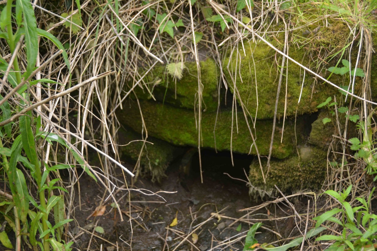
St Andrew's Well (Ovington) submitted by Anne T on 11th Jun 2021. Stepping carefully round the hole for the well, with feet either side of what would have been the water channel flowing from the well, the remain of a stone structure can be seen.
After a period of rain, water flows into a small channel which leads south. The ground was still muddy and boggy at the time of our visit, after a prolonged dry period.
(View photo, vote or add a comment)
Log Text: St Andrew's Well, Ovington: Parking in Ovington village by the old red phone box (now the Village Information Centre), it was a very pleasant walk along St Andrew's Lane to find this well, now no longer shown on the OS maps, but still very much there.
We carried on towards Whittle Dene, another glorious location, to find Dean Head Well and Eddybroth Well.
Eddybroth Well (Whittle Dene)
Trip No.163 Entry No.2 Date Added: 11th Jun 2021
Site Type: Holy Well or Sacred Spring
Country: England (Northumberland)
Visited: Yes on 8th Jun 2021. My rating: Condition 3 Ambience 4 Access 3
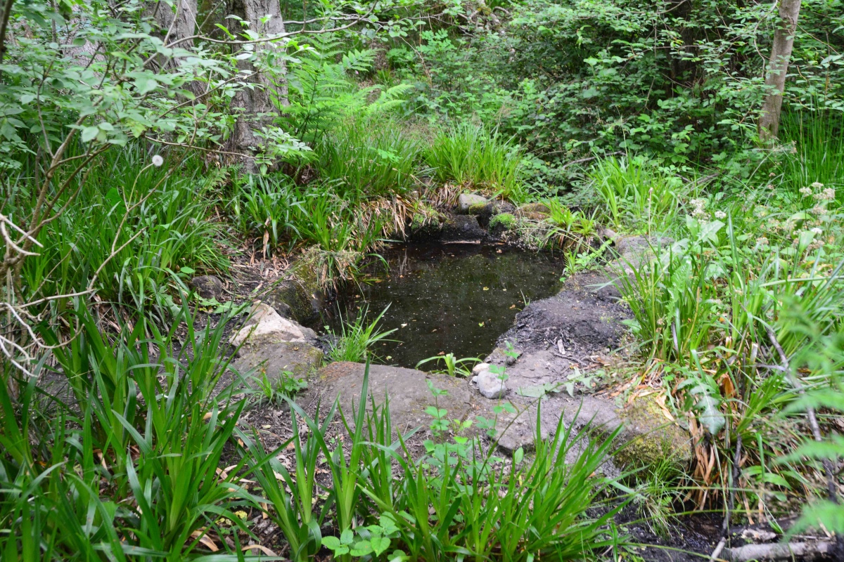
Eddybroth Well (Whittle Dene) submitted by Anne T on 11th Jun 2021. First view of Eddybroth Well, turning right (east), following the footpaths along the pond that used to feed the old corn mill sluice system.
(View photo, vote or add a comment)
Log Text: Eddybroth Well and Dean Head Well, Whittle Dene: A lovely walk along St Andrew's Lane from Ovington, then down (and across) Whittle Burn, and along leafy, shady paths which follow the side of the Burn. A lovely managed woodland, complete with small wooden chalets that were being well used in this warm weather. Once passed these, we saw only one other person. A really pleasant afternoon, and so pleased to have found this well.
Jingling Gate
Trip No.22 Entry No.1 Date Added: 11th May 2017
Site Type: Ancient Village or Settlement
Country: England (Northumberland)
Visited: Yes on 9th May 2017. My rating: Condition 2 Ambience 4 Access 5
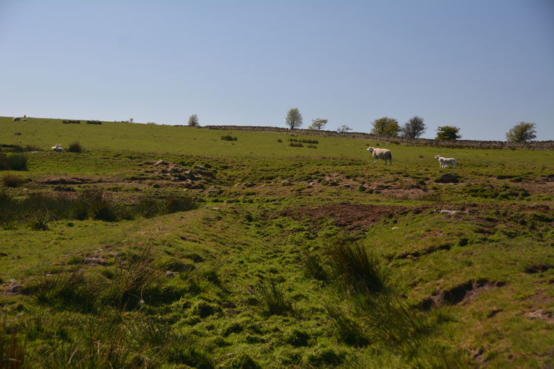
Jingling Gate submitted by Anne T on 11th May 2017. The double rampart on the northern side of this homestead.
(View photo, vote or add a comment)
Log Text: Jingling Gate Homestead, near Dotland, Hexhamshire: OK, probably this should have been called Edge House Homestead, but the name Jingling Gate sounds so much nicer! What a spot this is. Farmland here is so lush and green and the views are tremendous. Locals still hold onto much of their Hexhamshire identity rather than claim Northumberland citizenship.
This homestead is clearly visible on UK Grid Finder, but a little harder to make out on the ground. There was no gate into the field - there was a very long, continuous stone wall (must form the boundary of a farm), so we ended up peering over the stone wall.
The double banks on the northern side of the homestead were very clear, as was the southern corner, where it executes a tidy turn.
The middle has been quarried across, which makes the western side of the homestead a little difficult to make out. We didn't know there were hut circles inside until we got home and looked at the Pastscape record.
On the opposite side of the road, just north of the homestead, there is a long, low earth and stone boundary feature. No mention of a field system around the homestead. This is probably medieval, but interesting nevertheless.
It is so peaceful and quiet here. No one but the sheep and the occasional tractor. Bliss. On from here to find wells that were named on the OS Map - Midge Well, Jack's Well and Holly Well.
Crag Well (Bellingham)
Trip No.171 Entry No.3 Date Added: 30th Aug 2021
Site Type: Holy Well or Sacred Spring
Country: England (Northumberland)
Visited: Yes on 15th Aug 2021. My rating: Condition 3 Ambience 4 Access 4
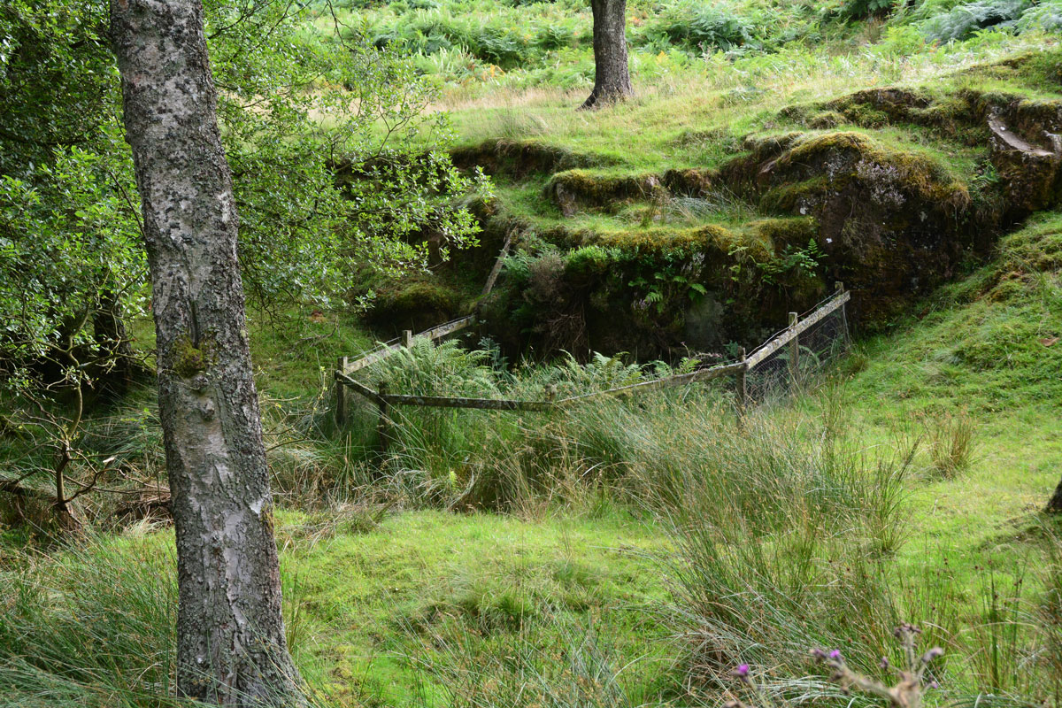
Crag Well (Bellingham) submitted by Anne T on 30th Aug 2021. The well from just to the north of it, avoiding stepping down into the now boggy well pond area.
(View photo, vote or add a comment)
Log Text: Crag Well, Bellingham: Not been able to find out anything much about this well, apart from reading a blog which since seems to have disappeared. Is there a tradition of church services being held next to this well, as the blog said? Will keep researching, but a very pretty spot, well worth visiting.
Hetherington (Wark)
Trip No.171 Entry No.2 Date Added: 30th Aug 2021
Site Type: Ancient Village or Settlement
Country: England (Northumberland)
Visited: Yes on 15th Aug 2021. My rating: Condition 3 Ambience 4 Access 4
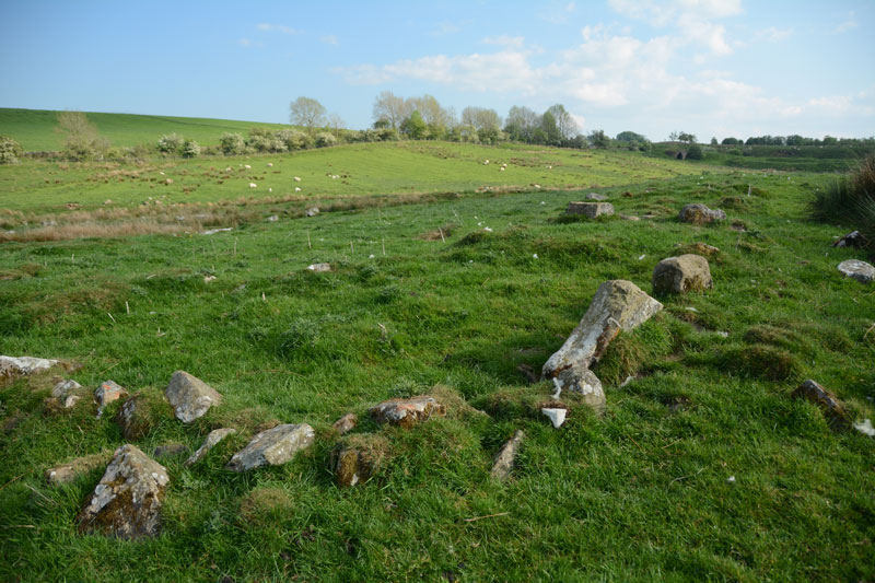
Hetherington (Wark) submitted by Anne T on 27th May 2017. The north western corner of the farmstead, which is sited on a gentle eastern slope.
(View photo, vote or add a comment)
Log Text: Hetherington (Wark): Our second visit to this site, the first being on 25th May 2017, but I forgotten all about it! A lovely site, and pleasant to explore on a sunny afternoon. Didn't realise that this site has been excavated twice, once in 1957, and again in 1972-73, so must try and find the excavation reports, if they are available.
Hetherington (Wark)
Date Added: 30th Aug 2021
Site Type: Ancient Village or Settlement
Country: England (Northumberland)
Visited: Yes on 25th May 2017. My rating: Condition 3 Ambience 4 Access 4

Hetherington (Wark) submitted by Anne T on 27th May 2017. The north western corner of the farmstead, which is sited on a gentle eastern slope.
(View photo, vote or add a comment)
Log Text: Hetherington (Wark): Homestead, built on top of an Iron Age Settlement. Lovely spot, and well worth exploring.
Holy Well (Stonehaugh)
Trip No.171 Entry No.1 Date Added: 31st Aug 2021
Site Type: Holy Well or Sacred Spring
Country: England (Northumberland)
Visited: Couldn't find on 15th Aug 2021
Log Text: Holy Well (Stonehaugh): We last tried to find this well on 30th June 2014, but failed, despite being directed by a local farmer and his dog, Meg. On this occasion, the steep path down the gorge was very slippery, with wet, knee high grass along the path, and quite dangerous, so we gave up, determined either to come back after a dry period, or to try a different path from the village of Stonehaugh towards the Black Pool.
Walwick Fell
Trip No.26 Entry No.1 Date Added: 22nd May 2017
Site Type: Ancient Village or Settlement
Country: England (Northumberland)
Visited: Yes on 21st May 2017. My rating: Condition 2 Ambience 4 Access 4

Walwick Fell submitted by Anne T on 22nd May 2017. Looking over at the two banks to the south west of the main structure.
(View photo, vote or add a comment)
Log Text: Walwick Fell Farmstead, near Hexham: This settlement is not far from Tower Tye, where the Tynedale North of the Wall Archaeology Group used to meet before the surveys. Turning south on the un-named road towards Whinney Hill, we parked in a small layby at the edge of the wood on the east side of the road, opposite the gate into the field containing the settlement. The footpath runs diagonally north west across the field, with the settlement to the right hand side towards the top of the hill, but with bullocks grazing in the field, looking very interested in coming over to us, we gave them a wide berth and approached the settlement from the east.
The settlement appears as a series of defined banks on the slope of the hill, with gorse bushes to its south-western side.
In the wood behind the stone wall to the north of this settlement lies the remains of a Roman camp, but it has been so disturbed by forestry works it is not really possible to see anything.
There are the clear remains of two hut circles, with their foundations built into the back of the slope. The banks are all turf covered and easy to make out. The site has wonderful views to the west, south and east (south to the South Tyne Valley), although it is in a sheltered spot just below the brow of the hill.
Looking on UK Grid Finder when I got home, it is impressive how much of the site can be made out on the aerial image.
There is a well marked on the OS map in the lower part of the field, although it was not evident when we made our way back to the gate.
East Steel Farm
Trip No.27 Entry No.1 Date Added: 26th May 2017
Site Type: Modern Stone Circle etc
Country: England (Northumberland)
Visited: Yes on 25th May 2017. My rating: Condition 3 Ambience 3 Access 5
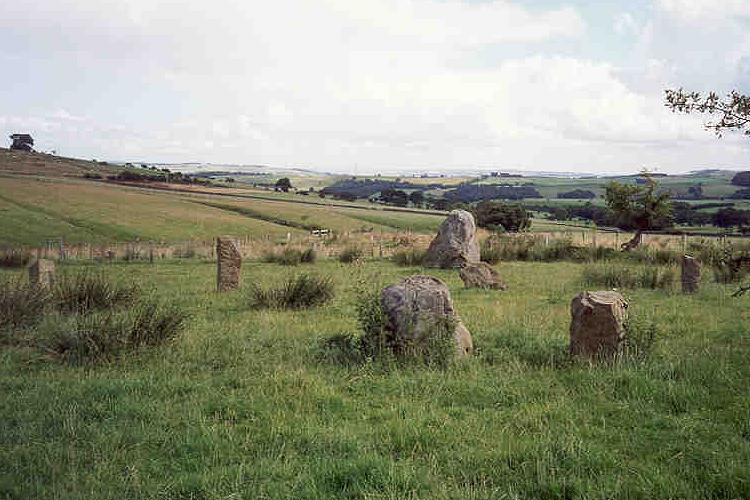
East Steel Farm submitted by Andy B on 24th Nov 2001. East Steel Farm Stone Circle
(View photo, vote or add a comment)
Log Text: East Steel Modern Stone Circle, Near Beltingham, Northumberland: From Beltingham, the further we drove out into the fells, we kept seeing bright yellow ‘Art Gallery Open’ signs. Long way to go for an art gallery, but a lovely drive. Note for future visitors – follow these signs!
As we pulled up to the lane leading down to East Steel House, marked by the signpost (see below), Dennis Kilgallon’s van was coming up to the road junction, signalling to turn right along the minor road. We indicated to go left and we passed each other. Parking by the circle, I hopped out with the camera, not realising Dennis had parked up and came across to speak to us. “Just taking a look?” he asked, “It’s a folly – built 10 years ago”. I thanked him kindly as he got back into his van and drove off. What a lovely place for an art gallery.
I counted 14 stones in the circle, most looking like reused gateposts, some of them leaning, largely built inside an old boundary, now just an arc of raised earth and stone in the ground topped in places by old, crooked, atmospheric hawthorn trees. Two of the stones were placed nearer to the track, outside the boundary - the circle wasn’t circular.
There was one really huge stone, presumably meant to be the heel stone. I wondered how it got there. My husband grunted and said “truck and crane probably.” At this point, a man in black was pelting up the track towards us, and I thought this was the farmer coming to warn us off, but no, it was a runner, who bid us good evening on his way past.
After 10 minutes or so appreciating the calls of the curlews on the surrounding fells, we headed off back to Beltingham and home.
St Cuthbert's Well (Bellingham)
Trip No.27 Entry No.2 Date Added: 26th May 2017
Site Type: Holy Well or Sacred Spring
Country: England (Northumberland)
Visited: Yes on 25th May 2017. My rating: Condition 3 Ambience 4 Access 5
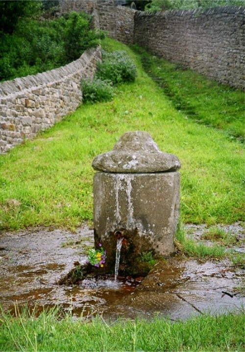
St Cuthbert's Well (Bellingham) submitted by KiwiBetsy on 11th Dec 2004. St Cuthbert, a noted dowser, found and dedicated this abundant spring of clear, pure water quite unlike the brackish marsh water of the area.
Today, the water is contained in a picturesque Georgian pant with it’s ever flowing spout directing the water down through a grill and away to the River Tyne. The upright pant was considered a vast improvement over the older dipping well provided water pressure justified building one.
The water is still used in the church for baptisms. The lo...
(View photo, vote or add a comment)
Log Text: Cuddy's Well (St. Cuthbert's Well, Bellingham): Parking in a small layby at NY 83833 83303, just opposite Manchester Square side road, we headed off to the church. The church was open, so we popped in to have a look. It looked relatively modern, but a plan hooked on the wall told us the sanctuary and chancel dated from the 13th century. Research this afternoon on British Listed Buildings said the church was extensively remodelled in 1609 and bell cote added in 1865. The stone barrelled roof was certainly interesting.
There was a marked grave ‘the lang pack’ in the churchyard, which the ‘A Church Near You’ website says is “the 'Long Pack' grave of a would be house-breaker who was killed by the butler of the house he was trying to rob.”
The well was mentioned briefly on the wooden plaque containing points of interest. To find this, we needed to go out of the church, walk south by the Black Bull, then turn right along the Pennine Way, following the eastern external wall of the churchyard. The path narrowed between two stone walls, but turning round a corner we encountered shallow steps leading down a bank, and there was the well at the bottom. We could hear water gushing from half way down the steps. The water rushed through the grill into the pool below, foaming up with the pressure. I did taste the water; it was fresh, but had no specific taste of any mineral.
On the eastern side of the current well structure there was another hole in the stone, and looked as if at some point either another spout came through, or the current spout had been moved.
Walking back up to the car, we noticed signs for the well and riverside walks from the main square (Manchester Square) in the town, which could be used for disabled access. I didn’t realise until I looked at UK Grid Reference Finder how close we had been to the North Tyne River, as the view was blocked by a very overgrown part of the cemetery.
Shitlington
Trip No.27 Entry No.4 Date Added: 27th May 2017
Site Type: Marker Stone
Country: England (Northumberland)
Visited: Yes on 25th May 2017. My rating: Condition 3 Ambience 4 Access 4
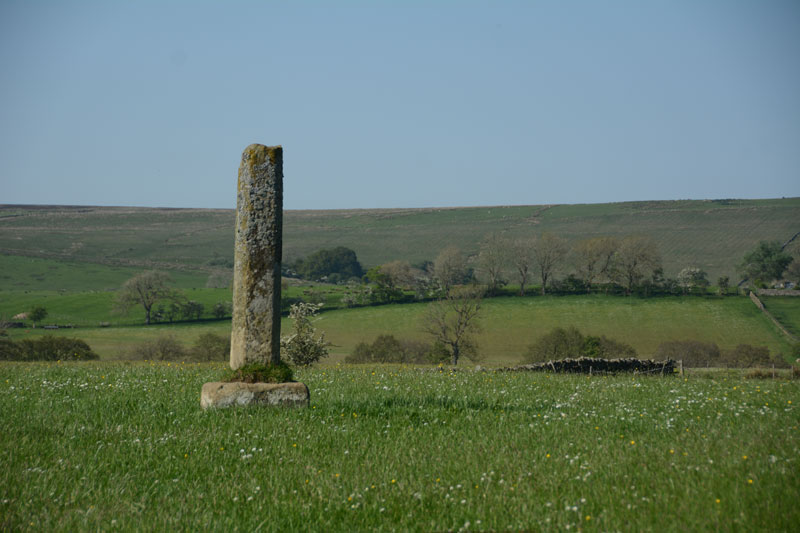
Shitlington submitted by Anne T on 27th May 2017. First view of the Shitlington Cross, walking across the field from the make-shift stile across the stone wall. The views across the surrounding moors are lovely.
(View photo, vote or add a comment)
Log Text: Shitlington Cross, near Bridge House (south of Bellingham): We stopped here because we were passing on the way to the Bridge House/Hetherington Farm homestead and it was marked on the OS map as a ‘cross’. It looks like an old standing stone on a sandstone cross base, similar to the Hurl Stone near Ewe Hill/Lilburn Grange (http://www.megalithic.co.uk/article.php?sid=35235but with a genuinely older base (not just reset in concrete).
Someone had made a stile over the wall into the field. As this was just pasture, we kept to the edge of the field to have a closer look. Very enigmatic, just sitting in the middle of the field with nothing around it.
Checked the top – there was no socket on top, just weathered. It was worth stopping to look because of the wonderful views over Watergate Moor, Wark Common and Broughy’s Hill. Could have sat here all day in the sunshine.
St. Mungo's Well (Simonburn)
Trip No.27 Entry No.1 Date Added: 27th May 2017
Site Type: Holy Well or Sacred Spring
Country: England (Northumberland)
Visited: Yes on 25th May 2017. My rating: Condition 2 Ambience 2 Access 4
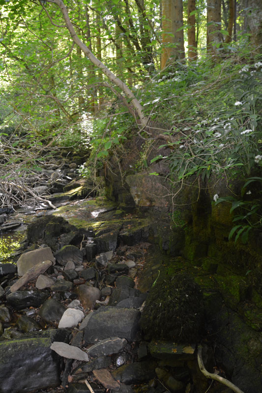
St. Mungo's Well (Simonburn) submitted by Anne T on 27th May 2017. This is the very tumbledown structure at the grid reference for the well. It hasn't been used for a very long time, and my husband wasn't convinced he'd found the right place, but it was the only structure that he could find around.
(View photo, vote or add a comment)
Log Text: St. Mungo's (Mugger's) Well, Simonburn: Our first stop on this hot, sunny day. Parking at Simonburn tea-rooms, we asked if it was OK to leave the car there whilst we walked round the village, and were told it was alright (there is another car park in between the south wall of the churchyard and the forest). I would thoroughly recommend sitting out in the tea-room gardens with a cup of tea and iced water, as they have very comfortable garden furniture and it’s a very quiet spot.
It was a relief to get into the cool of the forest leading down to the Crook Burn, which hardly had any water in it at all after so little rain for weeks and weeks. It was possible to walk on the stream bed.
Following the tracks through the forest to the burn, there is little or no sign of the well. There appears to be an flattened area which might represent an old path, running along the ledge at the top of the burn on its north side, but this has been long out of use. It’s also a three foot plus drop onto the bed of the burn at this point.
Lacking the confidence to walk along the large slippery blocks of stone along the stream bed, I handed the camera to my husband and went exploring the forest tracks. Andrew came back having seen the remains of a structure, long disused, at the grid point indicated for the well, so we are not entirely convinced this is it.
Bellshiel Law
Trip No.28 Entry No.1 Date Added: 29th May 2017
Site Type: Chambered Cairn
Country: England (Northumberland)
Visited: Yes on 28th May 2017. My rating: Condition 3 Ambience 5 Access 5
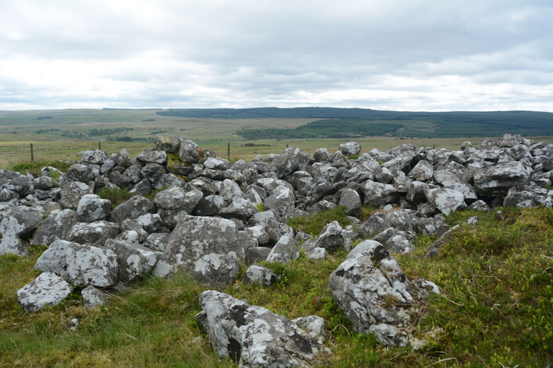
Bellshiel Law submitted by Anne T on 29th May 2017. The northern side of the cairn is partly earth and turf covered for the first few feet. Whether this is just build of earth through the prevailing wind blowing it in or the remains of a purpose built covering was difficult to tell.
(View photo, vote or add a comment)
Log Text: Bellshiel Law, Otterburn Ranges: It felt very strange driving onto the Otterburn Ranges with no red flags flying and no military around – I felt like I was trespassing. The ranges are absolutely huge – the Access map and Guide says they cover 90 square miles. We saw 3 other cars all day, 2 of those from a long distance, and 3 cyclists.
Bellshiel Law can be reached by a military road approx. 2 km on the western side of Rochester. The start to this road system is quite complex, but we headed left and left again taking us up over Bellshiel Road. AT NT 81079 01161 the road forks. At this point take the right hand fork. The cairn comes into view on the right hand side of the road. There is a small parking area underneath a natural crag at NT 81267 01260. My first reaction was “Wow, this is huge”.
Narrow trackways through the grass lead you to the cairn, which is fenced off and labelled “Archaeological Area” and “Out of bounds to Troops”. A gate (difficult to open with all the marren grass around it, but managed to squeeze through) lets you into the cairn. It is large – Pastscape recording it as 367 feet long and 52 feet wide at its eastern end, with a maximum height of 6ft (1932 measurements), which translates to 109m long, varying in width from 8.8m at the west end to 15m at the broader east end, maximum height of 1.6m (1994 English Heritage Scheduling).
Someone has built a sheep pen on the southern side, presumably using stones from the cairn. Walking along the stones at the side of the cairn, largely turf covered, I spotted a number of circular ‘rooms’ inside the cairn, with one oblong shape. Called a long cairn by Pastscape, they record “the cairn on the whole, was found to contain no structural remains of an earlier period (ie cists, chambers, revetments internal structures ….. and cannot be dated any earlier than Early Bronze Age and possibly later.”
Great views to the south to the River North Tyne Valley and beyond.
St Mungo's Well (Northumberland)
Trip No.28 Entry No.6 Date Added: 29th May 2017
Site Type: Holy Well or Sacred Spring
Country: England (Northumberland)
Visited: Yes on 28th May 2017. My rating: Condition 4 Ambience 4 Access 5
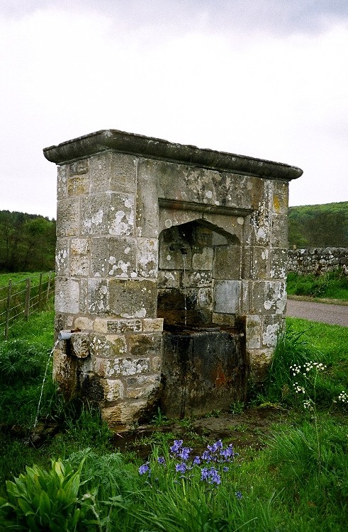
St Mungo's Well (Northumberland) submitted by KiwiBetsy on 27th Nov 2004. St Mungo's Well amidst well watered wildflowers.
(View photo, vote or add a comment)
Log Text: St. Mungo's Well, Holystone, Northumberland: We’d already visited the lovely Lady Well on 8th September 2013, but stopped to look at this one, which is at the side of the Coquet River. Sitting by the right hand side of the road just before entering the village from the Otterburn Ranges, just before the corner of the road leading up to Holystone Priory Farm and the footpath up to Lady’s Well.
The grass and weeds had grown right up to the well, although there was a small track to the well basin, showing a few other people had visited.
I did taste the water, which was clear, but didn’t taste of any particular mineral. The flow of water was strong (but not as strong as St. Cuthbert’s Well in Bellingham), indicating it might be artesian after a long spell of very dry weather in this part of the world.
I hadn’t done any research on this well before visiting, just passing by on the spur of the moment. Pastscape is dubious about this being a holy well. The shrubbery around the well hid the overflow pipe at the burn side of the structure, and I wished I had looked for the conduit at the village green. Another trip to this beautiful part of the county is called for.
