Contributory members are able to log private notes and comments about each site
Sites Anne T has logged. View this log as a table or view the most recent logs from everyone
Kirkhaugh Wells
Trip No.94 Entry No.2 Date Added: 1st Sep 2018
Site Type: Holy Well or Sacred Spring
Country: England (Northumberland)
Visited: Yes on 31st Aug 2018. My rating: Condition 3 Ambience 4 Access 5
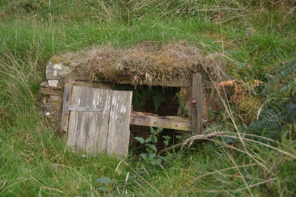
Kirkhaugh Wells submitted by Anne T on 1st Sep 2018. At first glance, this structure looks like a 'doorway into the hillside' but closer inspection through the rotten wooden doors shows a curving, stone well chamber.
(View photo, vote or add a comment)
Log Text: Kirkhaugh Wells, near Church of the Holy Paraclete: After having spent about 2 hours wandering around Epiacum fort, we left to go for a cup of tea in Alston, where we called to the Top Café for tea and crumpets. As suggested by Alastair Robertson, we called into Local Links/Library at the Town Hall to see if they had a copy of his book/report on the fort, but the librarian knew nothing about it (“he wrote a book, but it’s out of print”), and had no further information. We left, walking across to the church of St. Augustine of Canterbury in Alston; I hadn’t taken my camera, and apart from some 13th century gravestones and architectural fragments, the only thing of note was the Derwentwater Clock, set up in the north west corner of the church. Surprisingly, there were instructions to see it working – remove one of the blocks from under the weights on its right hand side, then set the pendulum in motion. Brilliant to see something so old ticking away. To see the hand made cog wheels turning was amazing.
Driving firstly along the A686 following the River South Tyne northwards out of Alston, on the eastern side of the river, we took the minor, very single track road with no passing places, to Kirkhaugh. Just past the farm building is a small triangle of grass; we parked just past this on the grass verge, and made to walk down what looked like the driveway to the Old Rectory, but is actually the only access to the Holy Paraclete Church – Paraclete being another term for ‘Holy Ghost’. The OS map showed ‘Wells’ marked around this point.
As I looked out of the car window, I saw what at first looked like a ‘doorway into the hillside’ but is a disintegrating well house. I walked up the slope to take photographs, and could see inside the well house which is still full of clear water.
The second well, which I saw walking back up the road from the church, is up a hill opposite the farmhouse; now a ruinous brick and concrete structure, it drains into a trough at the bottom of the slope by the road. Presumably it is then piped into the River South Tyne.
Kirkhaugh Cross
Trip No.94 Entry No.3 Date Added: 1st Sep 2018
Site Type: Ancient Cross
Country: England (Northumberland)
Visited: Yes on 31st Aug 2018. My rating: Condition 3 Ambience 4 Access 4
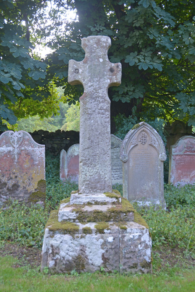
Kirkhaugh Cross submitted by Anne T on 1st Sep 2018. Our first view of this Saxo-Norman cross, approaching along the path through the churchyard from the west, turning towards the south door of the church. The cross is located some 10m from the church door. This side of the cross (Face A in the Corpus record) is said to have two lightly incised crosses, one top and one bottom, although we could not find these.
(View photo, vote or add a comment)
Log Text: Kirkhaugh Cross, Church of the Holy Paraclete: Having seen one of the wells on the opposite side of the road, we turned our attention to finding the cross. This church is virtually hidden behind the trees, with only a portion of its eastern end and a narrow, tall spire peeping out of the trees at its western end.
I thought at first this cross was a modern grave marker, as it sits up a modern plinth, but closer examination showed this cross has been used as a gate post at least once in its past.
Behind the cross is a grave stone which has grown into the side of a large horse chestnut tree and been cracked. With the River South Tyne babbling away just behind the eastern churchyard wall, this is a lovely spot.
Saffron Well (Barhaugh)
Trip No.94 Entry No.4 Date Added: 2nd Sep 2018
Site Type: Holy Well or Sacred Spring
Country: England (Northumberland)
Visited: Yes on 31st Aug 2018. My rating: Condition 2 Ambience 3 Access 4

Saffron Well (Barhaugh) submitted by Anne T on 2nd Sep 2018. This well pool is more than a little neglected and overgrown. The waters issue seemingly from nowhere, directly out of the hillside, then running into Barhaugh Burn. Photo taken by Andrew T
(View photo, vote or add a comment)
Log Text: Saffron Well (Barhaugh): After the peace and quiet of Kirkaugh Wells and the Church of the Holy Paraclete, we drove past this even more remote spot. Andrew was brave enough to hop over the stile and descend the very steep, overgrown path down to the river. He reported that a ‘stream just started from nowhere, forming a pool, then running into Barheugh Burn’. Due to the sheer amount of foliage and trees, it was difficult to photograph. Only a very short entry on Pastscape. I've done several internet searches and not been able to find out anything else.
St Cuthbert's Church (Norham)
Trip No.95 Entry No.1 Date Added: 9th Sep 2018
Site Type: Ancient Cross
Country: England (Northumberland)
Visited: Yes on 6th Sep 2018. My rating: Condition 3 Ambience 5 Access 5
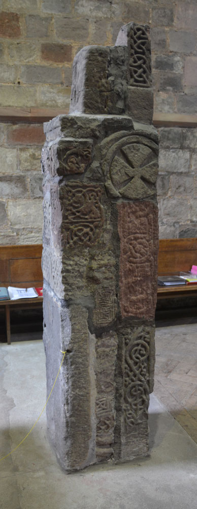
St Cuthbert's Church (Norham) submitted by Anne T on 9th Sep 2018. This is the side of the pillar which faces the south door into the church.
(View photo, vote or add a comment)
Log Text: Anglo Saxon Pillar, Norham: The journey seemed to take a lot longer than anticipated, and we didn’t arrive here until almost 3pm. At first, keeping the tower of the church in view, we went the wrong way, past the village cross and the first school, then turned round, travelling back along West Street (the B6470), turning down North Way to Church Lane. We spotted the churchyard first; the church is at the bottom of Church Lane, so we ended up parking near the gate at the bottom at NT 89710 47356 and walking up to the south porch along the path.
Andrew thought there were originally 25 stones here, but there are actually only 18, built into a ‘pillar’, with different sides showing, some recorded separately on the Corpus. A few of the fragments have been lost between their finding in 1833 and today, but the Corpus holds some drawings from the 19th century.
After photographing the Saxon pillar, we looked around outside, spotting the musket ball holes where Oliver Cromwell’s army had shooting practice, and looked at the site of the original Saxon church, which is on a mound slightly higher than the modern church.
Monk's Well (Upsettlington)
Trip No.95 Entry No.2 Date Added: 9th Sep 2018
Site Type: Holy Well or Sacred Spring
Country: Scotland (Scottish Borders)
Visited: Yes on 6th Sep 2018. My rating: Condition 2 Ambience 3 Access 4
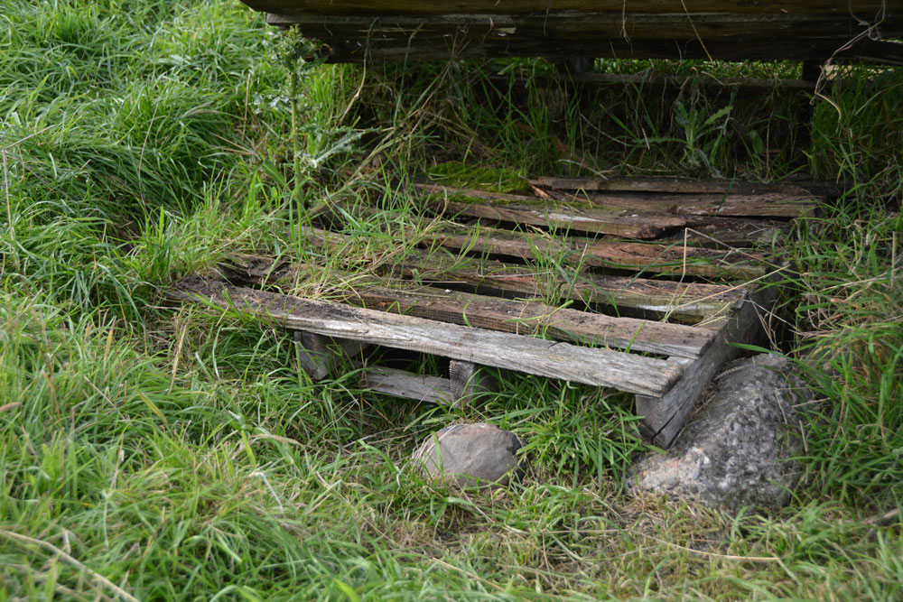
Monk's Well (Upsettlington) submitted by Anne T on 9th Sep 2018. Lifting up the larger pallet, there is a smaller, partly rotten wooden pallet which hides more ?dressed stone pieces and what looks like a manhole cover. Being partly sunk into the ground, it was not possible to lift this up for further investigation to confirm it was Monk's Well or not.
(View photo, vote or add a comment)
Log Text: Monk's Well, Upsetllington: From St Cuthbert's Church in Norham with its Saxon pillar, we went to Norham Castle (well worth looking round, and free of charge). This was the start of quite a treat - three holy wells in two adjacent fields!
From the castle, we crossed the bridge over the River Tweed, going from England to Scotland, following the B6470 to a left hand turn, by a Victorian water fountain by the side of the crossroads. This turning led to Upsettlington, which seems to have been renamed Ladykirk at some point (all the signs and house names read ‘Ladykirk’ Lodge, etc).
At the cross roads between the houses, at the entrance to the main house, we turned left towards Black Row, the Smithy and East Lodge, parking by the phone box. We let ourselves into the field (gate to the left of the phone box), only to find there were four horses galloping from the far side of the field towards us, and a fence between us and the well. We decided to drive back along the road towards the B6470, where there was another gate into a stock-free field. This field also contained two of the wells and gave access through a gate into the field with Nun’s Well.
There was a large pallet at the point where the grid reference for this well was. Lifting the pallet, a smaller pallet, half buried in the mud beneath, with a man-hole cover underneath. Some 20m to the south east there was a modern man hole cover, demarked from the rest of the field by three stakes placed in a triangle, with a pipe leading down the slope. Which of these is the real well, we weren’t sure. There were a few possibly dressed stones peeping above the turf near the pallet.
Having photographed both possible well sites, it looked as if the ‘staked site’ had possibly been the site for a drinking trough, but there had been so much ground disturbance it was difficult to tell.
St Mary's Well (Upsettlington)
Trip No.95 Entry No.3 Date Added: 9th Sep 2018
Site Type: Holy Well or Sacred Spring
Country: Scotland (Scottish Borders)
Visited: Yes on 6th Sep 2018. My rating: Condition 3 Ambience 3 Access 4
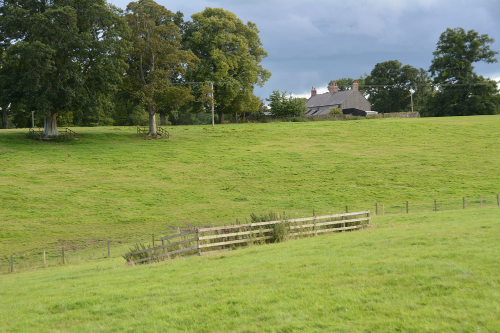
St Mary's Well (Upsettlington) submitted by Anne T on 9th Sep 2018. St Mary's Well from just uphill to its north east, heading for the gate into the next field, where Nun's Well can be found.
(View photo, vote or add a comment)
Log Text: St Mary's Well, Upsettlington: From Monk’s Well, and in the same field, we walked east-north-east towards this fenced off area of the field. To our left hand side, raised some 0.5m+ above ground level, and seemingly in a perfect circle, was a funny wooded area; closer inspection revealed it was being used as a large, tree-covered feeding station for pheasants/grouse? There was no record on Canmore of this being a cairn or the site of a hillfort.
St Mary’s Well, with its inscription barely legible on the top, reminded me very much of the well houses in Durham City. The structure was very overgrown, although underneath the name of the well, there was still the remains of a metal pipe leading into the well trough below (the latter was hidden by vicious nettles).
The latest visit report recorded by Canmore in 1971 says the well is now dry, but the inscription is still intact.
From here, we walked northwards, uphill, to a gate into the next field which contained Nun’s Well.
Nun's Well (Upsettlington)
Trip No.95 Entry No.4 Date Added: 9th Sep 2018
Site Type: Holy Well or Sacred Spring
Country: Scotland (Scottish Borders)
Visited: Yes on 6th Sep 2018. My rating: Condition 3 Ambience 4 Access 4
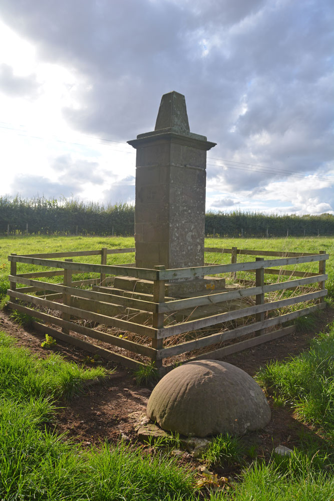
Nun's Well (Upsettlington) submitted by Anne T on 9th Sep 2018. Nun's Well from the south east. The well itself is the feature captured by the fluted, domed stone bowl.
(View photo, vote or add a comment)
Log Text: Nun's Well, Upsettlington: From St. Mary's Well, walking up the hill to the gate which leasds into the next field, we walked back down hill towards a steam. The well monument can be seen between two large trees, just before a small burn leading westwards into the RiverTweed. The trees on the western bank of the river hid the view of the water, but what a magnificent spot.
I didn’t realise until we got home and brought up the Canmore record that the actual well is hidden by the stone dome, which is outside the monument enclosure.
The monument seems to be built on much older steps, which are held together with a large number of iron staples. These aren’t mentioned in the Canmore record.
Norham Cross
Trip No.95 Entry No.5 Date Added: 9th Sep 2018
Site Type: Ancient Cross
Country: England (Northumberland)
Visited: Yes on 6th Sep 2018. My rating: Condition 3 Ambience 4 Access 5
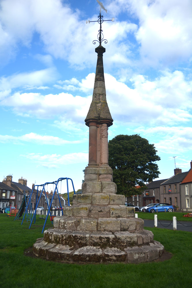
Norham Cross submitted by Anne T on 9th Sep 2018. Norham Cross, looking eastwards across the children's playground and up the main street in the village, to the Castle at the top of the hill.
(View photo, vote or add a comment)
Log Text: Norham Village Cross: (Before looking at this cross, we stopped off to look at the Victorian Jubilee Fountain just over the border in Scotland, which still has its original pump handle, although this doesn't work). We passed this cross several times today, but with it being immediately next to the children’s playground, there were children sitting on its lower steps, and propping their bicycles against it. When we passed by on the way back from seeing the holy wells at Upsettlington, there was fortunately no children around it, so we stopped to take photographs, much to the amusement of two ladies passing by who stopped to watch. It was nice to see the cross still very much part of village life today.
Whilst the top part of this cross looks Victorian/relatively recent, the steps look much, much older and are very worn.
Twizel Standing Stone
Trip No.95 Entry No.6 Date Added: 9th Sep 2018
Site Type: Standing Stone (Menhir)
Country: England (Northumberland)
Visited: Yes on 6th Sep 2018. My rating: Condition -1 Ambience 3 Access 4
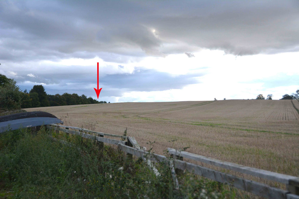
Twizel Standing Stone submitted by Anne T on 9th Sep 2018. The red arrow marks the spot where this standing stone/rubbing post should have been located. Next time we drive by, we'll knock on the door of the farmhouse and ask to check the spot.
(View photo, vote or add a comment)
Log Text: Site of possible standing stone, Twizel: The boulder no longer appears to be in the field, although there is a small raised area in the field – as this is England, we couldn’t find anyone to ask permission to walk into the field, so photographed it from the fence near the cottage. For a last stop of the day, a little disappointing, as a standing stone would have 'wrapped things up nicely'.
Newbeggin Stone Row
Trip No.96 Entry No.1 Date Added: 12th Sep 2018
Site Type: Stone Row / Alignment
Country: England (Cumbria)
Visited: Yes on 11th Sep 2018. My rating: Condition 3 Ambience 3 Access 4
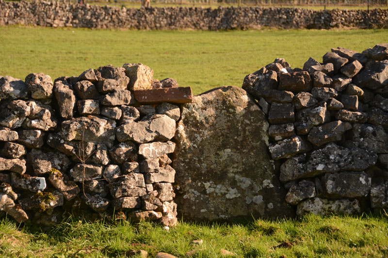
Newbiggin Stone Row (Stone 5) submitted by Anne T on 28th Mar 2017. This stone, number 5 on Dr. Rich's map, also sits on the wall to the left of the footpath running between Newbeggin and the A66. It is somewhat more obvious than the others. It is sited at NY 46849 28893.
(View photo, vote or add a comment)
Log Text: Newbeggin Stone Row: We went along to Newbeggin armed with permission from a number of landowners to walk along their boundary stone walls to look for other possible standing stones. We found a few more, but these looked more like erratics which had been shaped and used in the stone walls. I will document these and send them off to Sandy G for comment.
We got to see the stones outside Sycamore View/House with the farmer, who said the archaeologists said they were probably rubbing stones, although the farmer said they weren't (currently) tall enough even for sheep to rub against. There were certainly no signs of animals having trodden away earth at the base of the stones.
Motherby (Cumbria)
Trip No.96 Entry No.4 Date Added: 13th Sep 2018
Site Type: Holy Well or Sacred Spring
Country: England (Cumbria)
Visited: Yes on 11th Sep 2018. My rating: Condition 3 Ambience 4 Access 5
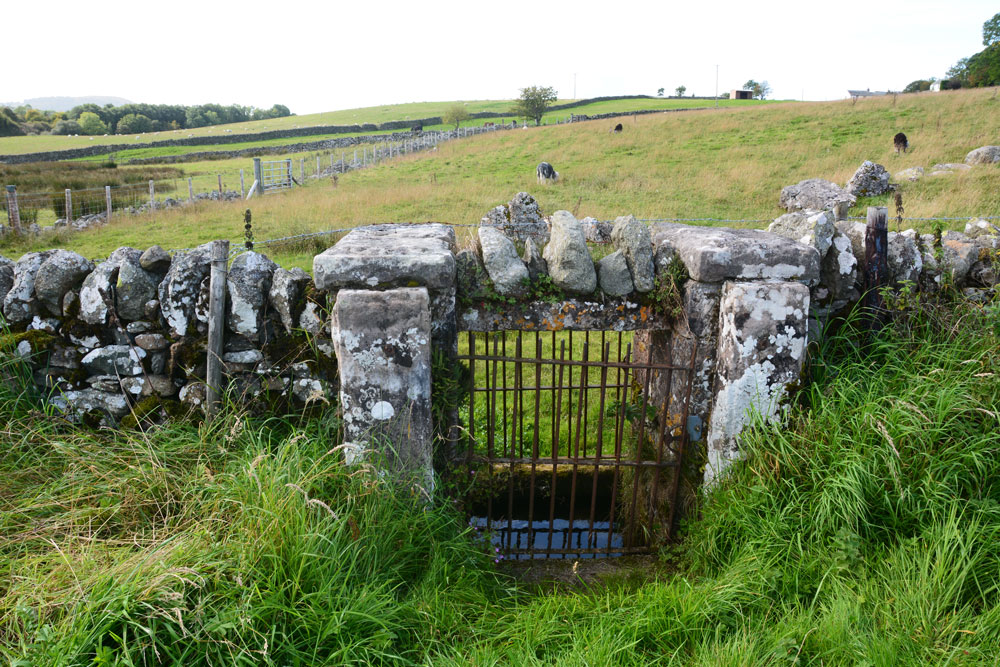
Motherby (Cumbria) submitted by Anne T on 13th Sep 2018. The well chamber is some 10+ metres further along the wall towards Motherby village, with the well chamber directly underneath the wall. An iron gate on either side of the wall gives access to the well itself.
(View photo, vote or add a comment)
Log Text: Well, Motherby, Cumbria: This is a very old village, with very picturesque cottages and farm houses. The well is not recorded on either Pastscape or Historic England.
The ‘wall’ is a strange structure. Following the line of stones up the hill, it ends in what seems to be a building platform and possibly an old quarry. The footpath at the village end of the footpath was closed due to building work, so we couldn’t investigate further.
I have emailed Mark Brennand at Cumbria County Council to see if he has any information. The line of stones follows an old footpath on the 1860 OS map, together with the letter 'T' (troughs?) where the troughs are currently located. No mention of the well.
Kells Well (Newbeggin)
Trip No.96 Entry No.5 Date Added: 13th Sep 2018
Site Type: Holy Well or Sacred Spring
Country: England (Cumbria)
Visited: Yes on 11th Sep 2018. My rating: Condition 2 Ambience 1 Access 5
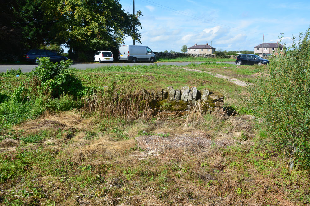
Kells Well (Newbeggin) submitted by Anne T on 13th Sep 2018. Standing to the east of the well, looking back across the road which leads into Newbeggin to the left and to the junction with the B5288 to the right. There doesn't appear to be a well trough any more, although all the ground around here is wet and spongy, indicating its the site of a spring.
(View photo, vote or add a comment)
Log Text: Kells Well, Newbeggin: This well is located opposite a house called Rockholme on the OS map, and near the Clickem Inn, just south of the B5288
The farmer from Sycamore View told us about the well, saying it had recently been “done up and claimed for the village” by the villagers. This was more like a glorified rubbish tip – the place was horrible, one of the worst places we’ve stopped at in years.
There was an old pebbled path leading round the well, together with the remains of an old stone structure, now largely covered in weeds and falling down. There was a pool of water to its northern side, and the whole of the central area around the stone structure was boggy and puddled; a small stream ran to a partly culverted ditch just to the north. Horrible. Glad to escape.
Redhills Rock Art
Trip No.96 Entry No.6 Date Added: 14th Sep 2018
Site Type: Rock Art
Country: England (Cumbria)
Visited: Yes on 11th Sep 2018. My rating: Condition -1 Ambience 4 Access 4
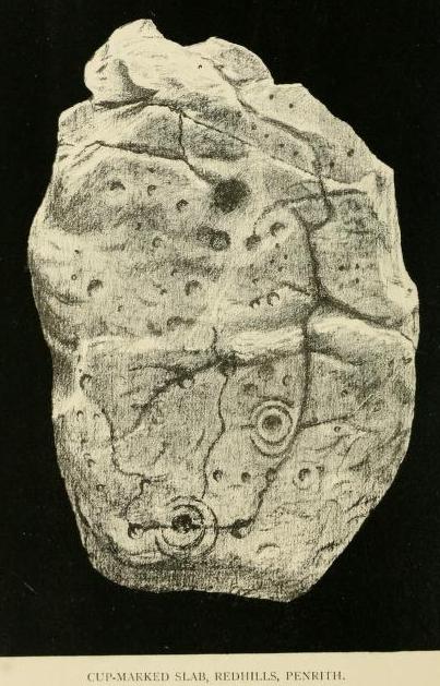
Redhills Rock Art submitted by durhamnature on 29th Oct 2012. Photograph from "Transactions of the Cumberland Archaeological Society" via archive.org
(View photo, vote or add a comment)
Log Text: Sockbridge / Redhills cist, small stone circle and round cairn (now all destroyed): We went to see this site as part of our amateur investigation of the possible Newbeggin Stone Alignment. Whilst the location is glorious, overlooking a steep scarp slope to the River Eamont below, and views to the hills of the North Lakes to the south, nothing can be seen here at all.
Just to the north of the scarp slope, there is a faint, very shallow, sub circular area, with one very broken stone at its edge, now almost buried in nettles. This stone is very unlike any of the others around Newbeggin in shape, almost looking like a mudstone rather than sandstone or limestone. This stone did have veins of quartz running through it, along with a few inclusions.
It was worth coming to this site for the walk and the scenery. We approached using the footpath from Sockbridge village, walking through a field of enormous Friesian cows, then a huge field of recently harvested sileage, then using the footbridge over the River Eamont, and up the hill, veering off to our left after the limestone pavement that ran along the top of the scarp slope.
Woodhorn Cross
Trip No.97 Entry No.1 Date Added: 23rd Sep 2018
Site Type: Ancient Cross
Country: England (Northumberland)
Visited: Yes on 16th Sep 2018. My rating: Condition 3 Ambience 4 Access 5
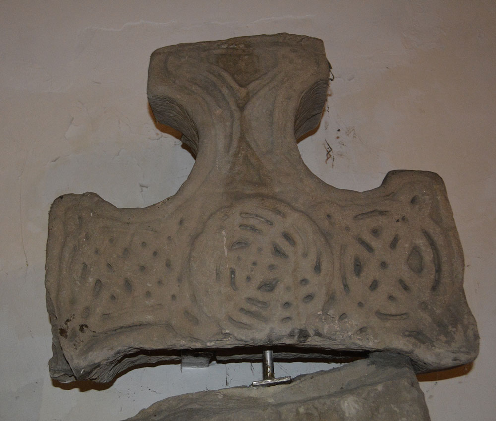
Woodhorn Cross submitted by Anne T on 23rd Sep 2018. Face a of the cross head of AS Corpus Woodhorn 01, described as: "There is a flat central roundel cleverly composed of a central motif of two intersecting loops which spin out into intersecting circles of interlaced strands. The upper arm has a split plait motif, in which the strands are bent into a V shape between the four end knots and the diagonal strand becomes an edge strand. On the right arm is a ring-knot of two concentric rings crossed diagonally by two closed circuit loops. On the left ...
(View photo, vote or add a comment)
Log Text: Woodhorn Church Museum: This church is now deconsecrated and is a museum. It is only open on Bank Holidays and Heritage Days, such as ‘Doors Open Days’. We arrived just before 1pm and they had just arrived to open the church up.
The Woodhorn Cross was easy to find, but asking where the other Norman stones recorded on a notice by the cross, plus the other stones featured on the Corpus, the Friends of the Church who were helping out told us they didn’t know where they were located, but gave us a leaflet about the church.
We found other fragments incorporated into the fabric of the building, plus others under a table at the north side of the sanctuary, plus others under the altar! AS Corpus Woodhorn 02 and 03 appear to be in the main museum nearby.
St Bartholomew's Church (Newbiggin by the Sea)
Trip No.97 Entry No.2 Date Added: 30th Sep 2018
Site Type: Ancient Cross
Country: England (Northumberland)
Visited: Yes

St Bartholomew's Church (Newbiggin by the Sea) submitted by Anne T on 26th Sep 2018. This unusual fragment is built into the southern end of the east wall, near the altar (inside). It has been interpreted as "a net with entangled fishes" (the fishes head can just be seen towards the top of the stone). This fragment is dated to the 12th century and is said to have been part of a column capital.
(View photo, vote or add a comment)
Log Text: Ancient cross slabs, Newbiggin by the Sea: The website for St. Bartholomew’s announces that the church “has one of the most important collections of coffin lids and grave markers in the county, mostly re-set during the 1913 restoration, when the north aisle, demolished in antiquity, was reinstated. Other fragments are distributed around the church and in the South porch. There are around 20 pieces in all. Most of the slabs are of late twelfth or thirteenth century date; several show signs of post medieval re-use.”
I have included my photographs and notes here, as I think these grave markers are more spectacular than those in Kilmartin churchyard – their designs are less worn and Peter Ryder, archaeologist for the church, has written about them in his assessment of the church, dated January 2013.
On the day of our visit, the mid afternoon sun was streaming through the windows on the northern side of the church, which made photographing some of the fragments a little tricky (my photographic skills weren’t quite up to it!) and the stream of visitors into the church made me feel rude by continually using the flash.
Some of the cross slabs are in the vestry and some in the tower, but it was not possible to see these. Another three have been used as paving slabs on the external west wall of the tower, but I didn’t spot these, as they seem to be worn.
From the small guide book “The Church of St. Bartholomew”, centre right page:
The two (cross slabs) above the altar at the east end are outstanding with their richly carved borders, delicate florets and symbolic shears and keys. An engraving of one was published as long ago as 1854, shortly after their discovery, when they were recognised as being of national importance.
Ulgham Cross
Trip No.97 Entry No.3 Date Added: 17th Sep 2018
Site Type: Ancient Cross
Country: England (Northumberland)
Visited: Yes on 16th Sep 2018. My rating: Condition 3 Ambience 3 Access 5
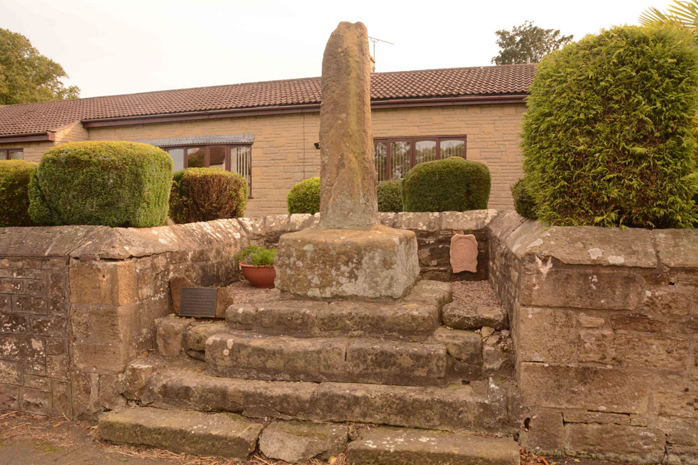
Ulgham Cross submitted by Anne T on 17th Sep 2018. The Ulgham Cross, which is set in a recess in the roadside wall, near to the junction of the B1337 and Ulgham Lane. It has an overall height of 3m, the plain (but weathered) cross shaft standing on four very old stone steps, which look as if they used to belong to an old village cross.
(View photo, vote or add a comment)
Log Text: Ulgham Cross, Near Ashington, Northumberland: From Newbeggin By The Sea, we headed inland to try and find this cross, which we thought was near the church. In typical Tate fashion, we'd arrived when there was a Sculpture Show at the Church; as they were charging to go in, we declined, and set off to find this cross, which is around 320m WSW of the church of St John The Baptist.
The photographs we'd seen of the cross had black painted iron railings in front of it, and we were temporarily confused as these have now been removed. This cross is located just west of the junction of Ulgham Lane with the B1337, in front of two modern bungalows. With the railings no longer in place, I walked up the four steps and had a look at the back of the cross. It looks as if it’s had a hard life and has numerous holes and weathering. It looked to my untrained eye as if it might have been a repurposed standing stone.
Much to the amusement of the passing traffic, I darted in and out of the road to try and get the best photographs I could, as the sunlight behind the cross was dazzling.
Grassmarket modern menhir
Trip No.98 Entry No.1 Date Added: 21st Sep 2018
Site Type: Standing Stone (Menhir)
Country: Scotland (Midlothian)
Visited: Yes on 18th Sep 2018. My rating: Condition 3 Ambience 3 Access 5

Grassmarket modern menhir submitted by ladrin on 8th Mar 2018. Modern menhir on the Grassmarket, Edinburgh.
(View photo, vote or add a comment)
Log Text: Modern Megalith, Grassmarket, Edinburgh: This stone was on our walk for the afternoon. It took a bit of finding, located behind the bins and underneath the trees. This modern megalith stands under a group of trees on the paved area of Grassmarket. In the time we spent photographing it, no-one else appeared remotely interested, despite the large numbers of tourists in the area.
It has a plaque which reads: “This plaque was unveiled on 3rd of October 1977 by the Rt. Hon. Kenneth Borwick, Lord Provost of the City of Edinburgh, to commemorate the 500th anniversary of a reorganisation of Edinburgh Markets authorised by King James III on 3rd of October 1477. The Cattle Market was situated at the western end of the Grassmarket and in King’s Stables Road. This area was then just outside the Burgh.” Underneath this larger plaque is a smaller one which says: “Stone laid by Grassmarket Area Traders Association, 3rd October 1977.”
Edinburgh Runestone
Trip No.98 Entry No.2 Date Added: 21st Sep 2018
Site Type: Carving
Country: Scotland (Midlothian)
Visited: Yes on 18th Sep 2018. My rating: Condition 3 Ambience 3 Access 4
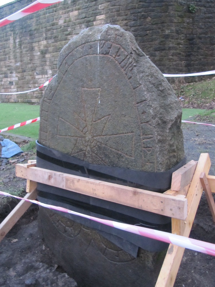
Edinburgh Runestone submitted by Anne T on 7th Jan 2018. The Runestone seen by clambering up the steep muddy track from Princes Street Gardens, just below the Castle Esplanade. The runes read: ""Ari engraved this stone in memory of Hialm his father. God help his soul."
(View photo, vote or add a comment)
Log Text: New site of the Edinburgh Runestone (not been moved yet): As we were going to a building near to hear, we thought we’d do a detour to this part of the University.
We wandered around George Square first of all, but only found a modern sculpture called The Dreamer. We then identified 50 George Square (taken from the BBC article about the relocation of the stone), but only spotted a large hole in the middle of a square flower bed, hedged by low privet, around the side of the building. Having walked all around it, we went into check and I asked the security guard at the reception desk. He told us the stone hadn’t yet been moved, but the hole had been dug in preparation. I thanked him and went to take a photograph of the new site.
St Andrew's Church (Heddon on the Wall)
Trip No.99 Entry No.1 Date Added: 23rd Sep 2018
Site Type: Ancient Cross
Country: England (Northumberland)
Visited: Yes on 19th Sep 2018. My rating: Condition 3 Ambience 5 Access 4
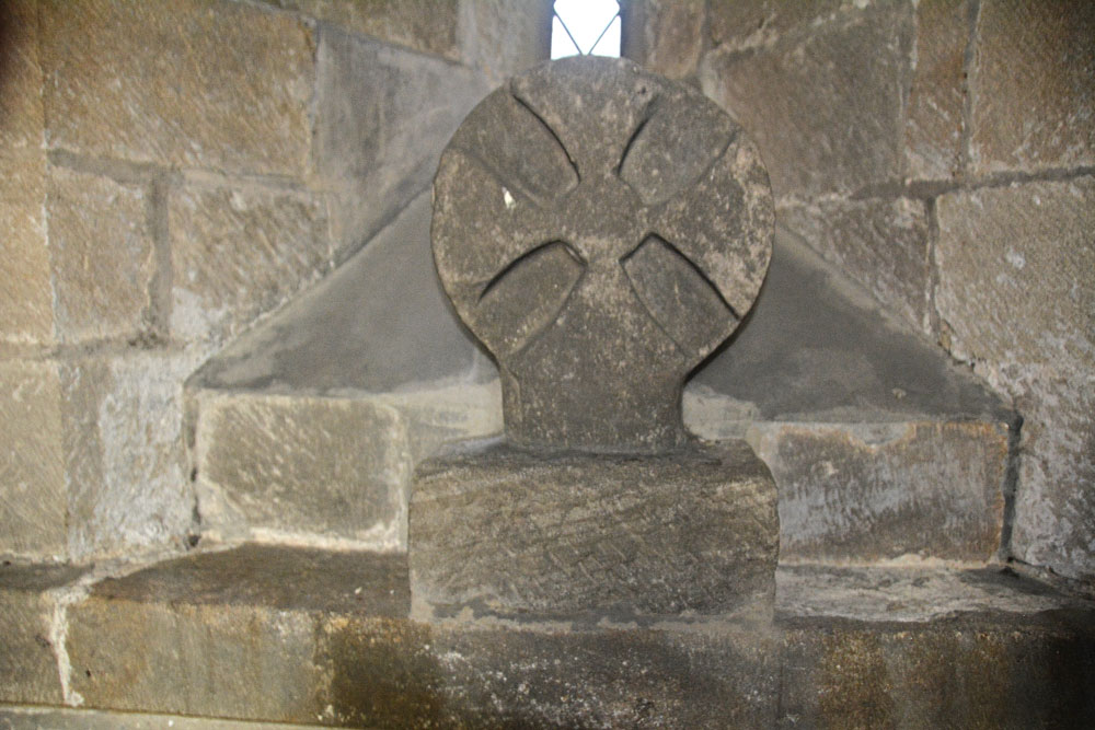
St Andrew's Church (Heddon on the Wall) submitted by Anne T on 23rd Sep 2018. The Saxo-Norman cross finial (or possibly a grave marker), cemented to the north window sill in the sanctuary of this old church. Found underneath the vestry floor during renovations, this is dated to the eleventh century. See AS Corpus Heddon-on-the-Wall entry for more information.
(View photo, vote or add a comment)
Log Text: St Andrew's Church, Heddon on the Wall: The church is no longer open every day, but we were asked to go along to Holy Communion at 10.30am on a Thursday and stay and enjoy the church afterwards. A very kind lady called Ann showed us round (I think she mentioned her husband was the historian), and I got proper photographs of the Anglo Saxon Cross Head in the Sanctuary this time (last time I visited I wasn’t aware this was an old piece, just thought it was an architectural fragment).
There are a number of other really interesting fragments on the west window sill of the meeting room. I really love the way the arches between the nave and chancel and chancel and sanctuary have settled over the years. Wonderful place! Would have loved to have wandered around this church on my own.
St Bartholomew's Church (Whittingham)
Trip No.100 Entry No.1 Date Added: 24th Sep 2018
Site Type: Ancient Cross
Country: England (Northumberland)
Visited: Yes on 23rd Sep 2018. My rating: Condition 3 Ambience 4 Access 4
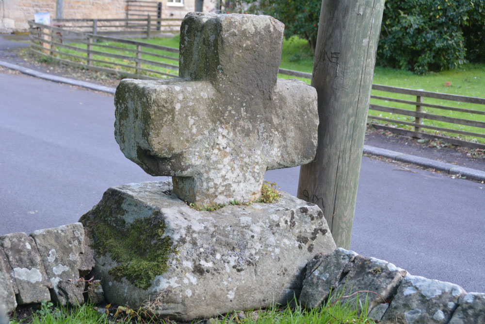
St Bartholomew's Church (Whittingham) submitted by Anne T on 24th Sep 2018. Looking south east across the cross head and base, showing its slightly damaged/chipped lower arm (towards the centre, left of the photo). Historic England simply says the cross is 'medieval'.
(View photo, vote or add a comment)
Log Text: Ancient Cross, St Bartholomew's Church, Whittingham: [please note: there are steps up to the churchyard and church; there may be wheelchair access which we didn't spot on the day - please check before visiting]. This cross was remarkably easy to spot, as it was sited on the corner of the wall to the south east of the churchyard, right by a parking spot for one car at the base of the steps into the churchyard.
There was an informative church guide, although the language was slightly archaic and we had to re-read several of the passages to ensure we were interpreting these correctly.
The guide reads: “Whittingham [spoken as “Whitingjum”, or “Witnjum”] is a name which has evolved from the Anglo Saxon Hwita-ing-ham, meaning “the home of Hwita’s people”. The present church stands on rising ground which could have been the meeting place of Hwita’s people for their Moots before it became the site of a church.
Our visit was interrupted by two people coming in to prepare for the 4pm service. As they were praying at the altar, it seemed disrespectful to continue taking photographs.
The church guide is very useful in explaining all the features, and I’ve emailed one of the church wardens to see if it’s possible to get hold of a copy of the detailed guide mentioned both in the church and on one of the websites I’ve visited (the Northern Vicar’s blog).
There is still Saxon work to be seen in the tower, with its semi-circular arch and squared, heavy side, dated to 900AD by the ‘long and short’ stone work (as we saw at Heddon on 20th Sept, last week).
There is also a section of Saxon stonework in the north aisle wall, forming what would have been a half-arch which was later filled in, and it thought to be the entrance to a small side chapel in the original church.
The guide goes onto say: “Almost certainly there had been another earlier church built on this site, but its possible form can only be conjectured (see the detailed guide). There is a record of a consecration at 735AD. It is also likely there was a yet earlier church existing at the time of the Synod of 684AD.
The guide also mentions, as one of the ‘curios’ a stone on the aisle walling to the left of the porch, at the wall’s left hand corner. Just to the right of the top of the buttress is a stone bearing two arrows (Norman chevrons). “This could be an inserted fragment from some demolished structure [or are these natural fault lines in the stone?].
We popped across the road to see the still working water fountain, although this is too recent a feature to log on the Portal.
