Contributory members are able to log private notes and comments about each site
Sites Anne T has logged. View this log as a table or view the most recent logs from everyone
Askrigg Cross
Trip No.144 Entry No.6 Date Added: 13th Aug 2019
Site Type: Ancient Cross
Country: England (Yorkshire (North))
Visited: Yes on 8th Aug 2019. My rating: Condition 3 Ambience 3 Access 5
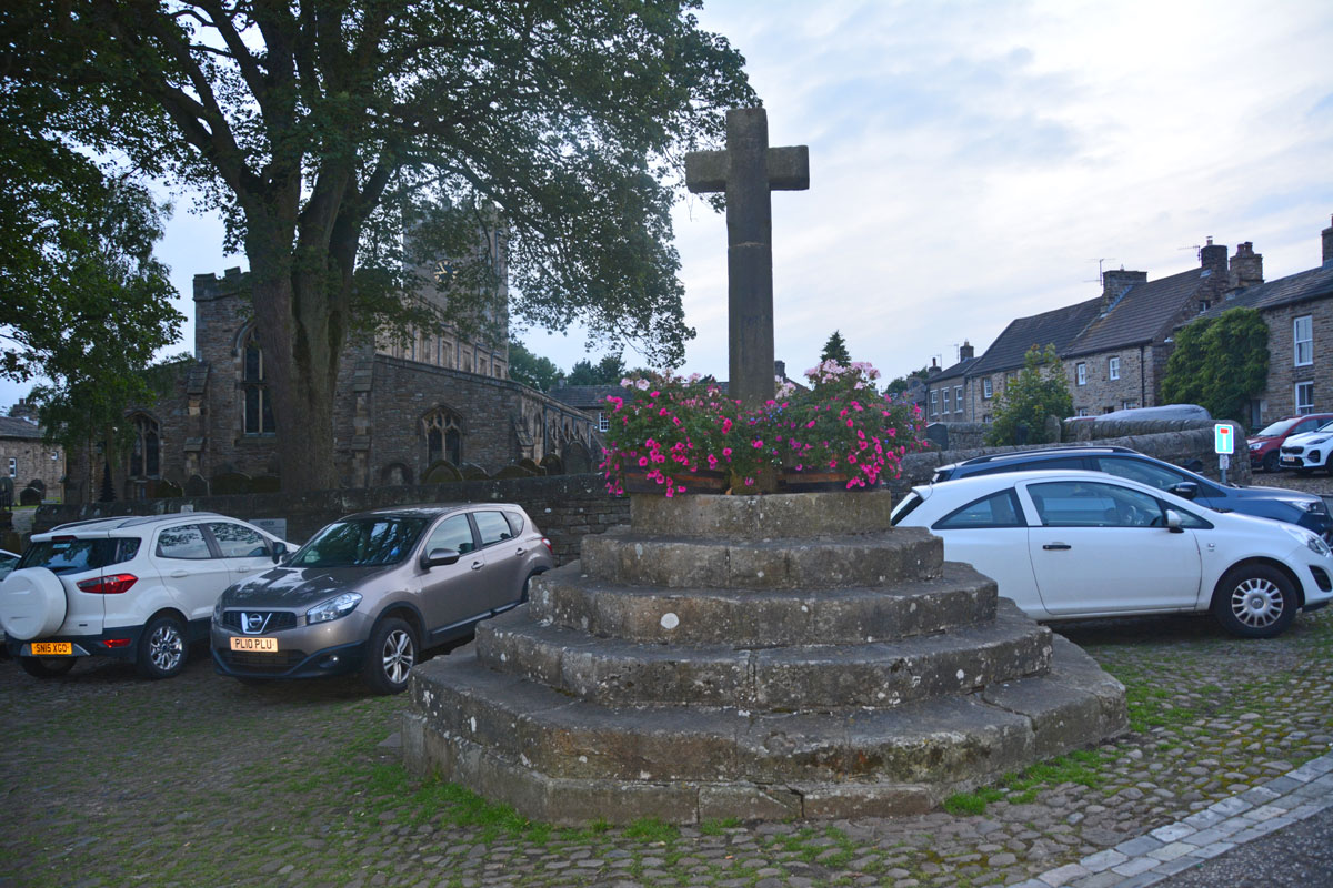
Askrigg Cross submitted by Anne T on 13th Aug 2019. The market cross, looking west towards the church in Askrigg. The shaft dates from 1830, but the steps are 16th century, possibly earlier. Picture taken as dusk was rapidly falling, so not brilliant!
(View photo, vote or add a comment)
Log Text: Askrigg Market Cross and Water Pump: It was dusk by the time we arrived back in Askrigg, and just as I started to take photographs, a large Tesco ‘click and collect’ van pulled up right next to the cross. Typical. With all the cars parked around what must have been the old village green, it wasn't a brilliant spot to linger.
Stanwick Hillfort
Trip No.10 Entry No.3 Date Added: 26th Feb 2017
Site Type: Hillfort
Country: England (Yorkshire (North))
Visited: Yes on 19th Feb 2017. My rating: Condition 3 Ambience 4 Access 5
Stanwick Hillfort submitted by rich32 on 2nd Oct 2006. Stanwick is one huge site, if you could walk round the ramparts you’d cover about 4miles & internally you’ve got 750 acres to get lost in.
The earliest evidence dates the fortifications from the mid to late Iron Age, with occupation waning towards the end of the 1st century AD. It’s likely to have been an important stronghold for the Brigantes & may have been the home of queen Cartimandua, who ruled at the time those chaps from Rome visited.
Theres bundles of evidence from other per...
(View photo, vote or add a comment)
Log Text: Stanwick Iron Age Fortifications:(note: whilst the main entrance of this enclosure can be driven to, getting onto the monument could be difficult because of the short climb to the top of the bank). We'd been in this area before, but to the churches of Stanwick St John and Forcett, to see the Anglo Saxon crosses. It was almost dark at the last visit, so I was glad to be able to see the site properly, although it is so large, it's only possible to glimpse parts. We managed to park opposite the main English Heritage entrance (with signpost), avoiding the myriads of walkers and horse riders who passed the site without seeming to take notice.
There are some quite steep wooden steps up to the top of the bank (the soil around has been eroded, so these (what look like) railway sleepers have been put in to aid walkers). These lead onto the top of the bank which is heavily overgrown with trees and shrubs, with ditches on both sides. About 100 metres into the walk northwards along this embankment, it opens out with a very steep ditch down into what looks like a quarried area. The Pastscape notes say the ditch was built into bedrock, but this looks like a modern quarry.
The bank carries on for quite a way, and from the road, you can trace its line curving round to a farmhouse in the distance, but the tree roots make it quite difficult to walk. On the opposite side of the road, the bank can be seen extending into the far distance, towards Forcett.
We drove slightly further up the road, and at the road junction for Aldbro and Stanwick, you could see more fortifications heading off into the distance. As usual, it was getting to be dusk by this point and we wanted to find the Roman bridge at Piercebridge, so headed off. Shame most of this Iron Age monument was on private land. It really would have been great to wander along/next to these defences. What a huge area it covers!
Scots Dyke (Olliver)
Trip No.10 Entry No.2 Date Added: 26th Feb 2017
Site Type: Misc. Earthwork
Country: England (Yorkshire (North))
Visited: Yes on 19th Feb 2017. My rating: Condition 3 Ambience 4 Access 4
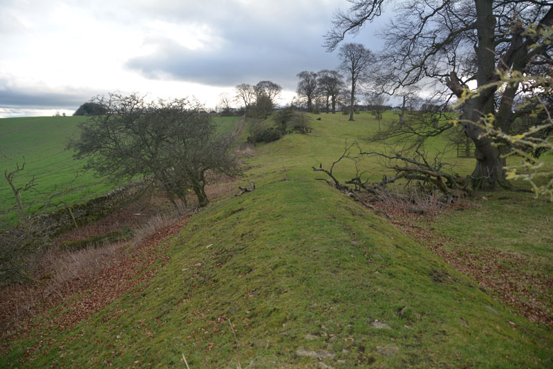
Scots Dyke (Olliver) submitted by Anne T on 26th Feb 2017. To the south of the trackway, the dyke runs for some 400 metres, with a ditch on either side.
(View photo, vote or add a comment)
Log Text: Scots Dyke (Olliver): From Scots Dyke at Easby, heading back into Richmond, we took the B6274 to Gilling West, turning off to the right to Olliver Cottages. Here, opposite Olliver Cottages, is a small (appears to be public) car park. Walking up the track towards Olliver itself (a large farm and prestigious office premises), after 400 metres, the track turns slightly to the right and goes up a shallow hill, transecting the dyke.
Facing up hill, the dyke the left-hand side dives down a steep hill and is transected by a farm house. Beyond the farm, looking northwards, a smaller section of the dyke can be seen at the field edge. To the right-hand side, the dyke continues for several hundred metres. The ditch is very steep at some points (Pastscape says 7 metres at the northern end). Standing on top of the dyke, looking eastwards, there are great views back to the A1 and beyond.
Looking more closely at the banks, they are made up of medium and large size stones, packed with earth. Under one tree was a small marker and stone - a treasured pet's burial place?
Scots Dyke (Easby)
Trip No.10 Entry No.1 Date Added: 26th Feb 2017
Site Type: Misc. Earthwork
Country: England (Yorkshire (North))
Visited: Yes on 19th Feb 2017. My rating: Condition 2 Ambience 3 Access 4
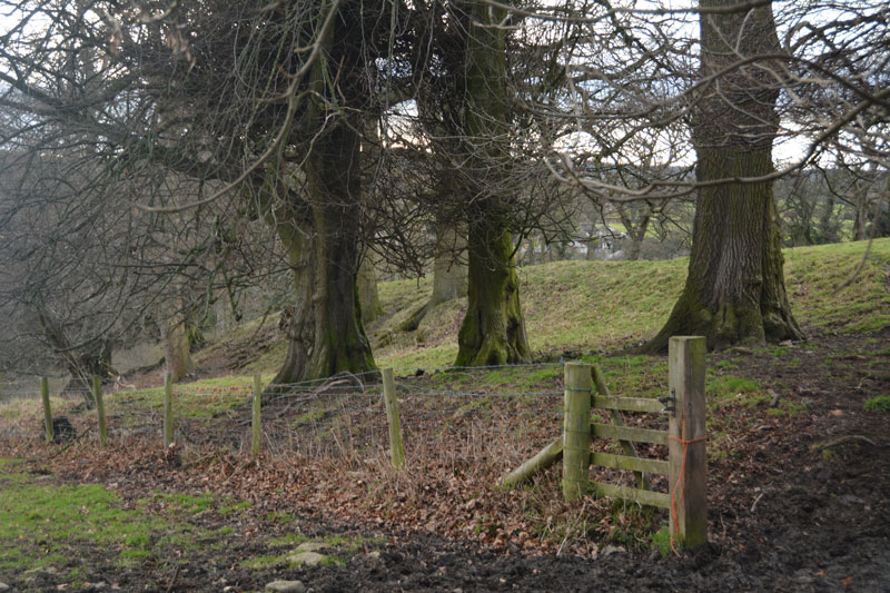
Scots Dyke (Easby) submitted by Anne T on 26th Feb 2017. This small section of Scots Dyke, south of Sandford House, can be seen as a bank about 2 metres tall, flanked by trees. This photo was taken from the layby next to it, where there were lovely views down to Easby Abbey and the River Swale.
(View photo, vote or add a comment)
Log Text: Scots Dyke (Easby): Having purchased our map (one of the few we don’t already possess), we headed off eastwards from Richmond, down the minor road passing through Anchorage Hill towards Brompton-on-Swale. Just past St. Nicholas, there is a right hand turn towards Easby. Turning down this road, there is a layby within 20 metres of the junction. With a lovely view south to the River Swale and Easby Abbey, our first sight of the dyke was within a few metres west of this layby – an earthwork bounded by relatively young trees.
Having photographed this small section as best I could (the gate was padlocked), I clambered round a tree, avoiding the deep rabbit holes.
There is a second section of the dike across the road, which Pastscape tells us runs for 360 metres south of the Darlington Road to Sandford House (monument 1034723), east of Whitefields Farm. From the layby on the lane leading down to Easby, on the opposite side of the road, a footpath leads to the left of Sandford House, and runs over the top of the dyke for some way. Heading northwards, the bank with its ditch to the east, there is a new build housing site to the west. Not a great ambience. We wondered how many of the new residents would know they were living next to an ancient monument.
Fat Betty
Trip No.15 Entry No.4 Date Added: 10th Apr 2017
Site Type: Ancient Cross
Country: England (Yorkshire (North))
Visited: Yes on 9th Apr 2017. My rating: Condition 3 Ambience 4 Access 5
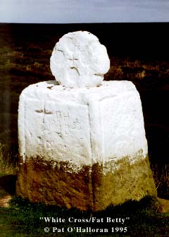
Fat Betty (White Cross) submitted by kelpie on 9th Jun 2002. NZ 68224 02001
This is reported as both a standing stone and a moorland cross (I prefer the latter).
(View photo, vote or add a comment)
Log Text: Fat Betty's Cross, Danby High Moor, North Yorkshire: From Wolf Pit Tumulus, carrying on down the road (New Way) over Danby High Moor, past the curiously named Lower Fryup Dale to the east, then over Seavey Hill, passing by the modern standing stone (Millennium Stone) at NZ 69699 01296, we turned west towards Rosedale Head. Where the Esk Valley Way crosses this road, there is a small, squat White Cross located to the north. Just a few metres up the Esk Valley Way footpath, stepping over a muddy ditch, we got the full force of the wind sweeping across this moorland. From a leisurely, warm lunch in Castleton an hour earlier, the temperature had dropped considerably, and I wished I’d brought a warmer coat!
The head of the cross bears four small circles on both sides, reminiscent of Anglo Saxon cross heads. There is considerable graffiti on the stone, together with offerings (see image of money at bottom of cross head).
Just over the road is Young Ralph’s Cross.
Young Ralph Cross
Trip No.15 Entry No.5 Date Added: 10th Apr 2017
Site Type: Ancient Cross
Country: England (Yorkshire (North))
Visited: Yes on 9th Apr 2017. My rating: Condition 3 Ambience 4 Access 5
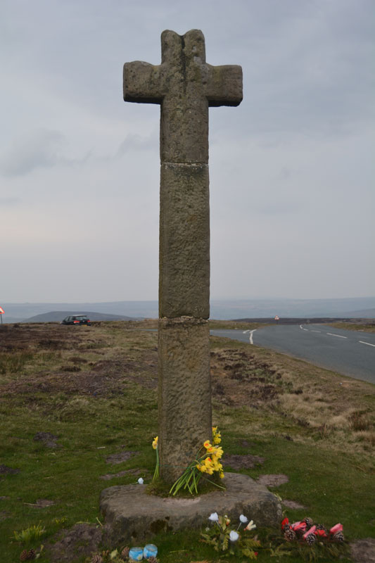
Young Ralph Cross submitted by Anne T on 10th Apr 2017. The Young Ralph Cross sits close to the side of the road on Ledging Hill.
(View photo, vote or add a comment)
Log Text: Young Ralph Cross, Ledging Hill, North Yorkshire: Just down the road from Fat Betty Cross/White Cross, Young Ralph’s Cross sits almost opposite the road junction of the minor road (Knott Road) to Rosedale and the road northwards across Castleton Rigg to Castleton.
Turning right at the road junction, we parked on the minor road leading north west towards Westerdale. This road was very busy, and traffic moved very fast. Whilst standing at Fat Betty, I heard several cars sounding their horns at each other.
From a distance, this cross looks as if it is made out of concerete, but the Historic England entry says this wayside cross possibly dates from the 11th century. The cross base looks much, much older than the shaft and head.
The Historic England entry talks about much weathered interlace ornament and cable moulded border. I couldn’t see any of this, perhaps put off a closer look by the biting wind and cold.
I was keen to try and find the Old Ralph Cross, but by this time it was late, we were cold and it was time to head off home. There is so much to see in this area, it would be well worth a repeat visit.
Millennium Stone Danby High Moor
Trip No.15 Entry No.3 Date Added: 10th Apr 2017
Site Type: Modern Stone Circle etc
Country: England (Yorkshire (North))
Visited: Yes on 9th Apr 2017. My rating: Condition 3 Ambience 3 Access 5
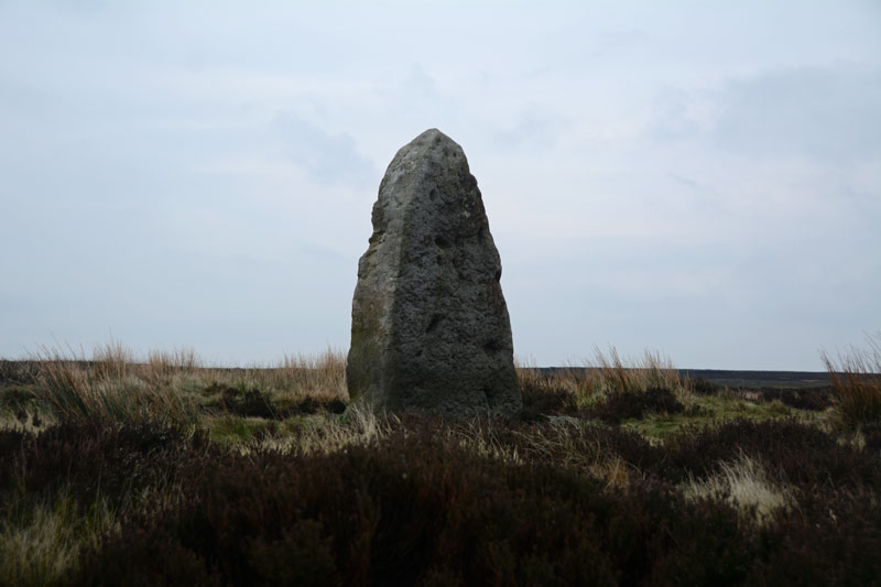
Millennium Stone Danby High Moor submitted by Anne T on 10th Apr 2017. Standing at the road junction of the moorland road from Ainthorpe and Knott Road, this stone sits over a metre above you.
(View photo, vote or add a comment)
Log Text: The Millennium Stone, Danby High Moor, North Yorkshire: Driving at a sedate pace along the moorland road from Wolf Pit Tumulus (which I realised as we got a phone signal back, that we’d picked up the wrong monument), I was really surprised to see what looked like a large standing stone at the junction of Knott Road. Immediately to our left was a small car park with an interpretation board (which didn’t mention this stone), and I spent a good half hour on the internet at home trying to find anything at all about it, which was a brief mention on the Hidden Teesside web site.
Getting out of the car to look more closely at this stone, my fleece and camera were almost blown away by the wind. The temperature had dropped from high teens to single figures in a very short while. I was glad to get back into the car, but pleased to have 'discovered' a stone not (yet) on the map! Next stop was the second 'White Cross' of the day - later discovered to be called 'Fat Betty'.
Three Howes Rigg (West)
Trip No.15 Entry No.2 Date Added: 11th Apr 2017
Site Type: Round Barrow(s)
Country: England (Yorkshire (North))
Visited: Yes on 9th Apr 2017. My rating: Condition 2 Ambience 3 Access 5
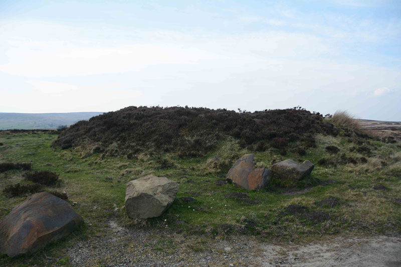
Three Howes Rigg (West) submitted by Anne T on 11th Apr 2017. The larger of the two round barrows on the western side of the road at Three Howes Rigg. The larger boulders presumably stop people from parking and destroying the site, although it creates a handy layby to stop and enjoy all five of the barrows at this location (bar the traffic speeding by!). Sited at NZ 68106 10279.
(View photo, vote or add a comment)
Log Text: Three Howes Rigg (West), Smeathorns Road, North Yorkshire: Despite being called ‘Three Howes’, there are actual 5 barrows in total! It would be easy to whizz by these barrows, as they appear as slight mounds at the top of the ridge. With cars speeding by at a good 60mph or so, it’s difficult to slow down and park, but there is a space between the two barrows on the western side of the road, flanked by large boulders to protect the fourth and fifth barrows.
Once identified, they are obvious in the landscape. Having first stopped at White Cross some 500 metres to the north, being on access land, we tramped over the heather and moorland to take a closer look.
We started with the two barrows to the west of the road and worked our way northwards. The northern-most has been cut slightly by the road to its eastern side; the southern-most was heavily covered in calf-high bracken. We missed the inscribed stone in the middle of this one, but the carving seems to be relatively modern, looking at the Historic England entry.
Three Howes Rigg (East)
Trip No.15 Entry No.2 Date Added: 11th Apr 2017
Site Type: Round Barrow(s)
Country: England (Yorkshire (North))
Visited: Yes on 9th Apr 2017. My rating: Condition 3 Ambience 3 Access 5
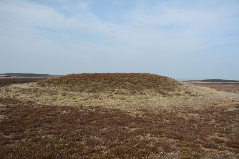
Three Howes Rigg (East) submitted by Anne T on 11th Apr 2017. The northern-most, most visible, of the three barrows on the eastern side of Smeathorns Road. As seen from the road.
(View photo, vote or add a comment)
Log Text: Three Howes Rigg (East), Smeathorns Road, North Yorkshire: Having stopped at White Cross and Three Howes Rigg (West) first, and having 'got our eye in', these barrows rise from the surrounding ground on access land. On the eastern side of Smeathorns Road, and clearly visible on UK Grid Finder, tramping across the heather moorland was easy on the feet.
Now largely used to feed the grouse (full feeding dishes on the tops of these barrows), they diminish in height from the north to the south. There is a fourth mound to the east of the middle barrow, but this looks more like a farmer's spoil heap rather than a barrow, and I couldn't find any reference to it on Pastscape or Historic England.
Looking at the map, there are so many barrows, crosses and other features around here, I'd like to spend more time in this area.
Wades Stone (South)
Trip No.159 Entry No.3 Date Added: 6th Mar 2020
Site Type: Standing Stone (Menhir)
Country: England (Yorkshire (North))
Visited: Saw from a distance on 4th Mar 2020
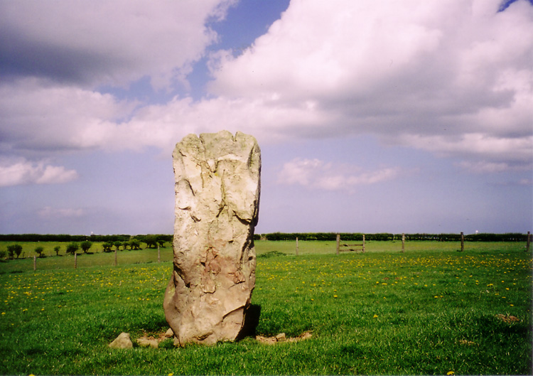
Wades Stone (South) submitted by DavidRaven on 13th May 2005. The southern Wade's Stone, looking north.
(View photo, vote or add a comment)
Log Text: Wades Stone (South): As per our last visit, we were unable to find anyone to ask at the now Council Depot (not the Outdoor Centre as marked on the map), and couldn't see any field access into the field containing the stone, either from the corner of East Barnby Lane and the A171 (at NZ 82845 13203), or off the main road. As there were other sites we were really keen to see, we drove on without making an attempt to see this stone. Shame.
Lady Well (Kirklington)
Trip No.161 Entry No.1 Date Added: 7th Jun 2021
Site Type: Holy Well or Sacred Spring
Country: England (Yorkshire (North))
Visited: Yes on 31st May 2021. My rating: Condition 3 Ambience 4 Access 4
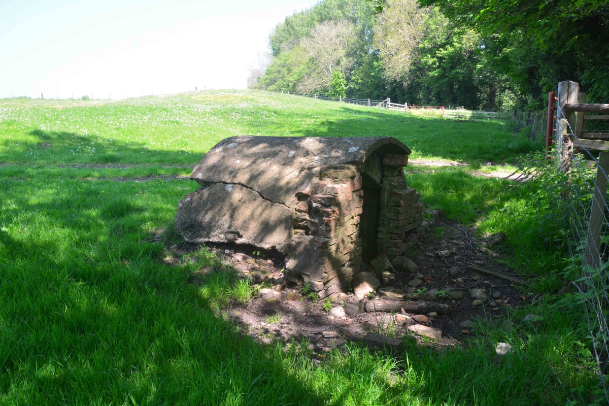
Lady Well (Kirklington) submitted by Anne T on 6th Jun 2021. View of Lady Well, Kirklington, from just to its western side. The remains of building platforms from the now deserted medieval village of Yarnwick lie above, and to the left of, the well house.
(View photo, vote or add a comment)
Log Text: Lady Well (Kirklington): our first site, in our first day out for 15 months. What a delightful location, although a shame the well house itself is crumbling and full of rubbish.
With the site of the deserted medieval village of Yarnwick in the same field, and to the north of, the well, it was a delight to be back in the countryside again
I stopped to photograph a second, now capped well, presumably the well supplying the farmhouse, at SE 31634 81303.
St Alkelda's Holy Well
Trip No.19 Entry No.6 Date Added: 29th Apr 2017
Site Type: Holy Well or Sacred Spring
Country: England (Yorkshire (North))
Visited: Yes on 27th Apr 2017. My rating: Condition 2 Ambience 1 Access 4
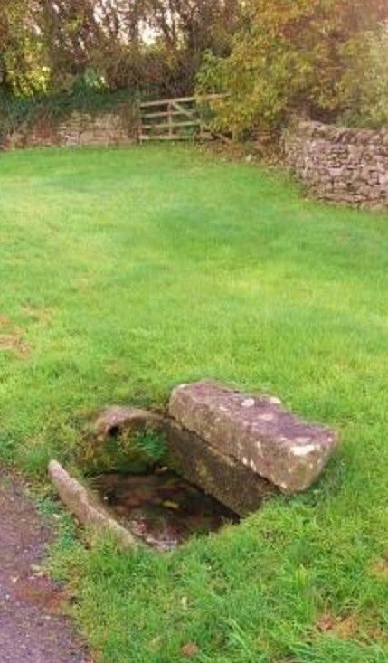
St Alkelda's Holy Well submitted by Sunny100 on 27th May 2010. St Alkelda's Holy Well at SE.124879. Square-shaped stone tank (now dried-up)
(View photo, vote or add a comment)
Log Text: St. Alkelda's Well, Middleham: How tragic – a now dried up well, completely uncared for.
From St. Mary’s and St. Alkeld’s church, I was determined to find St. Alkeld’s Well. Armed only with the mobile phone, OS maps and the grid reference from Pastscape, we set off westwards across the fields, through the gate in the churchyard across a grassy field with a play area at the far end, through a gate leading into where St. Alkeld’s Road and The Springs meet, then through a stile into a grassy field. Measuring the distance between the church porch and the well, the distance is just under 250 metres.
We walked past the well without realising it, thinking it was only a pile of stones and rubble that someone had tossed over their garden wall. On checking the grid reference, we walked back to it.
Having seen the image of the trough by the roadside on both the Portal and Yorkshire Holy Wells, we searched in vain, eventually walking back to The Springs and looking down the driveways. The well is sited at the bottom of the gardens of the two small houses, one called ‘Well Cottage’. Having taken some photographs, we followed the footpaths back into the town centre, ending up at a medieval cross at SE 12607 87679 (see on a previous visit).
St Mary and St Alkelda
Trip No.19 Entry No.5 Date Added: 29th Apr 2017
Site Type: Ancient Cross
Country: England (Yorkshire (North))
Visited: Yes on 27th Apr 2017. My rating: Condition 3 Ambience 4 Access 4
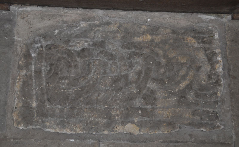
St Mary and St Alkelda submitted by Anne T on 29th Apr 2017. We were unable to get into the church on 27th April 2017, as evensong was in progress, but I found a photograph of this cross shaft embedded in the floor of the nave from a previous visit on 19th August 2013. I am doing some more research to determine the date of this fragment.
(View photo, vote or add a comment)
Log Text: Anglo Saxon Cross Fragment, Middleham: On the way to the holy well, we stopped off to look at the porch of St. Mary’s & St. Alkeld, but evensong was one, so we couldn't go inside but carried on westwards through the churchyard into the fields beyond to find St. Alkelda’s Well.
At home (29th April) reading through the entry from British Listed Buildings, I noted there was mention of a cross shaft fragment built into the floor of the nave. I looked up my photographs from 19th August 2013, when we’d had a holiday cottage not far away, at a time when we weren’t looking for Anglo Saxon cross fragments, and there was one photograph.
After a brief look around the exterior of the church, we carried on through the churchyard to find the site of St. Alkelda's Well.
All Saints (Ingleby Arncliffe)
Trip No.19 Entry No.1 Date Added: 29th Apr 2017
Site Type: Ancient Cross
Country: England (Yorkshire (North))
Visited: Yes on 27th Apr 2017. My rating: Condition 3 Ambience 3 Access 5
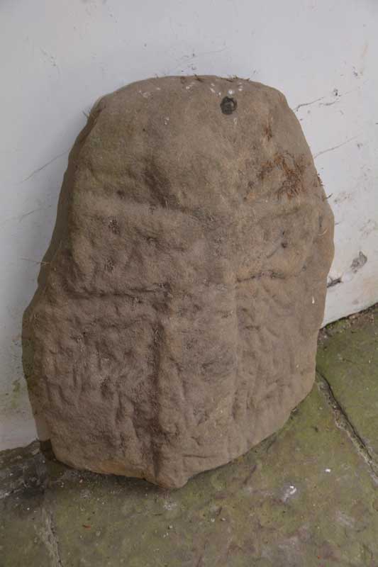
All Saints (Ingleby Arncliffe) submitted by Anne T on 4th Aug 2015. This is the cross which can be found leaning against the north wall of the porch of All Saints, Ingleby Arncliffe. The porch is at the base of the tower.
(View photo, vote or add a comment)
Log Text: Cross fragments (not found), Ingleby Arncliffe, North Yorkshire: We last visited here on 28th July 2015, but the church was locked and I’d arranged for the church warden, to unlock the church for us, although when I’d mentioned the Anglo Saxon fragments to the vicar, he’d replied “this doesn’t sound much like our church.” The stone cross is still located in the porch, shut behind a metal railing door to keep it safe.
Inside, the church is very simple and plain, furnished with box pews, now painted a dusky, dark rose pink. The effigies placed either side of the altar are interesting, together with some stained glass in the east window, which the Yorkshire Moors Gazeteer says represents the Fauconberg and St Quintin families. One of the effigies is of Sir William Colvill, the other of his brother, Robert. These effigies are both in armour with ailettes, and hold hearts in their hands. The British Listed Buildings entry for Ingleby Arncliffe says the ailettes (the origin of modern epaulettes) is a 'very rare feature'.
The vestry was locked, so we couldn’t get in. We also hunted high and low around the tower for possible cross fragments. I took photographs and have since enlarged them using Photoshop, but these only show weathered sandstone.
A disappointing visit, but we tried to find these cross fragments.
St Helen's Church (Bilton-in-Ainsty)
Trip No.19 Entry No.2 Date Added: 1st May 2017
Site Type: Ancient Cross
Country: England (Yorkshire (North))
Visited: Yes
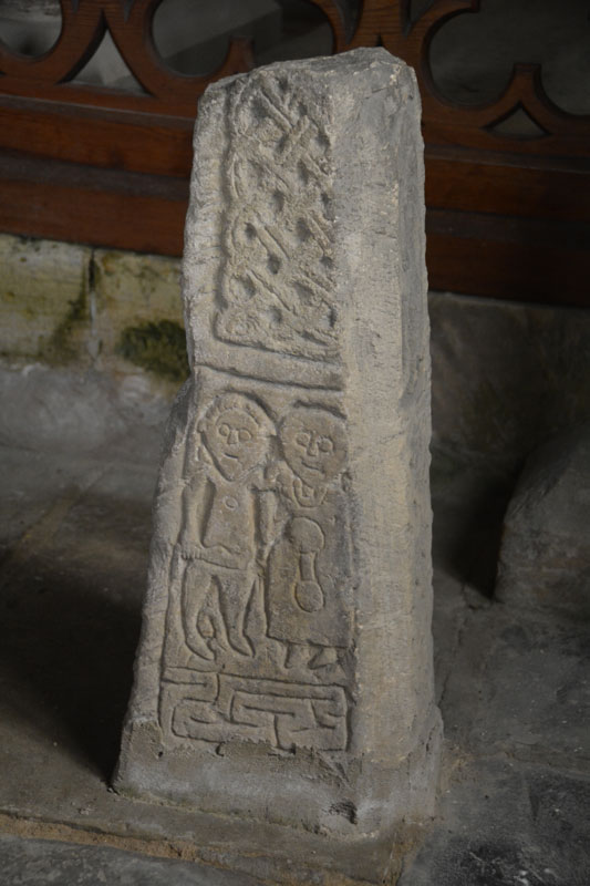
St Helen's Church (Bilton-in-Ainsty) submitted by Anne T on 1st May 2017. The southern face of the eastern-most shaft fragment in the south-east chapel. Said to depict Abraham sacrificing Moses.
(View photo, vote or add a comment)
Log Text: Anglo Saxon Crosses, St. Helen's Church, Bilton-in-Ainsty: We’d tried to visit this church before, but because there was no vicar in post, the church was kept locked. Emails to the York Diocese weren’t helpful.
Knowing we were coming down to Ingelby Arncliffe again, I checked on A Church Near You, and have been corresponding with the vicar, the Reverend Richard Battersby. In the last communication I had with him, he said he had set up a mother and toddler group on a Thursday morning, which met between 10 am and 11.30am. An email to enquire if it was OK to call in after this (so as not to clash with the M&T group) and drop the key off after had no reply, so I phoned and spoke to his mother, who told me the Bishop had sent him to an event so he wasn’t around.
There were three crosses in the small chapel at the south-east end of the church, next to a very interesting set of mass dial/scratch clocks and old graffiti. There was the lovely effigy of a woman in the sanctuary.
I waited until the M&T group had finished before taking photos of the wheelhead cross at the west end of the church. Even though it was a dull day, this proved difficult to get a good image of because the light streamed in above it. In the end, I had to use the flash to compensate. I was unable to get to the notes as the group was closing up and moving everything out of the church, so I grabbed a guide book, thanked them for letting me ‘barge in’ and quietly left.
The Rev. Battersby also recommended visiting Healaugh Church, although we didn’t have time today. Next stop was Bardsey near Leeds.
St Gregory's Church (Bedale)
Trip No.23 Entry No.1 Date Added: 14th May 2017
Site Type: Early Christian Sculptured Stone
Country: England (Yorkshire (North))
Visited: Yes on 11th May 2017. My rating: Condition 3 Ambience 4 Access 5

St Gregory's Church (Bedale) submitted by Sunny100 on 17th Aug 2010. Arched-shaped fragment of a 9th century Viking hogsback tombstone in the crypt of St Gregory's church, Bedale. The carving could depict Christ's crucifixion, or it could be The Tree of Life.
(View photo, vote or add a comment)
Log Text: Anglo-Danish stones, St. Gregory's, Bedale: We’d been to St. Gregory’s a long time ago, but the stone fragments had just been moved into the crypt at the advice of North Yorkshire Police because one stone had been stolen.
So as not to be disappointed this time, I’d been corresponding with ‘Rev Robb’ (Rev. Ian Robinson) to make an appointment to get into the crypt. At the time I’d last contacted him, it was just before Easter. He offered the date of 27th May, when a group was also visiting. I elected to leave it until he returned from holiday, and arranged 11th May, with us attending Holy Communion at 10am, staying on to look round the church and be shown the stones.
The parishioners made us very welcome indeed. After the service, Rev. Robinson came and introduced us and took us round to the crypt (which is on the outside of the church – I’d had visions of climbing down dusty, steep steps!), with a step down into the crypt, which is built under the altar in the sanctuary (note: later exploring the church, climbing up the steps to this altar, you are at least 6 to 8 feet above the congregation; it would not be good if you missed one of the steps!).
I gave Rev. Robinson a printout of the Portal page with the drawings. First of all he told me that since he’d been vicar here (for 6 years) there had only been the two stones – one had ‘gone missing’ and weren’t sure of it’s location (possibly Durham Cathedral?). He helped me identify the half torso. Because of the story associated with this stone, he was torn between keeping the stone because of it’s non-Christian origins vs being part of the church’s history.
The church guide says “A Viking myth tells of a man called Weland (pronounced Wayland), a highly skilled smith. He is captured by a king, who has his hamstrings cut to prevent him from escaping; but he escapes on a flying machine he has made. The caring on the stone …. Shows part of Welland on his machine. You can make out the fan shaped tail and one of the wings as well as his feet, legs and body bound together by Celtic knots. On the ned of the tombstone are the remains of a nativity scene ….. this is part of a hogback tombstone dating from the 10th century. In 2003 it was rediscovered in the crypt and has been identified as the Weland stone of which there are only three known examples in this country. The others are in Leeds Parish church and Sherburn Church, near Filey.”
The other stone “was part of a column or pillar, (and) is a good example of Anglian knotwork.”
Also in the crypt is a curious staircase which leads up to the side of the altar. We were told this was for the Chantry monks to go straight up to the main body of the church. There was also a small ‘arms column’ locked with three enormous, hand-made padlocks. In the vestry, there were numerous examples of chests locked with three keys (each needing a different key). There are five effigies; four at the west end of the nave, one in the vestry. The staircase to the bell tower had a portcullis (you can still see where it used to be raised up), and looking up into the tower there is a hatch; above this, the Reverend told us there was a room with a guard-robe and a fireplace.
All Saints (Pickhill)
Trip No.23 Entry No.2 Date Added: 16th May 2017
Site Type: Ancient Cross
Country: England (Yorkshire (North))
Visited: Yes on 11th May 2017. My rating: Condition 3 Ambience 4 Access 5
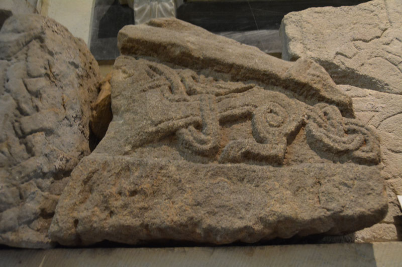
All Saints (Pickhill) submitted by Anne T on 16th May 2017. This piece of hogback shows the remains of a monster with an elaborately knotted tail.
(View photo, vote or add a comment)
Log Text: Hogback and Cross Fragments, Pickhill, North Yorkshire: This church was recommended by ‘Rev Robbo’ (Reverend Ian Robinson) of St. Gregory’s, Bedale, who told us that there was a collection of fragments in the base of the tower. I’d sent an email to the vicar but received no reply, so phoned the number on ‘A Church Near You’ website. The church is open during the day.
The church really is in a lovely location. Going through the lych gate, I was greeted by a mounting block with what looked like an old cross shaft on top, but which was a sundial. On the south wall of the tower there is a very interesting carved beam from the 15th century depicting a hunting scene and a green man.
In the churchyard there are some interesting grave markers. Mentioned in the church guide are 3 markers mentioning the children of the White family, who all died tragically young. The guide also mentions to look out for the mound on which the Norman castle was built.
St Thomas (Brompton)
Trip No.23 Entry No.4 Date Added: 16th May 2017
Site Type: Ancient Cross
Country: England (Yorkshire (North))
Visited: Yes on 11th May 2017. My rating: Condition 4 Ambience 4 Access 5

St Thomas (Brompton) submitted by Anne T on 16th May 2017. These three hogbacks are truly magnificent. Having been buried in the ground for so long, they look as if they have been carved recently. Well worth a visit just to see these, never mind the other cross fragments.
(View photo, vote or add a comment)
Log Text: Hogbacks and Crosses, Brompton, North Yorkshire: This is a visit I’d arranged some time ago, arranging to meet the church warden at 2pm on 11th May (details on the 'A Church Near You' website). The church is kept locked, as we found out when we’d tried to visit a couple of years ago, and I was much looking forward to this return visit.
We were a little late, having stopped to photograph the remains of the motte at Pickill, and having hit a little traffic in Northallerton, but we found the church wardens sweeping up cherry blossom from the porch of the church. We were certainly made very welcome.
There are three complete hogbacks, the carving of which is very crisp, almost as if they had been done yesterday – preserved after having been buried in the ground for so long.
A further two fragments sit, almost hidden, against the north eastern corner of the nave, wedged between an altar, some heating pipes and the wall.
Sitting to the south of these, against the boundary between the nave and the chancel, was a wheel head cross. Another cross sat on the south wall of the chancel, with a further 3 sitting on the southern window ledge of the western wall.
The Cock Shaft sits almost hidden at the back of the pews, in the south west corner of the church, and is named so because there are three cocks on the southern face.
To my surprise, Doreen said there were three further fragments in the external south and east walls of the church, so we hunted for these whilst she spoke to the man repairing the churchyard wall. There are also the remains of a grave marker, now broken in two, placed in separate parts high up on the eastern wall.
We were given the ‘Village Trail’ and also told much interesting history about the linen factories in the village, and started off on the walk to see the village green, Cockpit Hill and the water splash. A great day out.
St Martin's Church (Kirklevington)
Date Added: 9th Aug 2022
Site Type: Early Christian Sculptured Stone
Country: England (Yorkshire (North))
Visited: Yes. My rating: Condition 3 Ambience 4 Access 4
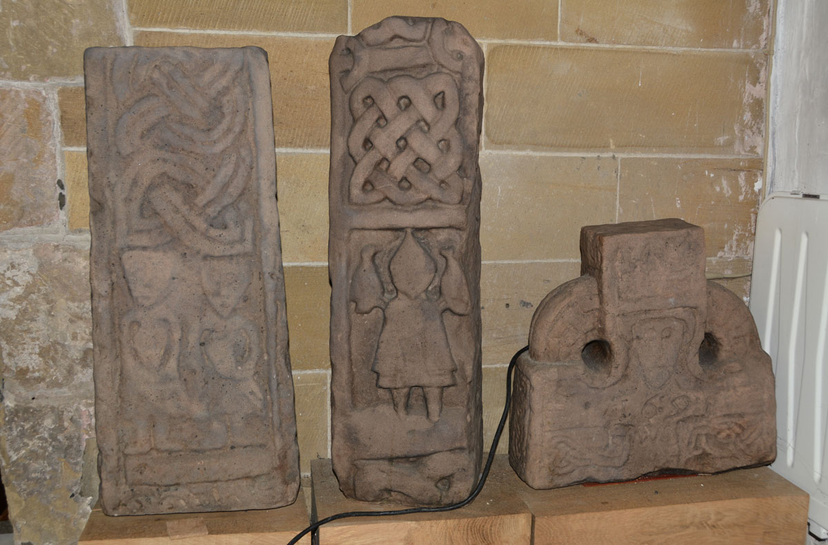
St Martin's Church (Kirklevington) submitted by Anne T on 24th Mar 2020. The three replicas of (left to right) AS Corpus Kirklevington 01, 02 and 15, which sit against the west wall of the chancel. The originals are now in Preston Hall Museum in Stockton. It is a shame these replicas are relatively poor quality; I am looking forward to seeing the originals.
(View photo, vote or add a comment)
Log Text: St Martin's Church, Kirklevington: Visited just before first lockdown was enforced. The church wardens opened the church for us and made us very welcome, but what we didn't know before our visit was that most of the stones are at the Preston Park Museum in Stockton-on-Tees. #
There is obviously some 'bad blood' between the congregation and the museum, as the church warden and the ladies cleaning the church made it very clear they think the stones have been 'stolen' and belong in the church.
Am trying to arrange a visit to the museum at some time in the future.
Glaisdale Rigg Tall Cairn
Trip No.32 Entry No.8 Date Added: 5th Jul 2017
Site Type: Cairn
Country: England (Yorkshire (North))
Visited: Yes on 2nd Jul 2017. My rating: Condition 3 Ambience 4 Access 4
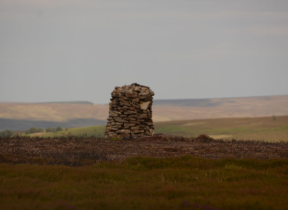
Glaisdale Rigg Tall Cairn submitted by Anne T on 4th Jul 2017. This modern tall dry stone cairn sits about 100 metres east of the Glaisdale Rigg moorland road, 500 metres south of a nearby Trig Point (TP3365 at NZ 74060 04148) and just north of Hart Leap, a Bronze Age boundary feature.
(View photo, vote or add a comment)
Log Text: Glaisdale Rigg Dry Stone Cairn, North Yorkshire: I spotted this whilst we were walking along the road to find Hart Leap. It looks relatively modern (there are lots of grouse shooting butts in the area) but by this late in the evening and after having walked seemingly miles across knee deep heather, my feet and ankles declined to go any further on this uneven ground, so I admired it from a distance.
When I got home, I found out it featured on the North Yorkshire Moors CAM web site from 2001, asking anyone who knew when and why this was built to contact them. I sent an email off to the author who replied virtually by return. He told me they never did find out any information, but he "did read that it was there in 1965."
