Contributory members are able to log private notes and comments about each site
Sites Anne T has logged. View this log as a table or view the most recent logs from everyone
Sewingshields Crags
Date Added: 8th May 2015
Site Type: Stone Row / Alignment
Country: England (Northumberland)
Visited: Yes on 8th May 2015. My rating: Condition 3 Ambience 4 Access 3
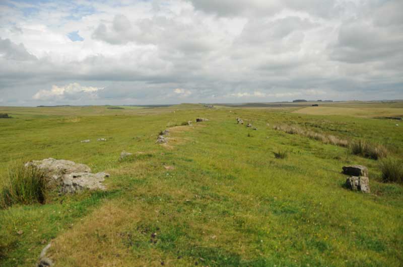
Sewingshields Crags submitted by Anne T on 8th May 2015. The boundary feature as it appears half way along its length, looking east.
(View photo, vote or add a comment)
Log Text: Sewingshields Crags Possible Stone Row, now known to be a boundary feature: I'm putting this on for completeness, as Andy B has added this as a site in it's own right; for my originalvisit report with more details, see Simonburn (Davy's Lee) Stone Circle visit report, 20th July 2014.
Having spotted a group of features on the map that looked interesting: Davy's Lee Settlement, Davy's Lee Stone Circle and various tumuli, we decided to take advantage of the sunshine and walk to this area. The previous weekend, we'd visited Standingstone Rigg, near Great Lonbrough Farm. If we had continued south along the footpath for a couple of kilometres from Standingstone Rigg, we would have reached Davy’s Lee from the north. Instead, we took the opposite approach, from the south, from the old military road (B6318). My husband parked the car by the Old Repeater Station (parking on the Old Military Road being sparse and difficult, with soft verges, lay-by's virtually non-existent and fast-flying cars driving up and down) having dropped me off at the farmhouse 100 yards west from this road junction, on the opposite side of the road, by the footpath up to Sewingshields and Sewingshields Crags. We’ve done this walk before, to see the Roman fishing loughs, but with this walk, we needed to follow the path nortwards past the farmhouses, round the back of Sewingshields Crags to the bottom of the hill, then turn off a track to the left hand side (approx. Grid reference: NY 80653 70820). The track disappears for a while, so we headed left up a bank with what looked like quarried stone at the top, running in a double row running approximately east to west (approx. Grid ref: NY 80393 70793).
Note: at the time of writing, I am going along to this area next week to help survey a group of stack-stands and/or sheilings (12th to 15th) so will have another look at this feature then.
St Mary's Well (New Etal)
Trip No.137 Entry No.2 Date Added: 12th Jun 2019
Site Type: Holy Well or Sacred Spring
Country: England (Northumberland)
Visited: Yes on 29th May 2019. My rating: Condition 1 Ambience 3 Access 4
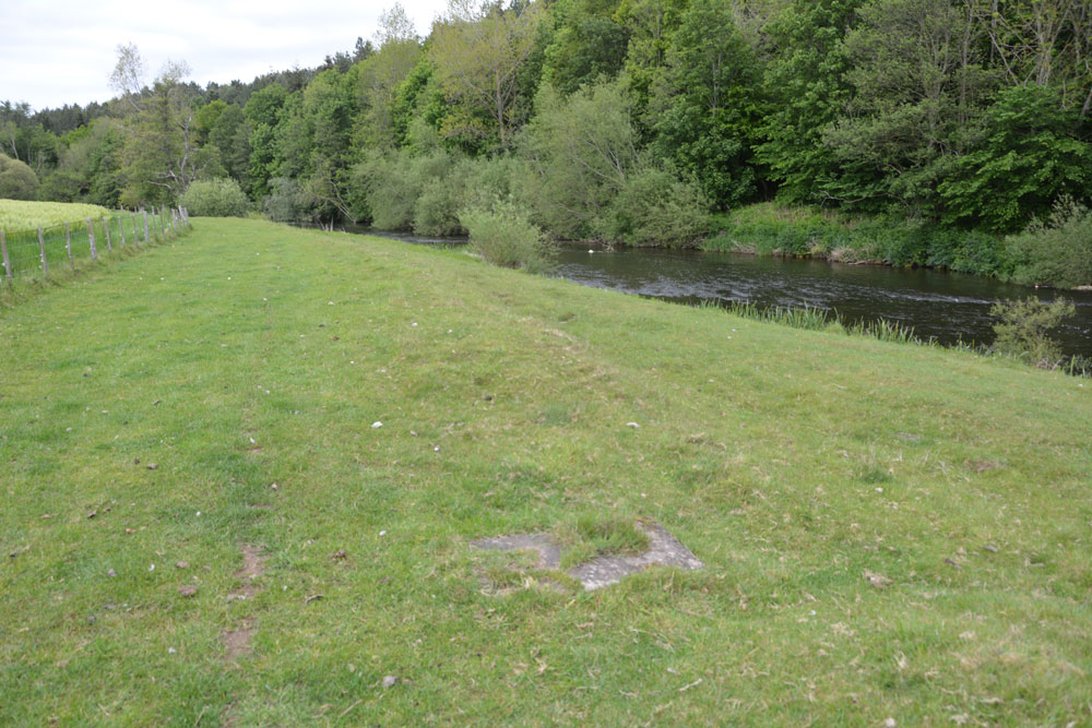
St Mary's Well (New Etal) submitted by Anne T on 12th Jun 2019. All that can be seen now of St Mary's Well is the rectangular slab inset into the grass. This is a natural spring, attributed to St Mary, the water being now piped into the River Till to its eastern side. View as approaching the well head from the western side of the ford across the River Till.
(View photo, vote or add a comment)
Log Text: St Mary's Well, New Etal: The ford across the river from Etal village was pretty high, so we decided not to chance wading across it, but drove round to New Etal and used the farm tracks to walk back down to the western side of the ford to find the remains of this chantry chapel and well.
No signs of the chantry chapel - the foundations are now mostly under the river. All that remains of the well is a rectangular concrete slab with a modern small drain cover at its western side and an access hole to the side nearest the river.
It is a peaceful spot and worth the walk, even though there wasn't a lot to see.
Alnmouth Wall Rock 37
Trip No.138 Entry No.4 Date Added: 13th Jun 2019
Site Type: Rock Art
Country: England (Northumberland)
Visited: Yes on 3rd Jun 2019. My rating: Condition 3 Ambience 3 Access 4
Alnmouth Wall Rock 37 submitted by SolarMegalith on 22nd Jan 2013. Close-up on the cup-marks (photo taken on January 2013).
(View photo, vote or add a comment)
Log Text: Alnmouth Wall Rock Panel 37: See visit report for Alnmouth Wall Rock Panel 32
Alnmouth Wall Rock 36
Trip No.138 Entry No.3 Date Added: 13th Jun 2019
Site Type: Rock Art
Country: England (Northumberland)
Visited: Yes on 3rd Jun 2019. My rating: Condition 3 Ambience 3 Access 4
submitted by on .
(View photo, vote or add a comment)
Log Text: Alnmouth Wall Rock Panel 36: For main visit report see AWR Panel 32. Trying to match these panels with the photos on the ERA records was interesting, but using the grid references taken with our GPS and the photos, I've managed this as best I can.
Alnmouth Wall Rock 34
Trip No.138 Entry No.2 Date Added: 13th Jun 2019
Site Type: Rock Art
Country: England (Northumberland)
Visited: Yes on 3rd Jun 2019. My rating: Condition 3 Ambience 3 Access 4
Alnmouth Wall Rock 34 submitted by SolarMegalith on 21st Jan 2013. Possible eroded cup-marks on the surface of Alnmouth Wall Rock 34 (photo taken on January 2013).
(View photo, vote or add a comment)
Log Text: Alnmouth Wall Rock 34: see main visit report for Alnmouth Wall Rock 32.
Alnmouth Wall Rock 15
Trip No.138 Entry No.5 Date Added: 13th Jun 2019
Site Type: Rock Art
Country: England (Northumberland)
Visited: Yes on 3rd Jun 2019. My rating: Condition 3 Ambience 3 Access 4
Alnmouth Wall Rock 15 submitted by SolarMegalith on 19th Jan 2013. Close-up on the cup-marks (photo taken on January 2013).
(View photo, vote or add a comment)
Log Text: Alnmouth Wall Rock 15: on top of panel 16. For main visit report see Alnmouth Wall Rock 32.
Alnmouth Wall Rock 16
Trip No.138 Entry No.6 Date Added: 13th Jun 2019
Site Type: Rock Art
Country: England (Northumberland)
Visited: Yes on 3rd Jun 2019. My rating: Condition 3 Ambience 3 Access 4
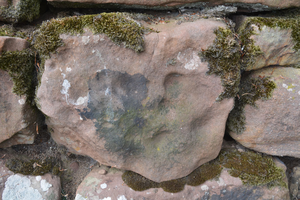
Alnmouth Wall Rock 16 submitted by Anne T on 13th Jun 2019. Alnmouth Wall Panel 16, which Beckensall has a minimum of 16 cups.
(View photo, vote or add a comment)
Log Text: Alnmouth Wall Rock 16: for main visit report see Alnmouth Wall Rock 32
Alnmouth Wall Rock 24
Trip No.138 Entry No.9 Date Added: 13th Jun 2019
Site Type: Rock Art
Country: England (Northumberland)
Visited: Yes on 3rd Jun 2019. My rating: Condition 3 Ambience 3 Access 4
Alnmouth Wall Rock 24 submitted by SolarMegalith on 20th Jan 2013. Close-up on the cup-marks (photo taken on January 2013).
(View photo, vote or add a comment)
Log Text: Alnmouth Wall Rock 24: for main visit report see Alnmouth Wall Rock 32.
Alnmouth Wall Rock 26
Trip No.138 Entry No.10 Date Added: 13th Jun 2019
Site Type: Rock Art
Country: England (Northumberland)
Visited: Yes on 3rd Jun 2019. My rating: Condition 3 Ambience 3 Access 4
Alnmouth Wall Rock 26 submitted by SolarMegalith on 20th Jan 2013. Close-up on the cup-marks on Alnmouth Wall Rock 26 (photo taken on January 2013).
(View photo, vote or add a comment)
Log Text: Alnmouth Wall Rock 26: for main visit report see Alnmouth Wall Rock 32.
Temple of Mithras (Carrawburgh)
Trip No.140 Entry No.5 Date Added: 23rd Jun 2019
Site Type: Ancient Temple
Country: England (Northumberland)
Visited: Yes on 23rd Jun 2019. My rating: Condition 3 Ambience 4 Access 4
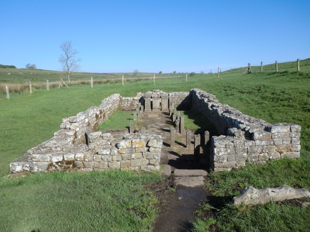
Temple of Mithras (Carrawburgh) submitted by johndhunter on 15th Jun 2019. Temple of Mithras - May 2012
(View photo, vote or add a comment)
Log Text: Temple of Mithras, Brocolita: This being a Sunday, there was a constant stream of visitors, most of whom ignored the fort and came straight down to the temple. I had hoped for bright blue skies and fluffy white clouds, which there had been at Great Chesters a couple of hours earlier.
Nothing much in the temple had changed since 2014, although I spotted more details on the altar stones this time, and took a few more photographs. Having just re-read Pastscape 1013363, "Replicas of the internal fittings have been fitted in cast stone", which came as a bit of a surprise!
Wallington Hall Standing Stone
Date Added: 24th Jul 2015
Site Type: Standing Stone (Menhir)
Country: England (Northumberland)
Visited: Yes on 1st Jul 2015. My rating: Condition 3 Ambience 4 Access 4
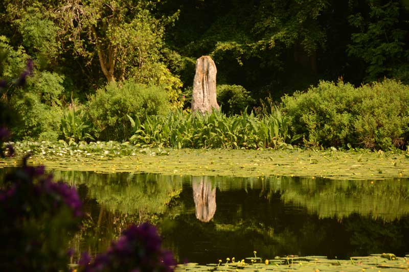
Wallington Hall Standing Stone submitted by Anne T on 6th Jul 2015. The first view of the Wallington Hall Standing Stone from the footpath. The stone sits on the south eastern side of the pond and is easily accessible by paths leading around the pond.
(View photo, vote or add a comment)
Log Text: Wallington Hall Standing Stone, Northumberland: Having been treated to National Trust membership for my birthday, we then sat and wondered how best to make use of this. We'd heard that there was a standing stone at Wallington Hall, but had never found it before. Having tracked down the location (around the China Pond (used to be called the Chinese Pond)), and absolutely loving their walled garden, which is absolutely breathtaking at this time of year, we set up on a Menhir Hunt.
Note to new visitors to Wallington: whereas you could park in the car park near the house then go to the hut to pay admittance, staff are on the entrance to the car park to take entrance money on the way in. I had my cards in the boot of the car, which didn't make me popular with the queue behind, but the less said about that, the better).
This stone, which is said to be the pair to the stone at the Poind and His Man, sits at the far side of the China Pond having been moved here by the famous Mr. Blackett who has built many structures and follys in and around Northumberland. Walking from the house and crossing the busy road to the forest walks, the China Pond is signposted, and it is less than a five minute walk. It certainly sits in a beautiful spot, although I was a little saddened to see it sitting on a concrete/stone base, having been propped up by bits of slates and other stones.
Whilst taking photographs, a couple stopped to watch, saying to each other "they're taking photographs for that Countryfile competition". We assured them we weren't. They were on the look-out for red squirrels, and listened politely when I explained about the standing stone.
Carrying on to the walled garden, I was stunned at the amount of work which goes into keeping this place immaculate. Whilst sipping hot tea at the cafe in the walled garden, the skies got very dark and we were treated to some some spectacular lightening on the way back. Shame the trees blocked the view of the lightening from the standing stone - that would have made a good photo.
Corbridge Rock Art Panel
Date Added: 24th Jul 2015
Site Type: Rock Art
Country: England (Northumberland)
Visited: Yes on 12th Jul 2015. My rating: Condition 3 Ambience 4 Access 5
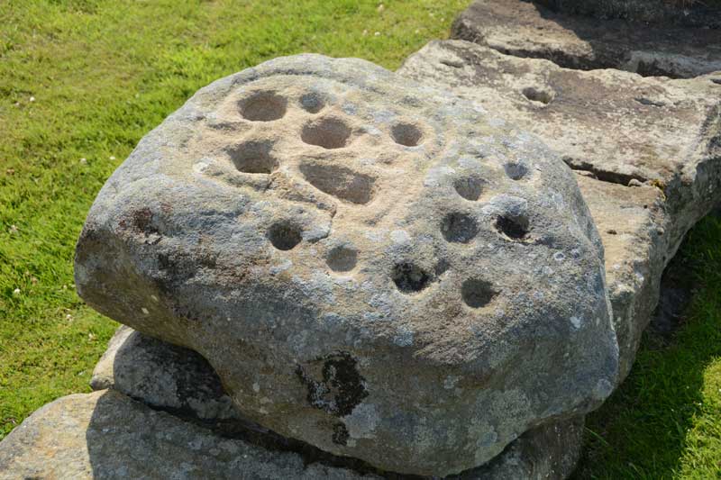
Corbridge Rock Art Panel submitted by Anne T on 13th Jul 2015. Close up of the rock art boulder which sits on the northern side of Stanegate, almost at the eastern end of the Corbridge Roman Fort site.
(View photo, vote or add a comment)
Log Text: Corbridge Rock Art Panel at Corbridge Roman Fort, Northumberland: OK, we've lived in this area for 13 years now, and the nearest we've been to this site is to take my daughter for driving lessons as it was good to practice reversing around corners in the quiet cul-de-sacs around here. Having said that, the Romans generally leave me 'cold' as they as so organised, everything is on a huge, grand scale, and having seen one or two forts, you can generally predict the layout of another. Sceptical? Probably.
However, the purpose of today's visit was to try to find the rock art panel which appears to just have been 'dumped' within the site; no-one seems sure where it comes from, apart from nearby somewhere.
The fort sits on level ground on top of a slope on the north side of the River Tyne, and as there is an old Roman bridge down by the river, this must have been a good place to cross in times gone by.
The staff at the kiosk knew nothing about the stone, until I called up an entry on the Modern Antiquarian (sorry, Portal) to show them, then the lady told me it was mentioned in the guided walks, and told me it was on the north side of the roman road (Stanegate) running through the site. After this, it was easy to find, almost at the far side of the site.
In the distance, across the fields, the church of St. Andrew's in Corbridge, with its anglo-saxon fragments, can be clearly seen.
I did find the strong room, with its set of narrow steps leading down into it, quite fascinating.
Aesica Vallum Round Barrow
Trip No.140 Entry No.2 Date Added: 25th Jun 2019
Site Type: Round Barrow(s)
Country: England (Northumberland)
Visited: Yes on 23rd Jun 2019. My rating: Condition 2 Ambience 3 Access 4
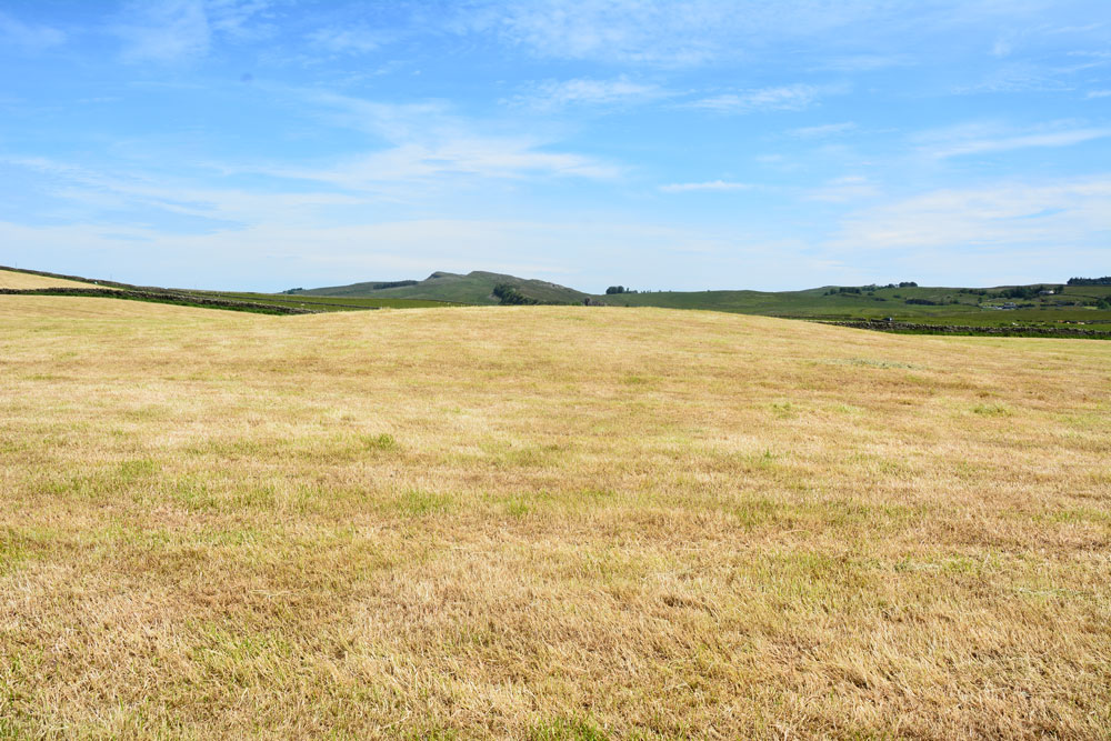
Aesica Vallum Round Barrow submitted by Anne T on 25th Jun 2019. Standing to the west of the round barrow, looking east towards Cawburn
(View photo, vote or add a comment)
Log Text: Aesica Vallum Tumulus: This tumulus is marked on the OS map and recorded in Pastcape. As we were nearby, and the tumulus was a simple walk along the metalled road, we walked along to take a look. The field had just been harvested, so we popped in to take a quick look.
Just to the south of the tumulus is the course of the vallum, parts of which are visible to the south west of the tumulus, between the tumulus and the dry stone wall, running west. At first, we thought this was the barrow, as it is much more obvious in the field, but looking closely at the map on our phones, we realised it was indeed the vallum and the barrow was further north.
Hollinghill Enclosure
Date Added: 1st Aug 2015
Site Type: Misc. Earthwork
Country: England (Northumberland)
Visited: Yes on 15th Jul 2015. My rating: Condition 2 Ambience 3 Access 3
Hollinghill Enclosure submitted by Anne T on 18th Jul 2015. Believe it or not, there is a ditch approximately 1 metre deep in the lower right hand quadrant of the photograph, on the gentle slope leading down to Fallowlees Burn. Across the burn to the north lies the Fontburn Four Poster Stone Circle. This photograph is taken from the Greenleighton Walk footpath, where it cuts the eastern bank of the enclosure half way along its length.
(View photo, vote or add a comment)
Log Text: Hollinghill Enclosure, near Fontburn Reservoir, Northumberland: Before setting off on this walk, we'd identified a number of sites (2 enclosures and several rock art boulders) close to tracks/marked pathways on the Ordnance Survey map. Parking at the car park to the east of Fontburn Reservoir (near the fishing hut and as far south as we could get), we followed the Waterside Walk along the south side of the reservoir. This was slow as we got caught up with a large walking group who hogged the boardwalks, but we finally managed to overtake them. At the sign for the Nature Reserve, we clambered up the small slope onto the track across the access land leading to the west of the reservoir. I confess to finding walking across this access land challenging due to the heavily tussocked grass, no clear pathways, the number of drainage channels, small streams and boggy areas to cross (but seasoned walkers will have no difficulty!). Passing the large cup marked boulder (Fontburn B) on route, we made our way onto the ridge running east-west south of Fallowlees Burn, and onto the National Trust Greenleighton walk with its grassy, mown trackways clearly visible.
It is relatively easy to spot this settlement as the path cuts right through it and there is a lone, low hawthorn tree at its western side. From here, you can see across the Burn to Fontburn Four Poster (it looks, from a distance) as if someone has cut down the hawthorn trees near the stones making up this little circle).
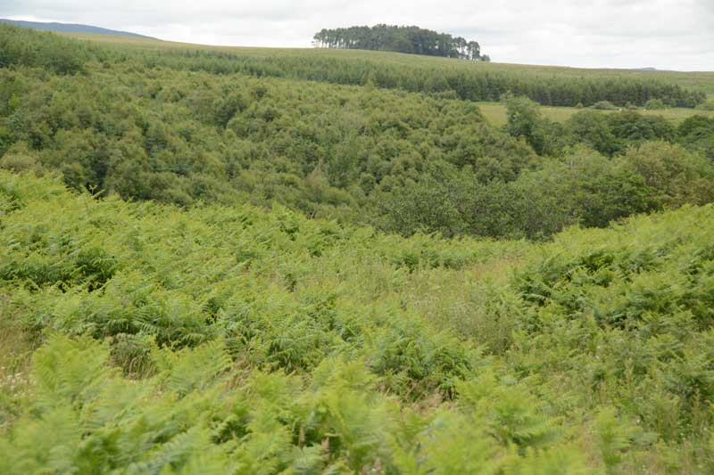
Stopping for a drink and to take photos, we carried on westwards until we got to West Shank enclosure, which is much more visible in the landscape in the then took the modern farm track down the slope to Fallowlees Burn, then across the wooden bridge. On the north side of the bridge two sets of quad bike tracks lead off to the left and right. To the right, the land slopes upwards. Fontburn a(i), a(ii) and a(iii) sit on this land, no more than 100 metres from the footpath, but at this time of year a(i) and a(ii) are hidden by tall bracken. Fontburn a(iii) gleams at you from across the valley.
Having taken these three boulders in, we retraced our steps to the footbridge and took the quad bike tracks to the left hand side, picking our way over two small streams which join Fallowlees Burn close to the the footbridge. From here, it is easy walking up the slope, about 200 yards to Fontburn a(vi), a(vii) and a(viii) and Fallowlees Settlement.
All in all, this 4 and a half mile walk took us 6 hours because of the heavy terrain and exploring the archaeology, but well worth it.
Fallowlees Settlement
Date Added: 1st Aug 2015
Site Type: Ancient Village or Settlement
Country: England (Northumberland)
Visited: Yes on 15th Jul 2015. My rating: Condition 3 Ambience 4 Access 3
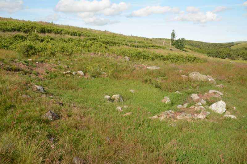
Fallowlees Settlement submitted by Anne T on 20th Jul 2015. This is one of the smaller hut circles, the foundations clearly visible above the turf. Just left of centre within the hut are a mound of stones which we would have liked to have thought of as the hearth.
(View photo, vote or add a comment)
Log Text: Fallowlees Settlement, just off the National Trust Greenleighton Walk, Northumberland: Close to Fontburn a(vi), a(vii) and a(viii). See visit report for Hollinghill Enclosure. From a distance, coming up the quad bike track from Fallowlees Burn, there appear to be standing stones on the slope, but as we got closer, it became apparent these were the foundations of three hut circles, with another disappearing into the plantation to the north. What a lovely site to live in - a sheltered spot with water close by and fertile ground for farming. No wonder our ancestors chose to live here. The boulders with rock art on are just to the south, and appear to be part of cairns. Well worth the walk to see this.
Joicey Shaft b
Trip No.141 Entry No.2 Date Added: 1st Jul 2019
Site Type: Rock Art
Country: England (Northumberland)
Visited: Yes on 30th Jun 2019. My rating: Condition 3 Ambience 3 Access 4
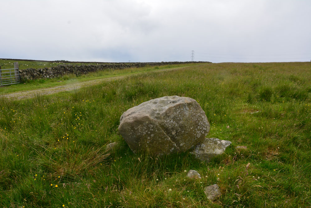
Joicey Shaft b submitted by Anne T on 1st Jul 2019. Photograph showing the Panel B boulder in relation to the track running to its south. The boulder sits on top of other stones, apparently the remains of an old field boundary/dry stone wall.
(View photo, vote or add a comment)
Log Text: Joicey Shaft B: This boulder is only 40m or so to the WSW of panel A, and is the only other large boulder in the field near this location. It is propped on top of other stones, part of the demolished field wall that ERA/NADRAP talk about.
ERA/NADRAP talk about two possible cup marks, which I found by comparing the shape of the stone with the NADRAP drawings. We also thought we saw two more, but these may be just solution holes or natural erosion.
Lindisfarne Priory
Date Added: 31st Oct 2015
Site Type: Museum
Country: England (Northumberland)
Visited: Yes on 18th Oct 2015. My rating: Condition 3 Ambience 4 Access 3
Lindisfarne Priory submitted by Thorgrim on 17th Nov 2004. Lindisfarne Priory has a fascinating museum of early carved stones and crosses. With a distant view of the Castle, Holy Island is a wonderful place to get in touch with the past.
(View photo, vote or add a comment)
Log Text: Anglo Saxon and Viking Stones on Lindisfarne, Northumberland. Sunday dawned dull and drizzly; looking up the weather forecast and the tide times for Lindisfarne strangely we were able to cross over (there and back) in the afternoon just when we wanted to.
In haste, I turned on my computer and printed off the AS Corpus sheets for Lindisfarne – there were over 50 stones listed, although some are now lost. We managed to see less than half of them.
I’ve never been to Lindisfarne at the weekend, so was amazed at the hoards of people wandering around. As parking is restricted on the island, we needed to park in the visitors car park and walk the rest of the way, but this was enjoyable in the sunshine. Fortunately we had our English Heritage membership cards to get free access to the priory and the museum. We only had to show our passes; we weren’t given tickets to count visitor numbers – just waved through.
We started off at the market place, only to find the old market cross had been replaced by a hideous concrete version; the original is now in the museum. In the museum, there were hoards and hoards of people all reading the descriptions of objects very carefully, and I got frustrated trying to photograph things without shadows and the strong museum lights in the way, so we went to the church to try and find a grave marker but couldn’t find it. We then went to the priory where we were the only people around for the first 20 minutes of so. Armed with the sheets, the guide was really interested in what we were trying to find, although we only found the cross base and what might have been the grave cover (AS Corpus Lindisfarne 48).
Going back to the museum half an hour before closing we were the only ones in besides the staff. I tried to get good photos of the marker stones but the lights were really strong and they were giving me a headache. I asked the lady at the desk if, as they were closing, I might be permitted to turn off the lights, but was given short shrift and told that someone else had managed. Then a staff member came and asked to turn off the light in the shop, and that was done, so I felt a bit put out!
Anyway, it was an enjoyable afternoon out, although its going to take me a while to process and label all the photographs.
Joicey Shaft Cairn
Trip No.141 Entry No.3 Date Added: 1st Jul 2019
Site Type: Round Barrow(s)
Country: England (Northumberland)
Visited: Yes on 30th Jun 2019. My rating: Condition 2 Ambience 3 Access 4
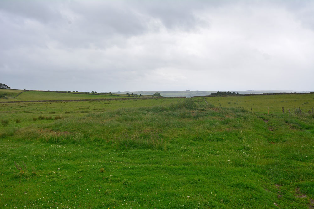
Joicey Shaft Cairn submitted by Anne T on 1st Jul 2019. The cairn as seen from the gate into the field at NY 82860 66456, showing how the farmer has driven his tractor over the western side of the mound, but the track 'bends' away from it, respecting most of the mound.
(View photo, vote or add a comment)
Log Text: Joicey Shaft Cairn: I spotted this mound almost by accident as I was photographing Joicey Shaft B from the track. At first I dismissed it as a manure heap, or possible tailings from the leading mining which used to take place here, but the more I walked round it, the more convinced I was it was a cairn, especially with its proximity to the rock art panels on the opposite side of the track, and because the modern field boundary and the track leading N-S to its western side 'bent' round to accommodate most of the barrow.
It is not recorded by HE or Pastscape, but it is on the old OS maps, so has been here for a while.
Mare and Foal
Date Added: 25th Jan 2016
Site Type: Standing Stones
Country: England (Northumberland)
Visited: Yes on 24th Jan 2016. My rating: Condition 3 Ambience 4 Access 5
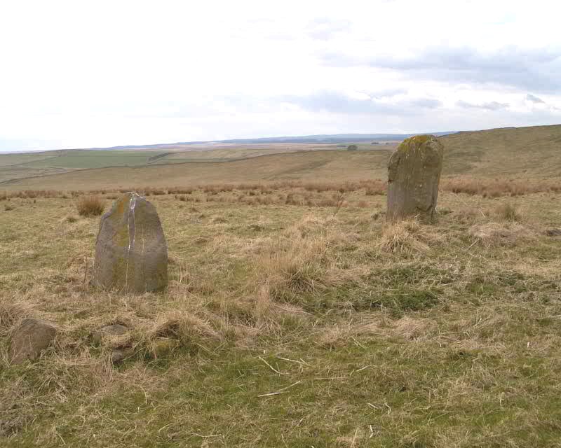
Mare and Foal submitted by spoors599 on 13th Apr 2002. Mare and Foal standing stones, Northumberland.
Landranger Sheet No:86 Grid ref: NY72546632
Located just off the B6318 and close to Hadrians Wall are two standing stones, the larger stone standing 1.51m high, the other 0.98m high at a distance apart of 4.82m. The 1769 Armstrong map of Northumberland marks 3 stones in situ. It has been suggested that the stones formed part of a ?four ? poster?. Loose boulders were packed around the base of the stones to prevent damage by cattle in 1992. The b...
(View photo, vote or add a comment)
Log Text: Mare & Foal Stone Circle, just west of Twice Brewed, Hadrian's Wall: After many months of not being able to get 'out and about', even though the day dawned dull, damp and dreary, it was great to be able to get out into the open countryside again. Strangely, we've driven past this little stone circle on many occasions as we've driven up and down the Military Road (the B6318), but I thought it was just north of Hadrian's Wall. How wrong can you be?
We'd been up into the Edges Green area to try and locate the course of the Roman Aqueduct which wends its way around the contours around here, but it's very difficult to pick out. Anyway, Roman's never did float my boat.
I've wanted to visit this stone circle for ages. We parked at the side of the road leading up toward Shield On The Wall farm. There is no actual footpath here, but it's possible to hop over the wooden fencing where the stone wall adjacent to the B6318 meets the wire fencing which runs northwards up the slope. There were no animals in the field, and the farmer was herding his sheep in the field opposite. I waved and he showed no signs of warning us off.
From the road looking west, it looks as if the stones sit on a low curved mound. The larger stone had a 'bruise' on one side, which in the photographs looked like a cup and ring, but actually seems to be where part of the stone has been broken away.
Smith's Shield Milestone
Trip No.142 Entry No.3 Date Added: 6th Jul 2019
Site Type: Marker Stone
Country: England (Northumberland)
Visited: Yes on 4th Jul 2019. My rating: Condition 2 Ambience 3 Access 4
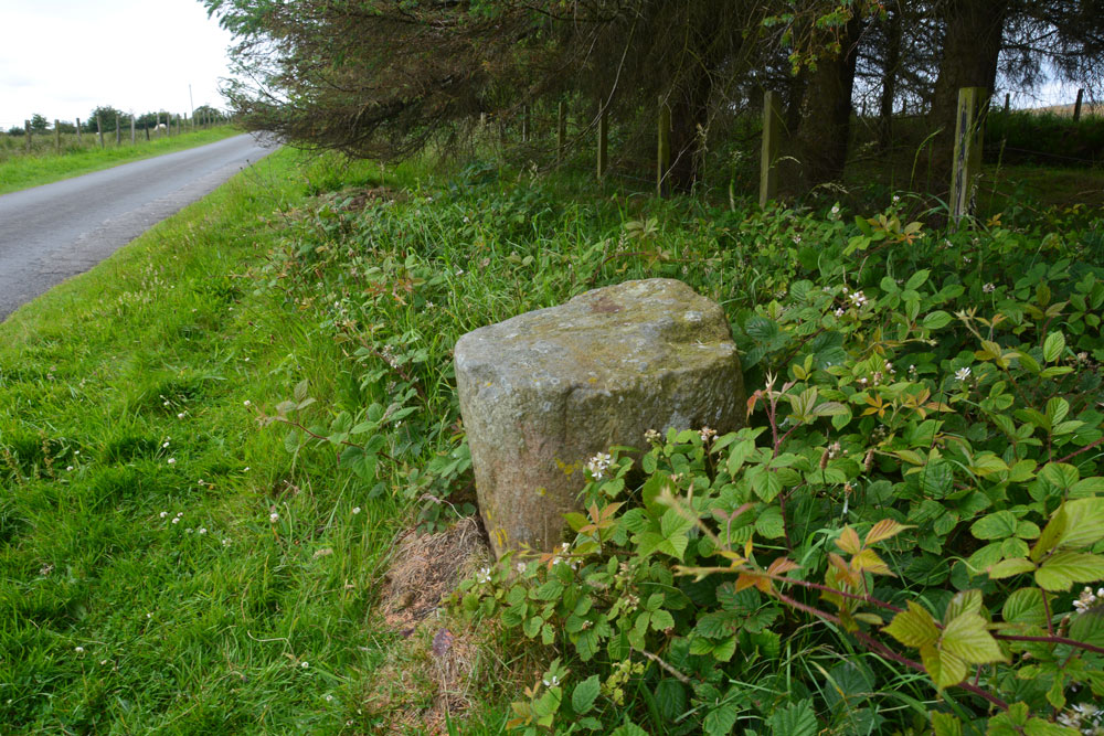
Smith's Shield Milestone submitted by Anne T on 6th Jul 2019. The base of the Smith's Shield Roman milestone, showing its location next to the minor road running east to Vindolanda. It is just over 100m east of the road junction which is just below Smith's Shield farmhouse.
(View photo, vote or add a comment)
Log Text: Smith's Shield Roman Milestone (base of): The base of this Roman milestone, located at the northern side of the road which runs east towards Vindolanda, is easy to spot.
A note of warning to future visitors - we had a run in with the AD122 local bus service who told us off for parking in what he thought was a passing place, but wasn't; there was plenty of room for him to pass, and he parked alongside us before he started yelling. I think he just wanted to shout at someone, but it certainly ruined my day.
There is a second, intact milestone at the eastern entrance to Vindolanda, which we have yet to go back and see.
