Contributory members are able to log private notes and comments about each site
Sites Anne T has logged. View this log as a table or view the most recent logs from everyone
The Elsdon Stone
Trip No.119 Entry No.3 Date Added: 27th Feb 2019
Site Type: Early Christian Sculptured Stone
Country: England (Northumberland)
Visited: Yes on 24th Feb 2019. My rating: Condition 3 Ambience 4 Access 4
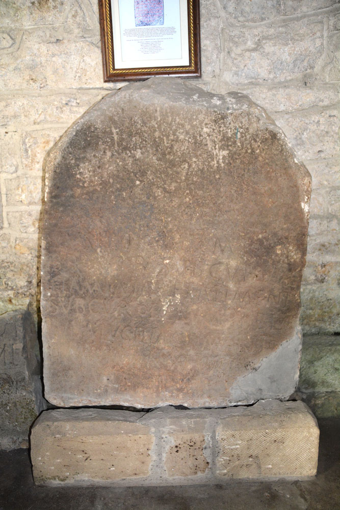
The Elsdon Stone submitted by Anne T on 27th Feb 2019. This is the unique Elsdon Stone, which is sited against the north wall of the nave, opposite the south door into the church. The inscription is barely visible unless the light catches it. There is a notice above with an explanation of the stone with a brief history of the Roman officer, and what remains of the legible inscription, in Latin.
(View photo, vote or add a comment)
Log Text: St Cuthberts, Elsdon (The Elsdon Stone): We stopped off at the very friendly and informal tea shop for tea (one tea bag in a pot for 2) and an ‘omelette sandwich’ (was supposed to be fried egg, and it took me a while to recover from the taste). We’ve been to the church before, but not with the HE and Pastscape information with us.
Spotted the unique Roman soldier’s tombstone (it lists his entire military career), the medieval cross slabs and the horse skulls. We thought we’d seen everything in this church on a previous visit on 25th August 2013, but indeed missed a great deal. Whilst I photographed most of what we took in today, at the time I wasn’t so interested in the medieval grave slabs and the Elsdon Stone (after all, it was only Roman, wasn’t it?!). I really wished I’d thought to take Peter Ryder’s articles on the medieval grave slabs, but until we got to the village, had no real thought of going back to the church.
I was really saddened to see how much the inside of the church has deteriorated since our visit four and a half years ago. There is so much black mould and dust around, especially towards the western end of the church.
I also hadn’t realised how complicated the stone work around the junction of the nave and the transept was – all small spaces and intricate junctions.
I could have spent all afternoon the churchyard photographing all the amazing grave markers.
Steng Cross and Winter's Gibbet
Trip No.119 Entry No.2 Date Added: 25th Feb 2019
Site Type: Ancient Cross
Country: England (Northumberland)
Visited: Yes on 24th Feb 2019. My rating: Condition 3 Ambience 4 Access 4
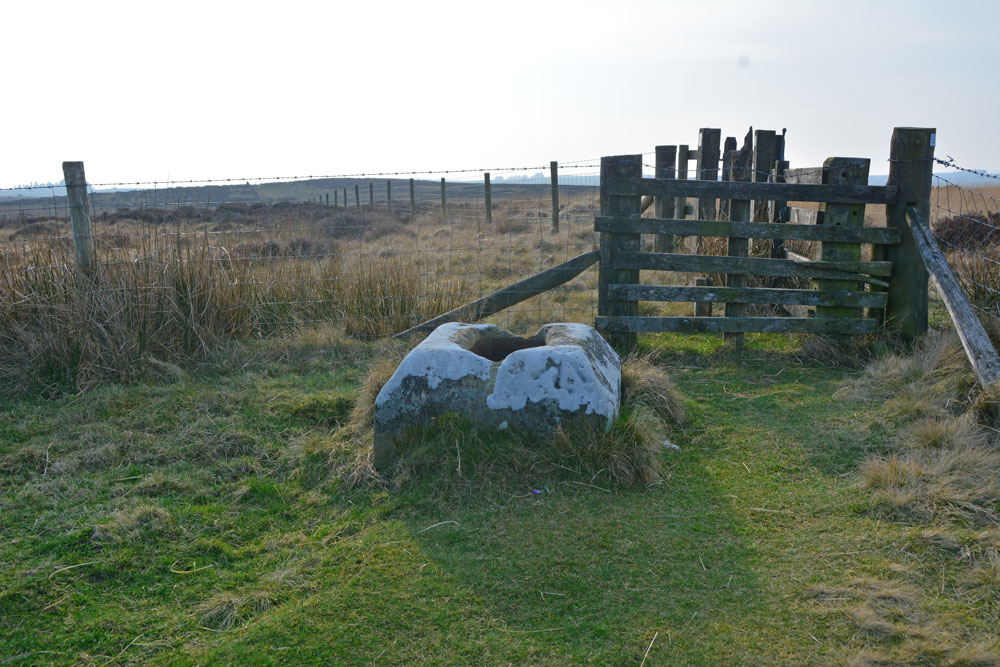
Steng Cross and Winter's Gibbet (Elsdon) submitted by Anne T on 25th Feb 2019. It's not until you walk almost up to the cross base that we realised how much larger it is than others we've seen. Pastscape records: "It measures 0.8m square chamfered down to 0.6m square, and stands to 0.4m above ground level, the socket stone is 0.4m by 0.25m and is 0.2m deep".
(View photo, vote or add a comment)
Log Text: Steng Cross & Winter's Gibbet, near Elsdon: If there was a category for Ambience = Spooky/Very Spooky I would assign it to this site.
This is a remote spot, at the very top of the moor at the western end of the forest which runs along the north side of the road. The thought of anyone being hung in chains and left to rot, murderer or not, doesn't bear thinking about. I expected to turn around and find the ghost of William Winter breathing over my shoulder at any moment. Even the birds seemed silent with the cold wind whistling along the long, straight road nearby. I was glad to escape back to the car and head off to Elsdon.
Just inside Northumberland National Park, St Cuthbert’s Way runs on the south side of the fence next to the cross, although to get to it you have to walk back to the road, a little further west, then onto the marked footpath.
The Rothbury Cross
Trip No.119 Entry No.1 Date Added: 25th Feb 2019
Site Type: Ancient Cross
Country: England (Northumberland)
Visited: Yes on 24th Feb 2019. My rating: Condition 3 Ambience 4 Access 5
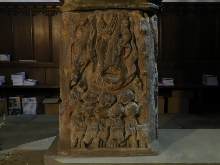
The Rothbury Cross submitted by Modern-Neolithic on 26th May 2013. The north panel displays "The Accession of Christ" with angels either side and the apostles looking upwards.
(View photo, vote or add a comment)
Log Text: The Rothbury Font/Anglo Saxon Cross & Other Fragments: We started off in Rothbury, parking on Haw Hill, just outside the church. We intended to go for a cup of tea, but the town was inundated with tourists and bikers, so we went straight to the church to find the font. I’d forgotten how glorious this was, but then it’s a long time since we looked in the church.
There were odd lights in the church, highlighting a few pieces, including the font, but it was so dark under the tower that, after hunting unsuccessfully for the light switches, we had to go and get the large flash gun from the car.
I also photographed the pieces on the west interior wall of the porch, and a sundial to the south of the nave. At the NW corner of the tower, there was a collection of fragments and a bell. The sign said: “These fragments of an Anglo Saxon Cross was discovered during recent building work in the All Saints Churchyard. It is believed to have been a carving that broke as it was being worked on”. The way the fragments were stacked in a jumble made it impossible to see any carvings on them.
We missed two scratch clocks on the exterior south wall; I looked for a church guide book, but the only thing on display were postcards, cards and the parish magazine.
On the western wall of the south transept, on the window sill, is a modern carving. The sign reads: “This carving celebrates the 500th anniversary of Bernard Gilpin. It depicts a historic incident in Rothbury Church. Bernard Gilpin was a Catholic priest whose brave efforts to bring Christianity and peace to the warring families of the Borders eventually earned their respect. They rewarded him with the honorary title of The Apostle of the North. Queen Mary order Gilpin to be brought to London to be burnt at the stake as a heretic. However, the Queen died before he reached London so he was able to return to the North to continue his good works”.
The notice board by the Font reads:
“The pedestal consists of the base of the ancient Saxon cross of Rothbury dating from the 8th century AD.
East Side: Before the Fall of Man
North Side: The Ascension of Christ with angels wither side and the Apostles looking upwards. The Evangelicals hold their gospels (this is said to be one of the oldest carvings of this subject in Britain).
West Side: After the Fall
South Side: The Saxon knot-work pattern
Other fragments of the Rothbury Cross are in the Museum of the Society of Antiquaries of Newcastle upon Tyne (Great North Museum). [The bowl is dated 1664].”
St Mary's Churchyard Cross (Wirksworth)
Date Added: 24th Feb 2019
Site Type: Ancient Cross
Country: England (Derbyshire)
Visited: Yes on 17th Sep 2015. My rating: Condition 3 Ambience 4 Access 5

St Mary's Churchyard Cross (Wirksworth) submitted by Anne T on 22nd Oct 2015. This cross shaft and base sits in the north west part of the church yard. The church guide tells me that whilst the cross shaft dates from the 13th century, the cross base is pre-Norman.
(View photo, vote or add a comment)
Log Text: St Mary's Churchyard Cross, Wirksworth: I've split this page off as the cross has it's own HE scheduling record and Pastscape record, and got a little lost in with the other Anglo Saxon carved stones within the church itself.
Until we wandered around the churchyard, we didn't know this cross was here, so it was a really nice surprise to have seen it.
The Fawns (Kirkwhelpington)
Trip No.118 Entry No.5 Date Added: 17th Feb 2019
Site Type: Rock Art
Country: England (Northumberland)
Visited: Yes on 14th Feb 2019. My rating: Condition 2 Ambience 4 Access 3
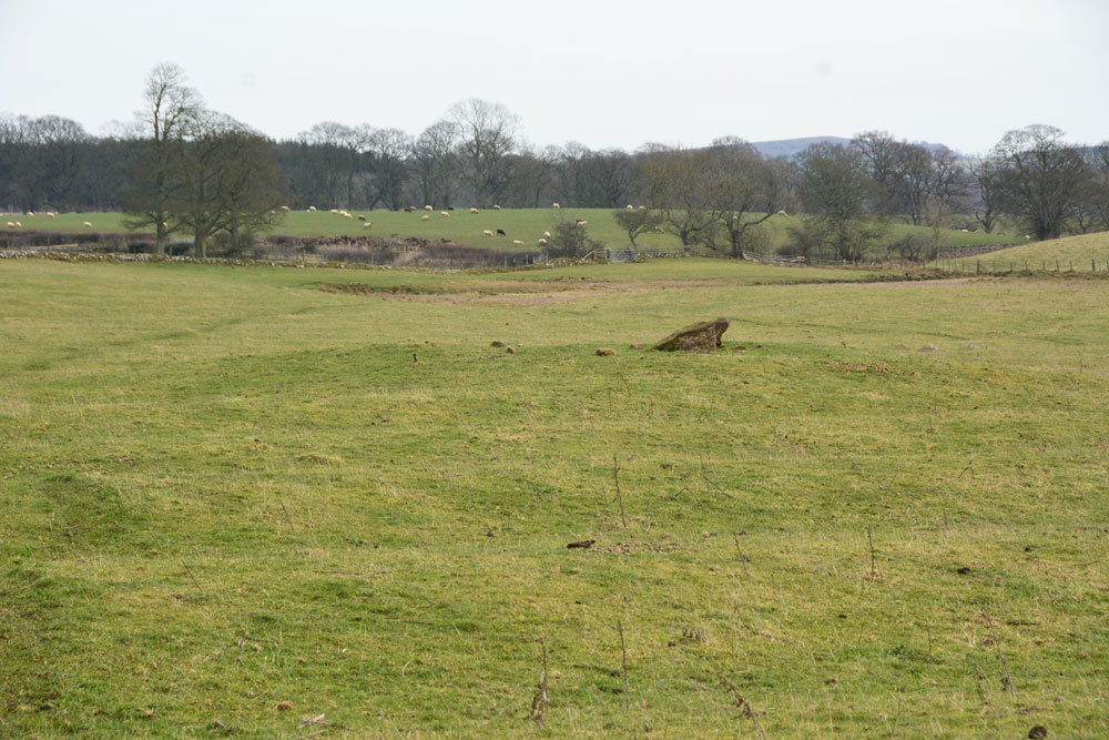
The Fawns (Kirkwhelpington) submitted by Anne T on 17th Feb 2019. First view of the cairn as we made our way south east from the Fawns Moated Manorial Site up the hill. The cairn has been partly damaged by later ploughing, but the rig and furrow seem to respect the centre of the barrow. It is located at the foot of two hillocks which are prominent in the landscape. To the south, the gate out of this field crosses a small stream which needs to be stepped across.
(View photo, vote or add a comment)
Log Text: Cairn SE of The Fawns (220m west of Broom House farm): This cairn is easily visible from the top of the ridge, as we walked from the Fawns Farm/Moated Manorial Earthworks, along the footpath, then down hill. The brown blob of the rubbing post comes into sight first, then the circular mound of the cairn comes into view as you get nearer.
A lovely spot to be buried in - very peaceful and quiet, at the bottom of two hillocks, with a small stream (now) running to the south. The gate from this field onto the footpath back to the village crosses this stream, which needs a long stride to get over it, but it's not very deep.
Wish I'd been able to see the rock art panel and the urns, but a trip to London would be necessary (if the British Museum can find these!).
It is a gentle walk down to the river valley below from here, following ancient dry stone walls now white with lichen. We drove to Kirkharle for a cup of tea and some soup, then visited St Wilfred's Church just along the road, which is where Capability Brown was baptised (he was born in Kirkharle). We stopped to see a very strange monument dedicated to "A Most Unfortunate Man" at the side of the road between the church and Kirkharle Courtyard.
Fawns Moated Site
Trip No.118 Entry No.4 Date Added: 17th Feb 2019
Site Type: Misc. Earthwork
Country: England (Northumberland)
Visited: Yes on 14th Feb 2019. My rating: Condition 2 Ambience 4 Access 3
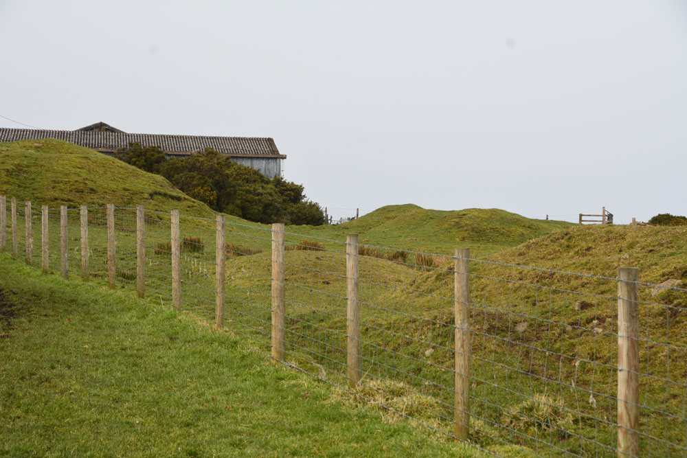
Fawns Moated Site submitted by Anne T on 17th Feb 2019. First view of the main part of this medieval moated site, with its lumps and bumps. Sadly on private land adjacent to the farm, and we could find no-one to ask permission to take a closer look. The footpath leading from the farmhouse, south east towards the cairn, gives good views back onto this site.
(View photo, vote or add a comment)
Log Text: Fawns Medieval Moated Site: "One of the few surviving examples in Northumberland and exceptionally well preserved" is how Historic England describe this site. As the third stop on our short circular walk to the east of Kirkwhelpington, this was a nice site to stop and look at. Easier to see the layout from the aerial photographs at home. Just a shame this site is on private land, as I'd have loved to have walked over the site to take a closer look.
There is much evidence of medieval field boundaries and rig and furrow ploughing all around here. The land looks rich and fertile, with magnificent sheep grazing in the fields.
St Mary's Well (Kirkwhelpington)
Trip No.118 Entry No.2 Date Added: 15th Feb 2019
Site Type: Holy Well or Sacred Spring
Country: England (Northumberland)
Visited: Yes on 14th Feb 2019. My rating: Condition 2 Ambience 4 Access 4
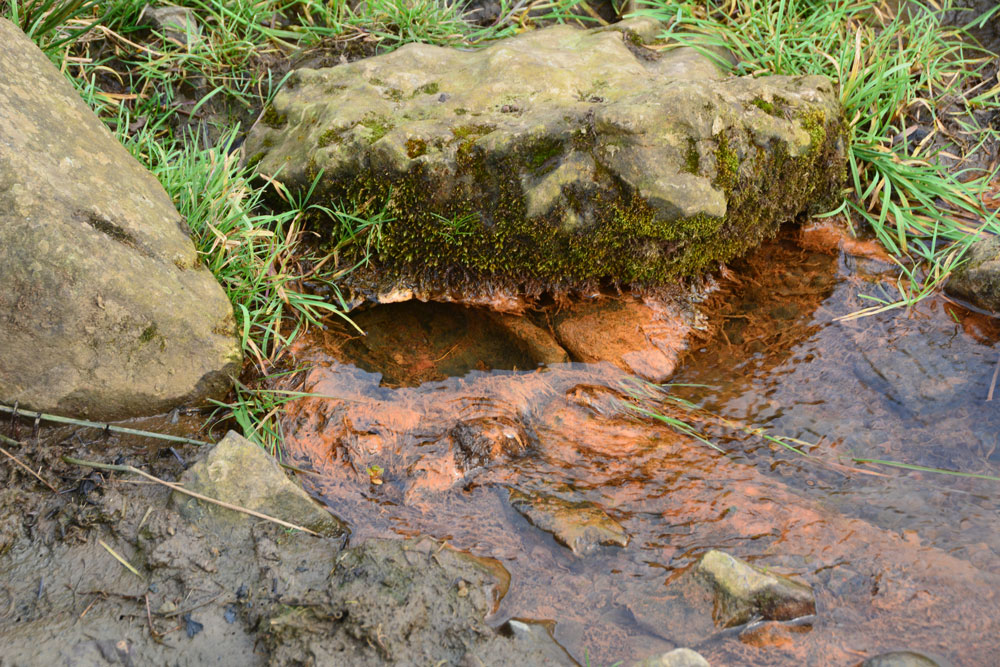
St Mary's Well (Kirkwhelpington) submitted by Anne T on 15th Feb 2019. Whilst there is no sign of the well at the grid reference given, this spring bubbles up at the side of the small stream almost directly south. I wondered if the water from the well had been culverted down to here.
(View photo, vote or add a comment)
Log Text: St Mary's Well, Kirkwhelpington: We had previously stopped off at St Bartholomew's Church in the village, and photographed the sundial and some medieval grave slabs. Parking at the eastern end of the the village, almost opposite the entrance to Eastlands, we crossed the small bridge over the ford and headed up over the fields. Having passed the last houses to our left hand side, we let ourselves through the gate into the field and turned right (east). This was the start of a short circular walk which took in 2 holy wells, the ruins of a moated medieval manorial complex and a tumulus.
No signs of the well in the field, which should have been located about 50m due west of the only tall tree in this part of the field, but walking down by the small stream, I spotted a spring issuing out of the bank, with larger stones above it, and what appeared to be a small iron basin over which the water flowed. Has the water from the well been culverted down to here?
There was no end of rig and furrow around here. This land used to belong to Newminster Abbey, which used to own land up to the Scottish Borders. The ruins of the Abbey can be found in Morpeth town centre.
St George's Well (Kirkwhelpington)
Trip No.118 Entry No.3 Date Added: 15th Feb 2019
Site Type: Holy Well or Sacred Spring
Country: England (Northumberland)
Visited: Yes on 14th Feb 2019. My rating: Condition 3 Ambience 4 Access 4
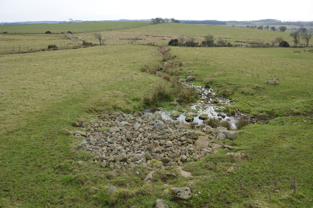
St George's Well (Kirkwhelpington) submitted by Anne T on 15th Feb 2019. Standing just to the north and just upslope from the well, looking down across the pile of stones which protect the spring head, the small pool into which the water comes up into, and the channel down which the water runs to join a small stream running east-west along the bottom of the field.
(View photo, vote or add a comment)
Log Text: St George's Holy Well, Kirkwhelpington: The second stop of four on our short circular walk around Kirkwhelpington. This well is in a lovely location, very peaceful and quiet (once the farmer and his numerous dogs had driven off in his four-wheel drive buggy!). Two holy wells within a couple of hundred yards was a treat, although I'm interested in finding out how they became known as holy wells and what they cured.
The water emerges very peacefully up into a small pool at the base of the stones. By the time the water has gone a couple of metres further downslope, it is quite lively, creating ripples through the grass.
Boulders appear to mark the edge of the pool and water channel, although I couldn't see any signs of a permanent structure.
Hallington Holy Well
Trip No.118 Entry No.1 Date Added: 15th Feb 2019
Site Type: Holy Well or Sacred Spring
Country: England (Northumberland)
Visited: Yes on 14th Feb 2019. My rating: Condition 3 Ambience 4 Access 4
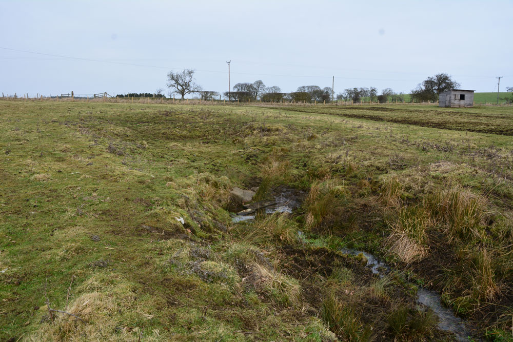
Hallington Holy Well submitted by Anne T on 15th Feb 2019. Standing a little bit further down towards the field boundary, looking back at the small pool of water near where the spring emerges, and the much larger hollow of what we interpreted as the well pool (now dry). There is evidence of stones around the rim of the larger pool area, indicating there might have been a structure here at one time.
(View photo, vote or add a comment)
Log Text: Hallington Holy Well: We drove past this well, despite having the OS map with the location of the well marked. In the end we drove slowly back towards Hallington village, identifying the field because it is smaller than the others, with a fence line and line of trees that runs parallel to the road, about 100m away.
The gate into the field was open, but a large wooden shed indicates the field is usually used for horses. We walked south to the well pool, about 50m from the gate, coming across a large hollow with boulders/stones poking out of the bank; we interpreted this as having at one point having been a larger well pool.
The spring bubbles up from the western bank of the channel, just where the larger ‘pool’ narrows into the channel into which the water flows south to the field boundary. The water is clear and freely flowing. The collection of stones and wooden blocks leading across the mud indicated people still collect the water today, although I didn’t’ taste the waters.
This is a very lovely spot, and it was a great start of our afternoon out.
Barningham Moor 99
Trip No.117 Entry No.9 Date Added: 13th Feb 2019
Site Type: Rock Art
Country: England (County Durham)
Visited: Yes on 6th Feb 2019. My rating: Condition 3 Ambience 4 Access 3
Barningham Moor 99 submitted by SolarMegalith on 29th May 2013. Cup with three rings/penannulars and two simple cup-marks to its left (photo taken on May 2013).
(View photo, vote or add a comment)
Log Text: Barningham Moor 99: This was a lovely stone, found a few metres east of the track. The cup with three penannulars was clearly made out. The cup marks were a little more difficult to spot on the day, but could be felt by running my finger tips over the rock. The five cups towards the north end of the rock appear slightly darker than the rest of the rock on the photo.
Barningham Moor 114
Trip No.117 Entry No.8 Date Added: 13th Feb 2019
Site Type: Rock Art
Country: England (County Durham)
Visited: Yes on 6th Feb 2019. My rating: Condition 3 Ambience 3 Access 3
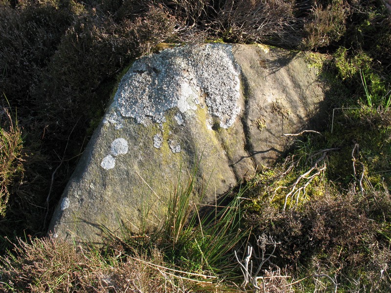
Barningham Moor 114 submitted by Rich32 on 20th Mar 2017. Carved stone close to the foot of scarp below Washbeck Green, Barningham Moor.
Stone is under 1.5m in length and has a number of grooves some of which incorporate cup marks. Tooling marks may also be present in one or two grooves.
Image captured in May 2009.
(View photo, vote or add a comment)
Log Text: Barningham Moor 114: This triangular shaped rock sits in relative isolation on the moor. There is considerably more lichen on the stone than when it was surveyed by NADRAP and photographed by rich32 in 2009. It was a good job I had the description with me, but even with rich32 pointing out the motifs, I’m still not sure I understood what I saw on the day. Looking at the photographs (which were taken in not too good lighting) together with the ERA drawing of the panel hasn’t really helped, either! I did query on the day if the grooves might have been the result of water running down the stone, but there was no fluting at the top to indicate this.
Cowclose House (Barningham Moor)
Trip No.117 Entry No.7 Date Added: 12th Feb 2019
Site Type: Ancient Village or Settlement
Country: England (Yorkshire (North))
Visited: Yes on 6th Feb 2019. My rating: Condition 2 Ambience 3 Access 5
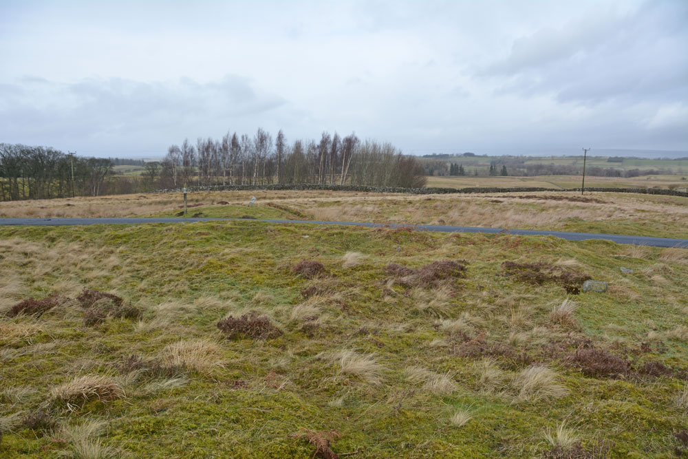
Cowclose House (Barningham Moor) submitted by Anne T on 12th Feb 2019. Standing at the southern side of this unenclosed settlement, looking northwards across it.
(View photo, vote or add a comment)
Log Text: Cowclose House Unenclosed Settlement, Barningham Moor: In some ways, this settlement was much easier to identify on the ground than Grey Stones, just to the south east, as there was a ditch running east-west alongside the southern side of the metalled track, and a clear circular enclosure, which stood out as being bright green, shorter grass on the north side of the road.
Would love to go back with the notes and the plan and look round again.
Barningham Moor 97
Trip No.117 Entry No.6 Date Added: 12th Feb 2019
Site Type: Rock Art
Country: England (County Durham)
Visited: Yes on 6th Feb 2019. My rating: Condition 3 Ambience 4 Access 4
Barningham Moor 97 submitted by Rich32 on 19th Mar 2017. Carved rock positioned in the Grey Stones area of Barningham Moor, Co Durham.
Motifs consist of a domino five cups and two further cups. Feathering marks can also be seen on the stone.
Recorded as ref 2 in PRAoCDSW and 97 on England's Rock Art database.
Image captured in June 2006.
(View photo, vote or add a comment)
Log Text: Barningham Moor 97 rock art panel: This rock was easy to pick out amongst the others on the hillside. It has clearly been squared off and has ‘feather’ marks in the middle as if it was just about to be quarried, but the workmen have walked off and forgotten about it.
Richard pointed out the domino pattern on its south eastern corner, but my goodness I had to look hard for it, then once I’d seen it, it was difficult not to see.
Unfortunately, the light wasn’t brilliant. Would like to come back with a bottle of water and a brush or on a day with brilliant sunlight to bring out the motifs.
Grey Stones (Barningham Moor)
Trip No.117 Entry No.5 Date Added: 12th Feb 2019
Site Type: Ancient Village or Settlement
Country: England (Yorkshire (North))
Visited: Yes on 6th Feb 2019. My rating: Condition 2 Ambience 4 Access 4
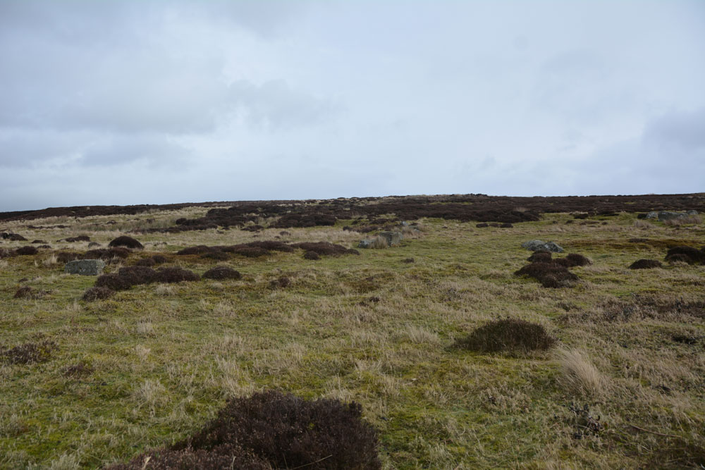
Grey Stones (Barningham Moor) submitted by Anne T on 12th Feb 2019. Looking virtually east across the settlement, from its southern most side. The circular bank, which incorporates the stone blocks, can just be made out.
(View photo, vote or add a comment)
Log Text: Grey Stones Settlement, Barningham Moor: As we parked just to the east of this settlement and walked south onto the moor, it was obvious we were walking up into something, but what that something was a little difficult to make out, until I started to be able to see low, circular banks. The blocks positioned on the banks made these easier to see.
Taking some photos and later comparing them with the HE and Pastscape records made it easier to understand what it was we were standing in. I’d love to go back with the notes and walk around again.
The carved rock (Barningham Moor 97) is within the settlement.
Barningham Moor 96
Trip No.117 Entry No.3 Date Added: 12th Feb 2019
Site Type: Rock Art
Country: England (County Durham)
Visited: Yes on 6th Feb 2019. My rating: Condition 3 Ambience 4 Access 4
Barningham Moor 96 submitted by Rich32 on 19th Mar 2017. The most north easterly carving on Barningham Moor, Co Durham. Recorded as reference 1 in the 1998 publication "Prehistoric Rock Art of County Durham, Swaledale and Wensleydale" and Barningham Moor 96 on England's Rock Art database.
Carving has around a dozen cups some with grooves running west towards the ground. Tooling marks are also visible.
(View photo, vote or add a comment)
Log Text: Barningham Moor 96: Our first rock art panel on Barningham Moor, and this was a lovely rock to start with. It was so near the road, and easy to reach, with stunning views over to the north towards Barnard Castle.
St Michael & All Angels (Barningham)
Trip No.117 Entry No.1 Date Added: 12th Feb 2019
Site Type: Ancient Cross
Country: England (County Durham)
Visited: Yes on 6th Feb 2019. My rating: Condition 3 Ambience 4 Access 4
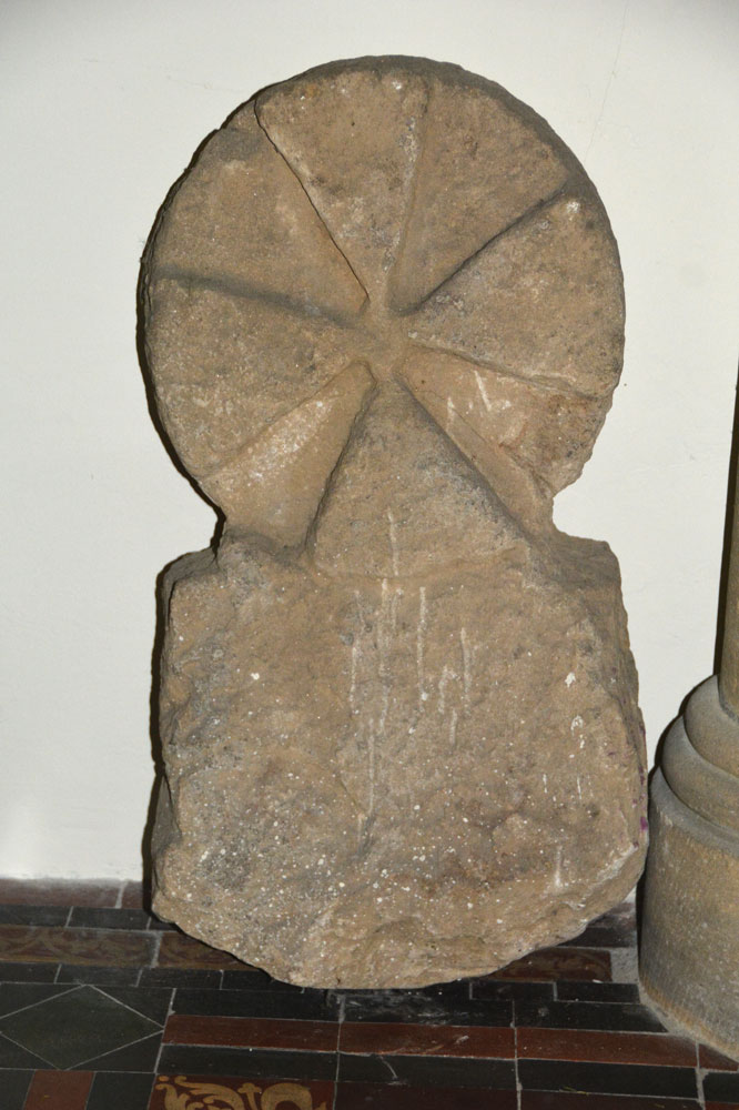
St Michael submitted by Anne T on 10th Feb 2019. Close up of the reverse (face C) of AS Corpus Barningham 02, which shows traces of a relief circle.
(View photo, vote or add a comment)
Log Text: Cross Base and Cross Head/Grave Marker (Barningham): Having arranged a day out with rich32 to seek out and photograph some of the Barningham Moor rock art panels, I'd also seen the cross base on Historic England, so we arrived in Barningham half an hour before the meeting time to look around the churchyard. As well as the cross base in the south eastern corner of the churchyard, there was also a round headed grave marker in the church; to my surprise, the church was open, and we were able to get in and photograph this, too.
The church looks surprisingly modern (and it is largely Victorian) but the churchyard is much, much older, and also includes a 1503 grave slab (too covered in moss to identify) which is sited within the remains of the medieval foundations of the original church. There are also some really interesting grave stones, which I photographed.
Within a couple of minutes walk there is also the modern stone (gate post) circle and the village Pant (drinking fountain), complete with its culvert and voussoir arch. A lovely start to the day!
Barningham Modern Stone Circle
Trip No.117 Entry No.2 Date Added: 9th Feb 2019
Site Type: Modern Stone Circle etc
Country: England (County Durham)
Visited: Yes on 6th Feb 2019. My rating: Condition 4 Ambience 3 Access 5

Barningham Modern Stone Circle submitted by rich32 on 9th Jul 2006. 12 gateposts sit proud overlooking the village of Barningham. Built in May 06 to give a 'prehistoric' feel to the villages '2500BC' theme day
(View photo, vote or add a comment)
Log Text: Barningham Modern Stone Circle: This stone circle, created for a village event in 2006, and made up of gateposts, lies on private land, but is visible from the road which runs roughly east-west through the village. Coming out of the lane from St Michael and All Saints, the circle is virtually opposite the Norbeck Bank road end.
Homers Lane Cross (Warden)
Trip No.116 Entry No.3 Date Added: 28th Jan 2019
Site Type: Ancient Cross
Country: England (Northumberland)
Visited: Yes on 27th Jan 2019. My rating: Condition 3 Ambience 4 Access 5

Homers Lane Cross (Warden) submitted by Anne T on 27th Jan 2019. Standing on Homer's Lane looking eastwards towards the River North Tyne. The carving of the elongated 'V' on the front of the broken shaft can be clearly seen.
(View photo, vote or add a comment)
Log Text: Homer's Lane Cross, Warden: This is another cross base that we hadn't spotted with a short radius of where we live (have Pastscape been adding new records to their database?) This cross base and part of its shaft was easy to find and in a really nice setting, with a small stream trickling away to its eastern side and a bench to sit on and admire it, with the River North Tyne also to the east and the Stanegate Roman Road nearby. A quiet, quiet spot. Lovely!
Acomb Sanctuary Cross
Trip No.116 Entry No.1 Date Added: 27th Jan 2019
Site Type: Ancient Cross
Country: England (Northumberland)
Visited: Yes on 26th Jan 2019. My rating: Condition 3 Ambience 3 Access 4
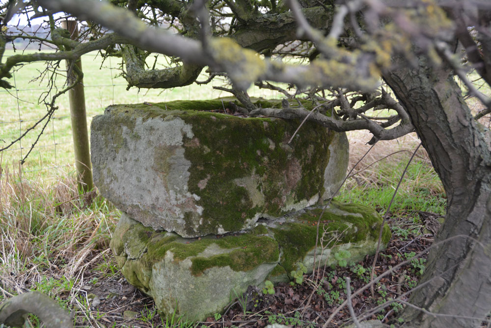
Acomb Sanctuary Cross submitted by Anne T on 27th Jan 2019. First view of this cross base, set upon sandstone blocks. It was certainly well hidden, but visible at this time of year with no leaves on the hawthorn hedge.
(View photo, vote or add a comment)
Log Text: Acomb Sanctuary Cross: I spotted this cross base whilst doing some research for a Journal of Antiquities tumulus not far away a few days ago. This cross base is just off the A6079 Cross Bank, going north from Acomb. This is a very busy road and after driving up and back down the road a couple of times, the only safe place we could find to park was just off the road at the entrance to a grassy farm track at NY 92364 66984. Walking north to the cross base, which we’d spotted as a rectangular lump of stone under the hedgerow, we were constantly having to jump up onto the grass verge as the fast travelling cars didn’t give us much room, and it felt quite dangerous.
Fortunately, between lulls in the traffic, I crossed the road to get a ‘context’ photo of the cross base. Close up, the quite large socket hole was filled with leaves and grass. The base sits on two other stones which are barely larger than the base itself.
Andrew managed to find a lower part of the fence and climbed into the field to get photos from the other side.
Corby's Bridge
Trip No.115 Entry No.2 Date Added: 24th Jan 2019
Site Type: Ancient Village or Settlement
Country: England (Northumberland)
Visited: Yes on 20th Jan 2019. My rating: Condition 2 Ambience 3 Access 4

Corby's Bridge submitted by Anne T on 22nd Jan 2019. The most obvious structures within this settlement were over a modern barbed wire fence. According to Pastscape, this outer enclosure measures about 105m in diameter.
(View photo, vote or add a comment)
Log Text: Corby's Bridge Settlement: This site was quite difficult to make out, as there were stones and banks everywhere, with trees and shrubs growing between them.
On the way down the slope from the rock shelter, we thought we saw the foundations of two old buildings (the stones were aligned in a shape), but were too moss covered to really distinguish. Walking further down the slope, as it becomes gentler, there are obvious traces of low, circular banks with stones in them. From this point there are several lines of stones running north east to south west down the slope. The best evidence of structures is at the south/south eastern end of the settlement, were there are stony walls, with aligned stones up to about 1.5m in height. There was a fence in between us and the southern part of the settlement, with no gate through, so we contented ourselves with leaning over the fence and getting photos.
