Contributory members are able to log private notes and comments about each site
Sites Anne T has logged. View this log as a table or view the most recent logs from everyone
St Oswald in Lee (Heavenfield)
Trip No.103 Entry No.1 Date Added: 13th Oct 2018
Site Type: Ancient Cross
Country: England (Northumberland)
Visited: Yes on 11th Oct 2018. My rating: Condition 3 Ambience 4 Access 4
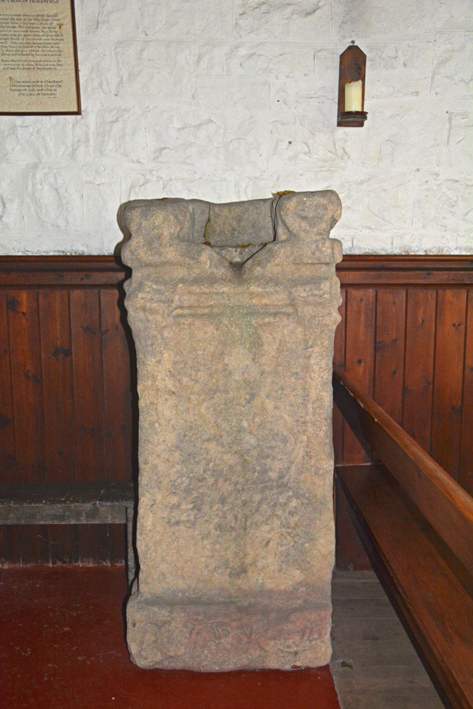
St Oswald in Lee (Heavenfield) submitted by Anne T on 13th Oct 2018. The southern side of the repurposed Roman altar, which is opposite you as you enter from the south door. Recorded as AS Corpus 02, this side has lettering and ornamentation, most of which has been obliterated, but at the base there is a vine trail.
(View photo, vote or add a comment)
Log Text: Heavenfield cross shaft and cross base: We have been to this church before, but didn’t realise the Roman altar had been recut for reuse as a cross base, so decided to revisit it. It is in a really glorious location. The church is set back from the road, so we parked in the layby by the large wooden cross and went through the gate into the field full of enormous sheep. You have to cross the vallum for Hadrian’s Wall to walk to the church, although this is now largely ploughed away.
Inside the porch, on the western shelf/bench, are the two pieces of AS Corpus St Oswald in Lee 01. As you go in through the south door, AS Corpus St Oswald in Lee 02 is straight in front of you. An information ‘board’ is on the wall next to the cross, which reads: “The cross of Heavenfield. The site is sacred where in 635AD Oswald raised the sign of the Holy Cross. From ancient times it has been a place of pilgrimage. For centuries the exact position was made known by a large stone cross set upon a Roman altar which stood south of the church near Hadrian’s Wall. This weather beaten stone was first hewn to furnish a heathen shrine in about the year 200AD, then claimed for Christ and hallowed by the cross it exalted. / Remember Oswald, king and martyr, in the communion of saints. Pray God may bless and keep the people of Northumbria. / How awesome is this place! This is none other than the house of God, and this is the Gate of Heaven. Genesis, 28.17”
On the south wall of the nave is what the church guide refers to as a mason’s mark, but it is very large to be one. It looks like an upside down Templar cross.
Also on the north wall of the nave is a small fragment bearing chevrons and small balls – this is dated to the Norman period.
The churchyard wall is also built with Roman stones.
Bamburgh Barrow 1
Trip No.102 Entry No.6 Date Added: 13th Oct 2018
Site Type: Round Barrow(s)
Country: England (Northumberland)
Visited: Saw from a distance on 9th Oct 2018. My rating: Condition 1 Ambience 3
Bamburgh Barrow 1 submitted by SolarMegalith on 13th Feb 2014. A Bronze Age cist with broken capstone and one of the upright stones visible (photo taken on February 2014).
(View photo, vote or add a comment)
Log Text: Rubbing Stone & Tumulus, Bamburgh: Spotted this apparent 'standing stone' in the field when we were walking back along Doctor's Lane towards St Aidan's Well. There was no obvious way into the field along this route, and we'd already walked for miles, so we contented ourselves with photographing from the stone wall in the next field.
On researching this site when I got home, found out that it was marked on the 1860 OS map as a tumulus with rubbing stone. The tumulus has now been destroyed and the stone is a 19th century insertion into the mound.
Had we realised there was still a visible cist, we might have tried harder to access the field. However, there is such a lot of history in Bamburgh, I'm sure we'll be making a return trip in the not too distant future.
Leper's Well (Bamburgh)
Trip No.102 Entry No.5 Date Added: 13th Oct 2018
Site Type: Holy Well or Sacred Spring
Country: England (Northumberland)
Visited: Yes on 9th Oct 2018. My rating: Condition -1 Ambience 3 Access 4

Leper's Well (Bamburgh) submitted by Anne T on 12th Oct 2018. We tracked down the grid reference/location of the leper's well from the 1860 OS map, but there is nothing here now apart from a modern manhole cover. Does anyone else know anything about this well? In 1955, Pastscape record an entry that says "the well here is modern". I wondered when it disappeared.
(View photo, vote or add a comment)
Log Text: Leper's Well, Bamburgh: Guided by the grid reference given on Pastscape, we walked down Doctor's Lane from St Aidan's Well. Some of the old stone walls around properties, and at the sides of the lanes running off here are ancient, and we thought they could well belong to the old leper hospital.
The grid reference took us to the corner of a row of cottages, where there was a modern manhole cover. The well was last recorded in 1955, so it looks as if it has now been destroyed. I took a few photos of the site, just in case.
Andrew called up the 1860 OS map on his phone and we were confident we had the right location. When I got home, I used the Pastscape and HE entries which gave distances (the dovecot is 140 NE of leper hospital) to triangulate the location of the well, and it agrees with the spot on the old OS map and the spot I photographed.
Bamburgh Castle
Trip No.102 Entry No.4 Date Added: 10th Oct 2018
Site Type: Sculptured Stone
Country: England (Northumberland)
Visited: Yes on 9th Oct 2018. My rating: Condition 3 Ambience 4 Access 3
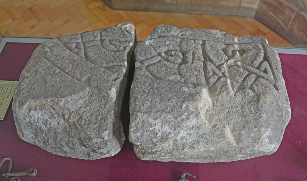
Bamburgh Castle submitted by Anne T on 10th Oct 2018. This piece of carved stone is recorded in the Corpus of Anglo Saxon Stone Sculpture as the 'Bamburgh Castle' stone. Its style dates it to the last quarter of the eighth century to the first quarter of the ninth. Originally described in the 19th century as part of a large cross head, it is know known to be part of the arm of a stone chair or throne. A reproduction can be found outside the keep of the castle, although the Corpus says it is not clear if it is meant to be part of the back or seat.
(View photo, vote or add a comment)
Log Text: Wells and Anglo Saxon Stones at Bamburgh Castle: Note: there is disabled parking next to the State Rooms, but there are many stairs in and around the castle. It’s been a long time since we last came here, and the visit today happened because I’d been sent a 1947 Antiquarian paper about the holy wells of Northumberland. There was also one piece of AS stone in the archaeological museum; listed on the Corpus, which we had still to see.
It was sunny but windy, high up above the sea. It was expensive to get in, but actually was worth the money, as we spent hours here, both wandering around inside and outside.
We found another stone with Celtic Heads in the small Stones Museum, along with a 9th century mortar stone which had been reused to hold a post.
The carved Anglo Saxon stone was in the new Archaeological Museum and Activity area, and there is a recreation of the chair/throne the chair may have looked like outside the keep. This was a favourite for photographs for visitors, so we looked at when it got quieter at the end of the castle opening hours.
Before our visit, I had contacted the castle to try and ascertain the location of three wells inside the castle. There is one well in bottom of keep; the other on the outside wall of the castle at its north western end (no longer visible, but the site can be seen, although covered in sand). The third well we thought we’d found, as we walked up the old Victorian footpath to the castle from the beach, but we were mistaken as we’d had the 1860 OS map orientated wrongly!
Once we’d been round the castle near the ticket office (found when walking back to the car park from the old Victorian footpath from the beach to the castle).
St Aidan's Well (Bamburgh)
Trip No.102 Entry No.3 Date Added: 12th Oct 2018
Site Type: Holy Well or Sacred Spring
Country: England (Northumberland)
Visited: Yes on 9th Oct 2018. My rating: Condition 3 Ambience 3 Access 5
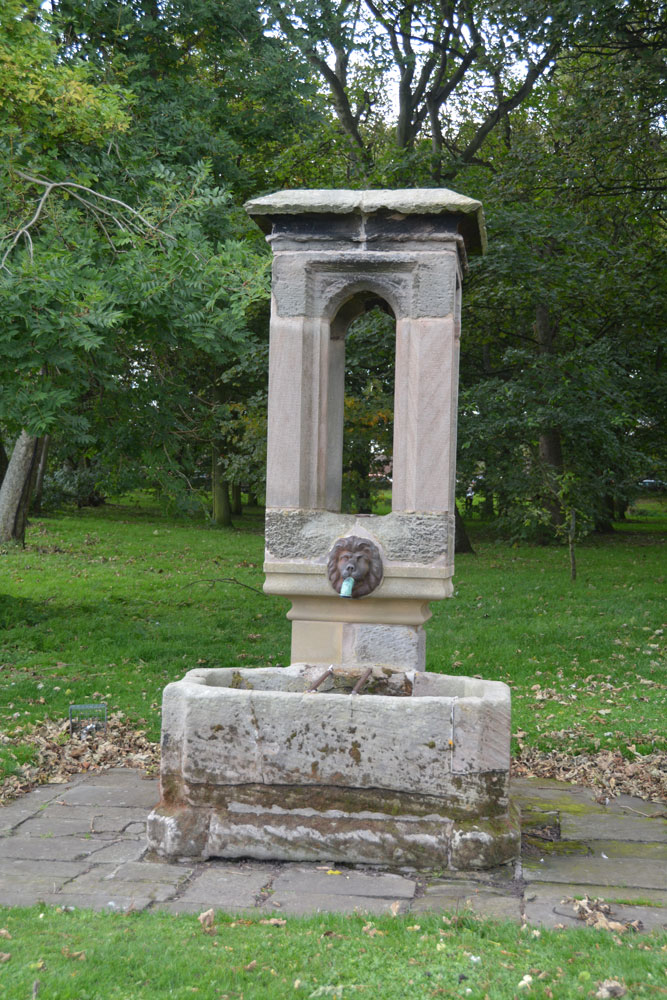
St Aidan's Well (Bamburgh) submitted by Anne T on 12th Oct 2018. First view of St Aidan's Well, standing just east of it, looking west across the triangular village green.
(View photo, vote or add a comment)
Log Text: St Aidan's Well, Bamburgh: This well seemed to form a ‘hub’ for visitors, with a school party and tourists sitting on the benches and grass around this structure, so we needed to make two trips to this well. By 5.30pm there was no one around (apart from the blue wheelie bins lined up along the street!). Obviously a modern structure, but this appears to be the original holy well associated with the church.
The well is now dry, which is a shame, as I'd have loved to see the water gushing into the basin. It might be a modern well housing, but this may well be an ancient site.
In 1947, when Revd Binnall and Miss Dodds produced their list and descriptions of Holy Wells in Northumberland and Durham, the village green was a small plantation of trees. Pastscape notes the name 'St Aidan's Well' is not known locally, but I don't know what it is called. The antiquarian notes mention it was mentioned as 'Edvn. Well' although I'm not sure was Edvn means.
St Aidan's Church (Bamburgh)
Trip No.102 Entry No.2 Date Added: 12th Oct 2018
Site Type: Early Christian Sculptured Stone
Country: England (Northumberland)
Visited: Yes on 9th Oct 2018. My rating: Condition 3 Ambience 4 Access 5
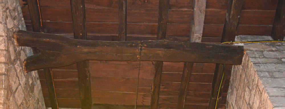
St Aidan's Church (Bamburgh) submitted by Anne T on 12th Oct 2018. "All that remains (of the original wooden church on this site) is a forked beam which can now be seen in the ceiling above the font. Bede’s account of Aidan’s death describes him as leaning against a beam when he died, in a shelter built for him outside the church. With the beam surviving at least two fires it became an object of veneration and was through to have miraculous healing qualities. People came to touch it and even take bits away. Years later it was built into the baptistry to k...
(View photo, vote or add a comment)
Log Text: St Aidan's Church, Bamburgh: We hadn’t intended to visit this church, but having seen two wells located in the property immediately to its east, we decided to take a look before heading off to the castle. The church is open during daylight hours, and is very welcoming, with lights in the nave, chancel and sanctuary, and a great display of literature and guide books.
With this church being so old (there was a cell of St Aidan and a monastery on the site), I was surprised there was no remnant of a preaching cross or cross base. To ensure I didn’t miss anything, I picked up the laminated church guide and ran through the features. It mentioned a timber from the original church, placed in the ceiling above the font. The church was so dark at this point (right at the west end of the church) that I sought lights to illuminate the spot, and looking up, indeed there was a very large (cruck) timber.
The guide also mentioned two old tombstones in the churchyard which are said to be older than the present church. I found one, but not the other.
Grace Darling also has a memorial in the churchyard.
Walking down the eastern wall of the churchyard and looking over to the farm buildings beyond, we identified the sites of two wells marked on the 1860 OS map.
St Mary The Virgin (Ponteland)
Trip No.102 Entry No.1 Date Added: 10th Oct 2018
Site Type: Ancient Cross
Country: England (Northumberland)
Visited: Yes on 9th Oct 2018. My rating: Condition 3 Ambience 4 Access 5

St Mary The Virgin (Ponteland) submitted by Anne T on 10th Oct 2018. The round headed, tenth century grave marker, to be found built into the south wall of the tower. Having moved the boxes off top of the cupboard, to get the best view, I had to sit half way up the wooden staircase to the top of the tower, and point the camera through the slats toward the stone. We also needed a torch as well as a flash to illuminate the stone to bring out the shadows to see the shape of the cross.
(View photo, vote or add a comment)
Log Text: 10th century grave marker, Ponteland: As this stone was one of only a few listed on the Corpus in Northumberland that we had still to see, we had previously visited on 20th September 2018, but were unable to get into the tower. Today, I’d arranged to meet church warden David Butler, plus another David, who had arranged to open the tower for us. They were building benches for memorials, so I had to step over the boxes.
The grave marker was largely hidden behind boxes on top of the cupboards, so we moved the crates, then I climbed half way up the wood steps to get a photo. Great fun!
We got into a conversations about wells, as we were heading off to Bamburgh. David told us that there used to be wells in Ponteland (he lives in a street called Ladywell), there are none remaining.
Cockburnspath Cross
Trip No.101 Entry No.3 Date Added: 2nd Oct 2018
Site Type: Ancient Cross
Country: Scotland (Scottish Borders)
Visited: Yes on 29th Sep 2018. My rating: Condition 3 Ambience 3 Access 5
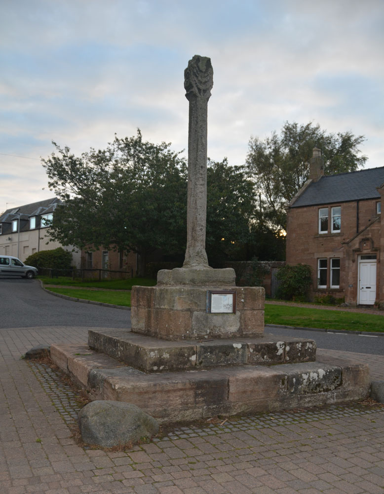
Cockburnspath Cross submitted by Anne T on 2nd Oct 2018. The cross, looking south west down Hoprigg Street.
(View photo, vote or add a comment)
Log Text: Cockburnspath Mercat Cross: Before coming to Cockburnspath, we'd visited the really beautiful Cove, with its smuggler's caves. We'd had to park in the village and follow the single track road running along the top of the cliffs to an old mine tunnel which formed a fun, but very dark, shortcut through to the cove. The bedding planes in the rocks here were fantastic - no wonder James Hutton found the solution to his unconformities only a few miles down the coast. The harbour looks like it might have come straight off an 18th century film set, and there was also a sea arch with a large, round hole in it. Brilliant.
By the time we got to Cockburnspath, only a few miles away, the light was starting to fade rapidly. Parking outside the post office (to avoid the car starring in more of my photographs!), I started to photograph the cross, only to find omeone had left a half eaten pack of McDonalds chips on the base of the stone; we ended up moving these and throwing them away in a nearby bin (yeuk). We also had a look at the churchyard, which had old grave stones, but at this time of night, couldn’t get in. The church had particularly heavy stone slabs used to roof it. We later found the same at Dunglass.
The notice on the side of the cross reads: “Cockburnspath. This Cross was erected in 1503 by King James IV of Scotland in celebration of his marriage to Princess Margaret Tudor, to whom he presented the lands of Cockburnspath as a dowry. The Princess was the sister of King Henry VIII of England and this union of the Scots Thistle and the Tudor Rose was to mark the start of a new and lasting peace, only shattered ten years later by the Battle of Flodden in 1513. / The Cross was repaired with the help of the Regional Council, but mostly by the loyal generosity of the people of this village.”
After seeing this cross, we hopped over the border to East Lothian to see Dunglass Collegiate Church, where we arrived to find a wedding in full swing, and needed torches to look round the inside of this ruined church. Definitely not a chance of getting to see the standing stones nearby at this time of the evening.
Wellbraes
Trip No.101 Entry No.1 Date Added: 30th Sep 2018
Site Type: Holy Well or Sacred Spring
Country: Scotland (Scottish Borders)
Visited: Yes on 29th Sep 2018. My rating: Condition 3 Ambience 2 Access 4
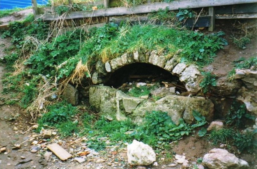
wellbraes submitted by mafenty on 19th Aug 2006. Well from which Wellbraes, Eyemouth derives its name (hidden since 1974 behind the swimming pool) picture taken at that time. Age uncertain ... allegedly "Roman".
grid ref NT944645
(View photo, vote or add a comment)
Log Text: Eyemouth Leisure Centre Well, Wellbraes: This well can only be accessed through the Leisure Centre. Having walked round the Leisure Centre and surrounding buildings, I had to ask at the reception desk, and show a photo of the well. The receptionist didn’t know but one of the personal trainers did, and let us through the fire exit door in the gym; there is a gate at the western end of the centre which leads through into a small garden area; alternatively there is the fire exit through the back of the small gym which leads into the same area.
We could barely recognise the well at first as it was so overgrown with nettles and weeds. Our eyes eventually spotted the arch of stones through the mass of weeds and we trod down a few of the large nettles and dock leaves to take a closer look. The well chamber goes back at least 2m, if not further; whilst there is a wall at the back, this doesn’t seem to be connected to the arched concrete covering over the well basin. We needed better torches to see the back wall of the well, which was partly obscured by a large pile of rubble (bricks and stone) at the back of the chamber.
We could hear water flowing through the well chamber, although there was only a puddle in the bottom. At the left hand side of the well was a very rusty water pipe, but this was dry. Investigating further, we found the water flowing into a low concrete construction at the back of the lip of the well; from there, the water came out of the well chamber through a small rectangular hole and disappeared into a small drain.
With the amount of rubbish around, I didn’t check the quality and taste of the water.
Percy's Leap (Beanley)
Trip No.100 Entry No.5 Date Added: 26th Sep 2018
Site Type: Natural Stone / Erratic / Other Natural Feature
Country: England (Northumberland)
Visited: Yes on 23rd Sep 2018. My rating: Condition 2 Ambience 2 Access 5
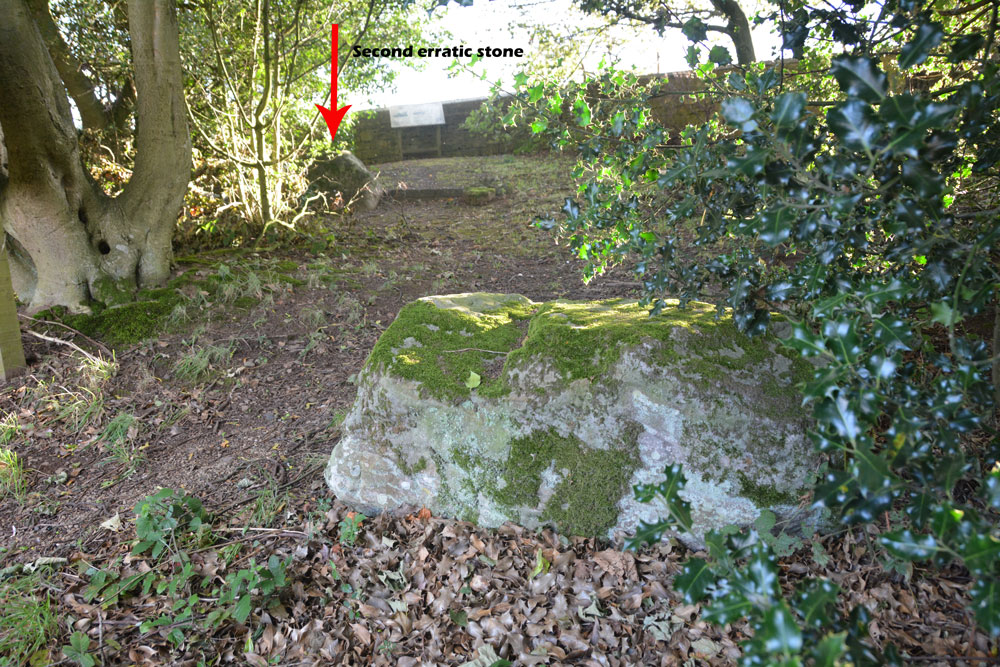
Percy's Leap (Beanley) submitted by Anne T on 26th Sep 2018. Standing near the gate to the enclosure, looking westwards to both the erratic stones. They are 9.5 of my paces - around 9 metres apart.
(View photo, vote or add a comment)
Log Text: Percy's Leap, Beanley (associated with Percy's Cross): Labelled ‘Percy’s Leap’ on the OS with a semi-circular enclosure marked against the edge of the road. Having the car pointed in this direction, and curious to see this site, as it sounded related to Percy’s Cross (by the name), we headed up and parked in the small layby by the information/interpretation board.
There is a low stone wall next to the layby and a gate leading into a semi-circular walled enclosure which is heavily littered and not pleasant. Inside the enclosure a two large stones, which look as if they have been dumped there for effect. In fact, these are two glacial erratics. There are two other interpretation boards inside the enclosure.
The first interpretation board inside the enclosure reads: “The Red Rose of Lancaster. For 30 years between 1455 and 1485 the two families of Lancaster and York fought for the Crown of England. Between 1461 and 1464 the North of England was the centre of activity in the Wars of the Roses. Edward IV supported by the Yorkists was on the throne which he had taken away from the weak Henry VI After the Lancastrian defeat in 1461 at Towton in Yorkshire Henry VI and his wife, Queen Margaret of Anjou, fled to Scotland to plan another campaign against Edward. / Sir Ralph Percy third son of the second Earl of Northumberland, changed sides four times in the Wars of the Roses. In Spring 1463 he was in the Lancastrian fold as were his castles at Bamburgh and Dunstanburgh. In 1464 Edward IV decided to seek a truce with Scotland to enable him to take action to crush the Lancastrians to the north. Lord Montague, younger brother of Warwick the Kingmaker, was sent to escort a Scottish mission through Northumberland in safety. / Learning of Lord Montague’s attempts to meet the Scottish mission the Lancastrians tried to ambush the Yorkists in Durham but this failed when Montague was alerted to the threat. Before proceeding further north Montague increased his forces at Newcastle. His path to Scotland was barred here at Hedgeley Moor by the Lancastrian troops of Sir Ralph Percy and the Lords Hungerford and Ros. / At the start of the battle Lords Hungerford and Ros decided to leave the field with their troops. Montague’s and Percy’s troops attacked head on. Sir Ralph Percy is reputed to have charged the Yorkist line at which his horse is said to have leapt and was wounded doing so. Sir Ralph fell soon afterwards and said at his death, “I have saved the bird in my bosom”. It is not known whether his final words meant that he died for his rightful monarch, Henry VI, or whether he had kept the secret of where Henry and Margaret were hiding. / Montague’s troops finished off the remaining Lancastrians quickly. Less than a month later the two armies met at Hexham where the Yorkists won a convincing victory which ended the Wars in the north for the time being. / Legend has it that the two stones in front of you mark the leap of Sir Ralph’s horse at the height of the battle.”
There is no record on HE for this site.
Percy's Cross (Beanley)
Trip No.100 Entry No.4 Date Added: 26th Sep 2018
Site Type: Ancient Cross
Country: England (Northumberland)
Visited: Yes on 23rd Sep 2018. My rating: Condition 3 Ambience 3 Access 4
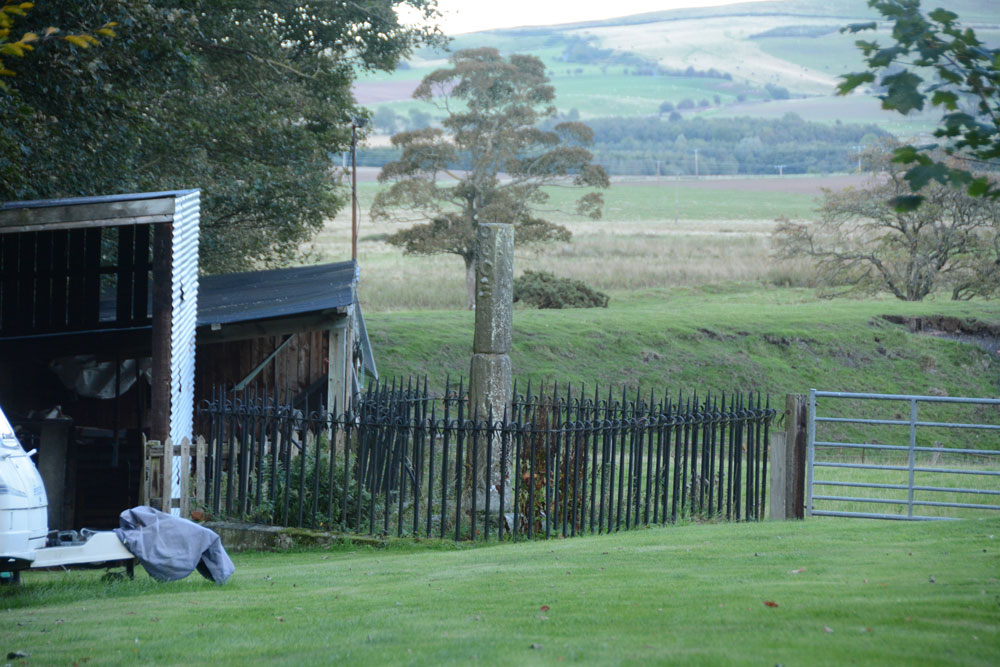
Percy's Cross (Beanley) submitted by Anne T on 26th Sep 2018. View of Percy's Cross, looking eastwards towards the now disused railway line. I'm standing in the middle of the field being used for caravan storage looking over the cross with its 19th century railings.
(View photo, vote or add a comment)
Log Text: Percy's Cross, near Beanley, Northumberland: We didn’t have enough time to head up the hill behind Old Bewick, as it had gone 5pm, and there was about a mile each way to walk to the first site. Having spotted Percy’s Leap and Percy’s Cross on the OS map, we decided to stop off and look at these instead.
It was difficult to park just off the busy A697, but we found the wide entrance to a farm track opposite the sawmill, on the western side of the road, and walked back to the farmhouse on the opposite side of the road.
We could see the cross from the gate into their garden, but the gate had a huge chain and even larger padlock. Fortunately, we spotted a track into the wood a metre or so to the north of the edge of the garden. Following this for about 100m led us to a gateway into a field being used partly for caravan storage, and this gate gave access to the very overgrown cross which was surrounded by iron railings with very sharp ornamental spikes.
Worth stopping off to see, although I wondered if this, being dated at 15th century, was too late to post on the Portal, although it is classed as a wayside cross, so I've posted it, along with its associated 'Percy's Leap' erratic rock site.
Holy Trinity (Old Bewick)
Trip No.100 Entry No.3 Date Added: 24th Sep 2018
Site Type: Ancient Cross
Country: England (Northumberland)
Visited: Yes on 23rd Sep 2018. My rating: Condition 3 Ambience 5 Access 4

Holy Trinity (Old Bewick) submitted by Anne T on 24th Sep 2018. The consecration cross on the southern column of the sanctuary.
(View photo, vote or add a comment)
Log Text: Ancient crosses, Holy Trinity Church, Old Bewick: This is truly a real gem of a church, with great historical notes in a binder in the church. I took these temporarily out of the folder and read out from them as we went round and saw the individual features identified. There was another set of notes, from a talk given in 2017 which I also photographed and will transcribe into my walk journal when time allows.
In some ways, this church is more enigmatic than Escombe Saxon Church, and is smaller. It comprises a nave, a chancel and a semi-circular apse which has been beautifully decorated.
There is so much to look at – original Norman windows. A 14th century effigy. Huge slabs in the west wall. There is what is described as a cross shaft in corner of porch. There is a lovely consecration cross on south pillar of sanctuary. The carvings on north pillar of chancel are particularly nice.
The cross base (?) in the churchyard that I photographed on 13th April 2014 no longer appeared to be there.
Hawklemass Well (Whittingham)
Trip No.100 Entry No.2 Date Added: 24th Sep 2018
Site Type: Holy Well or Sacred Spring
Country: England (Northumberland)
Visited: Yes on 23rd Sep 2018. My rating: Condition 2 Ambience 4 Access 4
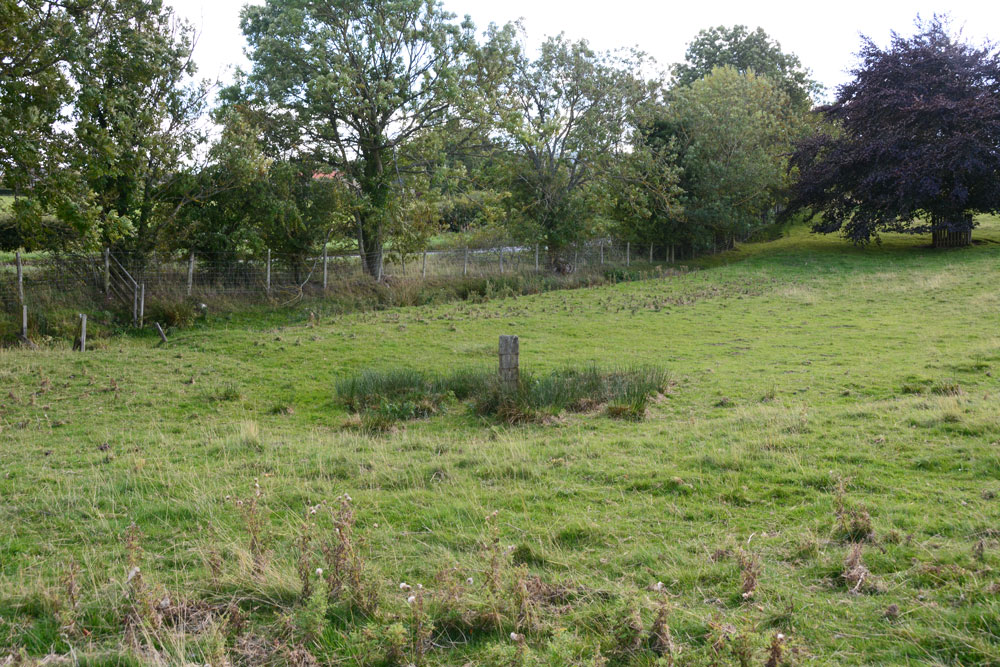
Hawklemass Well (Whittingham) submitted by Anne T on 24th Sep 2018. The well site, seen from slightly higher up the slope, just to its north west, looking east.
(View photo, vote or add a comment)
Log Text: Hawklemass Well, Whittingham: From St Bartholomew's Church in Whittingham, we drove round to this site, parking on the verge near the footpath sign to the church, which was quarter of a mile over the hill. Stepping over the stile into the field, there was a boggy patch marked by a substantial post, such as I've seen on a number of other wells, including Robin Hood's Well in Colwell. Sited at the bottom of a slope, it was a natural place to find such a well.
At the hedgerow to the east of the well, but just to the west of the road, there was a small gully or drain coming down alongside the hedgerow, which seemed to form a rectangular pool in the grass near the well. The OS map shows two drains or small streams which meet near this point.
There was no sign of any stone or brick structure to indicate this has been a well basin or trough. There is no record of this well on the modern OS map, neither on HE or Pastscape, or any other local record on the internet - curious.
On such a nice sunny afternoon, this site seemed entirely peaceful and normal - I was disappointed not to meet the Hawklemass Ghost mentioned by The Northern Antiquarian!
St. Helen's on the Lea (Old Cambus)
Trip No.100 Entry No.2 Date Added: 30th Sep 2018
Site Type: Sculptured Stone
Country: Scotland (Scottish Borders)
Visited: Yes on 29th Sep 2018. My rating: Condition 2 Ambience 4 Access 4
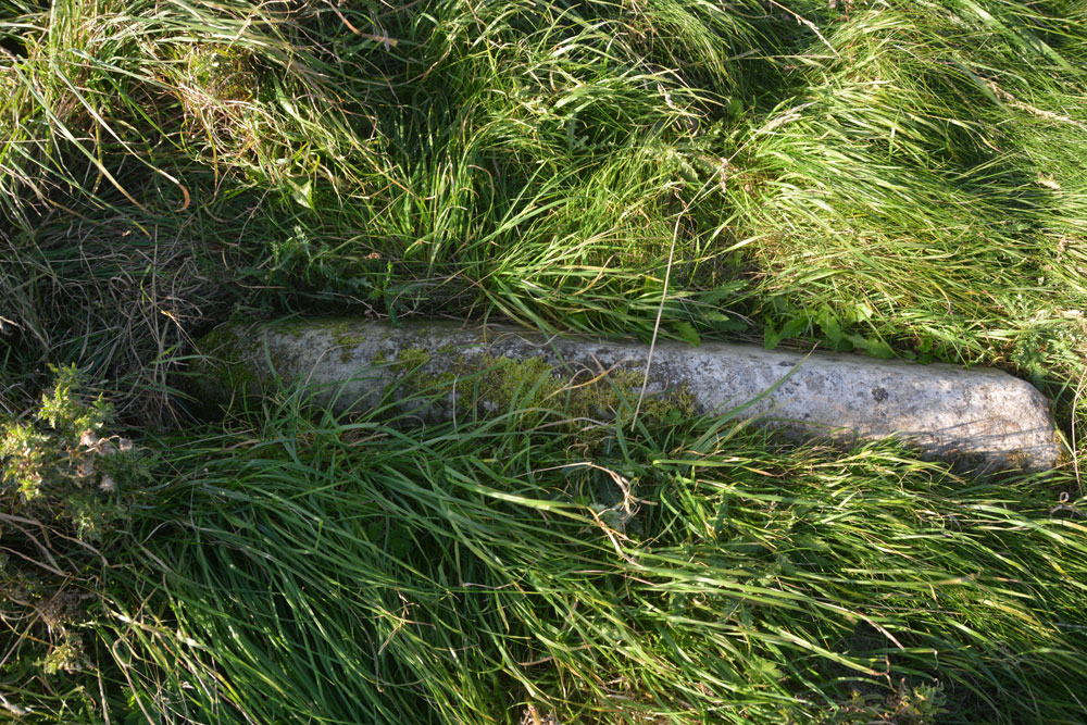
St. Helen's on the Lea (Old Cambus) submitted by Anne T on 30th Sep 2018. The almost complete hogback stone, to be found at the southern side of the eastern gable wall of the church. Canmore 59948 describes some decoration on the hogback, but there was nothing we could see. The stone was almost buried in knee high grass that covered the site.
(View photo, vote or add a comment)
Log Text: Hogback at the ruins of St Helen's Chapel, Old Cambus: We found the first hogback easily – at the northern side of the east gable wall, but the second one we hunted for but were unable to find. The cross incised slab we searched for ages, even matching up the angles of the stone to the masonry behind on the Canmore images, but drew a blank. The site was knee deep in grass, with tumbles of stone underneath, so it could have been anywhere. A strimmer would have helped! Similarly with the fragment of hogback on the southern side of the chancel. We found many tumbled stones in the grass, but even looking closely for the tegulations, we didn’t locate it, which was disappointing.
The information board which sits near the junction of the road to the quarry to the footpath to the chapel and Siccar point reads:
“Proceed from here, through the kissing-gate, past the ruin of St Helen’s Chapel and along the top of the steep sea-braes to Siccar Point, arguably the most important geological site in the world. In 1788 it gave James Hutton final proof of his revolutionary claim that the Earth is eons old He based his claim on painstaking observation of rocks and soil over a period of some 30 years. / James Hutton (1726-1797) farmed locally near Reston and was a self-taught geologist. Having already published his theory, he was on a mission to establish the evidence. Before discovering the proof at Siccar Point, by boat with his friends Sir James Hall and John Playfair, Hutton knew what he was looing for and had an idea of where to find it. He sent Sir James, a local landowner from Dunglass and also a geologist, to review the area before embarking on their boat trip below the braes. Sir James may have done this by observing that the stone used to construct field boundaries in the vicinity was (and still is) a combination of rock from above and below the uncomfority (red sandstone and greywacke). / Hutton’s theory released science and philosophy from limitations of the biblical age of the earth (6,000 years old). Though bitterly disputed at the time, it is now accepted as a fundamental of science. James Hutton also expounded with authority of theories as diverse as the nature of light and methods of education, and was a significant agricultural innovator and improver.”
Just before reaching the ruins of St Helen’s, someone has carved an old tree trunk into an L-shape with a toilet seat on top! Note: the gate to the field was locked, and we had to climb over the rather tall gate.
St Bartholomew's Church (Whittingham)
Trip No.100 Entry No.1 Date Added: 24th Sep 2018
Site Type: Ancient Cross
Country: England (Northumberland)
Visited: Yes on 23rd Sep 2018. My rating: Condition 3 Ambience 4 Access 4
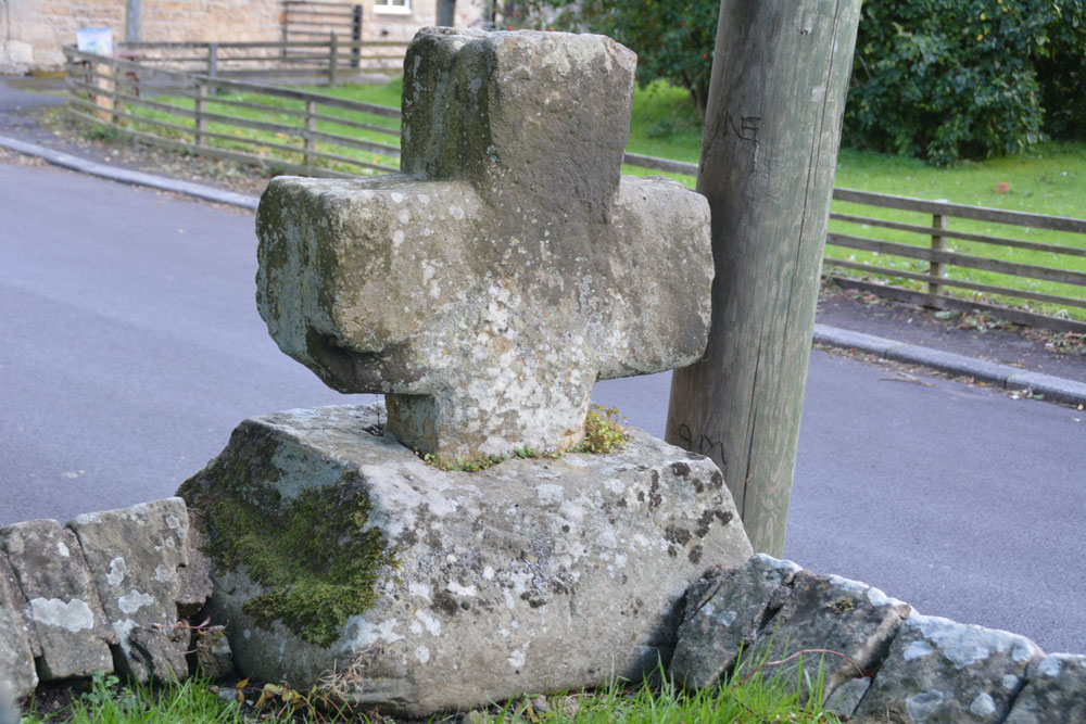
St Bartholomew's Church (Whittingham) submitted by Anne T on 24th Sep 2018. Looking south east across the cross head and base, showing its slightly damaged/chipped lower arm (towards the centre, left of the photo). Historic England simply says the cross is 'medieval'.
(View photo, vote or add a comment)
Log Text: Ancient Cross, St Bartholomew's Church, Whittingham: [please note: there are steps up to the churchyard and church; there may be wheelchair access which we didn't spot on the day - please check before visiting]. This cross was remarkably easy to spot, as it was sited on the corner of the wall to the south east of the churchyard, right by a parking spot for one car at the base of the steps into the churchyard.
There was an informative church guide, although the language was slightly archaic and we had to re-read several of the passages to ensure we were interpreting these correctly.
The guide reads: “Whittingham [spoken as “Whitingjum”, or “Witnjum”] is a name which has evolved from the Anglo Saxon Hwita-ing-ham, meaning “the home of Hwita’s people”. The present church stands on rising ground which could have been the meeting place of Hwita’s people for their Moots before it became the site of a church.
Our visit was interrupted by two people coming in to prepare for the 4pm service. As they were praying at the altar, it seemed disrespectful to continue taking photographs.
The church guide is very useful in explaining all the features, and I’ve emailed one of the church wardens to see if it’s possible to get hold of a copy of the detailed guide mentioned both in the church and on one of the websites I’ve visited (the Northern Vicar’s blog).
There is still Saxon work to be seen in the tower, with its semi-circular arch and squared, heavy side, dated to 900AD by the ‘long and short’ stone work (as we saw at Heddon on 20th Sept, last week).
There is also a section of Saxon stonework in the north aisle wall, forming what would have been a half-arch which was later filled in, and it thought to be the entrance to a small side chapel in the original church.
The guide goes onto say: “Almost certainly there had been another earlier church built on this site, but its possible form can only be conjectured (see the detailed guide). There is a record of a consecration at 735AD. It is also likely there was a yet earlier church existing at the time of the Synod of 684AD.
The guide also mentions, as one of the ‘curios’ a stone on the aisle walling to the left of the porch, at the wall’s left hand corner. Just to the right of the top of the buttress is a stone bearing two arrows (Norman chevrons). “This could be an inserted fragment from some demolished structure [or are these natural fault lines in the stone?].
We popped across the road to see the still working water fountain, although this is too recent a feature to log on the Portal.
St Andrew's Church (Heddon on the Wall)
Trip No.99 Entry No.1 Date Added: 23rd Sep 2018
Site Type: Ancient Cross
Country: England (Northumberland)
Visited: Yes on 19th Sep 2018. My rating: Condition 3 Ambience 5 Access 4
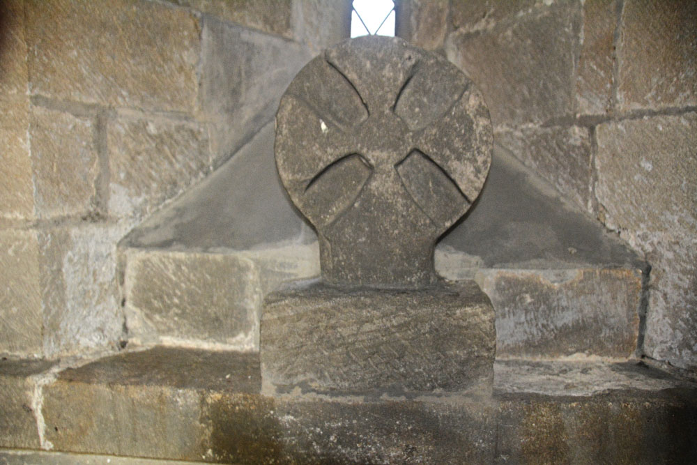
St Andrew's Church (Heddon on the Wall) submitted by Anne T on 23rd Sep 2018. The Saxo-Norman cross finial (or possibly a grave marker), cemented to the north window sill in the sanctuary of this old church. Found underneath the vestry floor during renovations, this is dated to the eleventh century. See AS Corpus Heddon-on-the-Wall entry for more information.
(View photo, vote or add a comment)
Log Text: St Andrew's Church, Heddon on the Wall: The church is no longer open every day, but we were asked to go along to Holy Communion at 10.30am on a Thursday and stay and enjoy the church afterwards. A very kind lady called Ann showed us round (I think she mentioned her husband was the historian), and I got proper photographs of the Anglo Saxon Cross Head in the Sanctuary this time (last time I visited I wasn’t aware this was an old piece, just thought it was an architectural fragment).
There are a number of other really interesting fragments on the west window sill of the meeting room. I really love the way the arches between the nave and chancel and chancel and sanctuary have settled over the years. Wonderful place! Would have loved to have wandered around this church on my own.
Edinburgh Runestone
Trip No.98 Entry No.2 Date Added: 21st Sep 2018
Site Type: Carving
Country: Scotland (Midlothian)
Visited: Yes on 18th Sep 2018. My rating: Condition 3 Ambience 3 Access 4
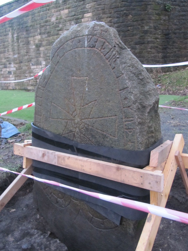
Edinburgh Runestone submitted by Anne T on 7th Jan 2018. The Runestone seen by clambering up the steep muddy track from Princes Street Gardens, just below the Castle Esplanade. The runes read: ""Ari engraved this stone in memory of Hialm his father. God help his soul."
(View photo, vote or add a comment)
Log Text: New site of the Edinburgh Runestone (not been moved yet): As we were going to a building near to hear, we thought we’d do a detour to this part of the University.
We wandered around George Square first of all, but only found a modern sculpture called The Dreamer. We then identified 50 George Square (taken from the BBC article about the relocation of the stone), but only spotted a large hole in the middle of a square flower bed, hedged by low privet, around the side of the building. Having walked all around it, we went into check and I asked the security guard at the reception desk. He told us the stone hadn’t yet been moved, but the hole had been dug in preparation. I thanked him and went to take a photograph of the new site.
Grassmarket modern menhir
Trip No.98 Entry No.1 Date Added: 21st Sep 2018
Site Type: Standing Stone (Menhir)
Country: Scotland (Midlothian)
Visited: Yes on 18th Sep 2018. My rating: Condition 3 Ambience 3 Access 5

Grassmarket modern menhir submitted by ladrin on 8th Mar 2018. Modern menhir on the Grassmarket, Edinburgh.
(View photo, vote or add a comment)
Log Text: Modern Megalith, Grassmarket, Edinburgh: This stone was on our walk for the afternoon. It took a bit of finding, located behind the bins and underneath the trees. This modern megalith stands under a group of trees on the paved area of Grassmarket. In the time we spent photographing it, no-one else appeared remotely interested, despite the large numbers of tourists in the area.
It has a plaque which reads: “This plaque was unveiled on 3rd of October 1977 by the Rt. Hon. Kenneth Borwick, Lord Provost of the City of Edinburgh, to commemorate the 500th anniversary of a reorganisation of Edinburgh Markets authorised by King James III on 3rd of October 1477. The Cattle Market was situated at the western end of the Grassmarket and in King’s Stables Road. This area was then just outside the Burgh.” Underneath this larger plaque is a smaller one which says: “Stone laid by Grassmarket Area Traders Association, 3rd October 1977.”
Ulgham Cross
Trip No.97 Entry No.3 Date Added: 17th Sep 2018
Site Type: Ancient Cross
Country: England (Northumberland)
Visited: Yes on 16th Sep 2018. My rating: Condition 3 Ambience 3 Access 5
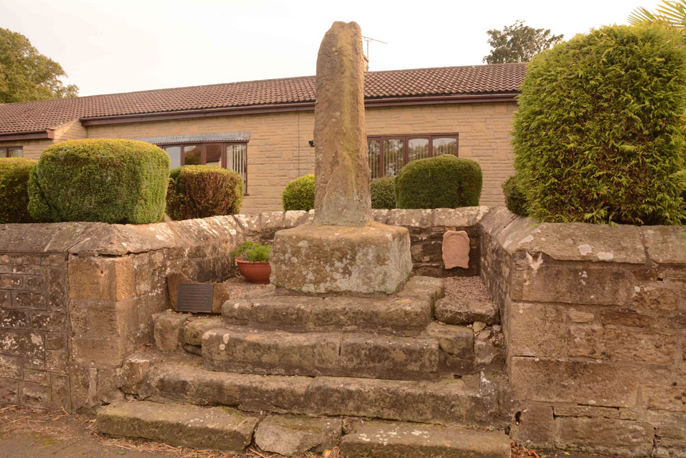
Ulgham Cross submitted by Anne T on 17th Sep 2018. The Ulgham Cross, which is set in a recess in the roadside wall, near to the junction of the B1337 and Ulgham Lane. It has an overall height of 3m, the plain (but weathered) cross shaft standing on four very old stone steps, which look as if they used to belong to an old village cross.
(View photo, vote or add a comment)
Log Text: Ulgham Cross, Near Ashington, Northumberland: From Newbeggin By The Sea, we headed inland to try and find this cross, which we thought was near the church. In typical Tate fashion, we'd arrived when there was a Sculpture Show at the Church; as they were charging to go in, we declined, and set off to find this cross, which is around 320m WSW of the church of St John The Baptist.
The photographs we'd seen of the cross had black painted iron railings in front of it, and we were temporarily confused as these have now been removed. This cross is located just west of the junction of Ulgham Lane with the B1337, in front of two modern bungalows. With the railings no longer in place, I walked up the four steps and had a look at the back of the cross. It looks as if it’s had a hard life and has numerous holes and weathering. It looked to my untrained eye as if it might have been a repurposed standing stone.
Much to the amusement of the passing traffic, I darted in and out of the road to try and get the best photographs I could, as the sunlight behind the cross was dazzling.
St Bartholomew's Church (Newbiggin by the Sea)
Trip No.97 Entry No.2 Date Added: 30th Sep 2018
Site Type: Ancient Cross
Country: England (Northumberland)
Visited: Yes

St Bartholomew's Church (Newbiggin by the Sea) submitted by Anne T on 26th Sep 2018. This unusual fragment is built into the southern end of the east wall, near the altar (inside). It has been interpreted as "a net with entangled fishes" (the fishes head can just be seen towards the top of the stone). This fragment is dated to the 12th century and is said to have been part of a column capital.
(View photo, vote or add a comment)
Log Text: Ancient cross slabs, Newbiggin by the Sea: The website for St. Bartholomew’s announces that the church “has one of the most important collections of coffin lids and grave markers in the county, mostly re-set during the 1913 restoration, when the north aisle, demolished in antiquity, was reinstated. Other fragments are distributed around the church and in the South porch. There are around 20 pieces in all. Most of the slabs are of late twelfth or thirteenth century date; several show signs of post medieval re-use.”
I have included my photographs and notes here, as I think these grave markers are more spectacular than those in Kilmartin churchyard – their designs are less worn and Peter Ryder, archaeologist for the church, has written about them in his assessment of the church, dated January 2013.
On the day of our visit, the mid afternoon sun was streaming through the windows on the northern side of the church, which made photographing some of the fragments a little tricky (my photographic skills weren’t quite up to it!) and the stream of visitors into the church made me feel rude by continually using the flash.
Some of the cross slabs are in the vestry and some in the tower, but it was not possible to see these. Another three have been used as paving slabs on the external west wall of the tower, but I didn’t spot these, as they seem to be worn.
From the small guide book “The Church of St. Bartholomew”, centre right page:
The two (cross slabs) above the altar at the east end are outstanding with their richly carved borders, delicate florets and symbolic shears and keys. An engraving of one was published as long ago as 1854, shortly after their discovery, when they were recognised as being of national importance.
