Contributory members are able to log private notes and comments about each site
Sites Anne T has logged. View this log as a table or view the most recent logs from everyone
Ramsdale
Date Added: 18th Aug 2014
Site Type: Standing Stones
Country: England (Yorkshire (North))
Visited: Yes on 15th Aug 2014. My rating: Condition 3 Ambience 4 Access 3
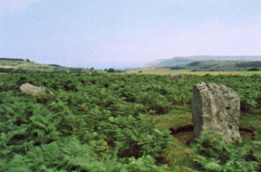
Ramsdale submitted by kelpie on 28th Sep 2002. A small circle overlooking the coast and cliffs at Ravenscar.
NZ 92057 03770
(View photo, vote or add a comment)
Log Text: Having escaped the rain and wind in our part of Northumberland, we headed for the east coast, where it was sunny and warm (although windy). However, it was a real relief to escape the sheer numbers of people in Whitby and head for the relative peace of the moors. Heading out of town on the A171, we followed the directions on the Portal site for the Ramsdale Stone Circle, which were spot on, thanks! Driving down the A171, we spotted the footpath we needed about 400 yards north of the junction of the A171 with the B1416, so turned round at the B1416 junction and parked on the grass verge at the edge of the entrance gateway to the track/footpath leading to Ramsdale House/Ramsdale Holiday Cottages.
We then followed the metalled track down towards Robin Hoods’ Bay; once over the brow of the hill, the views across to Robin Hood’s Bay were spectacular - we could see the waves breaking on the shore of the bay below.
Avoiding being mowed down by the four-wheel drive vehicles which came up and down the track at regular intervals, we missed the track off to the right mentioned in the directions on the Portal (but spotted it on the way back, as it dog-leg’s across the metalled track, rather than going straight across), and ended up following another track down to the gate in the next field boundary. It was then easy to turn and follow the sheep tracks back up the small hill to where the stones where located. The Ramsdale Stones appeared quietly, but suddenly, out of the heather. What a place to build a monument.
It was odd that there were only three stones, and we wondered (like many others) if there had been a fourth. We wandered around looking for stones under the grass, but only found a number of small, loose stones.
There were clear cup marks on the western most stone, and some possible ones on the northern stone.
The A171, which wasn’t far away, was very busy with Friday afternoon traffic, which spoiled the ambience a little, but the site itself is a lovely place to be. It is only a short walk from the main road, and worth stopping to visit, should you be passing.
White Cross (Three Howes Rigg)
Trip No.15 Entry No.1 Date Added: 10th Apr 2017
Site Type: Marker Stone
Country: England (Yorkshire (North))
Visited: Yes on 9th Apr 2017. My rating: Condition 2 Ambience 2 Access 5
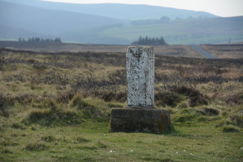
White Cross (Three Howes Rigg) submitted by Anne T on 10th Apr 2017. Standing on Smeathorns Road looking across to the stone and its earlier cross base, with the moors of the National Park in the distance to the west.
(View photo, vote or add a comment)
Log Text: White Cross, Three Howes Rigg, North Yorkshire: Approaching the Three Howes Tumuli on Smeathorns Road, we spotted this "White Cross" marked on the map at the road junction with Commondale Village. Stopping and running across the road in between the fast moving traffic, I took some photographs. This cross is listed by Historic England as entry 1250385, and is described as an "early to mid-C19 boundary stone on medieval base of wayside cross." The views across the National Park to the west would have been spectacular but for mist.
Wades Stone (South)
Date Added: 18th Aug 2014
Site Type: Standing Stone (Menhir)
Country: England (Yorkshire (North))
Visited: Yes on 15th Aug 2014. My rating: Condition 3 Ambience 3
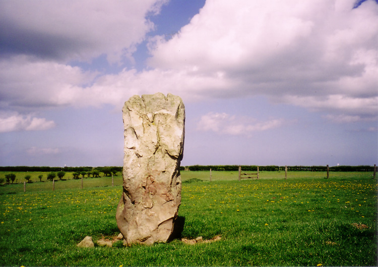
Wades Stone (South) submitted by DavidRaven on 13th May 2005. The southern Wade's Stone, looking north.
(View photo, vote or add a comment)
Log Text: From Wade’s Stone North, we drove back down Goldsborough Lane to the junction with the A174 and crossed straight over to East Barnby. Immediately over the road junction, there is a view of Wade’s Stone South from the first field gate (about 50 yards south of the junction), to the right hand side of the road.
There are no public footpaths leading to the stone, so we contemplated asking the Outdoor Centre next door if we could walk to the back of their site and hop over the hedge to take a photograph. However, this place was very forbidding, with many notices requesting ‘visitors to report to reception’ and a strong, metal barrier across the entrance gate, it had more of a feeling of a strict army camp rather than an outdoor activity centre. There was no-one wandering around, so we bottled out.
Bumping up onto the verge opposite the Centre, we walked back to the field gate by the road junction and looked over. There was a clear track used by a tractor from the field gate diagonally across the field to the Wade’s Stone South field. I later regretted not being brave enough to walk across the field to get a closer photograph, but the part of me that obeys the code/rules baulked at trespassing. We used my 300 mm lens to take a photograph of this stone; however, as this lens doesn’t have any vibration correction, the shots were fuzzy.
I’m going to try and track down the farmer/landowner, and next time we head back (hopefully to see the Old Wife’s Neck), we can include this in our list of sites to visit.
Money Hill (Pickhill)
Trip No.23 Entry No.3 Date Added: 16th May 2017
Site Type: Artificial Mound
Country: England (Yorkshire (North))
Visited: Yes on 11th May 2017. My rating: Condition 2 Ambience 3 Access 5
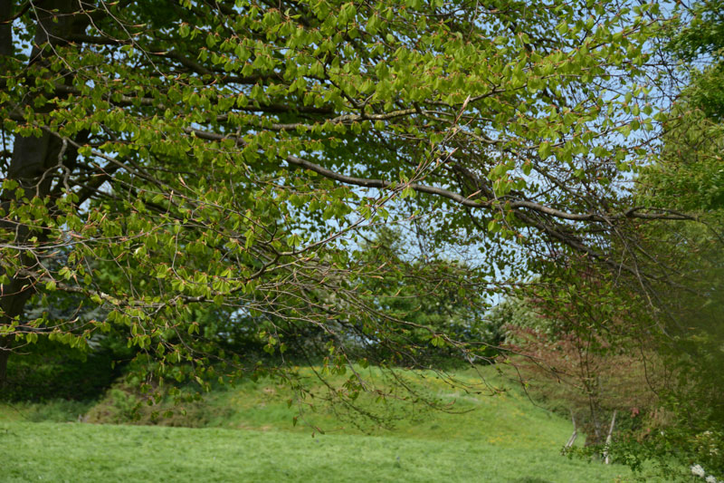
Money Hill (Pickhill) submitted by Anne T on 16th May 2017. The south eastern side of the motte rises about 3 metres high. Without the mentions on the OS map and the All Saints church guide, I would have driven straight past this scheduled ancient monument!
(View photo, vote or add a comment)
Log Text: Money Hill Motte, Pickhill: Leaving All Saints, going back down Money Hill to Street Lane, we stopped to look at the remains of the motte. I confess that without the grid reference and the OS map, I would have mistaken this for just another earthwork.
This is in fact a scheduled ancient monument, which was cut be the old railway line and the building of a bungalow. It is unusual in that it is square in shape.
Didn’t stop to wander round, as we were late for our appointment at St. Thomas’s, Brompton.
Wades Stone (North)
Date Added: 18th Aug 2014
Site Type: Standing Stone (Menhir)
Country: England (Yorkshire (North))
Visited: Yes on 15th Aug 2014. My rating: Condition 4 Ambience 4 Access 4
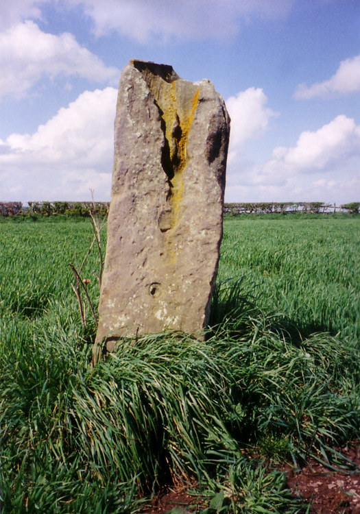
Wades Stone (North) submitted by DavidRaven on 10th May 2005. Showing the large groove on the northern Wade's Stone.
(View photo, vote or add a comment)
Log Text: From Robin Hood’s Bay, sadly Old Wife’s Neck was the wrong direction (at this time of day and for this trip) so needs to wait for another day; wanting somewhere to go on the way home, we hit upon Wade’s Stones near Goldsborough and East Barnby. Avoiding Whitby, we headed west on the A174, and turned off north onto Goldsborough Lane towards the northern stone. Goldsborough Lane is a single track road and at this time of night (about 6pm) was busy with traffic going home. After just over 1km, we passed a wood on the left hand side, and almost immediately found the footpath/track heading westwards towards Brockrigg Farm. The only available parking space visible at this point was at a field entrance on the opposite side of the road, so thinking we could run back if the tractor in the field needed to get out, we squeezed into the field entrance and headed up the footpath opposite.
At first, we saw nothing but stacks of hay bales, then after 100 yards, the track took a shallow left hand bend, and the stone came into sight - about another 100 yards up the track and about yards left across the field.
There was a combine harvester in the field, and a car had just bombed up the track as we were walking up, but we couldn’t find anyone to ask if we could walk up to the stone. The crop had only just been harvested, so we didn’t think the farmer would mind up walking over the stubble to take some photographs.
The sun was quite low in the sky at this point, and the quartz crystals on the stone sparkled in the light. I had to admire the skills of the farmer and his combine harvester – judging by the wheat stalks left around the stone, he managed to get incredibly close to the stone, without touching it (We wondered to ourselves if he had ever knocked it down in the past, but there were no signs of damage from machinery!)
I just started to talk photographs when there was a loud rustling from the wood to the south. There was a short silence, then something burst out of the trees and headed towards us – I thought at first it was a couple of large dogs, but then realised they were two deer. They chased across the field we were in, into the next field (I got photographs of their ears and heads peeping above the wheat), then they appeared back in ‘our’ field, just seeming to chase each other for the sheer pleasure of running around. Only having seen deer once or twice in the daylight, this felt very special, although they were too fast to get many photographs of. The deer disappeared back into the woods, and we continued to take photographs of the stone.
Had the modern hedges not been in the way, you would have been able to see clear views of Whitby to the east and Runswick Bay to the west, and I checked this out when we crossed the road back to the car, and peered over the gate to the coast.
Danby Rigg Marker Stones
Trip No.32 Entry No.2 Date Added: 10th Jul 2017
Site Type: Marker Stone
Country: England (Yorkshire (North))
Visited: Yes on 2nd Jul 2017. My rating: Condition 3 Ambience 4 Access 4
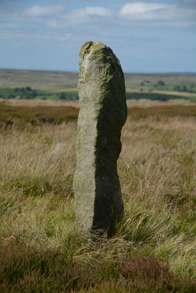
Danby Rigg Marker Stones submitted by Anne T on 9th Jul 2017. This is the same stone from a different angle, looking north east across the moorland towards Ainthorpe village. It s a lonely spot, which could be very wild in winter months.
(View photo, vote or add a comment)
Log Text: Danby Rigg Marker Stones, North Yorkshire: I was really surprised to find these marker stones on top of the moor, running from the Standing Stone and trig point in line with Slate Hill to Danby Dale.
We didn't walk to all of them, as we wanted to get across to the cross dyke, round cairn and ring cairn on the northern side of the ridge.
As an olden-day traveller, particularly in winter months, I would have been grateful to have seen these stones marking the way. Beautiful views.
Thornborough Central
Trip No.64 Entry No.3 Date Added: 16th Jan 2018
Site Type: Henge
Country: England (Yorkshire (North))
Visited: Yes on 15th Jan 2018. My rating: Condition 3 Ambience 4 Access 4
Thornborough Central submitted by DavidRaven on 28th Nov 2003. Thornborough central, by the southern gap in the henge banks. November 2003.
(View photo, vote or add a comment)
Log Text: Thornborough Henge: We stopped off here just before sunset and walked round the henge in the dusk. This time, rather than being here on our own, there were lots of dog walkers around for the first part of our visit. I was horrified by the amount of burrowing that was all around the henge; it seemed to be slowly destroying the banks of the henge. I don't remember there being this much on our last visit. Not sure what to do about it. An email to the local archaeologists?
I took some photographs but need to work out how to produce a panorama from them, as my photostitch software seems to have stopped working.
St Mary (Leake)
Date Added: 29th Sep 2014
Site Type: Ancient Cross
Country: England (Yorkshire (North))
Visited: Yes on 26th Sep 2014. My rating: Condition 3 Ambience 4 Access 5

St Mary (Leake) submitted by Anne T on 29th Sep 2014. St. Mary The Virgin, Leake, taken from the churchyard wall nearest the A19, looking back at the west end of the Norman tower.
The Saxon cross can just be seen in the centre of the image, just above the window arch.
(View photo, vote or add a comment)
Log Text: St Mary’s Church, Leake: Saxon Cross and Sundial: I hate the A19 as I think it’s a fast, dangerous road, and avoid it whenever I can. However, driving up and down to York in a previous life, I’ve seen this church which is right by the A19 a couple of times before – driving past at 70 mph there is barely time to acknowledge that ‘that church looks interesting’ before you’ve past it.
Not wanting to turn up and find the church closed, I’d checked with the vicar’s wife before setting off (the church is usually left open during the day - “just push the bird screen and close it behind you”).
Having picked husband Andrew up from Northallerton station, we took the road westwards through Bullamoor and Kirkby Sigston back to the A19. Taking our life in our hands, we eventually crossed the road. Looking very carefully for the turnoff to Leake Hall (owned by major farmer G.E. Peacock), the side road was easier to find than we thought, and we pulled up outside the church. There is surprisingly a large car park for the congregation, which is wonderfully well cared for – this church has a very friendly atmosphere.
The skies were brilliant blue, which made taking photographs interesting – lots of light and dark shadows.
The first amazing thing about this church was the door, which is obviously very old with a smaller door set inside it (and internally, its lock).
It is easy to spot the Saxon cross on the west wall of the tower. The church guide says that this may well have been the original churchyard cross.
It was a little harder to make out the sundial, which is on the south wall of the nave, just east of the porch, as I was expecting a ‘scratch cross’. It can be found next to a medieval roundel, and is just a plain base with the remnants of an iron post in the centre. The medieval roundel is splendid, with a carved beast prominent.
Internally, the building has some really interesting features – the Norman pillars with their carved capitals; the bend in the arch above the west door, and also the carvings on the bench-ends from the 1500s (which came from Bridlington Priory following the Dissolution).
The farm (Leake Hall) next door is really old, and it would have been nice to have been able to wander round this, too.
Definitely worth a stop if passing by.
Howe Hill (Felixkirk)
Date Added: 29th Sep 2014
Site Type: Round Barrow(s)
Country: England (Yorkshire (North))
Visited: Yes on 26th Sep 2014. My rating: Condition 2 Ambience 4 Access 5
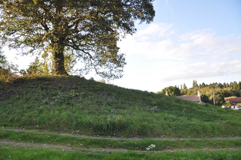
Howe Hill (Felixkirk) submitted by Anne T on 29th Sep 2014. Standing between the minor roads (leading north and north east from the base of the mound) and the metalled driveway, looking back towards the Carpenters Arms (the church is just off shot to the top right hand side).
(View photo, vote or add a comment)
Log Text: Howe Hill Round Barrow, Felixkirk: After having been to Pudding Pie Hill Round Barrow in Sowerby, we drove to the village of Felixkirk from the A170, up the first minor road leading north east. There is no doubt that Howe Hill is something ancient – but what? My initial impression, driving up the hill into the village was that it was a motte, but then it’s too small for a castle.
Howe Hill is immediately opposite the Carpenter’s Arms public house, which has a large car park, and the Howe Hill mound rises up above you. As it is topped by a very large tree, the mound seems to dominate everything around it (in a nice sort of way).
It is possible to sit outside the pub to have a meal and a drink and admire Howe Hill. It being now early evening and getting chilly, we sat inside and had a drink, looking out onto the mound, waiting for the angle of the sun to dip below the mound so I could get some photographs.
However – the monument has sort of been developed around in a somewhat insensitive manner - someone’s driveway (the Old Vicarage? Now up for sale) up its left hand side (facing from the pub), also someone has used the southern side of the mound to burn old tree trunks, which has left a mess. There’s also a road junction with numerous signposts to the northern end of the barrow and the right hand side been landscaped into edge of someone’s drive, but it is still recognisable as an ancient site.
The English Heritage record (not to be confused with How Hill, west of Richmond, North Yorkshire) says that this is a bowl barrow, dating from the Late Neolithic to the Late Bronze Age.
St Felix Church is only a short distance away (different web sites vary between 130 and 200 yards!). Apart from the sheep keeping the grass short in the church yard (this did keep the graveyard looking very neat) and the remains of the Norman windows in the chancel, this church had been extensively modernised, and I was disappointed.
In my opinion, Howe Hill is only worth stopping to look at if you are passing by. Sorry!
Pudding Pie Hill
Date Added: 29th Sep 2014
Site Type: Round Barrow(s)
Country: England (Yorkshire (North))
Visited: Yes on 26th Sep 2014. My rating: Condition 3 Ambience 4 Access 4
Pudding Pie Hill submitted by rogerkread on 11th Sep 2014. The large mound of Pudding Pie Hill.
(View photo, vote or add a comment)
Log Text: Pudding Pie Hill, Sowerby near Thirsk: From St Mary The Virgin at Leake, we headed south to Thirsk, leaving the A19 at its junction with the A168 to get as close as we could to Pudding Pie Hill.
It wasn’t possible to get to the round barrow from this direction, as there are all private roads leading to houses and small holdings, so we tried driving back into Thirsk and back round to Sowerby.
I always like coming to Thirsk, but never been to Sowerby, and it’s a really quaint little village. Blakey Bridge was closed to traffic so we walked across, through the field with Cod Beck to our right hand side.
The barrow rises up out of what appears to be the flood plain for the Cod Beck. If it weren’t for the very busy A168 roaring past on the eastern side, this barrow would be in a lovely spot indeed.
There is an information board by the footpath leading up to the barrow which explains something of the history and has old photographs of children on the barrow.
We walked up to the top of the mound, and there is indeed a hollow where they excavated it in the nineteenth century.
The ditch around the mound can be seen to its eastern and southern sides. Definitely worth coming to visit briefly.
St Peter (Osmotherly)
Date Added: 29th Sep 2014
Site Type: Ancient Cross
Country: England (Yorkshire (North))
Visited: Yes on 26th Sep 2014. My rating: Condition 3 Ambience 4 Access 5
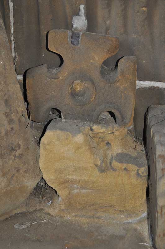
St Peter (Osmotherly) submitted by Anne T on 29th Sep 2014. I was really interested in this Saxon cross head fragment. It is amongst the group on the bench on the western wall of the porch.
(View photo, vote or add a comment)
Log Text: St Peter’s Church, Osmotherley. Saxon cross fragments: Note, whilst there is parking on School Lane immediately by the church, there are steps to negotiate from the road up to the church.
Having failed to get to Mount Grace Priory and St. John’s Well from the northern carriageway of the A19 (there is only access from the southbound carriageway), we went into Osmotherley as I’d seen St. Peter’s and their Saxon cross fragments on the Portal.
St. Peter’s really was ‘the disappearing church’ – coming down North End, it towered over the houses but as we turned to go up West End and got closer to it, it disappeared and we lost our bearings. After two attempts of driving up and down, we turned down School Lane (not Church Lane, as we might have expected!), which, whilst narrow there is parking.
The cross shaft fragments are in the porch of the church, which is open to the weather, so available to visit anytime.
As I was making my way up the steps towards the church porch, there were some ladies coming slowly down the steps towards us. The first lady told us they had just had a choir practice for Harvest Festival, and if I was quick, I could look round the inside of the church.
This church has a lovely atmosphere, and I’d like to go back and have a more leisurely look. The ladies told me that the south nave is Victorian, so the Norman porch must have been moved when this was built.
I saw the cross fragments and photographed them, with the kind ladies surrounding me – all lovely and really interested. They told me about other crosses at Sockburn and St Wilfrid’s Parish Church in South Kilvington to add to my list of places of ‘must see’ sites.
St John's Well (Osmotherley)
Date Added: 8th Oct 2014
Site Type: Holy Well or Sacred Spring
Country: England (Yorkshire (North))
Visited: Couldn't find on 5th Oct 2014
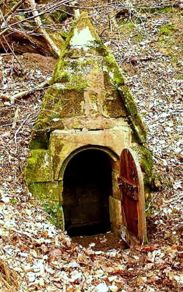
St John's Holy Well submitted by Sunny100 on 14th Jun 2010. St John's Holy Well, near Osmotherley, N.Yorkshire, at SE.447981.
(View photo, vote or add a comment)
Log Text: St John's Well (Osmotherlery): This being a glorious late afternoon, and having not only precise instructions on how to reach St John’s Well from the Mount Grace Priory staff but the GPS co-ordinates and a map I’d printed off with the exact location of the well, we set off to try and reach it. Not as easy as it first appeared! The first path, following what we both thought were the directions given to us, went too far up hill, then path just stopped at the top of the hill. Retracing our steps and turning on the GPS device, we followed the watercourse wending its way south away from the priory, between the edge of the forest and the adjoining meadow and found the track we should have followed. Whilst we could see the path leading up the hill towards the well, I let my husband take the lead, but it became just too difficult – waist high bracken, broken branches and large, boggy holes to fall into – it would have been too easy to twist and ankle or fall over. As it was getting late, we decided to come back in the winter, when the undergrowth has died back. We knew that this well was one of three which supplied the Priory, the first being in the north east corner, just outside the Great Cloister. A second is to the south of this, supplying the Lesser Cloister, and the third (not managed by English Heritage) is St. John’s Well. We did manage to get a photograph of Well House one. Despite there having been a lengthy dry spell, there was still a good flow of water from this spring, and the water was beautifully clear. There is a great similarity between the well house we saw and the image of St John's Well submitted by Sunny100.
Stanwick Crosses
Date Added: 8th Sep 2015
Site Type: Ancient Cross
Country: England (Yorkshire (North))
Visited: Yes on 5th Oct 2014. My rating: Condition 4 Ambience 4 Access 4

Stanwick Crosses submitted by Anne T on 7th Oct 2014. The Viking Ring Cross which is situated at the base of the tower inside the church. This image was taken by flash, as there were no lights in the church during my visit.
(View photo, vote or add a comment)
Log Text: Stanwick Crosses, North Yorkshire (St John The Baptist): 8th August 2015, return visit in daylight. As we were passing close by on the way back from Richmond, we decided to pop in to try and see the rest of the stones in relative daylight (there is no electricity in the church - should have thought to take torches). We saw most of the ones in the outer south wall and some of the ones in the south west corner, although I'm still trying to marry up the text and images in the Stanwick Stones book inside the church with the actual stones I photographed. Despite being a glorious summer evening we needed to use the torch app on my husband's phone to try and photograph the Viking Ring Cross in all its glory, and somewhat failed. Hoping for a repeat visit in early September with the flash gun I can slave to the camera.
Original visit: 5th October 2014: We meant to go to St. Cuthbert’s in Forcett, but as I spotted a signpost saying ‘historic church’, husband wrenched the wheel of the car hard left and we drove the 200 yards down the road to end up at St. John the Baptist Church in Stanwick (so much for my map-reading skills!). This was definitely worth coming to – lots of Saxon and Viking remains, but as there were no lights in the church (there were light switches but they didn't function) and it was very definitely dusk. Definitely needs a repeat visit!
The name Stanwick comes from old Norse (‘stein veggr’ meaning stone walls or building). Settlement at Stanwick dates back to the Iron Age, with the original site of habitation at Tofts, the hill just to the south of the church.
In this small hamlet, the present church of St John The Baptist dates from the 13th century, although there is plenty of evidence for earlier Christian presence on this site. Inside the church, under the tower, is a Viking Ring Cross and built into the walls of the porch are two hog-back fragments. The churchyard is roughly circular which suggests a Saxon burial ground and the shaft of a 9th century Anglo Saxon cross sits at the south east corner of the church. The tower, main doorway, part of the chancel and the eastern window in the south aisle are all 13th century.
The church was declared redundant in 1990 and is in the care of the Churches Conservation Trust, although there appear to be occasional services here and there are some recent burials in the churchyard. As well as the Viking and Anglo Saxon crosses, there is an unusual tomb-chest in the south aisle and a hand-pumped organ.
There were no lights within the church, so a daytime visit seems to be essential to see everything this beautiful church has to offer.
All Saints (Helmsley)
Date Added: 11th Oct 2014
Site Type: Early Christian Sculptured Stone
Country: England (Yorkshire (North))
Visited: Yes on 10th Oct 2014. My rating: Condition 2 Ambience 2 Access 5
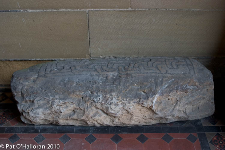
All Saints (Helmsley) submitted by kelpie on 2nd Apr 2011. The hogsback stone in the porch of the church
(View photo, vote or add a comment)
Log Text: All Saints (Helmsley) (Hogback Tomb Remanant): We last visited Helmsley on 19th August 2010 (was it really so long ago?) as we’d heard a lot about this attractive little town but never been. There was an event on at the castle and the place was totally overrun with tourists. After a cup of tea and a visit to the church, we escaped gratefully.
This time, it was very different. It was half past four and the town was quiet. The church is open until 5pm, so we went in search of the hogback fragment in the porch.
It sits on its own on the east wall of the porch, tucked away as an almost forgotten remnant behind the gates to the porch. At first, it’s almost not recognisable as a hogback, particularly as the simple rectangular interlaced pattern was so reminiscent of the Anglo Saxon cross shaft we’d seen built into the wall at St. Gregory’s Minster earlier today. The stone looks as if it has been completely hacked about and is now a ragged rectangular shape. I had to come back and read my ‘Grammar of Anglo-Saxon Ornament’ by Rosemary Cramp to see what shape it might have been to start with.
For anyone planning to visit the church, the wall paintings, whilst modern, are impressive. It has a lovely atmosphere and there are various stations around the church were candles are burning in remembrance.
There was no guide book, but I have an address to send away for one, and there is quite a bit of history about the church on the Helmsley Parish web site.
The Dragon Stone
Date Added: 12th Oct 2014
Site Type: Early Christian Sculptured Stone
Country: England (Yorkshire (North))
Visited: Yes on 10th Oct 2014. My rating: Condition 3 Access 5

The Dragon Stone, Levisham submitted by Sunny100 on 1st Jun 2010. The Dragon Stone at Levisham, N.Yorkshire, at SE.832907.
(View photo, vote or add a comment)
Log Text: The Dragon Stone, St John The Baptist, Levisham: The last time I was in Levisham was on a sunny but extremely cold January morning, when our department went on a ‘team building exercise’ – 7½ miles on a circular walk followed by lunch at The Horseshoe Inn. We stopped half way round the walk for a break and our guide told us we were sitting next to some ancient land boundaries but wasn’t knowledgeable to tell us what to look for, and no-one at the time was sufficiently interested to ask, as we had an hour to race back to The Horseshoe Inn for our pre-booked lunch. Shame.
Having stopped of in Kirkdale and Middleton on our way over to Levisham we had planned to stop off in Pickering for lunch, but arrived at the start of a ‘war re-enactment weekend’; almost everyone was in 1940s clothing or uniform – hundreds and hundreds of people. We felt out of place, and there was certainly no-where to park so we went into Malton.
Driving back to Levisham through Lockton, I recognised the scenery, but had no memory of the steep climb up to the village. Levisham is such a tiny village, built along both sides of a wide street. On my last visit, I hadn’t even noticed the tiny chapel tucked away at the road junction near the pub. This time, the whole of the street was lined with ‘no parking’ cones and large notices saying ‘no parking for the war time event’ (even though Levisham station was a good mile and a half away).
St John The Baptist is left open during the day (it has a 'church open' notice next to the door). It looked and felt very much like a Methodist church. The Dragon Stone is tucked right up against the north wall of the church, wedged between the pulpit and a storage heater at its east end and a pew at the west end. During our visit, there was a large stand of flowers over the stone, which we carefully had to slide out of shot (but only just as it was so heavy) and replace before we left.
There is a laminated sheet with a description of the stone on the window-ledge above it: “The Levisham Dragon Stone: This grave slab is decorated in the Viking Age style known as Mammen, which suggests a dating of the late 10th or early 11th century. The writhing beast carved onit is clearly derived from Norse pagan legends. But is it a dragon or a serpent – possibly Migarösorms (The World Serpent) – or something idiosyncratic? One theory is that it is a dedication to someone called Ormr, signifying ‘worm’ or ‘serpent’, a common name among the Vikings or their descendents. If so, Ormr, almost certainly a Christian convert, is represented here. The modern surname Hornsby, a derivation of Ormabyr, meaning Orm’s farm or settlement can be traced to this area.
The Dragon Stone was found in the vicinity of the old Levisham parish church of St. Mary, where it must have been lying for over a thousand years. It has been known to archaeologists since at least 1927, when it figures in a book by W.G. Collingwood. At some point it was brought up to the village to be housed in the present church. Information supplied by the University of Hull, 2009.”
Kirkdale Sundial
Date Added: 13th Oct 2014
Site Type: Early Christian Sculptured Stone
Country: England (Yorkshire (North))
Visited: Yes on 10th Oct 2014. My rating: Condition 4 Ambience 5 Access 5
Kirkdale Sundial submitted by Thorgrim on 20th Jan 2006. Sundial on the wall of St Gregory's Minster. (cast in the Science Museum, London)... The inscription reads: "This is the day's sun-marking at every hour. And Hawaro made me, and Brand, priest" . The lines with cross bars correspond to 6am, 9am, noon, 3pm and 6pm. The uncrossed lines divide time into one and a half hour periods. The line with a cross on it on the lefthand side of the dial denotes 7.30am which marked the brginning of "daytime". (N and M Kerr's Guide to Anglo-Saxon Sites)
(View photo, vote or add a comment)
Log Text: Anglo Saxon Crosses, St. Gregory’s Minster, Kirkdale, North Yorkshire (Kirkdale Sundial): Because the Corpus of Anglo Saxon Sculpture catalogue for Yorkshire cost £145, and my budget won’t currently run to buying it (!) I typed in ‘Anglo Saxon Sculptures’ into the internet and the search came up with both St. Gregory’s Minster and St. Andrew’s at Middleton. Good choice, Google! Thank you.
We arrived just after 11 o’clock to find two other cars in the car park. It turned out that one belonged to a florist setting up flowers for a wedding in the church that afternoon (she also said there was another wedding tomorrow, but they didn’t want to share the flowers) and one belonging to an elderly gentleman who, as we watched, hung his jacket on the church gate and picked up a brush and rake. He greeted us and asked us if we were going into the church and if we’d been before. On answering ‘no’, he told us to be careful of the step down into the church.
St. Gregory’s Minster is in a beautiful location, and is an even more beautiful building. It is clearly ancient and sits easily within the landscape.
The sundial above the main door into the church is breathtaking in its completeness. There are “Early Medieval carved stones built into the church include two early 9th century crosses; an early 10th century shaft/ slab fragment and a worn piece of late 9th century interlacing. Two grave slabs, early 8th century and 11th century two cross heads and a 10th-11th century shaft fragment are kept inside the church”.
Because there were so many flowers around the church, it was difficult to get a good photo of the cross heads inside the church. But outside it was spectacular and I was surprised to find only one other family wandering around looking at the fabric of the church, but not the cross-shafts.
By the time we’d finished wandering around the outside, there were many people coming in and out of the church and wandering around the churchyard. The car park was completely full, so we were glad we’d arrived earlier. The gentleman who’d greeted us on arrival caught us in the churchyard as we were going out. He told us that there had been ‘ladies’ who’d been round and told them they weren’t allowed to mow the back part of the churchyard, as there were over 80 (he spelled out ‘eight-oh’ to emphasise his point) species of wild flower. Walking back up the path with us, he asked if we’d enjoyed our visit, and I replied ‘very much so’. He said that people saying that made keeping the church tidy and clean worth while.
I felt very welcome at this hugely historic church and would go again to spend time and sit when it’s not so busy.
Middleton Crosses
Date Added: 13th Oct 2014
Site Type: Ancient Cross
Country: England (Yorkshire (North))
Visited: Yes on 10th Oct 2014. My rating: Condition 3 Access 5
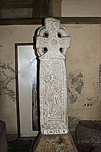
Middleton Crosses submitted by kelpie on 6th Mar 2004. These five Viking crosses are housed in Middleton Church (SE 78193 85438).
Cross A is a Jellinge type cross and shows a hunter with spear and scramasax, the other side shows a serpent type of animal.
(View photo, vote or add a comment)
Log Text: Middleton Crosses, St. Andrew’s Church, Church Lane, Middleton, North Yorkshire: From St. Gregory’s Minster, the A170 took us right through Middleton, and it was easy to spot the church on the left hand side of the road. I’d tried to phone beforehand to check if the church was open during the day, but the number published on the ‘achurchnearyou’ website was for a private house; I sent an email to Reverend Stephen Gamble but didn’t receive a reply until we were actually inside the church, saying the church is usually left open during the day.
Turning into Church Lane, it is long and narrow. There was just room to bump the car up onto the kerb opposite a gateway to a farm. At first glance, this church looks modern and not particularly interesting, but the more we looked, the more ancient and interesting the building became.
Apart from the crosses (crosses A and B kept against the base of the tower on the west wall, C, D and E kept in the north transept). It’s a shame that the area that C, D and E are kept in is used for general storage (we had to clamber over stacked chairs and other items) as it did spoil the ambience a little. Crosses A and B had clearly been whitewashed at some point in their lives, which made them look somewhat ‘unreal’.
The south entrance door has a wonderful 13th century trefoil and the door itself is from the 15th century (much repaired internally). The north aisle and tower date from the 12th and 13th centuries, although the base of the tower is Saxon. In the west wall, there is a blocked up doorway from the 11th century with an 8th century cross head and part of a shaft above it (we didn’t find the one in the south wall of the nave, as described on the visitor boards inside the church).
There is a sundial above the entrance to the porch, and an interesting ‘vow cross’, similar to the one at Escomb on a pillar in the north aisle.
Notes from the hand-held boards in the church:
The Crosses: The crosses and fragments in the North Aisle have been dated to the 10th century, perhaps related to the Viking kingdom of York c 876 to 954 AD. Cross A and Cross B are described as Jellinge crosses, after the cross of a similar type at Jellinge in Denmark. The stone types are all of a kind found on the North Yorkshire moors.
Cross A:A ring-head cross, typical of the area, depicts a hunter with spear, sword, shield and scramasax (a short sword), two dogs and a stag. On the reverse is a ‘Jellinge’ animal. The crossed has formerly been built into the tower, and was first recorded in 1911 and was removed in 1948.
Cross B: Depicts a warrior with a pointed helmet, spear, swod, shield, axe and scramasax. Again, on the reverse can be seen a ‘Jellinge’ animal. This cross also was discovered in the tower wall and ‘liberated’ in 1948. Celtic influences are mixed with Anglo-Scandinavian work, and it is supposed, by reason of the local stone (some is exposed 2km north of the church) and inferior workmanship, to be local in origin.
Cross C: First recorded at the east end of this aisle, in 1907, and is interesting in that it seems to combine both pagan, animal heads and a degenerate form of Christian vine scroll. It is unlike the others here, and has some Irish influences on an Anglian design, possibly representing an Anglian ‘Revival’.
Cross D:A fragment showing a warrior’s helmeted head, together with forked beard. A similar beard appears on the Kirkdale crucifix, although the example here is much cruder. A knife is slung from his belt, and a scramasax is to the right of his legs. This is very similar to Cross B, and it is thought that the same template was used. The contoured plait is unusual for this area.
Cross E:Formed of two fragments. The top part is a part of a ring-head cross. The bottom part has the head and shoulders of a man with a pointed helmet. The two fragments may have belonged together originally, but it is not possible to be sure.
There is another cross-head and shaft still built into the tower on the south wall against the nave wall. One arm of the cross has been dressed off, in order to use the monument as a quoin, but it seems that the full length survives."
All Saints (Crathorne)
Date Added: 22nd Oct 2014
Site Type: Ancient Cross
Country: England (Yorkshire (North))
Visited: Yes on 17th Oct 2014. My rating: Ambience 3 Access 5

All Saints (Crathorne) submitted by majick123 on 15th Jun 2013. Plinth where cross may have stood. at the East end of the chutch
(View photo, vote or add a comment)
Log Text: All Saints (Crathorne): Anglo Saxon Cross Shafts and Hogback Fragments: This church was on the way home, being very close to the A19, so I stopped off hoping it would be open so I could see the Saxon fragments incorporated into the fabric of the nave; according to the Pastscape record for this church, these include two 10th century cross shafts and six 10th century hogback fragments.
I arrived a little late in the afternoon, and as I pulled up to the lych gate, someone came from the church, got in their car and drove off. As the church was closed, I assume they had been to lock up. I’ve sent an email via the 'achurchnearyou' web site to find out when the church is open outside service times. In the meantime, I saw the cross shaft plinth by the south west corner of the church, reproducing the image submitted by majick123 in June 2013.
Hopefully I'll be able to return soon to see the cross shafts and hogback fragments. A disappointing end to a wonderful day.
21st October 2014: I've had response from the vicar, the Reverend Pam Sanders with details of a weekday service (Wednesday at 8am - unfortunately I'd need to leave home before 6am to attend and stay on to see the crosses) and the telephone number of the keyholder (see private notes).
St Cuthbert (Forcett)
Date Added: 20th Oct 2014
Site Type: Ancient Cross
Country: England (Yorkshire (North))
Visited: Yes on 17th Oct 2014. My rating: Condition 3 Ambience 4 Access 5
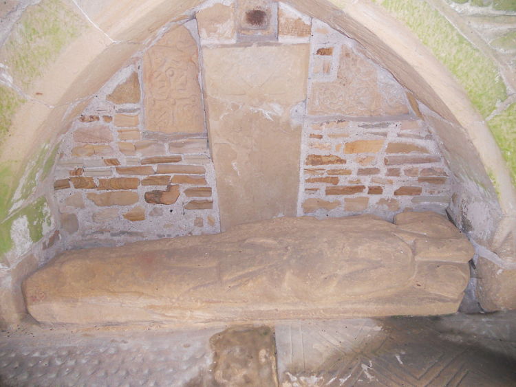
St Cuthbert (Forcett) submitted by hadrian on 4th Aug 2011. Internal wall.
(View photo, vote or add a comment)
Log Text: St Cuthbert (Forcett): Anglo Saxon Cross Shafts and Cross Arms in Porch: From Piercebridge, it is only 4 and half miles south west to Forcett, via the B6275 and Greystone Lane (although the road in Piercebridge was closed so I had to detour - thankfully I had my son’s SatNav to help, otherwise complete panic would have set in!).
I found the church easily enough, on the edge of the village, but there didn’t seem to be anywhere to park. In the end, I bumped up on the pavement by the cottages opposite. One of the resident’s came out and asked me if I knew the church; when I replied ‘no’ and asked if there was a proper parking area, he told me I’d be OK where I was for a short while (note: whilst it is possible to stop by the gate to the church, there are steps up the slope to the church).
The inside of the church is very Victorian and unremarkable, but the porch is something special. I had to gain entry to the porch first by untangling a piece of wire which held the wire gates shut, but once inside the more I looked, the more I saw, and was very impressed.
Different sources say there are between 5 and 8 Anglo Saxon cross fragments, varying in date between the 8th and 10th century. I certainly saw at least 6, and took photographs of all the fragments and grave covers that I saw so I can sit and unpick what I saw at a more leisurely pace in the next few days.
Apparently there is another fragment on the outside of the porch, but whilst I walked slowly around the whole exterior of the church I didn’t find this one.
Grey Stones (Barningham Moor)
Trip No.117 Entry No.5 Date Added: 12th Feb 2019
Site Type: Ancient Village or Settlement
Country: England (Yorkshire (North))
Visited: Yes on 6th Feb 2019. My rating: Condition 2 Ambience 4 Access 4
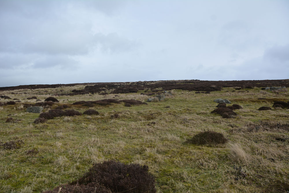
Grey Stones (Barningham Moor) submitted by Anne T on 12th Feb 2019. Looking virtually east across the settlement, from its southern most side. The circular bank, which incorporates the stone blocks, can just be made out.
(View photo, vote or add a comment)
Log Text: Grey Stones Settlement, Barningham Moor: As we parked just to the east of this settlement and walked south onto the moor, it was obvious we were walking up into something, but what that something was a little difficult to make out, until I started to be able to see low, circular banks. The blocks positioned on the banks made these easier to see.
Taking some photos and later comparing them with the HE and Pastscape records made it easier to understand what it was we were standing in. I’d love to go back with the notes and walk around again.
The carved rock (Barningham Moor 97) is within the settlement.
