Contributory members are able to log private notes and comments about each site
Sites Anne T has logged. View this log as a table or view the most recent logs from everyone
Millstone Burn 2dd
Trip No.71 Entry No.4 Date Added: 8th May 2018
Site Type: Rock Art
Country: England (Northumberland)
Visited: Yes on 7th May 2018. My rating: Condition 2 Ambience 3 Access 4
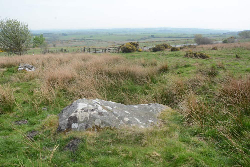
Millstone Burn 2dd submitted by Anne T on 8th May 2018. Millstone Burn 2dd panel, looking east across the A687.
(View photo, vote or add a comment)
Log Text: Millstone Burn 2dd: only 15m away from Millstone Burn 2d, and relatively easy to find amongst all the other boulders in the field. As these motifs are on top of the rock, they must have been designed to have been seen as you were coming down the hillside.
This rock looks very different shapes depending on what angle you view it at. We had huge difficulty making out any cup marks at all beneath the lichen and moss, although there are some grooves, which look as if they have been created (enhanced?) by rainwater trickling down and over the side of the rock over the years.
Not the best example of rock art we've seen, but one to tick off the list.
Millstone Burn 1e
Trip No.71 Entry No.6 Date Added: 9th May 2018
Site Type: Rock Art
Country: England (Northumberland)
Visited: Yes on 7th May 2018. My rating: Condition 2 Ambience 3 Access 4
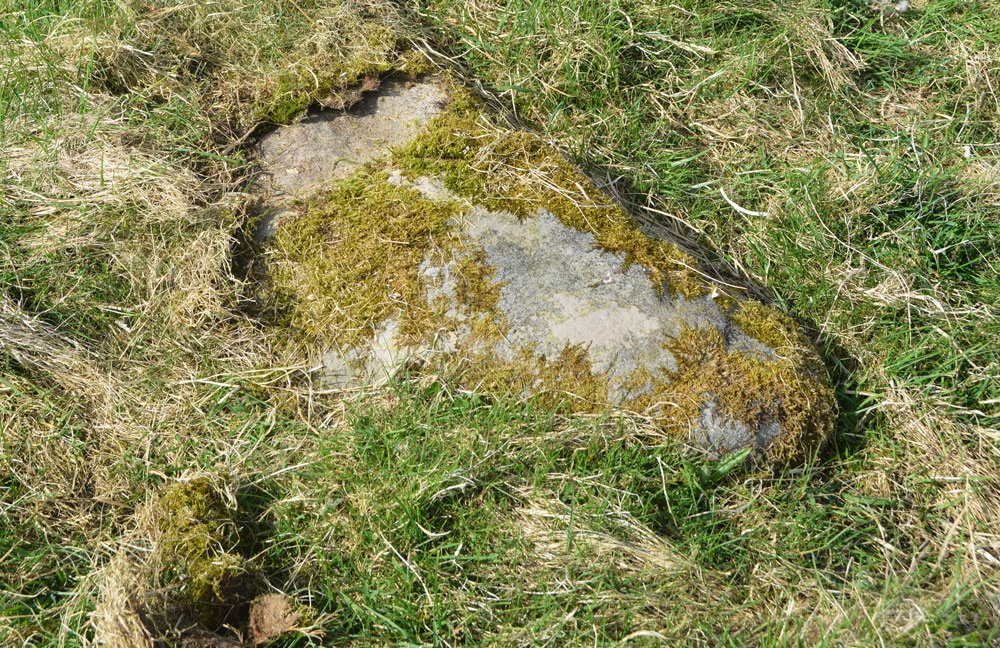
Millstone Burn 1e submitted by Anne T on 9th May 2018. Millstone Burn 1e was too heavily under moss to make out any motifs at all. We didn't want to move any moss, so left the panel as it was.
(View photo, vote or add a comment)
Log Text: Millstone Burn 1e: On the eastern side of the A697, not far from the gate into the field. This was the stone at the grid reference given, but was almost completely buried under moss/turf, with one end of it seeming to have been grazed by farm machinery, which had taken off the moss and a shallow layer of stone. We left the moss as it was, not wanting to harm the motifs (but then NADRAP said they didn't observe anything).
Millstone Burn 1c
Trip No.71 Entry No.8 Date Added: 9th May 2018
Site Type: Rock Art
Country: England (Northumberland)
Visited: Yes on 7th May 2018. My rating: Condition 2 Ambience 3 Access 4
Millstone Burn 1c submitted by SolarMegalith on 7th Jun 2013. General view of the cup-marked boulder as seen from the east (photo taken on June 2013).
(View photo, vote or add a comment)
Log Text: Millstone Burn 1c: This panel was very near the road (some motorists tooted their horns as they went past) and parts of it were under turf and moss. Part of the line of cups visible on the ERA photographs were covered by moss, which we left undisturbed. It was difficult to distinguish any other cups on the rock, despite having the ERA images on my phone to compare it to.
Netherwitton Hall
Trip No.76 Entry No.5 Date Added: 28th May 2018
Site Type: Round Cairn
Country: England (Northumberland)
Visited: Yes on 26th May 2018. My rating: Condition 2 Ambience 2 Access 5
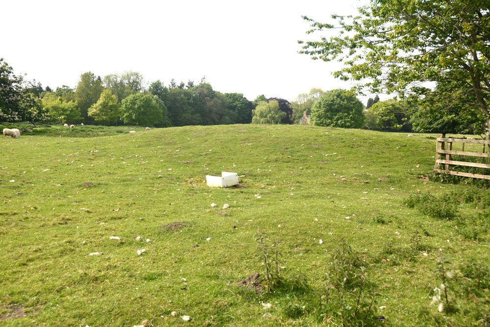
Netherwitton Hall submitted by Anne T on 28th May 2018. The mound or possible round barrow by Netherwitton Hall looks like an undisturbed barrow. The gate into the field was tied with a series of 'Gordian knots', and not being terribly excited by this mound, I photographed it from the gate.
(View photo, vote or add a comment)
Log Text: Round Cairn near Netherwitton Hall: Pulling up by the side of the road, taking the spot of a car that had just driven off northwards, this field was chock full of sheep and lambs, with the gate tightly tied with string in a ‘gordian knot’. Usually, I’d spent time untying the string, but as the mound didn’t look very exciting, I photographed it through the gate. Whilst it’s recorded on the OS map as a cairn, both HE and Pastscape wonder if this is actually a cairn or not, even though it’s scheduled as a round barrow.
St John Lee Church (Oakwood Stone)
Date Added: 15th Sep 2014
Site Type: Rock Art
Country: England (Northumberland)
Visited: Yes on 14th Sep 2014. My rating: Condition 3 Ambience 3 Access 5
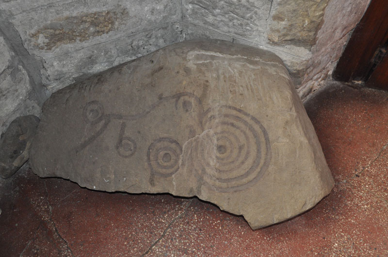
St John Lee Church (Oakwood Stone) submitted by Anne T on 15th Sep 2014. Close up of the Oakwood Stone in the porch of the church of St John of Beverley at St John Lee. Note someone has apparently used watercolour to highlight the motifs, which are striking.
(View photo, vote or add a comment)
Log Text: St John Lee Rock Art, near Hexham. Also known as The Oakwood Stone: We’ve been to St John Lee Church near Acomb a few years ago, as it is only 6 miles from our house, when our interests lay in finding Roman remains reused within local churches. At the time I only had a small camera and wasn’t taking many photographs.
St. John Lee can be reached from the roundabout at the junction with the A69 and the A6079 turnoff to Hexham. Turning north from the roundabout opposite the A6079, drive along a small side road signposted to St John Lee. The road climbs uphill but levels out after about half a mile and just as the houses come into view there is a sharp left hand turn down a small single track road to the church.
The church is on the left hand side of the road, with the graveyard divided between both sides of this small road. There is room to park one car on the verge by the lych gate.
The Church itself is relatively modern: The Church of England web site tells me St John Lee was built in 1884, but it certainly contains some old relics, including this portable rock art stone, according to ADS “found approx. 1,000 metres east of the church, although this was still unlikely to be its original position.”
The stone is located in the porch of the church, which is sited at the west end, furthest away from the lych gate (although the path is smooth and disabled access is possible). We were a little taken aback that someone had very recently chain-sawed down two or three of the yew trees at either side of the path, and the church felt somewhat denuded as a result, although we had a clear view of the east end of the church as a result.
The stone itself is situated immediately to the right hand side of the door as you walk into the porch. The rock art motifs are striking, but someone has outlined the patterns using what looks like brown watercolour, which has sunk into the stone. Using my finger, I traced round the faint lines and found the marks to be accurate to the faint depressions in the rock.
There is no church guide book, which is a shame, but there is a framed description of the stone on the wall above the stone (there is a page of visitor notes in the porch which describes the painted memorial plaques, but nothing else that we could find).
Also within the porch, to the left hand side, is a Roman altar stone, the top of which has been chiselled out to house an old sundial.
On the wall facing you as you enter the porch, there are also some old grave covers and the remains of old carvings displayed. On the window sills there are also small stone fragments, but no explanation as to what they are.
Worth stopping by if you are passing.
Coventina's Well
Date Added: 16th Sep 2014
Site Type: Holy Well or Sacred Spring
Country: England (Northumberland)
Visited: Yes on 14th Sep 2014. My rating: Condition 1 Ambience 2 Access 4
Coventina's Well submitted by PurpleEmperor on 3rd Oct 2010. From the description I guess Coventina's Well is somewhere near the intersection of these two walls, under the thick, marshy grass. Hope to go back one day with wellies and have a good look - Converse trainers almost sank without trace this time!
(View photo, vote or add a comment)
Log Text: Coventina's Well, near Carrawbrough Roman Fort, Northumberland: Having visited Robin Hood’s Holy Well in Colwell a short time ago, I was interesting in seeing Coventina’s Well and the adjacent Brocolitia, aTemple of Mithras. Having tried to visit 10 days ago, intending to park in the car park for Carrawbrough Roman Fort for half an hour, I was surprised (and disappointed) to find I had to pay £4 for all day parking – I couldn’t just pay for an hour (I understand from one of the other visitors I was talking to that the ticket is valid for all four of the National Trust car parks along the wall for the day, but this didn’t help me). However, my husband is better at finding parking spots than me, and on the way to Ridley Common Stone Circle, spotted a possible parking spot next to the Hadrian’s Wall footpath where we could leave the car for a very short time, so we stopped on the way back.
I’m glad I checked the images and grid reference of Coventina’s Well before we left home, so I knew exactly where to go.
Having parked in the small spot available where the Hadrian’s Wall Footpath meets the footpath to Slaterfield Farm to the north and the footpath to the Mithraeum to the south, we took our life in our hands and crossed the busy, extremely fast, B6318 (known locally as the Military Road). There is a stile across the dry stone wall into the field with Coventina’s Well, with the footpath continuing in a south easterly arc across the field towards the Temple of Mithras and Carrawbrough Roman Fort (an easier way is probably to park in the proper car park and walk across the Fort towards the Temple, despite the parking fee).
The ground in the field was very boggy, even after a prolonged period of dry weather, but thankfully someone had laid a path of stone slabs leading across the field. Looking for the Well, the ground on both sides of the path was high in weeds and marsh grass so it was difficult to make it out. Having crossed a small trickling stream almost at a second stile to cross over to Brocolitia, the Temple of Mithras, we were then able to trace the source of the water back to a heavily weeded, fenced off area. A patch of bright green water weed stood out amongst the grass about 20 yards in front of us, and we took this to be the well, not being able to get closer because of the boggy ground. Checking the grid reference confirmed this was indeed the site of Coventina’s Well. In other images I saw last night, there is also a standing stone which marks the site of the well, but this was well hidden in the foliage.
It was a shame this site had been neglected, as it appears to have a fascinating history. The Pastscape Record for this well records a spring contained in a rectangular basin, found in an 1876 excavation. The contents of the well apparently included at least 13, 487 coins and I'd like to find out where these are located.
I'm wondering whether a visit in winter with either wellies or waders would let me see more of the well. There wasn't even a visitor's board with any details about the well that I could find.
Ridley Common
Date Added: 16th Sep 2014
Site Type: Stone Circle
Country: England (Northumberland)
Visited: Yes on 14th Sep 2014. My rating: Condition 3 Ambience 4 Access 2
Ridley Common submitted by TheWhiteRider on 2nd Jul 2006. Ridley Common Stone Circle. Only visible from the other side of a boundary fence. A number of keep out/private property signs made it abundantly clear that taking the easier route up a road to look at the circle was not allowed. Instead I had to scramble through difficult boggy ground along the field boundary until I spotted the circle.
(View photo, vote or add a comment)
Log Text: Ridley Common Stone Circle and Enclosure, Northumberland: All the web sites we’d looked at quickly before visiting this stone circle said that it was sited on private land, and access was difficult. According to our 2007 Ordnance Survey Map, this land is now marked as Access Land, so we decided to explore. This stone circle is almost 2km along the Pennine Way from the B6318 (Military Road), then turning off down a private road on access land to reach the circle. The footpaths we took passed an old lime kiln, up and over a gap in Hadrian’s Wall (with a splendid view of Cuddy’s Crags immediately north of the Wall) onto the Pennine Way and over Ridley Common towards Cragend.
We parked at grid reference NY 78147 67858, down a small side road which runs south off the B6318 towards West Crindledykes and the ‘back entrance’ to Vindolanda. There is a small layby which will take two cars just before the junction with the main road. The footpath is then 50 yards right across the fast and busy B6318 (the most difficult and dangerous part of the whole ‘expedition’).
It was cloudy but warm. At first there was a lot to see and the crags behind Hadrian’s Wall were brilliant. There were many walkers along both Hadrian’s Wall Path and the Pennine Way to the east and west, but as soon as we crossed to the north of Hadrian’s Wall, we only met two people coming in the opposite direction all day.
I confess that Ridley Common isn’t the most fascinating of walks, being largely scrub and rough heathland, but you can see for miles, along to Sewingshields Crags, Gwenhyfhar’s Chair, Queen’s Crags, King’s Crags and Broomlee Lough to the east.
I would seriously recommend taking wellington boots for a walk after a period of wet weather – the peaty ground was bad enough after a prolonged dry spell up here, even on higher ground. Previous walkers have put stepping stones into particularly bad parts, but even so, detours are necessary around some particularly boggy parts of the path.
Continue along the Pennine Way until it crosses Jenkins Burn then comes to a kissing gate where the Pennine Way continues northwards with a grassy track crossing it from south-west to north-east. At this point, there is a proliferation of old gate posts and an old sheep pen. To the left, there is an old ‘private, no public access’ sign, low in the grass (but nothing like the many notices recorded on other web sites at previous visits recorded by others in 2002 and 2006). Having checked the map again and being sure we were on access land, we continued westwards down the track towards the stone circle.
A couple of hundred yards along, the track appeared to cut through what could have been another stone circle or feature, and I took a photograph to look at later when we got home.
At first, we were unable to make it out any stone circle, then some low lying white stones became clear in the grass to the left of the track, with the fence-line diverting around its left hand side.
We were amazed at its size – husband Andrew paced out the diameter – 16 metres from south to north, with 14 stones around the perimeter (some only just visible through the grass). There were two outliers towards the south-east corner and another in the hillside rising to the north on the other side of the track (further investigation of this hillside led to discovering what seemed to be pairs of stones buried in the grass towards the top of the hill).
The tallest stone, to the west hand side, rises 1.1 metres above the current ground level, and its western side is stained red where all the sheep have rubbed against it.
There appeared to be one cup mark on one of the taller stones to the south-eastern side of the circle.
In walking round the circle, I could feel other stones under the grass inside the outer circle, some with their points just showing above the turf. I got the impression (and would have like to have been able to prove) that there was an inner circle or cairn within the main circle.
On the map there were hut circles and an enclosure marked on the hillside to the north of the circle, so after sitting amongst the stones of the circle to take in the ambience, we explored this.
Thinking about the whole of the context of the site whilst I was there – the position of the enclosure is perfect – being defensible with water and farmland. But I couldn’t understand the placement of the circle, being in a low-lying bowl with no clear lines of sight, unless to Gwenhyfar’s Chair, Queen’s Crags and King’s Crags to the north west (where of course there are other settlements and stone circles).
In trying to find out more about this stone circle and the surrounding monuments, we weren’t able to find out very much, except that there is a number of monuments which have been scheduled together (English Heritage Monument Number 1017961), including this stone circle, a defended Iron Age Settlement, an Iron Age/Romano-British farmstead a Roman camp and 15 shielings of medieval date. Fascinating, and still so much to understand about this part of the world.
Goatstones A
Date Added: 23rd Sep 2014
Site Type: Rock Art
Country: England (Northumberland)
Visited: Yes on 21st Sep 2014. My rating: Condition 3 Ambience 3 Access 3
Goatstones A submitted by SolarMegalith on 4th Jul 2013. Goatstones A in the artificial lighting. Large cup-marks are easily distinguishable (photo taken on June 2013).
(View photo, vote or add a comment)
Log Text: Goatstones A to P, Simonburn, Northumberland (excepting K, L and P): Having previously wasted time hunting for rock art we couldn't find, my husband splashed out on a cheap, but cheerful GPS device in Carlisle yesterday. We decided to put it to use today by going to find the rock art near Goatstones Four Poster, which I've longed to see. This might have been a mistake, as not even having read the manual, we set off with the grid references of the stones SolarMegalith had posted, and off we went.
Actually, the trip was a success! Without a GPS system, we would have had no hope in finding these stones, buried as most of them were in deep marsh grass.
Apart from stones K, L and P, which we decided to save for another visit, as there were some extremely LARGE (and magnificent) cattle in that area - even husband, Andrew, who was brought up with livestock and is used to them, was keen to avoid them.
I have to confess that compared to some rock art we’ve seen recently, this was only a 3 out of 10, but even so, it was a fascinating journey through the landscape of our ancestors. I usually try and put myself into their mindset and try and identify why they put rock art in certain places. Given that Goatstones Four Poster Stone Circle is to the west of this rock art, and further south west is the wonderful Standingstone Rigg double stone row, this place must have been part of a thriving Neolithic/Bronze Age landscape.
The Goatstones rock art stones seem to form three separate groups within the same general area, but apart from F, which was perched on the brow of a hill, and stone J which was on a cairn (but portable - it would have been so tempting to pick it up and take it home, but NO!), I couldn’t make out any obvious reason for placing the art where it was. A mystery I will continue to ponder on.
It is still in a beautiful and peaceful spot, and I enjoyed this warm, but misty afternoon.
St Andrew's Church (Bywell)
Date Added: 2nd Oct 2014
Site Type: Ancient Cross
Country: England (Northumberland)
Visited: Yes on 25th Sep 2014. My rating: Condition 3 Ambience 4 Access 5
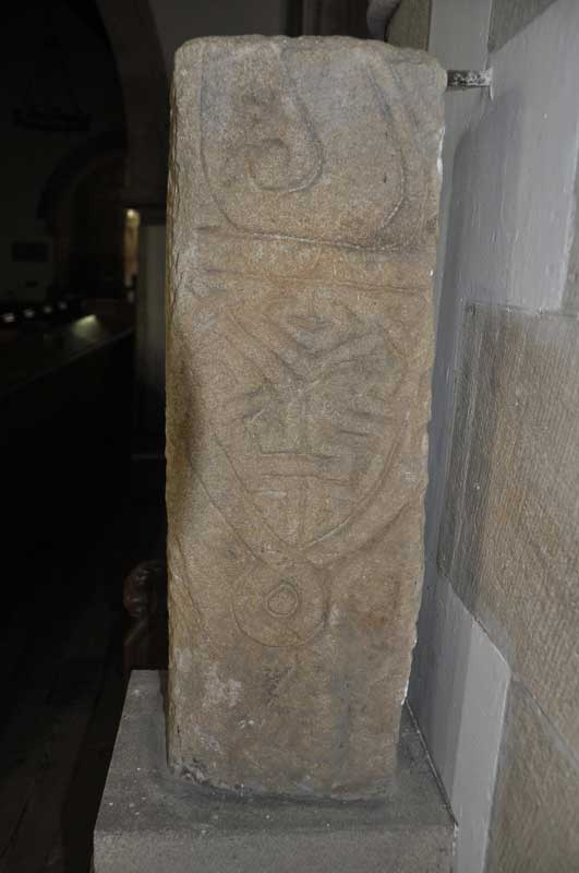
St Andrew's Church (Bywell) submitted by Anne T on 30th Sep 2014. Close up of the second decorated side of the larger fragment, which is the lower part of a cross shaft (Corpus of Anglo-Saxon Stone Sculpture reference: Bywell 01). This face shows the remains of a ring knot and shield shaped pendant.
(View photo, vote or add a comment)
Log Text: Bywell Anglo Saxon Cross (St. Andrew's Church): This is a very pretty spot, nestled in a bend of the River Tyne, surrounded by neatly kept estate lands. The two neighbouring churches on this site are less than 2 miles from my house, but although I've been here on more than one occasion, can't say I've noticed the Anglo Saxon cross in St. Andrew's.
The grid reference on the Anglo-Saxon Corpus Stone Sculpture web site indicated that the cross shaft was located at St. Peter's rather than in St. Andrew’s, the Churches Conservation Trust church, but instinct told me otherwise. However, I went to check anyway. This is the first time I’ve been able to get into the St. Peter's during the day to look around (outside carol services). I was investigating when I heard the west door rattle, which gave me the creeps. There was another gentleman who was walking from Ovingham and wanted to come and look, so we exchanged a few courtesies as we walked around.
What I hadn’t realised was that there were some interesting grave covers with crosses built into the porch of the church.
I couldn’t find the cross shaft, so set off to St. Andrew’s where I saw the stone as soon as I walked through the door.
St Andrews, Bywell Grid reference: NZ 04837 61485
The prettiness of the church, with its unique Saxon tower, never fails to hit me every time I come here. I always remember a good friend's reaction to this when we stopped off here on the way to our presentation at Aykley Heads ("makes me want to get my walking boots on").
The cross shaft is located to the north side of chancel, between the choir stalls and the altar.
Chollerton Cross
Date Added: 7th Oct 2014
Site Type: Ancient Cross
Country: England (Northumberland)
Visited: Yes on 2nd Oct 2014. My rating: Condition 4 Ambience 4 Access 5
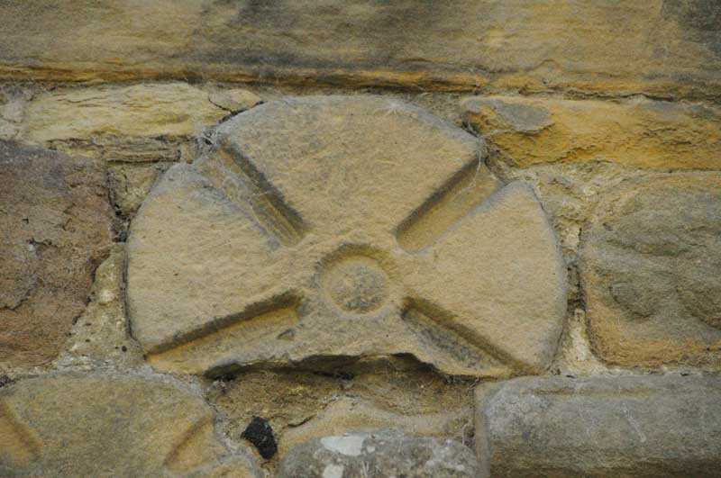
Chollerton Cross submitted by Anne T on 6th Oct 2014. Close up of 'Chollerton 02', part of a cross-head (reference from the Corpus of Anglo Saxon Stone Sculpture).
(View photo, vote or add a comment)
Log Text: Chollerton Cross (St. Giles, Saxon Crosses, Chollerton): It being the most beautiful sunny day with blue skies (but a frosty start), it was a perfect autumn afternoon. Last night I looked through the Anglo Saxon Corpus database and picked out some places within easy reach of my house.
My husband and I have been to St. Giles before, on 30th August 2007, but to look at the Roman features incorporated into the church and I had the tiniest little camera which took appalling photographs!
The tower was completely scaffolded and three or four men were working at the top of it in the sunshine. Parking by the old mortuary building, as I was changing lenses on my camera an elderly lady came across the road. She said she was waiting for the bus to come down and told me how she and her brothers and sisters used to come and clean the church when they were young; her father had changed the altar cloths and put everything ready for communion. She also told me how lucky they were to have someone as nice as Rev. Slade.
I found the Anglo-Saxon crosses on the north wall of the nave easily enough. On opening the door to the porch, there was part of another Saxon cross built into the wall above the door to the church.
The sun was so strong it was difficult to get a shot of the church without overexposing the shot, even at 1/4000th of a second.
In the guide book, a pretty child’s grave cover is described as sitting next to an 18th century sundial. I found the sundial, but next to it was a bucket of stone fragments. Despite walking twice round the church, I was unable to find this grave cover, so assume it’s either been broken or moved. I was touched by a pair of slippers kept by the font!
The guide book says that the church is Grade 1 listed, sited at the southern most end of Chollerton parish, was consecrated in 1097 and is the “mother church” of the parish. The name Chollerton derives from Anglo Saxon (Cholverton, Cholreton, Cholveriton).
The guide goes onto say the original church was probably wooden, with the stone church built around 1260 by William de Swinburne a Scottish knight (presumably there are links between his family and Swinburn Castle, with its standing stone) not far away. Part of the 12th century remains in the west walls between the nave and the tower tower and Roman piers have been used to create the south arcade.
There is a Roman font inside, dedicated to Jupiter, which has been inverted and modified for use today, although a more modern (13th century!) font with a Jacobean lid is in use today.
There is parking for two cars next to the old stable and hearse house with its mounting block, and it is possible to get a wheelchair up to the church (although not around to the north wall of the chancel to see the Saxon stones).
Birtley Iona Cross
Date Added: 7th Oct 2014
Site Type: Ancient Cross
Country: England (Northumberland)
Visited: Yes on 2nd Oct 2014. My rating: Condition 4 Ambience 4 Access 5
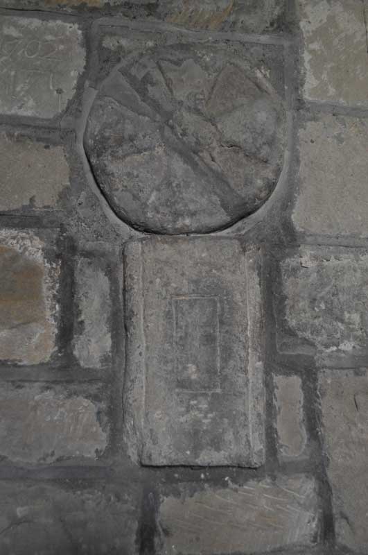
Birtley Iona Cross submitted by Anne T on 6th Oct 2014. An undated Saxon cross-shaft fragment and circular grave marker/dedication cross from the second half of the 11th century are built into the northern wall of the nave near the font.
(View photo, vote or add a comment)
Log Text: Iona Cross, Birtley (St. Giles, Birtley): From St. Giles in Chollerton, this church is easy to find, being only 6 miles away. To reach it, drive down the small road to the left hand side of the church and continue on down through Barrasford, turning right just before reaching the village of Wark (signpost says Birtley is 2 miles). The church is then on your right hand side as you enter the village. It sits with it’s narrowest (west side) next to the road and is hidden under trees, so it’s only when I saw the grave yard that I realised I’d arrived. I drove up into the village to turn around (been here for a walk years ago and parked at the top end of the village) and bumped up onto the pavement to park by the gate to the church.
The present church was rebuilt in the 18th century and renovated in the 19th century, and has a wonderful feel the minute you step through the door.
Opening the porch, there are grave covers built into the wall, and glorious flower arrangements left to welcome visitors as you enter.
Rev. Slade had told me about the Iona cross before my visit, so I left this until last to find. Three of the fragments are built into the north wall (two of them together, these near the font). The Iona cross is in the chancel. The fourth was high up on a ledge in the porch (I would have missed this had I not looked a third time to find it – didn’t think to look up).
Thockrington Cross
Date Added: 28th Mar 2018
Site Type: Ancient Cross
Country: England (Northumberland)
Visited: Yes on 3rd Oct 2014. My rating: Condition 3 Ambience 4 Access 4

Thockrington Cross submitted by Anne T on 6th Oct 2014. Grade II listed fragment of Anglo Saxon cross sitting in its more modern plinth, 10 metres south of the porch of the church.
(View photo, vote or add a comment)
Log Text: Thockrington Cross, Northumberland:
Having emailed to thank the Reverend Michael Slade (Mike) for the information about Chollerton and Birtley, he replied to my email this morning, saying: Dear Anne, Thank you for your encouraging email. I am so glad you enjoyed your visit. Do have a look at one of my other churches, St Aidan's Thockrington. It is open during the day too and is in the most spectacular location. There is a Grade 2 listed Saxon Cross in the churchyard, at least what's left of the cross! Well worth a visit anyway. And there is St Christopher's Gunnerton, an Arts and Crafts church, kept locked but a key is available locally. Michael Slade, Vicar
So husband Andrew and I went along this afternoon. Thockrington is essentially a very large farm with a house or two attached. The roads, whilst only a couple of miles from the A68, are across bleak moorland.
There is parking (on grass at the side of the single track road) by the gate to the church, then a gate leads you up into a field to a gate to the churchyard. The wind was extremely strong.
I spotted the remains of a cross shaft – propped up in a modern plinth (it moved when touched). It is very weathered and the remains of carving (apparently an upside down figure) can be seen upon one side.
The inside of the church is strange. The nave is obviously Victorian, but the chancel seems to be the original, old church with very off-true pillars. Fascinating.
Saffron Well (Barhaugh)
Trip No.94 Entry No.4 Date Added: 2nd Sep 2018
Site Type: Holy Well or Sacred Spring
Country: England (Northumberland)
Visited: Yes on 31st Aug 2018. My rating: Condition 2 Ambience 3 Access 4

Saffron Well (Barhaugh) submitted by Anne T on 2nd Sep 2018. This well pool is more than a little neglected and overgrown. The waters issue seemingly from nowhere, directly out of the hillside, then running into Barhaugh Burn. Photo taken by Andrew T
(View photo, vote or add a comment)
Log Text: Saffron Well (Barhaugh): After the peace and quiet of Kirkaugh Wells and the Church of the Holy Paraclete, we drove past this even more remote spot. Andrew was brave enough to hop over the stile and descend the very steep, overgrown path down to the river. He reported that a ‘stream just started from nowhere, forming a pool, then running into Barheugh Burn’. Due to the sheer amount of foliage and trees, it was difficult to photograph. Only a very short entry on Pastscape. I've done several internet searches and not been able to find out anything else.
Twizel Standing Stone
Trip No.95 Entry No.6 Date Added: 9th Sep 2018
Site Type: Standing Stone (Menhir)
Country: England (Northumberland)
Visited: Yes on 6th Sep 2018. My rating: Condition -1 Ambience 3 Access 4
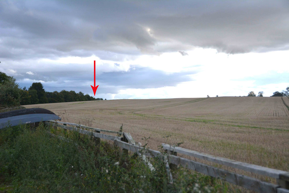
Twizel Standing Stone submitted by Anne T on 9th Sep 2018. The red arrow marks the spot where this standing stone/rubbing post should have been located. Next time we drive by, we'll knock on the door of the farmhouse and ask to check the spot.
(View photo, vote or add a comment)
Log Text: Site of possible standing stone, Twizel: The boulder no longer appears to be in the field, although there is a small raised area in the field – as this is England, we couldn’t find anyone to ask permission to walk into the field, so photographed it from the fence near the cottage. For a last stop of the day, a little disappointing, as a standing stone would have 'wrapped things up nicely'.
Homers Lane Cross (Warden)
Trip No.116 Entry No.3 Date Added: 28th Jan 2019
Site Type: Ancient Cross
Country: England (Northumberland)
Visited: Yes on 27th Jan 2019. My rating: Condition 3 Ambience 4 Access 5

Homers Lane Cross (Warden) submitted by Anne T on 27th Jan 2019. Standing on Homer's Lane looking eastwards towards the River North Tyne. The carving of the elongated 'V' on the front of the broken shaft can be clearly seen.
(View photo, vote or add a comment)
Log Text: Homer's Lane Cross, Warden: This is another cross base that we hadn't spotted with a short radius of where we live (have Pastscape been adding new records to their database?) This cross base and part of its shaft was easy to find and in a really nice setting, with a small stream trickling away to its eastern side and a bench to sit on and admire it, with the River North Tyne also to the east and the Stanegate Roman Road nearby. A quiet, quiet spot. Lovely!
Queen's Crags Cup Marked Boulders
Date Added: 17th Nov 2014
Site Type: Rock Art
Country: England (Northumberland)
Visited: Yes on 9th Nov 2014. My rating: Condition 3 Ambience 4 Access 3
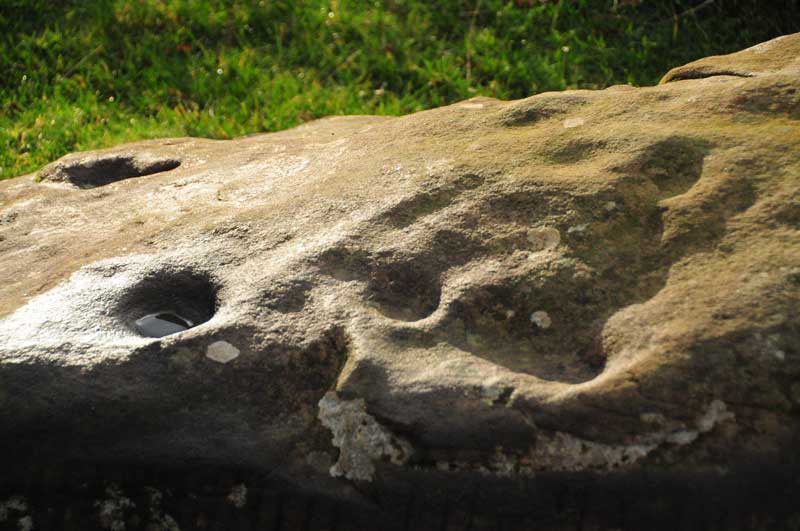
Queen's Crags Cup Marked Boulders submitted by Anne T on 12th Nov 2014. A close up of some of the cup marks on the larger of the two boulders at Queen's Crags. This boulder can be found at grid reference NY 79713 70421.
(View photo, vote or add a comment)
Log Text: Queen's Crags Cup Marked Boulders, Northumberland: We last visited this area, immediately to the north of Sewingshields Crags/Hadrians' Wall in July this year, and I was fascinated and intrigued by what I thought might have been another possible stone row and stone circle/enclosure on the way to Simonburn Stone Circle. We'd met the farmer on this visit and he'd told us the archaeologists had marked out an area for a survey and were due to come back shortly. I then found a short piece in the local Hexham Courant newspaper, and thought I identified SolarMegalith in the photo, so contacted him to find out. Then a subsequent message to him, to try and find out what rock art stones at Goatstones were the best to find, had alerted me to another rock art boulder near Queen's Crags, which put this spot firmly on my 'to re-visit' list. We then spotted an initial report on the area on the Tynedale Archaeological Group web site, so after 2 weeks stuck in the house, both decorating and my husband and his bad back, it was a relief to get on my walking boots and do this gentle walk, mostly along a cobbled track and grassy paths. It was also an exercise in getting used to using our (basic but good) GPS system.
I just wish I had more experience to understand what I was seeing, as this seems to be much larger landscape of monuments, stone circles, cairns and settlements.
Whilst it is well over a kilometre from the road to this spot, through often boggy places, it is well worth a visit just to soak in the atmosphere of this place, with Sewingshields Crags standing guard over the area to the south, and Broomlee Lough shining in the low autumn sunlight to the south west.
Walking up to the top of Queen's Crags, we came upon the cliffs very suddenly - a long drop down to the valley below and my fear of falling took over and I had to retreat down to the cairns lower down the hill.
Since our visit, I've emailled Tynedale Archaeological Group to find out if it will be OK to include a link from the page I've created to submit my photographs, as it is their work that has highlighted these features, and they deserve all the credit - I just took these few photographs. I'm still waiting to hear and will update the page when I do (Update: 17th November at 17:19 - TAG have kindly agreed to a link between the relevant pages on the Portal and their web site, and also invited me along to their AGM tomorrow night to find out more).
Congratulations to SolarMegalith for finding the boulder with 5 cups - I can't imagine how exciting it must be to make a discovery like this. Well done, SolarMegalith!
Fawns Moated Site
Trip No.118 Entry No.4 Date Added: 17th Feb 2019
Site Type: Misc. Earthwork
Country: England (Northumberland)
Visited: Yes on 14th Feb 2019. My rating: Condition 2 Ambience 4 Access 3
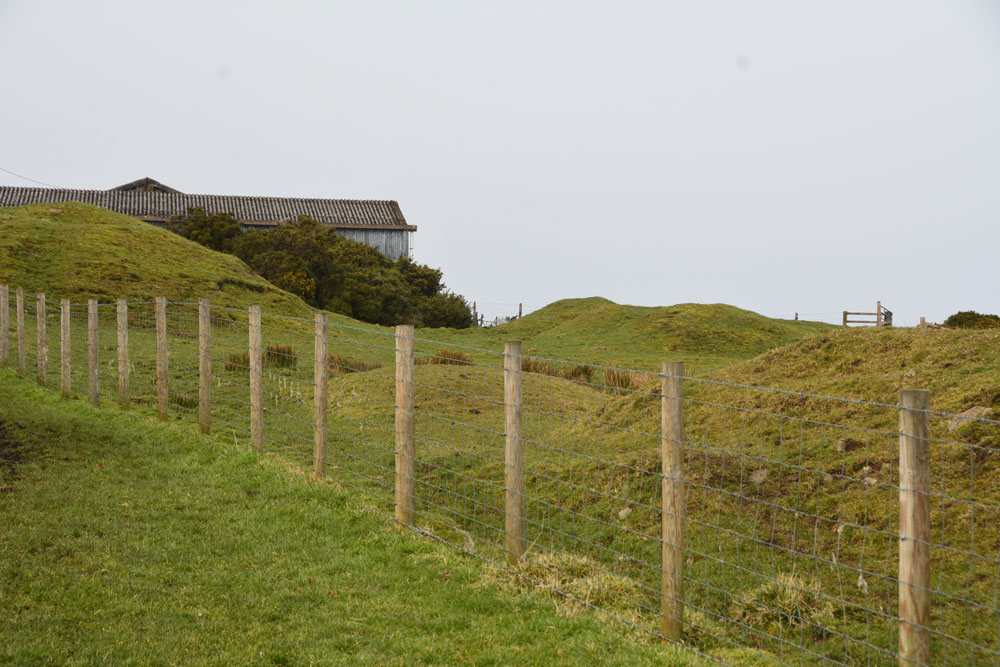
Fawns Moated Site submitted by Anne T on 17th Feb 2019. First view of the main part of this medieval moated site, with its lumps and bumps. Sadly on private land adjacent to the farm, and we could find no-one to ask permission to take a closer look. The footpath leading from the farmhouse, south east towards the cairn, gives good views back onto this site.
(View photo, vote or add a comment)
Log Text: Fawns Medieval Moated Site: "One of the few surviving examples in Northumberland and exceptionally well preserved" is how Historic England describe this site. As the third stop on our short circular walk to the east of Kirkwhelpington, this was a nice site to stop and look at. Easier to see the layout from the aerial photographs at home. Just a shame this site is on private land, as I'd have loved to have walked over the site to take a closer look.
There is much evidence of medieval field boundaries and rig and furrow ploughing all around here. The land looks rich and fertile, with magnificent sheep grazing in the fields.
Thornborough High Barns
Date Added: 14th Mar 2015
Site Type: Rock Art
Country: England (Northumberland)
Visited: Yes on 8th Mar 2015. My rating: Condition 3 Ambience 3 Access 4
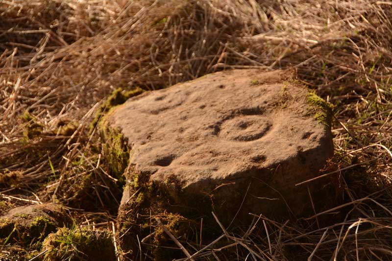
Thornborough High Barns submitted by Anne T on 12th Mar 2015. This single, displaced, stone shows two clear cup and ring motifs with other cup marks running around the cup and ring motif to its north-eastern corner.
(View photo, vote or add a comment)
Log Text: Thorborough High Barns Rock Art (single displaced stone): We first went to visit this site on 25th May 2014. Even though we were armed with a six figure grid reference number and detailed map, we were unable to locate this stone due to the high grass and deep brambles on both sides of the hedge. However, on this visit, the stone was clearly visible on the opposite side of the hedgerow/fence line from the footpath/bridleway. Close to the location of the stone there was a broken fence and a clear trackway which other walkers had used, so we nipped through very quickly to photograph this stone. Note to future visitors to this site: the hedge row has recently been planted, so access in future years will be difficult. I'm not sure who the landowner is, but will try and find out, and add a comment to this page. Further down the footpath, where it reaches a wood and stream, there is a gateway through to the field containing the stone, and it looks possible to walk back to the stone.
Howden Hill Middle Cairn
Trip No.125 Entry No.5 Date Added: 26th Apr 2019
Site Type: Cairn
Country: England (Northumberland)
Visited: Yes on 20th Apr 2019. My rating: Condition 2 Ambience 4 Access 3
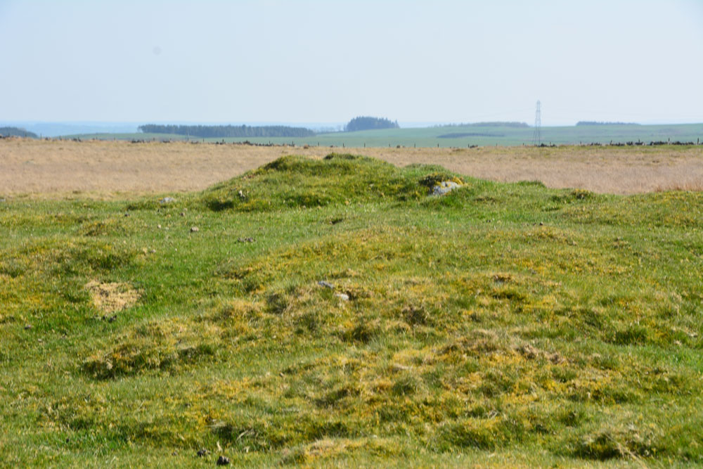
Howden Hill Middle Cairn submitted by Anne T on 26th Apr 2019. The middle cairn (middle of the photograph) as taken from the western-most of the three visible cairns at this location (stony foreground, now much levelled).
(View photo, vote or add a comment)
Log Text: Howden Hill Middle Cairn: From the rock art panels, it is only just over 150m to walk to this cairn, which is the most prominent of the two on this side of the ridge above Settlingstones Burn.
In a very lovely spot, the make up of the cairn from stones and earth becomes evident. It is around 9m in diameter and about 1m (perhaps slightly higher) above the surrounding ground level.
With its proximity to Hadrian’s Wall, the location of this cairn cemetery with its rock art, cists and cairns is intriguing. Sewingshields Crags is visible on the skyline to the south east.
St Michael's Church (Warden)
Trip No.126 Entry No.3 Date Added: 5th May 2019
Site Type: Ancient Cross
Country: England (Northumberland)
Visited: Yes on 1st May 2019. My rating: Condition 3 Ambience 4 Access 4
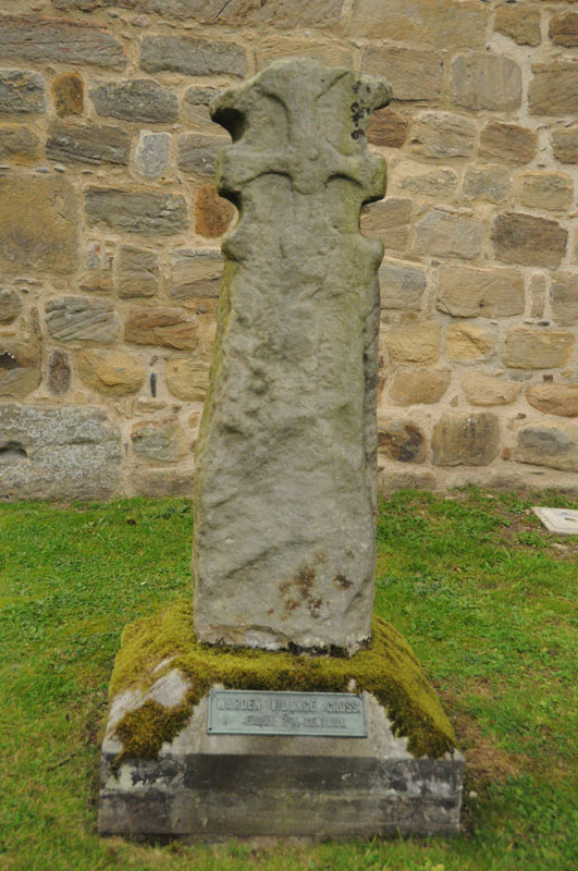
St Michael's Church (Warden) submitted by Anne T on 4th Sep 2014. The 7th century cross at the west side of the porch of St. Michaels, by the Saxon tower.
(View photo, vote or add a comment)
Log Text: St Michael and All Saints, Warden: Anglo Saxon Sculptured Stones, including The Warden Man and Hammerhead Churchyard Cross: I last visited this church on 3rd September 2014, when I was almost new to the Portal, and hadn’t yet come across Pastscape, Historic England or the Corpus of Anglo Saxon Stone Sculpture databases, so taking Andrew back here was a very pleasant surprise, as I learned an awful lot about these stones.
Well worth a repeat visit!
