Contributory members are able to log private notes and comments about each site
Sites Anne T has logged. View this log as a table or view the most recent logs from everyone
Dumfries Museum
Trip No.174 Entry No.1 Date Added: 25th May 2022
Site Type: Museum
Country: Scotland (Dumfries and Galloway)
Visited: Yes on 25th May 2022. My rating: Condition 4 Ambience 4 Access 4
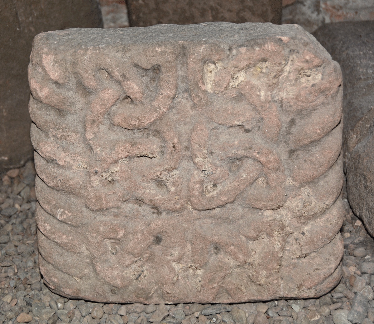
Dumfries Museum submitted by Anne T on 8th Jun 2022. This is Museum Accession number DUMFM:1960.11.7, recorded on the Future Museum website as Cross Shaft, Kirkconnell. Dated to the 11th century, its dimensions are: height 280mm, width 310mm, depth 110mm. It also has a generic record in Canmore - see Site ID 319221 St Connel's Church.
Points, in his 2016, Dumfriesshire Gazetteer, Pages 173-174, tells us: "Both the front face and the left-hand side are decorated with a band of cable-pattern moulding which wraps itself around both the right-h...
(View photo, vote or add a comment)
Log Text: Dumfries Museum: We parked on Whitesands, and walked over the Nith by the Old Bridge, to the NW, then turned left to the Robbie Burns House, then up the hill to the Museum and Camera Obscura.
We lived in Dumfries and Lockerbie between 1992 and 2002, but for some reason had never visited the museum, despite going to many other historic sites, and what an oversight!
Armed with Guy Points' book "A Gazetteer of Anglo Saxon, Anglo Scandinavian & Anglo Norse sites in Cumbria, Dumfriesshire and Wigtownshire, we had a wonderful afternoon in the basement of the tower. Treasures indeed, much appreciated after the dearth of things of visit during the two years of lockdown.
Staff at the museum were incredibly helpful. I've been given the details of someone at the Council (press officer for the museum?) to apply for permission to upload some photographs, and hopefully she'll get back to me shortly.
Moor Divock Cairn
Date Added: 18th May 2022
Site Type: Cairn
Country: England (Cumbria)
Visited: Yes on 14th May 2022. My rating: Condition 2 Ambience 3 Access 4
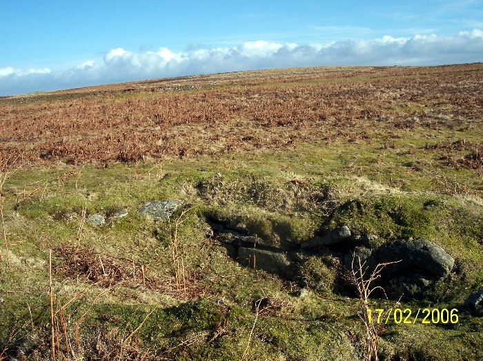
Moor Divock Cairn submitted by donstobbart on 24th Jul 2006. Along the side of the cairn, with a good view of the straight edge that can be seen in the interior of the carn.
(View photo, vote or add a comment)
Log Text: Moor Divock Cairn - Query: We, too, found this feature, just to the right hand side of the main bridleway/footpath leading towards White Raise Cairn. I photographed it, just in case it was documented on what used to be Pastscape, or Historic England. Some 70m to the north west of Moor Divock 3/Askham Fell Cairn and Stone Row, we debated long and hard as to whether this is part of an old quarry, a shooting butt, or part of a robbed cairn (we know Canon Greenwell carried out extensive excavations around here in the 1880s).
Cop Stone
Trip No.173 Entry No.3 Date Added: 17th May 2022
Site Type: Standing Stone (Menhir)
Country: England (Cumbria)
Visited: Yes on 14th May 2022. My rating: Condition 3 Ambience 4 Access 4
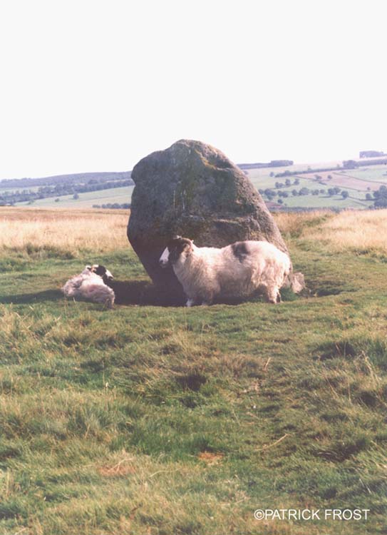
Cop Stone submitted by Patrick Frost on 14th Oct 2002. The Cop Stone in Cumbria at GR: 496216
(View photo, vote or add a comment)
Log Text: The Cop Stone, Askham Fell: Our second visit to this area, which has a wealth of archaeological sites, and reminds me very much of Dartmoor (in places). The weather was gloriously hot, and with many other walkers on the moor, we joined the row of cars parked by the side of the road at around NY 49586 21586.
Nothing much has changed about the Cop Stone since our last visit in 2014, although I was amazed at the number of people who just walked straight on by, without stopping. I had forgotten that the Cop Stone lies on the South Eastern border of a ring cairn, which has been described and illustrated by W. Waistell Taylor in his 1885 Antiquarian paper "Prehistoric Remains on Moordivock". Most of the stones in the ring are largely hidden, or just peeping above, the turf.
Askham Fell Cairn Stone Row
Trip No.173 Entry No.4 Date Added: 16th May 2022
Site Type: Stone Row / Alignment
Country: England (Cumbria)
Visited: Yes on 14th May 2022. My rating: Condition 3 Ambience 4 Access 4
Askham Fell Cairn Stone Row submitted by SandyG on 7th Jan 2018. The two western stones and nearby kerbed cairn. View from south (Scale 1m).
(View photo, vote or add a comment)
Log Text: Askham Fell Cairn and stone row: Using M. Waistell Taylor's Antiquarian paper from 1885, plus Sandy Gerrard's notes from the Stone Rows of Great Britain, we parked at the end of a row of cars at the junction of the single track road and the footpath which runs across it, near the Cop Stone. We set off with our trusty GPS to walk up to this amazing cairn to find the associated stone row.
We've visited this area before (28th June 2014), but more recently, Sandy G has been along to this area and surveyed the 2 verified stone rows in this area. We were unable to join him on this survey, but we're curious to find out more.
Thankfully we had Sandy G's diagram of the 4 small stones in this row (I thought they were just part of the kerb). Andrew very gracefully modelled the location of the smaller 2 stones using my walking poles.
Given the number of walkers around, I was amazed how many people were sticking to the paths and bridleways, rather than look at the archaeology. So much to see in such a concentrated area.
Bloch Well (Langholm)
Trip No.172 Entry No.1 Date Added: 31st Aug 2021
Site Type: Holy Well or Sacred Spring
Country: Scotland (Dumfries and Galloway)
Visited: Yes on 26th Aug 2021. My rating: Condition 2 Ambience 3 Access 4
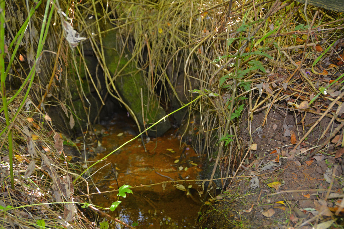
Bloch Well (Langholm) submitted by Anne T on 31st Aug 2021. Not much left of the structure of Bloch Well, but it gives a plentiful supply of water, which seems to piped under the road, running directly south along the eastern side of a small plantation.
(View photo, vote or add a comment)
Log Text: Bloch Well (Langholm): Described as a "dubious holy well" by J.R. Walker in 1883, now completely ruined. Not been able to find out anything much about this well, apart from its' brief Canmore entry, and a mention that the well is sulphurous, although there was no smell of sulphur at the time of our visit.
Holy Well (Stonehaugh)
Trip No.171 Entry No.1 Date Added: 31st Aug 2021
Site Type: Holy Well or Sacred Spring
Country: England (Northumberland)
Visited: Couldn't find on 15th Aug 2021
Log Text: Holy Well (Stonehaugh): We last tried to find this well on 30th June 2014, but failed, despite being directed by a local farmer and his dog, Meg. On this occasion, the steep path down the gorge was very slippery, with wet, knee high grass along the path, and quite dangerous, so we gave up, determined either to come back after a dry period, or to try a different path from the village of Stonehaugh towards the Black Pool.
Hetherington (Wark)
Date Added: 30th Aug 2021
Site Type: Ancient Village or Settlement
Country: England (Northumberland)
Visited: Yes on 25th May 2017. My rating: Condition 3 Ambience 4 Access 4
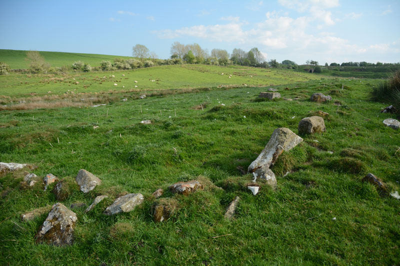
Hetherington (Wark) submitted by Anne T on 27th May 2017. The north western corner of the farmstead, which is sited on a gentle eastern slope.
(View photo, vote or add a comment)
Log Text: Hetherington (Wark): Homestead, built on top of an Iron Age Settlement. Lovely spot, and well worth exploring.
Hetherington (Wark)
Trip No.171 Entry No.2 Date Added: 30th Aug 2021
Site Type: Ancient Village or Settlement
Country: England (Northumberland)
Visited: Yes on 15th Aug 2021. My rating: Condition 3 Ambience 4 Access 4

Hetherington (Wark) submitted by Anne T on 27th May 2017. The north western corner of the farmstead, which is sited on a gentle eastern slope.
(View photo, vote or add a comment)
Log Text: Hetherington (Wark): Our second visit to this site, the first being on 25th May 2017, but I forgotten all about it! A lovely site, and pleasant to explore on a sunny afternoon. Didn't realise that this site has been excavated twice, once in 1957, and again in 1972-73, so must try and find the excavation reports, if they are available.
Crag Well (Bellingham)
Trip No.171 Entry No.3 Date Added: 30th Aug 2021
Site Type: Holy Well or Sacred Spring
Country: England (Northumberland)
Visited: Yes on 15th Aug 2021. My rating: Condition 3 Ambience 4 Access 4
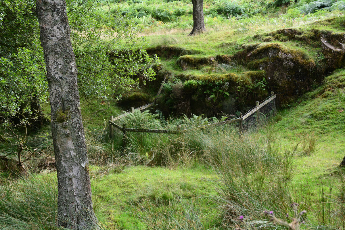
Crag Well (Bellingham) submitted by Anne T on 30th Aug 2021. The well from just to the north of it, avoiding stepping down into the now boggy well pond area.
(View photo, vote or add a comment)
Log Text: Crag Well, Bellingham: Not been able to find out anything much about this well, apart from reading a blog which since seems to have disappeared. Is there a tradition of church services being held next to this well, as the blog said? Will keep researching, but a very pretty spot, well worth visiting.
All Saints (Bradbourne)
Trip No.170 Entry No.7 Date Added: 12th Aug 2021
Site Type: Ancient Cross
Country: England (Derbyshire)
Visited: Yes on 16th Jul 2021. My rating: Condition 3 Ambience 4 Access 4
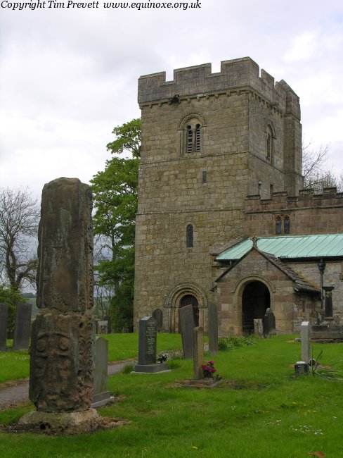
All Saints (Bradbourne) submitted by TimPrevett on 13th May 2007. The remains of the Anglo Saxon cross shaft at Bradbourne, which until quite recently formed parts of a stile... nice, but has not faired as well as that at Eyam.
(View photo, vote or add a comment)
Log Text: All Saints, Bradbourne: Our last visit of this holiday. We had a very 'interesting' journey to Bradbourne, as the police had closed off the main road and routed all traffic down some very minor, single track roads, in which traffic was trying to move in both directions, and not succeeding, which was very frustrating.
There is a large parking area outside the church, although the actual entrance to the churchyard was a bit tricky to find, as there were a number of entrances to different driveways, and we ended up walking down one of these by accident.
The first cross is just inside the churchyard, to your right as you enter from the south. The sundial is just a little further to the north-north-east.
We missed the second cross within the churchyard, as we didn't have access to the HE website at the time of our visit, and whilst looking around, thought it was just another grave marker, so I didn't photograph it.
Loved the carving on the door into the south side of the tower.
Whilst there, a couple of other visitors were very keen for us to see the grave of actor Alan Bates ("Who?" I asked, to much disgust on their part), so we did wander round to find it, out of curiosity.
Hands Well
Trip No.170 Entry No.6 Date Added: 12th Aug 2021
Site Type: Holy Well or Sacred Spring
Country: England (Derbyshire)
Visited: Yes on 16th Jul 2021. My rating: Condition 3 Ambience 3 Access 5
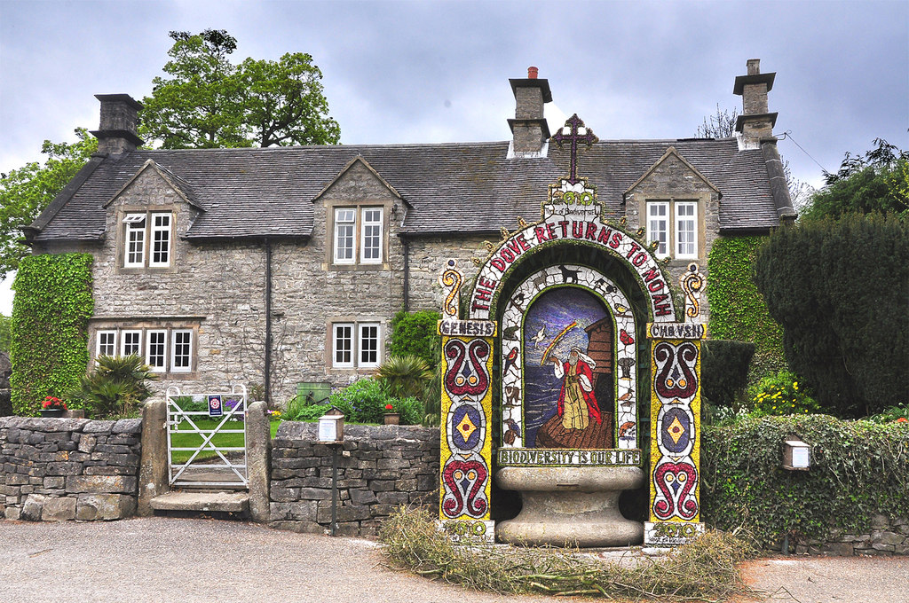
Hands Well submitted by Creative Commons on 6th May 2013. Hands Well dressing and cottage - Tissington 2010
Copyright Mick Lobb and licensed for reuse under the Creative Commons Licence.
(View photo, vote or add a comment)
Log Text: Hands Well, Tissington: The sixth, and final, well marked on the Tissington village leaflet map, and looked like a large, stone cotton-reel. As we approached it, some people were dipping their hands into the water. There was no flow of water into the basin, although the water appeared fresh and clear.
Children's Well
Trip No.170 Entry No.5 Date Added: 12th Aug 2021
Site Type: Holy Well or Sacred Spring
Country: England (Derbyshire)
Visited: Yes on 16th Jul 2021. My rating: Condition 3 Ambience 3 Access 5
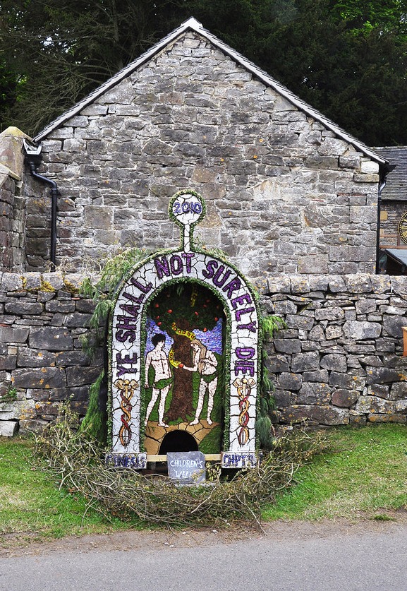
Children's Well submitted by Creative Commons on 6th May 2013. Dressing of Children's Well - Tissington 2010
Rather a macabre sentiment from children I would think.
Copyright Mick Lobb and licensed for reuse under this Creative Commons Licence.
(View photo, vote or add a comment)
Log Text: Children's Well, Tissington: The fifth well we visited in the village, and easy to spot. Not recorded on HE or HERR. The basin within the well head was slightly muddy and dry, but looking over the dry stone wall, there is a boggy area of ground, which is where the water appears to rise, and a stone trough just behind the well head, which was full of water.
Coffin Well
Trip No.170 Entry No.4 Date Added: 11th Aug 2021
Site Type: Holy Well or Sacred Spring
Country: England (Derbyshire)
Visited: Yes on 16th Jul 2021. My rating: Condition 2 Ambience 2 Access 5

Coffin Well submitted by AngieLake on 12th Feb 2007. The beautiful clay-based panel of dried flowers and seeds creating this artistic well-dressing at the Coffin Well in 2003.
(View photo, vote or add a comment)
Log Text: Coffin Well, Tissington: Finding this well was pretty tricky, as even with the leaflet showing the location of all the wells in Tissington, we walked up and down, and down and up a lane called 'The Foot'. Eventually, I realised that whoever was in the cottage had parked their car right across the front of the well, with the front passenger tyre almost in the well itself. I had to do contortions, avoiding the bonnet of the car, to get any photograph at all.
Presumably the main part of the well is behind the garden wall, in the private garden. The gate to the cottage had a sign which said 'no entry' or 'strictly private', and I was reluctant to knock on the front door and seek permission.
Not impressed by the parking, and no sign to say this was the well.
Town Well
Trip No.170 Entry No.3 Date Added: 11th Aug 2021
Site Type: Holy Well or Sacred Spring
Country: England (Derbyshire)
Visited: Yes on 16th Jul 2021. My rating: Condition 4 Ambience 3 Access 4
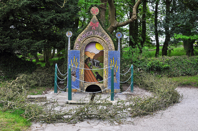
Town Well submitted by Creative Commons on 6th May 2013. Dressing of Town Well - Tissington 2010
The designs are laid out on a frame with stretched sacking to which is applied wet mud into which the decoration is applied. The week saw warm dry weather that dried out the mud which cracked like the dried up bed of a lake. This photograph shows deterioration of the dressing on the final display day.The next day the display was removed.
Copyright Mick Lobb and licensed for reuse under this Creative Commons Licence
(View photo, vote or add a comment)
Log Text: Town Well, Tissington: Our third well out of the six in the village. From Yew Tree Well, we headed east along The Green, past the pond (which had very cute young ducklings being taught to swim by their parents). The well is just to your left hand side at the far side of the green.
Yew Tree Well
Trip No.170 Entry No.2 Date Added: 11th Aug 2021
Site Type: Holy Well or Sacred Spring
Country: England (Derbyshire)
Visited: Yes on 16th Jul 2021. My rating: Condition 4 Ambience 3 Access 5
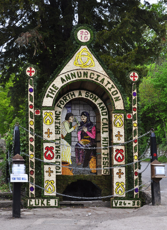
Yew Tree Well submitted by Creative Commons on 6th May 2013. Dressing of Yew Tree Well - Tissington 2010
The last day of the various dressings and colours have faded but do not detract to the effort that goes into dressing of the wells in the village.
Copyright Mick Lobb and licensed for reuse under this Creative Commons Licence.
(View photo, vote or add a comment)
Log Text: Yew Tree Well, Tissington: The second well of the day. We walked down The Street from Hall Well (with the cafe to our right hand side and church to our left), turning left into Narlow Street. This well is almost at the entrance to the Candle Workshop, underneath a tall, but relatively young Yew Tree.
There was water in the well basin, but nothing seemed to be flowing into or out of the well, or along the drainage channel at the front of it, at the time of our visit.
Hall Well (Tissington)
Trip No.170 Entry No.1 Date Added: 11th Aug 2021
Site Type: Holy Well or Sacred Spring
Country: England (Derbyshire)
Visited: Yes on 15th Jul 2021. My rating: Condition 4 Ambience 4 Access 5
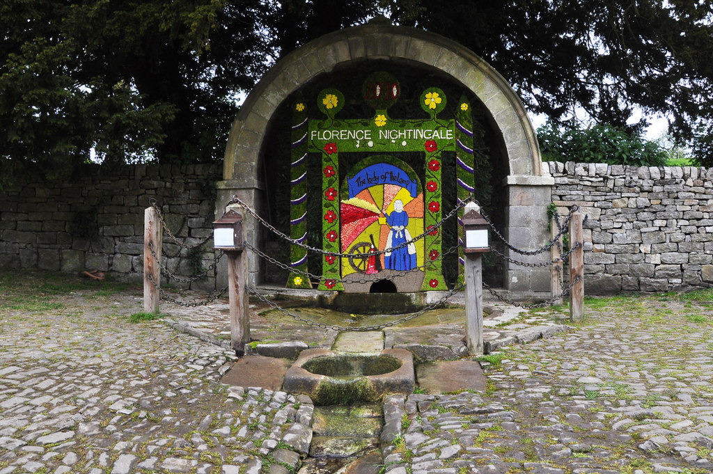
Hall Well (Tissington) submitted by Creative Commons on 6th May 2013. Dressing of Hall Well - Tissington 2010
Copyright Mick Lobb and licensed for reuse under this Creative Commons Licence.
(View photo, vote or add a comment)
Log Text: Hall Well, Tissington: We have been to Tissington before, on a Well Dressing weekend, a long, long time ago (about 38 years!), but because of the sheer number of visitors and really only interested in seeing the church, we took a quick look around only. This time, we walked round to see the wells in their 'ordinary' state. There was a large number of visitors again, but no-one else seemed particularly interested in the wells. It being a very, very hot and humid day, we were grateful for the cafe being open, although the queues to get ice-cream from the traditional sweet shop were horrendous, so we gave up.
I picked up a leaflet in the main cafe which showed the location of the wells, which made locating them easy.
A very pleasant village, and well worth visiting. Would have liked to have spent longer.
Crossfoot Farm Standing Stone
Trip No.169 Entry No.5 Date Added: 9th Aug 2021
Site Type: Standing Stone (Menhir)
Country: Wales (Powys)
Visited: Couldn't find on 15th Jul 2021. My rating: Ambience 3 Access 4

Crossfoot Farm Standing Stone submitted by jfarrar on 18th May 2019. Standing stone north of Clyro in a private field.
(View photo, vote or add a comment)
Log Text: Crossfoot Farm Standing Stone: We tried to find this stone, and even hopped across the gate into the field which the OS map shows it in, but no standing stone was visible.
The field is next to a building site and it looks as if the field was being used to store both materials and rubble, making the field very difficult to walk across.
We think the stone now may have fallen, and may be in an area of unmown grass, so is not visible from the highly chained and padlocked gate into the field.
St Julian's Well (Ludlow)
Date Added: 9th Aug 2021
Site Type: Holy Well or Sacred Spring
Country: England (Shropshire)
Visited: Yes on 15th Jul 2021. My rating: Condition 3 Access 5
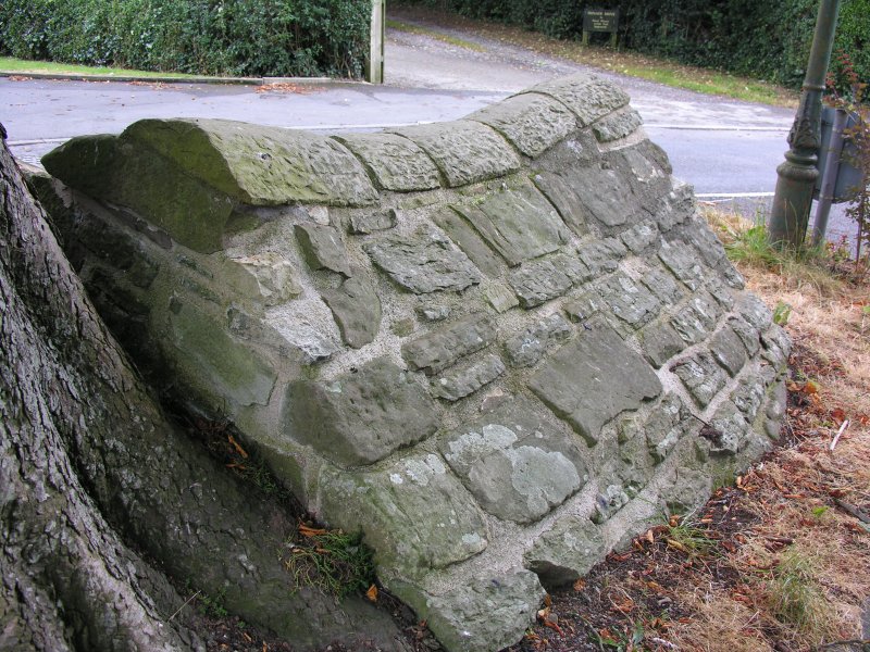
St Julian's Well (Ludlow) submitted by TimPrevett on 23rd Sep 2007. The obvious or not so obvious if you don't know it's there - St Julian's Well in the centre of Livesey and St Julian's Ave, Ludlow. A property called Wellside is to its north. This was the first not famous holy well I went in search of several years ago, and I'm glad to have worked out where it is at last!
(View photo, vote or add a comment)
Log Text: St Julian's Well, Ludlow: Last stop of the day before collecting our car from the garage and driving back to the holiday cottage, then home tomorrow. The well was deep in dappled shade, it being late afternoon on a hot, sunny day. We parked just south west of the well, at the side of Livesey Road. This road was busy with other cars, presumably because of all the roadworks in the area, routing cars along past the well.
A very odd spot for the well, and the tree next to it had grown over part of the well structure. Someone had wedged a drinks cannister into what had been the pipe from inside the well house, which now appeared to be dry. We couldn't see any obvious channels for water to flow down, and we were unable to hear any water flowing anywhere in the vicinity.
Worth stopping off to take a few photographs, and another well site to tick off the list.
St Milburga's Well (Stoke St Milborough)
Trip No.169 Entry No.3 Date Added: 9th Aug 2021
Site Type: Holy Well or Sacred Spring
Country: England (Shropshire)
Visited: Yes on 15th Jul 2021. My rating: Condition 3 Ambience 3 Access 4
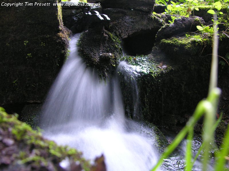
St Milburga's Well (Stoke St Milborough) submitted by TimPrevett on 23rd Sep 2007. The superlative St Milburga's Well at Stoke St Milborough. One of the best I have visited. It is situated in its own enclosure to the immediate adjacent west of the road which arcs to the east of the village.
The flow is the strongest I have observed on any holy well, coming through a pipe at the bottom of a flight of steps. A standpipe stands outside the enclosure, and with a turn of the knob, yields water.
Pay attention to the latch on the gate and head on the handrail, too.
(View photo, vote or add a comment)
Log Text: St Milburga's Well, Stoke St Milborough: We visited the church first of all, and whilst some of the church dates from the 13th century, there was little of this in evidence, the fabric having been restored in Victorian times. The church had been left open, so we looked inside, but not much of note, apart from the lovely geese (I thought they were ducks until I saw the official records) carved into the top of the wooden door into the base of the tower at the west end.
Not having a map for this area, we thought the holy well might be near to the church, but thankfully bumped into the church warden as we exited the church. He was carrying a large wooden stake and hammer, so I joked with him "are you hunting vampires?". It turned out he was marking out a burial plot for a recently deceased villager.
He directed us to the well, but told us that "thanks to the water company, there's very little left of the well". Coming out of the churchyard, we headed south on the minor road, then turned left and headed up the hill, following the road round to the left as it levelled off. Just round this bend, there was a gate into the well enclosure. Steps led down to the well head, which still exists, together with a small well pool and a lively outflow into a stream which heads westwards, back towards the church.
A very peaceful spot. Just a shame about the modern domestic water apparatus next to the well.
St John the Baptist (Hope Bagot)
Trip No.169 Entry No.2 Date Added: 8th Aug 2021
Site Type: Holy Well or Sacred Spring
Country: England (Shropshire)
Visited: Yes on 15th Jul 2021. My rating: Condition 3 Ambience 4 Access 4
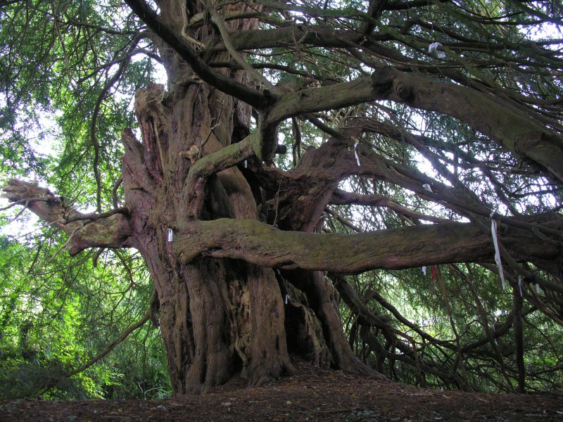
St John the Baptist (Hope Bagot) submitted by TimPrevett on 23rd Sep 2007. The yew certainly adds a heavy ambience to the place. I found it a little creepy myself, but interestingly enough, it has many clouties - the most I've seen on a well outside of Cornwall. (Lots more not visible in this photo).
(View photo, vote or add a comment)
Log Text: St John The Baptist, Hope Bagot: We parked in the village hall car park, about the only place in the village we could leave the car, as the lanes here were so narrow. The church was very difficult to spot from the road, but thankfully, a sign in the village hall car park pointed us up some steps, through a gate and straight into the churchyard.
What an unusual old church, very reminiscent of Escomb Saxon Church. Just as we entered the churchyard, we met the Church Warden's wife, who stopped to talk to us, and told us how to find the well (underneath a yew tree at the northern side of the churchyard (approaching the church from the north, there is a wooden gate into the churchyard; come through this gate and take the small path to your right hand side. This leads the 20m or so to the well).
There is also a Victorian well head at SO 58858 74092. The Church Warden's wife told us there were a number of springs in the village.
