Contributory members are able to log private notes and comments about each site
Sites Anne T has logged. View this log as a table or view the most recent logs from everyone
Haer Stane
Trip No.109 Entry No.8 Date Added: 12th Nov 2018
Site Type: Standing Stone (Menhir)
Country: Scotland (Clackmannanshire)
Visited: Yes on 31st Oct 2018. My rating: Condition 3 Ambience 3 Access 4
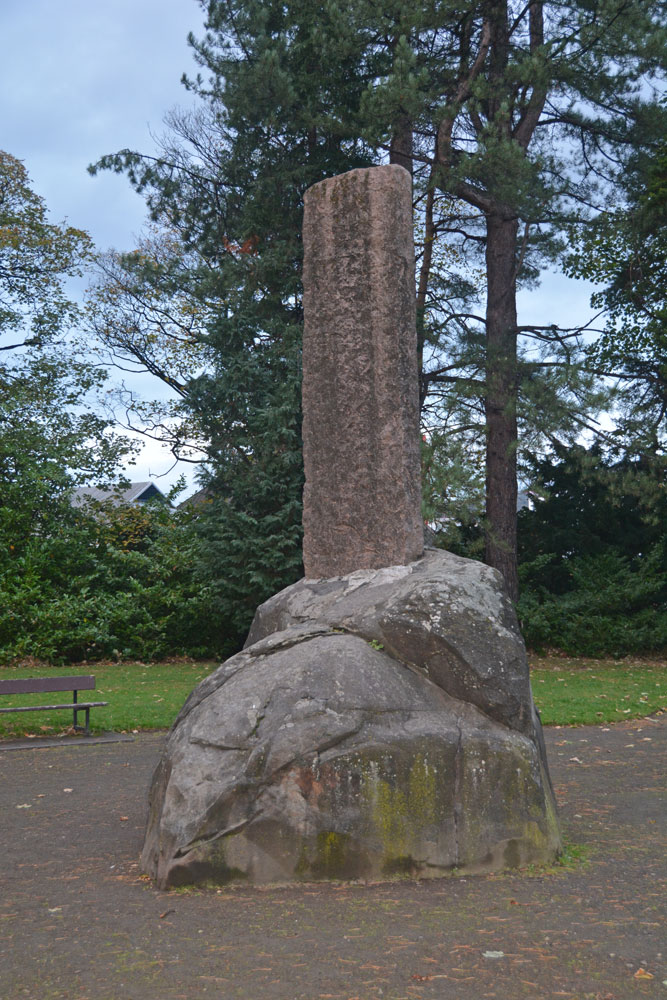
Haer Stane submitted by Anne T on 12th Nov 2018. Site in Clackmannanshire Scotland. Approaching the Haer Stane, which is at the far (north western) end of the park. It was dusk on Halloween, and the light was failing fast!
(View photo, vote or add a comment)
Log Text: Haer Stane, Tullibody: This is one of the strangest erratics I’ve seen, as it’s been repurposed as a war memorial. We parked on School Road, by the school, and walked down to the entrance to this long, thin park; the only gate we could find into this area was through a lych gate at the corner of School Road and Lychgate Road. The erratic is almost at the far (north western) end of the park.
The stone was adjacent to the rear of the school where a large construction project is taking place, so the noise was very intrusive. We were the only people taking note of this erratic; all the other people around must have been locals who were walking their dogs.
The crosses on the eastern face of the cross shaft have been well done, and mimic Anglo Saxon crosses with interlaced designs.
The Maiden Stone (Tullibody)
Trip No.109 Entry No.7 Date Added: 12th Nov 2018
Site Type: Sculptured Stone
Country: Scotland (Clackmannanshire)
Visited: Yes on 31st Oct 2018. My rating: Condition 3 Ambience 3 Access 4
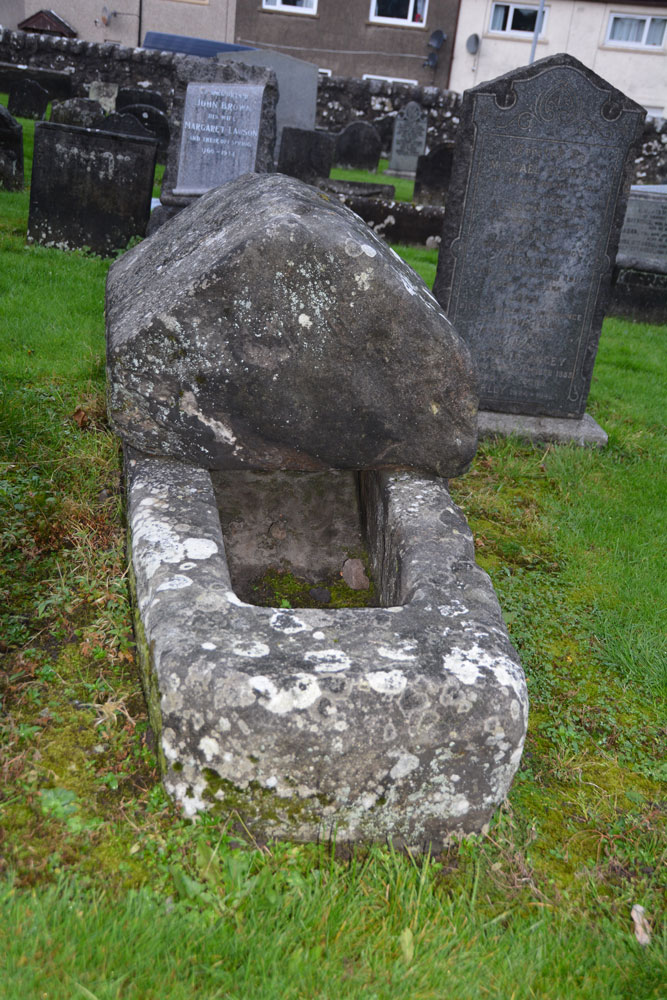
The Maiden Stone (Tullibody) submitted by Anne T on 12th Nov 2018. Site in Clackmannanshire Scotland. The Maiden Stone from the east. Whilst there are no visible carvings on the coped cover, I thought it might resemble how a hogback looked on a Viking tomb.
(View photo, vote or add a comment)
Log Text: The Maiden Stone, Tullibody: This stone coffin is next to the ruins of the old church. We parked in the car park for the new church and walked through the graveyard which runs parallel to the road. Some really unusual tombstones, and quite spooky to walk through the graveyard and look around the outside of the Old Church as dusk was falling on Halloween!
Deil's Cradle (Dollar)
Trip No.109 Entry No.5 Date Added: 11th Nov 2018
Site Type: Natural Stone / Erratic / Other Natural Feature
Country: Scotland (Clackmannanshire)
Visited: Saw from a distance on 31st Oct 2018. My rating: Condition 3 Ambience 3 Access 3
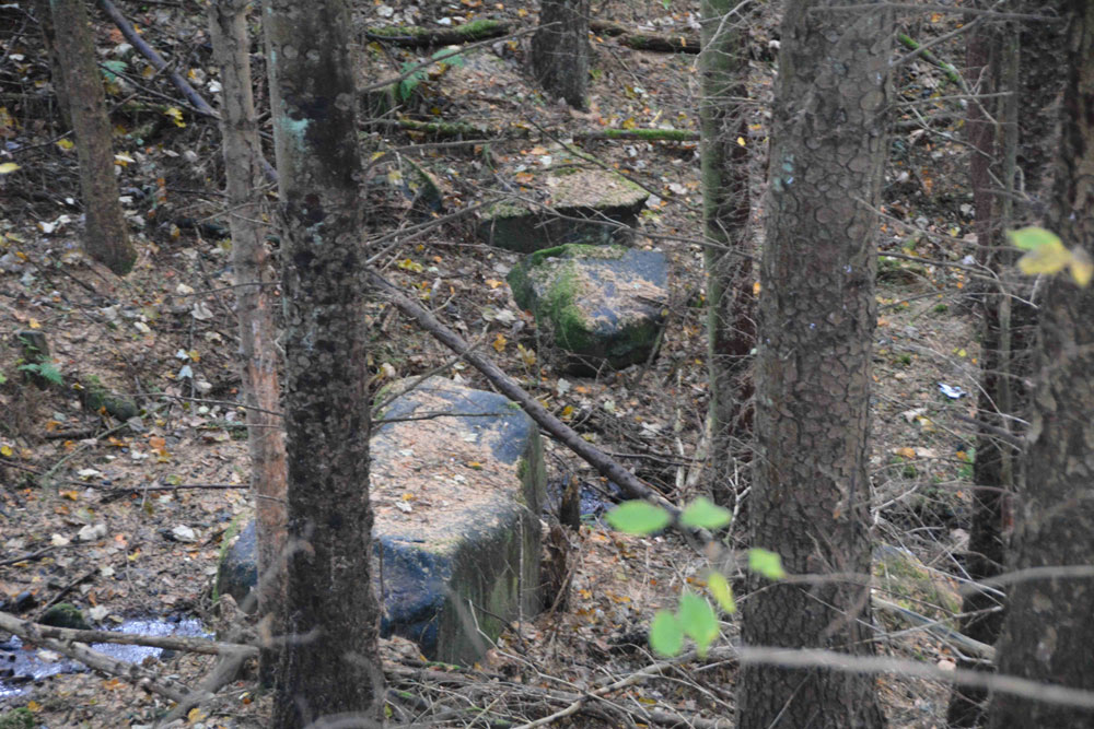
Deil's Cradle (Dollar) submitted by Anne T on 11th Nov 2018. Site in Clackmannanshire Scotland. With this large erratic at the bottom of a small gorge, with daylight failing, we wanted to get to Tullibody to see the Maiden's Stone, so photographed it from a distance only.
(View photo, vote or add a comment)
Log Text: Devil's Cradle, Dollar: With this being Halloween, I was keen to try and see this massive erratic rock. From the Wizard’s Stone eastwards, the road gets narrower, not much wider than a single track road, so we parked in Tarmangie Drive, at NS 96743 99038, and walked up Upper Hillfoot Road (the southern part) at NS 96743 99038. Looking down through the woodland, we saw a large erratic by the side of a small burn.
This stone is in a very deep gorge, and we couldn’t immediately see a way to get to it With a 70 degree slope on one side and a near vertical drop on the other, we decided, with the failing light, to carry on to Tullibody and see sites which we really wanted to get to before dark, so photographed this stone only from a distance.
Wizard's Stone (Dollar)
Trip No.109 Entry No.4 Date Added: 11th Nov 2018
Site Type: Natural Stone / Erratic / Other Natural Feature
Country: Scotland (Clackmannanshire)
Visited: Yes on 31st Oct 2018. My rating: Condition 3 Ambience 3 Access 4

Wizard's Stone (Dollar) submitted by Anne T on 11th Nov 2018. Site in Clackmannanshire Scotland. Standing just to the east of the stone, looking north west across the footpath.
(View photo, vote or add a comment)
Log Text: Wizard's Stone (Dollar): We stopped off at a café in Dollar for a sandwich and cup of tea, then set off north east out of the town to find the Wizard’s Stone. This was really easy to spot. There is a small area to park on Hillfoot Road, where the road divides, at NS 96634 98999.
Rather than walk up ‘the (marked foot) path’ we walked into the field to photograph the stone. There are a number of pieces lying immediately around the stone, the larger of which appears deeply embedded in the ground; a smaller piece looks as if it had spalled off through, perhaps, frost action.
Carleith (Crook of Devon)
Trip No.109 Entry No.3 Date Added: 11th Nov 2018
Site Type: Cairn
Country: Scotland (Perth and Kinross)
Visited: Saw from a distance on 31st Oct 2018. My rating: Condition 3 Ambience 4 Access 4
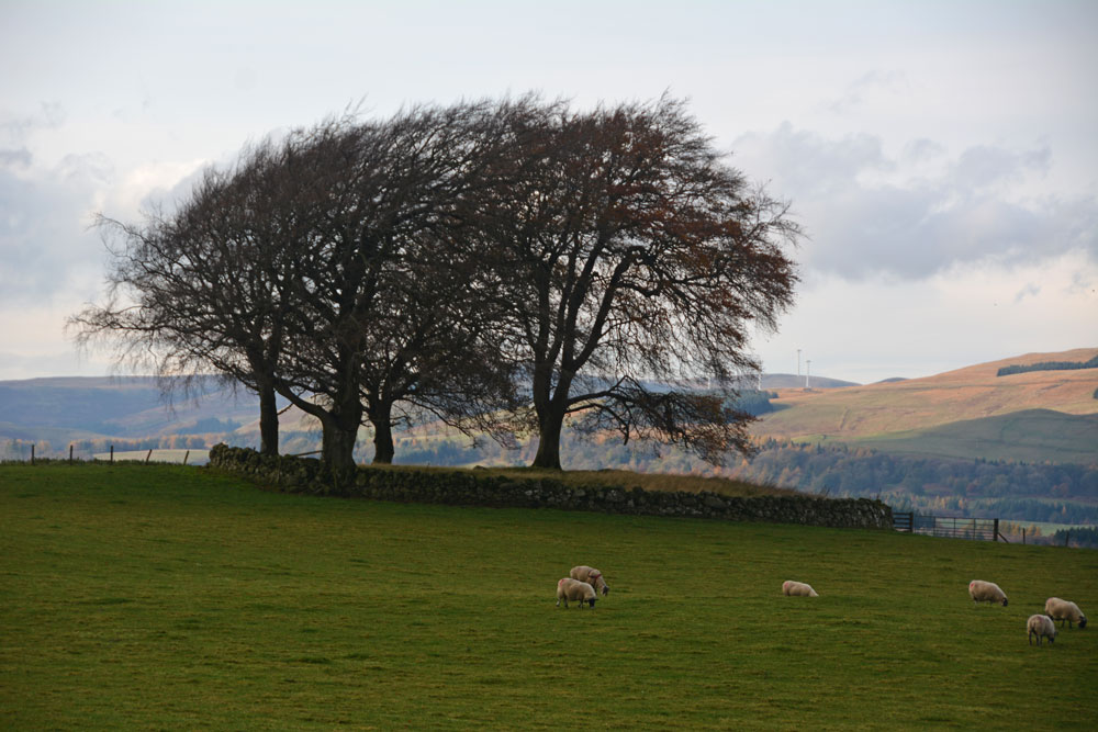
Carleith (Crook of Devon) submitted by Anne T on 11th Nov 2018. Using the camera lens on maximum zoom to try and get an idea of this perfectly circular cairn, bounded by a drystone dyke.
(View photo, vote or add a comment)
Log Text: Carleith Cairn (Crook of Devon): We didn’t go into the field as there were two very boisterous young bullocks who crowded the gate, along with their protective mothers, so I photographed it mainly from the gate into the field. From the edge of the field, this looked almost completely round, and I would have loved to have walked over it. The view to the distant hills was lovely.
Bull Stone (Crook of Devon)
Trip No.109 Entry No.2 Date Added: 10th Nov 2018
Site Type: Standing Stone (Menhir)
Country: Scotland (Perth and Kinross)
Visited: Yes on 31st Oct 2018. My rating: Condition 2 Ambience 3 Access 4
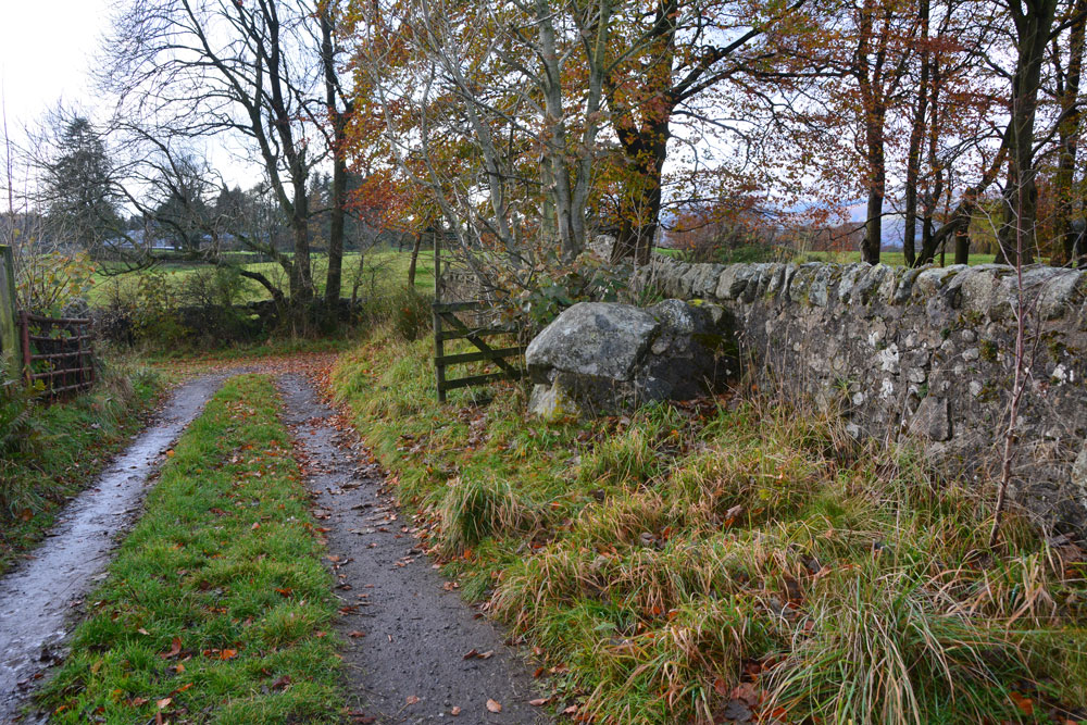
Bull Stone (Crook of Devon) submitted by Anne T on 10th Nov 2018. The Bull Stone, showing how it sits in relation to the footpath leading south from Church Road, and the farm track leading east.
(View photo, vote or add a comment)
Log Text: The Bull Stone, Crook of Devon: We parked in St Serf’s Road, Crook of Devon, at NO 03303 00037 and walked down Church Road, then took the right hand fork of the footpath, which lead almost directly south. Just under 220 metres from the fork, there is a farm track which leads off to the east. The Bull Stone is showed on the map just up this track, on its northern side.
I thought this stone was just part of an old stone wall, as the stone was fragmented and cemented together again. It wasn’t until I saw the photo on TNA that I believed we had seen the right stone! Not a brilliant monument, but a nice, short walk, and another to ‘tick off the list’ of sites seen.
Tullibole
Trip No.109 Entry No.1 Date Added: 11th Nov 2018
Site Type: Sculptured Stone
Country: Scotland (Fife)
Visited: Yes on 31st Oct 2018. My rating: Condition 2 Ambience 3 Access 4
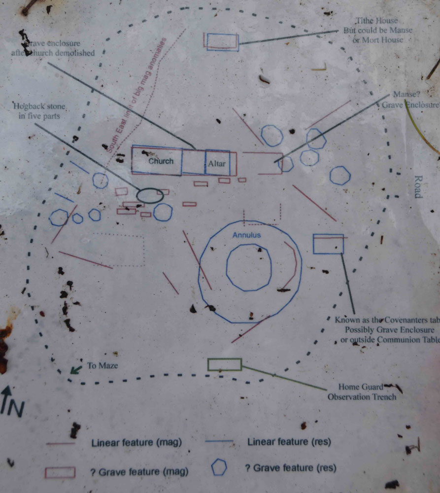
Tullibole submitted by Anne T on 11th Nov 2018. The paper sheets covered by plastic on the information board, propped up by the large memorial surrounded by iron railings, were sodden with rain. I photographed the plan for future visitors in case it became illegible in the near future. This shows where to find the hogback pieces, but beware, we only found what we thought were two pieces, deeply buried under grassy tussocks.
(View photo, vote or add a comment)
Log Text: Tullibole Church Ruins with hogback in five pieces: Our first stop of the day, and as Andrew told me this was a site where 11 witches were tried, condemned and burned, a site I thought would be a good, spooky, start to the Halloween. But, this is essentially a field with a few gravestones sticking out of it, and it turned out the trials had taken place at nearby Tullibole Castle. The remains of the church are there, on the south side buried deep in the grass and turf, but more visible on the northern side, where several courses of stones stick up out of the ground.
There is a display board next to a large monument surrounded by a metal railing and tall conifers, but we had difficulty orientating ourselves to the photos, eventually picking up the display board (which was propped up against the railings, and taking it over to the chest tombs).
We did find one part of the hogback, and possibly a second, but the grass tussocks were so high, we were unable to find any more pieces.
As the information sheets were covered in plastic, but the rain was seeping through, and they are likely to become even more worn and stained, I photographed a couple of them and typed them up for future reference.
Chapel Well (Cambusbarron)
Trip No.108 Entry No.7 Date Added: 10th Nov 2018
Site Type: Holy Well or Sacred Spring
Country: Scotland (Stirling)
Visited: Yes on 30th Oct 2018. My rating: Condition -1 Ambience 2 Access 4
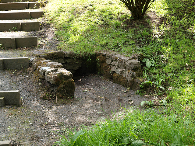
Chapel Well (Cambusbarron) submitted by peigimccann on 12th Sep 2016. Bruce's Well 7-7-09
(View photo, vote or add a comment)
Log Text: Bruce's Well, Cambusbarron: Even with the GPS from the Portal, we had great trouble finding this well, and in the end had to ask two locals. One pointed us to an old water fountain in a nearby park, now repurposed as a planter; the other took us to a footpath by the side of a small stream and pointed us down the path, saying “a lot of people come to look, but there’s not really much to see.”
We found the steps, as photographed on the Portal, but there was a sign declaring this the site of the well only.
In the middle of the village, a police officer was standing in a doorway with a number of people outside making phone calls. As we headed up the steps from the site of the well back to the car, a white clothed forensics officer exited the house. Haven't found out what happened, but this certainly made it a memorable visit to the site of this well.
Coneypark Nursery (Cambusbarron)
Trip No.108 Entry No.6 Date Added: 10th Nov 2018
Site Type: Cairn
Country: Scotland (Stirling)
Visited: Yes on 31st Oct 2018. My rating: Condition 2 Ambience 3 Access 5
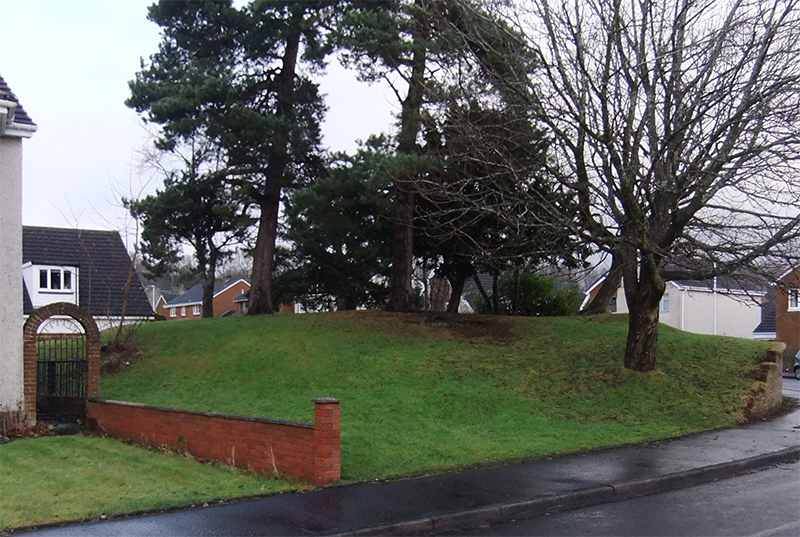
Coneypark Nursery (Cambusbarron) submitted by peigimccann on 24th Dec 2017. Coneypark mound photo by David Sibbald
(View photo, vote or add a comment)
Log Text: Coneypark Nursery Cairn: This cairn is right in the middle of a modern housing estate, where it has been left as a corner ‘open space’. The sides of the cairn have been marginally cut away to create the road and the gardens for the houses, but it is possible to walk over the cairn. A few of the residents were arriving home and in their driveways; none of them took (much) notice of me taking photographs and having a walk all around the cairn.
There is nothing much to see here, but it was ‘one to tick off our list’.
St Thomas's Well (Cambusbarron)
Trip No.108 Entry No.5 Date Added: 10th Nov 2018
Site Type: Holy Well or Sacred Spring
Country: Scotland (Stirling)
Visited: Yes on 30th Oct 2018. My rating: Condition 3 Ambience 4 Access 5

St Thomas's Well (Cambusbarron) submitted by peigimccann on 27th Sep 2016. St Thomas's well pond.
(View photo, vote or add a comment)
Log Text: St Thomas's Well, Cambusbarron: St Thomas’s Well is not far from the rock art panel. Going back to the car, we drove further down Douglas Terrace, past the grave yard, to where the road (St Thomas’s Well) turns right. The well is just past it’s junction with the Old Turnpike Road.
This well is in a private garden. It is possible to walk all the way round the well pool, but not to access the garden. The pool still had water in it, but only a relatively small amount. The whole pool was around 30m across. At its western side, there was a paved area with a round well basin built into it, but this looked like a garden feature rather than part of the well structure.
By the names and the old buildings, this is obviously a very old location with history, but no longer has the atmosphere with the modern houses built up around the historical sites. The busy M9 lies almost immediately to the west, although the noise of the traffic was masked to some extent by the buildings between the well and the road.
King's Park Cup and Rings
Trip No.108 Entry No.4 Date Added: 10th Nov 2018
Site Type: Rock Art
Country: Scotland (Stirling)
Visited: Yes on 30th Oct 2018. My rating: Condition 3 Ambience 4 Access 4
King's Park Cup and Rings submitted by SolarMegalith on 27th Jun 2017. Cup-and-ring mark on King's Park panel seen in the artificial lighting (photo taken on May 2017).
(View photo, vote or add a comment)
Log Text: King's Park Cup and Rings, Sterling: From Stirling, we headed off to south end of King’s Park which lies south of the A811 Dumbarton Road. The rock art panel is located at the southern end, near the golf course.
We parked on Douglas Terrace and used the little cut-through to the park at the eastern end of the row of terraced houses before its junction with Park Place. We then turned west along the footpath that ran along the bottom of the cliffs, but had to double back and use the footpath and steps up to the golf course, just to the right of the cut-through. From here, we turned west along the footpath. The grid reference is spot on, and the rock had had the turf cleared from it. The low light at this time of the afternoon helped to pick out the motifs.
I wondered what other motifs there might be around here, as the footpath here runs along the top of some small cliffs, but these were heavily wooded.
St Ninian's Well (Stirling)
Trip No.108 Entry No.3 Date Added: 10th Nov 2018
Site Type: Holy Well or Sacred Spring
Country: Scotland (Stirling)
Visited: Yes on 30th Oct 2018. My rating: Condition 3 Ambience 2 Access 5
St Ninian's Well (Stirling) submitted by KiwiBetsy on 16th Oct 2006. It is said that a chapel stood near the well and was still in existence in 1497 but that none of it now remains and the structure now covering the well is a wash house.
(View photo, vote or add a comment)
Log Text: St Ninian's Well, Stirling: This was just over the road from the Wellgreen Carpark, but we had difficulty in finding this well, because of its rather hidden location. Despite the GPS telling us we were only 20m away, we were unable to find it until we saw the footpath leading to Wellgreen Place at the southern side of the A811 Wellgreen Road. Shame the area is used by smokers, as the rubbish is horrible.
Opposite the well, nearer to the office block is a small set of steps leading upwards to a now very much overgrown garden area. The steps are virtually hidden under shrubbery, and although Andrew had a try at climbing up, it was very difficult and we gave up and went onto our next destination.
Butt Well
Trip No.108 Entry No.2 Date Added: 9th Nov 2018
Site Type: Holy Well or Sacred Spring
Country: Scotland (Stirling)
Visited: Yes on 30th Oct 2018. My rating: Condition 3 Ambience 4 Access 4
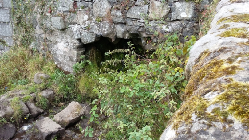
Butt Well submitted by rogerkread on 16th Oct 2015. The waters which would once have flowed into the Butt Well now tumble down the hillside on the far side of the wall behind the wellhead.
(View photo, vote or add a comment)
Log Text: Butt Well, Sterling Castle: We parked in the layby near the King’s Knot, just off the A811. There is a footpath signposted to Butt Well leading through the field next to the layby, just down the grassy slope.
Walking up towards the Castle, we were met by a fair number of dog walkers walking to or from the well. The footpaths here look as if they give access up to the castle, but we stopped short at the well.
Our first sight of part of this feature was a small well chamber, still with a fair flow of water running into it, just over the dry stone wall, below the main well housing and at the bottom of the flight of steps, at NS 78937 93894. The water from this runs in a small channel across the field to the northern side of the wall, at the opposite side to the footpath. Looking down at this chamber from above, there appears to be the remains of a stone drinking trough just outside the chamber, but largely buried under the grass and weeds around it.
The well itself, at NS 78948 93898, is now dry and capped off, with a handy bench next to it.
Climbing up the few steps above the main well housing, there is a channel running underneath the footpath running off to the north west at NS 78952 93902.
As I was photographing the well, a young black Labrador was running around with a large tree branch in his mouth. I was laughing at him, and his owner came up and asked us where we were from. He said when he was young, he used to play on the ‘cup and saucer’ (the King’s Knot) then run up here for a drink; “the water was the clearest you’ll ever taste”. He told me that they’d capped the well off some 20 to 30 years ago.
Randolphfield Stones
Trip No.108 Entry No.1 Date Added: 8th Nov 2018
Site Type: Standing Stones
Country: Scotland (Stirling)
Visited: Yes on 30th Oct 2018. My rating: Condition 3 Ambience 3 Access 4
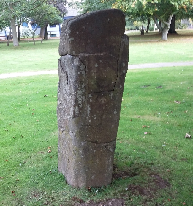
Randolphfield Stones submitted by rogerkread on 16th Oct 2015. The larger stone, showing evidence of destruction and subsequent repair.
(View photo, vote or add a comment)
Log Text: Randolphfield Stones, Sterling: This visit felt really strange, as the stones were literally in front of the police station, and I wondered if I’d get a tap on the shoulder and the memory card from my camera confiscated! No one seemed to turn a hair, though I took a number of photographs of both stones.
Kelvingrove Museum and Art Gallery
Trip No.107 Entry No.4 Date Added: 15th Nov 2018
Site Type: Museum
Country: Scotland (North Lanarkshire)
Visited: Yes on 29th Oct 2018. My rating: Condition 3 Ambience 3 Access 5
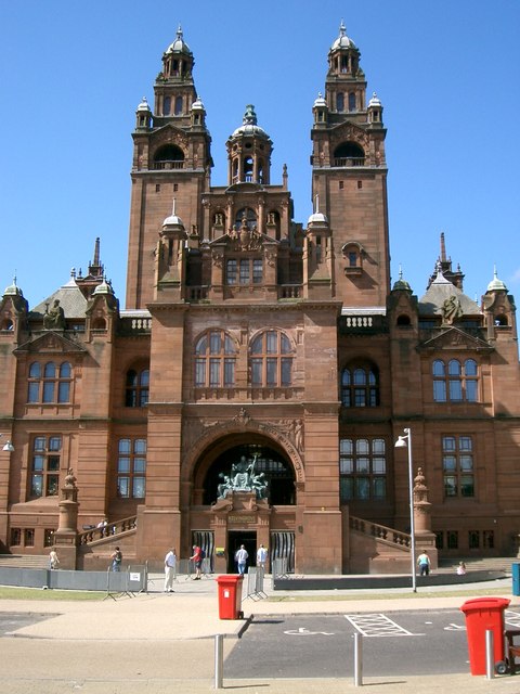
Kelvingrove Museum and Art Gallery submitted by Creative Commons on 13th Mar 2014. Kelvingrove Art Gallery And Museum
Taken from Kelvingrove Park.
Copyright Paul McIlroy and licensed for reuse under this Creative Commons Licence
Site in North Lanarkshire Scotland
(View photo, vote or add a comment)
Log Text: Kelvingrove Museum, Glasgow: After Glasgow Cathedral and the Govan Stones, I found the exhibition of Scotland's Early People a little small and disappointing, but what they had on display was interesting. Best items on display for me were the beaker found when they excavated Temple Wood in Kilmartin and a wooden ladder from a crannog. And of course the rock art stone Andy B was photographed with!
The Govan Stones
Trip No.107 Entry No.3 Date Added: 8th Nov 2018
Site Type: Museum
Country: Scotland (North Lanarkshire)
Visited: Yes on 29th Oct 2018. My rating: Condition 3 Ambience 5 Access 5
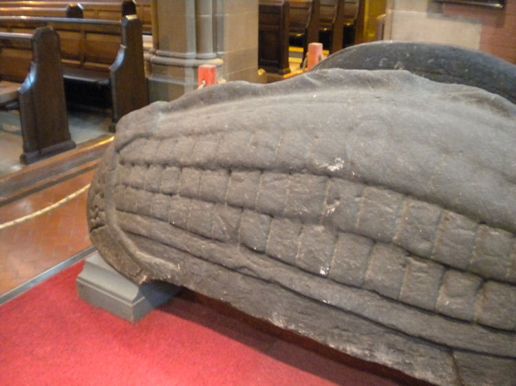
The Govan Stones submitted by joedkins on 19th Jun 2011. Hogback stone in Govan Old Church, Glasgow
(View photo, vote or add a comment)
Log Text: The Govan Stones, Govan Old Church: We only found out about this exhibition/display through a chance email to Glasgow Life, enquiring if St Mungo's Museum of Religious Life and Art next to Glasgow Cathedral had any early Christian stones we could see and photograph. They replied 'no' but told us about The Govan Stones. With only a few days to go before the exhibition closed for the winter on 31st October, we rushed to see it at the first opportunity, and were blown away!
We spent about 2 hours here, wandering around, looking at the stones, hogbacks and the sarcophagus. A guide joined us for part of our visit and put on special lights in which to view the sarcophagus.
I photographed most of the stones, and am still trying to find out more about each one. This exhibition deserves to be much, much wider known than it currently is. It is the best display of early Christian stones that we've seen to date, and I would go again in a heart-beat.
Very, very highly recommended indeed.
Since my visit, I've been in touch with Govan Heritage Trust to find out more information about the stones. They have been immensely helpful and even provided some of the photographs for submission here.
Lady Well (Glasgow)
Trip No.107 Entry No.2 Date Added: 7th Nov 2018
Site Type: Holy Well or Sacred Spring
Country: Scotland (North Lanarkshire)
Visited: Yes on 29th Oct 2018. My rating: Condition 3 Ambience 3 Access 5
Lady Well (Glasgow) submitted by KiwiBetsy on 23rd Sep 2006. Site in Renfrewshire The well used to flow from the east bank of the Merchants Park, but when this was converted to the Necropolis, the well became polluted and was closed. In 1836, The Merchants House built a niche on the spot to mark the site of it’s exit from the brae. This was rebuilt in 1874.
(View photo, vote or add a comment)
Log Text: Lady Well, Glasgow: To get to this well, we had to walk through the path to the south of the cathedral leading to the Necropolis, then use a gate at the junction of Wishart Street and Ladywell Street, walking east towards the dead end of this street. The well is to the northern side of Ladywell Street, opposite an entrance into Tennent’s Wellpark brewery. It is dry, and now somewhat delapidated, although people have left offerings of money.
As the Canmore entry reads, Lady Well was “anciently a holy well dedicated to the Virgin Mary, was probably one of the sixteen public wells in Glasgow in 1736. It used to flow from the E bank of the Merchants' Park, but when this was converted to the Necropolis, the well became polluted and was closed. The Merchants' House, in 1836, built a niche on the spot to mark the site of its exit from the brae. This was rebuilt in 1874.”
A small brass plaque reads: “The Lady Well. Restored by Tennent Caledonian Breweries Ltd. 1983.”
St Mungo's Well (Glasgow Cathedral)
Trip No.107 Entry No.1 Date Added: 7th Nov 2018
Site Type: Holy Well or Sacred Spring
Country: Scotland (North Lanarkshire)
Visited: Yes on 29th Oct 2018. My rating: Condition 3 Ambience 4 Access 4
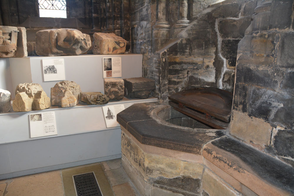
St Mungo's Well (Glasgow Cathedral) submitted by Anne T on 18th Nov 2018. St Kentigern's Holy Well in the south west corner of the crypt, with the small collection of stones from earlier cathedral buildings to its left hand side, against the east wall of the lower crypt.
(View photo, vote or add a comment)
Log Text: St Mungo's/St Kentigern's Well, Glasgow Cathedral: This Cathedral is also known as Barony Kirk, High Church, Metropolitan Kirk & St Mongo’s. The holy well is in the south eastern corner of the crypt/undercroft, next to a collection of architectural fragments and part of the arcade of the original St Mungo’s tomb.
Whilst we were there, the Cathedral guide repeatedly brought people to the well, if only for a brief look. I had to chuckle (only a little) as the well cover made looked like an old fashioned toilet seat. I’m not sure how deep the well is, even with a light, but I couldn’t see any water in it – it was either very deep or dry.
The only mention of this well in the Church’s guide book is on page 16: “In the south east corner of the crypt is St Kentigern’s Well, from which water was drawn for liturgical use. Also in that chapel is a display of carved stones, including possible fragments from the base of St Kentigern’s Shrine, and a painted stone thought to have come from the cathedral of the 1100s.
Boar Stone (Armadale)
Trip No.106 Entry No.7 Date Added: 6th Nov 2018
Site Type: Natural Stone / Erratic / Other Natural Feature
Country: Scotland (West Lothian)
Visited: Yes on 28th Oct 2018. My rating: Condition 3 Ambience 4 Access 4
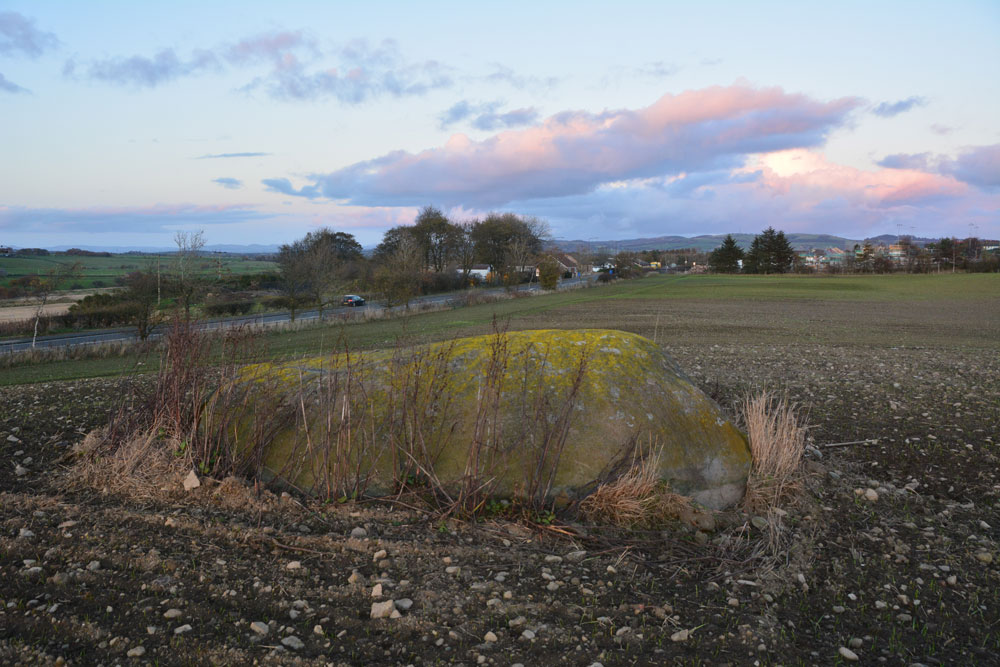
Boar Stone (Armadale) submitted by Anne T on 6th Nov 2018. This photo is looking east over the stone, towards Armadale. Daylight was fading fast, and while there were a few scars and scrapes on top of the stone, we did not see any carvings or markings.
(View photo, vote or add a comment)
Log Text: The Boar Stone (Barbachlaw), Armadale: This is another site we'd picked up from the Ancient Stones website, and although it's not far from my daughter's house in Amadale, we wouldn't normally drive this road. This stone is clearly visible from the A89. We managed to park in the gateway to another field opposite, crossed the road and had to climb over the gate as it was tied shut with some very tight knots.
The field had been planted and there were some young seedlings showing through. By walking along the edge of the field, then up a tractor track, we managed to reach the stone and walk round it.
Goodness knows how much of this stone is underneath the ground – it was certainly large, and no wonder they hadn’t tried to move it!
Niddrie House
Trip No.106 Entry No.5 Date Added: 6th Nov 2018
Site Type: Standing Stone (Menhir)
Country: Scotland (Midlothian)
Visited: Yes on 28th Oct 2018. My rating: Condition 3 Ambience 2 Access 5
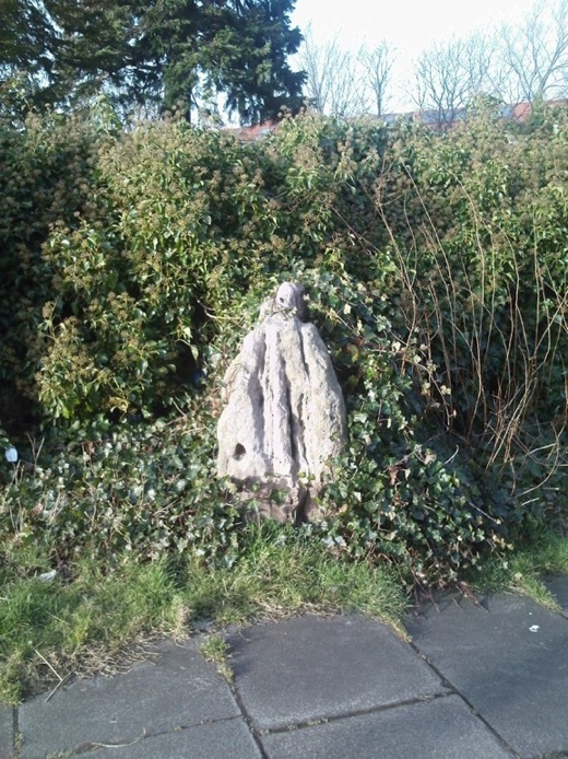
Niddrie House submitted by crannog on 27th Feb 2012. Half-covered in ivy with a great splosh of pink paint covering the top, this wee stone sits surrounded by established housing with new-build developments blossoming all around.
Has one cup mark.
(View photo, vote or add a comment)
Log Text: Niddrie House Stone: This has to be one of the saddest little standing stones I’ve seen. Largely hidden by ivy and surrounded by rubbish, in between a largish utility building and a padlocked, disused cemetery, with a bus stop about 10m to the south west and a new estate with many security cameras to the north east. And a splodge of what was red paint running down from the top of the stone, too. If I could have dug this up and taken it home with me, I would.
