Contributory members are able to log private notes and comments about each site
Sites Anne T has logged. View this log as a table or view the most recent logs from everyone
Mercat Cross (Clackmannan)
Trip No.84 Entry No.8 Date Added: 26th Jul 2018
Site Type: Ancient Cross
Country: Scotland (Clackmannanshire)
Visited: Yes on 14th Jul 2018. My rating: Condition 3 Ambience 4 Access 5
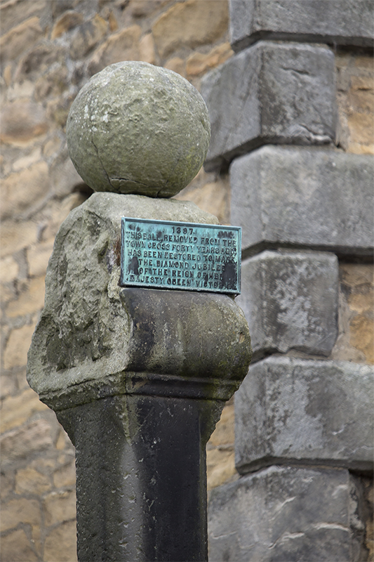
Mercat Cross (Clackmannan) submitted by peigimccann on 27th Aug 2017. Clackmannan market cross
(View photo, vote or add a comment)
Log Text: The Mercat Cross, Clackmannan: The Mercat Cross, the Stone of Mannan and the Tolbooth are all in the same small area. When we arrived, it was about 6.40pm and the sun was low in the sky, giving deep shadows. Much to the amusement of the people drinking outside the pub behind the Tolbooth, I took a number of photographs of these monuments, then retreated to the car to try and get out of the heat. Was worth seeing, but at this time of day I wanted something to eat, drink and cool shade!
Stone of Mannan
Trip No.84 Entry No.9 Date Added: 26th Jul 2018
Site Type: Standing Stone (Menhir)
Country: Scotland (Clackmannanshire)
Visited: Yes on 14th Jul 2018. My rating: Condition 3 Ambience 4 Access 5

Stone of Mannan submitted by peigimccann on 27th Aug 2017. Stone of Mannan
(View photo, vote or add a comment)
Log Text: Stone of Mannan, Clackmannan: I was surprised to find this only about 20m east of the Mercat Cross (refer to that page for the rest of my visit report). Right next to the market cross and the Tolbooth. See the report above. I was interested to read the plaque on the eastern wall of the Tolbooth: “The Stone or Clack, originally placed at the foot of Lookabootye Brae, was sacred to the pre-Christian deity Mannan and is an unique relic of pagan times. It was raised on the large shaft in 1833”.
Market Cross (Kincardine)
Trip No.84 Entry No.10 Date Added: 26th Jul 2018
Site Type: Ancient Cross
Country: Scotland (Fife)
Visited: Yes on 14th Jul 2018. My rating: Condition 3 Ambience 2 Access 5

Market Cross (Kincardine) submitted by Anne T on 26th Jul 2018. Apart from the finial, this Mercat Cross in Kincardine was virtually identical in style to the Mercat Cross in Clackmannan, not that far away.
(View photo, vote or add a comment)
Log Text: Mercat Cross, Kincardine: Our last stop of this very hot day, thankfully. This cross was in a very busy stop, next to the main bus stop in the town, with lots of take away shops around the ‘triangle’ of what might have been the village green. Not an impressive site, although the cross (apart from the finial) seems almost identical to the Mercat Cross, Clackmannan. Just one to 'tick off the list' that we've seen it (and photographed it).
Castle Law
Trip No.85 Entry No.1 Date Added: 26th Jul 2018
Site Type: Hillfort
Country: Scotland (Midlothian)
Visited: Yes on 15th Jul 2018. My rating: Condition 3 Ambience 4 Access 4
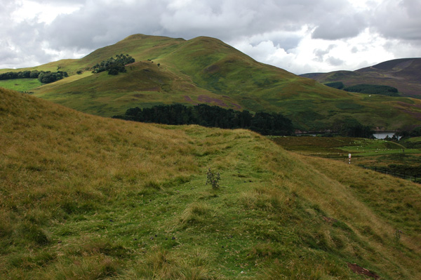
Castle Law submitted by nicoladidsbury on 14th Oct 2007. Castlelaw Hillfort - this photo shows the earth banks and terraces of the hill fort.
(View photo, vote or add a comment)
Log Text: Castle Law Hillfort, Glencorse: First stop of the day, and I was surprised this hill fort was so close to a modern military firing range. Because of its proximity to Edinburgh, there were a few other people parked in the small car park below the fort, but very few walked up onto it; a track carried on up the hill.
The earth house was very unusual, with steps leading down into it, and a narrow, curving passage leading into it. About half way down, a small doorway leads into a circular chamber.
We searched, and found, the cup marked stone towards the eastern wall of the terminus. If other stones had been put on top of this, the cups couldn’t have been seen. It was difficult to capture the cups (and some micro-cups?) in the dim lighting, even using flash and a torch, and had me giggling with our efforts to get a good photograph.
We walked round the inner defences of the fort, admiring the shooting range below, then carried on up the hill to what was left of the palisaded settlement. Walking up the hill to this site gave us an excellent view down on to the hillfort.
Castle Knowe (Glencorse)
Trip No.85 Entry No.2 Date Added: 27th Jul 2018
Site Type: Ancient Village or Settlement
Country: Scotland (Midlothian)
Visited: Yes on 15th Jul 2018. My rating: Condition 2 Ambience 3 Access 4
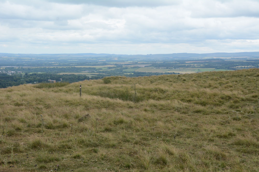
Castle Knowe (Glencorse) submitted by Anne T on 27th Jul 2018. The main line of the low palisade bank/trench to the north eastern side of this palisaded settlement.
(View photo, vote or add a comment)
Log Text: Castle Knowe Palisaded Settlement, Glencorse: From Castle Law hill fort, we continued northwards up the track, turning right up another footpath onto the Castle Knowe Palisaded Settlement. I stopped half way up to get some photos of Castle Law Hill Fort, looking down on it. There were a few other people walking up the track, and whilst they had largely stopped at the fort to look quickly around, no-one paid any attention to this settlement.
There wasn’t a lot to see, apart from some small boundary banks and ditches on the northern and just the north eastern side. There is a modern cairn on top – just a pile of red sandstone rocks, but this was very eye-catching, particularly from the car park and fort below, mostly because of its red colour.
The military earthworks to the north of this settlement look like a much more substantial monument, but are just for military training exercises.
Whilst there were only a couple of the palisade trenches visible on the north and north east side of the settlement, and possibly signs of one of the timber house circles, it was well worth walking further up the hills for the views to the east and north.
Glencorse Cup and Ring Marked Stone
Trip No.85 Entry No.3 Date Added: 27th Jul 2018
Site Type: Rock Art
Country: Scotland (Midlothian)
Visited: Yes on 15th Jul 2018. My rating: Condition 3 Ambience 3 Access 5

Glencorse Cup and Ring Marked Stone submitted by uisdean on 19th Apr 2007.
Cup and ring marked stone in Glencorse (NT24706259)
(View photo, vote or add a comment)
Log Text: Glencorse Cup and Ring Marked Stone: Just outside the tall, imposing (and locked) Parish Church, which had an amazing old tree in the field opposite, and a long layby; this village is obviously popular with walkers, as there were lots of cars parked around here, and footpaths leading through the woods, away from the church.
This poor cup and ring stone is contained behind railings, so it looked as if the stone had been caged. The lichen and moss growing on it made it a little difficult to pick out the cups (we certainly couldn’t count 22), and we saw a couple of cup and ring motifs. Even trying to view the stone from different angles, to try and highlight the cups, didn’t make it any easier. A brush and a bottle of water would have come in useful.
I was much amused by the ‘reserved’ signs next to the stone, as if the minister and church warden might have had cars with specially shaped bonnets to fit neatly around the ‘railing cage’.
We did try the church door, just in case, but like many of these churches, locked and bolted. This church had the most amazing number of floodlights around it, so it must have been well lit in the dark.
St Matthew's Well (Roslin)
Trip No.85 Entry No.4 Date Added: 27th Jul 2018
Site Type: Holy Well or Sacred Spring
Country: Scotland (Midlothian)
Visited: Yes on 15th Jul 2018. My rating: Condition 3 Ambience 3 Access 4
St Matthew's Well (Roslin) submitted by KiwiBetsy on 6th Oct 2006. The water flows into a white (or it probably once was) concrete dome which is brick lined and is very hard to spot in the undergrowth.
(View photo, vote or add a comment)
Log Text: St. Matthew's Well, Roslin: Getting to this well was interesting! Parking in Roslyn Chapel car park at NT 27405 63109, we took the gate from the south east of the car park through the cemetery, then out of the cemetery down a very overgrown lane, with very tall nettles on either side. About 50m from the grid reference for the well, we needed to head off south west into the wood. There were some tracks through here, but obviously not regularly used. We could see a green, mossy mounds/structure through the trees, but couldn’t find a way of getting down to them. In the end, I realised the track had been covered by a heavy, large dead tree branch, which Andrew and I managed to haul away from the path with a little difficulty. Having cleared the track, we used the tree roots as stepping stones at first, then slide the 20m or so down the slope to the well (I told myself it was always easier going up!).
At first we thought there was only one dome here, but looking harder, there was a second one, a few metres up the slope. The front face of the second dome (nearest the river Esk) had a hole in the front, which I poked the camera through to take a photograph. The was a large iron pipe which gushed water into the well chamber. A continuation of this pipe could be seen in a small gully which headed towards the river from the well chambers, although the gloom and all the detitus made it difficult to capture the location.
Heading back to look at the ruins of St. Michael’s church, we looked over the western end of the graveyard, looking south west, and realised we could not only see the well houses, but it also looked as if there were the remains of a wall and steps, as there were cut blocks of stone lying around.
I went back to photograph the 'Spooky Angel' I'd seen when I visited with my friend two years ago (hidden under a bush by the small outbuildings) - she much reminded me of an episode of Dr. Who, where the angels only moved when you didn't look at them.
Inveraray Castle
Trip No.86 Entry No.1 Date Added: 27th Jul 2018
Site Type: Standing Stone (Menhir)
Country: Scotland (Argyll)
Visited: Yes on 16th Jul 2018. My rating: Condition 3 Ambience 4 Access 5
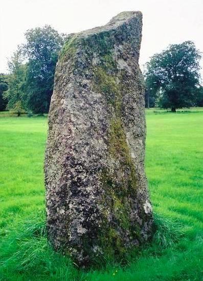
Inveraray Castle submitted by Bladup on 31st Dec 2013. Inveraray Castle standing stone.
(View photo, vote or add a comment)
Log Text: Inveraray Castle Standing Stone: On our way from our daughter’s house to Craignish peninsula (having had the trauma of catching their cat and taking her to the cattery first!) we decided to stop of in Invarary to see our first standing stone of this part of the trip. Mistake.
We arrived the day before the Highland Games at the castle started, so the town was heaving, both with coach tours of largely American tourists, and people attending the games. There was a large funfair on the grass by the harbour, which didn’t aid the flow of traffic through the town.
We managed to turn up the entrance into the castle, only Andrew had to stay in the car whilst I ran out onto the grassy show-ground area to take photographs of the stone. I chuckled to think what the delivery drivers and people putting up the marquees and stands must have thought of this woman running around the stone with a camera must have thought!
Craignish Sculptured Stones
Trip No.86 Entry No.2 Date Added: 27th Jul 2018
Site Type: Ancient Cross
Country: Scotland (Argyll)
Visited: Yes on 16th Jul 2018. My rating: Condition 3 Ambience 4 Access 4
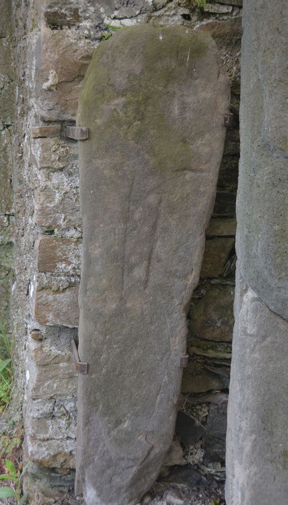
Craignish Sculptured Stones submitted by Anne T on 27th Jul 2018. The one cross slab on display under the shelter inside the chapel. This corresponds to Canmore 318669: slab 1.21m by 0.34m, much worn, which bears the pecked outline of a Latin cross, open at the foot.
(View photo, vote or add a comment)
Log Text: Craignish Sculptured Stones, Kirkton: After having arrived at the cottage we were staying in for the next three nights, we decided to head off to find supper, but taking in a couple of sites on the way, one of which we learned about from Rachel Butter's Kilmartin book, the other marked on the OS map. Not the most auspicious of starts, as a lady on a bicycle rode (at speed) up from the lane leading to the castle and told us off for parking on the grass by the garage near the entrance to the castle. She told us the area opposite had been cleared for a car park. I apologised whilst Andrew moved the car and told her we thought the cleared area was just a large passing place, as the road just in front (heading south) split into two – one road to the castle, the other to Aird Farm. We got chatting and she eventually said ‘not to worry’ (a ‘park here’ notice might have helped). She pointed out the old Kirk and told us to ‘enjoy’, which we most certainly did!
Having moved the car to the layby, we walked up to the metal gates up a short, grassy lane by the side of the modern cemetery, which had a “Craignish Sculptured Stones’ sign hanging on it, and let ourselves into the churchyard. Going through the south door into the church nave, turning to our left (west) there was a collection of old grave markers; to the east are some old box tombs. Almost straight in front of us was a cross base, not recorded on Canmore, with a sundial (see the highlighted entry below).
There are a number of Canmore entries for this location. The ‘Kilmartin’ book by Rachel Butter (page 98) reads: Old Parish Church, Kilmarie, Craignish NM 778 014. This former parish church probably dates to the 13th century though much repair is more recent. It overlooks Loch Craignish and neighbours ruins of a former township, Kirkton. Its dedication was to St. Maelrubha of Applecross. The church contains a collection of medieval slabs which formerly were n the graveyard.
Most of the carved stones are products of the 14-15th century Loch Awe School. They depict crosses, swords, armoured figures in niches, and are mostly carved in local epidiorite or quartzite gneiss. Some are of Easdale slate. There are also some Early Christian slabs (pre 10th century) and some 16th century stone chests.
An epidiorite cross base is carved with a sundial; it has a central socket and 24 rays with cardinal points marked by crosses.
Access: Six miles north of Kilmartin on the A816 take a left turn along the B8002 to Ardfern. You will come to the village after 1 mile. The chapel is a further 3 miles on the left. Kilmarie Church is in private ownership.
Clach An T-Sagairt (Soroba)
Trip No.86 Entry No.3 Date Added: 28th Jul 2018
Site Type: Chambered Tomb
Country: Scotland (Argyll)
Visited: Yes on 16th Jul 2018. My rating: Condition 3 Ambience 4 Access 4
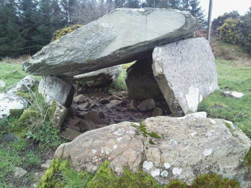
Clach An T-Sagairt (Soroba) submitted by crannog on 16th Mar 2012. Very easy to find. Sits happily and peacefully overlooking Loch Craignish.
(View photo, vote or add a comment)
Log Text: Clach An T' Sagairt Chambered Tomb, Ardfern: From the map, this cairn appeared to be just behind the small school in the middle of Ardfern, and finding a small path behind the back of the school, followed this for about 20m before discovering we were in someone’s garden! The reality was we had to walk up the small road to Ardlarach, going past the school buildings to our right, until we got to what looked like a private road (seemingly unnamed). This led up a slope to the right to a number of other houses. A new gate in the fence to our left hand side led into the field with some beautiful horses, with the cairn some 100 yards straight in front of us.
What beautiful views from this chambered cairn. It looked as if it had a number of ‘arms’ coming out of the central mound, presumably the spoil form the excavations.
We were followed to the gate by a local resident, and we got chatting. She had lived in the village for 16 years and her children, who played on the cairn, told her there were dead bodies and gold in it. She started talking about the whole field being protected if there was an ancient monument in it, so I suggested she looked at Canmore, as it was usually only the area immediately around the monument that was scheduled.
She told us the gate had only appeared in the last few days, and the residents were wondering if a developer was looking to build in-fill houses. Seeing us with a camera walking the site got her worried we'd come to survey the site, so she came out to check.
She also said about once a year, before the gate, people asked to go into the field from her garden.
We went onto dinner at the Galley of Lorne Inn in the village. The last two sites had been a good introduction to this area, and despite the lack of internet and therefore having to rely on the OS map for information, we were both looking forward to seeing the many, many sites around here.
Barnacarry
Trip No.87 Entry No.1 Date Added: 28th Jul 2018
Site Type: Crannog
Country: Scotland (Argyll)
Visited: Saw from a distance on 17th Jul 2018. My rating: Condition 3 Ambience 4
Barnacarry submitted by caradoc68 on 15th Dec 2011. There is a amazing amount of Archaeology around this Loch with four Crannog's in the Loch but only two can be seen above water today.
(View photo, vote or add a comment)
Log Text: Barnacarry Crannog, Loch Nell: (note on access: boat needed to get across!) Not having any broadband or mobile connection at the cottage we were staying in, we relied on the OS map. Andrew picked today’s sites, but mistakenly thought the area we were going to was only 10 miles north of Ardfern. Wrong. More like 30 and an hour and a half’s drive along twisty roads. Having wanted to come to the Kilmartin area for so long, I was cross that we’d already strayed so far from what I really wanted to see. However, the sites we did see today more than made up for this, I’m pleased to say.
First on the agenda were two sites close to each other – the Barnacarry Crannog and the Kilmore, Dalineun (or Dalnaneum) Chambered Cairn. A real treat.
Driving along the road from Kilmore village to the south, we came to the southern shore of Loch Nell. Just after Barnacarry Farm, before we sighted the crannog, we came across Clan (holiday?) cottages, which looked like they were really old and thatched. We couldn’t get close enough to really tell. This is a hugely pretty spot.
Without a boat, we couldn’t really get close to the crannog, but stood on a very small piece of sandy shore (where someone had left a nicely carved wooden seat and table, presumably for fishing), and looked from a distance. A very pretty little island, covered in trees. Not too far from the shore, although the water looked deep.
Dalineun
Trip No.87 Entry No.2 Date Added: 28th Jul 2018
Site Type: Chambered Tomb
Country: Scotland (Argyll)
Visited: Yes on 17th Jul 2018. My rating: Condition 3 Ambience 4 Access 4

Dalineun submitted by hamish on 17th Feb 2004. On your way to Strontoiller you must visit this lovely Cairn at Dalnaneun Farm.The chamber and capstone are completely exposed and not much of the original covering is left.It is interesting to see the construction of one of these.Plenty of places to park,but access is over a barbed wire fence which is just at crotch height so be careful.
NM879267.Argyll.Chambred Cairn.
(View photo, vote or add a comment)
Log Text: Dalineun (Dalnaneun Farm) Chambered Cairn, Loch Nell: We made the mistake of thinking the chambered cairn was in the field opposite the crannog, and climbed over a small stile over the fence; however, we realised that we were in the wrong field, climbed back onto the road and walked down to the gate in the field at about NM 88045 26771; this way there were no small streams or field drains to cross.
Climbing up the slope, the stones of the cist came into view – it reminded me of the photos that Kristiansen has been sending in from Denmark. Turning to look east, there were great views across Loch Nell. Another nice place to be buried.
This was by far a much more atmospheric chambered cairn that the one in Adfern that we’d looked at the night before, as the location seemed both isolated and special. We walked round all sides of the cairn, photographing it as best we could. The Barnacarry crannog is visible from here, and I manged to get a photograph with the lens on maximum zoom. Certainly wish I’d had the plan whilst we were here – should have done a lot more research before we visited, but then that takes the spontaneity out of our daily trips.
It was certainly hot up on this hill. I could have stayed here for a few hours, just looking over the loch, but time marched on, and other sites called.
Diarmid's Grave
Trip No.87 Entry No.3 Date Added: 28th Jul 2018
Site Type: Cairn
Country: Scotland (Argyll)
Visited: Yes on 17th Jul 2018. My rating: Condition 3 Ambience 4 Access 5
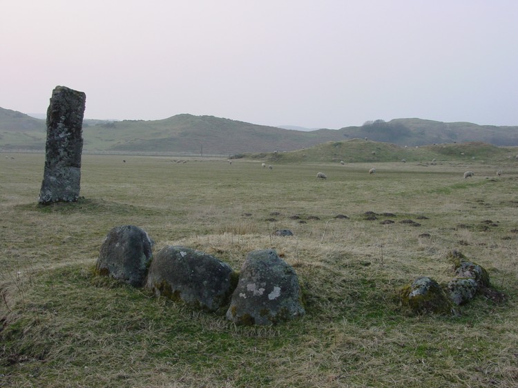
Diarmid's Grave submitted by PaulH on 1st May 2003. A kerb cairn near Strontoiller
Farm to the east of Oban with the standing stone of Clach na Carraig in the background.
(View photo, vote or add a comment)
Log Text: Strontoiller (Small Cairn), next to the Clach Na Carraig standing stone: This was perhaps the most amusing encounter of our whole trip, involving a human and two sheep. As we pulled up by the cattle grid at NM 90788 28935, just before some houses set back from the road, I heard a man’s voice repeatedly shouting loudly: “Go away! Get out of here! Get out!” Thinking he might possibly be shouting at us because of where we’d left the car, I hopped across the cattle grid, only to be almost knocked off my feet by two very large lambs hurtling back across the cattle grid into the field. “Oh, I wasn’t shouting at you”, the man said. “Been naughty?” I asked him, pointing back to the sheep. “It’s always the lambs”, he said, closing the gate.
I asked him if it was OK to park where we where to look at the stone circle, and he replied, “It’s OK. Go ahead. It’s over there.” He pointed, rapidly closing the farm gate into his driveway and scuttled back to his house.
The gate into the field was a little further west along the road, at the junction of the road with the driveway to Stontoiller Farmhouse/Cottage. We let ourselves into the field and walked across to where this neat little stone circle lay, the stones almost buried in tall grass and marsh grass at this time of year. We did a ‘round tour’ of the field, starting off by photographing this neat little cairn, then the stone circle, then the larger cairn, and finally coming back to the standing stone and the small cairn.
Note: the Portal’s page for this site is called ‘Diarmid’s Grave’. I’ve not yet come across any reference with this name in. I’d be curious to know more.
Strontoiller circle
Trip No.87 Entry No.4 Date Added: 29th Jul 2018
Site Type: Stone Circle
Country: Scotland (Argyll)
Visited: Yes on 17th Jul 2018. My rating: Condition 3 Ambience 3 Access 4
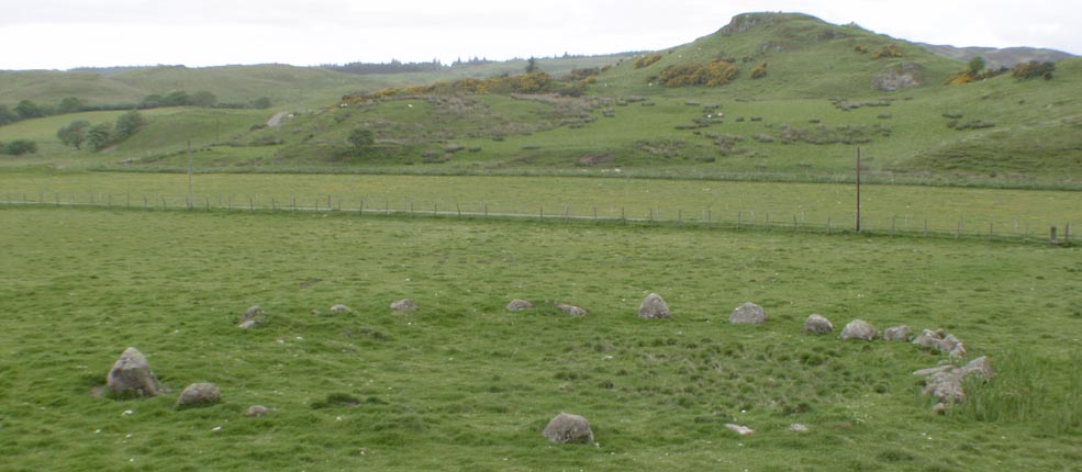
Strontoiller circle submitted by Tom_Bullock on 1st Mar 2005. Photo used by kind permission of Tom Bullock. More details of this location are to be found on his Stone Circles and Rows CD-ROM.
(View photo, vote or add a comment)
Log Text: Strontoiller Stone Circle, Lorn: After having taken a few photographs of the small cairn, we walked a couple of hundred yards back along the road to the gate in the field, which is at the corner of the road and the track to Strontoiller farmhouse/cottage. It was a short walk over the pasture to the stone circle – whilst we could see a few stones, mainly the cluster at the northern side (which looked a little like large toadstools popping their heads above the grass), the circle was largely hidden by tall grass and marsh grass.
I was amazed how close the stones were to each other; I’d read about one small stone circle where the stones had been touching, but there were definite gaps between the stones. I thought at first that the stones towards the NNE were part of a ‘double row’, but reading Canmore when I got access to the internet, Canmore says these are four stones which have probably been displaced.
I didn’t get the usual sense of atmosphere at this stone circle, unless others I’d been to, although this was a very pleasant spot, and had three other monuments within a few hundred yards (a small cairn, large cairn and a spectacular standing stone). Worth seeing, and I’d glad we’d stopped. We then strolled the 75m or so to investigate the larger cairn in the field.
Strontoiller Large Cairn
Trip No.87 Entry No.5 Date Added: 29th Jul 2018
Site Type: Cairn
Country: Scotland (Argyll)
Visited: Yes on 17th Jul 2018. My rating: Condition 2 Ambience 3 Access 4
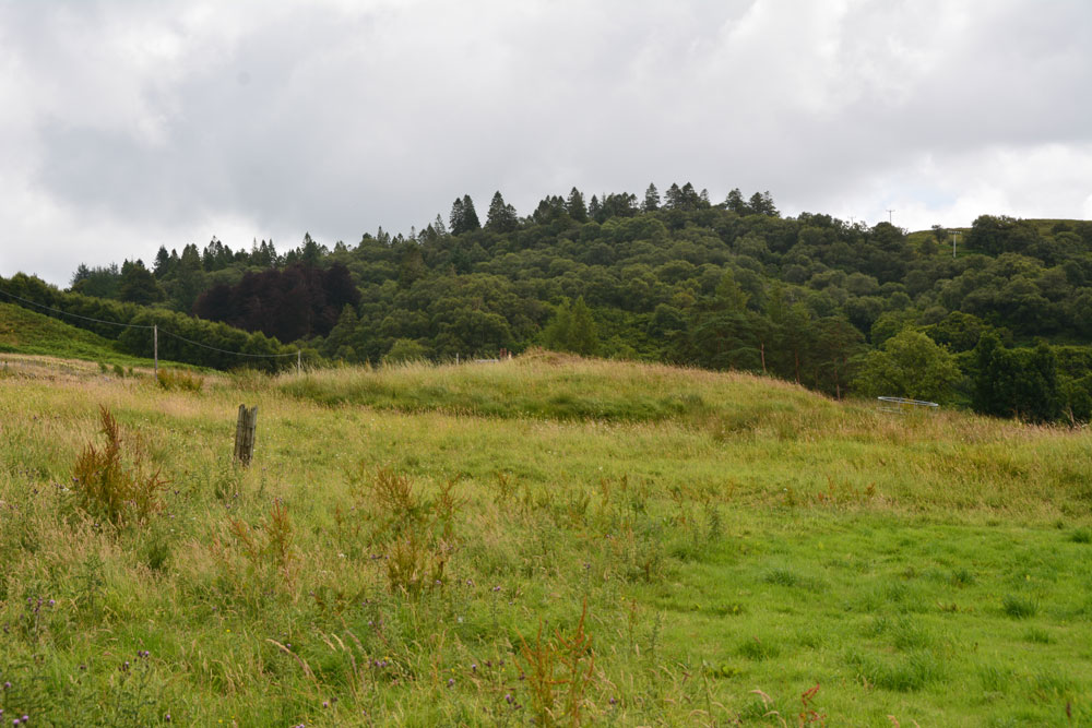
Strontoiller Large Cairn submitted by Anne T on 29th Jul 2018. The larger of the two cairns in this field, as seen from the east of the stone circle.
(View photo, vote or add a comment)
Log Text: Strontoiller Round Cairn, Lorn: This cairn is just to the south west of the stone circle. From the stone circle, it definitely looks like a grassed-over round cairn. As we walked over to it, on our way back to the standing stone, I was not convinced we were looking at the right thing, but the GPS and its position in relation to the stone circle and the standing stone were correct.
In actual fact, looking back on the photographs, and now having seen a number of large, circular, stony cairns, I realise what I was looking at, and wished I’d taken more notice at the time (well, I confess to being keen to see more standing stones before having to head off back to the cottage).
Clach na Carraig
Trip No.87 Entry No.6 Date Added: 29th Jul 2018
Site Type: Standing Stone (Menhir)
Country: Scotland (Argyll)
Visited: Yes on 17th Jul 2018. My rating: Condition 3 Ambience 4 Access 5
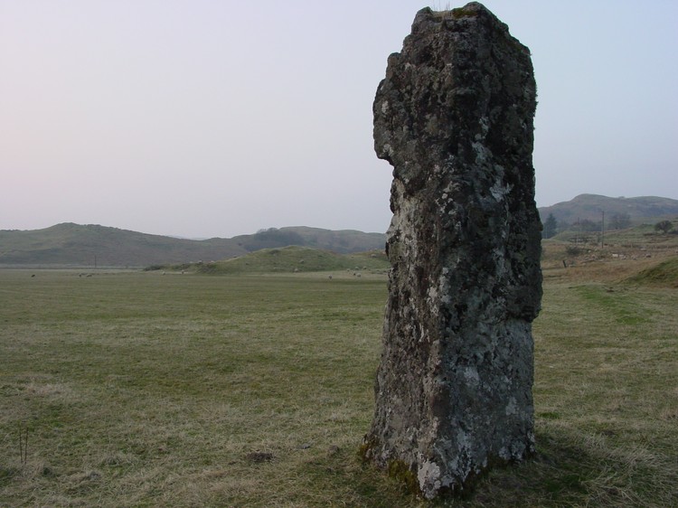
Clach na Carraig submitted by PaulH on 1st May 2003. This is a menhir called Clach na Carraig located just metres from a kerb cairn called Diarmid's Grave. The grid reference is NM908289.
(View photo, vote or add a comment)
Log Text: Clach na Carraign, Lorn: When Andrew said ‘that’s the standing stone’ as we approached it on the road, I thought at first this was just part of an old buttress, like the one’s at St. Matthew’s Old Church in Roslin. I wasn’t until I got closer and had photographed the small cairn to its east, that I really looked saw it was actually a huge block of stone.
It is really impressive, especially so with its location near the stone circle and two cairns. It is right by the road, but we visited the stone circle and the larger, now ruinous cairn, on our way to really appreciate this stone.
Glenamachrie Cairn
Trip No.87 Entry No.7 Date Added: 30th Jul 2018
Site Type: Cairn
Country: Scotland (Argyll)
Visited: Yes on 17th Jul 2018. My rating: Condition 3 Ambience 3 Access 5
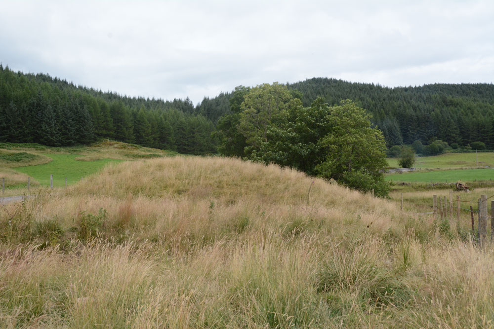
Glenamachrie Cairn submitted by Anne T on 29th Jul 2018. The Glenamachrie Cairn from the south west. Canmore tells us it is oval and measures 18.6 by 17.4 metres, standing to a height of 1.9 metres.
(View photo, vote or add a comment)
Log Text: Glenamachrie Cairn: This cairn was marked on the map on the way to An Dun fort and the standing stone to the east; I asked “if we spot this, can we stop”, and there it stood, almost on top of the road. As the road was quite busy with lots of cars and trucks going by, Andrew moved the car to the other side of the road and stayed in it, just in case he needed to move.
There were other small lumps and bumps in the fields either side of the river at this point, although indications on Canmore say these may be natural features, possibly glacial deposits - see Canmore 23191 and 23196.
Glenamacrie Dun
Trip No.87 Entry No.8 Date Added: 30th Jul 2018
Site Type: Stone Fort or Dun
Country: Scotland (Argyll)
Visited: Yes on 17th Jul 2018. My rating: Condition 3 Ambience 4 Access 4
Glenamacrie Dun submitted by caradoc68 on 6th Feb 2012. Probably one of the easiest Dun's you will ever drive too, get out of car and you are standing on An Dun.
(View photo, vote or add a comment)
Log Text: An Dun/Glenamachrie Dun: Not far to the east of the cairns and standing stone at Glenamachrie Farm. We bypassed those, and came here first to take photos then turn the car around to go back and photograph the standing stones and cairn. When husband came back, he said he’d had the most bizarre experience. As we stopped at the different sites along this road, we kept being passed by three men in a white truck; Andrew said they’d stopped him asking him if he’d seen a crane. I think on these narrow roads we’d most definitely have been run off the road and noticed. He said ‘no’. However, that alerted us to having to move on, just in case.
Left alone in the middle of nowhere for a few minutes, my first reaction was: “If this is a fort, there weren’t really any outer banks and ditches – this just looked like a large outcrop with a small terrace around it.” These Scottish duns/fort are quite unlike the hillforts we have in England. But then I hadn’t seen Dun Add.
Clenamacrie Stone Row
Trip No.87 Entry No.9 Date Added: 31st Jul 2018
Site Type: Stone Row / Alignment
Country: Scotland (Argyll)
Visited: Yes on 17th Jul 2018. My rating: Condition 3 Ambience 3 Access 5
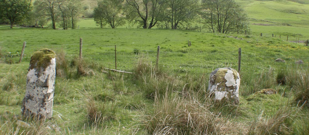
Clenamacrie Stone Row submitted by Tom_Bullock on 26th Feb 2005. Photo used by kind permission of Tom Bullock. More details of this location are to be found on his Stone Circles and Rows CD-ROM.
(View photo, vote or add a comment)
Log Text: Glenamacrie/Clenamacrie Stone Row: After An Dun, we headed off a few hundreds yards west back down the road. I took two lots of photos here, because I think I mistook an outcrop (an unmown area of the field with stones protruding, at NM 92745 28409). Andrew had mentioned both a ‘stone row’ and ‘four stones forming a chamber’, so I thought I had photographed the right thing. Driving down to the farm, I spotted the right three standing stones in a field nearer the farm, which I also photographed. Andrew said the ‘lump’ in the field behind was also a cairn, but this was the closest I could get, so we’ve got these standing stones with the cairn behind.
I wish now I’d had the courage to go and ask to see these up close, but I felt intimidated because the farm was so big and the gate into the field seemed to be along the far end of the track. I can’t get used to the ‘responsible right to roam’ act in Scotland, but it still feels like trespassing at times, especially when you are going doing someone’s driveway.
Glenamacrie Farm
Trip No.87 Entry No.10 Date Added: 30th Jul 2018
Site Type: Cairn
Country: Scotland (Argyll)
Visited: Saw from a distance on 17th Jul 2018. My rating: Condition 3 Ambience 3 Access 4
Glenamachrie Farm submitted by caradoc68 on 6th Feb 2012. This cairn can been easily seen from the road side, with the Glenomachrie standing stone's in the next field. The cairn is in the farmers yard/land though so might be better to ask before going to have a look.
(View photo, vote or add a comment)
Log Text: Glenamacrie Farm Cairn: Having stopped to look at the standing stones, with waist height, new wire fence and barbed wire all around this field, the nearest gate appeared to be by the farmhouse. If we'd been bold enough to walk up the farm track to get a closer look, we'd have got much better photos, but something about these big farms always holds me back. I contented myself with photographing the stones by leaning over the top of the fence, trying not to get caught by the barbed wire. It wasn’t until I got back to the car that Andrew (who’d stayed in the car in case the roadworks crane needed to come by) had got a mobile signal and told me this was a cairn. I’ve only got it photographed over the top of the standing stones/stone row.
