Contributory members are able to log private notes and comments about each site
Sites Anne T has logged. View this log as a table or view the most recent logs from everyone
Hetherington (Wark)
Date Added: 30th Aug 2021
Site Type: Ancient Village or Settlement
Country: England (Northumberland)
Visited: Yes on 25th May 2017. My rating: Condition 3 Ambience 4 Access 4
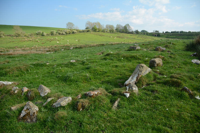
Hetherington (Wark) submitted by Anne T on 27th May 2017. The north western corner of the farmstead, which is sited on a gentle eastern slope.
(View photo, vote or add a comment)
Log Text: Hetherington (Wark): Homestead, built on top of an Iron Age Settlement. Lovely spot, and well worth exploring.
East Steel Farm
Trip No.27 Entry No.1 Date Added: 26th May 2017
Site Type: Modern Stone Circle etc
Country: England (Northumberland)
Visited: Yes on 25th May 2017. My rating: Condition 3 Ambience 3 Access 5
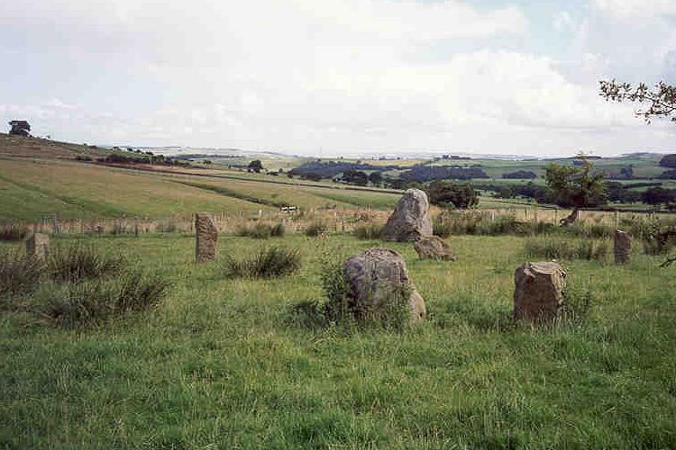
East Steel Farm submitted by Andy B on 24th Nov 2001. East Steel Farm Stone Circle
(View photo, vote or add a comment)
Log Text: East Steel Modern Stone Circle, Near Beltingham, Northumberland: From Beltingham, the further we drove out into the fells, we kept seeing bright yellow ‘Art Gallery Open’ signs. Long way to go for an art gallery, but a lovely drive. Note for future visitors – follow these signs!
As we pulled up to the lane leading down to East Steel House, marked by the signpost (see below), Dennis Kilgallon’s van was coming up to the road junction, signalling to turn right along the minor road. We indicated to go left and we passed each other. Parking by the circle, I hopped out with the camera, not realising Dennis had parked up and came across to speak to us. “Just taking a look?” he asked, “It’s a folly – built 10 years ago”. I thanked him kindly as he got back into his van and drove off. What a lovely place for an art gallery.
I counted 14 stones in the circle, most looking like reused gateposts, some of them leaning, largely built inside an old boundary, now just an arc of raised earth and stone in the ground topped in places by old, crooked, atmospheric hawthorn trees. Two of the stones were placed nearer to the track, outside the boundary - the circle wasn’t circular.
There was one really huge stone, presumably meant to be the heel stone. I wondered how it got there. My husband grunted and said “truck and crane probably.” At this point, a man in black was pelting up the track towards us, and I thought this was the farmer coming to warn us off, but no, it was a runner, who bid us good evening on his way past.
After 10 minutes or so appreciating the calls of the curlews on the surrounding fells, we headed off back to Beltingham and home.
St Cuthbert's Well (Bellingham)
Trip No.27 Entry No.2 Date Added: 26th May 2017
Site Type: Holy Well or Sacred Spring
Country: England (Northumberland)
Visited: Yes on 25th May 2017. My rating: Condition 3 Ambience 4 Access 5
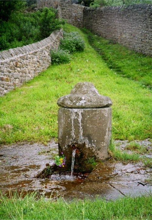
St Cuthbert's Well (Bellingham) submitted by KiwiBetsy on 11th Dec 2004. St Cuthbert, a noted dowser, found and dedicated this abundant spring of clear, pure water quite unlike the brackish marsh water of the area.
Today, the water is contained in a picturesque Georgian pant with it’s ever flowing spout directing the water down through a grill and away to the River Tyne. The upright pant was considered a vast improvement over the older dipping well provided water pressure justified building one.
The water is still used in the church for baptisms. The lo...
(View photo, vote or add a comment)
Log Text: Cuddy's Well (St. Cuthbert's Well, Bellingham): Parking in a small layby at NY 83833 83303, just opposite Manchester Square side road, we headed off to the church. The church was open, so we popped in to have a look. It looked relatively modern, but a plan hooked on the wall told us the sanctuary and chancel dated from the 13th century. Research this afternoon on British Listed Buildings said the church was extensively remodelled in 1609 and bell cote added in 1865. The stone barrelled roof was certainly interesting.
There was a marked grave ‘the lang pack’ in the churchyard, which the ‘A Church Near You’ website says is “the 'Long Pack' grave of a would be house-breaker who was killed by the butler of the house he was trying to rob.”
The well was mentioned briefly on the wooden plaque containing points of interest. To find this, we needed to go out of the church, walk south by the Black Bull, then turn right along the Pennine Way, following the eastern external wall of the churchyard. The path narrowed between two stone walls, but turning round a corner we encountered shallow steps leading down a bank, and there was the well at the bottom. We could hear water gushing from half way down the steps. The water rushed through the grill into the pool below, foaming up with the pressure. I did taste the water; it was fresh, but had no specific taste of any mineral.
On the eastern side of the current well structure there was another hole in the stone, and looked as if at some point either another spout came through, or the current spout had been moved.
Walking back up to the car, we noticed signs for the well and riverside walks from the main square (Manchester Square) in the town, which could be used for disabled access. I didn’t realise until I looked at UK Grid Reference Finder how close we had been to the North Tyne River, as the view was blocked by a very overgrown part of the cemetery.
Shitlington
Trip No.27 Entry No.4 Date Added: 27th May 2017
Site Type: Marker Stone
Country: England (Northumberland)
Visited: Yes on 25th May 2017. My rating: Condition 3 Ambience 4 Access 4
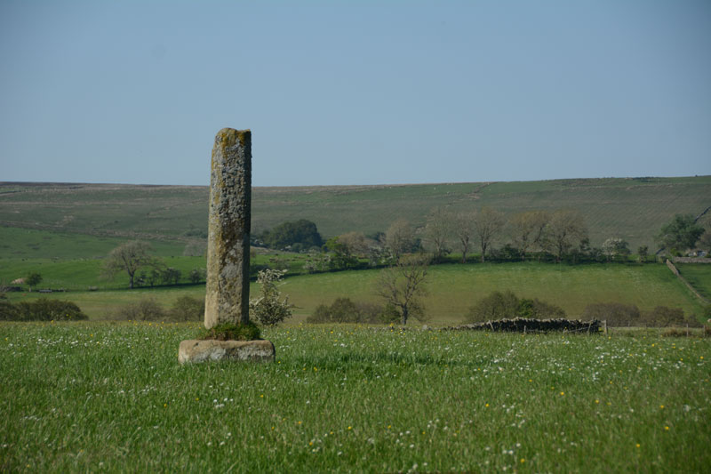
Shitlington submitted by Anne T on 27th May 2017. First view of the Shitlington Cross, walking across the field from the make-shift stile across the stone wall. The views across the surrounding moors are lovely.
(View photo, vote or add a comment)
Log Text: Shitlington Cross, near Bridge House (south of Bellingham): We stopped here because we were passing on the way to the Bridge House/Hetherington Farm homestead and it was marked on the OS map as a ‘cross’. It looks like an old standing stone on a sandstone cross base, similar to the Hurl Stone near Ewe Hill/Lilburn Grange (http://www.megalithic.co.uk/article.php?sid=35235but with a genuinely older base (not just reset in concrete).
Someone had made a stile over the wall into the field. As this was just pasture, we kept to the edge of the field to have a closer look. Very enigmatic, just sitting in the middle of the field with nothing around it.
Checked the top – there was no socket on top, just weathered. It was worth stopping to look because of the wonderful views over Watergate Moor, Wark Common and Broughy’s Hill. Could have sat here all day in the sunshine.
St. Mungo's Well (Simonburn)
Trip No.27 Entry No.1 Date Added: 27th May 2017
Site Type: Holy Well or Sacred Spring
Country: England (Northumberland)
Visited: Yes on 25th May 2017. My rating: Condition 2 Ambience 2 Access 4
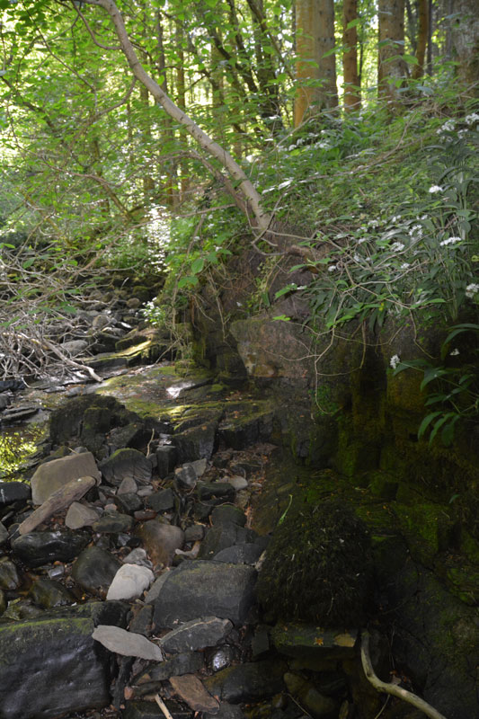
St. Mungo's Well (Simonburn) submitted by Anne T on 27th May 2017. This is the very tumbledown structure at the grid reference for the well. It hasn't been used for a very long time, and my husband wasn't convinced he'd found the right place, but it was the only structure that he could find around.
(View photo, vote or add a comment)
Log Text: St. Mungo's (Mugger's) Well, Simonburn: Our first stop on this hot, sunny day. Parking at Simonburn tea-rooms, we asked if it was OK to leave the car there whilst we walked round the village, and were told it was alright (there is another car park in between the south wall of the churchyard and the forest). I would thoroughly recommend sitting out in the tea-room gardens with a cup of tea and iced water, as they have very comfortable garden furniture and it’s a very quiet spot.
It was a relief to get into the cool of the forest leading down to the Crook Burn, which hardly had any water in it at all after so little rain for weeks and weeks. It was possible to walk on the stream bed.
Following the tracks through the forest to the burn, there is little or no sign of the well. There appears to be an flattened area which might represent an old path, running along the ledge at the top of the burn on its north side, but this has been long out of use. It’s also a three foot plus drop onto the bed of the burn at this point.
Lacking the confidence to walk along the large slippery blocks of stone along the stream bed, I handed the camera to my husband and went exploring the forest tracks. Andrew came back having seen the remains of a structure, long disused, at the grid point indicated for the well, so we are not entirely convinced this is it.
Harbottle
Trip No.28 Entry No.7 Date Added: 30th May 2017
Site Type: Modern Stone Circle etc
Country: England (Northumberland)
Visited: Yes on 28th May 2017. My rating: Condition 3 Ambience 5 Access 4
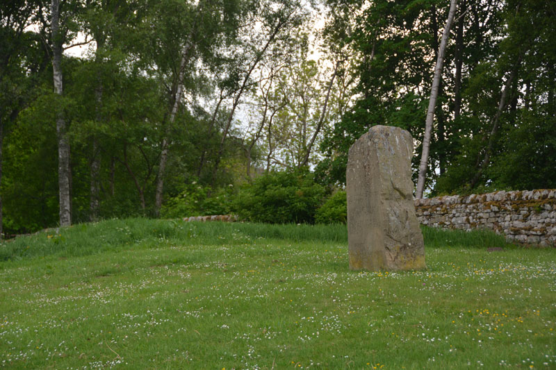
Harbottle submitted by Anne T on 30th May 2017. This modern standing stone can be found on a grassy bank at the western side of the car park for the castle.
(View photo, vote or add a comment)
Log Text: Harbottle Modern Standing Stone/Castle: From Holystone, we passed through Harbottle to get back to the A68, so stopped to look at the castle. The site is lovely.
I spotted the modern standing stone to the west of the car park. The standing stone is inscribed with words:
The Sad Castle
Who Made me/Into a ruin/like an old city?
Was it the soldiers who rode out on horseback?
Was it my old enemy the Scots?
Or was it those Border Reivers?
Perhaps it was just the centuries passing.
Felicity Lance
Apparently there are supposed to be 2 poems, the above by Felicity Lance, another by Robert Corley from Harbottle School, carved into the stone by local stonemason David Edwick. I walked all around the stone, even photographing the other faces to see if anything came up on the camera, but only saw the one poem.
The Pastscape record says there could have been a pre-Conquest fortress on the site. The motte is very steep, and a walk around the moat/outer ditch was charming. Walking into the ruins from the eastern side, there are lots of lumps and bumps of the remains of walls and buildings. Very enigmatic. Really pleased to have been here.
Bellshiel Law
Trip No.28 Entry No.1 Date Added: 29th May 2017
Site Type: Chambered Cairn
Country: England (Northumberland)
Visited: Yes on 28th May 2017. My rating: Condition 3 Ambience 5 Access 5
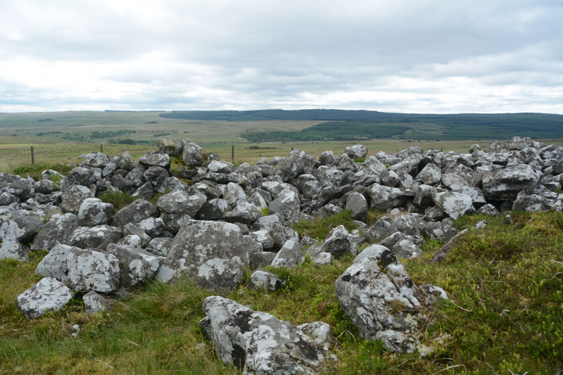
Bellshiel Law submitted by Anne T on 29th May 2017. The northern side of the cairn is partly earth and turf covered for the first few feet. Whether this is just build of earth through the prevailing wind blowing it in or the remains of a purpose built covering was difficult to tell.
(View photo, vote or add a comment)
Log Text: Bellshiel Law, Otterburn Ranges: It felt very strange driving onto the Otterburn Ranges with no red flags flying and no military around – I felt like I was trespassing. The ranges are absolutely huge – the Access map and Guide says they cover 90 square miles. We saw 3 other cars all day, 2 of those from a long distance, and 3 cyclists.
Bellshiel Law can be reached by a military road approx. 2 km on the western side of Rochester. The start to this road system is quite complex, but we headed left and left again taking us up over Bellshiel Road. AT NT 81079 01161 the road forks. At this point take the right hand fork. The cairn comes into view on the right hand side of the road. There is a small parking area underneath a natural crag at NT 81267 01260. My first reaction was “Wow, this is huge”.
Narrow trackways through the grass lead you to the cairn, which is fenced off and labelled “Archaeological Area” and “Out of bounds to Troops”. A gate (difficult to open with all the marren grass around it, but managed to squeeze through) lets you into the cairn. It is large – Pastscape recording it as 367 feet long and 52 feet wide at its eastern end, with a maximum height of 6ft (1932 measurements), which translates to 109m long, varying in width from 8.8m at the west end to 15m at the broader east end, maximum height of 1.6m (1994 English Heritage Scheduling).
Someone has built a sheep pen on the southern side, presumably using stones from the cairn. Walking along the stones at the side of the cairn, largely turf covered, I spotted a number of circular ‘rooms’ inside the cairn, with one oblong shape. Called a long cairn by Pastscape, they record “the cairn on the whole, was found to contain no structural remains of an earlier period (ie cists, chambers, revetments internal structures ….. and cannot be dated any earlier than Early Bronze Age and possibly later.”
Great views to the south to the River North Tyne Valley and beyond.
St Mungo's Well (Northumberland)
Trip No.28 Entry No.6 Date Added: 29th May 2017
Site Type: Holy Well or Sacred Spring
Country: England (Northumberland)
Visited: Yes on 28th May 2017. My rating: Condition 4 Ambience 4 Access 5
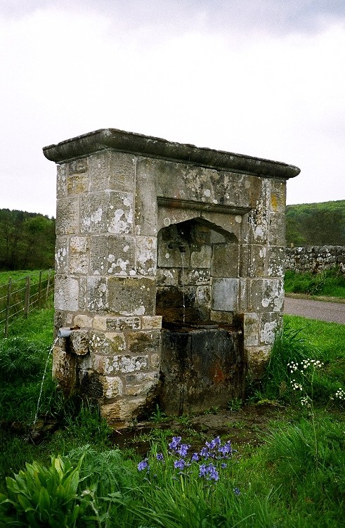
St Mungo's Well (Northumberland) submitted by KiwiBetsy on 27th Nov 2004. St Mungo's Well amidst well watered wildflowers.
(View photo, vote or add a comment)
Log Text: St. Mungo's Well, Holystone, Northumberland: We’d already visited the lovely Lady Well on 8th September 2013, but stopped to look at this one, which is at the side of the Coquet River. Sitting by the right hand side of the road just before entering the village from the Otterburn Ranges, just before the corner of the road leading up to Holystone Priory Farm and the footpath up to Lady’s Well.
The grass and weeds had grown right up to the well, although there was a small track to the well basin, showing a few other people had visited.
I did taste the water, which was clear, but didn’t taste of any particular mineral. The flow of water was strong (but not as strong as St. Cuthbert’s Well in Bellingham), indicating it might be artesian after a long spell of very dry weather in this part of the world.
I hadn’t done any research on this well before visiting, just passing by on the spur of the moment. Pastscape is dubious about this being a holy well. The shrubbery around the well hid the overflow pipe at the burn side of the structure, and I wished I had looked for the conduit at the village green. Another trip to this beautiful part of the county is called for.
Ridlees Cairn
Trip No.28 Entry No.5 Date Added: 29th May 2017
Site Type: Cairn
Country: England (Northumberland)
Visited: Yes on 28th May 2017. My rating: Condition 3 Ambience 4 Access 4
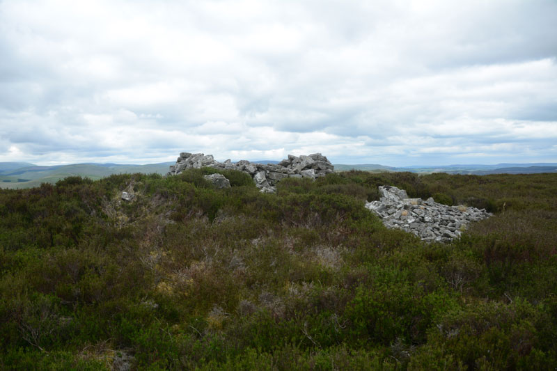
Ridlees Cairn submitted by Anne T on 29th May 2017. Approaching Ridlees Cairn from the east. It is a substantial cairn, made up of small and medium sized stones.
(View photo, vote or add a comment)
Log Text: Ridlees Cairn, Otterburn Ranges: This is one of the times I’ve actually made it up to a Trig Point (usually too steep a climb or too high a drop for my liking), but this was easy. Ridlees Cairn was actually 250 metres to the east north east of Bushman’s Crag, but I’m sure some people may visit the crag thinking it is the cairn. The views here are impressive. No wonder the military have a bunker hidden just up the road, and possibly hollowed out the centre of the cairn for use as a machine gun nest (apologies if this is not the case, this is just husband guessing).
Parking at the cairn (the metalled roads had deteriorated from this point and were very narrow), we walked to the east of the cairn and pushed through the heather to reach it.
It is substantial, with a flattened stone kerb around it, partly hidden by heather, partly by tumbled stones.
Inner Golden Pot (Otterburn)
Trip No.28 Entry No.2 Date Added: 29th May 2017
Site Type: Marker Stone
Country: England (Northumberland)
Visited: Yes on 28th May 2017. My rating: Condition -1 Ambience 4 Access 5
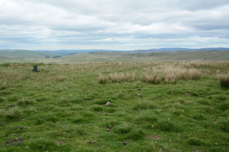
Inner Golden Pot (Otterburn) submitted by Anne T on 29th May 2017. At the site of the Inner Golden Pot there were only broken sandstone pieces and modern army equipment. I thought it was worth stopping to look to see if anything remained, especially as it was a nice viewpoint.
(View photo, vote or add a comment)
Log Text: Inner Golden Pot, Otterburn Ranges: No trace of this cross base can be found, but I couldn't resist having a look. There were some small sandstone pieces around the grid reference point, together with a funny green box - presumably some military equipment. A great viewpoint across to Upper Coquetdale.
Outer Golden Pot (Otterburn)
Trip No.28 Entry No.4 Date Added: 29th May 2017
Site Type: Marker Stone
Country: England (Northumberland)
Visited: Yes on 28th May 2017. My rating: Condition 2 Ambience 4 Access 5
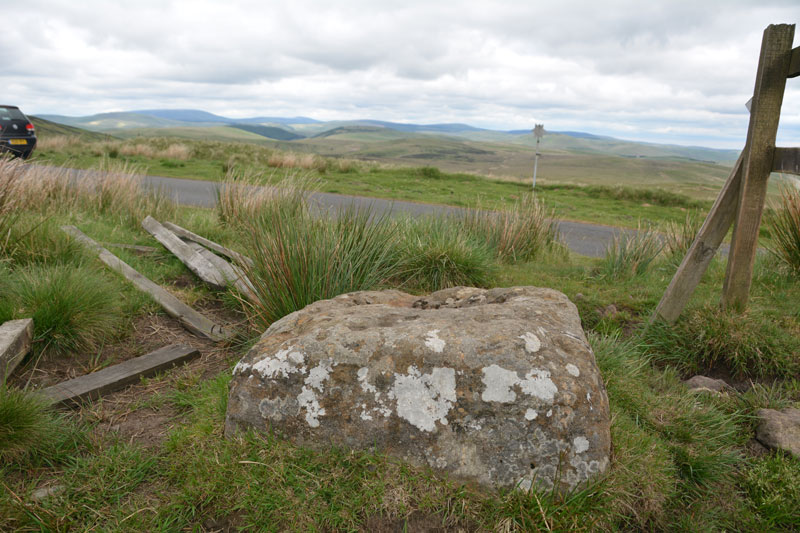
Outer Golden Pot (Otterburn) submitted by Anne T on 29th May 2017. From it's eastern side, the Outer Golden Pot has wonderful views over Upper Coquetdale.
(View photo, vote or add a comment)
Log Text: Outer Golden Pot (Otterburn): What stunning views across to Upper Coquetdale from here. No wonder the site is marked as a view point on the Otterburn Ranges Access Map. The fencing surrounding this Golden Pot has been broken on three sides, so it’s possible to appreciate its form more fully than the Middle Golden Pot.
The base is smaller than the Shitlington Cross but is about the same size as many of the Anglo Saxon Cross Bases we’ve seen in and around churches in North Yorkshire.
As I stepped back towards the road to photograph the base, I saw what looked like a cart track running diagonally up the hillside, crossing under the road and carrying on in a north-east/south-west direction. Andrew pointed out that if I moved a bit further over, I could see the second ditch, so this was the old course of Dere Street, now metalled and called ‘Roman Road’.
After stopping to photograph this stone, we went in search of Ridlees Cairn and Bushman’s Crag, to the south east of these intriguing cross bases.
Middle Golden Pot (Otterburn)
Trip No.28 Entry No.3 Date Added: 29th May 2017
Site Type: Marker Stone
Country: England (Northumberland)
Visited: Yes on 28th May 2017. My rating: Condition 2 Ambience 4 Access 5
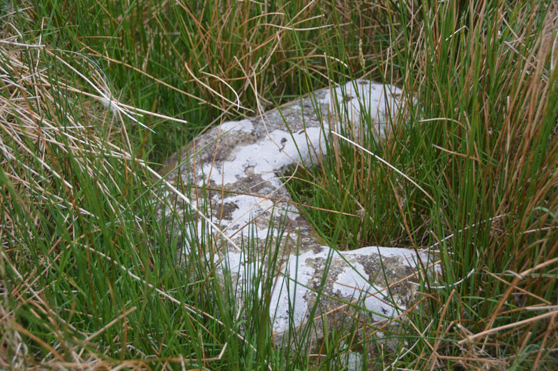
Middle Golden Pot (Otterburn) submitted by Anne T on 29th May 2017. The Middle Golden Pot from a different angle.
(View photo, vote or add a comment)
Log Text: Middle Golden Pot (Otterburn): Fenced off behind a nice, neat fence with a label “Do not feed the cross base” – no seriously, “Archaeological Area”. This stone was mostly hidden under the marsh grass and I struggled to get decent photographs as the camera kept focusing on the grass rather than the stone. Whilst I snapped away, Andrew went off wandering along the top of Dere Street off to the east – very well defined with a visible ditch on either side. The modern metalled road (imaginatively called ‘Roman Road’ turns a left-handed right angle here, as the course of Dere Street changes. Being just below the brow of a hill, I wondered why the stone was placed here, but looking at the change of direction of the road, it made sense. Stepping behind the stone and looking north-west, Dere Street could be seen running up hill, joining with the section to the east of the stone.
Midshiels Standing Stone
Trip No.29 Entry No.7 Date Added: 31st Jul 2017
Site Type: Standing Stone (Menhir)
Country: Scotland (Scottish Borders)
Visited: Yes on 3rd Jun 2017. My rating: Condition 3 Ambience 4 Access 4
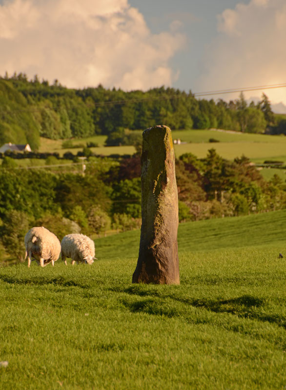
Midshiels Standing Stone submitted by Anne T on 4th Jun 2017. This is the nearest we could get to the standing stone on the evening of our visit. The field was full of quietly grazing sheep but many lively, curious young bullocks. The minute we started to open the gate, they were racing towards us.
(View photo, vote or add a comment)
Log Text: Midshiels Standing Stone, Hawick: We'd arrived (unknowingly) in Hawick on their Riding of the Marches day. The shops were shut and the town was almost deserted. Having visited some other sites on the southern side of Hawick, we decided to stop off to see this standing stone and cairn on the way back home. Following the curious one-way system though Hawick, we ended up on the Borders Abbey Way heading north-east out of the town. At Bucklands, we found where the entire town was - at a community centre at the edge of the town. A marshall stopped us and told us we wouldn't be able to get any further up the road as the procession of horses was coming through. Doubling back through the industrial estate, we took the A698 out of town, turning left over the picturesque Hornshole Bridge, rejoining Borders Abbey Way a few hundred yards before the entrance to Midshiels Farm.
A couple of hundred yards further north-east along the road, there was a large passing place, so we hugged the car into the hedgerow and hopped out. About 50 metres further back, on the other side of the road, a gate let us into the field leading to the dismantled railway embankment to the west. Following the left hand hedge-line along, we came to another gate, just before a tall brick bridge leading under the railway line. This gate gave access to the field with the standing stone and cairn.
However, the field was full of gently grazing sheep and lots of lively, curious bullocks along with what looked like a very large bull. My hand went onto the gate and they were running towards us. I elected to use the zoom lens on the camera, and was really disappointed not to have seen this standing stone closer up. But there is lots to see in this area, so undoubtedly a return visit will be in the offing at some point in the not too distant future.
Midshiels Cairn
Trip No.29 Entry No.8 Date Added: 31st Jul 2017
Site Type: Cairn
Country: Scotland (Scottish Borders)
Visited: Saw from a distance on 3rd Jun 2017. My rating: Condition 3 Ambience 4 Access 4
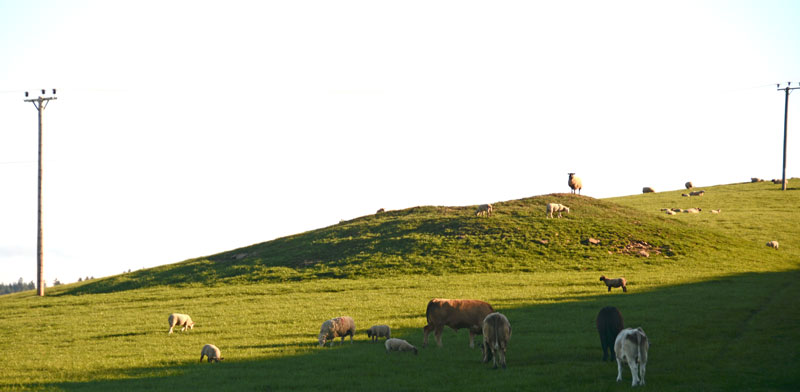
Midshiels Cairn submitted by Anne T on 4th Jun 2017. This is the closest we could get to the cairn on this visit - most of the young bullocks that had been on the right hand slope of the cairn were running (fast!) towards where we were standing at the gate to the field.
(View photo, vote or add a comment)
Log Text: Midshiels Cairn, Hawick: See visit report for Midshiels Standing Stone (the two are 90 metres apart), sites entered separately as Canmore lists them individually. Couldn't get really close to the cairn - would have loved to have walked up to it, but there was a really big bull and lots of over-friendly and very lively bullocks in the field. Must revisit at a different time of year!
There are plenty of other forts and settlements around here. The problem with another visit, is which sites to pick?
Burgh Hill Stone Circle
Trip No.29 Entry No.4 Date Added: 31st Jul 2017
Site Type: Stone Circle
Country: Scotland (Scottish Borders)
Visited: Yes on 3rd Jun 2017. My rating: Condition 3 Ambience 4 Access 3
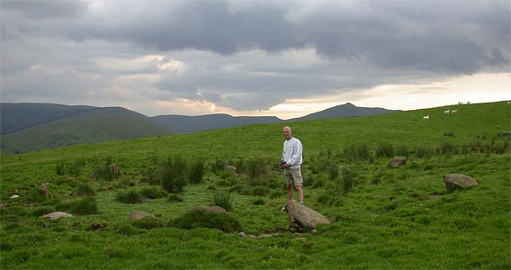
Burgh Hill Stone Circle submitted by nicoladidsbury on 17th Mar 2004.
(View photo, vote or add a comment)
Log Text: Burgh Hill Stone Circle, Hawick: After visiting Lord's Tree and Ca Knowe Cairns, we headed off towards Teviothead and some wild, lonely countryside. There is a track leading up the hill towards the stone circle (and the hill fort beyond), at NT 47365 06725, with parking for 2-3 cars opposite.
Following the track up the (reasonably steep) hill, we took the left hand fork and followed the mowed grassy track towards the stone circle. The circle lies just past the first peak with rocks outcrops to your right, but not as far as the fort. We went past the stones at first, having climbed too high up the hill, but Andrew found a metal pole with a large aluminium star attached to it, presumably marking this as an archaeological site.
Looking at the site on UK Grid Reference Finder, the circle lies in between two small banks running in very shallow arcs. The stones of the circle seem to lie in a dip with a small bank around. It reminded me very much of a cairn circle rather than a stone circle, as none of the stones seemed to be worked in any way, and they were all comparatively small. I note the Canmore record for this site says it's been re-designated a Stone Setting rather than a stone circle.
Having stayed to enjoy the views, and also photograph the Dod settlement from above, we climbed up to the fort, where it was VERY windy (but thankfully the wind was warm).
Lord's Tree (Hawick)
Trip No.29 Entry No.2 Date Added: 31st Jul 2017
Site Type: Cairn
Country: Scotland (Scottish Borders)
Visited: Yes on 3rd Jun 2017. My rating: Condition 3 Ambience 4 Access 4
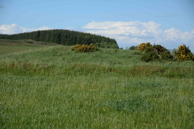
Lord's Tree (Hawick) submitted by Anne T on 4th Jun 2017. Standing at the southern side of the cairn looking up the slight slope to the low mound of the cairn. The circular bank around the cairn clearly visible.
(View photo, vote or add a comment)
Log Text: Lord's Tree Cairn, Hawick: We arrived in Hawick, intending to buy a map, but the majority of the shops (apart from the bookmakers, charity shops and 1 café, were closed (looking at the opening times, they largely shut at 2pm on a Saturday. The town seemed deserted apart from a few tourists. We later found out that most local people had gathered near the community centre for the Riding of the Marches.
Relying upon the Trigpointing UK maps (good job there was a phone signal!), we navigated our way through the town (stopping off to look at The Mote on the way), past the golf course and out into the glorious open countryside with the hills beyond.
This cairn appears as a slight bump at the top of a small rise of a hill; it's unmistakably a large, low cairn, and the lush green grass and wild flowers invited a walk through the meadow towards it.
Completely circular, there is a low bank surrounding the cairn. Shame the old Lord's Tree wasn't there. Lovely view down to Ca Knowe Cairn further south.
Ca Knowe (Hawick)
Trip No.29 Entry No.3 Date Added: 31st Jul 2017
Site Type: Cairn
Country: Scotland (Scottish Borders)
Visited: Yes on 3rd Jun 2017. My rating: Condition 2 Ambience 4 Access 4
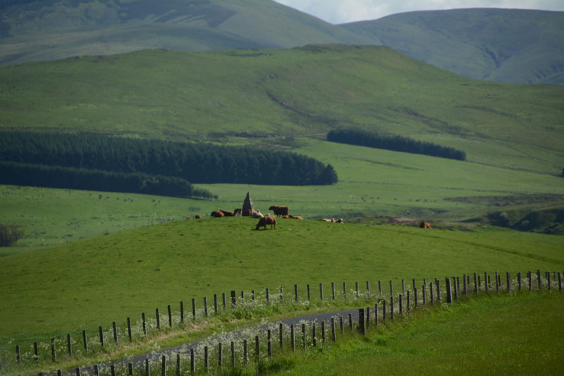
Ca Knowe (Hawick) submitted by Anne T on 4th Jun 2017. Ca Knowe Cairn from Lord's Tree Cairn.
(View photo, vote or add a comment)
Log Text: Ca Knowe Cairn, Hawick (aka Hero's Grave): Simply marked as ‘cairn’ on Trigpointing UK's OS map, we could see this cairn from Lord’s Tree Cairn. There is a proper tarmacked footpath up to the modern standing stone with plaque on it. Closer to, it is much larger than it appears from the mark on the map, and has a proper tarmacked path up to it.
Unfortunately, both on our way to our next site, and our way back to Hawick, the monument was surrounded by a number of very large cows with their calves, so we decided not to risk upsetting them and drove on after having taken some photographs.
The Dod
Trip No.29 Entry No.6 Date Added: 31st Jul 2017
Site Type: Ancient Village or Settlement
Country: Scotland (Scottish Borders)
Visited: Yes on 3rd Jun 2017. My rating: Condition 2 Ambience 4 Access 5
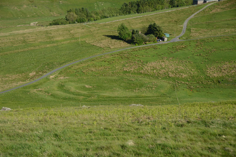
The Dod submitted by Anne T on 5th Jun 2017. The Dod settlement as seen from the slope just to the east of Burgh Hill Stone Circle.
(View photo, vote or add a comment)
Log Text: The Dod, near Bugh Hill Stone Circle and Hillfort: It was amazing what could be seen of this site from the slope just below Burgh Hill Stone Circle. Looking at the plan on Canmore, it is cut in two by the syke by the farm to it's south, but what remains, looking at the settlement from the road, are deep ditches and reasonably high banks.
The area is boggy, but the settlement can be reached by entering the field at its north-eastern end, walking westwards along the fence line next to the gate, then cutting across the field at the far end. For those not keen on boggy ground, a lot can be seen from the road.
Thankfully (after Burgh Hill Hillfort) The Dod was not windy! The sun was very strong at the time of our arrival here, and I struggled to avoid flare even using a polaroid and UV filters together. Was really pleased to have seen this site, but with so many other settlements and hill forts in the area, how to fit them all in? We decided to call it a day, calling in at Midshiels Standing Stone and Cairn on the way back home.
Burgh Hill Hillfort
Trip No.29 Entry No.5 Date Added: 31st Jul 2017
Site Type: Hillfort
Country: Scotland (Scottish Borders)
Visited: Yes on 3rd Jun 2017. My rating: Condition 3 Ambience 5 Access 3
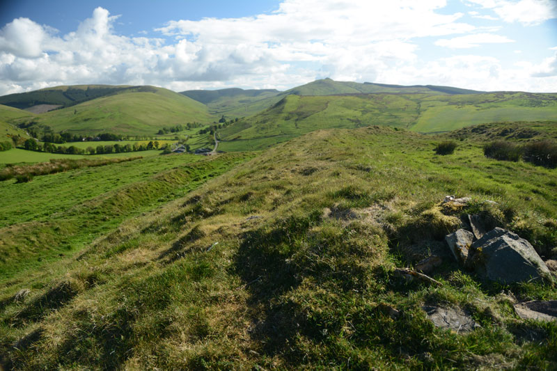
Burgh Hill Hillfort submitted by Anne T on 5th Jun 2017. Standing half way along the eastern upper bank of the fort, looking south west towards the hills beyond.
(View photo, vote or add a comment)
Log Text: Burgh Hill Hillfort, Scottish Borders: What is a 'bit more of a walk' for me is probably a 'short walk on a footpath' for others, but even so, this was a brilliant place to have visited.
With Burgh Hill Stone Circle (or possibly a cairn circle?) not far away, it was worth the additional short trek up to the south west summit of Burgh Hill. Goodness it was windy, although thankfully, as it was a nice warm spring/summer day, the wind was at least warm.
On the western side of the hillfort, the ground (as at Woden Law) dropped away sharply, making me take a quick step backwards to admire the views over the Allan Water valley below.
There are clear internal boundaries/banks/walls and a couple of hut circles, although these didn't come out very clearly on the photographs I took. There was a solitary large (standing) stone which didn't seem to be associated with any internal features.
The double banks and ditches on the south, east and northern sides of the fort were really visible, made of stone and earth, with two clear entrances to the north-east and south-west.
Hawick Mote
Trip No.29 Entry No.1 Date Added: 31st Jul 2017
Site Type: Misc. Earthwork
Country: Scotland (Scottish Borders)
Visited: Yes on 3rd Jun 2017. My rating: Condition 3 Ambience 3 Access 5
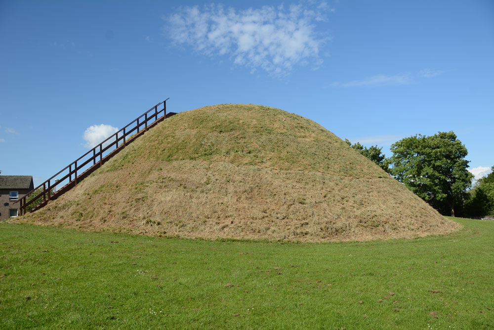
Hawick Mote submitted by Anne T on 27th Jul 2017. The Mote from the south western side, which has a ladder leading to the top of the mote which has an interpretation board.
(View photo, vote or add a comment)
Log Text: Hawick Motte/Mote, Scottish Borders: We arrived in Hawick, intending to buy a map, but the majority of the shops (apart from Dorothy Perkins, the bookmakers, charity shops and 1 café, were closed (looking at the opening times, they largely shut at 2pm on a Saturday. The town seemed deserted apart from a few tourists. We later found out that most local people had gathered near the community centre for the Riding of the Marches.
We couldn’t get a map, so relied on Andrew’s phone with TrigPoint on it. We were on our way to Lord’s Tree Cairn, driving down a street called Loan, when we spotted The Mote, so screeched to a halt by the side of the road and went round to take a photograph.
Quite extraordinary, The Mote is in the middle of a housing estate, with people’s washing hung up nearby. It rises steeply up out of the ground and there is a wooden staircase which takes you to the viewing point at the top. Andrew said it was only as large as our living room – no room for more than 12 people at most. Looking at this on UK Grid Reference Finder, it is located in Moat Park at the Southern end of the town. Plenty of dog walkers, all whom ignored me taking photographs.
