Contributory members are able to log private notes and comments about each site
Sites Anne T has logged. View this log as a table or view the most recent logs from everyone
Clavering's Cross
Trip No.76 Entry No.5 Date Added: 28th May 2018
Site Type: Ancient Cross
Country: England (Northumberland)
Visited: Yes on 26th May 2018. My rating: Condition 3 Ambience 4 Access 4
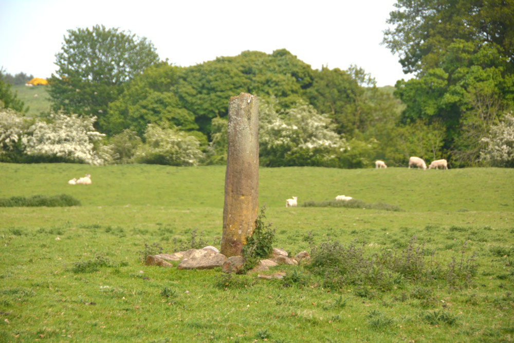
Clavering's Cross submitted by Anne T on 28th May 2018. Getting close, approaching from the north west, the fracture at the top of the cross shaft is clearly visible. Is the cross head really in the dike at the west side of this field??
(View photo, vote or add a comment)
Log Text: Clavering's Cross, Stanton: Disappointed by the third cairn, which we were really unsure of, I’d spotted this cross on the OS map, and as it wasn’t too far away, we thought we go on our way to Ewesley.
Parking on the verge just north of the farmhouse, there were roadworks being set up and a very large, yellow skip had been placed by the gate into the field. As there was a large ditch to its south, there was a very narrow piece of land to walk across, and with the side of the skip looming above my left hand side, I managed the two steps across, because I really wanted to see this cross.
We had to shoo the lovely, fat hens out of the way to open the gate, and spent a few minutes walking round and taking photographs. The steps were in a sorry state, which is unusual - Pastscape tells us the cross has (within living memory) been relocated back to the site where it originally stood, so perhaps the steps weren't built properly during the relocation.
Netherwitton Hall
Trip No.76 Entry No.5 Date Added: 28th May 2018
Site Type: Round Cairn
Country: England (Northumberland)
Visited: Yes on 26th May 2018. My rating: Condition 2 Ambience 2 Access 5
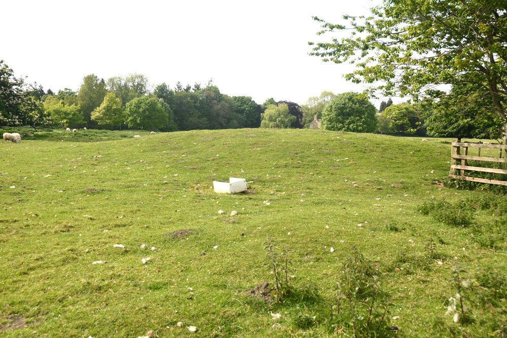
Netherwitton Hall submitted by Anne T on 28th May 2018. The mound or possible round barrow by Netherwitton Hall looks like an undisturbed barrow. The gate into the field was tied with a series of 'Gordian knots', and not being terribly excited by this mound, I photographed it from the gate.
(View photo, vote or add a comment)
Log Text: Round Cairn near Netherwitton Hall: Pulling up by the side of the road, taking the spot of a car that had just driven off northwards, this field was chock full of sheep and lambs, with the gate tightly tied with string in a ‘gordian knot’. Usually, I’d spent time untying the string, but as the mound didn’t look very exciting, I photographed it through the gate. Whilst it’s recorded on the OS map as a cairn, both HE and Pastscape wonder if this is actually a cairn or not, even though it’s scheduled as a round barrow.
Ewesley Enclosure
Trip No.76 Entry No.6 Date Added: 27th May 2018
Site Type: Misc. Earthwork
Country: England (Northumberland)
Visited: Yes on 26th May 2018. My rating: Condition 2 Ambience 4 Access 4
Ewesley Enclosure submitted by SolarMegalith on 16th Jun 2013. Bank and ditch in the western part of the probable Iron Age enclosure (photo taken on June 2013).
(View photo, vote or add a comment)
Log Text: Ewesley Defended Settlement, Northumberland: This was our last stop of the day, and it was really warm. There is a permissive footpath which runs along the dismantled railway line, although we drove past and had to retrace our steps to find it. The footpath sign is on a gate at approx.. NZ 05932 92605, just south of the railway bridge, and a small bridge over a stream, on the B642, before the farm to the north of the bridge.
Be warned, as the ‘footpath’ is really non-existent, and if we’d have strayed off the higher ground, we’d have needed waders to cross certain parts. As it was, we found an old boundary bank running north-south across a fence line and followed that to the drier side on the other side of a burn/drainage ditch.
The southern part of the structure can be clearly seen from the road, and it’s clearly a settlement of some kind, although why it’s southern been built on a slope, I’m not sure. There is an outer bank and ditch, which we followed up to where the settlement is cut by the railway line, and we found the easiest way down and across, up to its northern side, where some of the inner banks remain.
This is certainly a settlement of some kind; we couldn’t reconcile ourselves to it being a henge. Certainly enigmatic..
Milfield Reconstructed Henge at Maelmin Heritage Centre
Trip No.77 Entry No.1 Date Added: 1st Jun 2018
Site Type: Henge
Country: England (Northumberland)
Visited: Yes on 31st May 2018. My rating: Condition 4 Ambience 4 Access 4
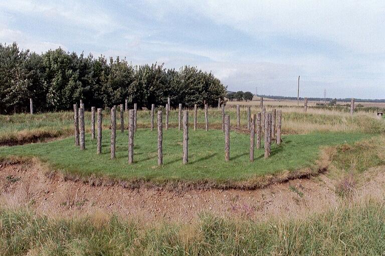
Milfield Reconstructed Henge at Maelmin Heritage Centre submitted by Andy B on 27th Feb 2003. Part of the Burnham family trip to Northumberland, August 2002
(View photo, vote or add a comment)
Log Text: Maelmin Recreated Henge, Milfield: We had a bit of a tortuous journey to get here, having been stuck in roadworks on the A1 northbound, so instead of the hour and a half it would have taken us, it was almost two and a half, so we were eager to get out of the car and walk.
Having found the ‘Archaeological Guide’ by Clive Waddington in a local charity shop about 10 days ago, I had read it from cover to cover and was really keen to see this site. I’d shown the booklet to our three year (going on 63) old grand-daughter and we’d talked through the photos on the journey here. As we walked into the centre of the henge from the car park, she turned to me and, pulling a face, said; “It’s just a ‘thing’ with a deep hole”.
Having spotted all the information boards round the site and running through the woods, she ran from one to the other. On getting to the Dark Age hut at the far side of the site, she was fascinated by this, and we had to go inside. Opening the door was amusing, at the wood had swollen in the rain and it took a while to get it to swing open gently without trapping fingers.
We walked back around to the henge following the circular path around the field, taking in the airfield. We found a sign saying ‘Mesolithic hut’ but there was only a hollow in the ground with a few poles laid inside.
No totem poles, or none that we could spot, anyway. It looks like these have now been replaced with two taller plain tree trunks.
After reading the story of the recreation of the henge, I did enjoy seeing it but had expected more from the heritage trail, which was essentially a ‘trail’ of information boards but without any real specific context or associated feature to look at. Would go again, without dearly loved child, to soak in the atmosphere. We went onto the Heatherslaw Light Railway - a great 15in gauge railway, ideal for small children and grandparents!
St Michael's Church (Illston On The Hill)
Trip No.78 Entry No.2 Date Added: 25th Jun 2018
Site Type: Ancient Cross
Country: England (Leicestershire and Rutland)
Visited: Yes on 24th Jun 2018. My rating: Condition 3 Ambience 4 Access 5

St Michael's Church (Illston On The Hill) submitted by Anne T on 25th Jun 2018. Close up of the socket stone and remains of cross shaft, looking towards the south porch from the southern edge of the churchyard, next to Main Street.
(View photo, vote or add a comment)
Log Text: St. Michael's Church, Illston on the Hill: This was our first port of call on the Sunday afternoon, on a brilliantly sunny day with blue skies and very hot. Although we probably could have walked here with the dog from Billesdon, I certainly wasn’t feeling up to a long walk today, and was very grateful that the cross was only just off the road.
A very pretty little church, which seemed larger on the inside than the out. The inside of the church wasn’t particularly interesting, apart from a very unusual set of steps that ran up to the top of the rood, from just behind the pulpit.
The cross was unusual, with the socket stone being set straight into the ground (no base or steps) and the remains of the cross shaft set diagonally into the socket. The shaft also had rolled-moulded edges. Also unusual was that it was set almost directly against three large gravestones which loomed above it.
King's Norton
Trip No.78 Entry No.3 Date Added: 25th Jun 2018
Site Type: Holy Well or Sacred Spring
Country: England (Leicestershire and Rutland)
Visited: Yes on 24th Jun 2018. My rating: Condition 3 Ambience 3 Access 5

King's Norton submitted by enkidu41 on 31st Aug 2004.
(View photo, vote or add a comment)
Log Text: Well, St John The Baptist, King's Norton: This is a very posh village, with very large houses. We parked by the tiny little village green just to the west of the church, almost next to the well, which is low down in the western churchyard wall.
Someone has been refurbishing the well, and recently, as there is a fresh footprint or two in the sand now forming the bottom of the well pool.
The church is relatively modern, a plaque next to the gate describing it as ‘Georgian Gothic’. The churchyard is relatively small, and not much to see in it, apart from a huge memorial right up against the exterior eastern wall. The church itself was locked, although a name/phone number was given to collect the keys from, but we weren’t interested enough to go inside.
Pastscape describes this well as a ‘horsetrough’. Whilst the well was very dry at the time of our visit, there is no sign within the churchyard (or the neighbouring house) as to where the source of the water comes from, although the top of the ground is at least 2m higher behind the well.
St John The Baptist (Rolleston)
Trip No.78 Entry No.4 Date Added: 26th Jun 2018
Site Type: Ancient Cross
Country: England (Leicestershire and Rutland)
Visited: Yes on 24th Jun 2018. My rating: Condition 3 Ambience 3 Access 4

St John The Baptist (Rolleston) submitted by Anne T on 26th Jun 2018. Site in Leicestershire and Rutland England. The floriated cross head looks more modern than the worn capital underneath.
(View photo, vote or add a comment)
Log Text: Churchyard Cross, St John The Baptist, Rolleston: Apart from one sign post on the road by the church in Skeffington, this exclusive hamlet may well not exist. The road is gated (at least 3 gates), the roads are very narrow, and at the junction of the road and the bridlepath down to the church, there are a number of ‘no parking’ signs. This meant our daughter-in-law-to-be had to drop us off and drive some distance away, then collect us afterwards.
There is a small iron gate into the churchyard. This appears to be the only entrance, as the road at the eastern end of the church is labelled ‘private’. Eventually managing to open the gate into the church, we found the cross at the south eastern corner of the church, almost hidden in the shadows of the trees. It looked as if the owner of the modern house had incorporated this part of the churchyard into their private garden, so we very much felt like we were trespassing and expected someone to come out of the house and shout at us to ‘move on’.
Due to the heavy shadows and bright sunlight, it was a little difficult to photograph this cross. There appears to be a difference of opinion between Historic England and Pastscape as to the date of this cross – HE says 14th century; Pastscape 17th. The socket stone was marginally intriguing as it had a small hole in each side, presumably to drain any water away.
Making our way back along the gated road to civilisation, we stopped by the stream to let the dog paddle.
Horseshoe Wood (Hownam)
Trip No.79 Entry No.1 Date Added: 1st Jul 2018
Site Type: Standing Stone (Menhir)
Country: Scotland (Scottish Borders)
Visited: Yes on 27th Jun 2018. My rating: Condition 3 Ambience 4 Access 4

Horseshoe Wood (Hownam) submitted by Anne T on 8th May 2015. One of the broader faces of this enigmatic standing stone in its gloriously scenic setting.
(View photo, vote or add a comment)
Log Text: Horseshoe Wood Standing Stone: This was my first real 'day out' since being ill with flu and having been confined to bed for a week, so not feeling hugely great in myself, but great to be outside again. We met Sandy G (of Stone Rows of Great Britain fame) in Hownam Village and followed The Street, Sandy kindly moderating his pace to a slow 'plod' to accommodate me, until we reached Horseshoe Wood. The sun was bright and the temperature rose higher as we walked up the slope. I was glad to stop at the standing stone for a drink and to take some photographs. Great to hear Sandy’s views about the location of the stone and its context; it’s difficult to know what ages standing stones actually are, and whether they are in their original location. However, this one is placed right next to an important route, The Street, described as a ‘historic cross border route), which provides the context.
There is a quarry to the immediate east of the stone, which makes the location look a little suspicious, but the stone looks as if it is in its original location with packing stones around its base and on a low, oval mound.
The Shearers
Trip No.79 Entry No.2 Date Added: 2nd Jul 2018
Site Type: Stone Row / Alignment
Country: Scotland (Scottish Borders)
Visited: Yes on 27th Jun 2018. My rating: Condition 3 Ambience 4 Access 3
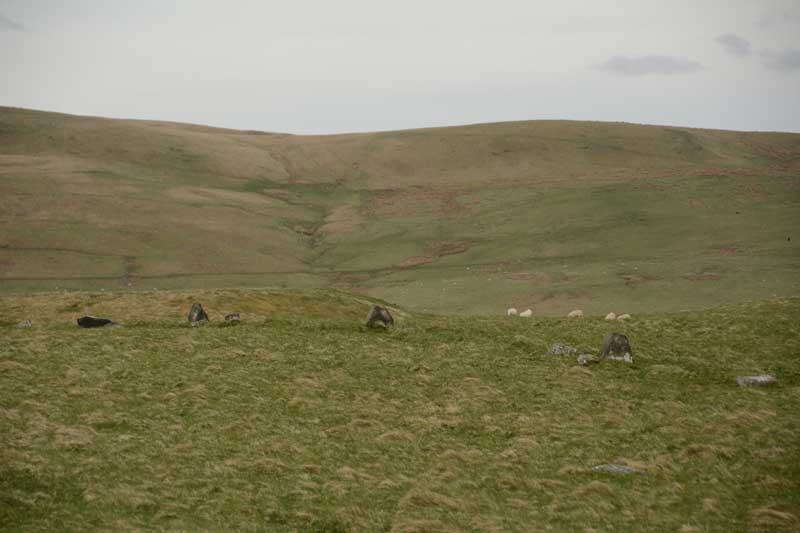
The Shearers submitted by Anne T on 8th May 2015. This was my first view of The Shearers, running across the centre/middle of the photograph from left to right.
(View photo, vote or add a comment)
Log Text: The Shearers, Hownam, Scottish Borders: By the time we got to the Shearers, the sun was high in the sky and beating down on us. Many horseflies, but thankfully no ticks. I was able to help with Sandy G's survey by acting as ‘the target’ for the disto (holding a piece of paper upright against the ranging pole so they could get accurate distances from the pole to each stone).
It occurred to me that where the row goes down the slope and ends at what is now a bog, at NT 7907 1927, perhaps this might have been a spring in ‘the olden days’ and been the water source for the hillfort.
The top end of the row seems to ‘bend’ slightly to the south east, heading towards looks like a hollowed out/partially excavated cairn.
It was fascinating to watch Sandy’s process of surveying the row, the row being too long to survey in one, so it was done in two halves. First he measured the distance of the centre of each stone from a ranging pole located in one spot, then took the angle of the stone from its central point to the ranging pole, transferring the measurements onto a plan, then photographed each stone individually. Finally, he walked up and down looking for ‘sighting lines’ – seeing what was visible from each stone, in which direction, and whether or not the stones echoed the shapes of any features in the landscape.
The conclusion Sandy came to (I think, as he says working out the details later will confirm or not) is that he counts this as a ‘possible’ stone row. It appears to be clearly associated with the nearby hill fort. I still dispute Canmore’s interpretation as the remains of a field boundary, as surely it would be connected to other old field boundaries nearby. None of these other boundary features had the earth removed from them.
We finally got back to the car at 6.30pm - the time had just flown. A very educational afternoon, and I was really pleased to have been involved in Sandy's survey. Pleasant day in pleasant company.
Cleatlam Wayside Cross
Trip No.80 Entry No.1 Date Added: 2nd Jul 2018
Site Type: Ancient Cross
Country: England (County Durham)
Visited: Yes on 1st Jul 2018. My rating: Condition 2 Ambience 3 Access 5
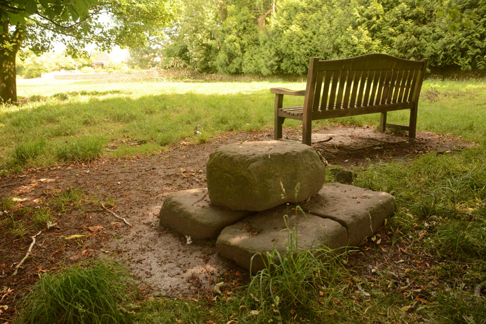
Cleatlam Wayside Cross submitted by Anne T on 2nd Jul 2018. First view of the cross base, approaching from the north and the minor road through the village.
(View photo, vote or add a comment)
Log Text: Cleatlam Wayside Cross, County Durham: This tiny village is picturesque, with large houses and farms on either side of the minor road through the village. The cross base wasn't easy to spot, hidden behind trees in a temporarily fenced off area of land, which looked like it used to be the old village green.
Sited just to the north of a wooden bench, the remains of this cross base is very odd. At first view, it looks to be a square block of stone split into two, but closer inspection reveals it is two separate pieces of stone embedded into the ground, with a smaller block placed on top.
Both Pastscape and HE say there is no socket hole, so presumably the cross would have been quite low and stood directly on top of this slab.
One of the strangest cross bases I've seen. In the field opposite, there are some interesting lumps and bumps, with a hollow way running almost parallel to the modern stone wall. Several housing/building platforms can be made out in the field. Pastscape attributes these earthworks to 'village shrinkage'.
St Mary's Church (Wycliffe)
Trip No.80 Entry No.2 Date Added: 2nd Jul 2018
Site Type: Ancient Cross
Country: England (County Durham)
Visited: Yes on 1st Jul 2018. My rating: Condition 3 Ambience 4 Access 4

St Mary's Church (Wycliffe) submitted by Anne T on 2nd Jul 2018. Close up of the main face of the hog back sited to the west of the south door, inside the church. Recorded as AS Corpus Wycliffe 05, this hogback dates to the first half of the 10th century. The church guide says it is Danish and was dug up on the north side of the church, found at a depth of 4ft 6ins, in 1801. The Corpus says the panels contain the tops of interlace patterns, probably four-cord plait.
(View photo, vote or add a comment)
Log Text: Hogback and Anglo Danish/Saxon cross fragments, Wycliffe, County Durham: This is a spectacular little village, down a narrow, dead end lane leading to the River Tees. It was difficult to park, as the lane to the church has a sign saying ‘private road’ (although a sign also says ‘to the church’), so we bumped up on the verge, as close to a stone wall as we dared, leaving just enough room for another car to pass (everywhere else said ‘private’ or ‘no parking’.
Walking down the lane to the church, we approached from the north west, walking round to the south porch, which held a ‘welcome’ notice. A strange church – lovely, warm (but very worn) yellow sandstone, but no tower, just a couple of bells.
The main hogback fragment is just to the west of the south door, inside the church, with another fragment immediately opposite, and more against the western wall.
There is a really old Bishop’s chair against the north wall of the sanctuary, a Norman (11th century) font also against the north wall of the sanctuary and some really interesting 13th and 14th century glass.
When I got a phone signal, we realised we’d not seen the hogback fragment in the exterior southern wall, and as we were passing on our way back, went back to spot this and also found a boundary marker at the entrance to the churchyard.
St Mungo's Church (Bromfield)
Trip No.81 Entry No.1 Date Added: 15th Aug 2018
Site Type: Ancient Cross
Country: England (Cumbria)
Visited: Yes on 9th Jul 2018. My rating: Condition 3 Ambience 4 Access 4

St Mungo's Church (Bromfield) submitted by Anne T on 10th Jul 2018. The dark red semi-circular stone is (the remains of) AS Corpus Bromfield 04, a 10th century hogback, as seen from the inside of the south porch. Located above the main door of the church, we stood for ages trying to make out the original hogback. The wavy edge at the top of this dark red sandstone is the only clue. According to the AS Corpus photos, the hogback can be better seen from inside the church, but the church was locked, so we were unable to see.
(View photo, vote or add a comment)
Log Text: Hogback and ancient crosses at St. Mungo's Church, Bromfield: Our first stop of the day. This is clearly an ancient village.
The church was locked, so the only stone we could see was in the porch – AS Corpus Bromfield 04. From the Corpus image, the top of the hogback looks clearer from the inside of the church, but of course we couldn’t get in.
After walking back from the well, I stopped to look at the hideous memorial in the southern part of the churchyard and noticed that it was built on what looked like the base of an old village/medieval cross. I haven’t been able to find anything out about this – it’s not mentioned in any literature I’ve currently come across – but suddenly it became more interesting!
We did try and find High Aketon Farm to see AS Corpus Bromfield 03, but couldn’t find it on the paper OS map and an internet search pulled up nothing. We decided to move on to the next location.
I’m going to try and contact the vicar to see if we can arrange entry into the church for sometime in mid-August.
St Mungo's Well (Bromfield)
Trip No.81 Entry No.2 Date Added: 22nd Jul 2018
Site Type: Holy Well or Sacred Spring
Country: England (Cumbria)
Visited: Yes on 9th Jul 2018. My rating: Condition 3 Ambience 4 Access 4
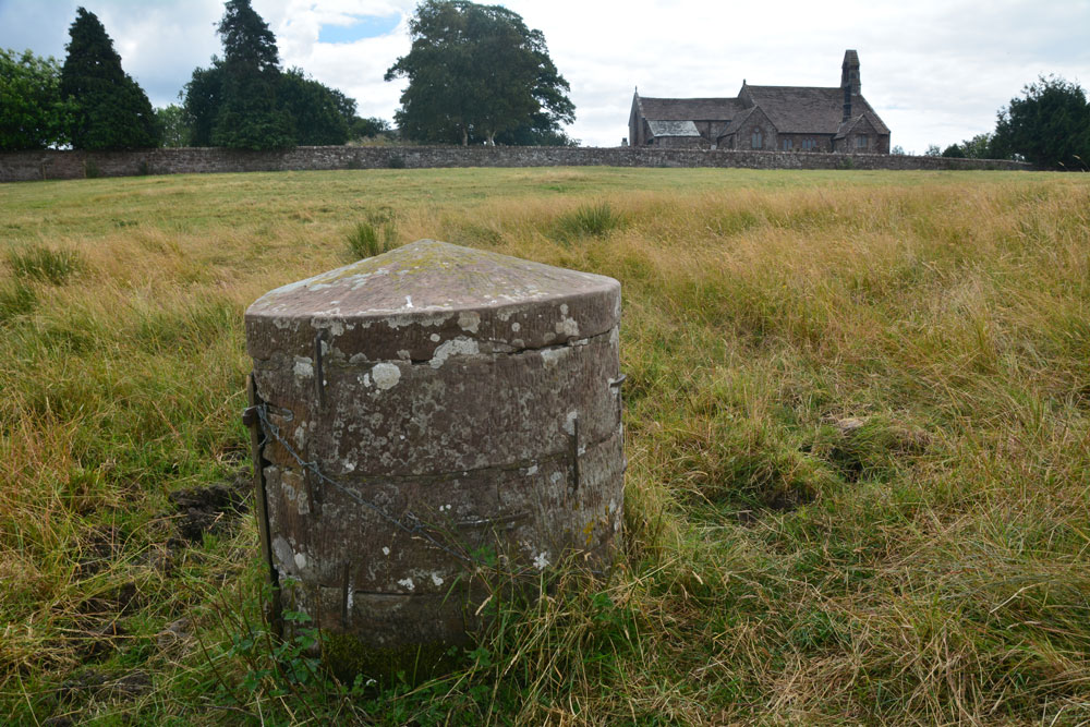
St Mungo's Well (Bromfield) submitted by Anne T on 10th Jul 2018. Standing just to the north of the well, looking back at St Kentigern's Church.
(View photo, vote or add a comment)
Log Text: St Mungo's Holy Well, Bromfield: The kissing gate from the north of the churchyard led down some sandstone gate, although the gate had been wired shut with a cable tie, so we had to clamber over. Even though there had been a long period of dry weather, parts of the ground around the well were still damp and the cattle’s hooves had sunk deep into the ground, creating tussocks and hollows. The well cavity itself was dry. In a very scenic setting, with lazy cattle (and a bull) lazing against a nearby hedgerow, looking over at us, but fortunately too hot to move.
A lovely well in a very nice, tranquil setting.
The Hatching Well (Gilcrux)
Trip No.81 Entry No.3 Date Added: 10th Jul 2018
Site Type: Holy Well or Sacred Spring
Country: England (Cumbria)
Visited: Yes on 9th Jul 2018. My rating: Condition 4 Ambience 3 Access 5
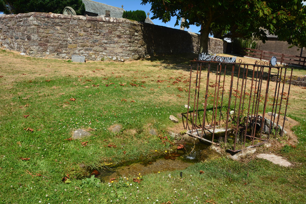
The Hatching Well (Gilcrux) submitted by Anne T on 10th Jul 2018. Standing just to the west of The Hatching Well, looking towards the southern boundary wall of St Mary's churchyard, just behind.
(View photo, vote or add a comment)
Log Text: The Hatching Well, Gilcrux: We arrived here and find this well bubbling away just outside the church - completely unexpected as it's not got any entries on Pastscape or Historic England. Neither is it mentioned in the Wikipedia entry for Gilcrux.
I guess finding this well made up for not being able to get into the church, which was very firmly locked and bolted, despite thinking we'd be able to get in. I'm trying to arrange with the vicar to go back mid-August to see AS Corpus Gilcrux 01.
St Mary's Church (Gilcrux)
Trip No.81 Entry No.4 Date Added: 10th Jul 2018
Site Type: Ancient Cross
Country: England (Cumbria)
Visited: Yes on 9th Jul 2018. My rating: Condition 3 Ambience 4 Access 4
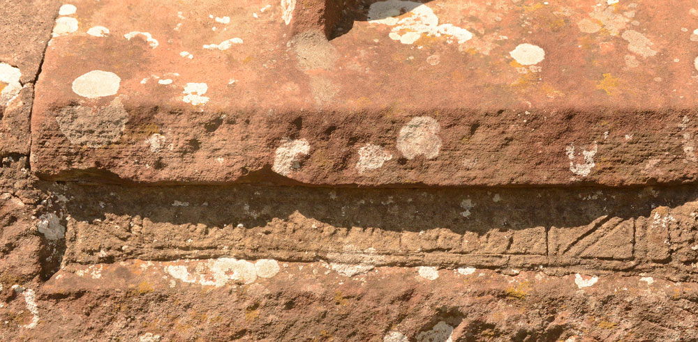
St Mary's Church (Gilcrux) submitted by Anne T on 10th Jul 2018. We may not have been able to see the Viking cross head and shaft fragment, but we did spot this underneath the window in the southern external wall of the sanctuary. The notes inside the church say it is the remains of a grave slab, recut for use as a lintel.
(View photo, vote or add a comment)
Log Text: Viking cross head and shaft fragments, St Mary's Church, Gilcrux: We arrived here to find the outer screen door open, but the door into the church very firmly locked. To say this was disappointing was an understatement, as the building looking fascinating with a lot of history from the outside.
I have since exchanged emails the vicar, who is arranging for the church to be opened for us on either 13th or 14th August.
St Mungo's Dearham
Trip No.81 Entry No.5 Date Added: 16th Aug 2018
Site Type: Ancient Cross
Country: England (Cumbria)
Visited: Yes on 9th Jul 2018. My rating: Condition 3 Ambience 4 Access 5
St Mungo's Dearham submitted by coin on 29th Mar 2017. The Viking Cross at Dearham
(View photo, vote or add a comment)
Log Text: Ancient Crosses and a Norman font, St Mungo's Church, Dearham: After having been to two other churches which had been firmly locked, this church was, thankfully open and very welcoming.
The church was packed full of knitted scenes from the bible, jewellery and books. We missed the Adam Stone, but are going back on 14th August, and have asked for permission to get into the vestry to see AS Corpus Dearham 03, a fragment of a wheel headed cross built into the wall.
We had to move quite a few items from the west window to photograph AS Corpus Dearham 02, and it took us ages to get everything back!
The Norman font, apparently carved from the cushion capital of a column, was really interesting.
There was no church guide book, although there was a postcard (30p) and a display board, which I took a few photos of.
The first notes on the display board say: “There can be no doubt that Dearham had a church during the Dark Ages, following the withdrawal of Roman Forces from Britain. Many pre-Norman sculptured stones displayed in the present church provide evidence that Christianity was prevalent during Anglo Saxon and Viking times. The Reverend William Slater Calverley was vicar of Dearham from 1877 until 1885 and was responsible for uncovering and displaying many of these stones. He worked tirelessly on restoring the church to much of the originality as possible during his period of incumbency. In 1880 it was recorded that he did not know to whom the church was dedicated, the original dedication having been lost. It was rededicated in 1935, as a result of the inspiration of the Reverend Canon Malcolm D. Grieve, to St. Mungo, a Scottish saint whose real name was St. Kentigern. In 1937 Canon Grieve was also responsible for the addition inside the church building, of a side chapel dedicated to the Holy Name. It stands at the east end of the north aisle.”
There is a section on the display called: “A brief look at the history of St. Mungo’s. It is believed that the original stone church dating back to the early 1100s was about 48 feet long in the shape of a long, low tunnel. During the Norman period parts were added and extended later in the Early English period. The tower was added probably early 14th century. The porch was also an addition to the original building covering the Norman doorway. The north aisle was a completely new addition during the 1882 restoration when Mr. Calverley enlarged the church. The vestry, at the east end, is an extension to the north aisle, the date being cut into the pillar of an arch. Built in the north wall of the vestry is the head of the “Kenneth Cross”. It was found near the east end of the church and built into the vestry wall curing restoration. The stained glass window behind the altar was given by Mr. John Wilson of Dearham and built in at the time of the 1882 restoration. The bell, which weights almost half a ton, was given by Colonel Sewell, whose family were seated at Brandlingill end of Hayborough. The ancient windows, dating back probably to 1150 were removed during the 1815 restoration and sadly lost to this day! Had they been lying about in 1880 Rev. Calverley would have restorated them to their rightful place, when he in turn removed the sash windows and inserted new ones fashioned in the style of the originals.”
The display says: “The magnificent wheel head cross (Viking cross) stands 5ft 4ins high and is carved with “Yggdrasil”, the Norse tree of the universe. It stood in the churchyard until 1900 and then brought into the church and placed in front of the organ.”
Another section reads: “The treasures of the Church include two stones found during 1882 restoration work. Standing 4ft high is the Adam stone, dating from AD 900, which depicts the Fall and Redemption of Man, with Adam and Eve hand in hand above a serpent. The Kenneth Cross shows the legend of the 6th century hermit, S. Kenneth, who was lame from birth and after his baptism cast away in a coracle. He was saved from the gales, and brought up by seabirds.”
The small door leading up into the tower was open, with a very narrow set of steps leading up. Not even Andrew fancied venturing up.
Blennerhasset Cross
Trip No.81 Entry No.6 Date Added: 10th Jul 2018
Site Type: Ancient Cross
Country: England (Cumbria)
Visited: Yes on 9th Jul 2018. My rating: Condition 3 Ambience 4 Access 5
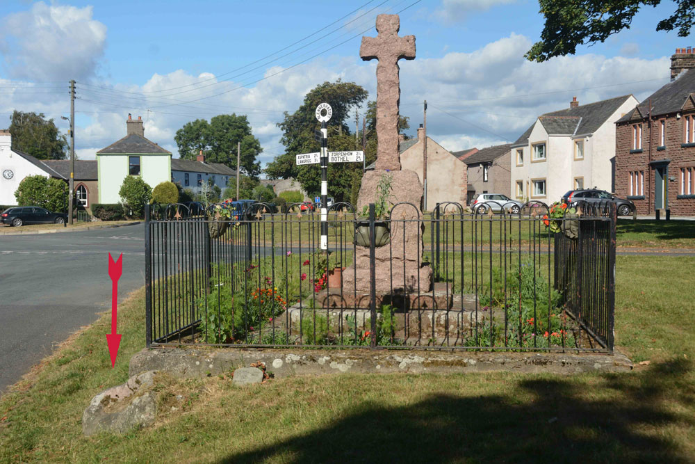
Blennerhasset Cross submitted by Anne T on 10th Jul 2018. The memorial, with discarded socket stone to the bottom left (highlighted by the red arrow), taken from the western side.
(View photo, vote or add a comment)
Log Text: Three crosses in one, Blennerhasset, Cumbria: Having been to four churches to see Anglo Saxon carved stones, and only found one unlocked, I wanted to stop and see the 'cross' marked on the OS map in this small village. This really is a stunning medieval village, and I wish we’d had more time to wander round and admire the old buildings. There was a lovely bridge over the river, although there was a children’s picnic and football match going on next to it, so we didn’t disturb them. There were two information boards outside the school, but neither mentioned the cross. Despite it looking like a war memorial, I wandered across only to find the base of the medieval cross and the discarded socket stone. Brilliant!
Talla Linnfoots
Trip No.82 Entry No.1 Date Added: 23rd Jul 2018
Site Type: Cairn
Country: Scotland (Scottish Borders)
Visited: Saw from a distance on 12th Jul 2018. My rating: Condition 2 Ambience 3 Access 4

Talla Linnfoots submitted by Anne T on 23rd Jul 2018. I'm not sure if I've photographed the right monument, as we couldn't get through the tall, very long deer fence, but this is the site estimated from the map and using our GPS to help. The enclosure lies some 100m to the north west of this 'cairn', which is the grassy lump which runs across the middle of the photograph.
(View photo, vote or add a comment)
Log Text: Cairn & Enclosure at south eastern end of Talla Reservoir: Our first, proper, stop of the day, as I can’t count the visit to Tweedmuir Kirk, as the stone we saw from from the 1600s.
This is a remote, but very pretty spot, albeit with tall, brooding hills around, only tempered by the gentle trickling of the Coddleteth Burn, Games Hope Burn and Talla Water, which join up before entering the reservoir lake.
We were prevented from getting right up to this cairn and enclosure by a long, continuous deer fence. I think I’ve photographed the cairn, but we had difficulty in seeing the enclosure on the ground.
The enclosure can just be seen, very faintly, on UK Grid Reference Finder.
Megget Stone
Trip No.82 Entry No.2 Date Added: 23rd Jul 2018
Site Type: Standing Stone (Menhir)
Country: Scotland (Scottish Borders)
Visited: Yes on 12th Jul 2018. My rating: Condition 3 Ambience 4 Access 5
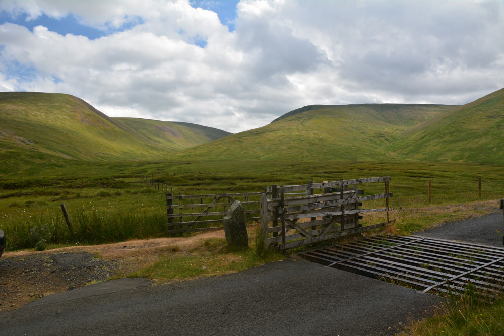
Megget Stone submitted by Anne T on 23rd Jul 2018. Looking across the Megget Stone to the West South West, across the step or shoulder in its eastern face, and trying to capture the majesty of the surrounding hills. Canmore tells us this is a slab of gritty greywacke, 7.5 ins thick, and 3ft 4ins high on one side, and 2ft 9ins above ground level; they add that the step/shoulder is apparently artificial.
(View photo, vote or add a comment)
Log Text: Megget Stone, east of Talla Reservoir: Continuing along the twisty, windy road that follows Talla Water, we passed an intrepid cyclist making his way slowly up the hills, and some motorcyclists who had stopped to photographs the waterfalls along the route.
When we got to the grid reference given for the Megget Stone, we couldn’t see it at first, as it was hidden by the gate. There was room for a car to park just past the cattle grid and gate. Hopping out to take photographs and examine this stone in more detail, the cyclist past us, and as he did, I realised that at this point, it was downhill all the way – the watershed.
This stone is definitely a boundary marker, not a true standing stone. It looks as if its eastern face has been broken. In a remote but lovely spot.
Patervan Settlement
Trip No.82 Entry No.3 Date Added: 23rd Jul 2018
Site Type: Ancient Village or Settlement
Country: Scotland (Scottish Borders)
Visited: Saw from a distance on 12th Jul 2018. My rating: Condition 2 Ambience 3 Access 4
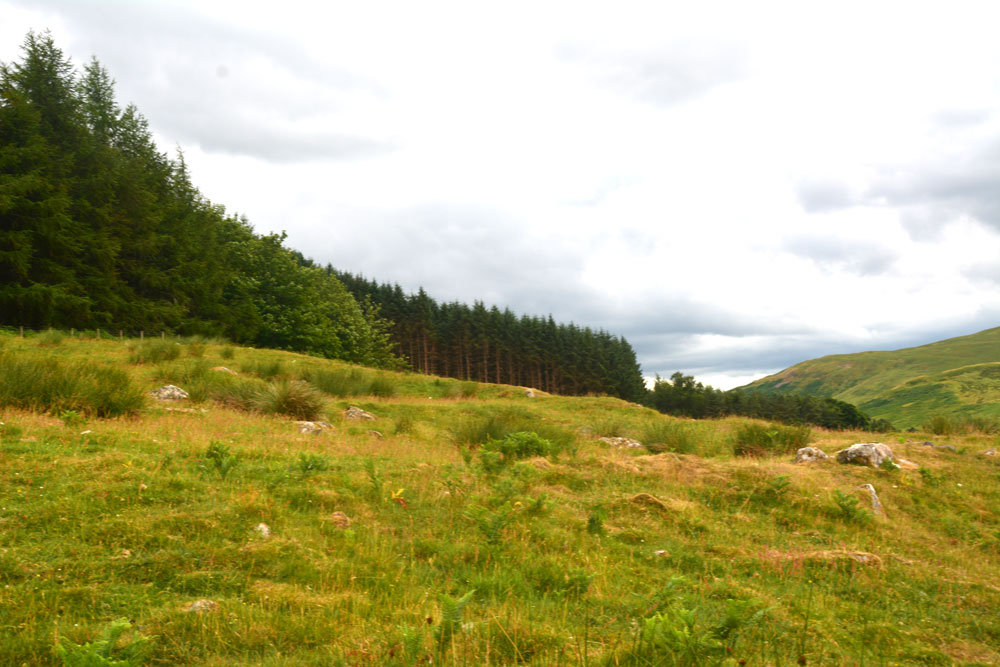
Patervan Settlement submitted by Anne T on 23rd Jul 2018. The outer wall of the settlement curves along the middle/bottom of the photograph, and contains boulders/facing stones which are believed to be in situ. Inside this 8ft wide bank, there is a large house platform measuring some 28ft in diameter.
(View photo, vote or add a comment)
Log Text: Patervan/Polmood Settlement, just west of Patervan Farm Cottage: After the Meggat Stone, we stopped off at Henderland Chapel (aka Chapel Knowe and Cockburn’s Tombstone) at NT 23112 23414, which was well worth a look, but too modern for the Portal!
This settlement is (almost!) easily reached. We parked at a layby on the western side of the A701, just north of the entrance to Patervan farm at NT 10850 28570. To think we’ve driven this way many, many times before over the years, but didn’t even consider exploring this area.
We crossed over the River Tweed (with its river monitoring station) via the robust bridge, and followed the track up to Patervan farm. We passed the cottage on our right hand side. then diverted on the footpath which led into the field just before the sign for ‘Patervan Steading’. The gate into the field on the other side of the track at this point was chained and padlocked, along with an electrified fence. We clambered over the wooden fence next to the gate, only to be confronted by another chained and locked gate. As we wanted to get on and climb up to the hillfort and another, larger settlement, we decided to hedge out bets and simply looked over the stone wall, deciding if there was time on the way back, to hop over and take a closer look (but we ran out of time).
I was really surprised to find so many ancient sites, almost an entire archaeological landscape, in a relatively small area. Worth investigating again, although not hugely, hugely exciting.
