Contributory members are able to log private notes and comments about each site
Sites Anne T has logged. View this log as a table or view the most recent logs from everyone
Finglandrigg Spa Well (Chalybeate)
Trip No.176 Entry No.2 Date Added: 6th Jun 2022
Site Type: Holy Well or Sacred Spring
Country: England (Cumbria)
Visited: Yes on 4th Jun 2022. My rating: Condition 2 Ambience 3 Access 3
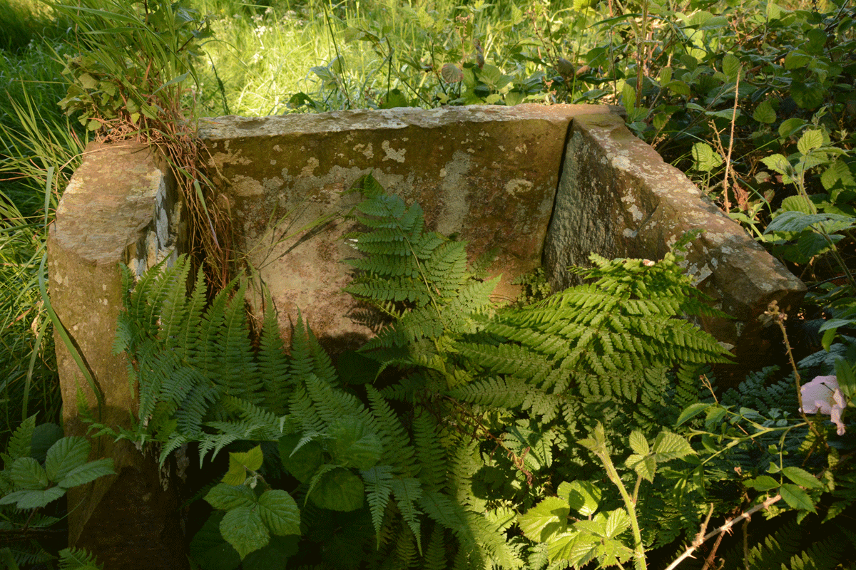
Finglandrigg Spa Well (Chalybeate) submitted by Anne T on 5th Jun 2022. There's nothing left of the information board shown on old photographs of this well. See Heritage and History for photographs taken in 2009.
(View photo, vote or add a comment)
Log Text: Finglandrigg Spa Well: A very pleasant walk through this nature reserve, although the well is not where the published map says it is. In the end, we walked round and round, then tried to find a spot with a phone signal so we could find a rough grid reference, which we acquired from the Old Cumbria Gazetteer. Some 50m from the published path, down a grassy 'lane'. Ruined, but ticked this one off the list. Am trying to trace what properties this water had, and added the nearby Toddel Well to my list of places to visit in the near future.
Five Ashes Cairn (Netherwitton)
Trip No.76 Entry No.1 Date Added: 27th May 2018
Site Type: Round Cairn
Country: England (Northumberland)
Visited: Yes on 26th May 2018. My rating: Condition 2 Ambience 4 Access 4
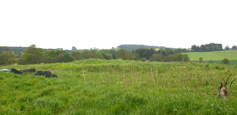
Five Ashes Cairn (Netherwitton) submitted by Anne T on 27th May 2018. First proper view of the Five Ashes Cairn from the gate into the field at approximately NZ 09596 90631. It is located on a slight rise in the landscape. The farmer has kept the area of, and just around the cairn, free of crops.
(View photo, vote or add a comment)
Log Text: Five Ashes Cairn, Netherwitton: From St. Giles’s Church, we drove back through Netherwitton, taking the right hand turn which runs northwards, to the west of the meandering River Font. Parking at NZ 09891 90457, next to the entrance to the field with the footpath running through, we set off across the mowed footpath. This section of shorter grass petered out after about 100metres. Five Ashes Cairn was visible to our west after about 300metres. There was a gate into the cairn field, technically trespassing, but the area with, and around, the cairn, had been left clear of crops, so we kept to the field edge and made our way the 50m or so across to the cairn.
At this time, a whole ribbon of small planes began to fly across, one at a time, about 30 seconds apart. I lost count after 20, then came the hang gliders and microlights, the some more small planes. They were all heading roughly from north east to south west, and we haven’t been able to find out where they came from, or where they were going to, although the Borders Gliding Club isn’t that far away from this location, near Milfield and Maelmin.
If we hadn’t have known this what we were looking at, and that it was marked on the OS map, anyone could have been forgiven for thinking this was just a farmer’s mound/junk heap with straw bales and other items left on its north eastern side.
This cairn looked quite large, with a steeper bank on its western side. It looks as if it has been crudely excavated, with various lumps and bumps under the long, tussocky grass (and lots of short, fierce nettles at ankle level!) over the mound.
Five Kings
Date Added: 10th Jan 2017
Site Type: Stone Row / Alignment
Country: England (Northumberland)
Visited: Couldn't find on 1st Jan 2017. My rating: Access 3

Five Kings submitted by Strider on 4th Feb 2003. Five Kings, Northumberland
NT955001
Alignment of four large, irregular stones - the fifth may have fallen but I could not be certain.
(View photo, vote or add a comment)
Log Text: Five Kings, near Grasslees, Northumberland: The easiest access looked as if it was from the footpath near Ovenstone Plantation off the B6341, just past Grasslees. Parking off the road at the entrance to the footpath, we headed off up the track - easy walking at this stage. 100 metres up the track there was a gate/stile with two display boards. Neither bore any similarity to each other, or to the OS map. We had intended walking up the footpath to its fork, 100 metres further up, then take the right hand fork following the stone wall up past The Long Chirn and Woodhouses to the Five Kings. Sadly (presumably being military land) this part of the footpath no longer exists and the walking was difficult (very tussocky, marshy ground). When the heavens opened (despite the weather forecast saying it would be fine!), we contemplated finding a second footpath through Dueshill Farm but it would be dark by the time we reached the stone row, so we decided to go somewhere else and headed back to the car and try another route on a better day. I was so disappointed, as this was a stone row I'd loved to have seen, but the Tosson Tower and Lordenshaw had to suffice for this afternoon.
Font Stone (Dryburgh)
Trip No.50 Entry No.6 Date Added: 7th Oct 2017
Site Type: Ancient Cross
Country: Scotland (Scottish Borders)
Visited: Yes on 24th Sep 2017. My rating: Condition 3 Ambience 3 Access 5
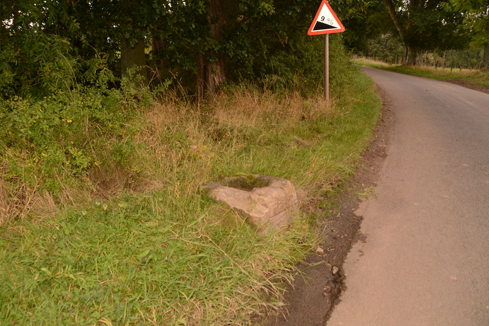
Font Stone (Dryburgh) submitted by Anne T on 7th Oct 2017. The Dryburgh Font Stone, showing its very close location to the side of the road.
(View photo, vote or add a comment)
Log Text: The Font Stone, Dyburgh (Cross Base): Sited on a corner of the B6356, it is a miracle that this cross base is still in one piece, being located so close to the road.
From Mertoun Kirk, we followed the B6356, turning right before reaching Dryburgh along a minor road signposted to Bemersyde, where the stone is located some 270 metres along the road on a slight right hand bend.
It is largely hidden by grass at the right hand side of the road as you head up to Bemersyde. There is a layby just before the stone, where we pulled in to photograph the stone. Note: this is a busy road, so be careful of traffic.
As we were very near the Scott’s View Geological Indicator and the Wallace Monument, whilst there was still light, we decided to go on and take a look.
Fontburn a(i)
Date Added: 1st Aug 2015
Site Type: Rock Art
Country: England (Northumberland)
Visited: Yes on 15th Jul 2015. My rating: Condition 3 Ambience 4 Access 3
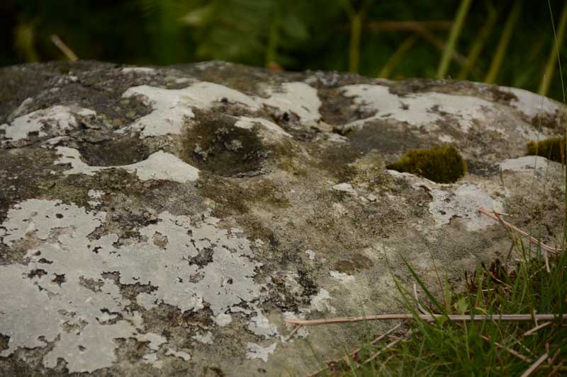
Fontburn a(i) submitted by Anne T on 20th Jul 2015. A close up of some of the cups and weathering marks on the top surface of Fontburn a(i). I counted 6 cups; the rest seemed to be caused by either natural weathering or were heavily eroded cups.
(View photo, vote or add a comment)
Log Text: Fontburn a(i), just off the National Trust Greenleighton Walk, Northumberland: See visit report for Hollinghill Enclosure.
Fontburn a(ii)
Date Added: 1st Aug 2015
Site Type: Rock Art
Country: England (Northumberland)
Visited: Yes on 15th Jul 2015. My rating: Condition 3 Ambience 4 Access 3
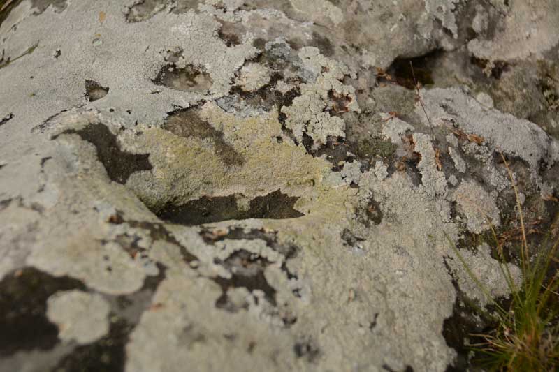
Fontburn a(ii) submitted by Anne T on 20th Jul 2015. There is one large oval shaped cup mark on top of this boulder. The rest of the marks appear to be natural weathering of the sandstone.
(View photo, vote or add a comment)
Log Text: Fontburn a(ii), just off the National Trust Greenleighton Walk, Northumberland: See visit report for Hollinghill Enclosure.
Fontburn a(iii)
Date Added: 1st Aug 2015
Site Type: Rock Art
Country: England (Northumberland)
Visited: Yes on 1st Jan 2015. My rating: Condition 3 Ambience 4 Access 3
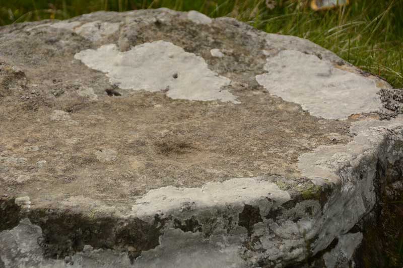
Fontburn a(iii) submitted by Anne T on 20th Jul 2015. We could only make out one cup mark on this boulder, although the Beckensall Archive says there is a line of 5, 12 others and two lightly peck marked areas. The ERA-1351 record identies three possible cups, although we were unable to see these.
(View photo, vote or add a comment)
Log Text: Fontburn a(iii), just off the National Trust Greenleighton Walk, Northumberland: See visit report for Hollinghill Enclosure.
Fontburn a(vi)
Date Added: 1st Aug 2015
Site Type: Rock Art
Country: England (Northumberland)
Visited: Yes on 1st Aug 2015. My rating: Condition 3 Ambience 4 Access 3

Fontburn a(vi) submitted by Anne T on 20th Jul 2015. Close up of the two deepest cups on the southern/top side of Fontburn a(vi). It was amazing how smooth and well definted these were, even after all these centuries.
(View photo, vote or add a comment)
Log Text: Fontburn a(vi), just off the National Trust Greenleighton Walk, Northumberland: See visit report for Hollinghill Enclosure.
Fontburn a(vii)
Date Added: 1st Aug 2015
Site Type: Rock Art
Country: England (Northumberland)
Visited: Yes on 15th Jul 2015. My rating: Condition 3 Ambience 4 Access 3
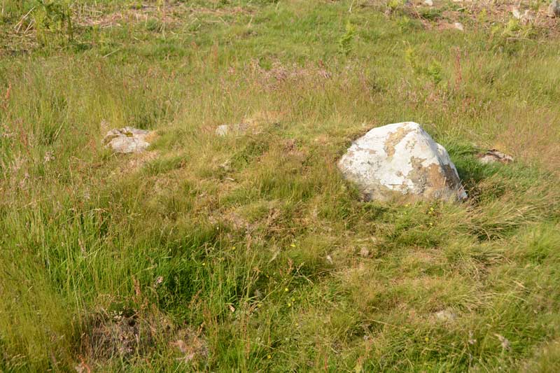
Fontburn a(vii) submitted by Anne T on 20th Jul 2015. Close up of the Fontburn a(vii) boulder, but even now the sun is out, the photo doesn't manage to highlight the two cup marks which are on it. I've posted this so other visitors can identify the right stone.
(View photo, vote or add a comment)
Log Text: Fontburn a(vii), just off the National Trust Greenleighton Walk, Northumberland: See visit report for Hollinghill Enclosure.
Fontburn a(viii)
Date Added: 1st Aug 2015
Site Type: Rock Art
Country: England (Northumberland)
Visited: Yes on 15th Jul 2015. My rating: Condition 3 Ambience 4 Access 3
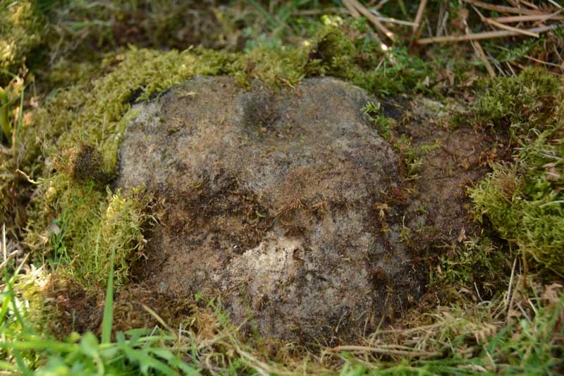
Fontburn a(viii) submitted by Anne T on 20th Jul 2015. This is one good photograph I managed to get of Fontburn a(viii). The ERA-1356 record tells me that the cup mark on the top of the rock is almost certainly artificial, the 'cup' on its lower edge is probably weathering.
(View photo, vote or add a comment)
Log Text: Fontburn a(viii), just off the National Trust Greenleighton Walk, Northumberland: See visit report for Hollinghill Enclosure.
Fontburn B
Date Added: 7th Sep 2014
Site Type: Rock Art
Country: England (Northumberland)
Visited: Yes on 5th Sep 2014. My rating: Condition 3 Ambience 4 Access 3
Fontburn B submitted by SolarMegalith on 16th Jun 2013. Decorated horizontal surface of Fontburn B boulder (photo taken on June 2013).
(View photo, vote or add a comment)
Log Text: Fontburn B (Rock Art), near Rothbury, Northumberland: Fontburn Reservoir is just over 12 km north of Wallington and 9 km south-south-west of Rothbury. Despite it not being very far from where I live I can’t say I’ve ever heard of it this reservoir, yet it’s clearly very popular with fishermen and has a cafe that’s open at weekends. On the map, there were no clear roads up to the reservoir yet two car parks clearly marked, so this was a little bit of a voyage of discovery. And there it was - a single track road with passing places that wound its way up past Roughlees Farm and the Goats On The Roof cafe to the dam.
Parking at the southern-most end of the car park, as far as we could get past the fishing shack, we walked clockwise around the lake. From the car park, heading southwards, a barrier blocks entry to cars, but the footpath turns and continues westwards along a grassy track, wending through the trees with the reservoir to the right hand side. There are good, solid boardwalks in the boggiest areas and wooden guard rails at some of the edges of the lake (but not always in the steepest places); being someone who hates sheer drops, the height down to the lake wasn’t too bad, and it was an easy path to walk on. About a third of the way around the southern side of the reservoir, the path divides. The small track which follows the edge of the reservoir enters a nature reserve and disappears amongst the trees; the footpath signs turn you left, leading up a slight hill to a gate (with a very heavy spring) which took you onto Access Land (avoiding the nature reserve) where the terrain was much rougher and more difficult to walk with humps and bumps and small streams to cross.
We missed the first stone, Fontburn N02, at grid reference: NZ0395993186, as in the trees along the riverside walk it was difficult to gauge how far we had gone. By the time we came to the access land and orientated ourselves using the fence boundaries and the sheepfolds, we had to walk a fair way back to see NO2, and decided to go back to it on the return journey. But an hour later, the skies were heavy and grey and it felt like thunder, so we returned to the car along the easier footpath to the north of the reservoir.
As an aside, we came upon an unknown Rock (Grid reference: NZ0310993518) just to the left hand side of the path. Just into the access land, we came upon what looked like the remains of a cairn, but couldn’t be sure as field drains had been dug into the field around it, but there was a clear oval shape in the grass, topped by stones. Just after this, we found the said stone sitting alongside the left hand side of the footpath, although it wasn’t clear if there was rock art on it. There was also a smaller stone located alongside with other marks on it. Looking this up on the ERA database and the Portal, there are no references to this rock at all, so the marks are just weathering or perhaps where ploughs have hit it [note: we missed Fontburn N01, which is located between the two halves of the car parks at the eastern end of the reservoir! grid reference: NZ 04897 93466].
Continuing along the footpath, and rounding the right hand turn it takes, Fontburn B came clearly into view to the left of the footpath. It looks like an erratic dropped at the side of the path above the (now) reservoir. It’s impressive in size, although it looks as if the northern edge has been quarried away as there is a sheer, rather than a rounded face on this side.
A few cup marks were visible from the ground, and many more visible by climbing a few metres up the hill to the south. Even better was just to carefully hop up the side of the rock and sit on top of it, just like our ancestors must have done all those thousands of years ago. In the sunshine, it was a remarkable spot, although dominated by the ground rising to the south. In the past, there would have been clear views down to the river below.
We then carried on following the footpath to where it loops back round to the reservoir, and goes back onto the Northumberland Water Board Water Trail and onto Fontburn Four-Poster.
Doing some research on the web since getting home, I’ve discovered that Fontburn B is a published landmark/site to see on the National Trust Greenleighton Moor Walk around the Wallington area.
Fontburn Four-Poster
Date Added: 7th Sep 2014
Site Type: Stone Circle
Country: England (Northumberland)
Visited: Yes on 5th Sep 2014. My rating: Condition 3 Ambience 4 Access 3
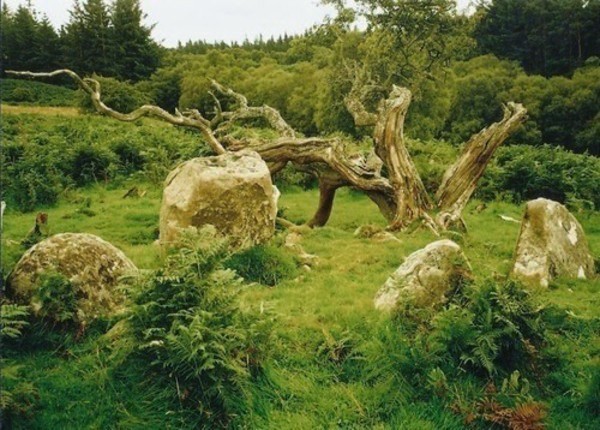
Fontburn Four-Poster submitted by Bladup on 30th Dec 2013. Fontburn Four-Poster.
(View photo, vote or add a comment)
Log Text: Fontburn Four Poster, near Rothbury, Northumberland: This was a continuation of our very pleasant meander around Fontburn Reservoir from Fontburn B.
Crossing over Fallowlees Burn and just starting to head back along the northern edge of the reservoir the Stone Circle comes into view on the horizon at the top of the hill.
My first impression is that this is a cairn, as there are many more stones around than the four uprights, but then why would two of the stones have cups on the top surfaces if they were meant to be covered up? Perhaps the site was used in antiquity? This site is likened to Goatstones Four Poster, but I’m not sure I saw much similarity (I'll need to sit and compare images).
Sitting on this small plateau with Dod Knowe hill rising up behind, and with the burn trickling pleasantly down below, this small stone circle is in a peaceful and lovely spot. It’s also very atmospheric, with the very old (hawthorn?) tree lying in broken pieces at the feet of the circle. There appear to be clear cup marks on two of the stones.
It was a very misty day, so we couldn’t make out any of the distant landmarks, so after lingering for a while to absorb the atmosphere, we made our way back to the marked path and walked back round to Fontburn Dam.
The place to seek permission to visit Fontburn Stone Circle is Newbiggin Farm, north of the reservoir, although there are references to finding the stone circle on the notice boards by the reservoir.
Ford Cist
Trip No.88 Entry No.6 Date Added: 1st Aug 2018
Site Type: Cist
Country: Scotland (Argyll)
Visited: Yes on 18th Aug 2018. My rating: Condition 2 Ambience 2 Access 5
Ford Cist submitted by caradoc68 on 20th Feb 2012. Very easy to get to being on the Ford cross roads, with a bus stop within feet of this monument.
(View photo, vote or add a comment)
Log Text: Ford Cist: Not having access to the internet, we thought this was just a cairn which had been marked on the OS map. This monument is in an odd location, just inside the village boundary, tucked between the junction of the road through to Torran and the B840 running along the south shore of Loch Awe, opposite the Crown Hotel and next to a bus stop. Tis mound was fenced off, with no means of accessing the area (apart from climbing the fence) and no information board.
We took some photographs of the mound, but didn’t climb the slope, as we were keen to see the cross-inscribed standing stone at Torran and didn’t know if we’d find it, plus we’d seen another standing stone is a field to the west of the road just before we entered the village and wanted to make time to explore that. The cist was just to the south of a babbling River Ford and a small road bridge over the river.
Ford Stone (Kilmartin)
Trip No.88 Entry No.8 Date Added: 1st Aug 2018
Site Type: Standing Stone (Menhir)
Country: Scotland (Argyll)
Visited: Yes on 18th Jul 2018. My rating: Condition 3 Ambience 4 Access 4
Ford Stone (Kilmartin) submitted by cosmic on 30th Aug 2003. The Ford Standing Stone at NM867034
(View photo, vote or add a comment)
Log Text: The Ford Stone, near Torran: We spotted this stone to the west of the road as we drove towards Ford village to see the cairn marked on the OS map and the Torran Cross Incised Stone, but the road was narrow and we could find nowhere to stop, so we decided to look on the way back.
This time, we managed to pull into the side of the road by a gate into a field on the opposite side of the road. Andrew stayed in the car in case it needed to be moved. A man on his ride quad bike and grass mower trailer was mowing up and down near the gate into the field with the standing stone. He stopped when he saw me hovering and I asked if it was OK if I went to take a look at the standing stone. He replied jovially: “This is Scotland, you can go where you want! ….. There’s another gate up there; go in through the right hand one.The horses are friendly.” I walked up the hill, avoiding him whizzing up and down on his mower. High up above the road, on a flat plain, it has lovely views to the east.
As I approached the standing stone, I realised a heap of stones nearby might possibly be a cairn, so photographed this as well.
Forteviot Cross
Trip No.84 Entry No.4 Date Added: 25th Jul 2018
Site Type: Sculptured Stone
Country: Scotland (Perth and Kinross)
Visited: Yes on 14th Jul 2018. My rating: Condition 5 Ambience 4 Access 5
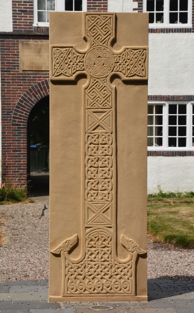
Forteviot Cross submitted by Anne T on 25th Jul 2018. The front of this modern Pictish cross slab, only unveiled in mid-March this year.
(View photo, vote or add a comment)
Log Text: Modern Pictish Cross Slab, Forteviot: Having been spooked by the Maggie Wall Memorial and disappointed at not being able to get into Forteviot parish church (St. Andrews), the lady gardener told us to walk down the road to look at the new cross slab that had just been erected.
Just behind the bus-stop, and in front of a charming courtyard of whitewashed houses, we found out later this cross had been erected only on either 17th or 18th March 2018, so very new.
The lady gardener told us there were some leaflets ‘in the bus stop’ and indeed there were several tucked underneath the bus timetable board. The cross was carved by David McGovern, of Monikierockart for the 2017 Tay Landscape Partnership project. “In the form of a Pictish Cross Slab, the new cross celebrates Forteviot’s status as an early Christian site and its association with King Cinead mac Alpin. The Pictish stone fragments that inspired the cross design can also be visited across the road in St Andrew’s Church (when open).” The leaflet also gives a guide to the patterns on the cross.
Four Stones (Powys)
Trip No.168 Entry No.3 Date Added: 3rd Aug 2021
Site Type: Stone Circle
Country: Wales (Powys)
Visited: Yes on 14th Aug 2021. My rating: Condition 3 Access 4
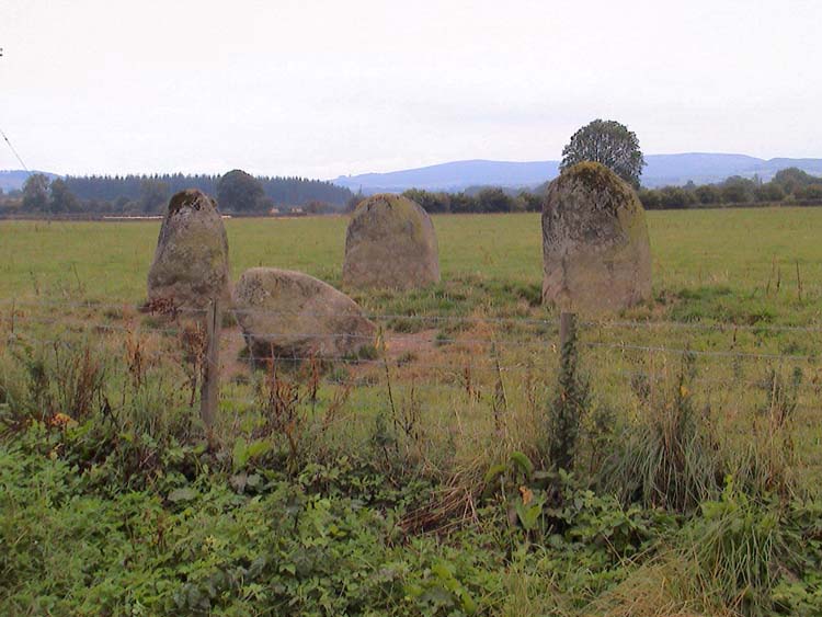
Four Stones (Powys) submitted by vicky on 13th Sep 2002. The Four Stones Stone Circle in Powys. Photo taken by Cassian Hall.
(View photo, vote or add a comment)
Log Text: Four Stones (Powys): Well worth the stop to see this four-poster. We parked at SO 24562 60871, opposite a small, but complicated road junction, where there was plenty of room for tractors and cars to pass, and walked back to the field.
My first reaction was: "Is this the right place?" on walking into the field, because the grass and weeds were so high, but walking towards the stones, the grass around them had been partly mowed, mostly trodden down by other visitors.
Starting at the southern-most stone, I photographed them all from different angles, in an anti-clockwise direction. Didn't spot any cup marks, but then the grass was still pretty tall around the base of each stone.
Four Stones Hill Standing Stones
Trip No.15 Entry No.3 Date Added: 3rd Apr 2017
Site Type: Standing Stones
Country: England (Cumbria)
Visited: Couldn't find on 2nd Apr 2017. My rating: Access 3
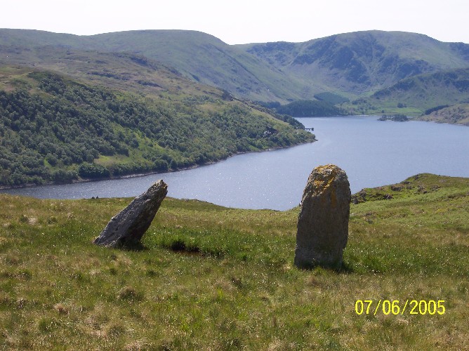
Four Stones Hill Standing Stones submitted by donstobbart on 11th Jun 2005. I have to agree with Nicoladidsbury that I did not feel any ambience when I visited this site. But I did get a great view of the lake!
(View photo, vote or add a comment)
Log Text: Four Stones Hill, Haweswater: Ashamed to say I was defeated by the large stiles with big drops and missing steps. Was so looking forward to going to see this site and from Google Earth, it seemed possible for me to walk this route. Did look for gates in the fields to avoid the stiles, but up by Lower Drybarrows, couldn't find any entry/exits; the one there was said very clearly "no public right of way". Perhaps I should have ignored those and tramped through the fields anyway, but it would have left me feeling guilty. Will try again. Note to self: parking was very difficult up by Winder Hill. Needed to wedge the car in besides a stone wall to leave ready access to the fields.
Fowberry Park B
Date Added: 19th Aug 2014
Site Type: Rock Art
Country: England (Northumberland)
Visited: Yes on 17th Aug 2014. My rating: Condition 3 Ambience 5 Access 4

Fowberry Park E submitted by durhamnature on 2nd Sep 2012. Rock art, discovered in 1886 from Berwickshire Naturalists, via Archive.org.
(View photo, vote or add a comment)
Log Text: Having been disappointed at not being able to reach the Doddington Stone Cricle from the footpaths across the golf course (they seem to have vanished with an extension to the quarry) we were determined not to head home without having seen something. We spotted a number of other cup and ring marked rocks on the map around Fowberry Park, and headed for the easiest to find – opposite Fowberry Mains Farm.
There was sufficient room to park on the grass verge at the entrance to the footpath, and it was an easy walk up a slight hill, following a stone wall to the left. When we’d almost reached a field boundary to our right, there was a field gateway to the left giving access to outcrops of rock.
We thought we’d have to walk backwards to find our way around a spring, but the farmer has built a path over the small stream and the boggy part of the field, leading to a rocky outcrop immediately to the left on the far side of the stream. This outcrop did not appear to have any rock art.
Following the footpath up the slope to our right, we immediately came upon another, larger, outcrop, and the rock art sprang into view. I’d rate this as highly as the rock art stone at Roughting Linn.
The outcrop has been heavily quarried, but what is left is wonderful. The first set of cup marks we came across appear to have been painted in red ochre, although there seemed to be this red pigment on other parts of the rock, too.
Most astonishing was the long, almost grave-cover shaped rock covered in miniature marks in a row; on closer observation, the marks turned around the end of the rock, forming a tall, narrow U shape. I’ve not seen this formation of marks before.
There were other smaller rocks, buried in the turf, complete with rock art markings, too. The English Rock Art site records 8 different panels, and I’ve since printed off the images of each, together with the grid references (oh, for a GPS system to help!). I’m looking forward to going back to explore more.
Continuing up the hill towards Fowberry Moor, there is a homestead and a settlement. As it was blowing a gale, with gusts of 50 mph and possibly above, we didn’t linger too long. The map shows many other cup and ring marked rocks in the surrounding area, and
Most very definitely worth a second, third and possibly more trips to discover the richness of artefacts in this area.
Galabraes
Trip No.49 Entry No.1 Date Added: 5th Oct 2017
Site Type: Standing Stone (Menhir)
Country: Scotland (West Lothian)
Visited: Yes on 22nd Sep 2017. My rating: Condition 3 Ambience 4 Access 4
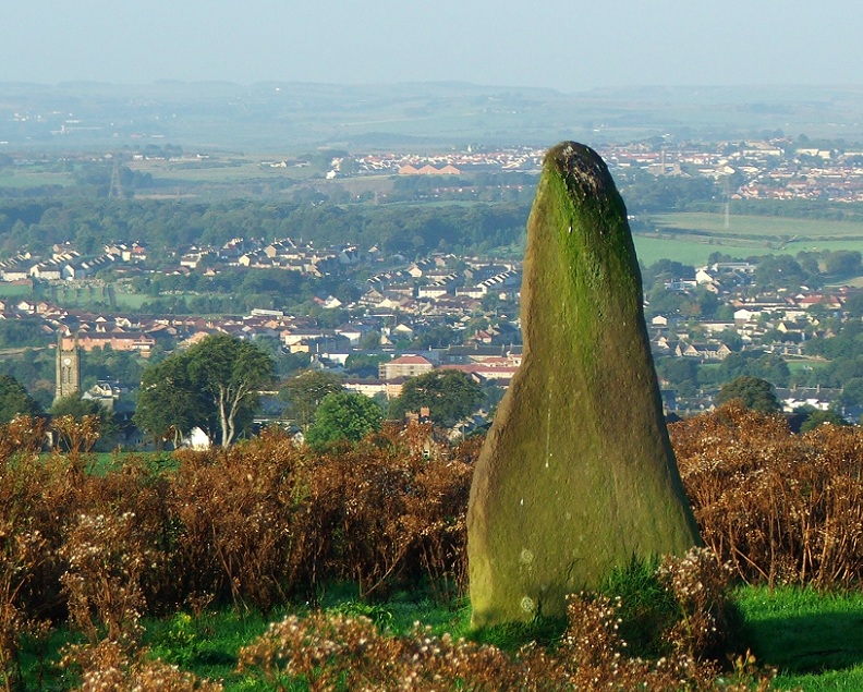
Galabraes submitted by postman on 11th Nov 2012. Site in West Lothian Scotland
Galabraes standing stone, it's not far from Cairnpapple and very close to the road, how com no-ones posted on here before
(View photo, vote or add a comment)
Log Text: Gala Braes Standing Stones, Bathgate: We drove up and down the road, but couldn’t see a gate into the field along either from the ‘main’ road (Drumcross Road) or the side road running north-south up to Cairnpapple Hill, so we ended up clambering over an almost demolished stone wall and squeezing through the wire fencing. There was a big (very unfriendly looking) bull in the field just below the western end of the ridge, who stood his ground and kept looking at us, so we didn’t dare approach the other small knoll where the other stone (B) should have been located.
As we were leaving, I spotted some old boundary features to the south of the standing stone so was photographing these, when I heard some cawing behind me. Looking up, a large crow was sitting on the standing stone, bobbing up and down. Eerie!
Galilee Well
Trip No.20 Entry No.1 Date Added: 1st May 2017
Site Type: Holy Well or Sacred Spring
Country: England (County Durham)
Visited: Yes on 30th Apr 2017. My rating: Condition 4 Ambience 4 Access 4
Galilee Well submitted by durhamnature on 24th Sep 2012. The Galilee Well
Site in County Durham England
(View photo, vote or add a comment)
Log Text: Galilee Well, Durham Cathedral: We arrived at the Cathedral only to find large marquees on the lawn outside, lots and lots of heavy duty cable laid neatly across the lawn. The west walls had been cordoned off with iron railing with filming equipment piled behind.
We decided to go to the café for tea and a sandwich then asked the guides at the desk where the well was and if we could access it. The lady who replied told us “there’s a really big event on at the cathedral; it’s only just been put on the web site. Even we aren’t allowed to go down there.” Helpful.
I remembered years ago walking up to the cathedral from the bridge on Silver Street, an old entrance tucked between two buildings, labelled the old Pilgrims Way up to the cathedral. We walked down into the town, found the entrance and followed the steps up the hill only to find out the path has been blocked off part way through. Retracing our steps, we found the riverside footpath which runs between Café Rouge and Geek Squad/9 altars café on the southern side of the river, at NZ 27282 42419. This path, high above the river, leads directly to the bottom of the west walls and the Galilee Well.
There is no information on this well on Pastscape, or in the cathedral notes for the Gaililee Chapel which must be immediately the other side of these enormous walls.
As the footpath is relatively narrow and has a steep drop down to the river Wear below, it was interesting to get a full face on photograph. The drop from the well into the water below is at least a couple of metres. There was no water flow at the time of our visit. Whilst standing on the path, I noticed a shelf of flat stones poking out of the bank very slightly. Whilst looking back up at the well from St. Cuthbert’s Well below, I noticed what looked like a cast iron bowl poking out of the sheer cliff. Is this associated with the Galilee Well? A pretty inaccessible place!
There is some information on the wells in Durham on the 'Ancient, Healing and Holy Wells of County Durham' by Laurence Hunt which we found useful in giving directions and information.
