Contributory members are able to log private notes and comments about each site
Sites Anne T has logged. View this log as a table or view the most recent logs from everyone
Bottesford Cross
Trip No.121 Entry No.6 Date Added: 19th Mar 2019
Site Type: Ancient Cross
Country: England (Leicestershire and Rutland)
Visited: Yes on 17th Mar 2019. My rating: Condition 3 Ambience 3 Access 5
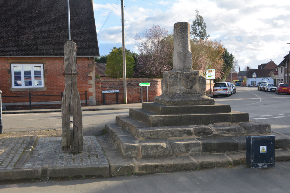
Bottesford Cross submitted by Anne T on 19th Mar 2019. Market Cross in Leicestershire and Rutland England. Looking east across the market cross and the remains of the stocks and whipping post, down Grantham Road.
(View photo, vote or add a comment)
Log Text: Market Cross, Bottesford: We saw this purely by chance as we turned down the road heading north towards the A1 and home, and stopped to take photographs. The village stocks and whipping post were right next to the cross, which was placed on top of five steps, the top two of which are modern repairs.
King's Norton
Trip No.78 Entry No.3 Date Added: 25th Jun 2018
Site Type: Holy Well or Sacred Spring
Country: England (Leicestershire and Rutland)
Visited: Yes on 24th Jun 2018. My rating: Condition 3 Ambience 3 Access 5

King's Norton submitted by enkidu41 on 31st Aug 2004.
(View photo, vote or add a comment)
Log Text: Well, St John The Baptist, King's Norton: This is a very posh village, with very large houses. We parked by the tiny little village green just to the west of the church, almost next to the well, which is low down in the western churchyard wall.
Someone has been refurbishing the well, and recently, as there is a fresh footprint or two in the sand now forming the bottom of the well pool.
The church is relatively modern, a plaque next to the gate describing it as ‘Georgian Gothic’. The churchyard is relatively small, and not much to see in it, apart from a huge memorial right up against the exterior eastern wall. The church itself was locked, although a name/phone number was given to collect the keys from, but we weren’t interested enough to go inside.
Pastscape describes this well as a ‘horsetrough’. Whilst the well was very dry at the time of our visit, there is no sign within the churchyard (or the neighbouring house) as to where the source of the water comes from, although the top of the ground is at least 2m higher behind the well.
St Michael's Church (Illston On The Hill)
Trip No.78 Entry No.2 Date Added: 25th Jun 2018
Site Type: Ancient Cross
Country: England (Leicestershire and Rutland)
Visited: Yes on 24th Jun 2018. My rating: Condition 3 Ambience 4 Access 5

St Michael's Church (Illston On The Hill) submitted by Anne T on 25th Jun 2018. Close up of the socket stone and remains of cross shaft, looking towards the south porch from the southern edge of the churchyard, next to Main Street.
(View photo, vote or add a comment)
Log Text: St. Michael's Church, Illston on the Hill: This was our first port of call on the Sunday afternoon, on a brilliantly sunny day with blue skies and very hot. Although we probably could have walked here with the dog from Billesdon, I certainly wasn’t feeling up to a long walk today, and was very grateful that the cross was only just off the road.
A very pretty little church, which seemed larger on the inside than the out. The inside of the church wasn’t particularly interesting, apart from a very unusual set of steps that ran up to the top of the rood, from just behind the pulpit.
The cross was unusual, with the socket stone being set straight into the ground (no base or steps) and the remains of the cross shaft set diagonally into the socket. The shaft also had rolled-moulded edges. Also unusual was that it was set almost directly against three large gravestones which loomed above it.
St John The Baptist (Rolleston)
Trip No.78 Entry No.4 Date Added: 26th Jun 2018
Site Type: Ancient Cross
Country: England (Leicestershire and Rutland)
Visited: Yes on 24th Jun 2018. My rating: Condition 3 Ambience 3 Access 4

St John The Baptist (Rolleston) submitted by Anne T on 26th Jun 2018. Site in Leicestershire and Rutland England. The floriated cross head looks more modern than the worn capital underneath.
(View photo, vote or add a comment)
Log Text: Churchyard Cross, St John The Baptist, Rolleston: Apart from one sign post on the road by the church in Skeffington, this exclusive hamlet may well not exist. The road is gated (at least 3 gates), the roads are very narrow, and at the junction of the road and the bridlepath down to the church, there are a number of ‘no parking’ signs. This meant our daughter-in-law-to-be had to drop us off and drive some distance away, then collect us afterwards.
There is a small iron gate into the churchyard. This appears to be the only entrance, as the road at the eastern end of the church is labelled ‘private’. Eventually managing to open the gate into the church, we found the cross at the south eastern corner of the church, almost hidden in the shadows of the trees. It looked as if the owner of the modern house had incorporated this part of the churchyard into their private garden, so we very much felt like we were trespassing and expected someone to come out of the house and shout at us to ‘move on’.
Due to the heavy shadows and bright sunlight, it was a little difficult to photograph this cross. There appears to be a difference of opinion between Historic England and Pastscape as to the date of this cross – HE says 14th century; Pastscape 17th. The socket stone was marginally intriguing as it had a small hole in each side, presumably to drain any water away.
Making our way back along the gated road to civilisation, we stopped by the stream to let the dog paddle.
St Bartholomew (Sproxton)
Trip No.121 Entry No.3 Date Added: 19th Mar 2019
Site Type: Ancient Cross
Country: England (Leicestershire and Rutland)
Visited: Yes on 17th Mar 2019. My rating: Condition 3 Ambience 4 Access 4

St Bartholomew (Sproxton) submitted by Anne T on 19th Mar 2019. Anglo Scandinavian Cross in Leicestershire and Rutland England. This is some of the detailed work on the northern, narrow, face of the cross.
(View photo, vote or add a comment)
Log Text: Sproxton Cross, St Bartholomew's Church: This church was a little way out of the village and we parked in a small metalled area next to a 'gallop' at SK 85667 24972 and braved the wind to walk back down the road to the gate into the churchyard.
The vicar had previously told us the cross had been moved inside the church, but looking after 11 churches in total, he must have been confused, because as soon as we rounded the west end of the church to reach the entrance through the south porch, the cross came into sight. What is inside the church is an 11th century cross slab/grave marker.
This is a very quiet spot, apart from the occasional car that came hurtling past.
The inside of the church appears relatively modern, but has some really interesting corbels. We also found a portion of carving, either part of a fluted column, or cemented to it, next to the north western side of the door into the tower.
We did have a good scout around for the shaped stone in the south western wall mentioned by The Journal of Antiquities, but were unable to find it.
In the field to the south of the church is a well, but could find no mention of this on Pastscape or Historic England.
All Saints (Asfordby)
Trip No.121 Entry No.1 Date Added: 24th Mar 2019
Site Type: Ancient Cross
Country: England (Leicestershire and Rutland)
Visited: Yes on 17th Mar 2019. My rating: Condition 3 Ambience 4 Access 4
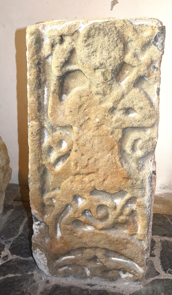
All Saints (Asfordby) submitted by Anne T on 19th Mar 2019. Anglo Saxon cross shaft fragments in Leicestershire and Rutland England. This is the figure 'giving a blessing' on the front of the central of the three fragments. Whilst in the church we debated whether the figure was holding a cross or an axe in its left hand. I favoured an axe, but given where it was, the preferred thinking is that it is a cross!
(View photo, vote or add a comment)
Log Text: All Saints, Asfordby: The church is usually open on Saturdays between 2pm and 4pm, but we were fortunate because there was a service here today, from 10.30am until 11.30am, so we arrived as close as we could to the finish time of the service (which, because we got lost, was 12 noon). The congregation was having coffee and biscuits, but made us hugely welcome – even our son and DIL’s Labrador was allowed into the church and made a fuss of. The vicar had very kindly made arrangements for us to meet the Secretary and Historian of the church, who warmly welcomed us, introduced us to the Curate, and showed us round the church.
All Saints is very obviously a vibrant, active church, and the building is well used for community activities, which is lovely to see.
Miriam, the historian, very kindly showed us the three Anglo Saxon stones cemented into the far south western corner of the nave, with members of the congregation very kindly re-arranging tables and chairs for us to have easier access.
I came prepared with a list of features I really wanted to see, including the rare Tudor painted bench end (next to a pillar just to the east at the north western corner of the nave), the Green Man (on a boss high up in the middle of the nave) and Norman aumbry (in the northern wall at the north eastern corner of the nave) with its original Norman chevrons. Miriam also pointed out a ‘ladder’ (stairway to heaven) on the pillar at the north eastern side of the nave, and pilgrim crosses and what looked like a scratch sundial on the external western side of the door frame into the church.
I really could have spent a lot longer in the church, as it had a lovely, calm, reflective atmosphere and would love to attend a service here.
St Michael and All Angels (Harston)
Trip No.121 Entry No.4 Date Added: 19th Mar 2019
Site Type: Ancient Cross
Country: England (Leicestershire and Rutland)
Visited: Yes on 17th Mar 2019. My rating: Condition 3 Ambience 3 Access 4
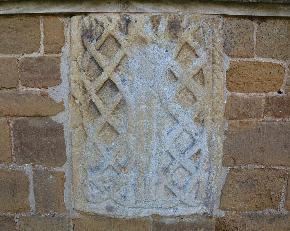
St Michael and All Angels (Harston) submitted by Anne T on 19th Mar 2019. Ancient cross in Leicestershire and Rutland England. This is the fragment of Anglo Saxon stone embedded in the exterior east wall of the church, immediately underneath the east window. Prof. Rosemary Cramp in her paper "New Directions in the study of Anglo Saxon Sculpture" (page 4) describes this as part of a grave cover.
(View photo, vote or add a comment)
Log Text: Anglo Saxon cross fragments, St Michael and All Angels, Harston: Before visiting, I wasn’t able to find out much about the church or the AS stone fragments. I was hoping for a church guide book, but there was nothing. There were newspaper articles and photos of the bell tower and the bells displayed in the bell tower, but nothing was made of the fragments – one in the external east wall, and another in the south porch. Pastscape mentions that the stone in the east wall is possibly part of a cross shaft
The church looks very appealing from the outside, being made of warm, yellow stone. Inside it is very Victorian. The only thing of any age appeared to be the stem of the font.
Nice to have been able to drop by and photograph the fragments.
St Peter's Church (Redmile)
Trip No.121 Entry No.5 Date Added: 19th Mar 2019
Site Type: Early Christian Sculptured Stone
Country: England (Leicestershire and Rutland)
Visited: Yes on 17th Mar 2019. My rating: Condition 3 Ambience 3 Access 4
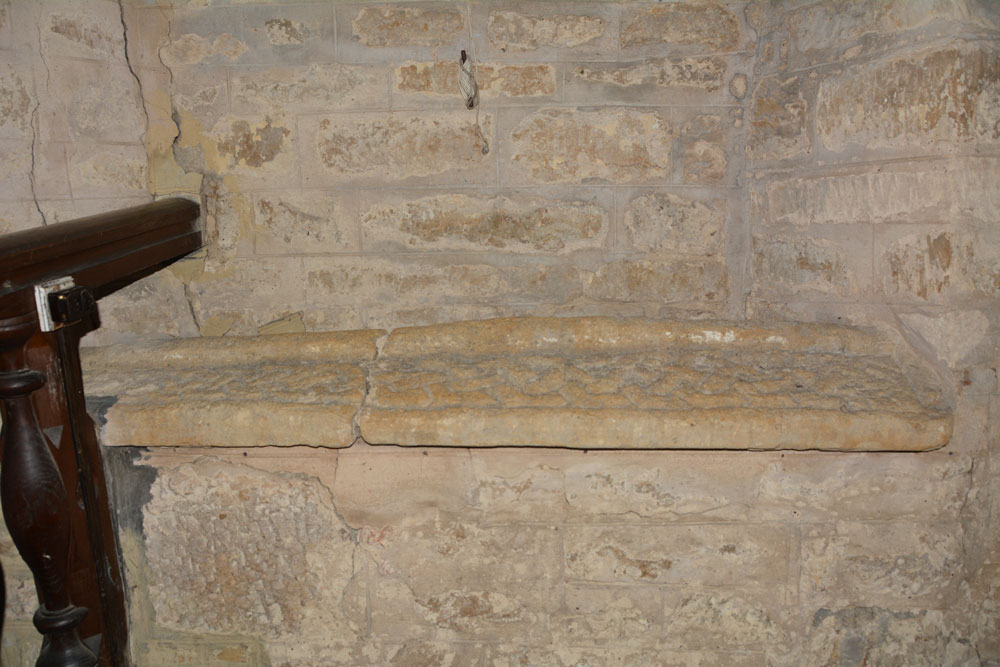
St Peter's Church (Redmile) submitted by Anne T on 19th Mar 2019. Anglo Saxon Carved Stone in Leicestershire and Rutland England. The carved stone, now reused as a windowsill.
(View photo, vote or add a comment)
Log Text: Carved Anglo Saxon Stone, St Peter's Church, Redmile: Our last planned visit before heading off home, and this church didn't disappoint, despite being greeted by "Warning. Falling Masonry" signs on entering the church through the south door! The north western part of the nave was cordoned off, with similar notices.
No two walls of this church were plumb, and the cracking in the north wall was quite spectacular. However, the atmosphere of the church was warm and friendly, and we felt relatively safe knowing there had been a service there only that morning.
We found the stone, reused as a windowsill, easily enough. Placed under a window by the pulpit, it proved a little tricky to photograph, and I could have done with a ladder to photograph all of it from above.
I also spotted what could have been what looked like another fragment in the south wall of the church, and Andrew found 'witches marks' on the eastern external jamb of the south porch.
Rothley Cross
Date Added: 20th Mar 2019
Site Type: Ancient Cross
Country: England (Leicestershire and Rutland)
Visited: Yes on 17th Mar 2019. My rating: Condition 3 Ambience 4 Access 4
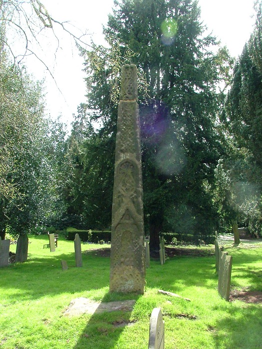
Rothley Cross submitted by gautrek on 20th Apr 2005. An Anglo-Saxon cross dating from the mid ninth century. It is 9ft high.it can be found in the grounds of St Mary and St John the Baptist church in Rothley.OS map (Charnwood,O.S.129, SK586126)
(View photo, vote or add a comment)
Log Text: The Rothley Cross, Leicestershire: The church is usually kept locked, but we had arranged to pick up a key from the Parish Office mid-afternoon. However, calling at the office, there was no reply. Walking back to the church, I spoke to a lady who had been busy clearing the churchyard of broken branches, and she told us the administrator had gone home ill. However, fortuitously, she had a key to the vestry and very kindly let us in.
The church has a long history, and has some amazing grave slabs and a Norman font. The bases of the pillars are said to date to the original Norman church. We found a cross scratched into one of the pillars.
The Rothley Cross is to be found to the south east of the church, near some tall yew trees. At the time of our visit, the cross was in deep shade, although the worn carving was still visible.
We also spotted an unsual carved mark - much more ornate than a mason's mark on the external western jamb of the vestry door.
St Mary and St Hardulf (Breedon on the Hill)
Trip No.120 Entry No.1 Date Added: 20th Mar 2019
Site Type: Ancient Cross
Country: England (Leicestershire and Rutland)
Visited: Yes on 15th Mar 2019. My rating: Condition 3 Ambience 5 Access 4
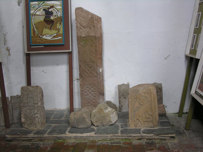
St Mary and St Hardulf (Breedon on the Hill) submitted by TimPrevett on 23rd Sep 2007. Just some of the Saxon stones in Breedon on the Hill church. Visit for yourself to take in the many stones incorporated into the fabric!
(View photo, vote or add a comment)
Log Text: St Mary & St Hardulph, Breedon on the Hill: This church is visible from miles around, perched on top of its hill, which used to be an Iron Age hillfort (The Bulwarks). Most of the fortifications have been quarried away, and at the eastern side of the church there is a steep drop down into a large quarry, protected by a substantial metal fence and barbed wire. This is also the site of a beacon.
We arrived on a day when there was a weather warning for high winds, and my goodness, the winds were high. Other walkers were sitting in their cars in the small car park at the viewpoint, whilst we struggled to open the car doors and braved the winds to walk up to the south porch to let ourselves into the church! I am glad I had my husband with me, as the wind made the outer porch door rattle badly and it sounded as if a group of people were standing just outside the door having a muffled conversation. Very spooky, although the atmosphere in the church was friendly and welcoming, and I could have spent several more hours here.
There is a church guide with a plan of the stones, but not all of them are included individually. I went armed with a copy of A W Clapham's paper "The Carved Stones at Breedon on the Hill, Leicestershire, and their position in the History of English Art". I had problems linking his descriptions with the actual stones, so ended up making my own drawing and labelling the stones and photo numbers, so it was easier to 'unpick' once I was at home.
I could have spent at least several more hours here, but time was pressing, and I left reluctantly, to brave the wind yet again!
Todley Hill Mound (Great Whittingham)
Trip No.92 Entry No.2 Date Added: 21st Aug 2018
Site Type: Misc. Earthwork
Country: England (Northamptonshire)
Visited: Yes on 21st Aug 2018. My rating: Condition 3 Ambience 4 Access 4
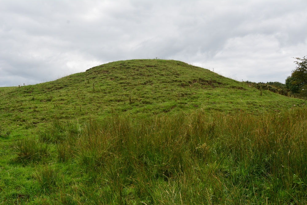
Todley Hill Mound (Great Whittingham) submitted by Anne T on 21st Aug 2018. Standing by the small ford across the stream to the north of the mound, looking south as the mound rises high above us.
(View photo, vote or add a comment)
Log Text: Todley Hill Mound, near Great Whittingham: Walking back to the car, we saw a couple of vans with trailers belonging to the farmers, and I was looking for someone to ask permission to enter the field to see the mound, but whilst the trailer doors were left wide open, no people were visible. There was a gate into the field at NY 99675 71602, almost opposite where we’d parked the car, but there was a stream in the way. We opted to drive further back up the road, and parked at NY 99488 71218, where the road widens out into a large field entrance and dump for roadstone.
The gate into the field had been chained shut, so we walked back down the road and found part of the fence we could hop over.
This is a large mound, in a pretty spot with a small stream to its northern side. There appeared to be a large earth-fast boulder towards its south western side, with smaller boulders surrounding it, but the latter had been broken and were probably field clearance.
Walking round the mound, it appeared to us to have vague traces of a kerb with boulders/stones poking through, mainly on its southern and eastern sides.
This mound/tumulus/barrow is right on the old Roman Road, the Devil’s Causeway, jus to the east of where this cuts the modern road. The vague remains of an edge of this road can be seen (possibly) in the field opposite, to the south of the small stream (or it maybe modern uplift from dredging the stream).
This really had the feel of a barrow to me, and I enjoyed walking round it.
Swinburne Stone
Date Added: 15th Jun 2014
Site Type: Standing Stone (Menhir)
Country: England (Northumberland)
Visited: Yes on 13th Jun 2014. My rating: Condition 3 Ambience 4 Access 4
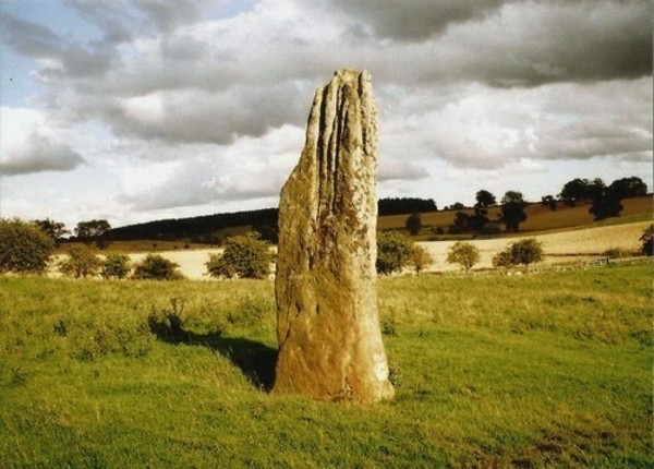
Swinburne Stone submitted by Bladup on 30th Dec 2013. The lovely tall and slender Swinburn Castle standing stone.
(View photo, vote or add a comment)
Log Text: We sought the landowner's permission prior to visiting the stone. We parked outside the Roman Catholic Church at Ox Hills, and walked back to the footpath leading firstly to Swinburne Castle, then splitting off to the left at a large tree to tumuli and the standing stone.
The footpath is easy walking. Almost immediately to the left are some impressive earthworks (possibly related to the original castle?) and some large terraces - much bigger than normal ridge and furrow ploughing. Websites from local historians say these may be medieval strip lynchets.
We first visited the tumuli just before a gate/field boundary crosses the path, before doubling back to the gate which allowed access to the field with the stone (there being sunken stone walls between the footpath and the field boundary, presumably allowing views of the stone from the upper floors of the castle (now private house).
The stone isn't visible from the footpath, but as soon as you top the brow of a small hill, the stone stands below you in the middle of the field.
The stone is impressive, being around 12 feet tall, and if the compass on my phone is correct (it switched 180 degrees several times during my visit) the wider faces are orientated north-north-west/south-south-east.
The southern face of the stone has some easily identifiable cup marks; generally there are quite a few initials carved into the stone.
There are also a couple of other tumuli, which are in private fields, but this is beautiful and peaceful part of the countryside, and we spent a very pleasant afternoon exploring.
Matfen
Date Added: 16th Jun 2014
Site Type: Standing Stone (Menhir)
Country: England (Northumberland)
Visited: Yes on 15th Jun 2014. My rating: Condition 3 Ambience 3 Access 5
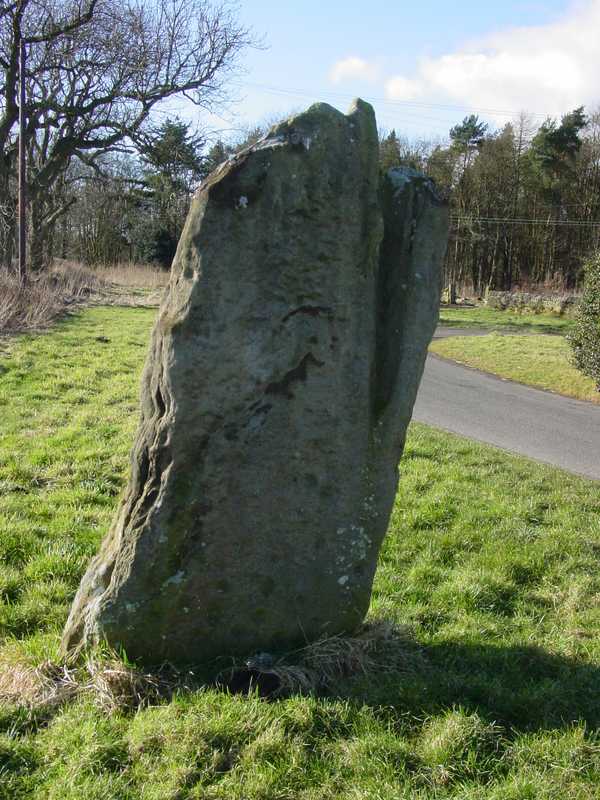
Matfen submitted by PaulH on 2nd Mar 2003. In the village of Matfen. About 2km north of the B6318, the modern road that follows the course of Hadrian's wall.
NZ032705
(View photo, vote or add a comment)
Log Text: This standing stone, near Matfen Hall Hotel/Golf Course, stands on the edge of a road in a hamlet called 'Standing Stone'. It is easy to find, being on a right hand turn just before the main entrance to Matfen Hall Golf Course, and opposite Standing Stone House, about 100 yards from the road junction.
It is difficult to park adjacent to the stone, unless you park in the entrance to the farm/farm buildings, but just opposite the road junction to Standing Stone hamlet, there is another left hand turn with room for a few cars to park at the side of the junction.
The short walk back to the stone was a little difficult, due to the stream of traffic and bicycles moving quickly along the road, but as long as you are careful, it's fine.
There are some impressive cup marks at the base of the north face of the stone, and some more at the top.
Worth seeing, and on the way to The Warrior Stone at Inghoe and Bygate Hill.
Warrior Stone (Ingoe)
Date Added: 16th Jun 2014
Site Type: Standing Stone (Menhir)
Country: England (Northumberland)
Visited: Yes on 15th Jun 2014. My rating: Condition 3 Ambience 4 Access 4
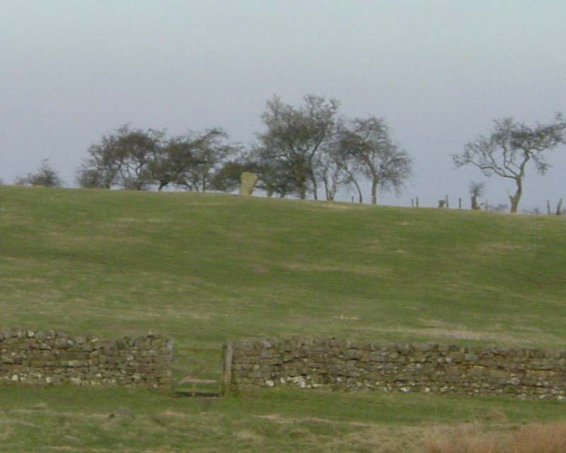
Warrior Stone (Ingoe) submitted by PaulH on 3rd Mar 2003. Northumberland
NZ044747
No public access to the stone itself
(View photo, vote or add a comment)
Log Text: We've visited Inghoe before, but to look at the remains of the medieval village and also the hut circles just beyond Sandyway Heads Farm.
Having just visited the Matfen Standing Stone, and having tried to visit the Bygate Hill site (which is a private plantation with a telecommunications mast and permission is needed to access the site), it was only a few more miles to the Warrior Stone. We parked just past the 'village green' (with a bus stop) and walked along the farm track. We were last here about 5 years ago, and the friendly farmer came out to tell us about the homestead in the field beyond the farm, showed us the cup and ring stone and quern stone by the gate to his cottage, and gave us permission to visit the Warrior Stone, which stands alone in a field just before the farm cottage. There was no-one around this time to ask permission, so I felt guilty about walking into his field.
There are beautiful views across the valley towards Matfen and Stamfordham, even though it was drizzly and misty.
A couple of web sites by local antiquarians describe cup marks on the stone, but I wasn't sure if we'd identified the right marks.
Will go back again when we've got blue skies to appreciate the site in all it's glory.
Brecken Hills
Date Added: 2nd Jul 2014
Site Type: Hillfort
Country: England (Northumberland)
Visited: Yes on 13th Jun 2014. My rating: Condition 2 Ambience 4 Access 4
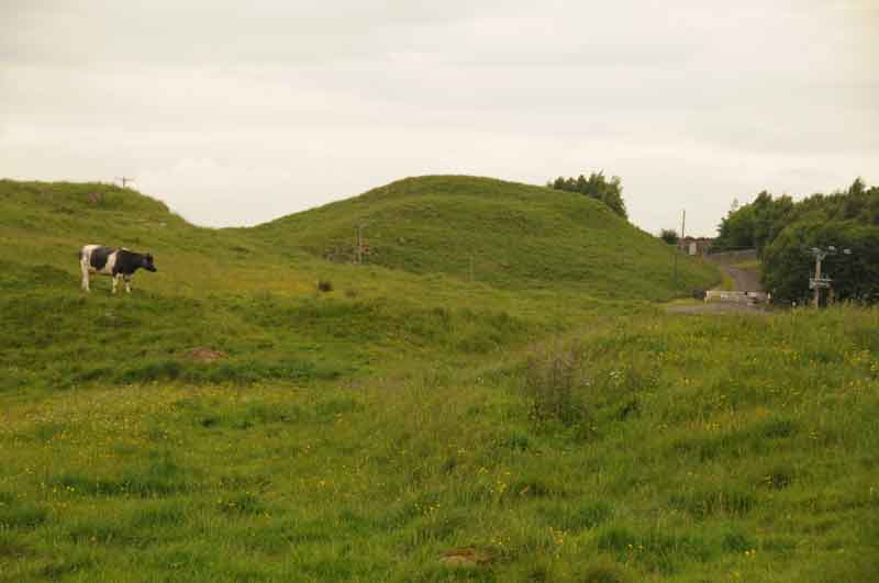
Brecken Hills submitted by Anne T on 17th Jun 2014. Photograph of Blue Crags/Brecken Hills Hillfort taken from gateway at southern edge of site.
(View photo, vote or add a comment)
Log Text: We know this site as 'Blue Crags Hillfort', rather than 'Brecken Hills', so both names are in use. The English Heritage Schedule describes Blue Crags Hillfort as a 'defended settlement of Iron Age/Romano-British date'. It makes excellent use of an existing outcrop of rock (whinstone, from the official records) as part of the defences, and there are very clear ramparts/defensive earthworks on the east, west and south sides of the site, with the main entrance appearing to be to the south west.
We originally went to look at the wells in Colwell (Pricky's well and Coley's Well), but spotted the extensive earthworks of the hillfort marked on the Ordnance Survey map just north west of Colwell, and went to take a look. Blue Crags is situated to the east of the course of Dere Street, with the A68 running between the hillfort and Dere Street.
There is a marked footpath running up to the fort from the west of Colwell, although the visible route vanishes when it reaches the field immediately south of the site, so we followed a vague track through the grass to a large barn which sits at the southern most edge of the hillfort.
The hillfort itself is impressively large and imposing as you walk up to it, as it sits on a hill above you. There is a further footpath that runs north west towards woodland, which would give a superb view of the fort and the outcrop on which it sits, but there were several large bulls, together with cows and their calves in this field, so we trod gingerly trying to get the best photographs from the area around the field entrance to illustrate the site.
On returning home, I logged onto the UK Grid Finder website. The aerial views show about 12 very clear hut circles on the platform of the fort. I will certainly go back in the autumn/early winter to have a closer look.
Roughting Linn Rock Art
Date Added: 20th Jun 2014
Site Type: Rock Art
Country: England (Northumberland)
Visited: Yes on 20th May 2014
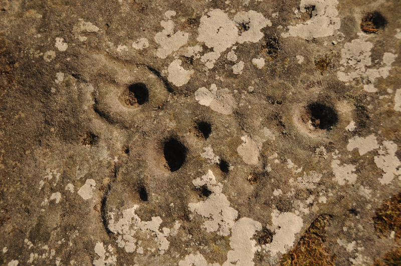
Roughting Linn Rock Art submitted by Anne T on 20th May 2014. Close up of some of the marks on the Roughting Linn outcrop.
(View photo, vote or add a comment)
Log Text: None
Middleton Standing Stone (Northumberland)
Date Added: 20th Jun 2014
Site Type: Standing Stone (Menhir)
Country: England (Northumberland)
Visited: Yes on 27th May 2014
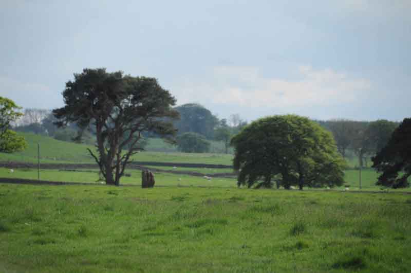
Middleton Standing Stone (Northumberland) submitted by Anne T on 27th May 2014. Middleton Standing Stone in the context of the landscape, looking towards the south west.
(View photo, vote or add a comment)
Log Text: None
Meg's Well, Aydon
Date Added: 20th Jun 2014
Site Type: Holy Well or Sacred Spring
Country: England (Northumberland)
Visited: Yes on 28th May 2014
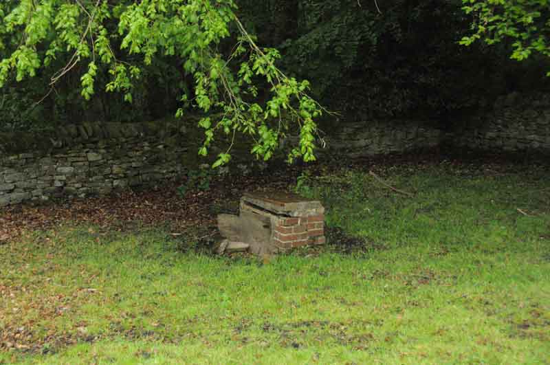
Meg's Well, Aydon submitted by Anne T on 28th May 2014. This is a view of Meg's Well from the road through the village, just below Aydon Cottage, adjacent to the footpath running towards Aydon Castle. The field appears to be private, and when we visited was full of livestock, so there's no direct access. I wouldn't have recognised the well without having already seen an image on the Megalithic Portal (so thank you!). There are no signposts to the well, and the site is very sadly neglected. I haven't been able to find much about the history of the ...
(View photo, vote or add a comment)
Log Text: None
Bow Bridge Homestead
Date Added: 20th Jun 2014
Site Type: Ancient Village or Settlement
Country: England (Northumberland)
Visited: Yes on 28th May 2014
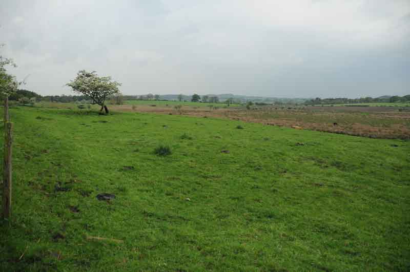
Bow Bridge Homestead submitted by Anne T on 28th May 2014. Image of Bow Bridge Settlement, near Aydon, Northumberland, taken from the road. At the time of our visit, there was a very large bull with his ladies in the field, so I didn't venture nearer! You can see a very clear settlement platform, looking down onto Shildon Bog (right hand side of photograph). The settlement runs underneath the road. We had a quick look for signs on the opposite side of the road, but at first sight appears to have been ploughed out.
(View photo, vote or add a comment)
Log Text: None
Sidwood Iron Age Settlement
Date Added: 20th Jun 2014
Site Type: Ancient Village or Settlement
Country: England (Northumberland)
Visited: Yes on 11th Jun 2014
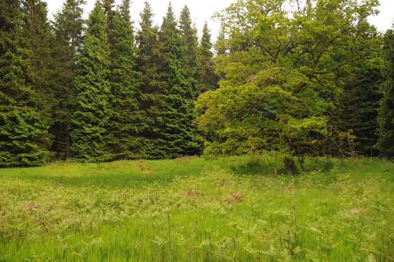
Sidwood Iron Age Settlement submitted by Anne T on 11th Jun 2014. This was our first view of the settlement, on the left hand side of the footpath from Tarset Burn. The site is in a forest clearing, demarked by an old tree which stands on its own.
The foundations of two hut circles are clearly visible through the grass and bracken, and the entrance (to the left hand middle of the photograph) and sunken yard are clearly identifiable.
(View photo, vote or add a comment)
Log Text: None
