Contributory members are able to log private notes and comments about each site
Sites Anne T has logged. View this log as a table or view the most recent logs from everyone
Torhouse North Cairn
Trip No.136 Entry No.11 Date Added: 26th Jun 2019
Site Type: Cairn
Country: Scotland (Dumfries and Galloway)
Visited: Yes on 17th Jun 2019. My rating: Condition -1 Ambience 3 Access 4
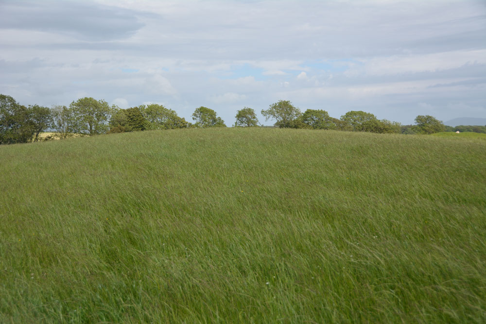
Torhouse North Cairn submitted by Anne T on 26th Jun 2019. Nothing to see now, but the site of the cairn, now destroyed, would have been at the top of the 'hump' of this natural knoll. The stone row is 200m to the north east and the stone circle 180m to the south.
(View photo, vote or add a comment)
Log Text: Torhouse North Cairn (now destroyed): Being so close to the stone row, the stone circle and other cairns, I was curious to see where this cairn might have been, and what views from it. From the Torhousekie North Side Cairn (to the left/west of the track – see above) we continued up the track for another 100m or so. The site of this cairn can be found at the top of a natural knoll with a view of the stone circle below.
There were no signs of the cairn (we looked around for any humps and hollows and stones at the top of the knoll but were unable to find anything), but took some photos showing where it would have been.
Using the zoom lens I took a couple of photos of the stone circle from just below the top of the knoll (see the Torhousekie Stone Circle entry).
Spittal Croft cairn
Trip No.136 Entry No.13 Date Added: 26th Jun 2019
Site Type: Cairn
Country: Scotland (Dumfries and Galloway)
Visited: Yes on 17th Jun 2019. My rating: Condition 2 Ambience 3 Access 4

Spittal Croft cairn submitted by PaulM on 30th Oct 2002. Spittal Croft cairn
This stoney cairn can be seen at NX35665800 just NE of a property called Spittal Croft (the cairn maybe called something different locally). It is located at a road junction. It is one of a cluster of monuments in the area including another cairn (White Cairn) a fort and a stone pair.
(View photo, vote or add a comment)
Log Text: Boreland Cairn: By this time of the afternoon (early evening) I was getting more than a little ‘cairned-out’ having seen, and still trying to make sense of, all those cairns at Torhousekie. But this was a lovely little cairn, complete with sheep warming themselves by the small piles of stones on top of the cairn.
With rain threatening and the dark clouds feeling as if they were virtually overhead, we walked some way up and down both sides of the road, both the B733 and the minor road running between the B733 and the B7052, but could find no gate into the field, so photographed the cairn as best I could from the dry stone wall.
We did go further up the road to find the standing stones and cairn at NX 3522 5808 and NX 3528 5819 (Canmore 62860 and 62849 respectively), but the field was jam-packed full of cattle.
Kirkmadrine Church Stones
Trip No.136 Entry No.14 Date Added: 26th Jun 2019
Site Type: Early Christian Sculptured Stone
Country: Scotland (Dumfries and Galloway)
Visited: Yes on 17th Jun 2019. My rating: Condition 3 Ambience 3 Access 4
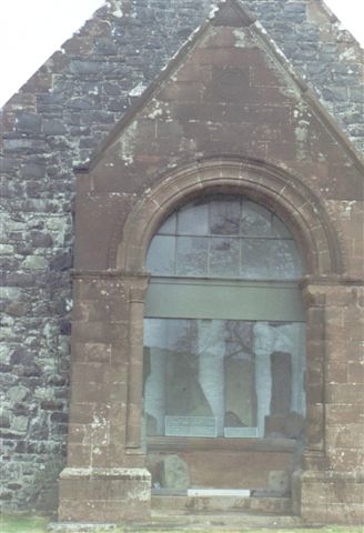
Kirkmadrine Church Stones submitted by cosmic on 15th Oct 2004. The glass frontage with stones behind
(View photo, vote or add a comment)
Log Text: Kirkmadrine Old Church & Early Christian Stones: Now this site I was so looking forward to seeing, but in some ways it was the most disappointing.
As we arrived at the foot of the grassy lane to the church, the heavens opened, and my, did it pour. Thankfully, we were sheltered to some extent by the trees on either side of the lane. Eventually, we came to the gate into the churchyard, with the cross on a mound to our right, and the church to our left.
The stones were displayed behind glass at the exterior western end of the church. To even see the stones we had to wipe the rain from the glass with a handkerchief. Unfortunately, raindrops had leaked behind the glass, affecting the clarity of our view of the stones. In addition, the light at this time of evening (around 5pm) was bouncing off the glass, and trying to photograph the most impressive, and oldest, stone at the back left hand side (northern) side of the display proved virtually impossible, despite the UV filter, because the reflections of the trees in the glass were too strong. I tried photographing from various angles, but to no real effect.
I went away really disappointed, as these stones are really impressive and I wanted to see more. I did contact Canmore with a photograph a week ago (today is 26th June) but have had no reply apart from an automatic acknowledgement of receiving my message.
Kirkcolm Cross
Trip No.137 Entry No.2 Date Added: 27th Jun 2019
Site Type: Ancient Cross
Country: Scotland (Dumfries and Galloway)
Visited: Yes on 18th Jun 2019. My rating: Condition 3 Ambience 3 Access 4
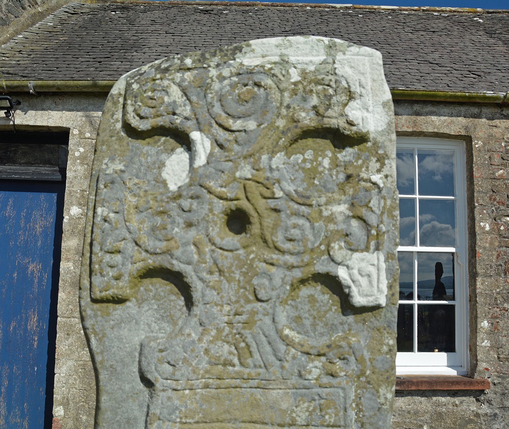
Kirkcolm Cross submitted by Anne T on 27th Jun 2019. The top panel of Face A of the Kirkholm Cross. Dr Craig describes it as "an ornate hammer-headed cross ... bordered by a roll moulding and filled with scroll work, with a sunken roundel at the centre". The cross stands 1.70m tall.
(View photo, vote or add a comment)
Log Text: Kirkcolm Cross: From the Knock & Maize standing stone we followed the minor roads across this peninsula until we reached the western shores of Loch Ryan, then drove north to Kirkcolm.
This cross slab has quite a complicated history of being sited in different locations (read the Canmore details below). The town has lovely views over Loch Ryan and Cairnryan ferry terminal.
The cross slab is now located in the external western corner of the south transept (although the building it stands next to looks more like an outhouse).
In the churchyard is an amazing statue of a woman with child clutching her. It looks as if she is a fisherwoman waiting for her man to come home. I guess she would have had views over Loch Ryan but the church building is in the way.
We did go in search of the original site of Kilmore Chapel and St Mary’s Well, to the south of Kirkcolm, but these appear to either be in a field next to a private house, now ploughed out, or partly in their very gated and (rightly so) private garden.
Culroy White Cairn
Trip No.138 Entry No.9 Date Added: 28th Jun 2019
Site Type: Cairn
Country: Scotland (Dumfries and Galloway)
Visited: Yes on 18th Jun 2019. My rating: Condition 2 Ambience 3 Access 4
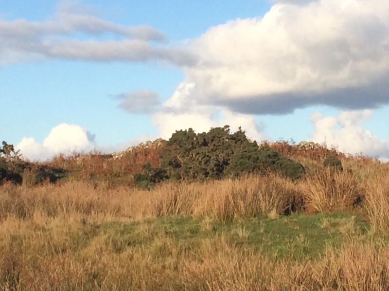
Culroy White Cairn submitted by markj99 on 21st Oct 2018. Culroy White Cairn as seen from the road
(View photo, vote or add a comment)
Log Text: Culroy White Cairn: The intention was to drive down this minor road, stopping to photograph three cairns to the south of the road on our way to Crouse. However, the road was very, very narrow with no marked passing places (just field entrances and the occasional driveway) and the stone walls were too tall to see over. All we could see in the end was one of these cairns and we could find no entrance/gate into the field, wo we contented ourselves with photographing the ones we could find.
We drove to where the minor road forks, just to the north west of a farm called Culroy. Taking the northern (left hand) fork, we parked on the short grass. This cairn is at the end of a quarried knoll, and not really obvious until you get up close to it, when the piles of white stones are clearly different from the quarried area around it.
We visited just after a period of dry weather; the ground in front of the cairn was covered in marsh grass, some areas still with small puddles, so wellies would be recommended after a rainy day or two (although you can always approach from the north if needed).
Kirkmaiden Old Church
Trip No.137 Entry No.12 Date Added: 28th Jun 2019
Site Type: Ancient Cross
Country: Scotland (Dumfries and Galloway)
Visited: Visited (still working on) on 18th Jun 2019. My rating: Condition 2 Ambience 4 Access 4
Kirkmaiden Old Church submitted by markj99 on 8th Sep 2019. Kirkmaiden Churchyard (St Medan)
(View photo, vote or add a comment)
Log Text: Kirkmaiden Old Church: A very lovely drive along the coast road (A747) through Port William to the golf course. We had difficulty finding the grassy track down to the church, but eventually stumbled upon it using the GPS.
Down a steep cliff on its eastern side, and with steps down to the beach to the west, this is a lovely spot. Whilst we could hear the sea, we couldn’t see it for the trees. The site comprises two very small churches – the old one to the west of the site, and the new church to the east. The old church really is just a ruin, but almost buried under ivy, it is very atmospheric.
The three cross slabs mentioned in Canmore we could not find– if there was a slab in the fenced enclosure, there were too many weeds to see. Another two are recorded as being in the church, which is padlocked with a huge chain. The padlock seemed so rusty, I’m not sure when it had last been opened.
With time pressing, I really wanted to get to Whithorn, so we went back to the car and drove on.
Little Balsmith
Trip No.137 Entry No.14 Date Added: 28th Jun 2019
Site Type: Standing Stone (Menhir)
Country: Scotland (Dumfries and Galloway)
Visited: Yes on 18th Jun 2019. My rating: Condition 3 Ambience 4 Access 5
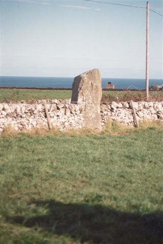
Little Balsmith submitted by cosmic on 23rd Oct 2004. View fromup farm road to West
(View photo, vote or add a comment)
Log Text: Little Balsmith/Stairfield Standing Stone: I was very reluctant to tear myself away from Whithorn Museum and Priory, but with it closing at 5pm, we didn’t really have a choice. I popped back into the visitor centre to buy some postcards, then we headed off down the street to buy an Italian Ice Cream, complete with chocolate flake – delicious!
This standing stone is not far out of Whithorn; take the road which heads east past the school, the B7063, and continue for 2.7km.
We had a very strange encounter driving towards the stone, as we came across a car parked across a farm entrance, with one man sprawled across the bonnet with his hands behind his head, the other was leaning up against the passenger side of the car. There was something really odd about this car – it was missing its rear driver side wheel! We waved at each other as we drove past – they didn’t flag us down and ask for help.
On the way back, another car had joined them and the men were talking animatedly. Wonder what had happened for them to lose the wheel.
The standing stone is in a flat plane here, with Wigtown Bay to the east. The road running past the stone continues to the Isle of Whithorn. Again, this stone is ‘a big boy’. Luckily the crop in the field had just been harvested, so I went in to get some photographs from all sides of the stone.
Crow Stone (Wigtown)
Trip No.137 Entry No.15 Date Added: 29th Jun 2019
Site Type: Standing Stone (Menhir)
Country: Scotland (Dumfries and Galloway)
Visited: Yes on 18th Jun 2019. My rating: Condition 3 Ambience 4 Access 4
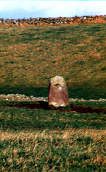
Crow stone (Wigtown) submitted by kelpie on 7th Jul 2002. A holed stone at NX 36637 55606. I could not gain access to the field and the shot was taken with a long lens, hand-held, thus the poor quality.
(View photo, vote or add a comment)
Log Text: Holed Stone/Crow Stone, Crouse: Coming to these last two sites marked the start of our return journey back to Northumberland, and I wasn’t really ready to go back! This stone stood near the northern edge of a field of grass, just east of the B7052, and south of the White Cairn at Crouse.
The field of grass had just been cut and the farmer and his various tractors and trailers were collecting the grass in the surrounding fields and transporting it back to Crouse farmhouse, just to the south and on the other side of the road. Because of all the traffic on the road, we dumped the car in a wide gated field entrance at NX 36446 55808, ready to run back to the car if we needed to move it. We got into the field with the holed stone through a gate at NX 36533 55647, walking NE towards it; it was further than it looked, having to step over the mounds of cut grass.
A very nice spot, with the Galloway Hills a dark blue/grey in the distance.
Whithorn Museum
Trip No.137 Entry No.13 Date Added: 29th Jun 2019
Site Type: Museum
Country: Scotland (Dumfries and Galloway)
Visited: Yes on 18th Jun 2019. My rating: Condition 4 Ambience 5 Access 4

Whithorn Museum submitted by Sunny100 on 24th Sep 2010. St Peter's Stone no 2 in the museum.
(View photo, vote or add a comment)
Log Text: Whithorn Visitor Centre, Museum, Priory and Roundhouse: I can honestly say that I have never felt so welcomed anywhere as being here as a visitor to Whithorn. From the moment we stepped into the Visitor Centre café for refreshments before buying our tickets, then looking around the round house, museum and priory, the staff were attentive, welcoming and made sure we were well looked after.
The café had good food at very reasonable prices, and the prices to get into the museum and priory were well below those we'd expected. A small guided tour had just started, but as we wanted to wander round on our own, we elected not to join. However, round at the museum, we learned that we were only able to get into the round house with a guide present, so we were very kindly let into the round house grounds to join the tour for ten minutes or so.
The interior of the round house was much, much bigger and far more practical than I'd ever imagined. The guide spoke with great knowledge about day-to-day living within this space and we had chance to look around the outside at the various tools and farming methods they were using.
We left to go and explore the museum and I was stunned to see the collection of over 60 early Christian stones displayed in this space. I had previously checked with the Whithorn Trust that is was OK to take photographs of the stones for my walk/photo journal, and was told this was OK if it was 'for personal use'. So armed with my camera, I double checked with the guide. The knowledge of the staff member (Ruaridh) and the time he took to talk to us was extraordinary.
After walking round the Priory and trying to recreate some of the photos in the guide book, we returned to the museum for another wander round, but it was closing at 5pm, so we needed to be swift. The one downside was that there was no guide book describing each of the stones, but I was allowed to use the Museum Interactive Display Screen, and to photograph the majority of the screens (a good job, as trying to find the stones on Canmore has proved a little tricky, as many of their entries don't have photographs).
We had time to go back to the Visitor Centre to buy some postcards, and I had my eye on an expensive reference book. With only a few moments to spare before closing, I decided not to buy it, but on getting home regretted my decision. On emailling the team the next day, they organised for me to buy the book, pay over the phone, and arranged for postage. Great customer service!
I also asked for, and received permission, to post a visit report and photographs to the Portal.
I just wish I'd had a whole day to spend here, and would love to return. 150/100 for visitor experience.
Peter Hill Roundhouse (Whithorn)
Trip No.136 Entry No.13 Date Added: 1st Jul 2019
Site Type: Ancient Village or Settlement
Country: Scotland (Dumfries and Galloway)
Visited: Yes on 18th Jun 2019. My rating: Condition 4 Ambience 4 Access 4

Peter Hill Roundhouse (Whithorn) submitted by Anne T on 1st Jul 2019. Submitted with the kind permission of The Whithorn Trust. The Peter Hill Roundhouse, located in a garden opposite the Museum buiding at Whithorn. Seen from the entrance to the garden.
(View photo, vote or add a comment)
Log Text: Peter Hill Roundhouse: Part of the visitor experience at the Whithorn Museum. We arrived just after a small guided tour had started. We asked if we could go round after the tour had finished, but were told we could only get in while there was an official guide there. I cheekily asked if we could join the tour for 10 minutes, and to my surprise, were allowed to go in.
I was really surprised and impressed by the inside of the roundhouse - the compartments for privacy, the central fire pits, and the sheer amount of room within it. Shame we didn't have time for the full tour, but I was so keen to see the early Christian stones in the museum.
Skip Knowe
Trip No.164 Entry No.3 Date Added: 27th Jun 2021
Site Type: Standing Stone (Menhir)
Country: Scotland (Dumfries and Galloway)
Visited: Yes on 25th Jun 2021. My rating: Condition 3 Access 4

Skip Knowe submitted by Apocryphus on 20th Jan 2019. On a minor road south of Moffat.
Located under trees and over a fence but close to the road. A substantial stone shown on OS maps
(View photo, vote or add a comment)
Log Text: Skip Knowe Standing Stone, Gateside: Our fourth stop of the day, after having investigated Hodge Wells and Springs at NY 10960 95700 [not recorded here, as this is neither a holy well or sacred springs]. I've said this is Access: 4, when you can actually park on the grass verge right by the stone, but the grass verge is very uneven and difficult (for me) to navigate. Couldn't find part of the fence low enough to hop over this time (must have been repaired since April 2019), nor could we find a gate off the side of the field nearest the road.
Not much has changed about this stone. We managed to identify the second stone mentioned by Canmore, some 18ft from the main standing stone, but it did look more like 'just a boulder', which had other stones around it.
Very pleasant countryside, and no workmen erecting telegraph poles this time round!
Moffat Well
Trip No.164 Entry No.5 Date Added: 27th Jun 2021
Site Type: Holy Well or Sacred Spring
Country: Scotland (Dumfries and Galloway)
Visited: Yes on 25th Jun 2021. My rating: Condition 3 Ambience 4 Access 4

Moffat Well submitted by Anne T on 26th Jun 2021. Standing near the gate in the small field containing the spring and well house. A second spring emerges from the ground (indicated by the area of taller grasses and reads) just to the south-east of the well house. There is a pipe running from a tank inside the well house which would have/will run water down to Birnock Water gorge below.
(View photo, vote or add a comment)
Log Text: Moffat Sulphur Well: I've described this location as 'good' because, as the well house itself is neglected and run down, the scenery around it is very pretty, and we enjoyed our visit.
Approaching the well from the small car park (having tripped over the low lying fence wire suspended 2 inches from the ground between the gate posts- beware!), we became aware of the strong smell of sulphur from about 10m away.
Taking a very deep breath of clean air, I ventured into the dark, dark, dank well house, and managed to take a few photos of the tunnel bringing water into the first of two troughs. No water flow was evident at the time of our visit, but there had been a prolonged dry period before hand.
Another spring appears to surface some metres to the south of the well, creating a boggy area with small ponds.
Looking down over the iron railing near the well house to the gorge below, we spotted a series of small waterfalls. Further north, there is a larger waterfall marked on the map, but by this time it was late evening, and we wanted to go home, so didn't venture further.
Dumfries Museum
Trip No.174 Entry No.1 Date Added: 25th May 2022
Site Type: Museum
Country: Scotland (Dumfries and Galloway)
Visited: Yes on 25th May 2022. My rating: Condition 4 Ambience 4 Access 4
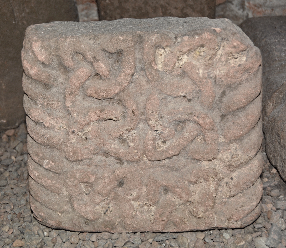
Dumfries Museum submitted by Anne T on 8th Jun 2022. This is Museum Accession number DUMFM:1960.11.7, recorded on the Future Museum website as Cross Shaft, Kirkconnell. Dated to the 11th century, its dimensions are: height 280mm, width 310mm, depth 110mm. It also has a generic record in Canmore - see Site ID 319221 St Connel's Church.
Points, in his 2016, Dumfriesshire Gazetteer, Pages 173-174, tells us: "Both the front face and the left-hand side are decorated with a band of cable-pattern moulding which wraps itself around both the right-h...
(View photo, vote or add a comment)
Log Text: Dumfries Museum: We parked on Whitesands, and walked over the Nith by the Old Bridge, to the NW, then turned left to the Robbie Burns House, then up the hill to the Museum and Camera Obscura.
We lived in Dumfries and Lockerbie between 1992 and 2002, but for some reason had never visited the museum, despite going to many other historic sites, and what an oversight!
Armed with Guy Points' book "A Gazetteer of Anglo Saxon, Anglo Scandinavian & Anglo Norse sites in Cumbria, Dumfriesshire and Wigtownshire, we had a wonderful afternoon in the basement of the tower. Treasures indeed, much appreciated after the dearth of things of visit during the two years of lockdown.
Staff at the museum were incredibly helpful. I've been given the details of someone at the Council (press officer for the museum?) to apply for permission to upload some photographs, and hopefully she'll get back to me shortly.
Brow Well (Ruthwell)
Trip No.177 Entry No.1 Date Added: 6th Jun 2022
Site Type: Holy Well or Sacred Spring
Country: Scotland (Dumfries and Galloway)
Visited: Yes on 6th Jun 2022. My rating: Condition 3 Ambience 3 Access 5

Brow Well (Ruthwell) submitted by Anne T on 6th Jun 2022. Getting a bit closer to the well pool.
(View photo, vote or add a comment)
Log Text: Brow Well (Ruthwell): Having escaped the noisy builders across the road, we decided on the spur of the moment to visit the Brow Well, as it’s only about half an hour’s drive away. We bombed off up the M6, turned off onto the A75 at Gretna, turned off down a side road which turned left at NY 13732 69544 (note: HUGE mistake – too many large, enormous pot holes – continue on down to the B725!), only to find the cottage next to the well was blasting out music at huge volume. Boo hoo.
In addition, the area around the well had been turned into a building site, meaning the entrance to the small parking area was blocked off, so we pulled into a gateway a few metres from the well.
The well was almost dry, very muddy, and not very nice to visit at all. So disappointed after all the photographs I’ve seen on the internet. We found out from the couple we were speaking to at Kingholm (Lady’s Well) that the bridge by the well had recently collapsed and had just been replaced.
The information board tells us:
“Healing powers of water.
Brow Well is a chalybeate spring with natural iron-salt rich water believed to cure a multitude of ills and was popular with the residents of Dumfries at the time of Burns. From early times spring water was believed to have healing qualities and many locations in Scotland were renowned for their holy or healing wells. In the 17th century spas with mineral rich waters became fashionable locations to visit in the pursuit of health and beauty. Later sea-bathing emerged as part of a growing activity and built on popular traditions that saw seawater as having healing powers.”
That Robbie burns bathed in the well in 1796 but died 3 days later isn't a hugely great advert for the healing properties of this chalybeate well!
Ladye Well (Terregles)
Trip No.177 Entry No.2 Date Added: 8th Jun 2022
Site Type: Holy Well or Sacred Spring
Country: Scotland (Dumfries and Galloway)
Visited: Couldn't find on 6th Jun 2022. My rating: Condition 1
Log Text: Ladye Well, Terregles: Armed with the OS map and a description from “Saints in Scottish Place-Names”, we went back (after many, many years) to Terregles. This well is on private ground, so I found myself chatting to a lady who was gardening just opposite the village hall about how we might be able to ask for access.
She was very cagey about giving us any information at all, telling us in order to see it, we’d have to walk half-way down someone’s driveway. I did explain the purpose of our visit – my ‘holy well’ project, and that we used to live in the area - which didn’t seem to convince her.
I did try and knock on the door of the house at the very end of the village, at NX 92749 77497, but no-one was at home, apart from the dogs. Just to the west of this house there was an access road into a building plot, and with no-one around to ask, we ventured down this track to the back of the "garden". All was derelict ground with weeds galore.
Finding nothing, we made our way back to the road, and I was going to walk down to Ladywell House, which was some distance down a long driveway, with the house not visible, only for a second lady who drove out of Ladywell House and parked up just down the road, to speak to the Gardening Lady (presumably waiting for us to walk up). I went up to them and told the Gardening Lady we couldn’t find the well, found myself telling them we used to live around here years ago, and my kids went to Shawhead School (only 4 miles away). The New Lady said “there’s nothing to see – it’s all weeds. Even the site of the old chapel is just a lump at the end of the field, covered in weeds. Nothing to see at all”. So that was us told!
We felt really unwelcome, which was very sad.
We went onto see a named well (not a holy well or sacred spring) at Kingholm, and our reception was completely different. Two of the residents were enormously helpful, even giving us a guided walk of the field with possible locations of the well and associated spring.
Rumbling Well (Buittle)
Trip No.182 Entry No.2 Date Added: 20th Jul 2022
Site Type: Holy Well or Sacred Spring
Country: Scotland (Dumfries and Galloway)
Visited: Couldn't find on 19th Jul 2022
Log Text: Rumbling Well, Buittle: Unable to get to. Since the Google Earth images and the map on Canmore were produced, an additional lake with platforms for fishing has been introduced at the head of the reservoir.
We parked in the 2-car layby by the footpath sign at NX 80296 61523 and made our way across the fields towards the reservoir, thinking we’d be able to walk around the head of this new lake. What we should have done was parked further north at about NX 80275 61662 (but this was only a field gate with no footpath sign and only passing places to park in), and walked towards the northern side of the reservoir.
With a party of teenagers arriving to swim in the waters, and temperatures in excess of 30 degrees C, the call of cross fragments and other sites called louder, so we gave up, saying we’d come back another day, as there is so much to see in this area.
St Winning's Well (Kirkgunzeon)
Trip No.182 Entry No.1 Date Added: 20th Jul 2022
Site Type: Holy Well or Sacred Spring
Country: Scotland (Dumfries and Galloway)
Visited: Yes on 19th Jul 2022. My rating: Condition 2 Access 4
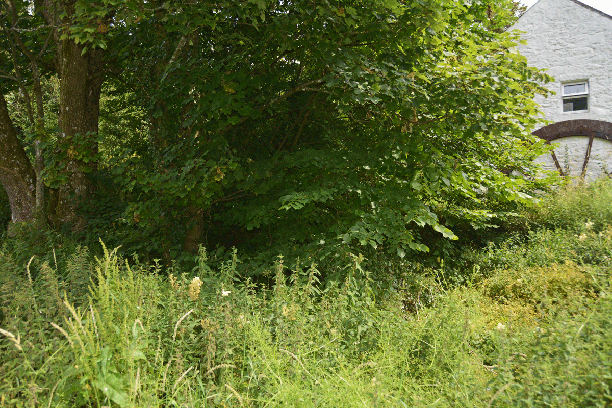
St Winning's Well (Kirkgunzeon) submitted by Anne T on 20th Jul 2022. The stand of trees showing it in context with the small white cottage (now offices) with the rusty remains of a threshing (?) wheel at its end.
(View photo, vote or add a comment)
Log Text: St Winning's Well, Kirkgunzeon: We parked near the telephone kiosk in the village, at about NX 86783 66771, and walked back to the small cross-roads, then north-westwards up the little dead-end lane. A very pretty spot. We had the grid reference of the well, so were looking around, when the owner of the large house round the corner came out to see if we were lost. He also warned us that the person who lived in the cottage at the very end of the lane was very wary of strangers, so helped us find the well. of which he told us there was nothing left. There is a small section of closely mown grass at the end of the white cottage with old threshing (?) wheel at the end, and the stand of trees under which the well is located. We walked up the 10m or so of this path and were able to see into the bowl of what was the well. It was dry at the time of our visit, although some remnants of the stonework forming its crude bowl were visible under the shrubbery. Better, perhaps, to visit in the winter when this has all died down.
Stewartry Museum
Trip No.183 Entry No.3 Date Added: 22nd Jul 2022
Site Type: Museum
Country: Scotland (Dumfries and Galloway)
Visited: Yes on 19th Jul 2022. My rating: Condition 4 Ambience 4 Access 5
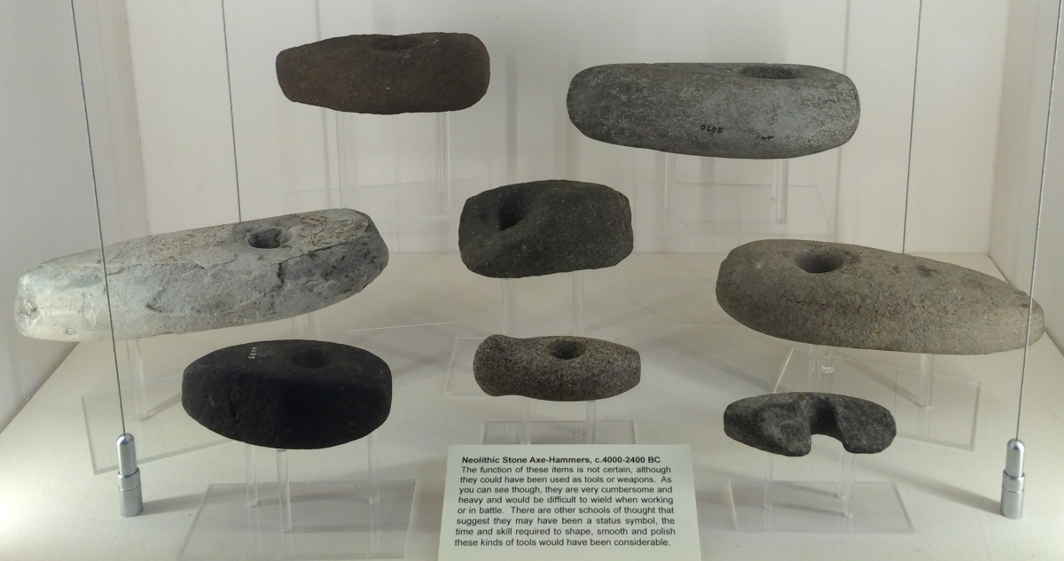
Stewartry Museum submitted by Andy B on 28th Feb 2017. Neolithic Stone Axe Hammers in the Stewartry Museum, Kirkcudbright
(View photo, vote or add a comment)
Log Text: Stewartry Museum: We arrived at the museum with 10 minutes to go until closing, having been to St Cuthbert's Church almost next door, only to discover that the 8th century cross arm was not in that church, but now located in the museum.
Our thanks go to Isla who obtained permission for me to upload photographs to the Portal (she admits to being a keen follower of the Portal, especially stones!), and for her enthusiasm and time in showing us the cross fragments, and also the rock art and rock art impressions they have at the museum.
Would love to come back and spend more time here. A small museum, reminiscent of a smaller Hunterian museum, with lots of things packed into a relatively small ground floor room, some interesting modern sculptures (including Odin's Throne) and impressions of rock art panels stored outside adjacent to the street.
Barmore Fort
Trip No.48 Entry No.5 Date Added: 5th Oct 2017
Site Type: Hillfort
Country: Scotland (Cowal)
Visited: Saw from a distance on 21st Sep 2017. My rating: Condition 3 Ambience 4 Access 4
Barmore Fort submitted by SolarMegalith on 28th Aug 2017. The northern wall of the Barmore fort (photo taken on August 2017).
(View photo, vote or add a comment)
Log Text: Barmore Hillfort, Ormidale, Argyll: We saw this hillfort from a distance only. The map indicated a footbridge across the River Ruel. We drove up and down several times but couldn’t find it. The ground was so wet after heavy rain, we would have needed wellies to navigate the fields, so elected to view this from a distance only. We did drive back along the A886 looking for a parking space on the south eastern side of the fort, but there were only private driveways. A disappointing end to the day.
Balliemore (Craigendive)
Trip No.48 Entry No.1 Date Added: 4th Oct 2017
Site Type: Standing Stones
Country: Scotland (Cowal)
Visited: Yes on 21st Sep 2017. My rating: Condition 3 Ambience 4 Access 4
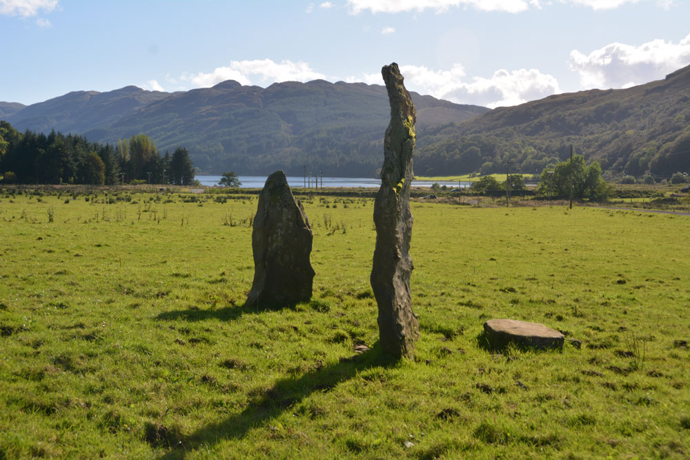
Balliemore (Craigendive) submitted by Anne T on 4th Oct 2017. Standing to the north of these two stones, looking south to the head of Loch Striven. A glorious location.
(View photo, vote or add a comment)
Log Text: Ballimore Standing Stones, West of Dunoon: To escape the rain in Armadale, we decided to take the ferry from Gourock to Dunoon. We stopped off in Dunoon for a cup of tea and a sandwich at The Tudor Coffee Shop above Thornton’s on the main high street, then we set off into the countryside, taking the B836 to Craigendive, past Loch Tarsan.
I spotted these on the map and as they were not very far off the beaten track, decided to stop off and find them. These two stones were in one of the loveliest places, just off the B836 (essentially a single-track road with passing places), to the north of Loch Striven. Surrounded by hills on three sides, on a lush, level grassy plain, with Loch Striven to the south, these standing stones lie immediately south of Balliemore Farm. We parked at NS 05511 84269, next to a pile of road gravel and stones, and walked up the track towards the farm.
There is one tall, narrow stone, and a shorter, triangular one, with a third slab lying at the base of the taller one. Packing stones can be seen in the grass.
The field was very, very wet, and we had to jump over the pools of water at the edge, particularly around the telegraph poles. A pair of wellies would have come in extremely handy!
