Contributory members are able to log private notes and comments about each site
Sites Anne T has logged. View this log as a table or view the most recent logs from everyone
Merrivale North Row
Trip No.133 Entry No.2 Date Added: 3rd Jul 2019
Site Type: Multiple Stone Rows / Avenue
Country: England (Devon)
Visited: Yes on 14th May 2019. My rating: Condition 3 Ambience 4 Access 4
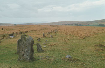
Merrivale North Row submitted by stewart on 12th Oct 2003. Grid Ref SX 555 747
There are two, main, rows at Merrivale - North and South.
The north row consists of two lines of stones, aligned east -west and nearly 200m long.
However, the two lines of stones are only about 1m apart so you can only just walk between them. It has larger stones at the west end and a blocking stone at the east.
The southern row doesn't start or finish on the same alignment, is not parallel to the northern one and was, probably, not built at the same time.
...
(View photo, vote or add a comment)
Log Text: Merrivale North Row (Merrivale 1): Between the prehistoric settlement and the first of our stone rows for the day, Sandy G had stopped to point out some of the stones of the Great Western Reave.
Continuing on, these stones could be seen from down slope at the Prehistoric Settlement, and proved a tantalising glimpse of what was in store for the rest of the morning. Sandy was amazing at explaining all the different features along the row, including part of which had recently been restored.
But my goodness, the wind was blowing, and blowing hard. At some points, it was a little tricky to stand upright – thank heavens for my walking poles!
Peter Hill Roundhouse (Whithorn)
Trip No.136 Entry No.13 Date Added: 1st Jul 2019
Site Type: Ancient Village or Settlement
Country: Scotland (Dumfries and Galloway)
Visited: Yes on 18th Jun 2019. My rating: Condition 4 Ambience 4 Access 4

Peter Hill Roundhouse (Whithorn) submitted by Anne T on 1st Jul 2019. Submitted with the kind permission of The Whithorn Trust. The Peter Hill Roundhouse, located in a garden opposite the Museum buiding at Whithorn. Seen from the entrance to the garden.
(View photo, vote or add a comment)
Log Text: Peter Hill Roundhouse: Part of the visitor experience at the Whithorn Museum. We arrived just after a small guided tour had started. We asked if we could go round after the tour had finished, but were told we could only get in while there was an official guide there. I cheekily asked if we could join the tour for 10 minutes, and to my surprise, were allowed to go in.
I was really surprised and impressed by the inside of the roundhouse - the compartments for privacy, the central fire pits, and the sheer amount of room within it. Shame we didn't have time for the full tour, but I was so keen to see the early Christian stones in the museum.
Joicey Shaft Cairn
Trip No.141 Entry No.3 Date Added: 1st Jul 2019
Site Type: Round Barrow(s)
Country: England (Northumberland)
Visited: Yes on 30th Jun 2019. My rating: Condition 2 Ambience 3 Access 4
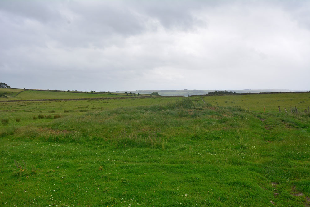
Joicey Shaft Cairn submitted by Anne T on 1st Jul 2019. The cairn as seen from the gate into the field at NY 82860 66456, showing how the farmer has driven his tractor over the western side of the mound, but the track 'bends' away from it, respecting most of the mound.
(View photo, vote or add a comment)
Log Text: Joicey Shaft Cairn: I spotted this mound almost by accident as I was photographing Joicey Shaft B from the track. At first I dismissed it as a manure heap, or possible tailings from the leading mining which used to take place here, but the more I walked round it, the more convinced I was it was a cairn, especially with its proximity to the rock art panels on the opposite side of the track, and because the modern field boundary and the track leading N-S to its western side 'bent' round to accommodate most of the barrow.
It is not recorded by HE or Pastscape, but it is on the old OS maps, so has been here for a while.
Joicey Shaft b
Trip No.141 Entry No.2 Date Added: 1st Jul 2019
Site Type: Rock Art
Country: England (Northumberland)
Visited: Yes on 30th Jun 2019. My rating: Condition 3 Ambience 3 Access 4
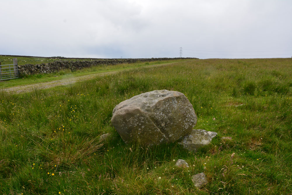
Joicey Shaft b submitted by Anne T on 1st Jul 2019. Photograph showing the Panel B boulder in relation to the track running to its south. The boulder sits on top of other stones, apparently the remains of an old field boundary/dry stone wall.
(View photo, vote or add a comment)
Log Text: Joicey Shaft B: This boulder is only 40m or so to the WSW of panel A, and is the only other large boulder in the field near this location. It is propped on top of other stones, part of the demolished field wall that ERA/NADRAP talk about.
ERA/NADRAP talk about two possible cup marks, which I found by comparing the shape of the stone with the NADRAP drawings. We also thought we saw two more, but these may be just solution holes or natural erosion.
Joicey Shaft a
Trip No.141 Entry No.1 Date Added: 1st Jul 2019
Site Type: Rock Art
Country: England (Northumberland)
Visited: Yes on 30th Jun 2019. My rating: Condition 3 Ambience 3 Access 4
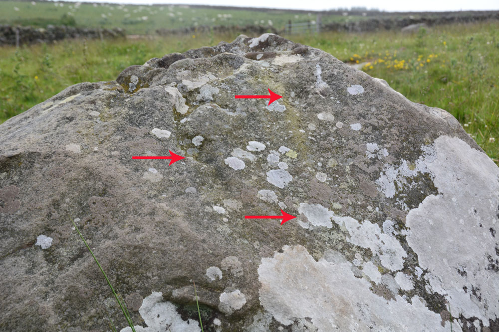
Joicey Shaft a submitted by Anne T on 1st Jul 2019. ERA/NADRAP says there are two cups here, the one to the east "fed by a natural gully from above". We thought we found three cups, marked with the red arrows, but there were so many erosion features, it was difficult to be certain.
(View photo, vote or add a comment)
Log Text: Joicey Shaft A: With the most of the rest of the UK enjoying warm sunshine, up in this part of Northumberland, the storm clouds had gathered. Having checked the weather forecast to make sure rain wasn't due to arrive until this evening, we set off to find these rock art panels, within easy reach of a road. This road was marked on the old OS map as a bridle path, but on the modern OS map it is now a metalled, yellow road, indicating it can be driven down.
OK, the road isn't the best, being potholed in parts, but the stone can be found just through a gate across the road at NY 82906 66462. Both boulders are on the northern side of the road, about 40m apart.
Being here was really wierd, as holes had been drilled in the northern-most gatepost, and as the wind howled through them, it played a tune, the 'melody' varying between different notes dependant upon the width of the hole.
I managed to photograph panel A before the rain started to come down, then we had to sit in the car for 10 minutes or so before there was a break in the clouds.
In walking back from panel B, I spotted through the gate on the south side of the road, a lump which looked like a cairn. I almost dismissed it as a farmer's manure dump, but realised the tractor track respected its western side (albeit cutting it a little). Andrew has just pointed out it is shown on the 1860 OS map.
Tony's Patch 1
Trip No.141 Entry No.4 Date Added: 1st Jul 2019
Site Type: Rock Art
Country: England (Northumberland)
Visited: Yes on 30th Jun 2019. My rating: Condition 3 Ambience 3 Access 4

Tony's Patch 1 submitted by Anne T on 1st Jul 2019. The irregular 'cups' seen from further down slope, using flash to give a bit more contrast/depth. At the time of our visit, on the warmest weekend of the year (so far) the heavens opened and we got drenched. The light was so bad it was like dusk.
(View photo, vote or add a comment)
Log Text: Tony's Patch Rock Art: The information for this nature reserve said there was room to park one car by the stile into the field at NY 81961 65368, and indeed there was, but only just. As we readied ourselves to walk towards the wood, the first spots of rain started, but we decided it would only be a short shower, so thought we'd walk down anyway, and if the rain got heavy, we'd be sheltered in the wood. Ha!
From the stile we headed ENE across this field of, for the most part, knee high grass, heading towards the gate into the nature reserve. Then followed the path through the wood, finding a small turn off to our right to this stone at about NY 82262 65565. By this time, the rain was hammering down, and we had started to get soaked.
I don't think anyone had been here for some time, as the branches from the trees had grown right over the rock and I kept getting caught up in them.
We eventually found the cup marks at the bottom, right hand side of the rock, where the rock starts to become 'undercut'. We needed to push some of the bracken aside to see them.
I really don't understand how NADRAP could have classified these are having ben made by water running over the rock surface? Where are the water channels that would have worn? Or if these were solution holes, the rock must have been in a different position for these to form.
Having photographed these as best I could in the very low light levels, we headed back to the car. By this time, the grass in the field was wet, but we waded through. I don't think my walking sandals will ever be quite the same!
Whithorn Museum
Trip No.137 Entry No.13 Date Added: 29th Jun 2019
Site Type: Museum
Country: Scotland (Dumfries and Galloway)
Visited: Yes on 18th Jun 2019. My rating: Condition 4 Ambience 5 Access 4

Whithorn Museum submitted by Sunny100 on 24th Sep 2010. St Peter's Stone no 2 in the museum.
(View photo, vote or add a comment)
Log Text: Whithorn Visitor Centre, Museum, Priory and Roundhouse: I can honestly say that I have never felt so welcomed anywhere as being here as a visitor to Whithorn. From the moment we stepped into the Visitor Centre café for refreshments before buying our tickets, then looking around the round house, museum and priory, the staff were attentive, welcoming and made sure we were well looked after.
The café had good food at very reasonable prices, and the prices to get into the museum and priory were well below those we'd expected. A small guided tour had just started, but as we wanted to wander round on our own, we elected not to join. However, round at the museum, we learned that we were only able to get into the round house with a guide present, so we were very kindly let into the round house grounds to join the tour for ten minutes or so.
The interior of the round house was much, much bigger and far more practical than I'd ever imagined. The guide spoke with great knowledge about day-to-day living within this space and we had chance to look around the outside at the various tools and farming methods they were using.
We left to go and explore the museum and I was stunned to see the collection of over 60 early Christian stones displayed in this space. I had previously checked with the Whithorn Trust that is was OK to take photographs of the stones for my walk/photo journal, and was told this was OK if it was 'for personal use'. So armed with my camera, I double checked with the guide. The knowledge of the staff member (Ruaridh) and the time he took to talk to us was extraordinary.
After walking round the Priory and trying to recreate some of the photos in the guide book, we returned to the museum for another wander round, but it was closing at 5pm, so we needed to be swift. The one downside was that there was no guide book describing each of the stones, but I was allowed to use the Museum Interactive Display Screen, and to photograph the majority of the screens (a good job, as trying to find the stones on Canmore has proved a little tricky, as many of their entries don't have photographs).
We had time to go back to the Visitor Centre to buy some postcards, and I had my eye on an expensive reference book. With only a few moments to spare before closing, I decided not to buy it, but on getting home regretted my decision. On emailling the team the next day, they organised for me to buy the book, pay over the phone, and arranged for postage. Great customer service!
I also asked for, and received permission, to post a visit report and photographs to the Portal.
I just wish I'd had a whole day to spend here, and would love to return. 150/100 for visitor experience.
White Cairn (Crouse)
Trip No.137 Entry No.16 Date Added: 29th Jun 2019
Site Type: Cairn
Country: Scotland (Dumfries and Galloway)
Visited: Yes on 18th Jun 2019. My rating: Condition 2 Ambience 3 Access 4
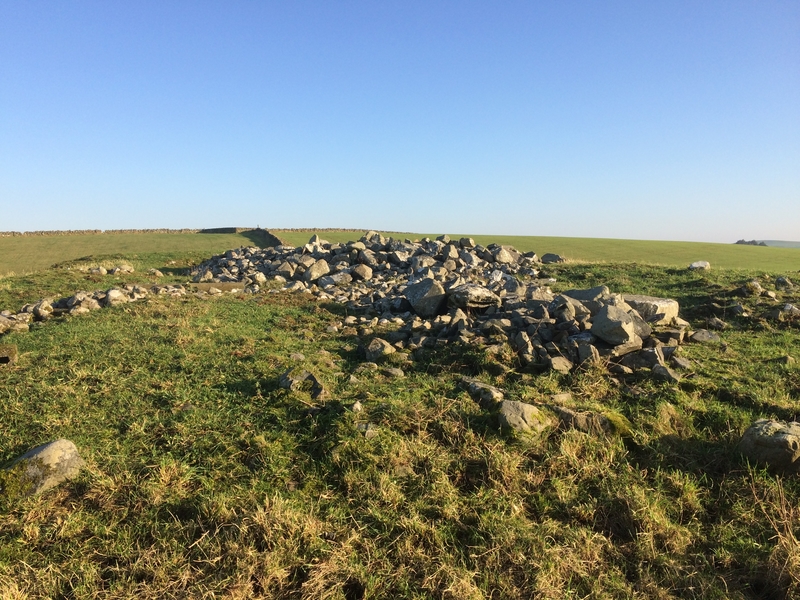
White Cairn (Crouse) submitted by markj99 on 31st Mar 2019. White Cairn (Crouse)
(View photo, vote or add a comment)
Log Text: White Cairn, Crouse: Our very last stop of this visit, and not a hugely dramatic one. The cairn has been used for field clearance, and there were lumps of concrete, barbed wire and old fence posts dumped at its western side.
Whilst I was photographing the holed stone, I got an excited cry from Andrew, to say; “You can see through the holed stone from the cairn”, so I wandered through the gate between the two fields and walked onto the cairn. Yes, he was right – there was a glimmer of light through the hole, although what it was sighted on, I’m not sure.
Crow Stone (Wigtown)
Trip No.137 Entry No.15 Date Added: 29th Jun 2019
Site Type: Standing Stone (Menhir)
Country: Scotland (Dumfries and Galloway)
Visited: Yes on 18th Jun 2019. My rating: Condition 3 Ambience 4 Access 4
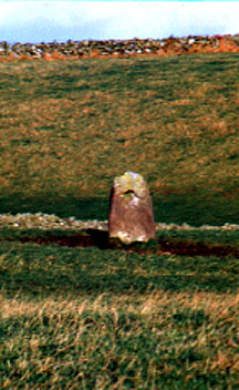
Crow stone (Wigtown) submitted by kelpie on 7th Jul 2002. A holed stone at NX 36637 55606. I could not gain access to the field and the shot was taken with a long lens, hand-held, thus the poor quality.
(View photo, vote or add a comment)
Log Text: Holed Stone/Crow Stone, Crouse: Coming to these last two sites marked the start of our return journey back to Northumberland, and I wasn’t really ready to go back! This stone stood near the northern edge of a field of grass, just east of the B7052, and south of the White Cairn at Crouse.
The field of grass had just been cut and the farmer and his various tractors and trailers were collecting the grass in the surrounding fields and transporting it back to Crouse farmhouse, just to the south and on the other side of the road. Because of all the traffic on the road, we dumped the car in a wide gated field entrance at NX 36446 55808, ready to run back to the car if we needed to move it. We got into the field with the holed stone through a gate at NX 36533 55647, walking NE towards it; it was further than it looked, having to step over the mounds of cut grass.
A very nice spot, with the Galloway Hills a dark blue/grey in the distance.
Little Balsmith
Trip No.137 Entry No.14 Date Added: 28th Jun 2019
Site Type: Standing Stone (Menhir)
Country: Scotland (Dumfries and Galloway)
Visited: Yes on 18th Jun 2019. My rating: Condition 3 Ambience 4 Access 5
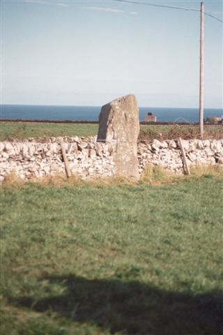
Little Balsmith submitted by cosmic on 23rd Oct 2004. View fromup farm road to West
(View photo, vote or add a comment)
Log Text: Little Balsmith/Stairfield Standing Stone: I was very reluctant to tear myself away from Whithorn Museum and Priory, but with it closing at 5pm, we didn’t really have a choice. I popped back into the visitor centre to buy some postcards, then we headed off down the street to buy an Italian Ice Cream, complete with chocolate flake – delicious!
This standing stone is not far out of Whithorn; take the road which heads east past the school, the B7063, and continue for 2.7km.
We had a very strange encounter driving towards the stone, as we came across a car parked across a farm entrance, with one man sprawled across the bonnet with his hands behind his head, the other was leaning up against the passenger side of the car. There was something really odd about this car – it was missing its rear driver side wheel! We waved at each other as we drove past – they didn’t flag us down and ask for help.
On the way back, another car had joined them and the men were talking animatedly. Wonder what had happened for them to lose the wheel.
The standing stone is in a flat plane here, with Wigtown Bay to the east. The road running past the stone continues to the Isle of Whithorn. Again, this stone is ‘a big boy’. Luckily the crop in the field had just been harvested, so I went in to get some photographs from all sides of the stone.
Culroy Cairn 1
Trip No.137 Entry No.10 Date Added: 28th Jun 2019
Site Type: Cairn
Country: Scotland (Dumfries and Galloway)
Visited: Yes on 18th Jun 2019. My rating: Condition 3 Ambience 3 Access 4
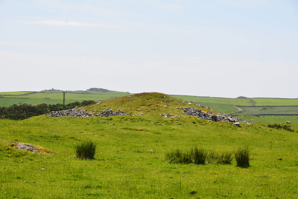
Culroy Cairn 1 submitted by Anne T on 28th Jun 2019. The northern side of Culroy Cairn 1, as seen from NX 24931 54457.
(View photo, vote or add a comment)
Log Text: Culroy Cairn 1: On the way back from Culroy White Cairn, we had intended to stop and photograph another 4 cairns along this road, but the road was far to narrow to park on, and with large tractors and other traffic coming along, I hopped out of the car and photographed this cairn as best I could.
By this time of the afternoon, I was getting twitchy and impatient to get to Whithorn and the museum, with their fantastic collection of cross slabs, cross heads and other early Christian stones, so finding an entrance into the field was pretty low priority!
Culroy White Cairn
Trip No.138 Entry No.9 Date Added: 28th Jun 2019
Site Type: Cairn
Country: Scotland (Dumfries and Galloway)
Visited: Yes on 18th Jun 2019. My rating: Condition 2 Ambience 3 Access 4
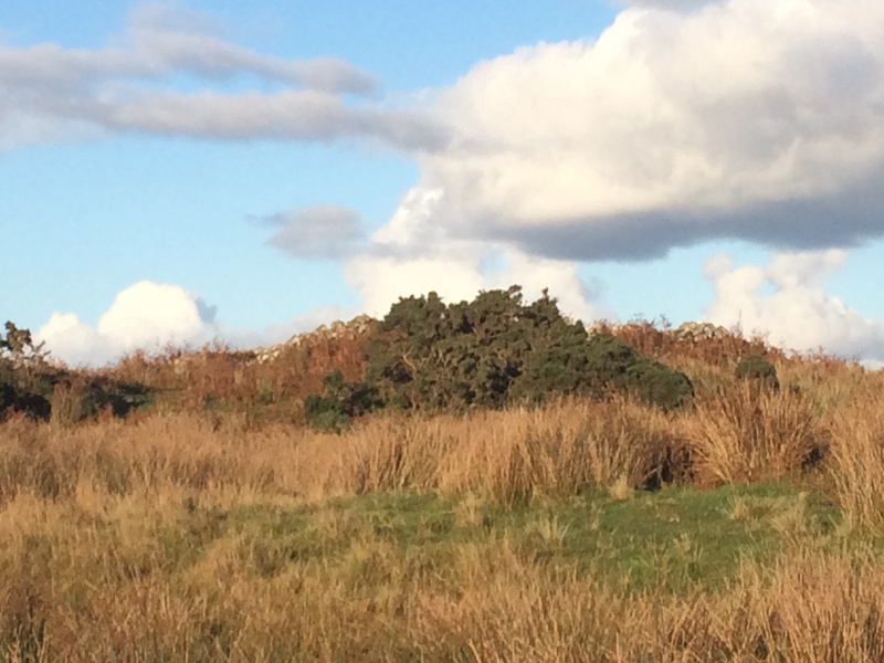
Culroy White Cairn submitted by markj99 on 21st Oct 2018. Culroy White Cairn as seen from the road
(View photo, vote or add a comment)
Log Text: Culroy White Cairn: The intention was to drive down this minor road, stopping to photograph three cairns to the south of the road on our way to Crouse. However, the road was very, very narrow with no marked passing places (just field entrances and the occasional driveway) and the stone walls were too tall to see over. All we could see in the end was one of these cairns and we could find no entrance/gate into the field, wo we contented ourselves with photographing the ones we could find.
We drove to where the minor road forks, just to the north west of a farm called Culroy. Taking the northern (left hand) fork, we parked on the short grass. This cairn is at the end of a quarried knoll, and not really obvious until you get up close to it, when the piles of white stones are clearly different from the quarried area around it.
We visited just after a period of dry weather; the ground in front of the cairn was covered in marsh grass, some areas still with small puddles, so wellies would be recommended after a rainy day or two (although you can always approach from the north if needed).
Mid Gleniron 1
Trip No.137 Entry No.8 Date Added: 28th Jun 2019
Site Type: Chambered Cairn
Country: Scotland (Dumfries and Galloway)
Visited: Yes on 18th Jun 2019. My rating: Condition 3 Ambience 4 Access 3
Mid Gleniron 1 submitted by rogerkread on 1st May 2013. The cairn with the most visible internal structure at Mid Gleniron, the one furthest west.
(View photo, vote or add a comment)
Log Text: Mid Gleniron 1: I was really impressed with this now oval-shaped cairn with its burial chambers and spent ages walking round it and over it. The photographs don’t really do it justice.
Mid Gleniron 5
Trip No.137 Entry No.7 Date Added: 28th Jun 2019
Site Type: Cairn
Country: Scotland (Dumfries and Galloway)
Visited: Yes on 18th Jun 2019. My rating: Condition 2 Ambience 4 Access 3
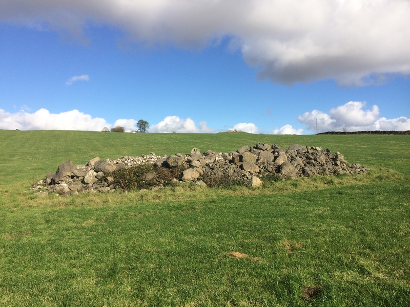
Mid Gleniron 5 submitted by markj99 on 21st Oct 2018. A candidate for Mid Gleniron 5?
(View photo, vote or add a comment)
Log Text: Mid Gleniron 5: This cairn lies west of track to the farmhouse, south east of the oval cairn, and is very distinct in the field and on the aerial photographs.
The mound of the cairn stood out particularly today as the farmer was spreading the lines of harvested grass to dry as we walked across the field, and he had gone round this cairn with the tractor.
Mid Gleniron 4
Trip No.137 Entry No.6 Date Added: 28th Jun 2019
Site Type: Cairn
Country: Scotland (Dumfries and Galloway)
Visited: Yes on 18th Jun 2019. My rating: Condition 3 Ambience 4 Access 3
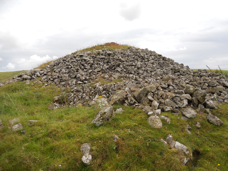
Mid Gleniron 4 submitted by markj99 on 10th Oct 2018. Mid Gleniron 4, looking S
(View photo, vote or add a comment)
Log Text: Mid Gleniron 4: This is the large bell cairn at the top of the hill, near the farmhouse, which dominates the view as you walk up the track towards the farmhouse.
Access into the field is easy, and it’s possible to walk all the way round the cairn to see its structure and enjoy the views.
Mid Gleniron 3
Trip No.137 Entry No.4 Date Added: 28th Jun 2019
Site Type: Cairn
Country: Scotland (Dumfries and Galloway)
Visited: Yes on 18th Jun 2019. My rating: Condition 2 Ambience 3 Access 3

Mid Gleniron 3 submitted by Anne T on 28th Jun 2019. This mound of stones, the slight mound rising from the centre left of the photo running to the centre middle, and the slight circular mound behind are all that seems to remain of the Mid Gleniron 3 cairn. I managed to get this photograph when the cattle had moved away from the mound, but we didn't want to aggrevate the cows and their calves, so didn't venture into the field.
(View photo, vote or add a comment)
Log Text: Mid Gleniron 3: OK, the GPS led me to this spot, but there wasn’t much to see. Had it not been for the sheer number of cows and their calves in the field, I would have gone for a closer look, but bottled out. I photographed this feature by leaning over the dry stone wall.
Mid Gleniron 2
Trip No.137 Entry No.5 Date Added: 28th Jun 2019
Site Type: Chambered Cairn
Country: Scotland (Dumfries and Galloway)
Visited: Yes on 18th Jun 2019. My rating: Condition 2 Ambience 3 Access 3
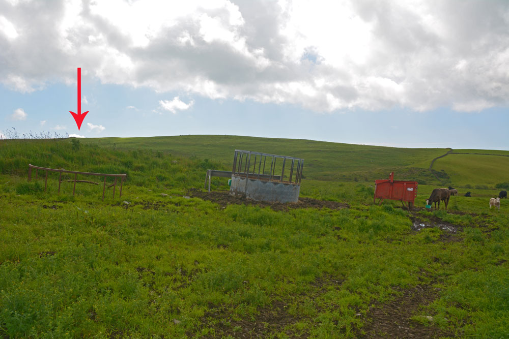
Mid Gleniron 2 submitted by Anne T on 28th Jun 2019. Only cairn is only just north of Mid Gleniron 3, this is all that appears to be left of this chambered cairn, now used as an animal feeding station for the numerous cows and their calves that were in the field at the time of our visit.
(View photo, vote or add a comment)
Log Text: Mid Gleniron 2: Photos taken from NX 18753 60931, I photographed a mound approximately 20 metres to east (right) of track as walked uphill, with a cattle feeder virtually on top.
I wasn’t sure that this was a cairn at all, although Andrew was certain. In fact Canmore shows there are the remains of two cairns here, one at NX 1877 6093,the other at NX 1876 6092. With the cattle feeder placed virtually on top of the cairn at NX 1876 6092 and numerous, very curious cattle in the field, I photographed these from the gate into the field.
Mid Gleniron Stony Mounds
Trip No.137 Entry No.3 Date Added: 28th Jun 2019
Site Type: Cairn
Country: Scotland (Dumfries and Galloway)
Visited: Yes on 18th Jun 2019. My rating: Condition 2 Ambience 3 Access 3
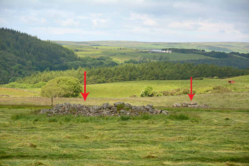
Mid Gleniron Stony Mounds submitted by Anne T on 28th Jun 2019. These two stony mounds are to the west of the farm track leading up to Mid Gleniron Farmhouse. They are at NX 18601 60877 and NX 18579 60986.
(View photo, vote or add a comment)
Log Text: Mid Gleniron Stony Mounds: I found these stony mounds as fascinating as the chambered cairns just north of these mounds, so took a few photographs (just in case they were recorded cairns) and grid references. If they are field clearance stones, why place them in different mounds in the same field? And why so many smaller stones? The larger stones are most likely field clearance, but the make up of the mounds is similar to Gleniron 1 to Gleniron 5 inclusive.
There are two mounds on the eastern side of the farm track and another four on the western side.
Kirkcolm Cross
Trip No.137 Entry No.2 Date Added: 27th Jun 2019
Site Type: Ancient Cross
Country: Scotland (Dumfries and Galloway)
Visited: Yes on 18th Jun 2019. My rating: Condition 3 Ambience 3 Access 4
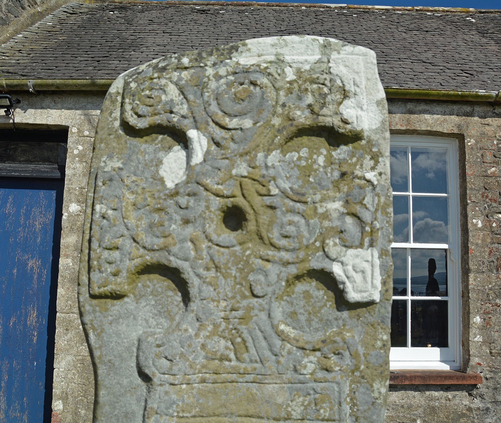
Kirkcolm Cross submitted by Anne T on 27th Jun 2019. The top panel of Face A of the Kirkholm Cross. Dr Craig describes it as "an ornate hammer-headed cross ... bordered by a roll moulding and filled with scroll work, with a sunken roundel at the centre". The cross stands 1.70m tall.
(View photo, vote or add a comment)
Log Text: Kirkcolm Cross: From the Knock & Maize standing stone we followed the minor roads across this peninsula until we reached the western shores of Loch Ryan, then drove north to Kirkcolm.
This cross slab has quite a complicated history of being sited in different locations (read the Canmore details below). The town has lovely views over Loch Ryan and Cairnryan ferry terminal.
The cross slab is now located in the external western corner of the south transept (although the building it stands next to looks more like an outhouse).
In the churchyard is an amazing statue of a woman with child clutching her. It looks as if she is a fisherwoman waiting for her man to come home. I guess she would have had views over Loch Ryan but the church building is in the way.
We did go in search of the original site of Kilmore Chapel and St Mary’s Well, to the south of Kirkcolm, but these appear to either be in a field next to a private house, now ploughed out, or partly in their very gated and (rightly so) private garden.
Knock and Maize
Trip No.137 Entry No.1 Date Added: 27th Jun 2019
Site Type: Standing Stone (Menhir)
Country: Scotland (Dumfries and Galloway)
Visited: Yes on 18th Jun 2019. My rating: Condition 3 Ambience 4 Access 4
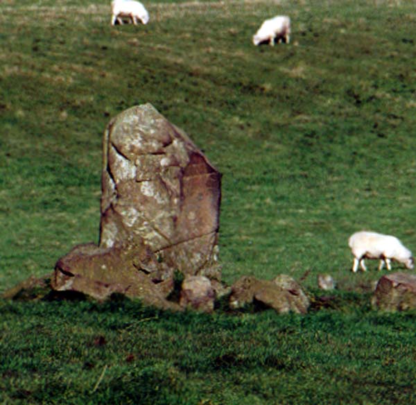
Knock and Maize standing stone submitted by PaulM on 30th Oct 2002. Knock and Maize standing stone
Located at a road junction where the Southern Uplands Way meets the B738 on The Rhinns to the SW of Stranraer (NW998588). A single stone standing bolt upright.
(View photo, vote or add a comment)
Log Text: Knock & Maize Standing Stone: Lovely views of the sea, but the view of the stone was a little spoilt by its proximity to the telegraph poles. It was only when we got into the field and I was photographing the stone that we realised there was a large herd of bullocks down the bottom end of the field. Half of them stood up, but thankfully they were too lazy to come over and take a closer look.
There were lots of smaller boulders around this stone – field clearance or where the stone has been fractured over the years? There are certainly lots of fracture lines and ‘dings’ on the stone. Perhaps the stones are both.
