Contributory members are able to log private notes and comments about each site
Sites Anne T has logged. View this log as a table or view the most recent logs from everyone
Horspit Cross
Trip No.130 Entry No.5 Date Added: 24th May 2019
Site Type: Ancient Cross
Country: England (Devon)
Visited: Yes on 11th May 2019. My rating: Condition 3 Ambience 4 Access 5
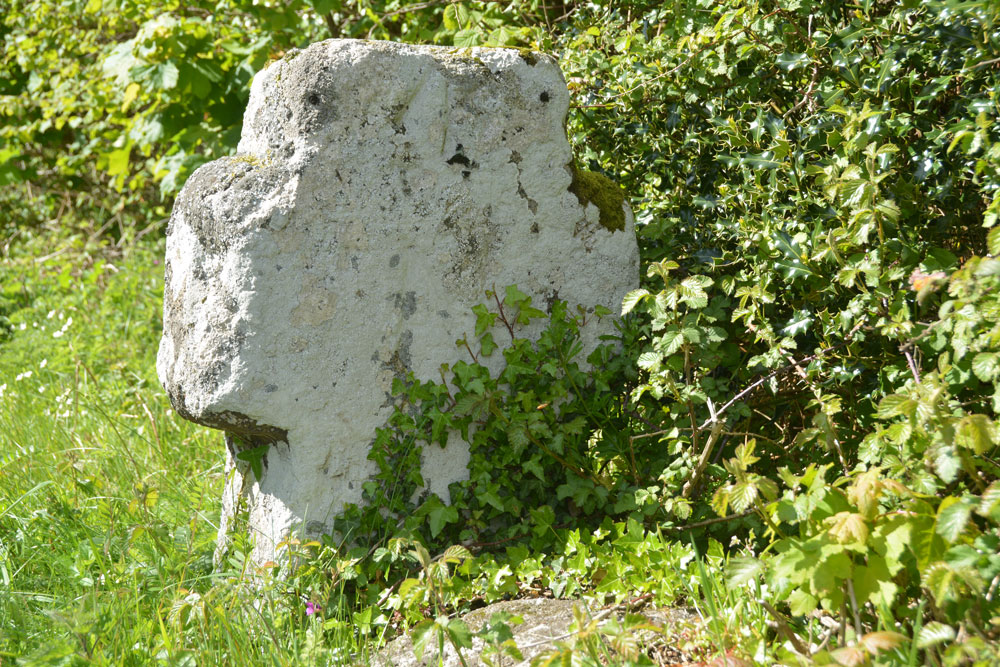
Horspit Cross submitted by Anne T on 24th May 2019. The eastern side of this short, stumpy cross. If there was an initial carved on this face, it was not visible (to us) on the day, or from looking at the photographs later. This is a bench mark on the front of this cross. The top of it is in the centre of the front, and just peeps out above the vegetation growing around its base.
(View photo, vote or add a comment)
Log Text: Horspit Cross, North Bovey: This was to be an afternoon of ‘cross sighting’, with the weather gradually turning from a bright, sunny day to a dull, almost misty day by the time we’d finished.
This squat, small cross sits right on a road junction, with a large boulder immediately adjacent. We managed o park in the entrance way to a new, but abandoned house, which had a tarmacked driveway next to the road, but large, padlocked gates to stop intruders.
The large boulder in front of the cross on the Pastscape photograph I thought looked like part of the cross shaft is in fact just a boulder. The cross has a bench mark on it, which we tried to find; Andrew eventually find it on the ‘front’ of the cross, the top of it showing only just above the vegetation that had grown up around the cross.
Moretonhampstead Cross
Trip No.130 Entry No.4 Date Added: 24th May 2019
Site Type: Ancient Cross
Country: England (Devon)
Visited: Yes on 11th May 2019. My rating: Condition 3 Ambience 3 Access 5
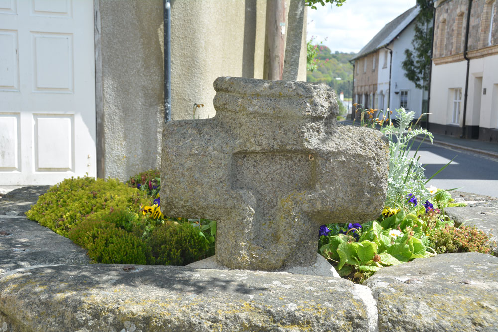
Moretonhampstead Cross submitted by Anne T on 24th May 2019. The eastern side of the cross head, with its T shaped recess (Pastscape describes it as cross shaped).
(View photo, vote or add a comment)
Log Text: Moretonhamstead Village Cross: The remains of this old village cross can be found, surprisingly, on Cross Street, outside the gate at the south side of the churchyard. I confess I had not expected to see a wayside/village cross mounted in a large flower bed! I got some strange looks from locals and visitors photographing this flower bed from different angles.
We then went to explore the church (St Andrew's) then for soup and a cup of tea in a nearby café (the Gateway Tearooms) with superb table service. Carrot and ginger soup with freshly made soda bread. Yum!
Challacombe Cross Settlement
Trip No.130 Entry No.3 Date Added: 24th May 2019
Site Type: Ancient Village or Settlement
Country: England (Devon)
Visited: Yes on 11th May 2019. My rating: Condition 3 Ambience 4 Access 4

Challacombe Cross Settlement submitted by TheCaptain on 5th Mar 2017. A photo of what I have called Shapley Common Hut, taken during a walk at Easter 1988.
I dont believe this would be at the location given on the Portal sitepage, but more to the northeast, around SX697830, as our walk first took us south along the ridge to Hookney Tor and Grimspound
(View photo, vote or add a comment)
Log Text: Challacombe Cross/Shapley Common Hut Circles: Having seen quite a few hut circles in Northumberland, I wasn’t expecting much from this site – a few stony-outlined circles in the bracken, but what a lovely surprise this site was – hut circles with very large boulders making up the perimeter. It turned out this was just a taster of the sites we saw around Merrivale, Stanlake and Kestor.
From the Leeper/Leapra Cross, we walked WSW along the B3212 to SX 70049 83251, where an old hollow way/track leads up onto the moor. Armed with the GPS for the first part of the walk,
The hut circles can be clearly seen on UK Grid Reference Finder. The HE entry gives a location just to the west of the line of hut circles – they run from SX 69750 83029 in the south to SX 69779 83133 in the north. Unfortunately the GPS attachment for my camera seems to have stopped working, so I’m waiting for a plan of this site to arrive, so I can assign grid references to each of the hut circles.
Walking to the top hut circle, looking down towards the viewpoint just off the B3212 Princetown Road at SX 69834 83454, it was possible to get a photo of the hut circles all in a line down the hill. Whilst we saw many people head off northwards across the moor, there was no-one else on or near this site at all.
We must have spent a good hour photographing the hut circles and looking at the medieval banks and ditches, some of which cut the hut circles.
Leeper Cross
Trip No.130 Entry No.2 Date Added: 24th May 2019
Site Type: Ancient Cross
Country: England (Devon)
Visited: Yes on 11th May 2019. My rating: Condition 2 Ambience 3 Access 4
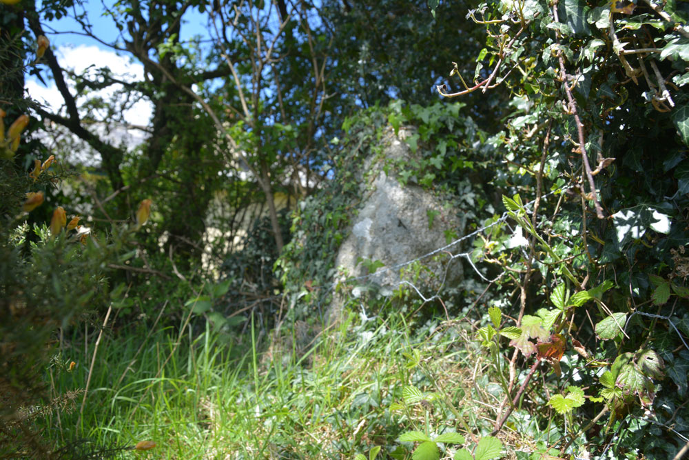
Leeper Cross submitted by Anne T on 24th May 2019. Trying to get a good close up of the south face of the Leeper/Leapra Cross, although it was deep in shade at this time, and I used the flash.
(View photo, vote or add a comment)
Log Text: The Leeper/Leapra Wayside Cross: We had problems locating this cross, so I ended up walking up the driveway up to Moorgate Farm. Just to the right hand side of the gate, I thought I identified an ivy covered cross head shape. Andrew didn’t believe me, so I let myself through the gate and had a closer look. Now I wasn’t convinced.
I heard voices through the hedge, so went in search of the voices, and ended up speaking to a young man who lived in the cottage. He said he knew where the cross was, and took us to the corner of the wall where my ivy covered shape was. This was indeed the Leeper Cross.
He told me that the cross had been moved from where it had been found at Moorgate Farm to Bovey Castle (“which isn’t a castle”), but there had been dissention so it had been moved back to this spot. His family had tried to get the cross located back to its original spot (at Moorgate Farm?) but “there doesn’t seem to be an appetite for it”.
He was happy to leave me to photograph the very ivy covered cross whilst he went back to erecting his new greenhouse.
Watching Place Waymarker
Trip No.130 Entry No.1 Date Added: 22nd May 2019
Site Type: Marker Stone
Country: England (Devon)
Visited: Yes on 11th May 2019. My rating: Condition 3 Ambience 3 Access 5
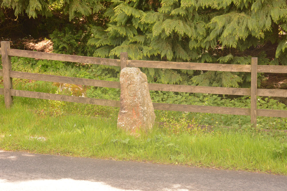
Watching Place Waymarker submitted by Anne T on 22nd May 2019. The Beetor/Watching Place waymarker. This stone dates only to the 18th century, but marks the original site of the Beetor Cross, now located some 100m to the south.
(View photo, vote or add a comment)
Log Text: Watching Place Waymarker/original site of Beetor Cross: Having seen the OS map and sorted out the Pastscape entries, I finally realised that this 'standing stone' was where the cross had originally been located.
Our first stop today was to go and photograph it so I could complete the Beetor Cross entry. It was nice to understand the relationship between the waymarker stone and the wayside cross, although it too me a while to understand the confusion between the names (HE calls the waymarker the Beetor Cross and the cross the Watching Place Cross).
I had to be careful photographing the front of the cross as cars sped quickly at irregular intervals.
North Bovey
Trip No.129 Entry No.5 Date Added: 23rd May 2019
Site Type: Ancient Cross
Country: England (Devon)
Visited: Yes on 10th May 2019. My rating: Condition 3 Ambience 3 Access 5
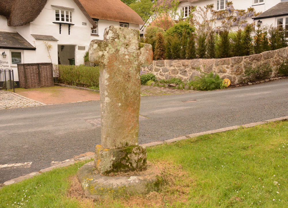
North Bovey submitted by Anne T on 23rd May 2019. Standing just to the north east of the cross, on the green, looking across at Stone Cross Cottage and the other thatched cottages which abut the churchyard. I managed to get this photo, taken in the few minutes between one car left and another parked up, on 11th May, the day after our original visit.
(View photo, vote or add a comment)
Log Text: North Bovey Wayside Cross: We’d booked into the local hostelry, The Ring O Bells, for supper, but arrived a little early. As well as seeing the cross on the village green, we wanted to see the local church, St John The Baptist. However, the church (given the time of the evening!) was firmly locked.
I was somewhat dismayed to find how close all the cars parked to the cross on the village green, but then there is so little parking in the village with narrow lanes and a small public car park, that I guess this is the easiest option for residents and visitors alike.
The different socket stone and shaft are clear, as is in the inserted piece of granite at the base of the shaft, inserted after the cross was knocked down by a vehicle in 1951 to help it fit the base better.
I almost had to sit on the bonnet of the car next to the cross to get a decent photo of the ‘front’ of the grass, facing back across the village green. On the green there is also a village pump, which attracted the numerous children playing on the green.
Hele Cross
Trip No.129 Entry No.4 Date Added: 23rd May 2019
Site Type: Ancient Cross
Country: England (Devon)
Visited: Yes on 10th May 2019. My rating: Condition 3 Ambience 4 Access 5

Hele Cross submitted by Anne T on 23rd May 2019. Standing 'behind' the cross on the farm track, putting the location of the cross into its context with the cross roads and the farm buildings opposite. We did look for remnants of the old chapel which once stood here/near here, thinking perhaps the farm buildings might have incorporated part of it into the current structure, but as Pastcape says, there are no signs (that we could see).
(View photo, vote or add a comment)
Log Text: Hele Cross, Devon: This cross is not far from the Beetor Cross – some 850m to the east, measured from UK Grid Reference Finder. The lane was narrow and a little windy, but a good introduction to the driving around this part of the world. There were few places to park, so we bumped up on the verge next to the farm, at about SX 72084 84153, where they had already parked one of their vehicles.
This area was heavily shaded by trees, with a (narrower) lane running east from the cross (eventually joining up with Yard Hill), and to the south a drop down to a stream.
The cross was again raised up above the road and was clearly visible once we’d walked onto the road junction. A tractor track up to a field gate allowed us to walk up ‘behind’ the cross and take photos. The socket stone was completely covered in ivy and brambles, so we didn’t really see this at all. (Later research using Crossing's Ancient Stone Crosses of Dartmoor (1902) says the chapel was by the stream).
Beetor Cross
Trip No.129 Entry No.3 Date Added: 22nd May 2019
Site Type: Ancient Cross
Country: England (Devon)
Visited: Yes on 10th May 2019. My rating: Condition 3 Ambience 3 Access 5
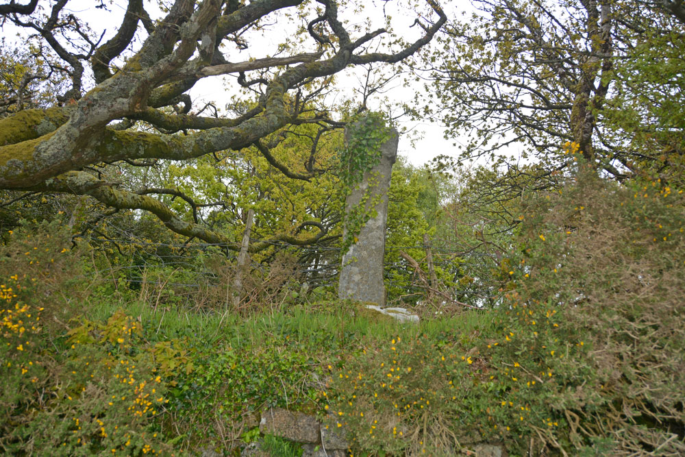
Beetor Cross submitted by Anne T on 22nd May 2019. Getting closer, this cross with its very narrow head and arms rises high out of the bank above you. Historic England says: "The primitive style of this cross, with its short head and arms, makes it a candidate for being a Christianised prehistoric standing stone".
(View photo, vote or add a comment)
Log Text: Beetor Wayside Cross, North Bovey: Our first trip out on the evening we arrived in Devon and having unpacked our things at the barn. This cross was less than a mile from the barn we were staying in.
I was really confused when I read the entries for this cross at first, not realising that it had been moved from its original spot just round the corner, opposite a crossroads. That original spot is now marked by a boundary marker.
This cross is very overgrown with ivy. It is in part of a private garden, used as part playground, part rubbish dump, but with no-one around, we opened the gate to see if there was a better view of the cross from the side opposite the road, but in fact because the cross was at the top of the bank and there was so much shrubbery around it, the view was worse.
Having worked out the original location of the cross and the significance of the nearby boundary marker, we made the boundary marker our first stop the next morning.
Holy Trinity (Rolleston)
Trip No.129 Entry No.2 Date Added: 21st May 2019
Site Type: Ancient Cross
Country: England (Nottinghamshire)
Visited: Yes on 10th May 2019. My rating: Condition 3 Ambience 4 Access 4
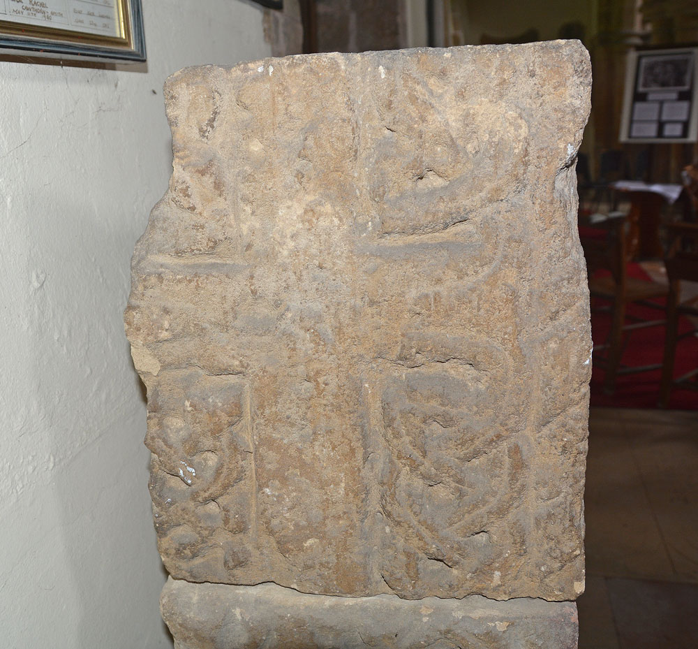
Holy Trinity (Rolleston) submitted by Anne T on 21st May 2019. The western side of the top-most block of the three making up the remains of this stone cross.
(View photo, vote or add a comment)
Log Text: Cross Shaft Fragments and Cross Slabs, Holy Trinity, Rolleston: By the time we’d photographed the sundial in the churchyard then walked up to the village cross, the church had been opened (thankfully) and we let ourselves in. The cross shaft was immediately opposite the south door into the church, although in a really difficult position to photograph (between a heavy wooden desk with information leaflets and a fire extinguisher). The most ornate section of the cross was to its western side, so after Andrew had moved the chairs, I virtually had to squeeze myself in next to the desk and squat down as best I could to capture the carvings – not the most elegant of positions!
It wasn’t until after I had photographed the cross and was making my way towards the fragments in the eastern wall of the northern aisle that I realised the chairs in the church had been set up in a labyrinth pattern. We did have to move some of the chairs to access several parts of the church, but made sure we put the chairs back exactly where we found them.
Thank goodness I had my printouts with Peter Ryder’s drawings and descriptions, as we would have missed a lot here! We’d spotted one or two of the most obvious carved stones built into the external fabric. However, now knowing how much was on the external walls, we went round the outside again and spotted so much more.
Rolleston Cross
Trip No.129 Entry No.1 Date Added: 21st May 2019
Site Type: Ancient Cross
Country: England (Nottinghamshire)
Visited: Yes on 10th May 2019. My rating: Condition 3 Ambience 3 Access 5
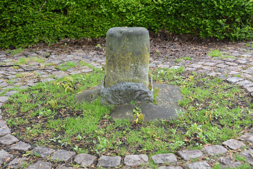
Rolleston Cross submitted by Anne T on 21st May 2019. Close up of the stump of the Rolleston Village Cross. Pastscape tells us it once had shields carved into it, although these are no longer visible, and they do not tell us who these belonged to. Dated to the 14th century, the local stocks were once said to be nearby.
(View photo, vote or add a comment)
Log Text: Rolleston Cross: This was our first stop on our way down to Dartmoor. Having stopped off in Newark for a very early breakfast, we arrived in Rolleston at 08:30, only to find (not surprisingly!) that the church had not yet been opened. After having photographed the sun dial in the churchyard of Holy Trinity, we walked up to find this old village cross, which I completely missed the first time round, as it blended in with the surrounding pavement and benches!
The very sad remains of an old village cross, but another site to have ticked off the list. By the time we'd photographed this cross stump, we walked back to Holy Trinity to find it now open.
The Hanging Stone (Haydon)
Trip No.128 Entry No.2 Date Added: 7th May 2019
Site Type: Standing Stone (Menhir)
Country: England (Northumberland)
Visited: Yes on 6th May 2019. My rating: Condition 3 Ambience 4 Access 4
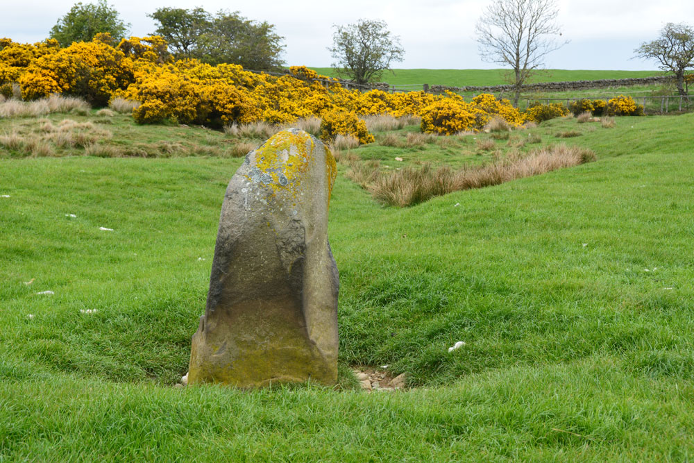
The Hanging Stone (Haydon) submitted by Anne T on 7th May 2019. Standing just behind the stone looking north east. The stone is in a slight dip in the landscape and a (water?) channel runs almost from the base of the stone to the north east, where it joins another small stream. I wondered if at some point the stone marked the location of a spring, although this is not shown on the early OS maps. From here, it looks as if the top half of the stone is 'hooked'
(View photo, vote or add a comment)
Log Text: The Hanging Stone, south of Haydon Bridge: We tried to find the Treacle Well (Traking Well) in Slaley, but despite an old footpath opposite the church being shown on the OS map, we couldn’t find our way through the houses to see it, so headed off through Hexham and off west on the B6305 to find The Hanging Stone.
This is marked on the OS map; Andrew found it on the 1860 map of the area, so it has been there a long time. There are no references to it on HE (although it is marked on their map), and only the briefest of mentions on Pastscape.
This stone wasn’t what I was expecting. I half thought that we’d see a flat stone marking the site of a gallows, not a standing stone! But it is very definitely a standing stone, and one that seems to have been here for some considerable time.
The road was very busy and the cars very fast. We did manage to bump up onto the soft verge, but for safety should have pulled up on the driveway up to the farm. The entrance to the field is at NY 88081 61695. After photographing the stone over the stone wall, I didn’t fancy trekking all the way up to the farm house in the distance, so took a chance and let myself into the field.
The stone is located in a dip, below current ground level, and has stones packed around its base. To its north east a rounded channel runs off to join a stream or modern field drain, as if the stone marked the start of a spring at some point.
St George's Well (Minsteracres)
Trip No.128 Entry No.1 Date Added: 7th May 2019
Site Type: Holy Well or Sacred Spring
Country: England (Northumberland)
Visited: Yes on 6th May 2019. My rating: Condition 3 Ambience 4 Access 4
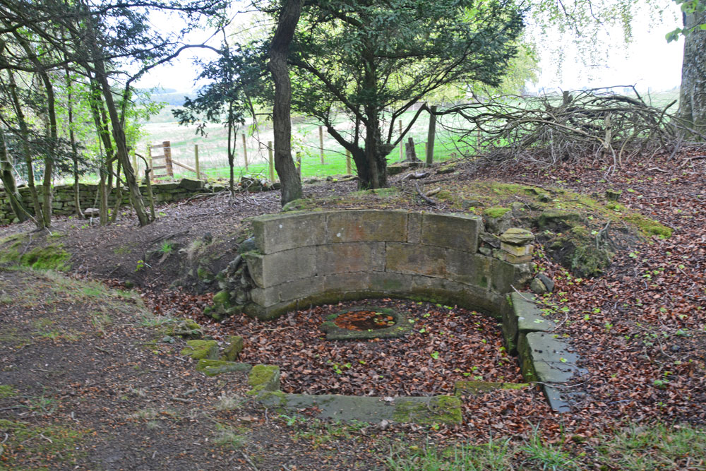
St George's Well (Minsteracres) submitted by Anne T on 7th May 2019. Getting closer, the structure of the well emerges from the surrounding tall trees. There is a semi-circular back wall, which has no exit tap or pipe; water must emerge directly from the ground into the small, circular well basin inside a larger, paved well pool.
(View photo, vote or add a comment)
Log Text: St George's Well, Minsteracres: Minsteracres had an open day today between 11am and 4pm, so we decided to drive up and see if we could find the well. I understood that it was located near to the chapel, but this was mistaken, as we found out on arrival.
Driving up the private road from the A68, we parked just past the cattle grid about 200m away from the main buildings, parked on the grass alongside the vegetable garden to our north, and walked back to The Shrubbery, a woodland with specimen and ornamental trees and two signposted walks.
With only a rough grid reference to guide us, but with the OS map in hand, it quickly became apparent that the well wasn’t in The Shrubbery, so we made our way back to the road and walked a little back towards the A68, heading north-north-east. In a small wood to our right hand side, the well became quickly apparent. I quickly recorded the waypoint on our GPS.
Whilst there was water in the pool, there was no water bubbling into the well pool. The well had a fairly large ditch running from it, so there appears to still be a fair flow of water from it at certain times.
Someone had recently been clearing away weeds and shrubs from the area. Scrapping away some of the leaves at the base of the steps into the well basin, water quickly flowed in to fill up the space where the leaves had been, although there was no evidence of flow.
Mossknowe Tumulus
Trip No.127 Entry No.6 Date Added: 7th May 2019
Site Type: Cairn
Country: Scotland (Dumfries and Galloway)
Visited: Saw from a distance on 2nd May 2019. My rating: Condition 2 Ambience 3 Access 4
Mossknowe Tumulus submitted by graemefield on 27th Jun 2012. The cairn before excavation
(View photo, vote or add a comment)
Log Text: Mossknowe Cairn 1/ Belten Mound: We stopped outside the cottage to the west of the minor road at NY 27846 69513, but could not see much. Carrying on to where the road bends at NY 28117 69281, the only gate into the field from the road here is at NY 28067 69222 and hadn't been opened in such a long time, the hawthorn hedge had grown round the edges. With the rain starting to pelt down, and with evening rapidly falling, we decided to cut our loses, quickly photograph the cairns from a distance and go home.
Mossknowe 3
Trip No.127 Entry No.5 Date Added: 7th May 2019
Site Type: Cairn
Country: Scotland (Dumfries and Galloway)
Visited: Saw from a distance on 2nd May 2019. My rating: Condition 2 Ambience 3
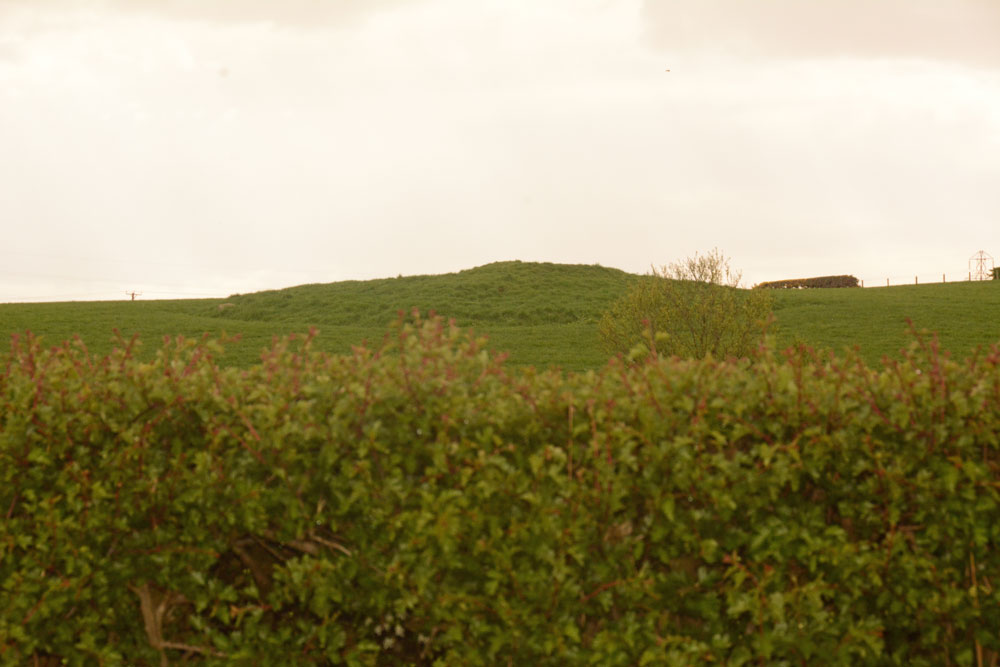
Mossknowe 3 submitted by Anne T on 7th May 2019. The third of the three cairns in close proximity. We only saw this from a distance, as the light was fading rapidly, the rain was heavy and we were unable to open the gate into the first field. Of the three cairns, this looked the most interesting to see, so I'd like to do a 'repeat visit' to all three at some time in the near future, if we pass through this area again.
(View photo, vote or add a comment)
Log Text: Mossknowe Cairn 3: Saw this from a distance only, as the light was fading rapidly, the rain was pelting down and we couldn’t open the gate into the first field. Couldn’t get too excited about this, although it looked the most interesting of the three cairns.
Fair Helen's Cross (Kirkconnel)
Trip No.127 Entry No.4 Date Added: 5th May 2019
Site Type: Ancient Cross
Country: Scotland (Dumfries and Galloway)
Visited: Yes on 2nd May 2019. My rating: Condition 3 Ambience 4 Access 3

Fair Helen's Cross (Kirkconnel) submitted by Anne T on 5th May 2019. First view of Fair Helen's Cross (not to be confused with the nearby Fair Helen's tombstone), hidden deep in the shrubbery, to the east of Kirtle Water, and north west of the Old Parish Church of Kirkconnel and its atmospheric graveyard.
(View photo, vote or add a comment)
Log Text: Fair Helen's Cross, Kirkconnel Old Church: It was a beautiful walk from the small parking area provided at about NY 25239 74833. We let ourselves through the kissing gate and followed the footpath which ran just to the east of Kirtle Water, and a pasture field with sheep and young lambs to our right. The very dark storm clouds gathering to the north east made a fantastic backdrop to the mature trees in the field.
Along the footpath, we were distracted by a modern tombstone about half way along our route to Old Kirconnel Church. We also stopped to admire the wonderful trees, with all their different colours, from a soft pink of a newly emerging copper beech tree, flowering cherries, silver birches and horse chestnuts. Eventually stumbling upon a very large marble tombstone at the entrance to the old churchyard, we let ourselves in and started exploring.
Having missed, at first, Fair Helen's Tombstone, and having to have it pointed out to me (well, it was hidden by a large metal signpost immediately in front of it), I walked round the ruins of the old church whilst Andrew went to search for the cross. "You'll need a machete", were his words on his return.
Walking through the kissing gate in the far north western corner of the churchyard, we walked 20-30m north along the path until the vague outline of the cross appeared behind the shrubbery. It didn't help that the largest tree next to the cross was a holly - very prickly!
As we arrived at the cross, the rain started to pelt down. Fortunately, the shower didn't last very long, and after taking photographs of this old village cross, we went back to admire and photograph the unusual grave markers in the churchyard.
Mossknowe 2
Trip No.127 Entry No.3 Date Added: 7th May 2019
Site Type: Cairn
Country: Scotland (Dumfries and Galloway)
Visited: Saw from a distance on 2nd May 2019. My rating: Condition 2 Ambience 3 Access 4
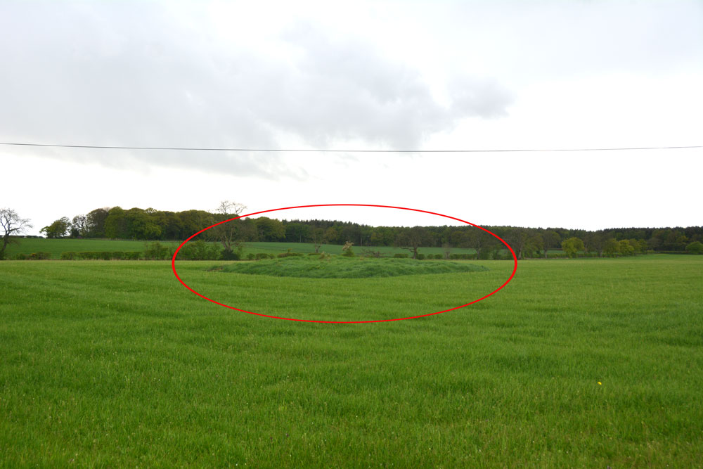
Mossknowe 2 submitted by Anne T on 7th May 2019. The location of this cairn is marked by the red oval. We could really only spot the location of the cairn by the tall grass left around it by the farmer. We were unable to open the gate into the field, and with the rain pelting down and light rapidly fading, we contented ourselves with photographing it from over the hedge.
(View photo, vote or add a comment)
Log Text: Mossknowe Cairn: the cairn nearest to the bend in the road, south east of the cottage which has Mossknowe Tumulus in its garden. Nothing special, but another site ticked off the list.
Fair Helen's Tombstone
Trip No.127 Entry No.2 Date Added: 7th May 2019
Site Type: Marker Stone
Country: Scotland (Dumfries and Galloway)
Visited: Yes on 2nd May 2019. My rating: Condition 3 Ambience 4 Access 3

Fair Helen's Tombstone submitted by Anne T on 7th May 2019. Fair Helen's tombstone (foreground), with Adam Fleming's behind. The large metal signpost gives details of the tragedy, now immortalised by Sir Walter Scott in his epic poem.
(View photo, vote or add a comment)
Log Text: Fair Helen's Tombstone: This ‘monument’ is in two parts, the first of which came as a complete surprise, to our west, just off the path in a clearing, just above Kirtle Water.
For the legend of Fair Helen of Kirkconnel see: Fair Helen's Legend and Sir Walter Scott's epic poem.
This was a simple gravestone with a plaque on it, which reads: “In memory of fair Helen of Kirkconnel as well as Richard Bell and Adam Fleming who were involved in the tragedy which took place here. Erected by Clan Bell descendants. Irving Bell. Founder”.
Walking into this small, overgrown but very atmospheric, graveyard, with its tumbled ruins, I struggled to find Fair Helen’s Tombstone, but Andrew pointed it out – right behind a large metal sign announcing this is “Kirkconnel Churchyard”. The sign reads: “In the ballad “Fair Helen of Kirkonnel”, Adam Fleming’s Lover Helen was shot by mistake by a rival in Kirkconnel churchyard. The bullet was meant for Adam, who promptly killed him. Adam was later buried beside Helan and this is his tombstone: Hic Jacet Adam Flemeng. The adjacent uninscribed stone is Helen’s; and the nearby late-medieval cross is called “Fair Helen’s Cross”, marking the site of her death. / The romantic story of the ballad might be an 18th century invention, and the association of the monuments in the churchyard with the ballad’s characters is questionable”.
Hoddom Parish Church
Trip No.127 Entry No.1 Date Added: 6th May 2019
Site Type: Sculptured Stone
Country: Scotland (Dumfries and Galloway)
Visited: Yes on 2nd May 2019. My rating: Condition 2 Ambience 2 Access 4
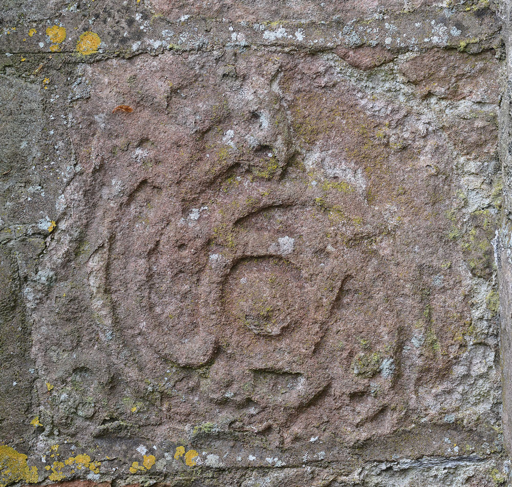
Hoddom Parish Church submitted by Anne T on 6th May 2019. A close up of the stone, taken with my zoom lens. I'm still trying to find out more details about where it came from and its age. The Canmore record mentions this church replaced an earlier one built in 1610, "of which fragments remain", but nothing more. Other fragments have been lost, and a Roman altar has been built into the porch of the new parish church at Hoddom.
(View photo, vote or add a comment)
Log Text: Sculptured Stone at Hoddom Old Parish Church: Our first stop of the day, and a strange place. A church in ruins, boarded up, although with parts of the churchyard really nicely tended – presumably because of the war graves.
Sitting on the southern side of the B725 to the south west of Ecclefechan, we parked in the layby outside the main gates into the churchyard, immediately next to the ruins. It took us ages to find the location of the sculptured stone, and trying to describe its location is a little tricky as the church is built in the shape of a square cross, orientate N-S, E-W. The stone is built into the outside corner of the eastern wall of the southern 'arm' and the south wall of the eastern 'arm'. We were unable to get right up to it because of the proximity of the railed family grave enclosure, although we succeeded in knocking some brambles down from the front of the stone so we could view it.
St Michael's Church (Warden)
Trip No.126 Entry No.3 Date Added: 5th May 2019
Site Type: Ancient Cross
Country: England (Northumberland)
Visited: Yes on 1st May 2019. My rating: Condition 3 Ambience 4 Access 4
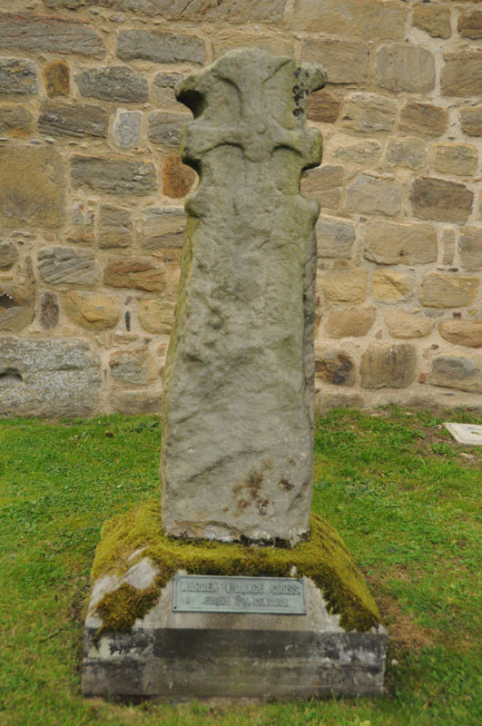
St Michael's Church (Warden) submitted by Anne T on 4th Sep 2014. The 7th century cross at the west side of the porch of St. Michaels, by the Saxon tower.
(View photo, vote or add a comment)
Log Text: St Michael and All Saints, Warden: Anglo Saxon Sculptured Stones, including The Warden Man and Hammerhead Churchyard Cross: I last visited this church on 3rd September 2014, when I was almost new to the Portal, and hadn’t yet come across Pastscape, Historic England or the Corpus of Anglo Saxon Stone Sculpture databases, so taking Andrew back here was a very pleasant surprise, as I learned an awful lot about these stones.
Well worth a repeat visit!
Homers Lane (Warden)
Trip No.126 Entry No.2 Date Added: 1st May 2019
Site Type: Rock Art
Country: England (Northumberland)
Visited: Couldn't find on 1st May 2019. My rating: Ambience 2 Access 4

Homers Lane (Warden) submitted by Anne T on 1st May 2019. But which boulder is it?? Looking over the dry stone wall, we were within 8-9m of the previously recorded location of the rock art panel. All the large boulders from around the tree to the top right hand side of the photo, which is where the panel had previousy been located, appeared to have rolled down the hill. We spent ages peering over the wall trying to spot any possible boulders the same size and shape as the panel, or any boulders with possible cups but drew a blank. Disappointing.
(View photo, vote or add a comment)
Log Text: Homers Lane, Warden, Rock Art Panel: Having visited Warden Hill Hillfort, we decided to drive the 1.15km to try and find this rock art panel, as it was so close. Driving north up the almost single track lane we managed to park next to the gate into the field with the rock art panel in, at NY 91110 68391, and walked back south the 50m or so towards the grid reference where the panel was located.
I'd gone armed with the ERA information and their photographs, and the GPS took us to within 9m of the previously recorded location of the panel. We leaned over the very ivy covered dry stone wall and tried to identify the boulder, but could not see it.
The field was planted with wheat, but with a large, long pile of fertiliser combined with a wide grassy edge to the field, we thought if we trod very carefully, we could let ourselves in through the gate and walk back to the piles of boulders. This was easy enough to do, although I wish there was someone I could have asked permission from first!
Using the GPS, we got to within 3m of the recorded grid reference, but still could not find a boulder the right size and shape. With the ERA photos in hand, I identified the two trees in one of the their photos, lined them up, but there were no boulders at that location. It looked as if they had been rolled further downhill, towards the drystone wall, to make room for the huge pile of fertiliser.
Andrew very bravely balanced on the boulders, trying to locate the panel, but after a reasonably through search, had to give up. Disappointing, but the NADRAP survey photos were dated 2008 - some 11 years ago.
