Contributory members are able to log private notes and comments about each site
Sites Anne T has logged. View this log as a table or view the most recent logs from everyone
Dunchraigaig Cairn
Trip No.88 Entry No.18 Date Added: 3rd Aug 2018
Site Type: Cairn
Country: Scotland (Argyll)
Visited: Yes on 18th Jul 2018. My rating: Condition 3 Ambience 4 Access 5

Dunchraigaig Cairn submitted by andy_h on 6th Mar 2003. Dunchraigaig Cairn, Kilmartin Valley, Argyll.
(View photo, vote or add a comment)
Log Text: Dunchcraigaig Cairn: Parking in the small car park opposite the cairn, we crossed (ran over between the cars doing at least 60mph) the busy road to have a look at yet another large, stony cairn (special in its own right, but so many of them around here!). Just as we drew into the car park, a black mini-bus with the name “Tour of the Tor”; we kept coming across this bus and its people a number of times for the next few days. They do ‘sacred tours’ of a number of areas, including Glastonbury and the Celtic Lands. I don’t know where they went, but they didn’t arrive at the cairn until after we’d started on towards the standing stones.
On the way down to the standing stones/stone row at Ballymeanoch, I spotted a smaller cairn to its north eastern side, and another chamber, topped by a large lintel stone on its southern side (note: Canmore says so much material may have been moved from this side of the cairn, it may have been the primary burial).
This was an impressive location, despite its proximity to the busy road.
Dunning
Trip No.84 Entry No.2 Date Added: 25th Jul 2018
Site Type: Standing Stone (Menhir)
Country: Scotland (Perth and Kinross)
Visited: Saw from a distance on 14th Jul 2018. My rating: Condition 3 Ambience 3 Access 4

Dunning submitted by Nick on 5th Nov 2002. The stone looking north
(View photo, vote or add a comment)
Log Text: Dunning North Standing Stone: From St Serf’s church, we walked along Kirk Wynd, down alongside the stream, down past some cottages, to where the footpath split. The standing stone was right in front of us, albeit in the middle of a ripening crop of wheat. It seemed very far away, and I was very, very reluctant to trample any of the crop, so we stuck to the footpath. With the camera lens on maximum zoom I tried to capture the different faces of the stone, but as the footpath ran roughly west-east, we couldn’t really get close.
The guide in the church told us there were two standing stones nearby; most people visited the northern (this) stone, but apparently not many people went to the southern stone.
If the field hadn’t been set with a crop, I’d have been tempted to look for the gate, or an alternate route to get closer.
Our next stop was to the very peculiar "Maggie Wall Monument", 1km west of Dunning on the B8062. This is a 20ft tall monument topped by a cross to a witch called Maggie Wall who was apparently burnt in 1657. The stories I've all tracked down say Maggie Wall didn't exist. This monument definitely made me shiver!
Duns Mercat Cross
Trip No.105 Entry No.1 Date Added: 4th Nov 2018
Site Type: Ancient Cross
Country: Scotland (Scottish Borders)
Visited: Yes on 27th Oct 2018. My rating: Condition 3 Ambience 3 Access 5
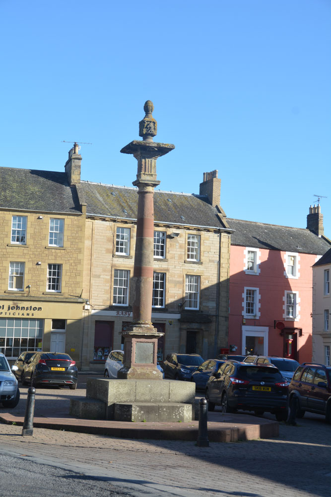
Duns Mercat Cross submitted by Anne T on 4th Nov 2018. The current market cross, moved to its present location in 1897.
(View photo, vote or add a comment)
Log Text: Duns Mercat Cross: Having set off after a snow storm this morning, we stopped off in Duns just after 12 noon for coffee and a scone.
We went to the café we went to when we were here last (some 3-4 years ago), only to find the café open but no-one in, despite many cars in the town. Parking just round the corner from the market square, I realised that there was a market cross which I don’t think I’d photographed before. Whilst the base was ‘modern’ the top appears old.
The café had changed hands, reverting to the original owner, who admitted to being 76 years old and having run a gallery in Harrogate. “We don’t do lunches” we were told. By this time we were cold and hungry so opted for hot scones and tea. A great selection of very reasonably priced antiques to browse round, too, although the only thing I would really have liked to buy wasn't for sale!
The plaque on the cross base reads: “The Mercat Cross of Duns originally stood on the site of the present town hall and was removed when it was rebuilt in 1820. It was re-erected by Andrew Smith Esqr. of Whitchester AD 1897.”
Dunsdale (College Valley)
Trip No.45 Entry No.4 Date Added: 14th Sep 2017
Site Type: Ancient Village or Settlement
Country: England (Northumberland)
Visited: Yes on 12th Sep 2017. My rating: Condition 1 Ambience 4 Access 5
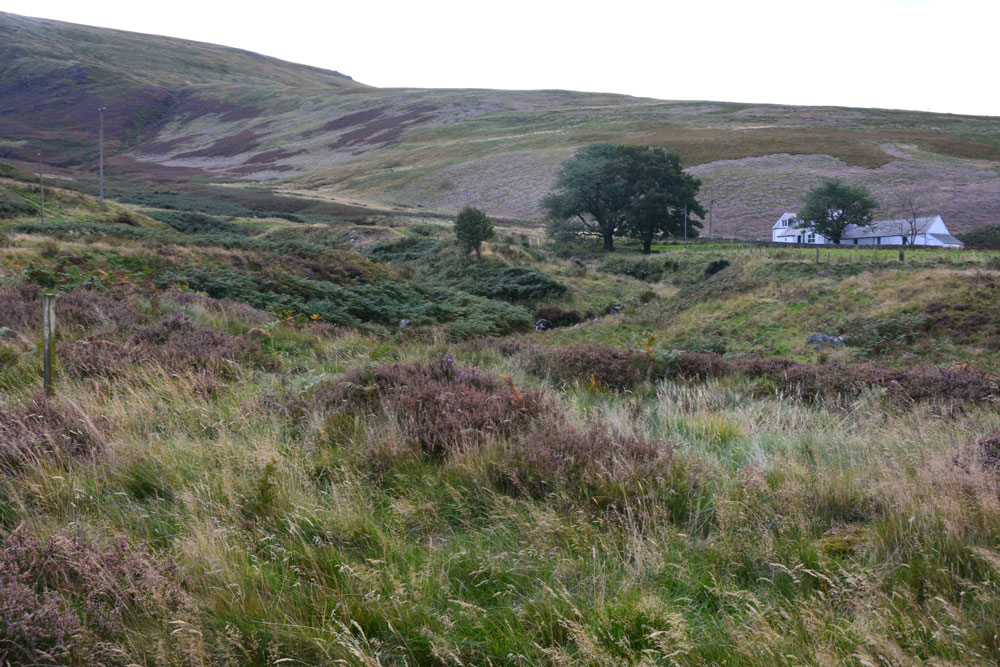
Dunsdale (College Valley) submitted by Anne T on 14th Sep 2017. Standing in the middle of the settlement (largely buried underneath bracken) looking over Bizzle Burn towards Dunsdale Farm
(View photo, vote or add a comment)
Log Text: Dunsdale Settlement, College Valley: Wow. The screen slopes to the north of this path are daunting and impressive at the same time. If there was a landslip here, you might be cut off for some time.
The settlement here was difficult to make out because of the very tall grass and heather, but we could feel stone foundations under our feet and depressions in the ground.
It is a very beautiful spot, with the scree slopes of Dunsdale Crag to the north and Bizzle Burn running to the west of this site.
Would really like to come back here in winter to see more of the site structure.
Dupplin Cross
Trip No.84 Entry No.1 Date Added: 25th Jul 2018
Site Type: Ancient Cross
Country: Scotland (Perth and Kinross)
Visited: Yes on 14th Jul 2018. My rating: Condition 4 Ambience 4 Access 5
Dupplin Cross submitted by cosmic on 16th May 2007.
Back of the cross with the dedication panel top middle
(View photo, vote or add a comment)
Log Text: Dupplin Cross, St Serf's, Dunning: Our first stop of the day, and a very old, popular, tourist village. We first saw a drinking fountain outside the churchyard, almost at the cross roads.
By the southern door to the church were two hogbacks.
Inside was the Duppline Cross and a smaller cross slab to its north west. There was a guide, already talking to a gentleman about the cross, but when she saw us, she interrupted her talk and came up to us to ask us to join in. Not usually one for ‘tours’ we reluctantly joined her, as I really wanted space and time to drink in this cross on my own, then photograph it; this was not to be, as there was a steady stream of visitors coming into the church. As we went out, another family came in, followed later by a large walking group.
I photographed most of the individual panels around the Dupplin cross and need to sort these out using the diagrams in the 'Official Souvenir Guide' (£1). I was particularly fascinated by the base, which appeared to have carved lines across one corner, and cups (or very worn interlacing) on its base.
Dyke Row
Trip No.5 Entry No.1 Date Added: 14th Aug 2016
Site Type: Stone Row / Alignment
Country: Scotland (Dumfries and Galloway)
Visited: Yes on 10th Aug 2016. My rating: Condition 3 Ambience 1 Access 4
Dyke Row submitted by cosmic on 4th Jun 2004. Dyke Row at NT084036 is just to the south of Moffat
(View photo, vote or add a comment)
Log Text: Dyke Row or Three Stanes, Moffat: I have driven this road many times before, but never noticed these three stones at the side of the road. Having come off the A74(M) onto the A701 travelling towards Moffat, travelling at the speed limit of 60 mph, they are difficult to see. The traffic was too heavy and fast to park at the road side, so finding a space for one car at the road junction to Dyke Farm (grid reference NT 08311 03653) we pulled on our anoraks and headed northwards up the A701. Whilst I’ve been to see many standing stones, this is the first time I felt my life was in danger whilst trying to view them. Timber lorries hurtled along the road in the heavy rain in quick succession. To avoid the spray and protect my camera, I had to turn my back to the road and step onto the grass verge as far away from the road as I could go. A quick run across the road to the stones meant taking my life in my hands to avoid the constant stream of cars, lorries and trucks.
The smallest, northern-most stone was completely hidden by the undergrowth, but we gently bent this out of the way to photograph it, then replaced the shrubbery and nettles back over the stones.
According to the Canmore record: "These standing stones are on a straight alignment NNE - SSW. The southernmost measures 1.0m x 0.8m x 1.2m high, is oriented ENE - WSW, and has an O S bench mark cut on its W face. The next measures 0.8m x 0.6m x 1.0m high, and is oriented NNE - SSW. The most northerly measures 0.8m x 0.4m x 0.7m high and is oriented ENE - WSW. The construction of the nearby roads would have destroyed any possible related structures."
Easington Cross
Trip No.159 Entry No.6 Date Added: 7th Mar 2020
Site Type: Ancient Cross
Country: England (Yorkshire (North))
Visited: Yes on 4th Mar 2020. My rating: Condition 3 Ambience 3 Access 4
Easington Cross submitted by johndhunter on 31st Jan 2020. Easington Cross at NZ 74427 18004 – Closer view, the possible shaft next to the broken medieval base looks like it has a sword carved on it, January 2012.
(View photo, vote or add a comment)
Log Text: Easington Cross Base: The cross base is recorded as HE 1011970 and as Pastscape 1583425. Pastscape 29031 tells us there are "nine Saxon stone fragments [in the basement] at (the) Church of All Saints", although my attempts to contact the vicar by telephone and email have not been successful. I did speak to a gentleman who I thought was the church warden, but he told me "he no longer holds an official position within the church".
As we were passing through the village anyway, we stopped to see the cross base, although the church was well and truly locked.
As well as the cross base, there is also a sundial towards the western end of the churchyard, and a drinking fountain at NZ 74521 18036, at the side of the main Loftus-Whitby Road.
Easington Cross
Trip No.160 Entry No.2 Date Added: 20th Mar 2020
Site Type: Ancient Cross
Country: England (Yorkshire (North))
Visited: Yes on 19th Mar 2020. My rating: Condition 3 Ambience 3 Access 4
Easington Cross submitted by johndhunter on 31st Jan 2020. Easington Cross at NZ 74427 18004 – Closer view, the possible shaft next to the broken medieval base looks like it has a sword carved on it, January 2012.
(View photo, vote or add a comment)
Log Text: Easington Hogbacks and A-S stone fragments: We had already seen the cross base in the churchyard, but arranged with the Reverend Danny Walker to revisit when the church was open. He was there with a very knowledgeable churchwarden (with his two wonderful dogs) to move some furniture around so they could leave the church open for parishioners and visitors at this current time of crisis.
The churchwarden took us into the tower to see a Norman arch that had been rebuilt on the first floor to preserve it. He also showed us St Hilda’s Cross base, and what he said was part of the cross shaft, but I said I thought was a medieval cross-slab as it clearly had a sword on it in the sunlight.
The vicar had cleared the steps to the basement boiler room, where we were allowed to move the old screens and debris to find any pieces we could. We found all but one of the pieces listed on the Corpus (the other may have been under debris, but with dead birds in the corner, we were reluctant to explore this part of the room). A real treat, and thanks to the vicar for opening the church up for us.
East Lordenshaw Channel Rock
Trip No.8 Entry No.2 Date Added: 10th Jan 2017
Site Type: Rock Art
Country: England (Northumberland)
Visited: Yes on 1st Jan 2017. My rating: Condition 3 Ambience 4 Access 3
East Lordenshaw Channel Rock submitted by DrewParsons on 2nd Oct 2011. September 2011.
(View photo, vote or add a comment)
Log Text: Channel Rock, Lordenshaw, Northumberland: At the main Lordenshaw car park, there is a display board with a QR reference which I scanned to get me through to the Newcastle University Rock Art Mobile site. This is the first time I’ve been able to use this, as I had a good mobile signal, and found it great.
Their directions to Channel Rock are: “From the top of the hillfort, facing towards Rothbury down the valley, continue through the hillfort to your right. At the waymarked hillfort exit (65m) follow the left hand path. When you reach another waymarker (135m) turn off the path to the right, down the slope. You should see an expanse of white rocks straight ahead (70m).”
We carried on northwards through the hillfort, dropping down the slope to the north, past a waymarker, then headed right. At first difficult to find, as the light grey/whiteish Channel Rock sits within a rocky landscape, once spotted, its easy to identify and sits right on the edge of the hill; the cup marks and channel can be clearly seen.
Nearby is an impressive undercut rock, rounded by water. Brilliant site, sitting well below the crest of the hill/hillfort.
East Steel Farm
Trip No.27 Entry No.1 Date Added: 26th May 2017
Site Type: Modern Stone Circle etc
Country: England (Northumberland)
Visited: Yes on 25th May 2017. My rating: Condition 3 Ambience 3 Access 5
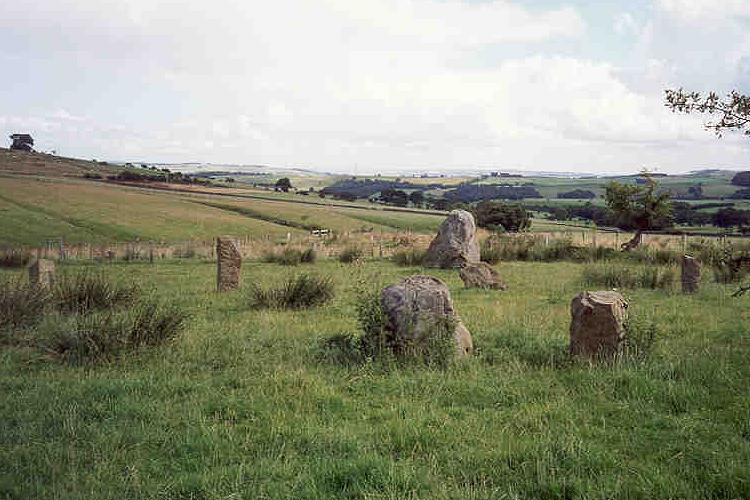
East Steel Farm submitted by Andy B on 24th Nov 2001. East Steel Farm Stone Circle
(View photo, vote or add a comment)
Log Text: East Steel Modern Stone Circle, Near Beltingham, Northumberland: From Beltingham, the further we drove out into the fells, we kept seeing bright yellow ‘Art Gallery Open’ signs. Long way to go for an art gallery, but a lovely drive. Note for future visitors – follow these signs!
As we pulled up to the lane leading down to East Steel House, marked by the signpost (see below), Dennis Kilgallon’s van was coming up to the road junction, signalling to turn right along the minor road. We indicated to go left and we passed each other. Parking by the circle, I hopped out with the camera, not realising Dennis had parked up and came across to speak to us. “Just taking a look?” he asked, “It’s a folly – built 10 years ago”. I thanked him kindly as he got back into his van and drove off. What a lovely place for an art gallery.
I counted 14 stones in the circle, most looking like reused gateposts, some of them leaning, largely built inside an old boundary, now just an arc of raised earth and stone in the ground topped in places by old, crooked, atmospheric hawthorn trees. Two of the stones were placed nearer to the track, outside the boundary - the circle wasn’t circular.
There was one really huge stone, presumably meant to be the heel stone. I wondered how it got there. My husband grunted and said “truck and crane probably.” At this point, a man in black was pelting up the track towards us, and I thought this was the farmer coming to warn us off, but no, it was a runner, who bid us good evening on his way past.
After 10 minutes or so appreciating the calls of the curlews on the surrounding fells, we headed off back to Beltingham and home.
Easter Broomhouse
Trip No.105 Entry No.8 Date Added: 5th Nov 2018
Site Type: Standing Stone (Menhir)
Country: Scotland (East Lothian)
Visited: Yes on 27th Oct 2018. My rating: Condition 3 Ambience 4 Access 4
Easter Broomhouse submitted by cosmic on 1st Jun 2008. Site in East Lothian:
Viewed from SE
(View photo, vote or add a comment)
Log Text: Easter Broomhouse Standing Stone: Dusk was falling as we arrived at this site, which I've long wanted to see. We parked by the water treatment works over the road at NT 67718 76493 and walked down the side of the ploughed area of the field until we were level with the stone, then ‘waded’ through the loose, ploughed soil until we reached the stone itself.
A lonely spot, although it has great views to the Firth of Forth and Bass Rock in the distance, to the north. It is a tall, sandstone pillar standing in an ocean of brown-red soil.
There are indeed 3 cups marks on its western face, along with some modern graffiti. The base of the stone has really been worn away; as the Canmore record says, this is the result of a steam plough cable.
Eastern Sanctuary Cross (Hexham)
Trip No.147 Entry No.2 Date Added: 6th Sep 2019
Site Type: Ancient Cross
Country: England (Northumberland)
Visited: Yes on 3rd Sep 2019. My rating: Condition 2 Ambience 2 Access 5
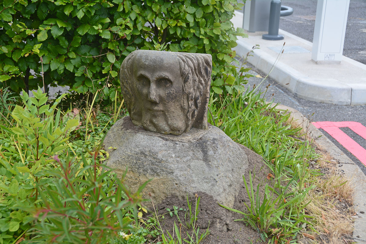
Eastern Sanctuary Cross (Hexham) submitted by Anne T on 5th Sep 2019. Cross base or top of a gate post (with a carved stone head inserted into the socket hole)? Really strange. Hodges, writing in 1897, appeared to confirm this was indeed the base of the eastern sanctuary cross of Hexham Priory.
(View photo, vote or add a comment)
Log Text: Eastern Sanctuary Cross of Hexham Priory (or just the top of a gate post??): We stopped to photograph the scheduled Glover's Pant before making our way to the eastern side of Hexham. We were incredibly surprised to find this cross base, which we’ve looked for before, but at the old grid reference. On this visit, I spotted it straight away, and took its current grid location with our GPS. It is now sited at the eastern entrance to the car park. Andrew walked right past it, and I might have too, had I not remembered about the carved stone head being in the socket hole! I almost got myself run over trying to take photographs from various angles.
I also found Hodges’ 1897 paper listed in the Pastcape reference (copied in the text below). He reports that the locations of all four of Hexham Priory Sanctuary Crosses were now known. He reports the location of the northern one is at Cross Bank. I’m wondering if this is the one at Crag House, north of Acomb, although this is some 5km from the location of this cross base.
Eddybroth Well (Whittle Dene)
Trip No.163 Entry No.2 Date Added: 11th Jun 2021
Site Type: Holy Well or Sacred Spring
Country: England (Northumberland)
Visited: Yes on 8th Jun 2021. My rating: Condition 3 Ambience 4 Access 3
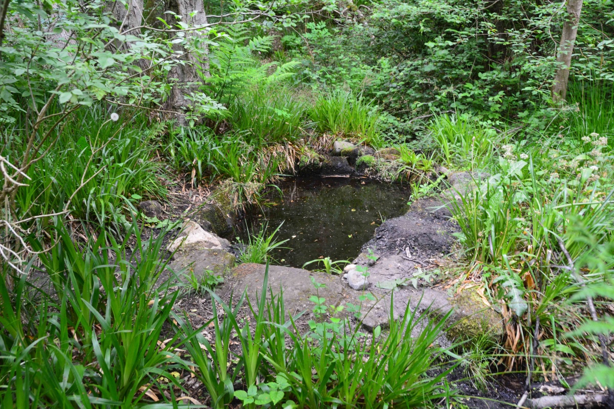
Eddybroth Well (Whittle Dene) submitted by Anne T on 11th Jun 2021. First view of Eddybroth Well, turning right (east), following the footpaths along the pond that used to feed the old corn mill sluice system.
(View photo, vote or add a comment)
Log Text: Eddybroth Well and Dean Head Well, Whittle Dene: A lovely walk along St Andrew's Lane from Ovington, then down (and across) Whittle Burn, and along leafy, shady paths which follow the side of the Burn. A lovely managed woodland, complete with small wooden chalets that were being well used in this warm weather. Once passed these, we saw only one other person. A really pleasant afternoon, and so pleased to have found this well.
Edenhall Cross (Langwathby)
Trip No.68 Entry No.1 Date Added: 6th Apr 2018
Site Type: Ancient Cross
Country: England (Cumbria)
Visited: Yes on 5th Apr 2018. My rating: Condition 3 Ambience 4 Access 5
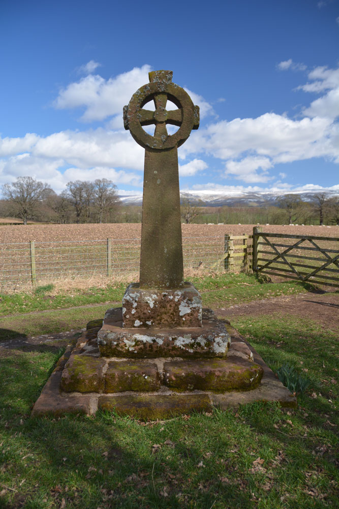
Edenhall Cross (Langwathby) submitted by Anne T on 6th Apr 2018. First view of the cross from the lane leading from Edenhall village to St. Cuthbert's Church. The River Eden runs 250 metres east of the cross. St. Cuthbert's church is 230m south east of the cross. The base looks very old, whereas the cross and shaft and head look as if they have been newly made, even though they were placed here in the 19th century.
(View photo, vote or add a comment)
Log Text: Edenhall Cross, near Langwathby, Cumbria: This is one of the crosses we didn't have time to visit on our last trip to Cumbria, and we picked a beautiful, if somewhat chilly day, to arrive.
No sooner had we pulled the car up by the cross to take some photographs, and I was wrestling with the lens of my camera, which had jammed, when a dog walker sidled up and asked us if we were planning on parking there. I said I was just going to take some photos, then we were heading down to the church; we wouldn't dream of blocking the gate into the field. The man looked mollified and moved on, only to be followed by a steady stream of dog walkers with large dogs.
The view across to the Pennines with their snow caps was lovely. The photographs didn't really do the scenery justice. A lovely spot.
Edin's Hall
Date Added: 2nd Jun 2015
Site Type: Broch or Nuraghe
Country: Scotland (Scottish Borders)
Visited: Yes on 30th May 2015. My rating: Condition 3 Ambience 4 Access 3
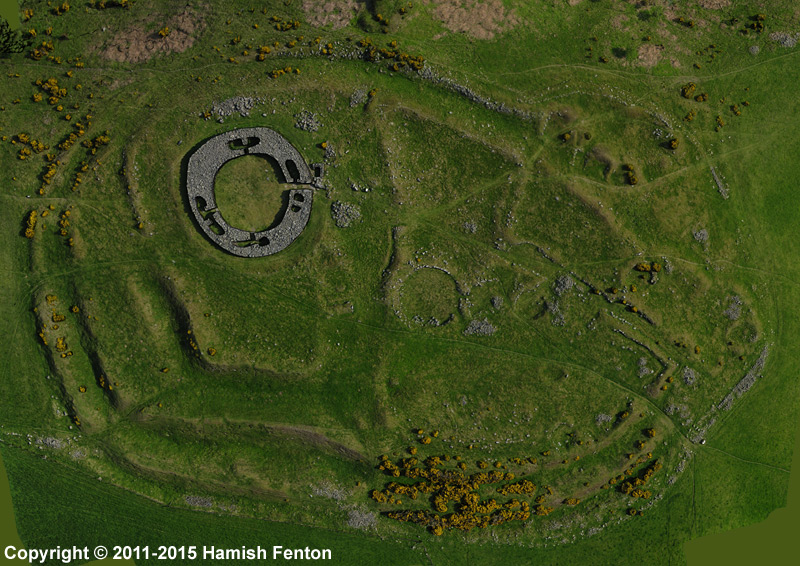
Edin's Hall submitted by h_fenton on 30th Mar 2015. Edin's Hall Broch / Fort / Settlement. Vertical image from 3D model which was created using 75 Kite Aerial Photograph s.
Photos taken: 19 May 2011
3D model created: March 2015
(View photo, vote or add a comment)
Log Text: Edin's Hall Fort & Broch, Scottish Borders: Having stopped at Duns for refreshments, there is a small car park, large enough for 3 to 4 cars just off the A6112 at grid reference NT 78933 60957 which gives access to a forest/river walk. At the car park, there is a signpost for the Broch, saying ‘2 ¼’ but two and a quarter what? Miles, kilometres? This contradicted our map which indicated the walk was just over a mile.
Walking through woodland, along an easy forest track, there is a sign saying: ‘Free range children and animals’ so whoever owns this land has a sense of humour (also try and spot the tree with personality by the car park - it has been given eyes, ears and a nose!).
Down the path, we approach the Whiteadder Water (yes, there is also a Blackadder) we come across the Elba foot suspension bridge, with a sign saying ‘only two people to cross at any one time. No jumping on the bridge’. It indeed moves up and down as you walk over. There are stunning views of vertical bedding planes forming the banks of Whiteadder Water at this point, with water tumbling over the rocks.
Continuing past the house, through its orchard, past the barking dogs and geese and hens, onto the flood plain with a bank to our left hand side which keeps the curious cattle at bay, we followed the river. Climbing up the bank towards the pylons running overhead led onto two stiles (stone steps) over the stone walls. This was somewhat of a challenge for me on the way there, having to sit on top of the wall and swing my legs over, but on the way back, I’d got bored of being frightened and actually managed to walk across them like a normal walker.
A pleasant walk up to the hill fort and broch, with a herd of cattle looking lazily down on us from the top of the hill in the first field and a flock of sheep and their now large lambs in the second. Rather than scramble across a third stile there is a gate in the wall higher up the slope which we used to gain entry to the field with the fort. The Duns History Society describe this walk as ‘slightly strenuous’ but I’d disagree. It’s pleasant enough, although the hillside immediately up to the fort is a little steeper in practice than it looks on the ground.
Following the track into the fort, there are some obvious defensive banks and ditches which rise gently up the hillside as you follow the trackway, with clear hut circles, large and small. There also appears to be the remains of some square stone structures which (according to the interpretation board) indicate later (more recent use of the site). The views down to the river valley were great, as was Cockburn Law Hill Fort rising still high above us – we drove past this on the way back to Abbey St. Bathans and will come back to explore this on another visit [note to self, use the A1 to Berwick then cut across country to Preston rather than use the A697 road from Morpeth – this was very slow].
The broch itself is impressive as you first approach – the entire lower few courses of stone are still in place round the entirety of the circular structure; there is only one entrance into the broch on its eastern side.
It is fascinating to walk around, as there are all sorts of internal chambers, and even the beginnings of a small set of stairs in an internal chamber on the south-western side of the broch. On the north-western side, where the ground starts to slope away towards Whiteadder Water, the walls are particularly thick; we guessed this was either because the walls needed reinforcing at some point to stop them sliding down hill, or it’s an internal chamber that’s been filled in.
The late afternoon/early evening sunshine brought out the contrast between the defensive banks and ditches and I could have spent a lot longer walking around here. If there had been time, we might have followed the footpath through the west-south-western entrance to the fort all the way up to Cockburn Law Hill Fort. The site appears to be really well cared for, with all the bracken being cut back.
Edinburgh Runestone
Trip No.62 Entry No.2 Date Added: 8th Jan 2018
Site Type: Carving
Country: Scotland (Midlothian)
Visited: Yes on 19th Dec 2017. My rating: Condition 3 Ambience 2 Access 4
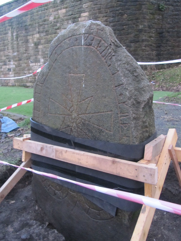
Edinburgh Runestone submitted by Anne T on 7th Jan 2018. The Runestone seen by clambering up the steep muddy track from Princes Street Gardens, just below the Castle Esplanade. The runes read: ""Ari engraved this stone in memory of Hialm his father. God help his soul."
(View photo, vote or add a comment)
Log Text: The Edinburgh Runestone: Getting to this stone was rather precarious! It was easy to walk up the 40 degree slope by clutching onto the nearby railings around the stone. Getting down was more difficult and left my friend with mud all over his walking boots. The stone is obviously in the middle of being moved - it has been strapped up and well protected. I'm glad its going to a much more accessible site. On my next trip up to Edinburgh I'll make a point of going to see this stone in its new location.
Edinburgh Runestone
Trip No.157 Entry No.4 Date Added: 20th Feb 2020
Site Type: Carving
Country: Scotland (Midlothian)
Visited: Yes on 18th Feb 2020. My rating: Condition 3 Access 4

Edinburgh Runestone submitted by Anne T on 7th Jan 2018. The Runestone seen by clambering up the steep muddy track from Princes Street Gardens, just below the Castle Esplanade. The runes read: ""Ari engraved this stone in memory of Hialm his father. God help his soul."
(View photo, vote or add a comment)
Log Text: Edinburgh Runestone, George's Square: A friend very kindly told me this stone has now been relocated, although it is still in the process of being bedded into its new spot, with the concrete shuttering still around its base.
The red cross on the eastern narrow side of the stone has now been picked out in red paint. The plain, southern side, is presumably to be hidden by shrubs once the bed is replanted.
Edinburgh Runestone
Trip No.98 Entry No.2 Date Added: 21st Sep 2018
Site Type: Carving
Country: Scotland (Midlothian)
Visited: Yes on 18th Sep 2018. My rating: Condition 3 Ambience 3 Access 4

Edinburgh Runestone submitted by Anne T on 7th Jan 2018. The Runestone seen by clambering up the steep muddy track from Princes Street Gardens, just below the Castle Esplanade. The runes read: ""Ari engraved this stone in memory of Hialm his father. God help his soul."
(View photo, vote or add a comment)
Log Text: New site of the Edinburgh Runestone (not been moved yet): As we were going to a building near to hear, we thought we’d do a detour to this part of the University.
We wandered around George Square first of all, but only found a modern sculpture called The Dreamer. We then identified 50 George Square (taken from the BBC article about the relocation of the stone), but only spotted a large hole in the middle of a square flower bed, hedged by low privet, around the side of the building. Having walked all around it, we went into check and I asked the security guard at the reception desk. He told us the stone hadn’t yet been moved, but the hole had been dug in preparation. I thanked him and went to take a photograph of the new site.
Edlingham Anglo Saxon Cross Bases
Date Added: 7th Aug 2016
Site Type: Ancient Cross
Country: England (Northumberland)
Visited: Yes on 23rd Jul 2016. My rating: Condition 3 Ambience 4 Access 5

Edlingham Anglo Saxon Cross Bases submitted by Anne T on 7th Aug 2016. These two cross bases sit at the south west external side of the church porch. Neither are decorated. Whilst recorded as being 8th century, the HER record queries this date, although they are similar to others of the same date.
(View photo, vote or add a comment)
Log Text: Edlingham Anglo Saxon Cross Bases, Northumberland: We went to visit Edlingham Castle/Fortified Manor House nearby, not expecting to find this charming (but very squat) 11th century church (St John The Baptist). As we approached, I spotted the Anglo Saxon cross bases by the south porch, although nothing is said about these in the church guide. According to the Northumberland HER record, there is also supposed to be the remains of an 8th century cross shaft in the north east corner of the nave, although we didn't spot this during our visit (but is recorded on the AS Corpus).
The location of this church is charming. Within a couple of hundred yards there is the ruined castle, with a wonderful example of a trilobe joggled lintel above the fireplace in the Solar Tower. Beyond is a viaduct from the now dismantled railway. Within easy walking distance is the cup and ring/rune marked rock at Lemmington Wood and the rock shelter at Corby Crags.
Following our visit to the church and castle, we walked to Noah's Well at the eastern end of the village, just outside Demesne.
Edmundbyers Cross (Muggleswick)
Trip No.42 Entry No.6 Date Added: 29th Aug 2017
Site Type: Ancient Cross
Country: England (Northumberland)
Visited: Yes on 28th Aug 2017. My rating: Condition 2 Ambience 3 Access 5
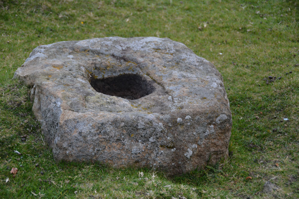
Edmundbyers Cross (Muggleswick) submitted by Anne T on 29th Aug 2017. Close up of the cross base, showing its socket hole.
(View photo, vote or add a comment)
Log Text: Remains of Edmundbyers Cross, Muggleswick: Marked in italic, old fashioned script on the OS map, I guess I was expecting something a little more exciting, such as a cross base with part of a shaft, but no. Just a cross base. Good job I knew what I was looking for as alongside the road there were other pieces of rectangular rock almost as large.
Sitting almost at the junction of the B6278 to Edmundbyers with the minor road leading almost to Smiddy Shaw Reservoir (just to the north of this road), it would have acted as a way marker. The cross base is located just over 1km from the boundary stone above.
When we got home, I was interested to read this from the Historic England entry: “Edmundbyers Cross is one of only three wayside crosses still in its original position in County Durham and the only known example on the route between Stanhope and Edmundbyers.”
