Contributory members are able to log private notes and comments about each site
Sites Anne T has logged. View this log as a table or view the most recent logs from everyone
Dyke Row
Trip No.5 Entry No.1 Date Added: 14th Aug 2016
Site Type: Stone Row / Alignment
Country: Scotland (Dumfries and Galloway)
Visited: Yes on 10th Aug 2016. My rating: Condition 3 Ambience 1 Access 4
Dyke Row submitted by cosmic on 4th Jun 2004. Dyke Row at NT084036 is just to the south of Moffat
(View photo, vote or add a comment)
Log Text: Dyke Row or Three Stanes, Moffat: I have driven this road many times before, but never noticed these three stones at the side of the road. Having come off the A74(M) onto the A701 travelling towards Moffat, travelling at the speed limit of 60 mph, they are difficult to see. The traffic was too heavy and fast to park at the road side, so finding a space for one car at the road junction to Dyke Farm (grid reference NT 08311 03653) we pulled on our anoraks and headed northwards up the A701. Whilst I’ve been to see many standing stones, this is the first time I felt my life was in danger whilst trying to view them. Timber lorries hurtled along the road in the heavy rain in quick succession. To avoid the spray and protect my camera, I had to turn my back to the road and step onto the grass verge as far away from the road as I could go. A quick run across the road to the stones meant taking my life in my hands to avoid the constant stream of cars, lorries and trucks.
The smallest, northern-most stone was completely hidden by the undergrowth, but we gently bent this out of the way to photograph it, then replaced the shrubbery and nettles back over the stones.
According to the Canmore record: "These standing stones are on a straight alignment NNE - SSW. The southernmost measures 1.0m x 0.8m x 1.2m high, is oriented ENE - WSW, and has an O S bench mark cut on its W face. The next measures 0.8m x 0.6m x 1.0m high, and is oriented NNE - SSW. The most northerly measures 0.8m x 0.4m x 0.7m high and is oriented ENE - WSW. The construction of the nearby roads would have destroyed any possible related structures."
Poldean menhir
Trip No.164 Entry No.1 Date Added: 26th Jun 2021
Site Type: Standing Stone (Menhir)
Country: Scotland (Dumfries and Galloway)
Visited: Yes on 25th Jun 2021. My rating: Condition 3 Ambience 4 Access 4
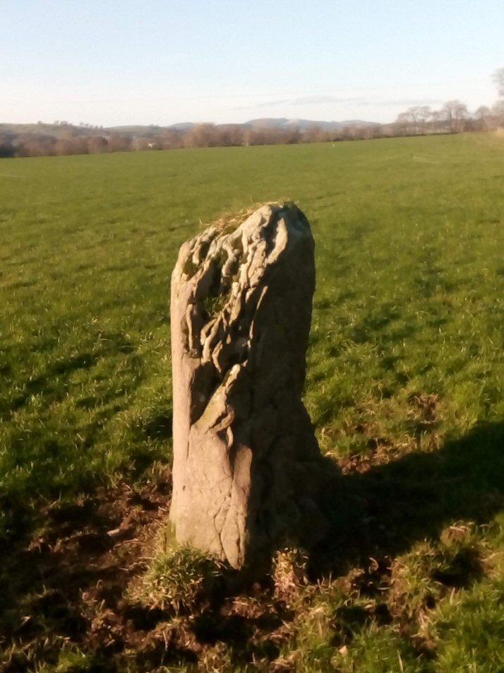
Poldean submitted by Apocryphus on 20th Jan 2019. A smaller stone located opposite Poldean Farm on a minor road south of Moffat
(View photo, vote or add a comment)
Log Text: Poldean menhir: Re-visited this stone whilst in the Moffat area. Not much has changed, except the weeds have been allowed to grow high around the stone. The area around its base has been heavily trampled, and was difficult to walk across. Two VERY large, very handsome bulls in the field of pasture, but thankfully an electric fence between us and them.
Chapman's Stone
Trip No.164 Entry No.2 Date Added: 27th Jun 2021
Site Type: Standing Stone (Menhir)
Country: Scotland (Dumfries and Galloway)
Visited: Yes on 25th Jun 2021. My rating: Condition 2 Ambience 3 Access 5

Chapman's Stone submitted by Anne T on 5th Apr 2019. Standing just to the north east of the stone, looking south west over the road, towards the course of the River Annan. Whilst Canmore classifies this stone as a prehistoric standing stone, they say "the stone traditionally marks the droving stance, and at a later date, the grave of a travelling horse trader" (called Chapman). We believe this is the ancient road to Carlisle from Glasgow, so the route may be really old, and this was one of the marker/way stone along that route.
(View photo, vote or add a comment)
Log Text: Chapman's Stone: Again, our second stop of the day, and I'd remembered wrongly there was a stile which allowed access to the field with this stone in. Rather, the stone acts as a stile, although the height of the fence and the barbed wire at the top stopped us from hopping over; neither could we find a gate on the side of the field nearest the road.
Such a shame this stone hasn't been set upright again. The views in either direction are very pretty.
Crunzierton Wood Scooped Settlement
Trip No.164 Entry No.4 Date Added: 27th Jun 2021
Site Type: Ancient Village or Settlement
Country: Scotland (Dumfries and Galloway)
Visited: Yes on 25th Jun 2021. My rating: Condition 2 Access 4
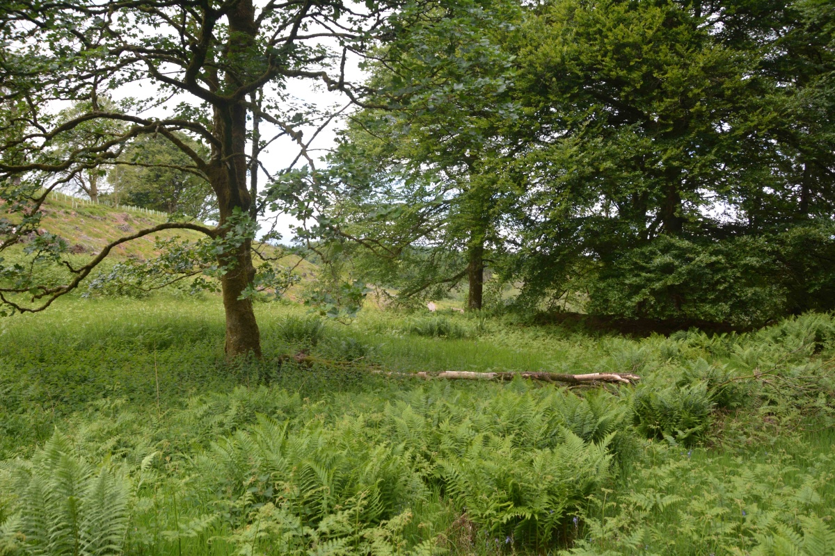
Crunzierton Wood Scooped Settlement submitted by Anne T on 27th Jun 2021. Standing in the middle of the southern bank of this settlement, looking north/north east across the sub-circular scoop. To the middle/left of the photo, the banks (which can more easily be seen with the naked eye) on the north western side of the scoop can be made out by the change in vegetation and the rise in ground level.
(View photo, vote or add a comment)
Log Text: Crunzierton Wood Scooped Settlement: I found the 'scramble' up the steep, leaf covered slope to reach the settlement a little bit of a challenge, and rather than slide back down, we came back down on what had been a forestry track (now ruined by recent harvesting) on the north eastern side of the settlement.
What a pleasant part of the world, very rural, with what appeared to be mixed forestry rather than just pine.
Easier to see the outline of the settlement with the naked eye rather than try and capture it with the camera. Would love to come back when the undergrowth has died back.
Bloch Well (Langholm)
Trip No.172 Entry No.1 Date Added: 31st Aug 2021
Site Type: Holy Well or Sacred Spring
Country: Scotland (Dumfries and Galloway)
Visited: Yes on 26th Aug 2021. My rating: Condition 2 Ambience 3 Access 4
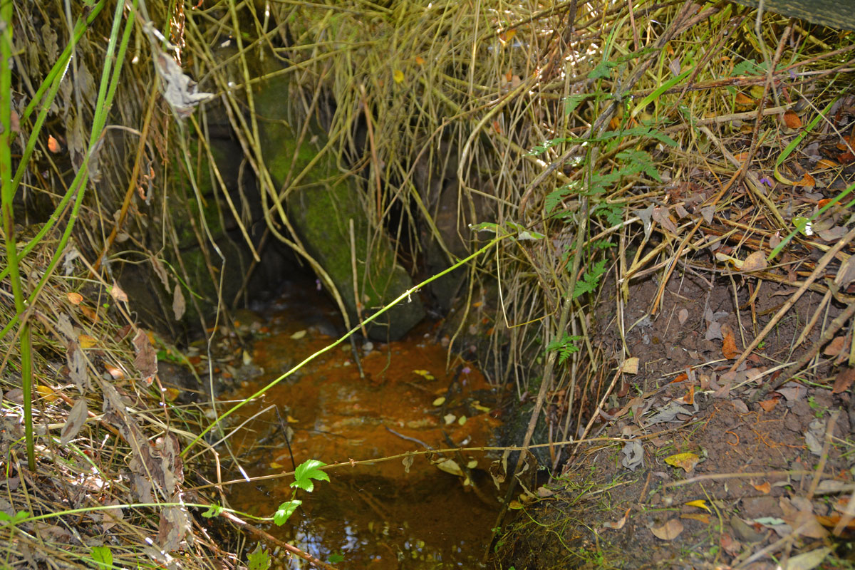
Bloch Well (Langholm) submitted by Anne T on 31st Aug 2021. Not much left of the structure of Bloch Well, but it gives a plentiful supply of water, which seems to piped under the road, running directly south along the eastern side of a small plantation.
(View photo, vote or add a comment)
Log Text: Bloch Well (Langholm): Described as a "dubious holy well" by J.R. Walker in 1883, now completely ruined. Not been able to find out anything much about this well, apart from its' brief Canmore entry, and a mention that the well is sulphurous, although there was no smell of sulphur at the time of our visit.
Mercat Cross (Kirkcudbright)
Trip No.183 Entry No.4 Date Added: 22nd Jul 2022
Site Type: Ancient Cross
Country: Scotland (Dumfries and Galloway)
Visited: Yes on 19th Jul 2022. My rating: Condition 3 Ambience 4 Access 5

Mercat Cross (Kirkcudbright) submitted by Anne T on 22nd Jul 2022. A view of the back of the cross from the top of the Tolbooth steps, looking across High Street.
(View photo, vote or add a comment)
Log Text: Mercat Cross, Tolbooth, Kirkcudbright: We'd stopped to see the old well at Mclellan's Castle (not named, just a water supply for the castle, so not recorded here), then walked across to the High Street. This is a lovely old market cross, now displayed high on the steps of the Tolbooth. Well worth walking across town to the High Street, as there are some great historic, old buildings to see. Perhaps a little late for the Portal, this cross being 17th century, but well worth a visit. There is also a well/well head underneath the cross.
Birrens Roman Fort
Trip No.190 Entry No.3 Date Added: 18th Sep 2024
Site Type: Stone Fort or Dun
Country: Scotland (Dumfries and Galloway)
Visited: Yes on 13th Sep 2024. My rating: Condition 2 Ambience 3 Access 4

Birrens Roman Fort submitted by Anne T on 18th Sep 2024. Standing just inside the gate into the field containing the fort, looking south along the minor road from Middlebie.
(View photo, vote or add a comment)
Log Text: Birrens Roman Fort: I didn't even know this fort existed until we spotted it on the OS map and it was on our way home, so we stopped to look. My hip wouldn't allow me to climb over the stile, but the farmer had left the gate unpadlocked, so we let ourselves carefully in and out.
The field had been heavily churned up by cattle, so walking across it was difficult. Would like to return to this site with some of the reports mentioned in the Canmore record and in better weather.
Langholm Market Cross
Trip No.190 Entry No.1 Date Added: 18th Sep 2024
Site Type: Ancient Cross
Country: Scotland (Dumfries and Galloway)
Visited: Yes on 13th Sep 2024. My rating: Condition 3 Ambience 3 Access 5
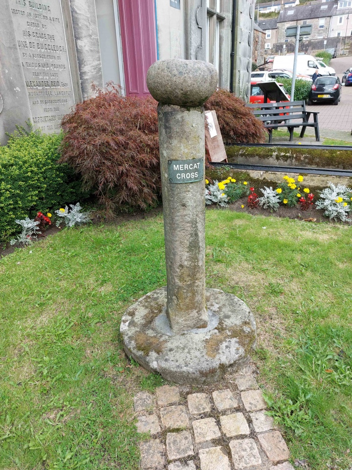
Langholm Market Cross submitted by Anne T on 17th Sep 2024. The cross, looking back towards the parking area in Parliament Square/Jouker's Close, showing the 'modern' sign attached to it explaining its purpose.
(View photo, vote or add a comment)
Log Text: Langholm Market Cross: It's odd to think we've driven past this cross many times, but never noticed it. A curiously small cross with a round boulder on top inscribed with a cross. Also an odd location, sited next to a statue, an information board about astronaut and first man on the moon, Neil Armstrong (now a freeman of the town) and an archway created by Thomas Telford.
The heavy traffic whizzing by on the main road made it difficult to take some of the photos without risking getting knocked over by the huge lorries driving through the narrow high street.
Merkland Cross (Woodhouse)
Trip No.190 Entry No.2 Date Added: 18th Sep 2024
Site Type: Ancient Cross
Country: Scotland (Dumfries and Galloway)
Visited: Yes on 13th Sep 2024. My rating: Condition 3 Ambience 3 Access 4
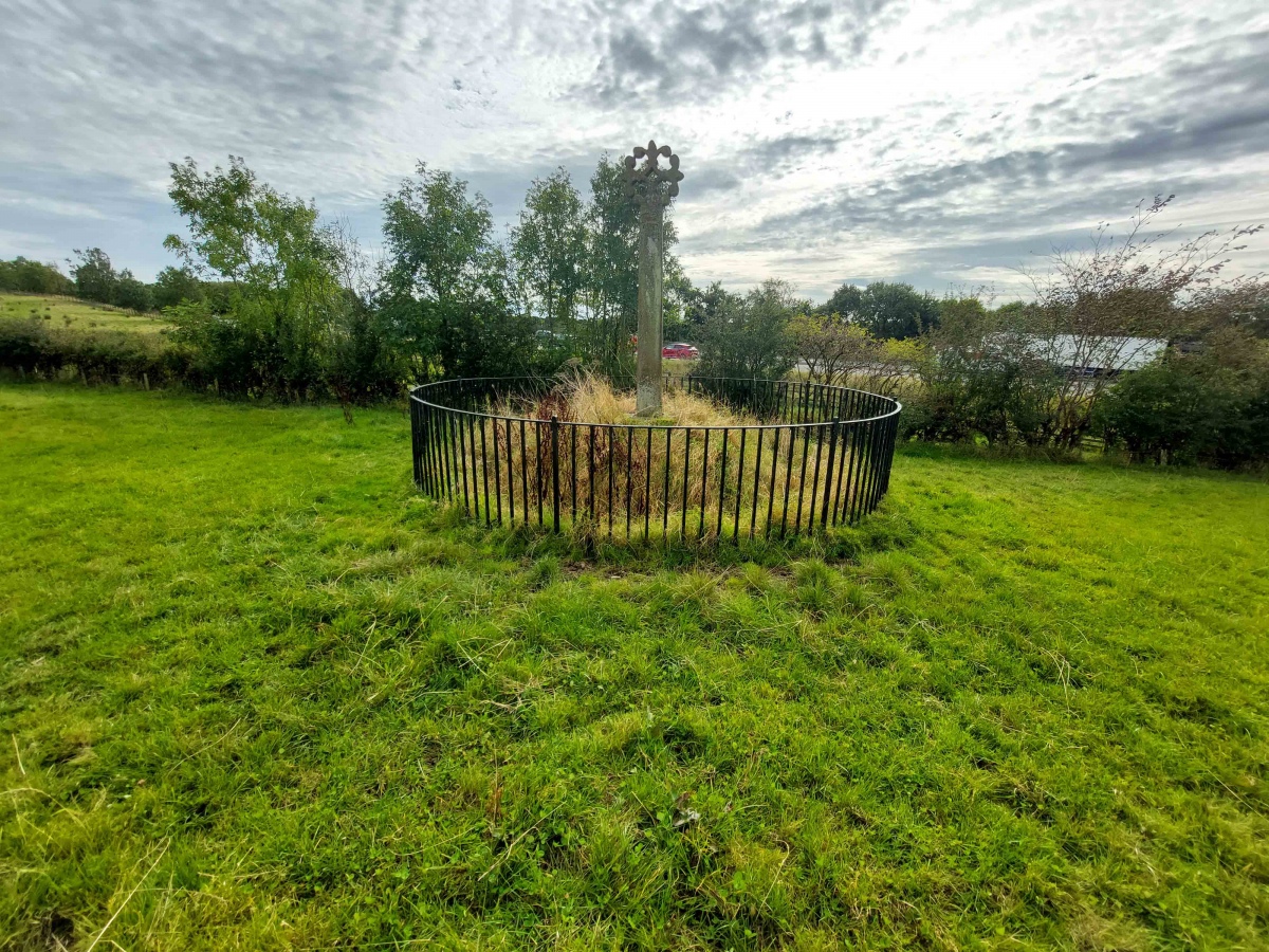
Merkland Cross (Woodhouse) submitted by Anne T on 15th Sep 2024. Standing behind the cross looking south westwards across the M74.
(View photo, vote or add a comment)
Log Text: Merkland Cross: Almost ten years have passed since our first visit in October 2014, but nothing much has changed. This would have been a glorious location if not for the tremendous amount of traffic rushing along the motorway to the west of this cross.
Skip Knowe
Trip No.124 Entry No.1 Date Added: 4th Apr 2019
Site Type: Standing Stone (Menhir)
Country: Scotland (Dumfries and Galloway)
Visited: Yes on 4th Apr 2019. My rating: Condition 3 Ambience 4 Access 4

Skip Knowe submitted by Apocryphus on 20th Jan 2019. On a minor road south of Moffat.
Located under trees and over a fence but close to the road. A substantial stone shown on OS maps
(View photo, vote or add a comment)
Log Text: Skip Knowe Standing Stone: Our first stop of the day, which nearly wasn’t, as we got caught in a SSE convoy putting up new poles and wires. We stopped by what looked like a community hall and I asked permission to park there for 10 minutes whilst we walked back 100m to look at the standing stone. We were told that was OK, but we needed to move within half an hour otherwise they would be stringing a cable over our car. No sooner had we spoken to one helpful worker, than another appeared and we went through the same exercise!
We were quickly able to walk back to the stone, hop over the fence into the field, take a few photos and back to the car just as a new pole was being craned into position in front of the neighbouring house.
This is a huge standing stone, just opposite Skip Cottage, with the River Annan just to the west. There were no discernible features on the stone that we could see, and we had a good look around. There were a couple of large boulders in the bank just to the west of the stone, but these looked like just part of the bank, but the Canmore entry from 1906 mentions a possible second stone.
St Cuthbert's Church (Wamphray)
Trip No.124 Entry No.4 Date Added: 5th Apr 2019
Site Type: Ancient Cross
Country: Scotland (Dumfries and Galloway)
Visited: Yes on 4th Apr 2019. My rating: Condition 3 Ambience 3 Access 4
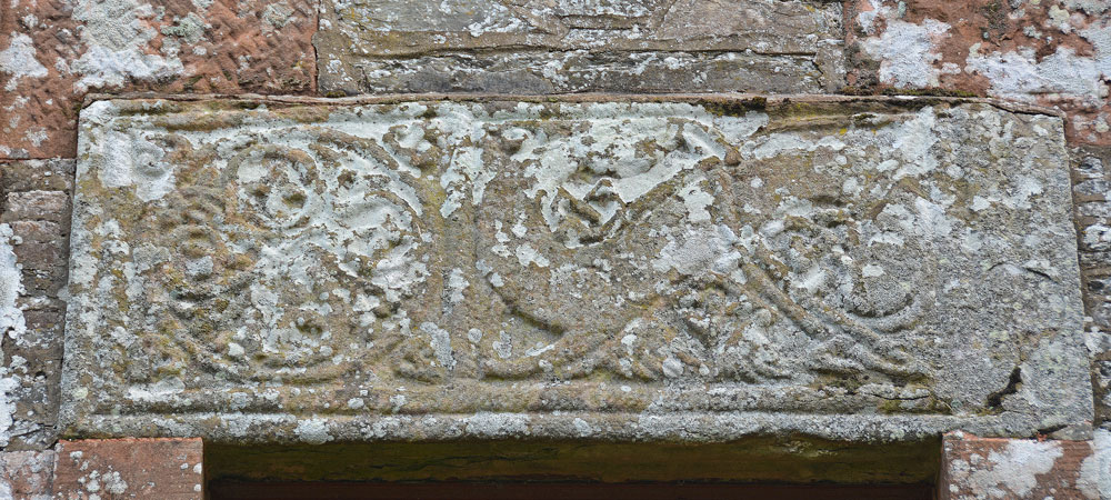
St Cuthbert's Church (Wamphray) submitted by Anne T on 5th Apr 2019. The Anglo Scandinavian cross slab above the west door of Wamphray Parish church, which is dedicated to St Cuthbert. Canmore tells us: "The front of the slab is divided into two panels by a cable moulding. The left panel is filled with a symmetrical knot formed by the interlacing of four plant scrolls, and that on the right by a backward-biting quadruped".
(View photo, vote or add a comment)
Log Text: Anglo Scandinavian Cross Slab, St Cuthbert's Church, Wamphray: This seemed far too modern a church to incorporate any old stones, but I was to be surprised. The churchyard was quite spectacular, with a large walled mausoleum and two very large monuments, one being a replica of a churchyard cross.
We found the stone over the west door of the church. It was an interesting exercise to photograph this, as the ground sloped down very steeply to the river. The stone was carved on its wide face, and also some interlacing on its underside, next to the door.
Sadly, the church was very firmly padlocked and doors locked, so we were unable to get to see the reverse side of the slab. There was a modern, recreation of a churchyard cross at the south side of the church, near the gate into the churchyard.
Fair Helen's Cross (Kirkconnel)
Trip No.127 Entry No.4 Date Added: 5th May 2019
Site Type: Ancient Cross
Country: Scotland (Dumfries and Galloway)
Visited: Yes on 2nd May 2019. My rating: Condition 3 Ambience 4 Access 3

Fair Helen's Cross (Kirkconnel) submitted by Anne T on 5th May 2019. First view of Fair Helen's Cross (not to be confused with the nearby Fair Helen's tombstone), hidden deep in the shrubbery, to the east of Kirtle Water, and north west of the Old Parish Church of Kirkconnel and its atmospheric graveyard.
(View photo, vote or add a comment)
Log Text: Fair Helen's Cross, Kirkconnel Old Church: It was a beautiful walk from the small parking area provided at about NY 25239 74833. We let ourselves through the kissing gate and followed the footpath which ran just to the east of Kirtle Water, and a pasture field with sheep and young lambs to our right. The very dark storm clouds gathering to the north east made a fantastic backdrop to the mature trees in the field.
Along the footpath, we were distracted by a modern tombstone about half way along our route to Old Kirconnel Church. We also stopped to admire the wonderful trees, with all their different colours, from a soft pink of a newly emerging copper beech tree, flowering cherries, silver birches and horse chestnuts. Eventually stumbling upon a very large marble tombstone at the entrance to the old churchyard, we let ourselves in and started exploring.
Having missed, at first, Fair Helen's Tombstone, and having to have it pointed out to me (well, it was hidden by a large metal signpost immediately in front of it), I walked round the ruins of the old church whilst Andrew went to search for the cross. "You'll need a machete", were his words on his return.
Walking through the kissing gate in the far north western corner of the churchyard, we walked 20-30m north along the path until the vague outline of the cross appeared behind the shrubbery. It didn't help that the largest tree next to the cross was a holly - very prickly!
As we arrived at the cross, the rain started to pelt down. Fortunately, the shower didn't last very long, and after taking photographs of this old village cross, we went back to admire and photograph the unusual grave markers in the churchyard.
Hoddom Parish Church
Trip No.127 Entry No.1 Date Added: 6th May 2019
Site Type: Sculptured Stone
Country: Scotland (Dumfries and Galloway)
Visited: Yes on 2nd May 2019. My rating: Condition 2 Ambience 2 Access 4
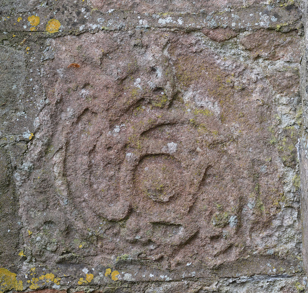
Hoddom Parish Church submitted by Anne T on 6th May 2019. A close up of the stone, taken with my zoom lens. I'm still trying to find out more details about where it came from and its age. The Canmore record mentions this church replaced an earlier one built in 1610, "of which fragments remain", but nothing more. Other fragments have been lost, and a Roman altar has been built into the porch of the new parish church at Hoddom.
(View photo, vote or add a comment)
Log Text: Sculptured Stone at Hoddom Old Parish Church: Our first stop of the day, and a strange place. A church in ruins, boarded up, although with parts of the churchyard really nicely tended – presumably because of the war graves.
Sitting on the southern side of the B725 to the south west of Ecclefechan, we parked in the layby outside the main gates into the churchyard, immediately next to the ruins. It took us ages to find the location of the sculptured stone, and trying to describe its location is a little tricky as the church is built in the shape of a square cross, orientate N-S, E-W. The stone is built into the outside corner of the eastern wall of the southern 'arm' and the south wall of the eastern 'arm'. We were unable to get right up to it because of the proximity of the railed family grave enclosure, although we succeeded in knocking some brambles down from the front of the stone so we could view it.
Fair Helen's Tombstone
Trip No.127 Entry No.2 Date Added: 7th May 2019
Site Type: Marker Stone
Country: Scotland (Dumfries and Galloway)
Visited: Yes on 2nd May 2019. My rating: Condition 3 Ambience 4 Access 3

Fair Helen's Tombstone submitted by Anne T on 7th May 2019. Fair Helen's tombstone (foreground), with Adam Fleming's behind. The large metal signpost gives details of the tragedy, now immortalised by Sir Walter Scott in his epic poem.
(View photo, vote or add a comment)
Log Text: Fair Helen's Tombstone: This ‘monument’ is in two parts, the first of which came as a complete surprise, to our west, just off the path in a clearing, just above Kirtle Water.
For the legend of Fair Helen of Kirkconnel see: Fair Helen's Legend and Sir Walter Scott's epic poem.
This was a simple gravestone with a plaque on it, which reads: “In memory of fair Helen of Kirkconnel as well as Richard Bell and Adam Fleming who were involved in the tragedy which took place here. Erected by Clan Bell descendants. Irving Bell. Founder”.
Walking into this small, overgrown but very atmospheric, graveyard, with its tumbled ruins, I struggled to find Fair Helen’s Tombstone, but Andrew pointed it out – right behind a large metal sign announcing this is “Kirkconnel Churchyard”. The sign reads: “In the ballad “Fair Helen of Kirkonnel”, Adam Fleming’s Lover Helen was shot by mistake by a rival in Kirkconnel churchyard. The bullet was meant for Adam, who promptly killed him. Adam was later buried beside Helan and this is his tombstone: Hic Jacet Adam Flemeng. The adjacent uninscribed stone is Helen’s; and the nearby late-medieval cross is called “Fair Helen’s Cross”, marking the site of her death. / The romantic story of the ballad might be an 18th century invention, and the association of the monuments in the churchyard with the ballad’s characters is questionable”.
Glenquicken Circle
Trip No.139 Entry No.1 Date Added: 22nd Jun 2019
Site Type: Stone Circle
Country: Scotland (Dumfries and Galloway)
Visited: Yes on 17th Jun 2019. My rating: Condition 3 Ambience 4 Access 4
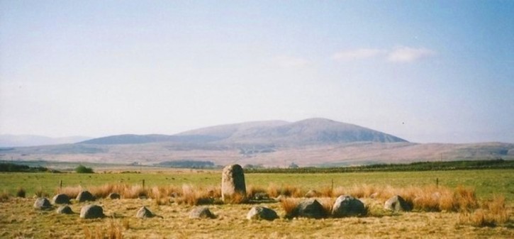
Glenquicken Circle submitted by Bladup on 18th Jun 2013. Glenquicken stone Circle with its centre stone and wonderful setting.
(View photo, vote or add a comment)
Log Text: Glenquicken Stone Circle:
Our first stop of the day, and in a delightfully rural location. There was a small layby just to the east of a bridge over Englishman’s Burn at NX 50847 58492 which was large enough for one car. Walking to the gate into the field at NX 50904 58456, the gate had been tied up with the Gordian Knott, but was eventually undone. There was an easy enough walk of a couple of hundred meters across a lush field of knee deep pasture and wild flowers.
The stone circle was indeed over a fence topped with barbed wire, but a gate to its east at NX 51057 58211 (opposite a modern cairn) let us in to the field, and we followed the small trails through the grass where other people had walked.
This was the first stone circle I’ve seen with a large central stone – can’t recall seeing any like this in Northumberland.
St. Kennera's Cross
Trip No.139 Entry No.3 Date Added: 24th Jun 2019
Site Type: Ancient Cross
Country: Scotland (Dumfries and Galloway)
Visited: Yes on 17th Jun 2019. My rating: Condition 3 Ambience 3 Access 4
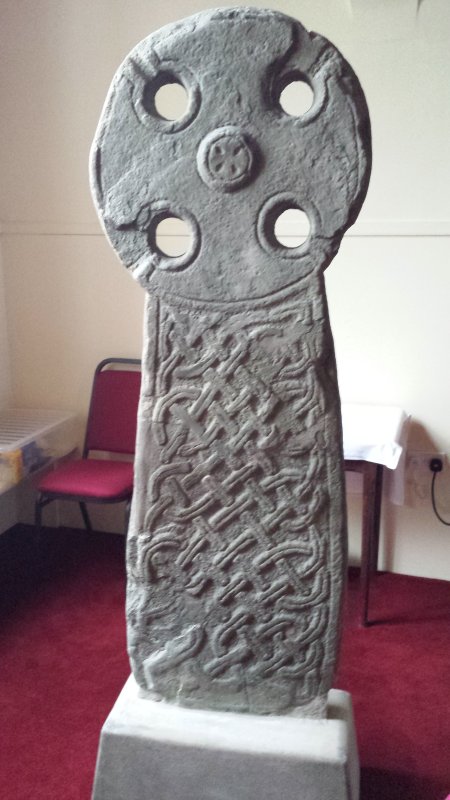
St. Kennera's Cross submitted by Enki on 18th Jan 2016. St. Kennera's Cross inside the parish church in Kirkinner.
(View photo, vote or add a comment)
Log Text: St Kennera's Cross, Kirkinner: It took a little bit of doing to contact the vicar at Kirkinner – numerous phone calls, but no answer, then an email to which there was initially no reply, so I'd crossed this cross slab off our visit list.
An email eventually came through whilst we were near Castle Douglas, travelling down the A75, giving the name and phone number of the church officer. On phoning the number, I was very kindly told the church was open today until 5pm, although it could be arranged to opened it Tuesday if necessary.
We eventually arrived at the church mid-afternoon. The church felt cold, lonely and neglected, the cross slab a mere by-thought in the north eastern corner, by the kettles and cups. We did try and get a photograph from the gallery, but a notice told us the stairs were too dangerous to use.
We later saw similar cross slabs at Whithorn Museum, and were told that the stone these slabs were made of was very difficult to carve as the stone flaked away at an angle from the carving, and they often broke.
It took a little while of looking at it to see the 'armpits' of the cross (carved running into the circular holes of the cross) and to see the shape of the cross itself.
The guide at Whithorn was surprised we managed to get into the church.
Torhousekie stone circle
Trip No.139 Entry No.5 Date Added: 25th Jun 2019
Site Type: Stone Circle
Country: Scotland (Dumfries and Galloway)
Visited: Yes on 17th Jun 2019. My rating: Condition 3 Ambience 4 Access 4
Torhousekie stone circle submitted by SandyG on 5th Jan 2018. View from above and south.
(View photo, vote or add a comment)
Log Text: Torhouskie Stone Circle: Our second stone circle of the day, and right next to the road. Contained by a fence to protect it from the huge cattle in the next field, this is a lovely little stone circle. We were at this site for what must have been an hour. Just after we arrived, a large ‘white van’ pulled up right behind us and sat there for almost half an hour before leaving; I had to be careful not to get it in my photographs. This stone circle was very popular with visitors, most of whom let themselves in through the kissing gate, walked to the information sign, then left within about five minutes.
This was the first time I used my wide angled lens, and I wasn’t sure how the focus on the photos was turning out, so I took some photos with my normal zoom to stitch together. Whilst we were there, the heavens opened for a short while, with needle-like shards of rain coming straight at my face thanks to the wind gusting across this fairly open piece of land.
I was struck how near the stone circle was to the River Bladnoch to the south of the stone circle, which glinted in the strong sunlight, in between rain showers.
Torhousekie Stones East
Trip No.139 Entry No.6 Date Added: 25th Jun 2019
Site Type: Standing Stones
Country: Scotland (Dumfries and Galloway)
Visited: Yes on 17th Jun 2019. My rating: Condition 2 Ambience 3 Access 4
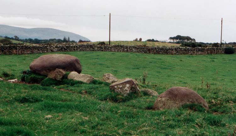
Torhousekie Stones East submitted by vicky on 29th Oct 2002. The ruined stone row near Torhousekie stone circle.
(View photo, vote or add a comment)
Log Text: Torhouseskie Stones East: To be found in the field immediately to the east of the Torhousekie Stone Circles, one of these stones was most certainly the size of the boulders used in the stone circle, although because of the sheer number of cattle (and The Huge Bull) around these stones (and the deep puddles around them and in the adjacent field) we didn't go and investigate further. I then got chatting to another gentleman with his camera who was also keen to investigate the stones, but taking one look at the cattle and The Huge Bull, we looked at each other and said 'No'.
I confess that even having printed off all the Canmore and Stone Rows of Great Britain records for this immediate area, I'd misread the grid reference and thought these stones were the ones to the south west of the circle (see Torhousekie South West Stones) and only realised my mistake when looking at the photographs and Canmore site together at home later. Although there appears to be a stone marked just to the east of the stone circle on Sandy G's plan of alignments at Torhousekie, which still confuses me - I need to check with Sandy.
Even to my untrained eye, it looked like large field clearance boulders had been dumped next to the large boulder. I have since read Sandy G's visit report, which confirms his thinking that these are field clearance stones, but their proximity to the stone circle has influenced thinking as to what they are interpreted as.
Torhousekie Standing Stone
Trip No.136 Entry No.7 Date Added: 25th Jun 2019
Site Type: Standing Stone (Menhir)
Country: Scotland (Dumfries and Galloway)
Visited: Visited (still working on) on 17th Jun 2019
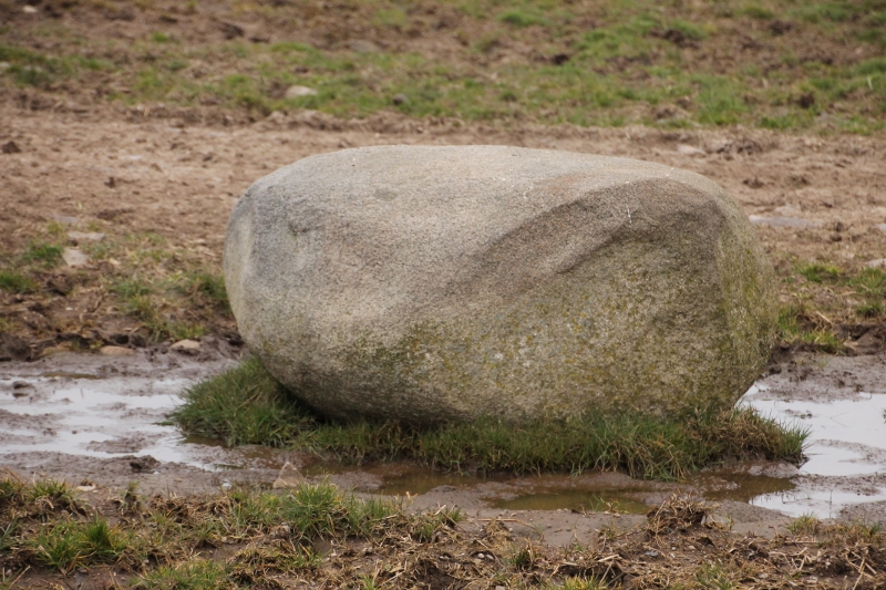
Torhousekie Standing Stone submitted by SumDoood on 22nd Mar 2016. Just over the wall near the gate into the 2nd field on the right (west), when approaching the farm "Cunninghame".
(View photo, vote or add a comment)
Log Text: Torhouskie Standing Stone: At the time of our visit, the only route to this stone was either along the very busy minor road then down the farm track (didn't fancy getting run over as sight lines for cars weren't very good) or across the field. With The Huge Bull standing guard, and watching our every move, we had a quick chat with another visitor who was keen to see the stones, we decided we were not brave enough to risk it!
Seeing SumDoood's photographs of this stone on the site page, the size of the stone is very similar in size and shape to the one lying in the field just to the east of the stone circle.
On my list for another visit.
Torhousekie East
Trip No.136 Entry No.8 Date Added: 25th Jun 2019
Site Type: Stone Row / Alignment
Country: Scotland (Dumfries and Galloway)
Visited: Yes on 17th Jun 2019. My rating: Condition 3 Ambience 4
Torhouskie East submitted by DrewParsons on 19th Oct 2010. PID
(View photo, vote or add a comment)
Log Text: Torhouseskie Stone Row: Crossing the road from the layby by the stone circle, we entered this field through the gate at NX 38340 56494. This proved a little tricky, as it was two gates bolted together, then tied with multiple loops of string. Whilst I managed to untie the knots, and Andrew and I between us bolted the gates back together, a later visitor told me he’d had to climb the gate!
Three large boulders with some smaller stones between them. Standing on this small knoll, looking south towards the River Bladnoch, with the stone circle to our south west, and cairns to the west, it felt like a very prehistoric landscape.
Whilst the stone circle was proving very popular with visitors who came and went every five or ten minutes, only one other of the visitors came across to see the stone row.
