Contributory members are able to log private notes and comments about each site
Sites Anne T has logged. View this log as a table or view the most recent logs from everyone
Mossknowe 3
Trip No.127 Entry No.5 Date Added: 7th May 2019
Site Type: Cairn
Country: Scotland (Dumfries and Galloway)
Visited: Saw from a distance on 2nd May 2019. My rating: Condition 2 Ambience 3
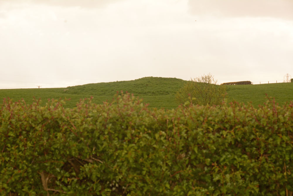
Mossknowe 3 submitted by Anne T on 7th May 2019. The third of the three cairns in close proximity. We only saw this from a distance, as the light was fading rapidly, the rain was heavy and we were unable to open the gate into the first field. Of the three cairns, this looked the most interesting to see, so I'd like to do a 'repeat visit' to all three at some time in the near future, if we pass through this area again.
(View photo, vote or add a comment)
Log Text: Mossknowe Cairn 3: Saw this from a distance only, as the light was fading rapidly, the rain was pelting down and we couldn’t open the gate into the first field. Couldn’t get too excited about this, although it looked the most interesting of the three cairns.
Minnigaff Old Church
Trip No.139 Entry No.2 Date Added: 23rd Jun 2019
Site Type: Ancient Cross
Country: Scotland (Dumfries and Galloway)
Visited: Visited (still working on) on 17th Jun 2019
Minnigaff Old Church submitted by markj99 on 12th Jul 2020. Minnigaff Old Church
(View photo, vote or add a comment)
Log Text: Cross Slabs, Minnigaff Old Church: The Canmore record says clearly that these two cross slabs are within the ruins of the old church at Minnigaff. We found these enigmatic ruins easily, within the burial ground of the modern-day church. However, the stones have been moved inside the modern church, and there is an information board just to the north of the west door into the church. I was very disappointed. I have sent Canmore a message, which they've acknowledged, so they can update their webpage for future visitors.
Bladnoch
Trip No.139 Entry No.4 Date Added: 24th Jun 2019
Site Type: Standing Stone (Menhir)
Country: Scotland (Dumfries and Galloway)
Visited: Yes on 17th Jun 2019. My rating: Condition 3 Ambience 3 Access 5
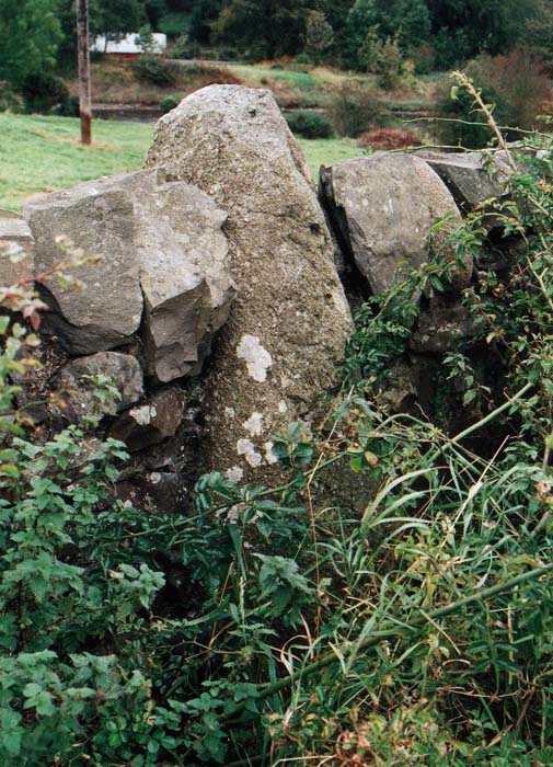
Bladnoch Standing Stone submitted by PaulM on 29th Oct 2002. This standing stone is marked on the OS Explorer Map 311 (Wigtown, Whithorn & The Machars) and can be found in the drystone wall flanking the A714 and directly opposite the house called Ashleigh in Bladnoch. The whisky distillery is only a short stagger away.
NGR: NX 423542.
(View photo, vote or add a comment)
Log Text: Bladnoch Standing Stone: We found this stone very hard to spot, eventually parking outside the cottages opposite the dry stone wall the stone was in and walked up and down the road with our GPS. We eventually spotted it by looking along the drystone wall and seeing where the tallest stone poking out of the wall was.
The stone was almost completely covered by wild roses, nettles and brambles, but we managed to push them gently to one side to take a photograph.
We did look for an entrance into the field by the river to look at the other side, but did not see one.
Torhousekie N
Trip No.136 Entry No.9 Date Added: 25th Jun 2019
Site Type: Cairn
Country: Scotland (Dumfries and Galloway)
Visited: Yes on 17th Jun 2019. My rating: Condition 2 Ambience 3 Access 4
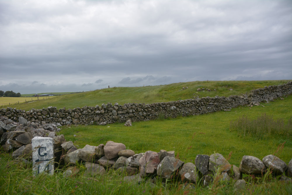
Torhousekie N submitted by Anne T on 25th Jun 2019. Crossing the road from the stone circle and walking a little way west, a large 'lump' (with a robbed dip in the middle?) appears in the field which runs from east to west. I was uncertain as to whether this was just field clearance or a cairn, so photographed it anyway! It's location and grid reference matched up with this site, and the street view that has been kindly posted to this site page.
(View photo, vote or add a comment)
Log Text: Torhousekie N cairn: We had a cairn further up slope recorded to find, together with one by the farmhouse, so it came as a surprise to find this cairn here. I took some photographs on the day (a few before a heavy shower of rain, one after in the sun), and found out about it later.
Recorded as Canmore 62839, it stands just to the north of a milestone which stands out bright white against the side of the road, and just to the west of a dry stone wall. It looks as if it may have been robbed in the middle.
Torhouse North Side Cairn
Trip No.136 Entry No.10 Date Added: 25th Jun 2019
Site Type: Cairn
Country: Scotland (Dumfries and Galloway)
Visited: Yes on 17th Jun 2019. My rating: Condition -1 Ambience 3 Access 4
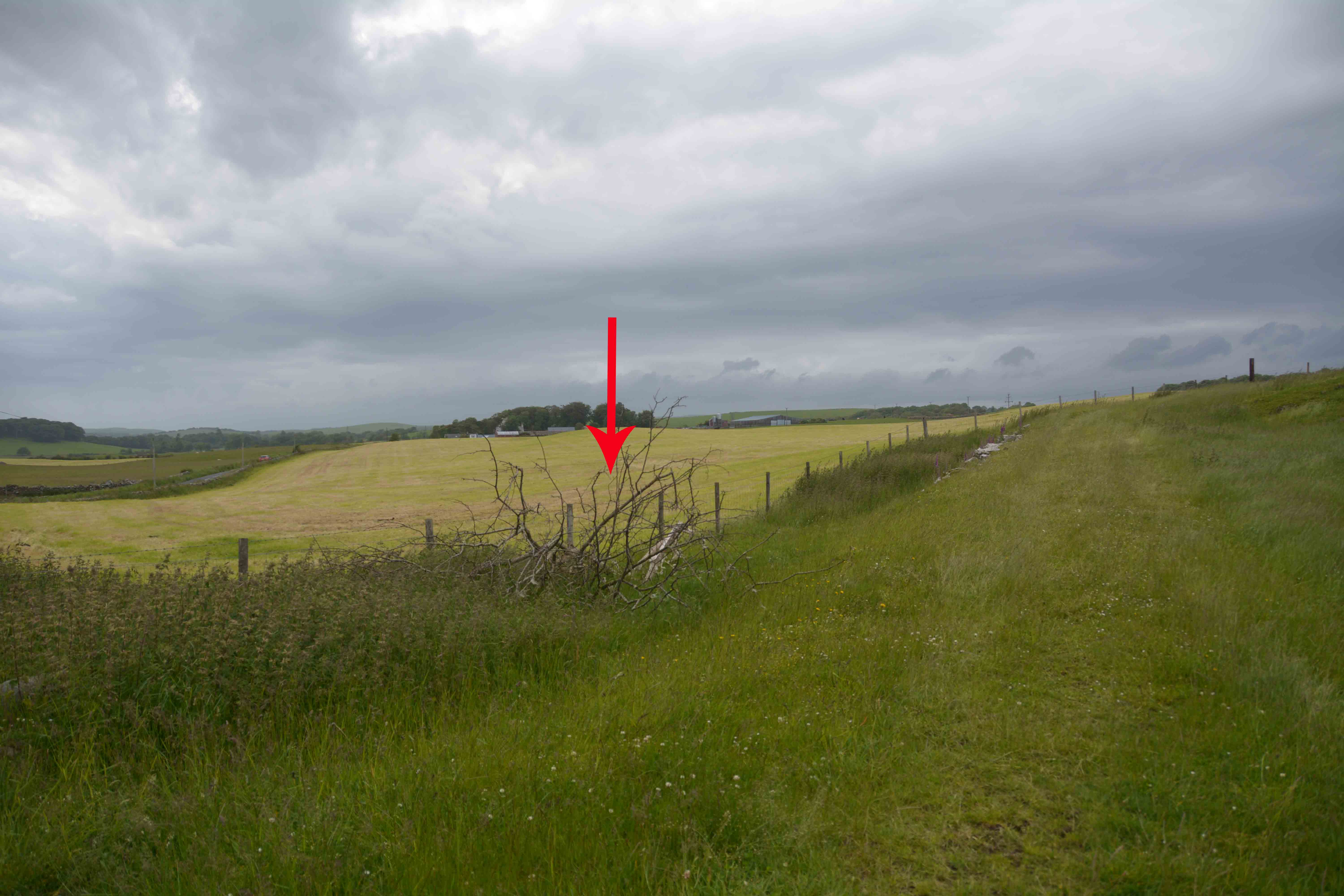
Torhouse North Side Cairn submitted by Anne T on 25th Jun 2019. Armed with the GPS, the location is exactly as described by SumDoood, although we couldn't find any trace of field clearance stones in this field - it appeared to be improved pasture land. The red arrow marks the spot where the cairn should be (although there is a brighter green central 'button' just to its left, behind the fence line which might possibly be it?)
(View photo, vote or add a comment)
Log Text: Torhouse North Side Cairn: We had the Canmore ID record printed off for this cairn, but we were a little confused. One entry in Canmore said the cairn had been almost entirely removed and the site used as a dump for field clearance stones, but at the grid reference point there was nothing but a ploughed field.
I've marked the location of where the cairn should be with an arrow on the photograph. It is in precisely the location identified by SumDoood, although we could make out nothing on the ground.
Torhousekie Farm Cairn
Trip No.136 Entry No.12 Date Added: 26th Jun 2019
Site Type: Cairn
Country: Scotland (Dumfries and Galloway)
Visited: Yes on 17th Jun 2019. My rating: Condition 2 Ambience 3 Access 4
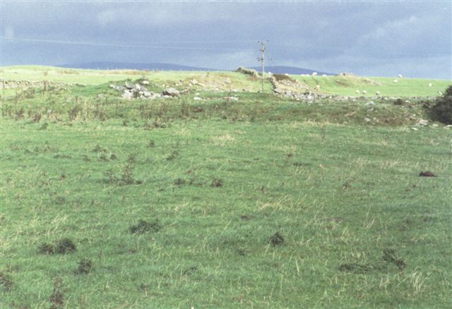
Torhousekie Farm Cairn submitted by cosmic on 17th Oct 2004. Remains of Cairn near Torhousekie Farm
(View photo, vote or add a comment)
Log Text: Torhousekie Farm Cairn: With tea-time fast approaching and cars whizzing up and down the road at high speed, Andrew pulled into a gateway opposite the cairn whilst I hopped out to take some photos.
It was a lot more interesting than it looked, with definite structures on the sides and top. I could only view it from the field to the east, where part of it protruded into the field, cut by a dry stone wall.
Cairnweil standing stone
Trip No.136 Entry No.15 Date Added: 26th Jun 2019
Site Type: Standing Stone (Menhir)
Country: Scotland (Dumfries and Galloway)
Visited: Yes on 17th Jun 2019. My rating: Condition 3 Ambience 4 Access 4

Cairnweil standing stone submitted by Jackanol on 11th Nov 2016. I think this is quite an impressive stone. It's true there are telegraph poles close to it, but it still has a lot of presence.
Taken September 2016.
(View photo, vote or add a comment)
Log Text: South Carnweil Standing Stone: From Kirkmadrine Church, we travelled back along the road eastwards towards the A716, we stopped off to see this standing stone, by a wall, up a hill, but not quite at the top of the hill. It certainly is a big stone.
The road was narrow, so we bumped right up on the grass blocking a gated entrance to a field, ready to run back if we were causing an obstruction. After such a heavy rainstorm not half an hour before, we got quite wet walking up the hill, but it was worth it.
In some ways, this made up for not being able to see the stones at Kirkmadrine very well.
Knock and Maize
Trip No.137 Entry No.1 Date Added: 27th Jun 2019
Site Type: Standing Stone (Menhir)
Country: Scotland (Dumfries and Galloway)
Visited: Yes on 18th Jun 2019. My rating: Condition 3 Ambience 4 Access 4
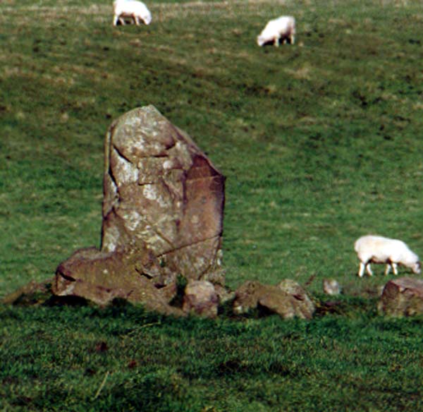
Knock and Maize standing stone submitted by PaulM on 30th Oct 2002. Knock and Maize standing stone
Located at a road junction where the Southern Uplands Way meets the B738 on The Rhinns to the SW of Stranraer (NW998588). A single stone standing bolt upright.
(View photo, vote or add a comment)
Log Text: Knock & Maize Standing Stone: Lovely views of the sea, but the view of the stone was a little spoilt by its proximity to the telegraph poles. It was only when we got into the field and I was photographing the stone that we realised there was a large herd of bullocks down the bottom end of the field. Half of them stood up, but thankfully they were too lazy to come over and take a closer look.
There were lots of smaller boulders around this stone – field clearance or where the stone has been fractured over the years? There are certainly lots of fracture lines and ‘dings’ on the stone. Perhaps the stones are both.
Mid Gleniron Stony Mounds
Trip No.137 Entry No.3 Date Added: 28th Jun 2019
Site Type: Cairn
Country: Scotland (Dumfries and Galloway)
Visited: Yes on 18th Jun 2019. My rating: Condition 2 Ambience 3 Access 3
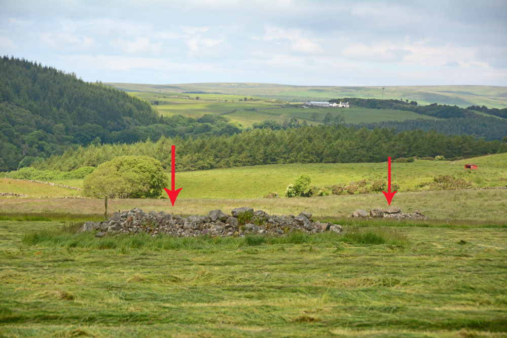
Mid Gleniron Stony Mounds submitted by Anne T on 28th Jun 2019. These two stony mounds are to the west of the farm track leading up to Mid Gleniron Farmhouse. They are at NX 18601 60877 and NX 18579 60986.
(View photo, vote or add a comment)
Log Text: Mid Gleniron Stony Mounds: I found these stony mounds as fascinating as the chambered cairns just north of these mounds, so took a few photographs (just in case they were recorded cairns) and grid references. If they are field clearance stones, why place them in different mounds in the same field? And why so many smaller stones? The larger stones are most likely field clearance, but the make up of the mounds is similar to Gleniron 1 to Gleniron 5 inclusive.
There are two mounds on the eastern side of the farm track and another four on the western side.
Mid Gleniron 2
Trip No.137 Entry No.5 Date Added: 28th Jun 2019
Site Type: Chambered Cairn
Country: Scotland (Dumfries and Galloway)
Visited: Yes on 18th Jun 2019. My rating: Condition 2 Ambience 3 Access 3
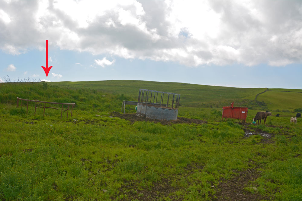
Mid Gleniron 2 submitted by Anne T on 28th Jun 2019. Only cairn is only just north of Mid Gleniron 3, this is all that appears to be left of this chambered cairn, now used as an animal feeding station for the numerous cows and their calves that were in the field at the time of our visit.
(View photo, vote or add a comment)
Log Text: Mid Gleniron 2: Photos taken from NX 18753 60931, I photographed a mound approximately 20 metres to east (right) of track as walked uphill, with a cattle feeder virtually on top.
I wasn’t sure that this was a cairn at all, although Andrew was certain. In fact Canmore shows there are the remains of two cairns here, one at NX 1877 6093,the other at NX 1876 6092. With the cattle feeder placed virtually on top of the cairn at NX 1876 6092 and numerous, very curious cattle in the field, I photographed these from the gate into the field.
Mid Gleniron 3
Trip No.137 Entry No.4 Date Added: 28th Jun 2019
Site Type: Cairn
Country: Scotland (Dumfries and Galloway)
Visited: Yes on 18th Jun 2019. My rating: Condition 2 Ambience 3 Access 3

Mid Gleniron 3 submitted by Anne T on 28th Jun 2019. This mound of stones, the slight mound rising from the centre left of the photo running to the centre middle, and the slight circular mound behind are all that seems to remain of the Mid Gleniron 3 cairn. I managed to get this photograph when the cattle had moved away from the mound, but we didn't want to aggrevate the cows and their calves, so didn't venture into the field.
(View photo, vote or add a comment)
Log Text: Mid Gleniron 3: OK, the GPS led me to this spot, but there wasn’t much to see. Had it not been for the sheer number of cows and their calves in the field, I would have gone for a closer look, but bottled out. I photographed this feature by leaning over the dry stone wall.
Mid Gleniron 4
Trip No.137 Entry No.6 Date Added: 28th Jun 2019
Site Type: Cairn
Country: Scotland (Dumfries and Galloway)
Visited: Yes on 18th Jun 2019. My rating: Condition 3 Ambience 4 Access 3
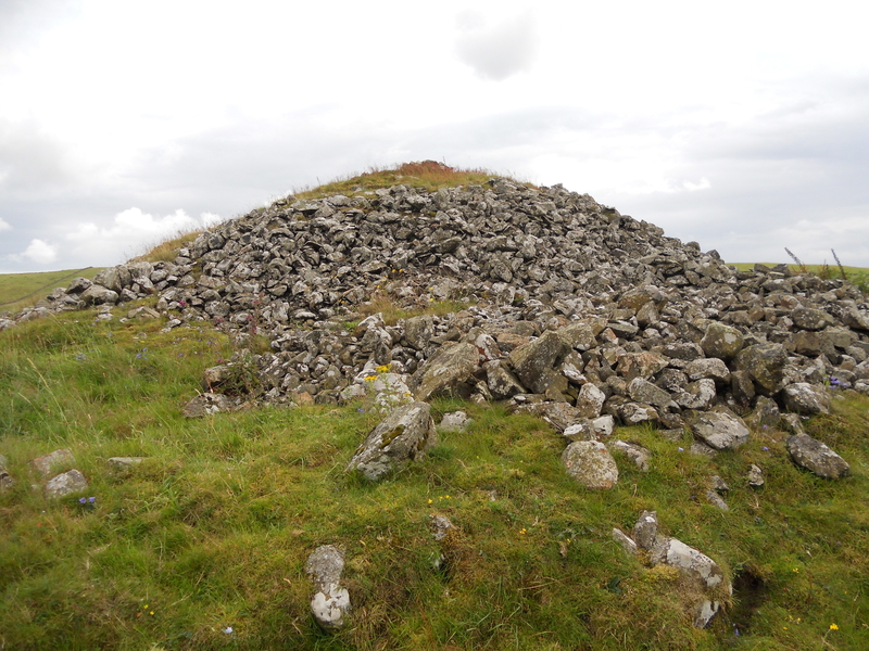
Mid Gleniron 4 submitted by markj99 on 10th Oct 2018. Mid Gleniron 4, looking S
(View photo, vote or add a comment)
Log Text: Mid Gleniron 4: This is the large bell cairn at the top of the hill, near the farmhouse, which dominates the view as you walk up the track towards the farmhouse.
Access into the field is easy, and it’s possible to walk all the way round the cairn to see its structure and enjoy the views.
Mid Gleniron 5
Trip No.137 Entry No.7 Date Added: 28th Jun 2019
Site Type: Cairn
Country: Scotland (Dumfries and Galloway)
Visited: Yes on 18th Jun 2019. My rating: Condition 2 Ambience 4 Access 3
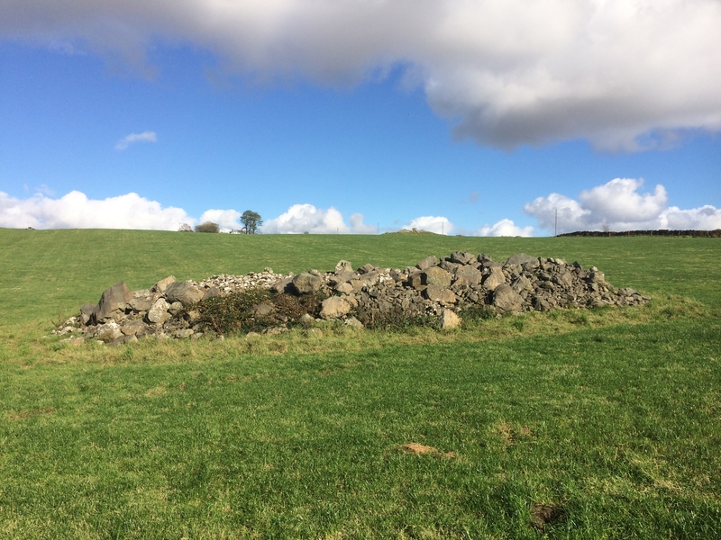
Mid Gleniron 5 submitted by markj99 on 21st Oct 2018. A candidate for Mid Gleniron 5?
(View photo, vote or add a comment)
Log Text: Mid Gleniron 5: This cairn lies west of track to the farmhouse, south east of the oval cairn, and is very distinct in the field and on the aerial photographs.
The mound of the cairn stood out particularly today as the farmer was spreading the lines of harvested grass to dry as we walked across the field, and he had gone round this cairn with the tractor.
Mid Gleniron 1
Trip No.137 Entry No.8 Date Added: 28th Jun 2019
Site Type: Chambered Cairn
Country: Scotland (Dumfries and Galloway)
Visited: Yes on 18th Jun 2019. My rating: Condition 3 Ambience 4 Access 3
Mid Gleniron 1 submitted by rogerkread on 1st May 2013. The cairn with the most visible internal structure at Mid Gleniron, the one furthest west.
(View photo, vote or add a comment)
Log Text: Mid Gleniron 1: I was really impressed with this now oval-shaped cairn with its burial chambers and spent ages walking round it and over it. The photographs don’t really do it justice.
Culroy Cairn 1
Trip No.137 Entry No.10 Date Added: 28th Jun 2019
Site Type: Cairn
Country: Scotland (Dumfries and Galloway)
Visited: Yes on 18th Jun 2019. My rating: Condition 3 Ambience 3 Access 4
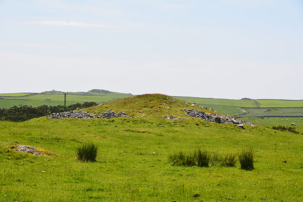
Culroy Cairn 1 submitted by Anne T on 28th Jun 2019. The northern side of Culroy Cairn 1, as seen from NX 24931 54457.
(View photo, vote or add a comment)
Log Text: Culroy Cairn 1: On the way back from Culroy White Cairn, we had intended to stop and photograph another 4 cairns along this road, but the road was far to narrow to park on, and with large tractors and other traffic coming along, I hopped out of the car and photographed this cairn as best I could.
By this time of the afternoon, I was getting twitchy and impatient to get to Whithorn and the museum, with their fantastic collection of cross slabs, cross heads and other early Christian stones, so finding an entrance into the field was pretty low priority!
Whitefield Loch Crannog
Trip No.137 Entry No.11 Date Added: 28th Jun 2019
Site Type: Crannog
Country: Scotland (Dumfries and Galloway)
Visited: Saw from a distance on 18th Jun 2019. My rating: Condition 1 Ambience 3 Access 4
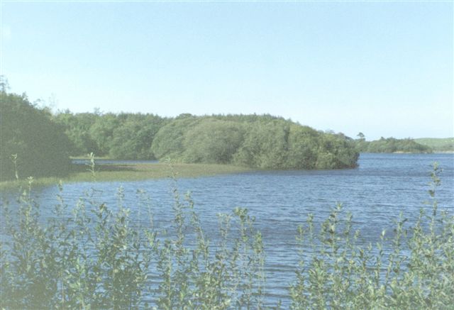
Whitefield Loch Crannog submitted by cosmic on 9th Oct 2004. Viewed from East
(View photo, vote or add a comment)
Log Text: Dorman's Island/Loch Whitefield Crannog (east): We went seeking Dorman’s Island crannog at the eastern side of the loch. Having missed the fisherman's road, and the road being too narrow to turn round, we ended up parking in the fisherman's car park at NX 23531 54887 and walked down the angler’s slipway but the tree cover was too dense to really make out anything. We could just about see round the small headland to our eastern side, and took a couple of photographs and may have just caught the crannog.
Looking at the Canmore map there is also a Tree Island crannog to the western end of the loch.
White Cairn (Crouse)
Trip No.137 Entry No.16 Date Added: 29th Jun 2019
Site Type: Cairn
Country: Scotland (Dumfries and Galloway)
Visited: Yes on 18th Jun 2019. My rating: Condition 2 Ambience 3 Access 4
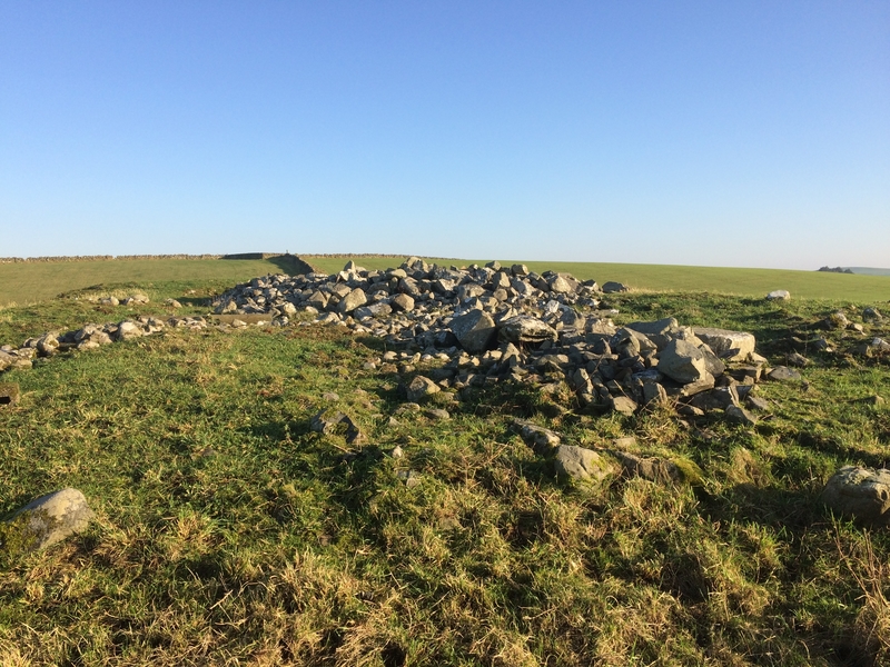
White Cairn (Crouse) submitted by markj99 on 31st Mar 2019. White Cairn (Crouse)
(View photo, vote or add a comment)
Log Text: White Cairn, Crouse: Our very last stop of this visit, and not a hugely dramatic one. The cairn has been used for field clearance, and there were lumps of concrete, barbed wire and old fence posts dumped at its western side.
Whilst I was photographing the holed stone, I got an excited cry from Andrew, to say; “You can see through the holed stone from the cairn”, so I wandered through the gate between the two fields and walked onto the cairn. Yes, he was right – there was a glimmer of light through the hole, although what it was sighted on, I’m not sure.
St Ninian's Cave (Isle of Whithorn)
Date Added: 3rd Jul 2019
Site Type: Early Christian Sculptured Stone
Country: Scotland (Dumfries and Galloway)
Visited: Would like to visit

St Ninian's Cave (Isle of Whithorn) submitted by Anne T on 3rd Jul 2019. Submitted with the kind permission of The Whithorn Trust. This is the collection of early Christian carved stones from St Ninian's Cave, now displayed in Whithorn Museum. I only succeeded in photographing a few properly as other visitors were in the museum, and by kneeling on the floor I was blocking the path!
(View photo, vote or add a comment)
Burnswark Hillfort
Trip No.4 Entry No.1 Date Added: 7th Aug 2016
Site Type: Hillfort
Country: Scotland (Dumfries and Galloway)
Visited: Yes on 31st Jul 2016. My rating: Condition 3 Ambience 5 Access 4
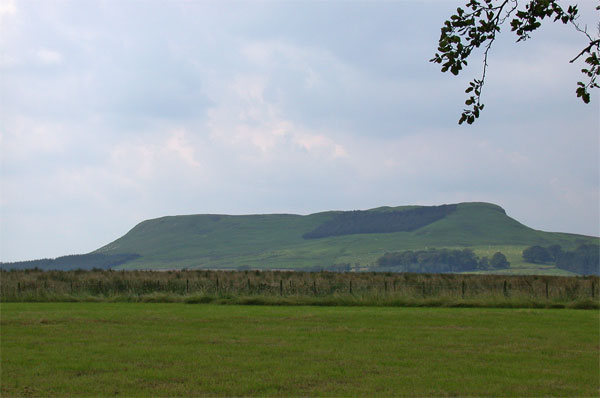
Burnswark Hillfort submitted by nicoladidsbury on 21st Mar 2005. Burnswark Ancient Hillfort
(View photo, vote or add a comment)
Log Text: Burnswark Hill Fort, Dumfries & Galloway: A week of being stuck in the house contemplating on, and preparing for, the building work to come I was glad to escape the house for a walk in open countryside with few people around. Considering we’ve lived in this area for 10 years, we never visited this impressive and enigmatic hill fort. It was as good as (if not better than) Edlingham Castle, and in my view, more interesting. There was such a lot to see. Exiting the A74(M) at Ecclefechan, we headed off up the narrow one track rock up past farms called ‘Paulsland’ and ‘Relief’. There is a small parking area just before the gate to Burnwark Farm at grid reference NY 18788 78332. We then plunged into the darkness through a track through the forest, to emerge onto a grassy hillside filled with large sheep. It was strange and nice to make the transition from English ‘stick to the footpaths’ to the Scottish ‘responsible right to roam’; different rules for only a few miles apart.
From the forest track, a trackway follows the hillside upwards to the hillfort. The first things to come into views were ‘the three bretheren’, which we took to be burial mounds surrounded by ditches, although the Canmore record below describes them as possible Roman artillery positions for attacking the fort.
On top of the plateau, there were huge views around 360 degrees, including the sun shining off the Solway Firth. Neither Andrew or I have ever been at a point where it’s been possible to see both Criffel and the Lake District (Helvelyn was the tallest peak) at the same time. There are also the grassed over remains of structures, although I found it impossible to interpret what they were.
Having walked over to the north-western side of the fort to see the Roman fortifications below, we made our way over to the nearby cairn on the next hilltop.
Whiteholme Rig
Trip No.4 Entry No.3 Date Added: 7th Aug 2016
Site Type: Stone Circle
Country: Scotland (Dumfries and Galloway)
Visited: Yes on 31st Jul 2016. My rating: Condition 2 Ambience 2 Access 3

Whiteholme Rig submitted by Anne T on 7th Aug 2016. The first stone in this ancient monument that we saw from the edge of the adjacent field. The farmer hadn't made it easy for visitors to reach this stone circle, and it was a real shame the ground had been left to go wild, which made it difficult to make out any monument at all.
(View photo, vote or add a comment)
Log Text: Seven Brethren Stone Circle, near Lockerbie: I was surprised to find this was so near where we used to live at Corrie. But when we lived here, with three young children, we didn't have the same interests as we do now, so (although the kids say we traumatised them by taking them to so many monuments) we never visited. We parked by the gate to the disused quarry near Standburn farm, hopped over the gate and followed the track up to Whiteholm Rigg. At present, along the top of this low ridge, a row of trees follows the trackway. Right at the end, motorway barriers have been erected to form a large, robust enclosure, gated at both ends, which looks as if it's used as a stock enclosure. Beyond the gate at the eastern end, cows and their calves grazed in the lush grass on the hillside below. Walking along the edge of the field, small toppled stones could be seen in the grass, which had been left to grow long and untended around the stones, but mown in the area beyond. Walking around the tussocks we spotted the remains of 6 stones, but how unimpressive this site is. If we hadn't have known that this was a stone circle, we would have thought these were just a few outcrops in the grass. Such a shame.
A funny (now) moment occurred at the end of our visit. Going back to clamber over the gates into the enclosure, the bulls in the field (of which there were several, excitable!) came to investigate. One stood pawing the ground with its front hoof. Husband climbed the 8 ft tall motorway barrier, which left me stuck in the stone circle field. However, husband managed to distract the cattle whilst I climbed over two gates to get back to safety!
