Contributory members are able to log private notes and comments about each site
Sites Anne T has logged. View this log as a table or view the most recent logs from everyone
Danby Rigg Marker Stone (Crossley Gate)
Trip No.32 Entry No.5 Date Added: 10th Jul 2017
Site Type: Marker Stone
Country: England (Yorkshire (North))
Visited: Yes on 2nd Jul 2017. My rating: Condition 3 Ambience 4 Access 3
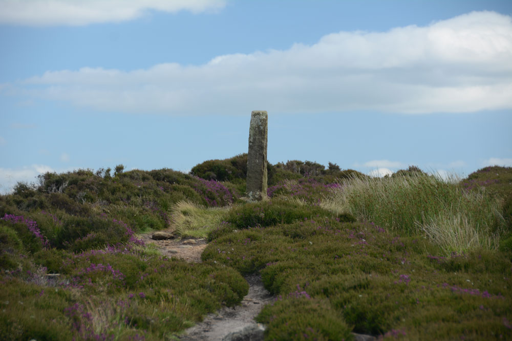
Danby Rigg Marker Stone (Crossley Gate) submitted by Anne T on 9th Jul 2017. Having walked about 100 metres down the track towards the ring cairn with standing stone, I turned back to look at this marker/standing stone, which is very visible to walkers on the horizon.
(View photo, vote or add a comment)
Log Text: Danby Rigg Marker Stone (Crossley Gate), North Yorkshire: this isn't marked on the OS map, but it is scheduled and listed on Pastscape. It is in a beautiful spot looking east to Lower Fryup Dale and marks the junction of two paths - one which comes up from the valley to the east, the track that runs along the eastern side of the rigg, and the northern most track that leads across the rigg from Lower Fryup Dale to Danby Dale, leading past the ring cairn with standing stone.
The stone working markings on the stone make it look like a modern replica, although Pastscape says it's medieval. Being so close to the nearby cross-dyke and round cairn, it is very much like walking in the footsteps of the people who lived on the ridge all those many years ago.
Danby Rigg Marker Stones
Trip No.32 Entry No.2 Date Added: 10th Jul 2017
Site Type: Marker Stone
Country: England (Yorkshire (North))
Visited: Yes on 2nd Jul 2017. My rating: Condition 3 Ambience 4 Access 4
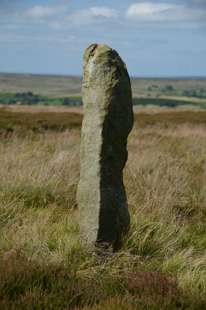
Danby Rigg Marker Stones submitted by Anne T on 9th Jul 2017. This is the same stone from a different angle, looking north east across the moorland towards Ainthorpe village. It s a lonely spot, which could be very wild in winter months.
(View photo, vote or add a comment)
Log Text: Danby Rigg Marker Stones, North Yorkshire: I was really surprised to find these marker stones on top of the moor, running from the Standing Stone and trig point in line with Slate Hill to Danby Dale.
We didn't walk to all of them, as we wanted to get across to the cross dyke, round cairn and ring cairn on the northern side of the ridge.
As an olden-day traveller, particularly in winter months, I would have been grateful to have seen these stones marking the way. Beautiful views.
Datuidoc's Stone
Trip No.130 Entry No.8 Date Added: 30th May 2019
Site Type: Early Christian Sculptured Stone
Country: England (Devon)
Visited: Yes on 11th May 2019. My rating: Condition 3 Ambience 3 Access 4
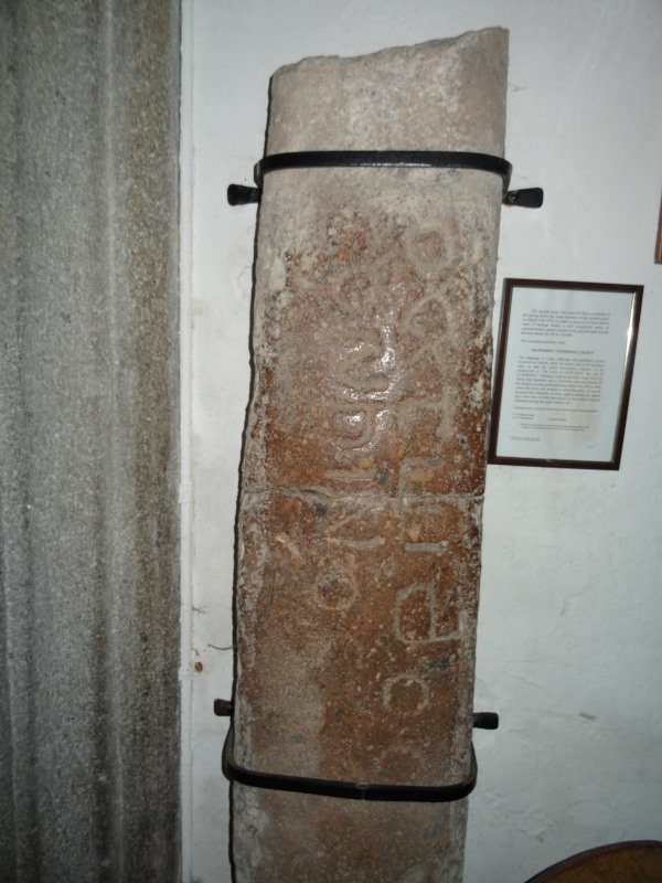
Datuidoc's Stone submitted by AngieLake on 5th May 2018. Another view of the stone in Lustleigh Church today, during the May Day celebrations. (Not to be missed on such a sunny, lovely, day!)
(View photo, vote or add a comment)
Log Text: The Writhelstan inscribed stone, St John The Baptist, Lustleigh: Expecting this to be the prettiest village in Devon, I was a little surprised to find I didn’t agree. The church is right in the middle of the village, and we managed to park by the south wall of the churchyard, immediately opposite the village pub.
Going into the church, the Writhelstan stone was stuck on the west wall of the nave in between, and partly hidden by, a gas heater on its south side, and wooden stacking chairs to its northern.
We couldn’t ascertain if the churchyard was oval/circular as a road had been cut to its northern side.
Some lovely old grave slabs in the floor of the chancel, northern chapel and nave. Interesting rood screen with pomegranates and heads. Whilst we were in the church, there were around four to five other sets of visitors, none of whom looked at this inscribed stone, which I thought was odd, but then it was well hidden unless you knew what to look for.
There was also a cross on the village green, which looked to be modern. Could not find this on Pastscape.
There was a photo frame with some information about this stone, which must have been on the wall, but had recently fallen off and the glass had shattered. I carefully moved it from the floor onto the top of the heater and photographed it.
“This ancient stone was removed from a position in the paving below the inner doorway of the church porch on March 13th 1979, in order to preserve it from further wear. It belongs with a well recognised series of commemorative stones erected in the post-Roman period between about AD 450 to AD 600.
The inscription probably read:
“DATUIDOCI CONHINOCI FILIUS”
The language is Latin, although the personal names involved are British. Both the names are in the genitive case, so that the whole inscription requires to be understood as “The stone of DATUIDOC the son of CONHINOC”. Nothing is known of either man, but it is likely that Datuidoc was a Christian, and was buried in the already existing graveyard here about AD 550 to 600, where the stone was erected to mark his grave. It can be assumed that Datuidoc at least, and probably his father also, were men of local importance in this area of eastern Dartmoor during the sixth century AD”.
Lustleigh is one of only four church sites in Devon with an inscribed stone
J.C. Wallace Kemp & A.P.W. Robertson (Churchwardens).
After walking around the church, and photographing the modern cross on the church green, we adjourned to the pub, The Cleave, opposite the church. As it was such as warm evening, we sat in the garden around the back of the pub, listening to the myriad of bird song.
Davy's Lee 1
Date Added: 21st Jul 2014
Site Type: Rock Art
Country: England (Northumberland)
Visited: Yes on 20th Jul 2014. My rating: Condition 4 Ambience 4 Access 2
Davy's Lee 1 submitted by SolarMegalith on 28th Mar 2014. Cup-marks and an arc or groove on Davy's Lee panel (photo taken on March 2014).
(View photo, vote or add a comment)
Log Text: Having visited Davy's Lee Settlement and Davy's Lee Stone Circle, rather than walk directly southwards across the boggy ground and the stream, we headed eastwards back to the main footpath between Halleypike Lough/Folly Lake. We lost the footpath, but continued as best we could, trying to keep on the access land (there was no delineation between access land and non-access land) and stumbled across this stone lying in the grass.
It definitely looked as if it had been shaped, so we stopped to look some more, and as our eyes adjusted, clusters of cup marks appeared. We weren't sure if the grooves had been deliberately made, or if they had been carved in antiquity (rival sites say they are natural grooves which determine the position of the cup marks).
We thought this stone rivalled the stones in the group of rocks in West Agra Farm Fields (although not the West Agra Plantation).
Not being aware this stone existed before our visit, this came as a real treat, especially with the lovely landscape around - it was a very special afternoon for us, in glorious sunshine.
Davy's Lee Enclosure
Date Added: 21st Jul 2014
Site Type: Misc. Earthwork
Country: England (Northumberland)
Visited: Yes on 20th Jul 2014. My rating: Condition 2 Ambience 4 Access 2
Davy's Lee Enclosure submitted by SolarMegalith on 28th Mar 2014. A bank in the northern part of Davy's Lee enclosure - view from the east (photo taken on March 2014).
(View photo, vote or add a comment)
Log Text: Continuing south on the footpaths from Standingstone Rigg at Great Lonbrough would have brought us to Davy's Lee Settlement and Davy's Lee Stone Circle and tumuli, but on this walk we elected to park at the Old Repeater Station, just off the B6318 (old military road), and follow the footpath to Sewingshields Crags, on the opposite side of the road.
We've done this walk before, but only to see the Roman Loughs (fishing ponds) in 2011, and couldn't do this bit of the walk due to the boggy ground. Note: I wouldn't like to follow this footpath after a period of wet weather - too wet, wellies would be needed!
We followed the footpath through Hadrian's Wall Vallum, up the hill past Sewingshields Farm, then turned round the back to the northern side of Sewingsheilds Crags. At the bottom of the hill, just past the cattle grid, there is a track that leads off to the left hand side which leads to both Davy's Lee Settlement and Davy's Lee Stone Circle.
At the top of the first ridge we came to, there were what appeared to be a row of standing stones, and possibly another small stone circle, but my inexperienced eyes thought I might be confusing these with quarried rocks left lying on the ground. However, we came across some blue posts hammered into the ground and some blue spray-painted crosses; the farmer we met shortly afterwards confirmed that archaeologists had been to do an initial survey of this area.
The footpath disappears for a while, but can be picked up at the western end of this first ridge. After walking up and down another ridge (with another rocky outcrop with a possible empty cairn at the top), it was necessary to cross another boggy piece of land, with a small, bubbling stream at the bottom, then it was an easy walk up to the settlement.
The entrance and the outer banks of the settlement are easily identifiable, and is in a fantastic landscape.
Davy's Lee Stone Circle is about 50 yards to the east of the entrance to the settlement, with other tumuli further to the east.
Dead Friar's Stone (Stanhope)
Trip No.42 Entry No.2 Date Added: 31st Aug 2017
Site Type: Marker Stone
Country: England (County Durham)
Visited: Yes on 28th Aug 2017. My rating: Condition 3 Ambience 3 Access 5
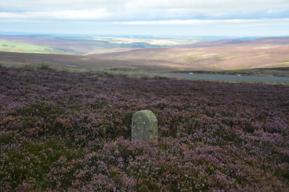
Dead Friar's Stone (Stanhope) submitted by Anne T on 31st Aug 2017. Standing at the edge of the parking area looking north east towards Edmundbyers.
(View photo, vote or add a comment)
Log Text: Dead Friar's Stone, Stanhope: From Old Man's Grave, just north of this stone, this was our second stop of the day - a curiously named stone next to Dead Friar’s quarry. Amusingly, husband thought a great slab of concrete lying next to the car park was the stone lying on its side! We looked again.
At a great viewpoint eastwards, although I thought this perhaps should have been a taller way marker rather than a boundary stone, given where it stands – at a bend of Meadows Edge (marked Dead Friar’s Road on the OS map), and where another smaller track heads off across the moorland westwards, then south, towards Rookhope.
The area around Rookhope always has ‘not very nice’ connotations for me, given my son-in-laws brother was killed in an accident green-laning on his trials bike just over 2 years ago, and I was glad to move on from this lonely spot.
Deil's Cradle (Dollar)
Trip No.109 Entry No.5 Date Added: 11th Nov 2018
Site Type: Natural Stone / Erratic / Other Natural Feature
Country: Scotland (Clackmannanshire)
Visited: Saw from a distance on 31st Oct 2018. My rating: Condition 3 Ambience 3 Access 3
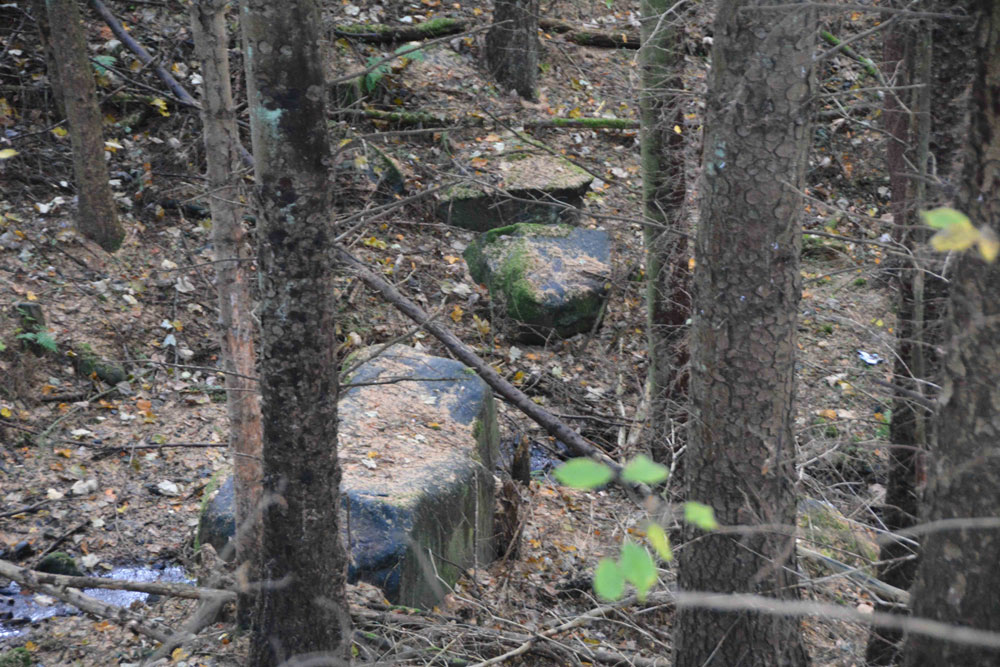
Deil's Cradle (Dollar) submitted by Anne T on 11th Nov 2018. Site in Clackmannanshire Scotland. With this large erratic at the bottom of a small gorge, with daylight failing, we wanted to get to Tullibody to see the Maiden's Stone, so photographed it from a distance only.
(View photo, vote or add a comment)
Log Text: Devil's Cradle, Dollar: With this being Halloween, I was keen to try and see this massive erratic rock. From the Wizard’s Stone eastwards, the road gets narrower, not much wider than a single track road, so we parked in Tarmangie Drive, at NS 96743 99038, and walked up Upper Hillfoot Road (the southern part) at NS 96743 99038. Looking down through the woodland, we saw a large erratic by the side of a small burn.
This stone is in a very deep gorge, and we couldn’t immediately see a way to get to it With a 70 degree slope on one side and a near vertical drop on the other, we decided, with the failing light, to carry on to Tullibody and see sites which we really wanted to get to before dark, so photographed this stone only from a distance.
Dere Street Cairn
Date Added: 25th Apr 2015
Site Type: Round Cairn
Country: Scotland (Scottish Borders)
Visited: Yes on 23rd Apr 2015. My rating: Condition 3 Ambience 5 Access 3
Dere Street Cairn submitted by minteddy on 4th Dec 2006. NT750155. Looking east over cairn towards whaleback of Cheviot
(View photo, vote or add a comment)
Log Text: Black Knowe Cairn (Dere Street Cairn), Scottish Borders:
From Trestle Cairn we followed the other side of the stone wall from Dere Street back downhill (this being Scotland I can’t get wholly used to the ‘right to roam’ even though we lived here for over 10 years. I wish we had this in England, too) with some interesting ‘lumps and bumps’ in the landscape on our right hand side – old quarries for Dere Street, old buildings or just marshy patches that have collapsed over the years?
Further down hill towards Black Knowe Cairn we spotted a green mown path cutting through the heavily tussocked grass that we were walking on by the stone wall, so switched onto this and it was easy walking down to the cairn.
What a site to end up at at the end of the day – it was very atmospheric and we spent ages wandering around the stones, looking at what might possibly be alignments between them, spotting two outliers to the north west and west, and just generally soaking up the magic of the place.
At the large stone in the field to the west I thought I saw a cup mark – it was definitely very smooth but worn, but I never know if my imagination is getting carried away. My husband certainly found no mention of rock art in this area before the visit.
Hubby walked over to the stone wall to see if there was possibly an alignment with the Black Knowe Standing Stone at the other side, but it was difficult to tell (I’d love to see an aerial photograph of these features).
Standing on the outlier at the north eastern edge of the cairn looking back, five of the stones seem to form an alignment running south west down the hill.
From the cairn the grassy path continues southwards down the hill. The only gate from the field is right in the middle of the lower side, then we had to track diagonally left to get back to the gate leading back onto Dere Street near the Scout Hut and parking area by Pennymuir Roman Camp A.
Diarmid's Grave
Trip No.87 Entry No.3 Date Added: 28th Jul 2018
Site Type: Cairn
Country: Scotland (Argyll)
Visited: Yes on 17th Jul 2018. My rating: Condition 3 Ambience 4 Access 5
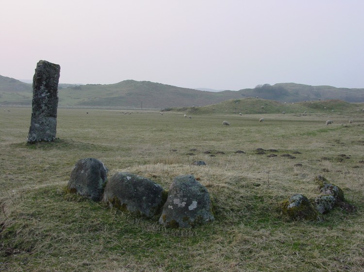
Diarmid's Grave submitted by PaulH on 1st May 2003. A kerb cairn near Strontoiller
Farm to the east of Oban with the standing stone of Clach na Carraig in the background.
(View photo, vote or add a comment)
Log Text: Strontoiller (Small Cairn), next to the Clach Na Carraig standing stone: This was perhaps the most amusing encounter of our whole trip, involving a human and two sheep. As we pulled up by the cattle grid at NM 90788 28935, just before some houses set back from the road, I heard a man’s voice repeatedly shouting loudly: “Go away! Get out of here! Get out!” Thinking he might possibly be shouting at us because of where we’d left the car, I hopped across the cattle grid, only to be almost knocked off my feet by two very large lambs hurtling back across the cattle grid into the field. “Oh, I wasn’t shouting at you”, the man said. “Been naughty?” I asked him, pointing back to the sheep. “It’s always the lambs”, he said, closing the gate.
I asked him if it was OK to park where we where to look at the stone circle, and he replied, “It’s OK. Go ahead. It’s over there.” He pointed, rapidly closing the farm gate into his driveway and scuttled back to his house.
The gate into the field was a little further west along the road, at the junction of the road with the driveway to Stontoiller Farmhouse/Cottage. We let ourselves into the field and walked across to where this neat little stone circle lay, the stones almost buried in tall grass and marsh grass at this time of year. We did a ‘round tour’ of the field, starting off by photographing this neat little cairn, then the stone circle, then the larger cairn, and finally coming back to the standing stone and the small cairn.
Note: the Portal’s page for this site is called ‘Diarmid’s Grave’. I’ve not yet come across any reference with this name in. I’d be curious to know more.
Dod Law Main Rock A
Date Added: 28th Jul 2014
Site Type: Rock Art
Country: England (Northumberland)
Visited: Yes on 27th Jul 2014. My rating: Condition 4 Ambience 4 Access 3
Dod Law Main Rock A submitted by DrewParsons on 3rd Oct 2011. Dod Law Main Rock. September 2011.
(View photo, vote or add a comment)
Log Text: Access to Dod Law Main Rock is exactly as DrewAndrews describes. It is a relatively easy walk up hill, following the path up hill, southwards, through Wooler Golf Course (one of the golfers told us it was alright to leave our car parked in their car park).
Immediately opposite the fenced boundary of the upper end of the golf course, there is Newcastle University Rock Art poster, indicating where the main rock is, although as DrewAndrews says, it is out of scale. We missed the rock on the way up, being hidden by bracken, and ended up walking up to the Trig Point. Had it not been raining so hard, the views from the settlements and enclosures above Shepherd's House would have been spectacular; indeed, when the rain stopped about 20 minutes later, and the sun came out, the almost 360 degree views (complete with rainbow) were wonderful.
We spotted the main rock on the way back down the path (it's actually only about 4 metres east of the footpath, which turns left up to the trig point, just above the top end of the Golf Course), and were rewarded by these wonderful rock art motifs.
Someone had been there not long before us, and literally ripped and torn the turf and moss away from the rock surface, to be able to view the whole of the motifs.
The rain made the markings stand out beautifully.
By the time we'd taken photographs, we realised how wet we were, having been caught in heavy rain for some time, and made our way back to the car.
My next trip to this area will be to see the remains of the stone circle, but I think we'll plan a longer circular walk, parking near Weetwood Hall, to take in more cup and ring marked rocks shown on the Ordnance Survey Map, with the furthest point being The Ringses Hill Fort.
Doddington Moor
Date Added: 1st Sep 2014
Site Type: Stone Circle
Country: England (Northumberland)
Visited: Couldn't find on 30th Aug 2014
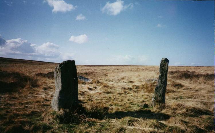
Doddington Moor submitted by Andy B on 24th Nov 2001. Doddington Moor Stone Circle
(View photo, vote or add a comment)
Log Text: Doddington Stone Circle, Northumberland (second failed attempt!). Having visited Weetwood Moor, as we were so near, and it was still only relatively early (5pm), we decided to drive a couple of miles further up the road to Weetwood Hall and try the footpath I’d identified as a possible easier route to Doddington Stone Circle.
We parked the car park where the footpath splits off northwards from the road just after Weetwood Hall (there is just room for one car opposite the field entrance at the corner of the junction). There is a metalled road which goes past the two or more houses to the left hand side, then it become a grassy path between two hedges, with tractor ruts in either side. After about half a mile, just past a wood to the right hand side, there is a gate with a footpath sign on, and the track becomes quad bike marks in the grass, and we followed these up the hill. There is a new stile (narrow, but new) , then the track more or less disappears, and is marked by a series of Scots Pines, standing alone, but growing more or less in a line north-north-west up the hill.
Passing an outcrop of rock to our left hand side, we climbed to the brow of the hill, but just where the land started to go downhill again, we were met by boggy land, covered completely with a heavy coverage of low growing thistles and gorse, which went on as far as the eye could see. Andrew decided this was impossible, so we turned back and went to find the cup and ring marked rocks marked on the map on the way back down the hill.
We'd previously tried to visit on 17th August 2014, but the quarry next to Wooler Golf Club had been extended and the footpaths had disappeared (or we couldn't find them).
There is a third possible footpath to try, from West Horton, so this will go on the 'want to do' list.
Dodlaw Burn
Date Added: 26th May 2015
Site Type: Standing Stone (Menhir)
Country: Scotland (Scottish Borders)
Visited: Yes on 23rd May 2015. My rating: Condition 3 Ambience 4 Access 3

Dodlaw Burn submitted by Anne T on 26th May 2015. Standing behind the 'entrance pair' of stones looking west over the Kale Water valley.
(View photo, vote or add a comment)
Log Text: Dodlaw Burn Standing Stones and Cairns, Scottish Borders (alternative name = Chatto Hill Standing Stone): I guess we’ve become more than a little bit fascinated by this part of the Scottish Borders, probably because it’s easy to get to (about an hour from our house), there are very, very few people around (apart from the odd farmer and cyclist) and there are so many features/sites marked on the map.
Husband Andrew spotted an area marked on the map as having ‘standing stones and cairns’ relatively near to Woden Law hillfort, which we both wanted to see. So, on a sunny Saturday, we set off north.
Taking a different route from Jedburgh through Oxnam, we ended up back at the Pennymuir Roman Camps, continuing past them up towards Chatto Craig and Tronshaw Hill. The minor road passes over a cattle grid near Chatto/Upper Chatto, and immediately over the grid there is a sheep-fold with room for several cars to park without blocking access to the field.
A gate gives access onto the field from here and the track climbs up and off to the left hand side of the field, up past a small wood to the left hand side then levels off in the area between Dod Law hill to the right and Little Heuch Law to the left. Almost immediately, we were struck by what appeared to be cairns on the eastern flank of Dod Law and in the flat area to the left hand side of the track, what could possibly be a large hut circle and a cairn or two. Because of the depth of the tussocked grass, we could walk the bank of the ‘hut’ but couldn’t really capture it in a photograph. More research to done on the RCAHMS site in this area, me-thinks (there are lots of ‘dots’ on Canmore mapping here, but you can’t click on a dot and bring up the information, so it’s going to take some time). We did take grid references, and I’ll look at these when there is more time (and less gardening) to do. (Note: a subsequent look at the Canmore site reveals this circular feature is a most probably a sheepfold).
Continuing up the gently slope between the hills and crossing over the small ford over the Dod Law Burn, the standing stone appears on the brow of the hill just above you. Following the path, it becomes clear on reaching the top that there are three stones; two sit close together as a sort of entrance. The third sits low and flat to the ground to the east.
There are in fact three cairns to the north of the third stone, at grid references NT 77795 16810 (measures 5.6 metres in diameter, 0.4 metres high), NT 77800 16814 (immediately to the north east, 4 metres in diameter and 0.4 metres in height), and NT 77799 16820 (to the north, 4.6 metres in diameter and 1.5 metres in width). I’m glad we had the GPS device. None of the cairns could easily be photographed, but we could definitely see them with the naked eye. Whilst the 1999 record says they stand 0.4 metres above the land surface, I reckoned they were about 20 cms higher, probably because of the tussocks of grass around them. Thank goodness for having taken part in the Davy’s Lee Level 1 and Level 3 surveys recently, as I began to get my eye in to look at lumps and bumps and identify changes in grass height and colour, which gave clues as to the banks surrounding the cairns.
Above us to the east rose a cairn on Little Heuch Law.
Dods Corse Stone (Boon)
Trip No.50 Entry No.1 Date Added: 6th Oct 2017
Site Type: Ancient Cross
Country: Scotland (Scottish Borders)
Visited: Yes on 24th Sep 2017. My rating: Condition 2 Ambience 3 Access 4
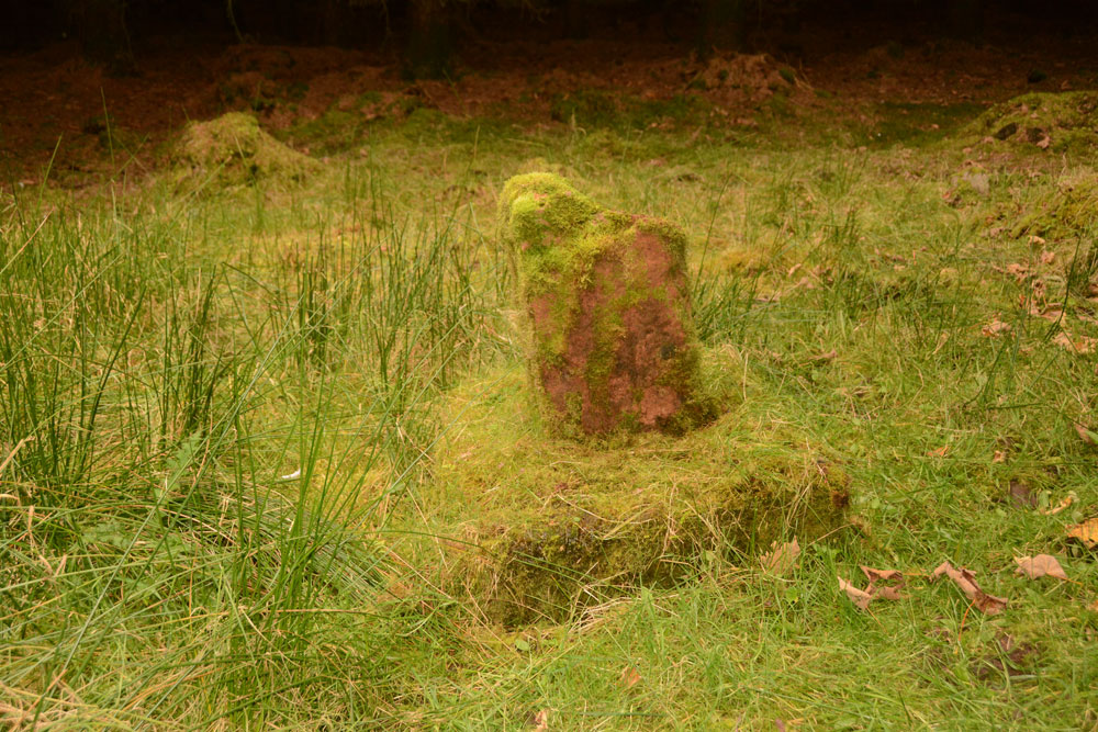
Dods Corse Stone (Boon) submitted by Anne T on 6th Oct 2017. On the mossy covered northern face, the (thin) incised cross can just be made out.
(View photo, vote or add a comment)
Log Text: Dods Corse Stone (Cross shaft and base): We pulled over in field entrance opposite wood the stone stands within, at NT 58395 46267. There was another huge bull with his ladies in this field, standing staring at us very menacingly, as if he was about the charge at us. As we were getting out of the car, we were overtaken by 3 army land rovers on exercise, the driver of the first vehicle waved.
The step on the stile into the wood was very tall, so my knees needed a bit of help getting up on it. There was a very narrow path leading to the north of the small wood. There is a fence line running east-west and another small section of wood (a narrow section of field is shown on the map). Following this inner fenceline some 200 metres to the west, we eventually came across the cross and base almost buried under moss and debris from the surrounding trees.
The incised cross on the northern face could just be made out, but the cross in relief on the southern face remained buried under the moss. All under foot around the cross were other bright red sandstone stones, but with all the forestry work, and debris from it, made it difficult to tell what archaeology there might be around us.
Dogton
Trip No.110 Entry No.5 Date Added: 13th Nov 2018
Site Type: Class III Pictish Cross Slab
Country: Scotland (Fife)
Visited: Yes on 1st Nov 2018. My rating: Condition 3 Ambience 4 Access 4
Dogton submitted by cosmic on 15th Feb 2006. Dogton from East
(View photo, vote or add a comment)
Log Text: The Dogton Cross: With the clocks having gone back an hour on the Sunday before, it was difficult to correctly judge how fast dusk would fall. It was getting a little dark, but whilst we were here, we really wanted to see this stone.
With the roads busy at this time of night, we managed to park just off the road at the entrance to the track leading up to Kinglassie House, just off the B922 and set off up the footpath to find this cross.
The gate into the field the stone was in was an amalgamation of several gates tied together, so it was easier just to step over the tumbled stones by the gate post. Fortunately the field the stone was in had just been harvested, so we walked up through the corn stubble, just as dusk was setting in.
I photographed each face of the cross by leaning over the railings, or poking the camera through the railings, then stitched them together.
The sign on the railings reads: “Dogton Stone. This stone is a free-standing Celtic cross probably 10th century AD. The top and arms of the cross have been destroyed, but the centre boss is still visible on the east face. A horseman is carved below it and there are entwined serpentine animals on the south face. Cared for by Historic Scotland.”
When I got back home and looked at the Canmore records, I was surprised to see the cross and its railings had been, in the not too distant past (photo dated 1927), incorporated into a dry stone wall, no longer there.
Dour Hill (Rochester)
Trip No.31 Entry No.1 Date Added: 19th Jun 2017
Site Type: Chambered Cairn
Country: England (Northumberland)
Visited: Yes on 17th Jun 2017. My rating: Condition 2 Ambience 4 Access 3
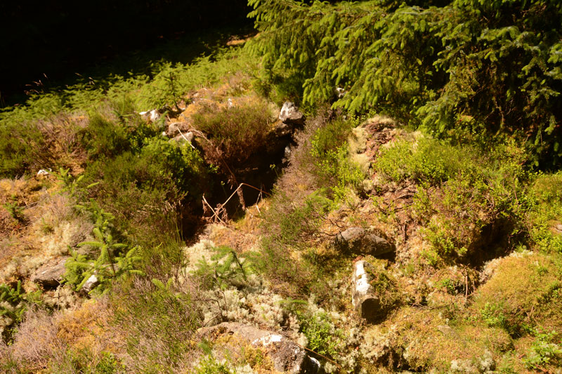
Dour Hill (Rochester) submitted by Anne T on 19th Jun 2017. This is the larger Bronze Age cist, sited towards the north western end of the cairn. We had to pull back a large conifer branch to get a clear view. This chamber was easily deeper and much more visible than the smaller chambers up and down the length of the cairn.
(View photo, vote or add a comment)
Log Text: Dour Hill Chambered Cairn, Near Otterburn: We picked the hottest day of the year so far to visit here, and climbed the gently sloping hill up past the very tall forest plantations towards the top of Dour Hill.
This visit was interesting as the army were carrying out exercises on the Otterburn Ranges less than 400 metres away. They must have been at the top of Dour Hill as, as soon as we'd reached the cairn, there was an almighty boom and the ground under our feet trembled with the ordnance being fired. On the way back to the A68 we heard the radios and voices not far away.
Unlike Bellshiel Law chambered cairn, this cairn sits in a forest clearing and nature has been allowed to reclaim it. The chambers can still be made out, and there is a large, deep Bronze Age cist cut into the cairn to the north west of its middle section (I had to pull back a large conifer branch to photograph it properly).
Well worth the walk. Would have liked to have seen the Bronze Age round cairn some 170 metres to its east but the forest was dense and we missed it.
Dreva Craig
Trip No.5 Entry No.5 Date Added: 18th Aug 2016
Site Type: Standing Stone (Menhir)
Country: Scotland (Scottish Borders)
Visited: Yes on 10th Aug 2016. My rating: Condition 2 Ambience 4 Access 4
Dreva Craig submitted by austenjohnreid on 29th Apr 2010.
the east side of the hill is littered with boulders & longstones, there is also some remains of a stone age stuff too much to photograph.
(View photo, vote or add a comment)
Log Text: Dreva Craig, hillfort and settlements, Scottish borders: OK, so it rained last year on my birthday. This year, the rain was equally as torrential, so we hopped from site to site. This was our last stop of the day, after (trying to visit) Tinnis Castle/Hillfort and Altarstone. There is a parking space for one or two cars next to the gate to the field, and a stile over the fence, although it proved easier to open the gate. Tramping through the knee high undergrowth, it was easy to reach the rocky outcrop on the ridge leading to the fort itself, but the surface of the rock was so wet it was quite treacherous. Husband would have been happy to continue, but I wimped out when I spotted the huge bull 50 yards away, opting to take a few photographs and retreat to the warmth (and safety) of the car. We plan to come back to this area when the weather is drier. This really looks like a fascinating site, with lumps and bumps on both sides of this minor road. The Canmore record tells me that there is a fort (photographed), defended by two stone walls, alongside three settlements. Had the sun been out, there would have been really fantastic views down to the River Tweed to the south.
Dreva Hill West (Broughton)
Trip No.82 Entry No.8 Date Added: 24th Jul 2018
Site Type: Ancient Village or Settlement
Country: Scotland (Scottish Borders)
Visited: Yes on 12th Jul 2018. My rating: Condition 2 Ambience 3 Access 4
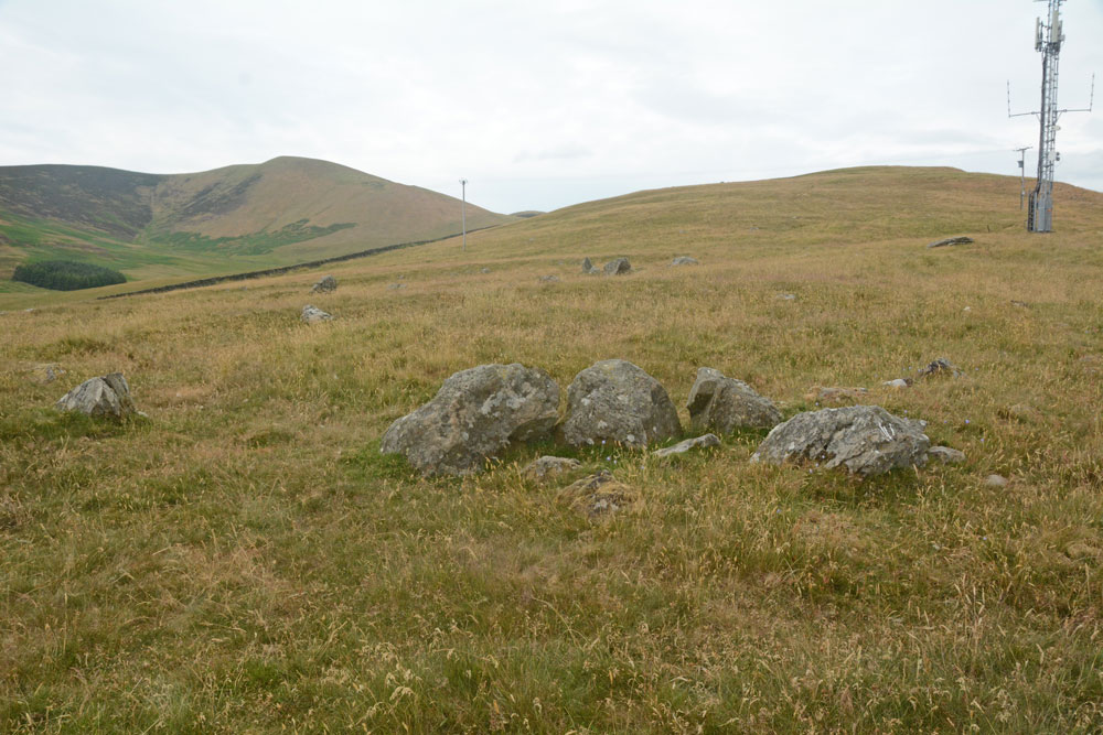
Dreva Hill West (Broughton) submitted by Anne T on 24th Jul 2018. A cluster of boulders towards the mid point of the northern side of the settlement, perhaps part of an internal structure, with a line of stones forming the outer bank beyond. It was difficult to ascertain whether or not this was part of the primary or secondary settlement phase.
(View photo, vote or add a comment)
Log Text: Dreva Hill West, Broughton, Scottish Borders: To the east of the road, there is a gate leading to a farm track, which we followed for about 100m then headed up towards the mast. In typical Tate fashion, Andrew had muddled up the entries for Dreva Craig Fort and this settlement, so I spent ages photographing boulders around the site, thinking they were the ‘chevaux de frixes’.
It’s a great site for a mast, but it’s so close to this settlement, to me it feels invasive and insensitive. The tall grass made it difficult to see any of the outer banks, although I could feel the rise and fall of the low banks at various points as I walked across the settlement. Because I was able to pick out more features here, on a flatter land with fewer boulders, I was more interested in this site than Laigh Hill. It would be nice to be able to track down a plan, so I can really interpret what I saw.
Drizzlecombe Brook
Trip No.134 Entry No.3 Date Added: 17th Jul 2019
Site Type: Marker Stone
Country: England (Devon)
Visited: Yes on 15th May 2019. My rating: Condition 3 Ambience 3 Access 3
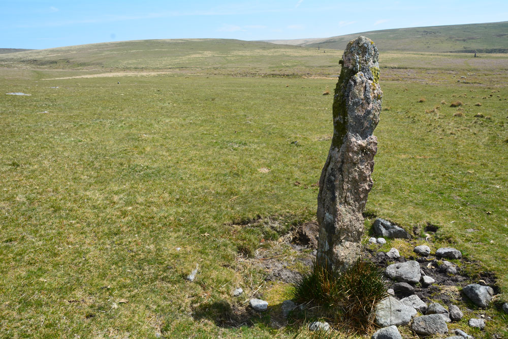
Drizzlecombe Brook submitted by Anne T on 11th Jul 2019. This is the 'standing stone' at SX 5870966946, in between Whittenknowles Rocks Settlement and Drizzlecombe Brook with its old tin workings.
(View photo, vote or add a comment)
Log Text: Drizzlecombe Brook 'Standing Stone': This stone was between the settlement an the tin works that Sandy showed us and I was hopeful of having spotted another monument on the moors not on today's list of sites to visit.
Not having a grid reference from the camera, we’ve tracked it down to one of six stones (one of which I photographed later, but which turns out to be the abandoned gate post!). Looking at the photograph and how near we are to the tin-works at the stream, this stone is at SX 58709 66946.
Judging by the photograph with the group, I estimate it to be just taller than Janet – 1.7m or just over.
Drizzlecombe cairn 13
Trip No.134 Entry No.12 Date Added: 17th Jul 2019
Site Type: Cist
Country: England (Devon)
Visited: Yes on 15th May 2019. My rating: Condition 3 Ambience 4 Access 3
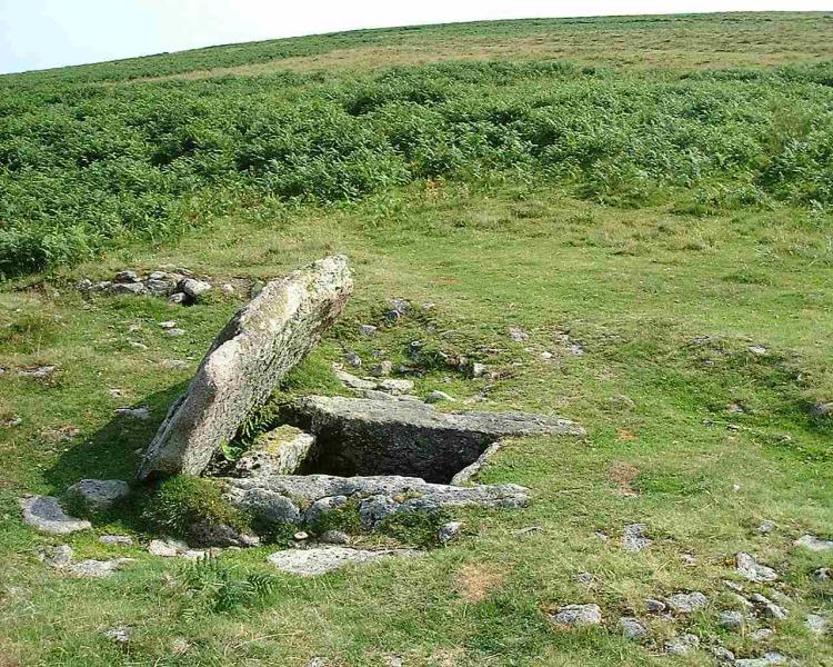
Drizzlecombe cairn 13 submitted by Brian Byng on 7th Feb 2002. View looking east of the large cist at Drizzlecombe which Burl claims has a row running in an Easterly direction in line with the tilted slab. I looked very carefully & found no sign of such a row. None of my references mention such a row & I have asked around those who should know - again without success. I think this is another of Burls iffy sites.
(View photo, vote or add a comment)
Log Text: Drizzlecombe Cairn 13: Leaving the stone rows behind, we walked up slope and to the WNW. This is a beautiful example of a cairn with central cist. What is very noticeable about this cist is that the stones making up two of the sides projects outside the other two ends. Looking at the Butler diagram for these sites (Volume 3, page 135), cairn 13 is indeed in ine with cairns 2, 3 and 4, but about 150m further from the stone rows.
Drizzlecombe Cairn 18
Trip No.134 Entry No.14 Date Added: 17th Jul 2019
Site Type: Cairn
Country: England (Devon)
Visited: Yes on 15th May 2019. My rating: Condition 3 Ambience 4 Access 3
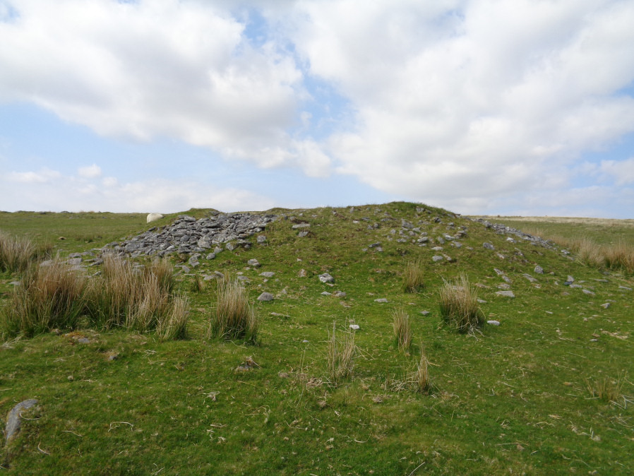
Drizzlecombe Cairn 18 submitted by davep on 16th Jul 2019. Photograph from Prehistoric Dartmoor Walks, site 1520, Drizzlecome 18 Cairn. Photograph taken 15.05.2019
(View photo, vote or add a comment)
Log Text: Drizzlecombe Cairn 18: An enormous cairn, which rivals the Giant's Basin in size, so why there is so little information about it, I'm not sure. I managed to clamber up to the top of the cairn and have a look inside, where there is a hollow where it has been excavated. Built almost on top of one of the settlements at the south-eastern side of Drizzlecombe, it looks over the River Plym to the south.
