Contributory members are able to log private notes and comments about each site
Sites Anne T has logged. View this log as a table or view the most recent logs from everyone
St Bernard's Well
Date Added: 30th Dec 2015
Site Type: Holy Well or Sacred Spring
Country: Scotland (Midlothian)
Visited: Yes on 17th Dec 2015. My rating: Condition 3 Ambience 2 Access 4
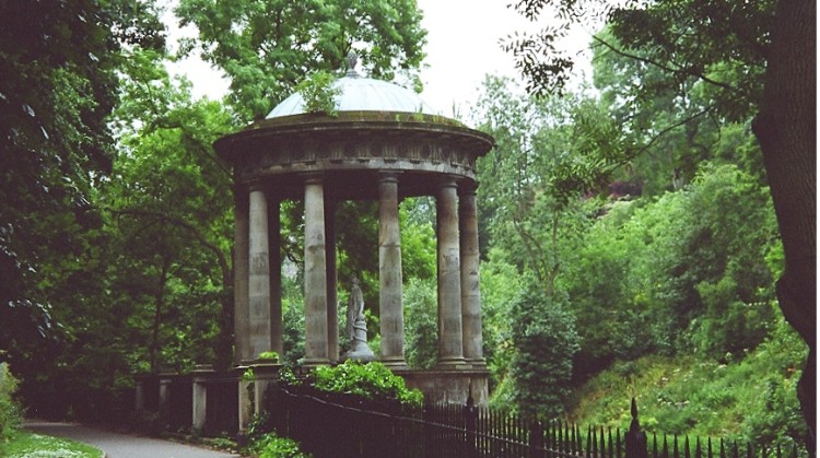
St Bernard's Well submitted by KiwiBetsy on 5th Dec 2004. One for the birds.
(View photo, vote or add a comment)
Log Text: St Bernard's Well, Edinburgh: This was by far the most attractive of the three wells we saw in Edinburgh today, although again I wouldn’t have known it was a well but for the plaque next to it telling us it had been refurbished in Victorian times. It sits at the base of a steep hill with housing and private gardens above, with the Water of Leith running below. It is apparently possible to get inside the structure during ‘Doors Open’ day, although the gate and door were very well padlocked, and the number of vodka bottles and cans inside the temple indicates its well used by drinkers who hop over the gate. We did intend going up to Arthur's seat to see 2 other wells and the hill fort but the wet and windy weather drove us indoors to get warm.
Mare and Foal
Date Added: 25th Jan 2016
Site Type: Standing Stones
Country: England (Northumberland)
Visited: Yes on 24th Jan 2016. My rating: Condition 3 Ambience 4 Access 5
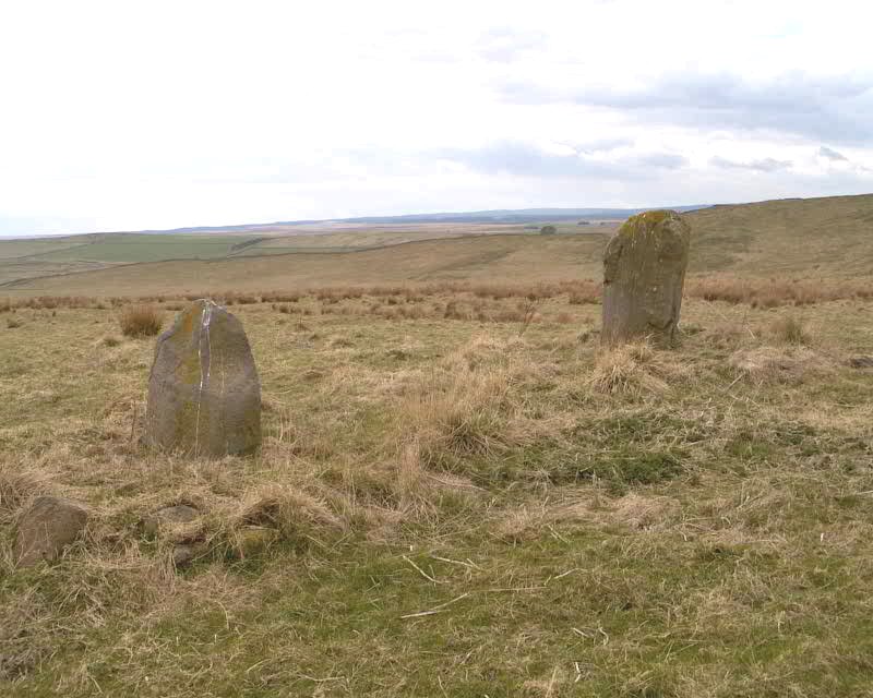
Mare and Foal submitted by spoors599 on 13th Apr 2002. Mare and Foal standing stones, Northumberland.
Landranger Sheet No:86 Grid ref: NY72546632
Located just off the B6318 and close to Hadrians Wall are two standing stones, the larger stone standing 1.51m high, the other 0.98m high at a distance apart of 4.82m. The 1769 Armstrong map of Northumberland marks 3 stones in situ. It has been suggested that the stones formed part of a ?four ? poster?. Loose boulders were packed around the base of the stones to prevent damage by cattle in 1992. The b...
(View photo, vote or add a comment)
Log Text: Mare & Foal Stone Circle, just west of Twice Brewed, Hadrian's Wall: After many months of not being able to get 'out and about', even though the day dawned dull, damp and dreary, it was great to be able to get out into the open countryside again. Strangely, we've driven past this little stone circle on many occasions as we've driven up and down the Military Road (the B6318), but I thought it was just north of Hadrian's Wall. How wrong can you be?
We'd been up into the Edges Green area to try and locate the course of the Roman Aqueduct which wends its way around the contours around here, but it's very difficult to pick out. Anyway, Roman's never did float my boat.
I've wanted to visit this stone circle for ages. We parked at the side of the road leading up toward Shield On The Wall farm. There is no actual footpath here, but it's possible to hop over the wooden fencing where the stone wall adjacent to the B6318 meets the wire fencing which runs northwards up the slope. There were no animals in the field, and the farmer was herding his sheep in the field opposite. I waved and he showed no signs of warning us off.
From the road looking west, it looks as if the stones sit on a low curved mound. The larger stone had a 'bruise' on one side, which in the photographs looked like a cup and ring, but actually seems to be where part of the stone has been broken away.
Anglo Saxon Cross Base, Wetheral Parish Church
Date Added: 12th Apr 2016
Site Type: Ancient Cross
Country: England (Cumbria)
Visited: Yes on 28th Feb 2016. My rating: Condition 3 Ambience 4 Access 5
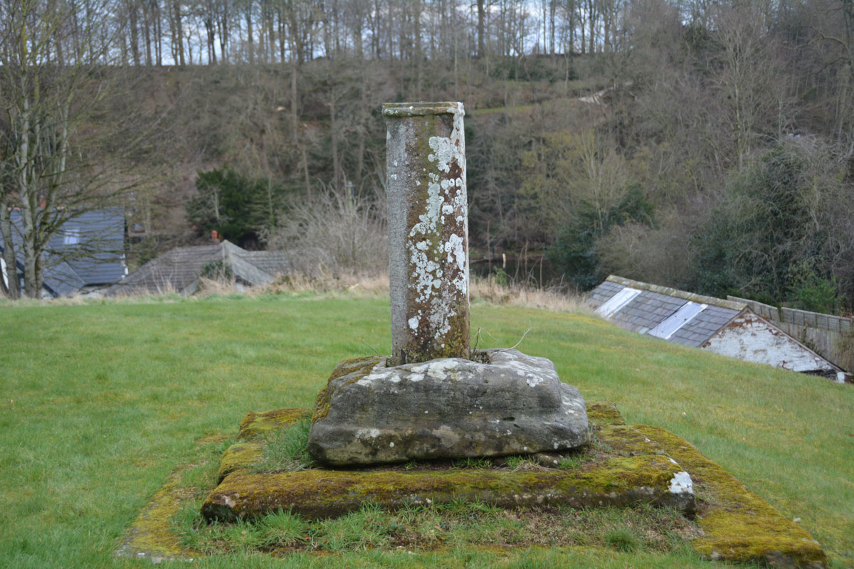
Anglo Saxon Cross Base, Wetheral Parish Church submitted by Anne T on 2nd Mar 2016. Standing to the west of the cross base looking down Ferry Hill towards the River Eden.
(View photo, vote or add a comment)
Log Text: Anglo Saxon Cross Base, Wetheral, Cumbria: A notice in the guard house at the Priory Gatehouse mentioned boundary crosses, so I thought it might be worth investigating whether or not there were any fragments inside the church. As we walked up from the Eden River up Ferry Hill, with the churchyard to my right, there was a fragment of cross shaft with what looked to be an original cross base.
The church itself was locked, although there appeared to be a light on inside, but only in the vestry. A check on the Anglo Saxon Corpus site tells me that only one fragment of cross arm is recorded for Wetheral, and this is now in the possession of H M Calvin of St John’s College, Oxford (see Corpus of Anglo Saxon Stone Sculpture Record Cumbria 169). The cross base isn't recorded on the AS Corpus site, and I'll email for their opinion, but it looks so similar to others that we concluded it must be. I'll update the record when I hear.
St Cuthbert's Holy Well
Date Added: 12th Apr 2016
Site Type: Holy Well or Sacred Spring
Country: England (Cumbria)
Visited: Yes on 28th Feb 2016. My rating: Condition 3 Ambience 3 Access 4
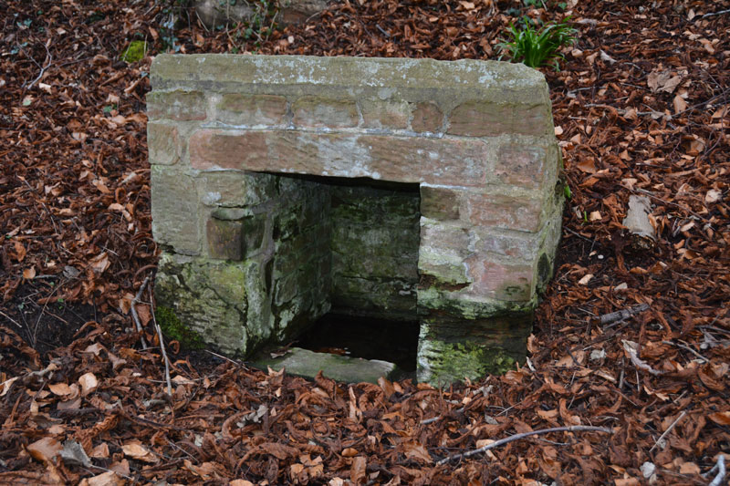
St Cuthbert's Holy Well submitted by Anne T on 2nd Mar 2016. The front and interior of St. Cuthbert's Holy Well. At the time of our visit, whilst the basin inside the well was full of clear water, there was little or no visible flow, unlike the spring opposite Wetheral Priory Gatehouse further up the village.
(View photo, vote or add a comment)
Log Text: St. Cuthbert's Well, Wetheral, Cumbria: I'd tried the (very pretty) walk along the recently flooded River Eden to St. Constantine's Cells, but failed as the path overhangs the river by some 5-6 metres. As a consequence, I was determined to go to this well. Just as you arrive into Wetheral village from the A69, there is a footpath sign leading off to the left, indicating St. Cuthbert’s Well.
There is parking outside the small railway station (there are just a couple of platforms here) and it’s about quarter of a mile down the slope towards the river to the well. A small sign sits to the right of the track as you head towards the river detailing a short history of the well. “According to legend, St Cuthbert’s Well was built long before Norman times when Wetheral Priory was founded. The exact date is not known, but St Cuthbert is thought to have visited Carlisle in 683 and 687.”
From the sign, the well can be seen topped by a concrete slab which has an inscription which reads: “The Holy Well/Called in the 12th century/Fons Sancti Cuthbert/Repaired 1897 and 2001.” A short flight of stone steps leads down to the well itself.
When visiting the village, the Wetheral Priory Gatehouse at the far side of the village is small but worth a visit.
Prudhoe Castle
Date Added: 12th Apr 2016
Site Type: Rock Art
Country: England (Northumberland)
Visited: Yes on 26th Mar 2016. My rating: Condition 3 Ambience 4 Access 4

Prudhoe Castle submitted by Anne T on 27th Mar 2016. Close up the cup and ring marked stone at Prudhoe Castle. The two larger cups with multiple rings (which appear to overlap) can be clearly seen, if somewhat worn.
(View photo, vote or add a comment)
Log Text: Rock Art @ Prudhoe Castle, Northumberland: I only found out about this stone because I'd been doing some research for the Tynedale North of the Wall Archaeology Group and spotted a record for Prudhoe Castle on the ERA web site (also another one in the Monastic Workshop in Hexham Abbey, which I’ve emailed them about). We’ve lived here for almost 14 years and never been to the castle. I confess to it being prettier than I’d imagined.
Coming up from the Badger Roundabout in Low Prudhoe (junction of the A695 with Station Road), the access road seems pretty tight, although it is wider than it appears. The car park is about 100 yards from the main entrance of the castle. There is a pond to the left of the gate, fed from a stream which is piped under the road from the hillside behind. There are some really nice yew block hedges which really make the entrance. If the trees were out in leaf, you wouldn’t be able to see the castle from the road.
The path climbs gently up the slope, through the gatehouse and under the gatehouse with chapel over. This leads into the outer bailey and immediately in front of you the block with rock art stands against the sloping north wall of the castle, with the ticket office to the left hand side. The sign next to it reads “prehistoric cup and ring marked stone found reused in the footings of a late medieval building on this site.” England’s Rock Art record (ERA-750) tell us that “this stone is very close to the north wall of the castle building (about 0.32m), by a small window. The carved surface faces south to the castle gateway and is in a fairly sheltered position and gets the sun. It was found during excavations of a 14th century hall within the castle. Motifs consist of two, possibly three single cups and two larger cups with multiple rings, the lower cup has three rings and the higher has two, both the outer rings overlap. The rings could be pennannulars, but they’re extremely faint and difficult to make out. Short radial grooves run from the central cups.”
The outer bailey is quite fascinating. When there were no trees (and no toilet roll factory) there would have been brilliant views across the Tyne towards Ovingham.
A footpath runs around the castle in a ditch and we walked round, seeing the foundations of a round tower that once stood. There are the remains of a mill to the left hand side as you leave the gatehouse, with an old mill stone dated 1786 propped by the wall. The old mill leat runs along a paved bed of stones and runs down to the Tyne below.
Brecken Hills
Date Added: 13th Apr 2016
Site Type: Hillfort
Country: England (Northumberland)
Visited: Yes on 10th Apr 2016. My rating: Condition 3 Ambience 4 Access 4
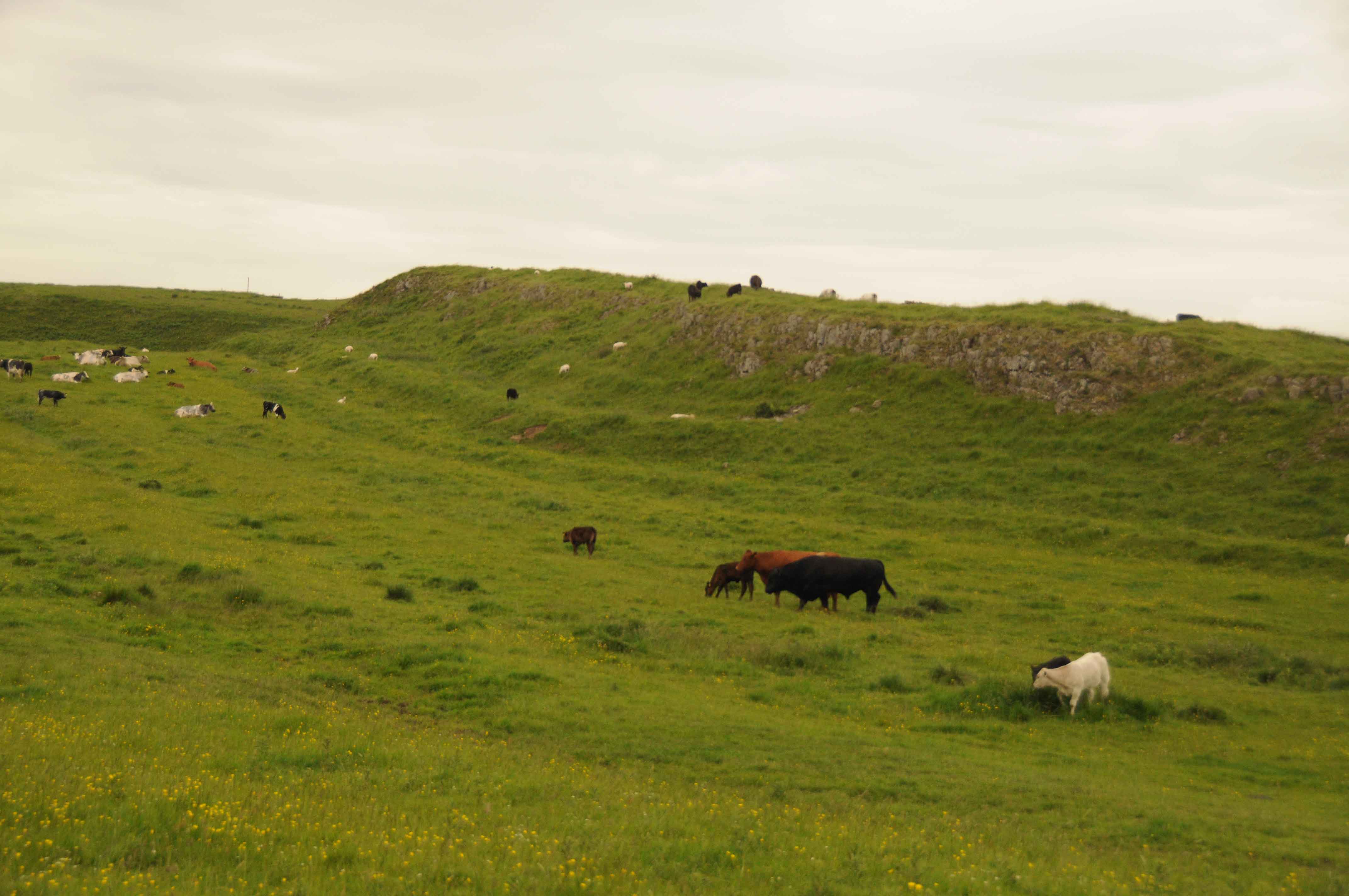
Brecken Hills submitted by Anne T on 17th Jun 2014. Photograph of Blue Crags/Brecken Hills Hillfort showing the rocky incline forming part of the defences on the western edge.
It wasn't possible during our visit to get closer, due to some large bulls and lots of cows with calves, so we thought it wiser not to disturb them.
From the map, the hillfort is extensive, and I look forward to visiting it again.
(View photo, vote or add a comment)
Log Text: Revisit to Blue Crags (Brecken Hills) Hillfort: The last time we visited this site we had to stop at the gate to the field on the Colwell Village side of the site, admiring the outcrop/settlement from a distance. My memory sees at least 3 enormous bulls, feet planted wide, staring at us, daring us to come nearer. Needless to say, we didn't.
This time we approached the site from its northern side, using the public bridleway/access road to Swinburne Quarry from the A68. The HER records (site number N9202) tell me this site covers about an acre and forms a wedge with the whinstone forming natural defensive northern edge and ramparts at the side, the highest part of the site being 600 feet above ground level (although it didn't see that high).
Walking up into the site is easiest from the far edge (near the gate to the footpath to Colwell village), where the site drops virtually to ground level. Walking up the slope to the entrance, a well-preserved hut circle sits to the left hand side of the path. Within the site there are more hut circles - we've never seen such well preserved ones in Northumberland and it was easy to imagine how our ancestors lived and used this space.
The north eastern side of the whin sill has been quarried away, but does not impact upon the site itself.
Well worth a visit.
On the opposite side of the track, to the north, lies the not so well preserved Dunn Crags settlement and enclosure.
Lemmington Wood
Trip No.1 Entry No.1 Date Added: 14th May 2016
Site Type: Rock Art
Country: England (Northumberland)
Visited: Yes on 8th May 2016. My rating: Condition 3 Ambience 4 Access 4
Lemmington Wood submitted by SolarMegalith on 28th Feb 2013. Cup-and-ring marks in artificial lighting (photo taken on February 2013).
(View photo, vote or add a comment)
Log Text: Lemmington Wood Rock Art/Rune Stone, Northumberland: We'd been told about this rock by a member of the Tynedale North of the Wall Archaeology Group who is renowned for visiting many and various rock art sites in Northumberland.
From the A1 North, we turned up on the A697 and drove the almost 16 miles to Edlingham (not to be confused with the nearby village of Eglingham to the north). We arrived in this quiet spot to the sound of a cuckoo in the fields nearby – a sound rarely heard up here these days. Just north of Corby’s Crags, an impressive settlement and rock shelter to the right hand side of the road, there is a turn to the left leading to Lemmington Hall. Just as this side road turns off, there is a small parking area and a memorial bench which looks out over to Edlingham Burn and the Aln Valley.
Whilst these are marked as private woods, there are three trails leading from the entrance gate to the wood. Various signposts say “No Bikes” but doesn’t discourage walkers. The ERA record (see below) says there is open access to this stone. These woods have obviously been decimated by the storms over Christmas and New Year and there are fallen trunks and branches everywhere. The trunks blocking the pathways have largely been chain-sawed to allow access.
A GPS is really needed to find this rock, which sits on the top of a slope, which, if the trees hadn’t been there, would have given great views over the valley beyond. The rock is really hidden in a dip and surrounded by conifers so is difficult to spot.
Someone had been there recently and scrapped off the moss in order to see the rock art and runes more clearly. This was good for us, but not so great for the preservation of these features.
According to the HER records (HER 4471), the runes were only found in 1991 by Ian and Irene Hewitt as they prepared the rock for wax rubbing and photography. The runes and rock art are on the edge and upper face of a 6ft outcrop. Described on the England’s Rock Art site ERA 579.
There is clear evidence on the stone of attempts to quarry it, so what else might have been on a more complete rock?
Jenny's Lantern
Trip No.1 Entry No.2 Date Added: 14th May 2016
Site Type: Hillfort
Country: England (Northumberland)
Visited: Yes on 8th May 2016. My rating: Condition 3 Ambience 4 Access 3
Jenny's Lantern submitted by SolarMegalith on 5th May 2013. Rampart and ditch in the southern part of Jenny's Lantern Iron Age hillfort (photo taken on May 2013).
(View photo, vote or add a comment)
Log Text: From the Lemmington Wood rock art/rune stone, we carried along on the minor roads headings towards the tiny village of Bolton, having gone through the somewhat exciting ford over the River Aln between Abberwick and Bolton Mills, then carried on past Jenny's Lantern Hill to Jenny's Lantern. Despite not having rained for a while, this ford was a lot deeper than it looked!
This site was one of the first we visited at the time we (I) signed up for the Portal. Having tried to find the Midstead Rock Art stones without a GPS, but with many stony outcrops on the hill, we failed, meaning to go back but haven’t until now.
Just east of this hillfort is also a Romano-British settlement, which also includes the remains of an Iron Age defended settlement, with a number of visible hut circles, recorded as HER 4379. The whole site is complex and even with the HER and Historic England records, it is quite difficult to unpick on the ground.
The outer banks and ditches are well preserved. From the road, it’s not easy to see the oval fort at all. There is room for a small car in the gateway to a field to the south, at grid reference NU 12433 15229, overlooking the observatory/listening station at Cloudy Crags to the south east. From the gate in the field opposite, follow the track up the hill then head west almost the field, boundary. On the way to the hillfort you will cross the low banks and ditches of a separate Romano-British settlement. Crossing a stone bank, you will see the eastern outer banks and ditches of the hillfort rising up against the skyline.
The actual Jenny’ Lantern, recorded as HER record 20729 (probably an 18th century’ eye-catcher’ folly) stands north east at the brow of the hill.
The hill fort and settlement sit below the brow of the hill, but there are superb views across to the Aln Valley to the south and west. I'd feel safe living here if I lived in days gone by.
Midstead 1
Trip No.1 Entry No.5 Date Added: 14th May 2016
Site Type: Rock Art
Country: England (Northumberland)
Visited: Yes on 8th May 2016. My rating: Condition 3 Ambience 4 Access 4
Midstead 1 submitted by SolarMegalith on 11th May 2013. Cup-and-ring mark with a gutter in the NE corner of Midstead 1 panel (photo taken on May 2013).
(View photo, vote or add a comment)
Log Text: After visiting Jenny's Lantern Hill fort and settlement and Midstead 2 and 3 to the west, we walked eastwards along the top of the crag to find the rock art we'd failed to find on our first trip in 2014. Thank goodness for GPS otherwise we never would have found these. The ground in this rocky field had obviously been very wet at some time in the recent past and been home to some large cattle. Not having rained for some time the ground had hardened, making walking over the tussocks difficult. This stone is the most impressive on the hillside with numerous motifs. Well worth seeing. I'm glad we returned. About 3 metres to the south west of this stone we found another with a cup mark at grid reference NU 12424 15448. Having been sent the HER records for Jenny's Lantern, the Historic England map for this entry (1008839) shows a homestead just above the site of this stone - not marked on the OS maps and not clear on the ground (although not being aware it was there we didn't hunt around).
Midstead 2
Trip No.1 Entry No.3 Date Added: 14th May 2016
Site Type: Rock Art
Country: England (Northumberland)
Visited: Yes on 8th May 2016. My rating: Condition 3 Ambience 4 Access 3
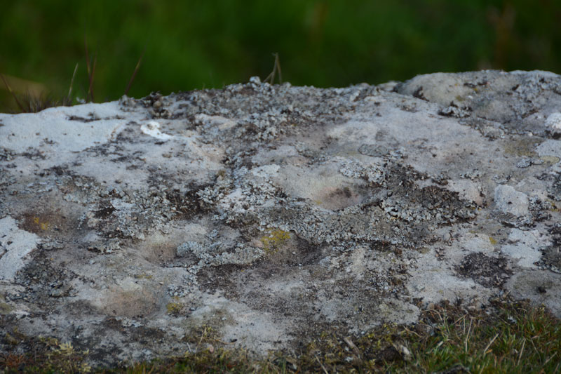
Midstead 2 submitted by Anne T on 11th May 2016. Close up of some of the cup marks on this rock. The ERA-599 record for this stone says there are 35 possible cup marks, but we didn't spot that many. I would have liked to have tried a rubbing of this rock to see how many there were.
(View photo, vote or add a comment)
Log Text: Midstead 2, Rock Art near Edlingham, Northumberland: Having visited Jenny's Lantern Hill Fort and Settlement, we headed back east with the GPS to find the rock art stones we'd failed to find on our visit back in 2014 (our first trip out to find rock art, without a GPS). This rock sits right on the edge of the crag with great views over the Aln Valley below. The cup marks are a little difficult to spot until your eyes adjust to the lumps and bumps on the rock. The cups are inter-disbursed with natural hollows. There are some cup marks on the vertical face of the rock although it was difficult to get too close because of the 'killer' brambles. Note to self: take garden shears/machete on next visit!
Midstead 3
Trip No.1 Entry No.4 Date Added: 14th May 2016
Site Type: Rock Art
Country: England (Northumberland)
Visited: Yes on 8th May 2016. My rating: Condition 3 Ambience 4 Access 3
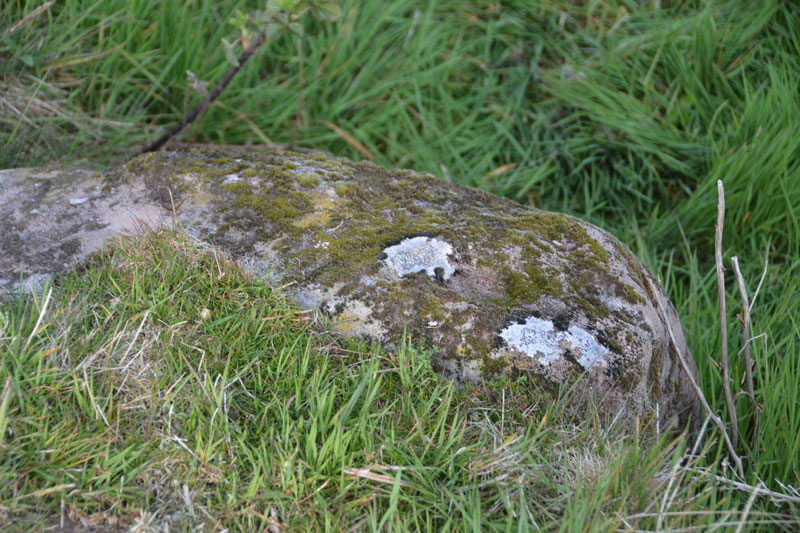
Midstead 3 submitted by Anne T on 11th May 2016. Midstead 3 showing some more of the cups on the far side of this boulder. When the NADRAP survey was done they uncovered parts of the stone buried under turf, so they were able to see all 13 cup marks.
(View photo, vote or add a comment)
Log Text: Midstead 3, Rock Art near Edlingham, Northumberland: Also see visit report for Jenny's Lantern Hill Fort and Settlement, Midstead 1 and Midstead 2. This stone is about 3 metres to the west of Midstead 2, although the cups are more difficult to spot. Beautiful views over the Aln Valley and to the listening/radar station at Cloudy Crags across the valley.
Elvaplain
Date Added: 23rd Jul 2017
Site Type: Stone Circle
Country: England (Cumbria)
Visited: Saw from a distance on 29th May 2016. My rating: Condition 3 Ambience 4 Access 4
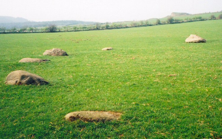
Elvaplain submitted by LizH on 29th Aug 2007. A closer picture of the stones in the circle
(View photo, vote or add a comment)
Log Text: Elvaplain Stone Circle, Setmurthy, Cumbria: After having seen the tumulus and settlements at Aughertree Fell we set off for Elva Hill. With a stunning image on the Visit Cumbria website, which told us this although this stone circle was on private land, it could be approached by a footpath, we found Elva Plain farm and the footpath up to Elva Hill easily enough. With well kept sheep and their large lambs, we enjoyed the sunshine as we walked up the hill. But, and there was a big BUT - the farmer had tied the gates up so strongly with thick twine it was like trying to untie the Gordian knot. With four gates to get through, and some of them wired shut, we could only see this stone circle from afar. Frustrating. If the farmer had been around, I would have asked (nicely) for access to the field. Whilst the stones are largely flat and just visible above ground (between the sheep!), this stone circle is in a stunning location, looking out over Bassenthwaite Lake in the valley to the south west and the fells beyond. Elva Hill (now quarried) lies to the north.
Thimbleby Nine Stones
Trip No.2 Entry No.1 Date Added: 9th Oct 2019
Site Type: Standing Stones
Country: England (Yorkshire (North))
Visited: Yes on 9th Jun 2016. My rating: Condition 3 Ambience 4 Access 3
Thimbleby Nine Stones submitted by SolarMegalith on 15th Mar 2013. Northern pair of standing stones - view from the south (photo taken on March 2013).
(View photo, vote or add a comment)
Log Text: Nine Stones Stone Row, near Osmotherley, North Yorkshire: Having added a few of the Stone Rows of Great Britain sites on the Portal, and needing to go down to Thirsk it was too much of a temptation to resist visiting one or two of the North Yorkshire sites. With only a 3 hour window before having to travel onto Doncaster, the only one we could reach and explore in time was Nine Stones, just outside Osmotherley.
We’ve been to this area before to look at Anglo Saxon crosses in churches and ended up getting hopelessly lost, but this time we had the OS map and our GPS. With the sun shining down from an almost cloudless sky, we reached the car park at Square Corner easily enough. It never ceases to amaze me that there are so many more people in this part of the world than in Northumberland. There were people picnicking on the side of the road near Solomon's Temple enjoying a wonderful view over Oak Dale valley and the woods of Crabtree Bank and Thimbleby Bank Plantations.
As we pulled up, a number of dog walkers drew up, chattering noisily, and I hoped they weren’t going to follow us and destroy the peace and quiet of the afternoon (I’m definitely getting to be a grumpy old woman!). Fortunately, they followed the Cleveland Way up the hill to the south.
From the car park, we walked the couple of hundred metres to the gate where the footpath west over Thimbleby Moor and the Cleveland Way southwards meet. The GPS told us there was almost 700 metres to walk to Nine Stones, so we set off over the stile over the wall by a second gate to the west. The first couple of hundred yards were easy walking along a stoned footpath leading off to some modern shooting butts to the west. After 200 metres we needed to veer off southwards to follow the dry stone wall westwards. This was all through knee deep heather with the occasional field drain and boggy patch thrown in. After another 200 yards we realised we’d reached a much quarried area; there were deep holes full of water which we could only see when we were almost upon them. I managed to disappear up to my ankles in one, although there were other that looked far deeper.
Whilst the area has many blocks of stone poking up through the heather, towards the top of the slope there suddenly appeared on the horizon two standing stones, looming large, beckoning the walker. Here was (were?) Nine Stones, at last.
This stone row was well worth the trudge through the undergrowth. At the northern tip of the row there are five stones, two tall, two stumpy and one almost buried in the heather. We wondered which were actually part of the stone row. The north-western most stone looked as if there had been an attempt to quarry the top of it in the distant past (comparing the holes to some at Edges Green, near Cawfields) that we’ve seen recently.
Two more tall stones sit close to the stone wall, and a few more stones appear further south in the forested area. The Stone Rows of Great Britain site tell us that this stone row is 60 metres long, but husband, tramping through the forest, thought it might be possible that the row was nearer to 100 metres (but then which are natural stones and which are recumbent standing stones?).
There are so many other features in this area to explore: Miley Pike Tumulus, Robinson’s Cross (remains of), a Holy Well, Faber’s Stone – well worth a repeat visit.
Mare and Foal
Date Added: 4th Jul 2016
Site Type: Standing Stones
Country: England (Northumberland)
Visited: Yes on 18th Jun 2016. My rating: Condition 3 Ambience 4 Access 4

Mare and Foal submitted by spoors599 on 13th Apr 2002. Mare and Foal standing stones, Northumberland.
Landranger Sheet No:86 Grid ref: NY72546632
Located just off the B6318 and close to Hadrians Wall are two standing stones, the larger stone standing 1.51m high, the other 0.98m high at a distance apart of 4.82m. The 1769 Armstrong map of Northumberland marks 3 stones in situ. It has been suggested that the stones formed part of a ?four ? poster?. Loose boulders were packed around the base of the stones to prevent damage by cattle in 1992. The b...
(View photo, vote or add a comment)
Log Text: Mare & Foal (2nd visit). We had been up at nearby Edges Green for a geology field day (afternoon) as part of the Tynedale North of the Wall Archaeology Group and had the pleasure of taking one of the members of the group (well known to the Portal, but I don't want to give his name here as I've not asked his permission) up to this small but brilliantly placed stone circle. Parking by the side of the minor road off the Military Road, we went through the gate in the field this time (as opposed to clambering over the wooden fence by the road). The ground was really tussocky and walking was difficult for the first 100 yards or so, having to balance on each one to take a step. Andrew and our guest marched off as if it was level ground, and I felt envious! Whilst there isn't a footpath up to this site, it looked as if other people had also recently walked this way.
Coming up to the Mare and Foal from the north-west the stones clearly sat on a raised bank. In the early evening light, it looked very inviting. Closer up, we could see the area around it had been heavily quarried in a number of areas and it looked as if the stones might have been re-erected judging by the packing around them. Standing just south of the smaller stone, looking north up to Cawfields Gap and the Hadrian's Wall ridge, there is a third, smaller stone buried deep in the grass.
Clifton Stones
Trip No.3 Entry No.2 Date Added: 4th Jul 2016
Site Type: Standing Stones
Country: England (Cumbria)
Visited: Yes on 3rd Jul 2016. My rating: Condition 3 Ambience 4 Access 3
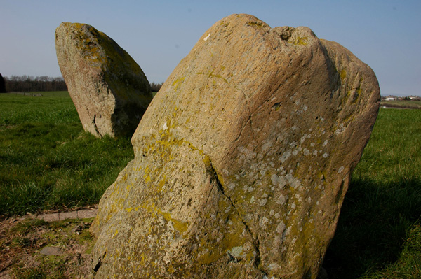
Clifton Stones submitted by nicoladidsbury on 31st Mar 2007. Clifton Standing stones - the smaller stone is set in concrete. Plough marks are visible on its southern side. Buzzards were flying overhead, fantastic :)
(View photo, vote or add a comment)
Log Text: Clifton Stones, near Penrith, Cumbria: These standing stones are only a short distance from Trainford Brow Long Barrow. There is a side road opposite Mount Clifton farm which allows for parking of one car on the grass verge. It was interesting crossing the A6 as cars sped along in both directions; however, sight lines were good. We followed the footpath through Mount Clifton farm (heavily mired with fresh cow dung). This path was gated, as they had a huge (but placid) bull in the barn yard with his ladies. The mire gave onto a tarmacked pathway leading to Tinkler’s Lane Bridge over the M6. It was then easy walking down to the field containing these two standing stones.
With a brilliant view of the North Pennines to the east and the Lake District (complete with notch in the hills) to the west, these stones sit next to the very busy M6 with a view of Penrith to the north. Because of the acoustics on the day, the traffic noise was a distant buzz in the background.
I was a little disappointed as the smaller stone had obviously fallen over in the past and been cemented into the ground.
After enjoying the ambience for a while, we tried to see the Cairn Circle at Leacet Plantation. The first forest track we tried had a Lowther Forestry working locking the gate. We then tried at Chatburn Kennels and Cattery, but the fields were cropped and walking through them heavy going. Being late in the day we decided to retreat to go and see the Countess Pillar then home. We got beeped at by the owners of the kennels who had come down to dump their rubbish exactly where we had parked the car.
Edlingham Anglo Saxon Cross Bases
Date Added: 7th Aug 2016
Site Type: Ancient Cross
Country: England (Northumberland)
Visited: Yes on 23rd Jul 2016. My rating: Condition 3 Ambience 4 Access 5

Edlingham Anglo Saxon Cross Bases submitted by Anne T on 7th Aug 2016. These two cross bases sit at the south west external side of the church porch. Neither are decorated. Whilst recorded as being 8th century, the HER record queries this date, although they are similar to others of the same date.
(View photo, vote or add a comment)
Log Text: Edlingham Anglo Saxon Cross Bases, Northumberland: We went to visit Edlingham Castle/Fortified Manor House nearby, not expecting to find this charming (but very squat) 11th century church (St John The Baptist). As we approached, I spotted the Anglo Saxon cross bases by the south porch, although nothing is said about these in the church guide. According to the Northumberland HER record, there is also supposed to be the remains of an 8th century cross shaft in the north east corner of the nave, although we didn't spot this during our visit (but is recorded on the AS Corpus).
The location of this church is charming. Within a couple of hundred yards there is the ruined castle, with a wonderful example of a trilobe joggled lintel above the fireplace in the Solar Tower. Beyond is a viaduct from the now dismantled railway. Within easy walking distance is the cup and ring/rune marked rock at Lemmington Wood and the rock shelter at Corby Crags.
Following our visit to the church and castle, we walked to Noah's Well at the eastern end of the village, just outside Demesne.
Burnswark Hillfort
Trip No.4 Entry No.1 Date Added: 7th Aug 2016
Site Type: Hillfort
Country: Scotland (Dumfries and Galloway)
Visited: Yes on 31st Jul 2016. My rating: Condition 3 Ambience 5 Access 4
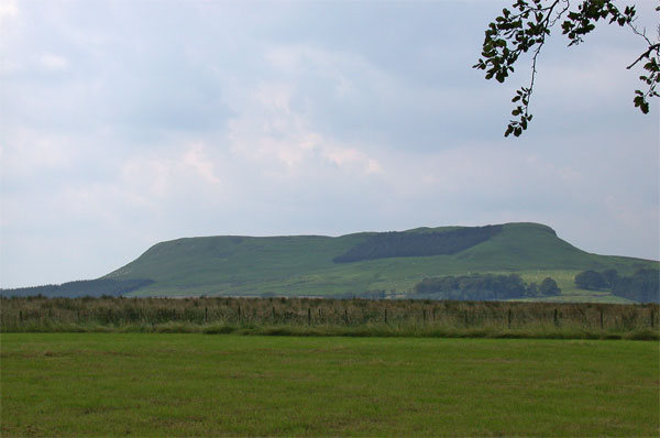
Burnswark Hillfort submitted by nicoladidsbury on 21st Mar 2005. Burnswark Ancient Hillfort
(View photo, vote or add a comment)
Log Text: Burnswark Hill Fort, Dumfries & Galloway: A week of being stuck in the house contemplating on, and preparing for, the building work to come I was glad to escape the house for a walk in open countryside with few people around. Considering we’ve lived in this area for 10 years, we never visited this impressive and enigmatic hill fort. It was as good as (if not better than) Edlingham Castle, and in my view, more interesting. There was such a lot to see. Exiting the A74(M) at Ecclefechan, we headed off up the narrow one track rock up past farms called ‘Paulsland’ and ‘Relief’. There is a small parking area just before the gate to Burnwark Farm at grid reference NY 18788 78332. We then plunged into the darkness through a track through the forest, to emerge onto a grassy hillside filled with large sheep. It was strange and nice to make the transition from English ‘stick to the footpaths’ to the Scottish ‘responsible right to roam’; different rules for only a few miles apart.
From the forest track, a trackway follows the hillside upwards to the hillfort. The first things to come into views were ‘the three bretheren’, which we took to be burial mounds surrounded by ditches, although the Canmore record below describes them as possible Roman artillery positions for attacking the fort.
On top of the plateau, there were huge views around 360 degrees, including the sun shining off the Solway Firth. Neither Andrew or I have ever been at a point where it’s been possible to see both Criffel and the Lake District (Helvelyn was the tallest peak) at the same time. There are also the grassed over remains of structures, although I found it impossible to interpret what they were.
Having walked over to the north-western side of the fort to see the Roman fortifications below, we made our way over to the nearby cairn on the next hilltop.
Whiteholme Rig
Trip No.4 Entry No.3 Date Added: 7th Aug 2016
Site Type: Stone Circle
Country: Scotland (Dumfries and Galloway)
Visited: Yes on 31st Jul 2016. My rating: Condition 2 Ambience 2 Access 3

Whiteholme Rig submitted by Anne T on 7th Aug 2016. The first stone in this ancient monument that we saw from the edge of the adjacent field. The farmer hadn't made it easy for visitors to reach this stone circle, and it was a real shame the ground had been left to go wild, which made it difficult to make out any monument at all.
(View photo, vote or add a comment)
Log Text: Seven Brethren Stone Circle, near Lockerbie: I was surprised to find this was so near where we used to live at Corrie. But when we lived here, with three young children, we didn't have the same interests as we do now, so (although the kids say we traumatised them by taking them to so many monuments) we never visited. We parked by the gate to the disused quarry near Standburn farm, hopped over the gate and followed the track up to Whiteholm Rigg. At present, along the top of this low ridge, a row of trees follows the trackway. Right at the end, motorway barriers have been erected to form a large, robust enclosure, gated at both ends, which looks as if it's used as a stock enclosure. Beyond the gate at the eastern end, cows and their calves grazed in the lush grass on the hillside below. Walking along the edge of the field, small toppled stones could be seen in the grass, which had been left to grow long and untended around the stones, but mown in the area beyond. Walking around the tussocks we spotted the remains of 6 stones, but how unimpressive this site is. If we hadn't have known that this was a stone circle, we would have thought these were just a few outcrops in the grass. Such a shame.
A funny (now) moment occurred at the end of our visit. Going back to clamber over the gates into the enclosure, the bulls in the field (of which there were several, excitable!) came to investigate. One stood pawing the ground with its front hoof. Husband climbed the 8 ft tall motorway barrier, which left me stuck in the stone circle field. However, husband managed to distract the cattle whilst I climbed over two gates to get back to safety!
Burnswark Hill Cairn
Trip No.4 Entry No.2 Date Added: 7th Aug 2016
Site Type: Cairn
Country: Scotland (Dumfries and Galloway)
Visited: Yes on 31st Jul 2016. My rating: Condition 3 Ambience 4 Access 3
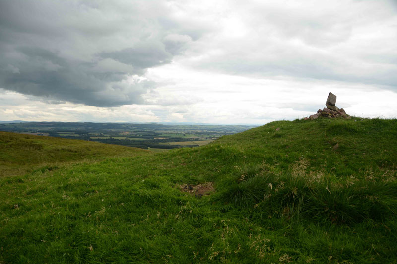
Burnswark Hill Cairn submitted by Anne T on 7th Aug 2016. The Cairn at Burnwark Hill as seen from the path from the hillfort.
(View photo, vote or add a comment)
Log Text: Cairn at Burnswark Hill, near Ecclefechan: After walking around the hill fort, we spotted this cairn on the next hill top to the north east and followed the tracks over. There were great views down to the Roman fortifications on the north western side of the fort. Whilst Romans usually leave me cold, the juxtaposition between the hillfort, the fortifications and the cairn, together with the views of the Solway Firth, Criffel and Helvelyn in the Lake District beyond, were stunning. A great afternoon, and well worth the visit.
Dyke Row
Trip No.5 Entry No.1 Date Added: 14th Aug 2016
Site Type: Stone Row / Alignment
Country: Scotland (Dumfries and Galloway)
Visited: Yes on 10th Aug 2016. My rating: Condition 3 Ambience 1 Access 4
Dyke Row submitted by cosmic on 4th Jun 2004. Dyke Row at NT084036 is just to the south of Moffat
(View photo, vote or add a comment)
Log Text: Dyke Row or Three Stanes, Moffat: I have driven this road many times before, but never noticed these three stones at the side of the road. Having come off the A74(M) onto the A701 travelling towards Moffat, travelling at the speed limit of 60 mph, they are difficult to see. The traffic was too heavy and fast to park at the road side, so finding a space for one car at the road junction to Dyke Farm (grid reference NT 08311 03653) we pulled on our anoraks and headed northwards up the A701. Whilst I’ve been to see many standing stones, this is the first time I felt my life was in danger whilst trying to view them. Timber lorries hurtled along the road in the heavy rain in quick succession. To avoid the spray and protect my camera, I had to turn my back to the road and step onto the grass verge as far away from the road as I could go. A quick run across the road to the stones meant taking my life in my hands to avoid the constant stream of cars, lorries and trucks.
The smallest, northern-most stone was completely hidden by the undergrowth, but we gently bent this out of the way to photograph it, then replaced the shrubbery and nettles back over the stones.
According to the Canmore record: "These standing stones are on a straight alignment NNE - SSW. The southernmost measures 1.0m x 0.8m x 1.2m high, is oriented ENE - WSW, and has an O S bench mark cut on its W face. The next measures 0.8m x 0.6m x 1.0m high, and is oriented NNE - SSW. The most northerly measures 0.8m x 0.4m x 0.7m high and is oriented ENE - WSW. The construction of the nearby roads would have destroyed any possible related structures."
