Contributory members are able to log private notes and comments about each site
Sites Anne T has logged. View this log as a table or view the most recent logs from everyone
St Michael's Well (Shawk)
Date Added: 10th Jul 2022
Site Type: Holy Well or Sacred Spring
Country: England (Cumbria)
Visited: Yes on 25th Jun 2020. My rating: Condition 3 Ambience 3 Access 3
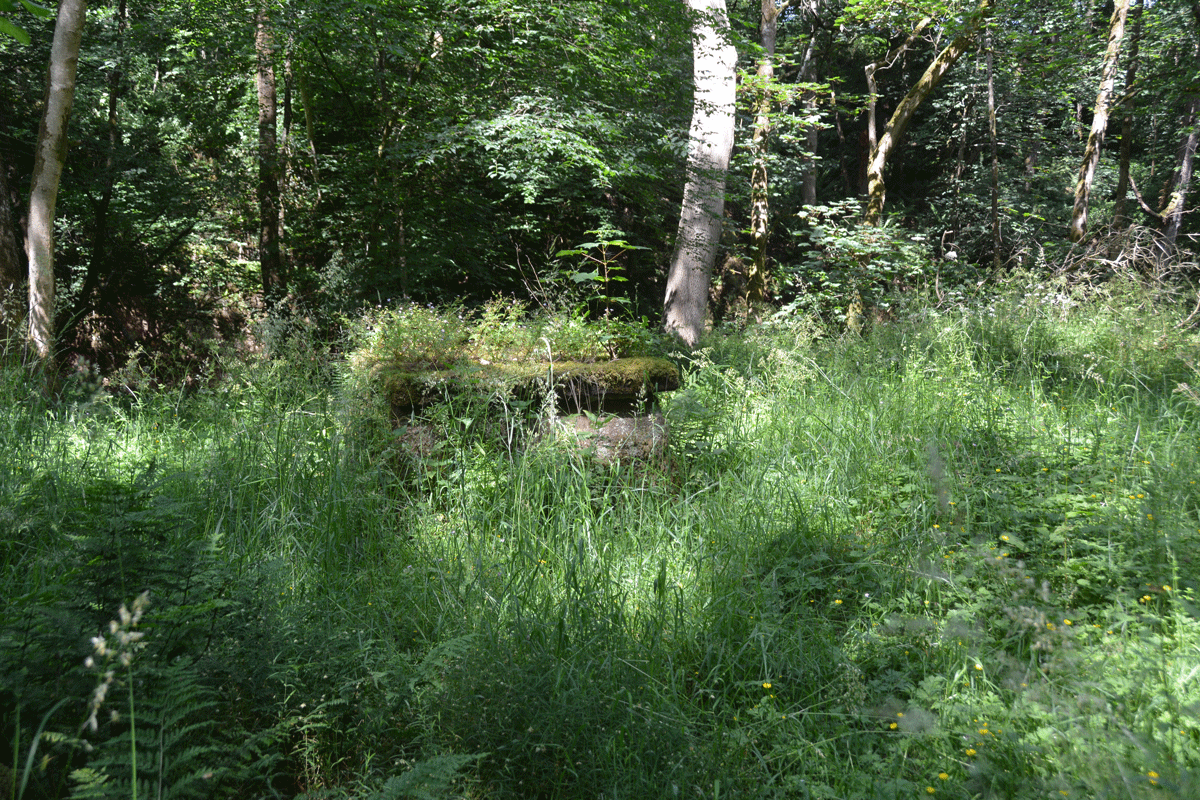
St Michael's Well (Shawk) submitted by Anne T on 10th Jul 2022. Looking back towards the footpath down through the wood (approached from the western side of the woodland).
(View photo, vote or add a comment)
Log Text: St Michael's Well, Shawk: Situated in a very lovely, heavily wooded area, to the east of a stream, Chalk Beck, which has stepping stones over it (these appear to move and be replaced when the stream floods, as there are several sets).
There is no mention on Pastscape or HE, although the HE map search shows a ‘W’ at the location of the well.
To reach the well, we parked on the grass verge at NY 33234 47664, and walked down the (private?) lane leading first south, then largely eastwards, past a number of properties, including the first which is called ‘Farthings’. At NY 33679 47362, the footpath carries on eastwards, through a gate; there is a private road which continues to the south. Our OS map indicated the well was nearer a footpath which started at NY 33653 47097, and which ran largely eastwards, but after 150m or so, it became so overgrown, we turned back.
We proceeded down the marked footpath at NY 33679 47362, where there are now a couple of wooden stables/sheds. There is an old hollow way which runs alongside the western side of the wood here, and we continued along this, through another gate, and followed the path which ran downhill, with a steep gorge to our right hand side. This path winds downhill, eventually coming to some stones laid across the course of Chalk Beck. We gingerly crossed this (wouldn’t like to try when the river is in flood or after it had been raining heavily). The well is immediately to our right hand side, about 20m to the east of the beck, largely hidden by tall grass and bracken.
The well structure is stone, with an opening in the top. The well was about 1/3 full of water, although we didn’t try and sample the water, as someone had thrown in a beer/lager can (a real shame). No visible signs of any ornamentation on the well housing.
The bedding planes on what we thought are red sandstone here were very clear, with a cliff on the western side of the river. Impressive!
St Michael's Churchyard Cross (Knill)
Date Added: 1st Aug 2024
Site Type: Ancient Cross
Country: England (Herefordshire)
Visited: Yes on 16th Jul 2024. My rating: Condition 3 Ambience 4 Access 4
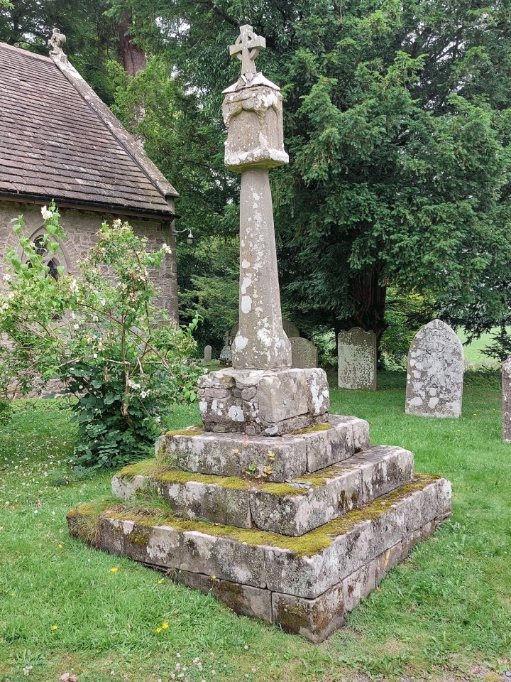
St Michael's Churchyard Cross (Knill) submitted by Anne T on 1st Aug 2024. The cross is about 4m south of the south porch and is very prominent in the churchyard.
(View photo, vote or add a comment)
Log Text: Knill churchyard cross: our first (and only) site visit for some considerable time, due to my current mobility issues. The church was easy to access, and it was lovely to be out in a really rural area on a warm, if overcast day.
Whilst old, the church seemed unremarkable, with no monuments inside of note apart from one very pretty stained glass window and the font, which is thought to date from the 12th century.
A very impressive carved large wooden dragon sits just to the south east of the church.
St Michael's Church (Well)
Trip No.161 Entry No.2 Date Added: 7th Jun 2021
Site Type: Ancient Cross
Country: England (Yorkshire (North))
Visited: Yes on 31st May 2021. My rating: Condition 3 Ambience 4 Access 4
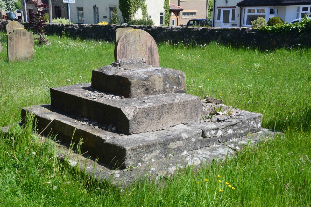
St Michael's Church (Well) submitted by Anne T on 7th Jun 2021. The cross base from the external south wall of the nave, looking eastwards down Church Street.
(View photo, vote or add a comment)
Log Text: Cross Base, St Michael's Church, Well: Our second stop of the day, arriving in glorious sunshine. Parking is available immediately outside the lych gate, and along Church Street. The HE record led me expect a 3m tall cross shaft, but this had been broken off, with no sign of it lying anywhere close to the cross base.
Understandably, the church remains locked to visitors due to pandemic restrictions, but we wandered round the outside of the church, photographing the few medieval grave slabs built into the fabric of the old building, and the sundial (very, very worn) over the south porch door.
The lower part of the tower is clearly early - 12th century in date at the bottom, the western side containing a very old wooden door which looks like it leads up to the belfry. I would be very interested to go back, as the church contains part of a Roman mosaic found locally, along with some interesting tombs and effigies
St Michael's Church (Warden)
Date Added: 5th May 2019
Site Type: Ancient Cross
Country: England (Northumberland)
Visited: Yes on 3rd Sep 2014. My rating: Condition 4 Ambience 4 Access 5
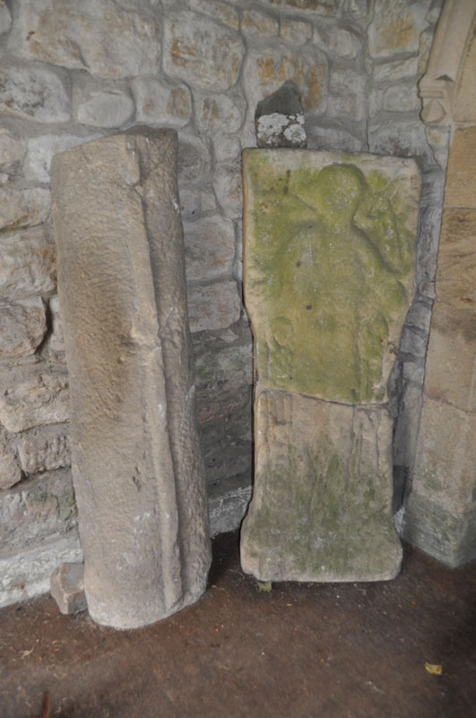
St Michael's Church (Warden) submitted by Anne T on 4th Sep 2014. The Warden Man, carved on a stone split from a Roman altar, situated on the western wall of the porch. Another grave cover stands to it's left hand side in this image.
(View photo, vote or add a comment)
Log Text: St Michael's Church, Warden, Northumberland: On the way back from Robin Hoods' Holy Well at Colwell, I detoured via Warden, a church we’ve visited before whilst visiting the Roman enclosure on the hill above Warden, but not really seen. On this last visit, on approaching St Michael’s, we heard a saxophone being played nearby – the same tune repeated over and over (and very badly (sorry, player!)). As we were going into the church, another couple were coming out. The noise of the saxophone got louder and louder, and a man appeared to serenade us. He proved a bit of a nuisance, so we escaped to the Boat pub for a drink, only to be closely followed by the saxophone and it’s player who then sat next to us.
The current church is 18th century, but built on much older foundations, originally thought to be the site of the oratory of the Anglo-Saxon saint St. John of Beverley.
On today's visit, I met a lady going into the church with some leaflets, and got chatting to her. She told me the same man still lives in the village, and she’d just come from his house. She also told me the Parish had just had the church restored and how proud they were of it now, pointing out the 7th century cross at the south side of the tower, by the porch.
The lady didn’t know anything about the Warden Man, so as we went into the porch, I spotted it and pointed it out. “Perhaps we should scrape the moss of it”, she exclaimed. I gulped loudly. “I think you should leave it as it is – you need to ask a professional before doing that”.
There are some fascinating features within the church – the 11th century arch at the base of the tower includes a roman stone, and the Saxon gravestone which is on the floor in the chancel (northern wall, next to the choir stalls, just before the altar rails).
The Saxon gravestone, in the right light, shows tegulations (a word I hadn’t heard of before I picked up the guide book for the church! – “use light and shade to create a distinctive appearance”) to look like a tiled roof. Outside, there is the 7th century cross (which the Keys To The Past record says is 7th to 11th century), gravestones with iron hoops over them to prevent body-snatchers taking the bodies and a Saxon tower.
In the porch, opposite the Warden Man, is a collection of grave stones. There was a really interesting small roundel, with what looked like knot-work on it. I was unable to find out any more about the date of these.
St Michael's Church (Warden)
Trip No.126 Entry No.3 Date Added: 5th May 2019
Site Type: Ancient Cross
Country: England (Northumberland)
Visited: Yes on 1st May 2019. My rating: Condition 3 Ambience 4 Access 4
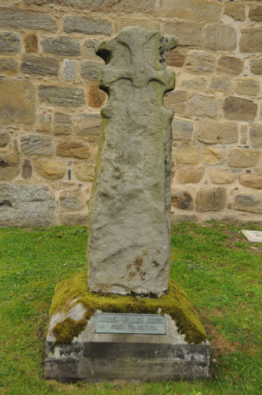
St Michael's Church (Warden) submitted by Anne T on 4th Sep 2014. The 7th century cross at the west side of the porch of St. Michaels, by the Saxon tower.
(View photo, vote or add a comment)
Log Text: St Michael and All Saints, Warden: Anglo Saxon Sculptured Stones, including The Warden Man and Hammerhead Churchyard Cross: I last visited this church on 3rd September 2014, when I was almost new to the Portal, and hadn’t yet come across Pastscape, Historic England or the Corpus of Anglo Saxon Stone Sculpture databases, so taking Andrew back here was a very pleasant surprise, as I learned an awful lot about these stones.
Well worth a repeat visit!
St Michael's Church (Kingsland)
Trip No.166 Entry No.1 Date Added: 22nd Jul 2021
Site Type: Ancient Cross
Country: England (Herefordshire)
Visited: Yes on 11th Jul 2021. My rating: Condition 3 Access 4
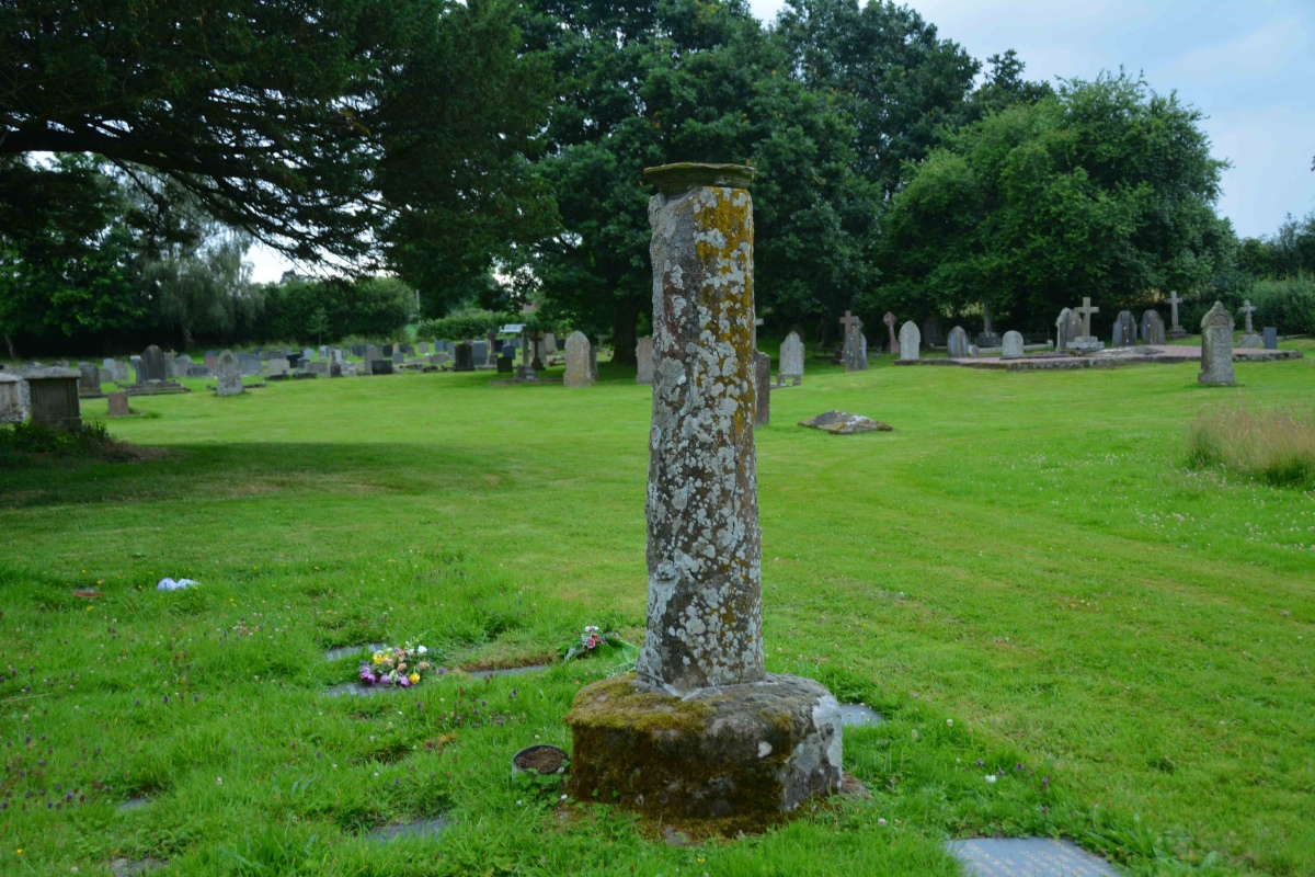
St Michael's Church (Kingsland) submitted by Anne T on 22nd Jul 2021. Standing nearer the church, looking south west, towards the site of Kingsland Castle (motte and bailey).
(View photo, vote or add a comment)
Log Text: St Michael's Churchyard Cross plus Motte and Bailey: This is the church my son and DIL should have been married in over a year ago, but thanks to Covid, then urgent roof replacement works, the wedding was moved to Aymestrey. Lovely church (from what we could see of it behind the scaffolding, almost Minster sized), but the cross took a little bit of spotting, as at first glance it looked just like a sundial (to be viewed from the back of a horse).
A gate from the near the entrance to the churchyard leads off onto a pleasant walk towards the motte and bailey site. As we enjoyed our walk, the rain started to pelt down, so we retreated back to the car. Nice site, and a lot to see.
St Michael's Church (Illston On The Hill)
Trip No.78 Entry No.2 Date Added: 25th Jun 2018
Site Type: Ancient Cross
Country: England (Leicestershire and Rutland)
Visited: Yes on 24th Jun 2018. My rating: Condition 3 Ambience 4 Access 5

St Michael's Church (Illston On The Hill) submitted by Anne T on 25th Jun 2018. Close up of the socket stone and remains of cross shaft, looking towards the south porch from the southern edge of the churchyard, next to Main Street.
(View photo, vote or add a comment)
Log Text: St. Michael's Church, Illston on the Hill: This was our first port of call on the Sunday afternoon, on a brilliantly sunny day with blue skies and very hot. Although we probably could have walked here with the dog from Billesdon, I certainly wasn’t feeling up to a long walk today, and was very grateful that the cross was only just off the road.
A very pretty little church, which seemed larger on the inside than the out. The inside of the church wasn’t particularly interesting, apart from a very unusual set of steps that ran up to the top of the rood, from just behind the pulpit.
The cross was unusual, with the socket stone being set straight into the ground (no base or steps) and the remains of the cross shaft set diagonally into the socket. The shaft also had rolled-moulded edges. Also unusual was that it was set almost directly against three large gravestones which loomed above it.
St Michael and All Angels (Isel)
Trip No.184 Entry No.2 Date Added: 31st Jul 2022
Site Type: Ancient Cross
Country: England (Cumbria)
Visited: Yes on 24th Jul 2022. My rating: Condition 3 Ambience 4 Access 4
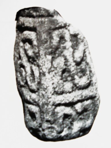
St Michael and All Angels (Isel) submitted by Sunny100 on 30th Apr 2011. The 9th-10th century 'Triskele Stone' in St Michael's church, Iselgate, Cumbria. This three armed Norse carving could well represent The Holy Trinity.
(View photo, vote or add a comment)
Log Text: St Michael and All Angels, Isel/Blindcrake: We had first visited the Grade II listed medieval well in Blindcrake at NY 1486 3482, which has a domed well head very similar to the holy well at Brompton.
This is a very, very pretty location for a church, and the inside did not disappoint. There are two fragments of the same cross shaft displayed immediately opposite as you walk in through the south porch, a couple of fragments built into the walls, and four sun-dials. We went armed with Guy Points's Cumbria Gazetteer, and found all the stones he mentioned.
St Michael and All Angels (Harston)
Trip No.121 Entry No.4 Date Added: 19th Mar 2019
Site Type: Ancient Cross
Country: England (Leicestershire and Rutland)
Visited: Yes on 17th Mar 2019. My rating: Condition 3 Ambience 3 Access 4
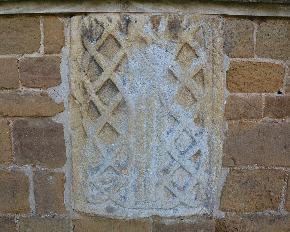
St Michael and All Angels (Harston) submitted by Anne T on 19th Mar 2019. Ancient cross in Leicestershire and Rutland England. This is the fragment of Anglo Saxon stone embedded in the exterior east wall of the church, immediately underneath the east window. Prof. Rosemary Cramp in her paper "New Directions in the study of Anglo Saxon Sculpture" (page 4) describes this as part of a grave cover.
(View photo, vote or add a comment)
Log Text: Anglo Saxon cross fragments, St Michael and All Angels, Harston: Before visiting, I wasn’t able to find out much about the church or the AS stone fragments. I was hoping for a church guide book, but there was nothing. There were newspaper articles and photos of the bell tower and the bells displayed in the bell tower, but nothing was made of the fragments – one in the external east wall, and another in the south porch. Pastscape mentions that the stone in the east wall is possibly part of a cross shaft
The church looks very appealing from the outside, being made of warm, yellow stone. Inside it is very Victorian. The only thing of any age appeared to be the stem of the font.
Nice to have been able to drop by and photograph the fragments.
St Michael (Lowther)
Trip No.68 Entry No.4 Date Added: 7th Apr 2018
Site Type: Ancient Cross
Country: England (Cumbria)
Visited: Yes on 5th Apr 2018. My rating: Condition 3 Ambience 3 Access 5
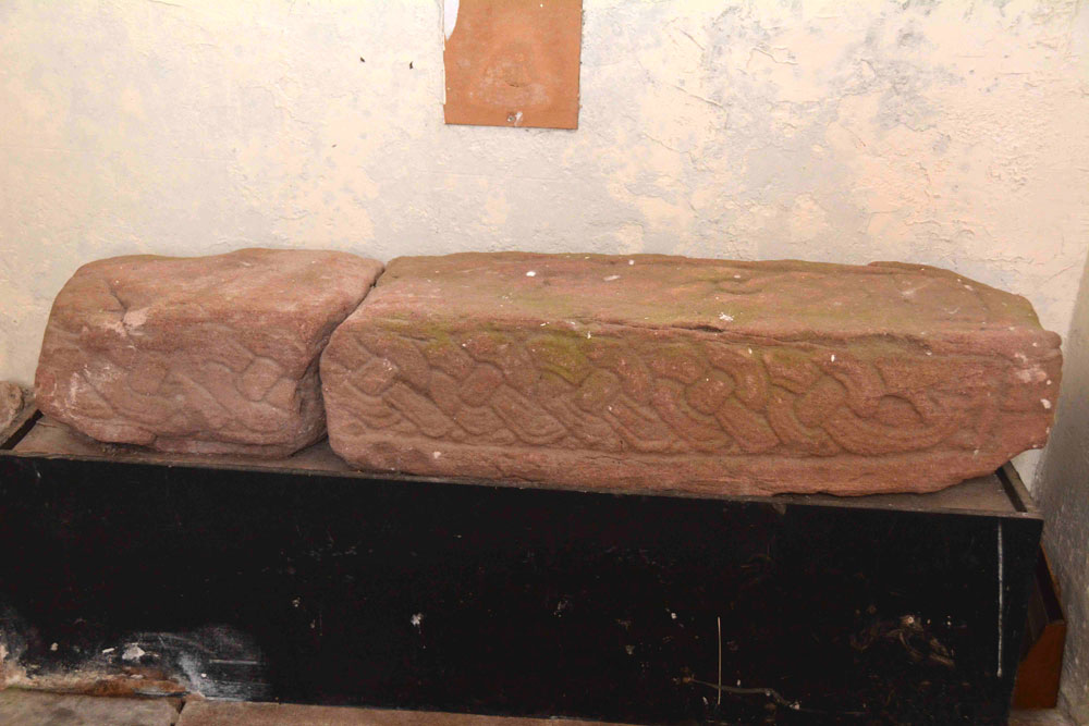
St Michael (Lowther) submitted by Anne T on 7th Apr 2018. This grave cover, now broken into two parts, can be found against the western wall of the porch. It is recorded as AS Corpus Lowther 07a-b and is dated to the 10th century.
(View photo, vote or add a comment)
Log Text: Ancient Cross and hogback fragments, Lowther: We arrived here eager to see the hogback and grave covers detailed on the Corpus of Anglo Saxon Stone Sculpture Volume II, but on arriving at the church, the door appeared to be locked. There were a few broken panels in the south window of the porch, so I resorted to trying to take photos through the window, but there was no light. I called up the Corpus on my phone to see what might be in the churchyard rather than inside the church and came up with Lowther 10, which is built into the retaining wall of the churchyard where it drops down to the River Lowther, 9m from the south west corner of the church. Andrew walked all the way round, whilst I stayed in the churchyard marking the spot, but despite having the Corpus photograph, this stone appeared to be too worn to identify.
In disappointment, I went and rattled at the church door again, a little more boisterously than before and as I let the handle go, heard the latch click and the door came open. We made our way inside the church. There are supposed to be a number of fragments in the porch, but only found 2 that are recorded on the Corpus.
There are three more fragments tucked away against the west wall of the north transept, and I had to go and get my large flash gun to take photographs. Only two of these are recorded on the Corpus.
This is a really strange church. Despite its size, it feels more like a mausoleum rather than a church, and I was glad to get out into the sunshine to find the cross in the churchyard.
St Michael & All Angels (Barningham)
Trip No.117 Entry No.1 Date Added: 12th Feb 2019
Site Type: Ancient Cross
Country: England (County Durham)
Visited: Yes on 6th Feb 2019. My rating: Condition 3 Ambience 4 Access 4
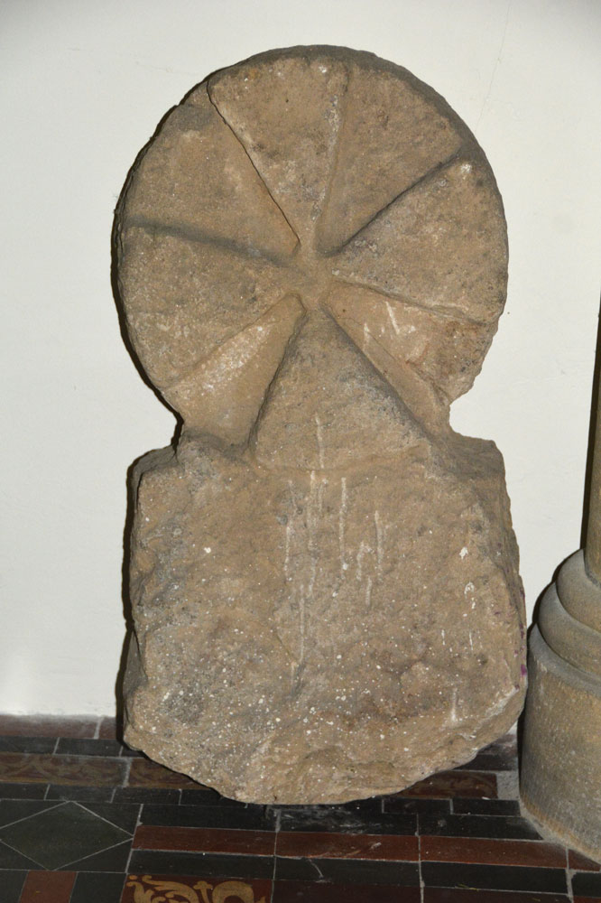
St Michael submitted by Anne T on 10th Feb 2019. Close up of the reverse (face C) of AS Corpus Barningham 02, which shows traces of a relief circle.
(View photo, vote or add a comment)
Log Text: Cross Base and Cross Head/Grave Marker (Barningham): Having arranged a day out with rich32 to seek out and photograph some of the Barningham Moor rock art panels, I'd also seen the cross base on Historic England, so we arrived in Barningham half an hour before the meeting time to look around the churchyard. As well as the cross base in the south eastern corner of the churchyard, there was also a round headed grave marker in the church; to my surprise, the church was open, and we were able to get in and photograph this, too.
The church looks surprisingly modern (and it is largely Victorian) but the churchyard is much, much older, and also includes a 1503 grave slab (too covered in moss to identify) which is sited within the remains of the medieval foundations of the original church. There are also some really interesting grave stones, which I photographed.
Within a couple of minutes walk there is also the modern stone (gate post) circle and the village Pant (drinking fountain), complete with its culvert and voussoir arch. A lovely start to the day!
St Maurice's Well (Ellingham)
Trip No.75 Entry No.5 Date Added: 22nd May 2018
Site Type: Holy Well or Sacred Spring
Country: England (Northumberland)
Visited: Yes on 20th May 2018. My rating: Condition -1 Ambience 4 Access 4
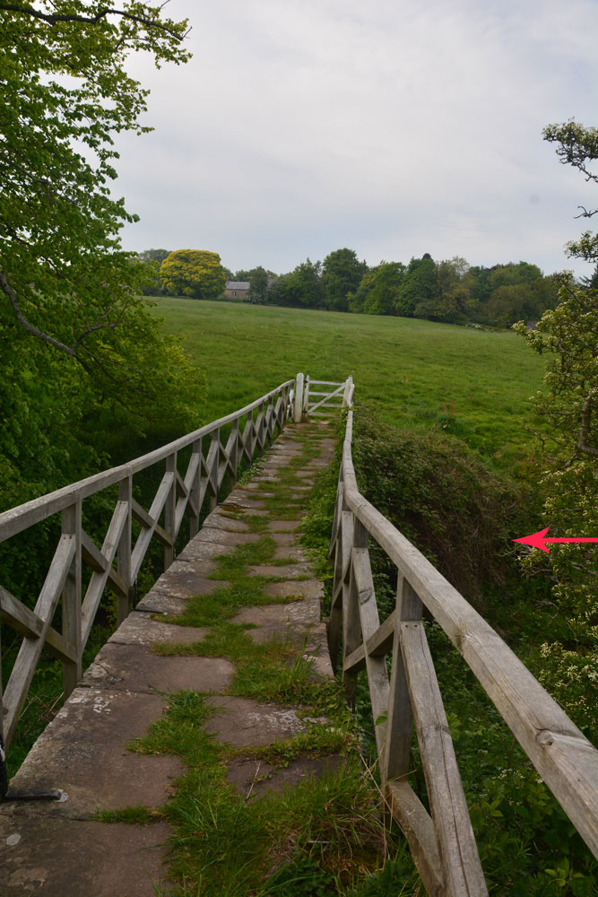
St Maurice's Well (Ellingham) submitted by Anne T on 22nd May 2018. We think this was the site of St. Maurice's Well, just to the south western side of this charming stone-flagged footbridge across the Long Nanny.
(View photo, vote or add a comment)
Log Text: St. Maurice's Well, Ellingham (destroyed): This church was in a glorious spot amongst old houses. The church looked relatively modern, and as it was still open, we popped our heads in. There was some really great stained glass windows. They also had a book sale, so we bought a couple of books on cathedral architecture for a £2 donation.
Inside, we spotted the head of an old font, dating (according to the church guide) to the Norman or Early English Church (but looked 16th/17th century in style to me). On either side of the path from the lych gate to the church were the old pinnacles from the previous church, dating to 1805.
Finding the right footpath from the church proved interesting, as it had a number of footpaths running from/around it, but we eventually orientated ourselves. Back to the Long Nanny stream.
From the description, we found the footbridge and the gorge/bank, but couldn’t really find any structures. I asked a lady (about 40ish) walking her dog if she knew where the well was. She replied “They used to come from the school to get the water. There used to be steps, but they’re gone, and no-one knows where the well was. It’s lost.”
We tried to find the location, which needed to be in a slight ravine (hence the reference to steps), and any old stonework. We thought we might have spotted something. But, then again, perhaps not! It was worth it to see the wonderful stone-flagged footbridge.
St Matthew's Well (Roslin)
Trip No.85 Entry No.4 Date Added: 27th Jul 2018
Site Type: Holy Well or Sacred Spring
Country: Scotland (Midlothian)
Visited: Yes on 15th Jul 2018. My rating: Condition 3 Ambience 3 Access 4
St Matthew's Well (Roslin) submitted by KiwiBetsy on 6th Oct 2006. The water flows into a white (or it probably once was) concrete dome which is brick lined and is very hard to spot in the undergrowth.
(View photo, vote or add a comment)
Log Text: St. Matthew's Well, Roslin: Getting to this well was interesting! Parking in Roslyn Chapel car park at NT 27405 63109, we took the gate from the south east of the car park through the cemetery, then out of the cemetery down a very overgrown lane, with very tall nettles on either side. About 50m from the grid reference for the well, we needed to head off south west into the wood. There were some tracks through here, but obviously not regularly used. We could see a green, mossy mounds/structure through the trees, but couldn’t find a way of getting down to them. In the end, I realised the track had been covered by a heavy, large dead tree branch, which Andrew and I managed to haul away from the path with a little difficulty. Having cleared the track, we used the tree roots as stepping stones at first, then slide the 20m or so down the slope to the well (I told myself it was always easier going up!).
At first we thought there was only one dome here, but looking harder, there was a second one, a few metres up the slope. The front face of the second dome (nearest the river Esk) had a hole in the front, which I poked the camera through to take a photograph. The was a large iron pipe which gushed water into the well chamber. A continuation of this pipe could be seen in a small gully which headed towards the river from the well chambers, although the gloom and all the detitus made it difficult to capture the location.
Heading back to look at the ruins of St. Michael’s church, we looked over the western end of the graveyard, looking south west, and realised we could not only see the well houses, but it also looked as if there were the remains of a wall and steps, as there were cut blocks of stone lying around.
I went back to photograph the 'Spooky Angel' I'd seen when I visited with my friend two years ago (hidden under a bush by the small outbuildings) - she much reminded me of an episode of Dr. Who, where the angels only moved when you didn't look at them.
St Mary's Well, Durham City
Trip No.20 Entry No.4 Date Added: 1st May 2017
Site Type: Holy Well or Sacred Spring
Country: England (County Durham)
Visited: Yes on 30th Apr 2017. My rating: Condition 3 Ambience 3 Access 4
St Mary's Well, Durham City submitted by durhamnature on 21st Oct 2012. The well and stone wellhead.
Site in County Durham England
(View photo, vote or add a comment)
Log Text: St. Mary's Well, Durham: From St. Cuthbert’s Well we walked past the Old Fulling Mill and the Boat House, across Prebend’s Bridge, were we heard shrieks from the river below. Peering over the bridge, we saw the lady rowers trying to avoid going into the bank!
St. Mary’s Well is easy to find. Immediately to the western end of Prebend’s Bridge there is a footpath running off to your right. St. Mary’s Well is about 20 yards to the north up the footpath, on the western side.
Couldn’t find any entry on this in Pastscape, although again Laurence Hunt's Ancient, Healing and Holy Wells gave us some information, along with SolarMegalith's entry on the Portal.
St Mary's Well (Wreay)
Trip No.90 Entry No.1 Date Added: 31st Jul 2018
Site Type: Holy Well or Sacred Spring
Country: England (Cumbria)
Visited: Yes on 30th Jul 2018. My rating: Condition 3 Ambience 4 Access 4
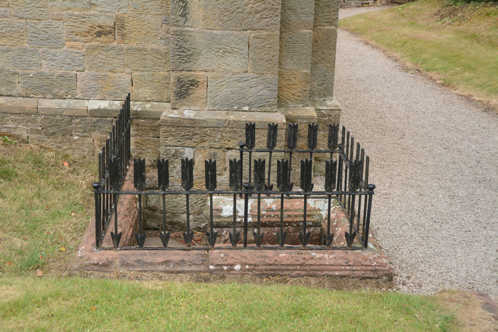
St Mary's Well (Wreay) submitted by Anne T on 31st Jul 2018. Approaching the well, with its curious railings made up of arrows, which represent 'death' according to the leaflets in the church.
(View photo, vote or add a comment)
Log Text: St Mary's Well and copy of the Bewcastle Cross, Wreay: This is a delightful little village, with some very old houses. The church is very easy to find, right in the middle of the village, opposite the colourful school, with plenty of parking on the streets nearby.
This well is to the southern side of the exterior western wall, although it has been dry for some considerable time. The well spout, in the form of an animal head, is quite superb and unusual (like the gargoyles on the roof line of the church).
The Holy Wells of Cumbria booklet (page 14) describes this well as:
Location: Approx. 9 miles south of Carlisle. The well is found by the front wall of St. Mary’s Church, Wreay.
Description: Although it is unknown whether this was a holy well, the highly unusual and attractive church is well worth a visit in itself. The original church dates back to 1319, and was rebuilt by Sarah Losh in 1840-42 – see also well 4 at Brisco – in memory of her sister Catherine and her parents. Italian in style, it is full of highly original and deeply symbolic carvings in wood and stone, many representing in forms from nature the eternal contrast between light and dark, or life and death. The well outside is a curious construction surrounded by cast iron arrows. Dog-leg stone steps lead down into the well, where water flows from a lion’s (or dog’s head) into a aquare stone piscina blessed with a solitary green fern and scattering of copper coins. The well (in 2008) was recently restored and is in excellent condition."
There was no water, no fern and no coins when we visited. Whilst the church, the sundial and the font in the churchyard are all scheduled, there is no mention of the well or the copy of the Bewcastle Cross. The church is indeed well worth looking inside. Andrew opened the door and said "I'm leaving you to go in first - it's scary!"
St Mary's Well (Upsettlington)
Trip No.95 Entry No.3 Date Added: 9th Sep 2018
Site Type: Holy Well or Sacred Spring
Country: Scotland (Scottish Borders)
Visited: Yes on 6th Sep 2018. My rating: Condition 3 Ambience 3 Access 4
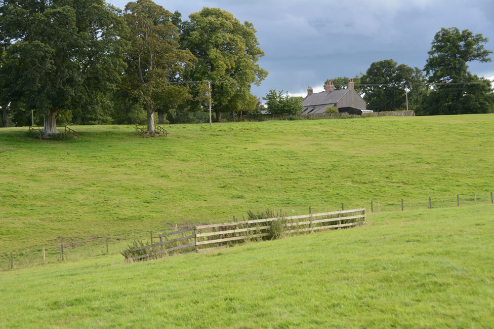
St Mary's Well (Upsettlington) submitted by Anne T on 9th Sep 2018. St Mary's Well from just uphill to its north east, heading for the gate into the next field, where Nun's Well can be found.
(View photo, vote or add a comment)
Log Text: St Mary's Well, Upsettlington: From Monk’s Well, and in the same field, we walked east-north-east towards this fenced off area of the field. To our left hand side, raised some 0.5m+ above ground level, and seemingly in a perfect circle, was a funny wooded area; closer inspection revealed it was being used as a large, tree-covered feeding station for pheasants/grouse? There was no record on Canmore of this being a cairn or the site of a hillfort.
St Mary’s Well, with its inscription barely legible on the top, reminded me very much of the well houses in Durham City. The structure was very overgrown, although underneath the name of the well, there was still the remains of a metal pipe leading into the well trough below (the latter was hidden by vicious nettles).
The latest visit report recorded by Canmore in 1971 says the well is now dry, but the inscription is still intact.
From here, we walked northwards, uphill, to a gate into the next field which contained Nun’s Well.
St Mary's Well (Rothsay)
Trip No.51 Entry No.1 Date Added: 8th Oct 2017
Site Type: Holy Well or Sacred Spring
Country: Scotland (Isle of Bute)
Visited: Yes on 25th Sep 2017. My rating: Condition 2 Ambience 3 Access 5
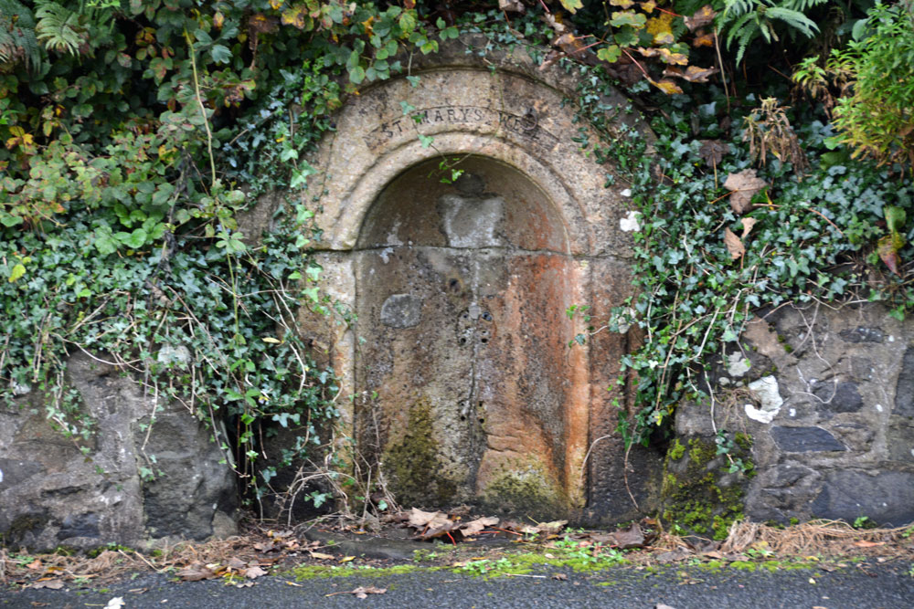
St Mary's Well (Rothsay) submitted by Anne T on 8th Oct 2017. St Mary's Well, showing it's sadly disused, dry state.
(View photo, vote or add a comment)
Log Text: St. Mary's Well, Rothsay: Almost immediately across the road from St Mary's Chapel, set into a dry stone wall and very sadly neglected. There is no outlet but the remains of a metal tethering ring for a cup or ladle is still embedded in the arch. Worth a walk across from the chapel to take a look.
St Mary's Well (New Etal)
Trip No.137 Entry No.2 Date Added: 12th Jun 2019
Site Type: Holy Well or Sacred Spring
Country: England (Northumberland)
Visited: Yes on 29th May 2019. My rating: Condition 1 Ambience 3 Access 4
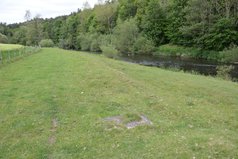
St Mary's Well (New Etal) submitted by Anne T on 12th Jun 2019. All that can be seen now of St Mary's Well is the rectangular slab inset into the grass. This is a natural spring, attributed to St Mary, the water being now piped into the River Till to its eastern side. View as approaching the well head from the western side of the ford across the River Till.
(View photo, vote or add a comment)
Log Text: St Mary's Well, New Etal: The ford across the river from Etal village was pretty high, so we decided not to chance wading across it, but drove round to New Etal and used the farm tracks to walk back down to the western side of the ford to find the remains of this chantry chapel and well.
No signs of the chantry chapel - the foundations are now mostly under the river. All that remains of the well is a rectangular concrete slab with a modern small drain cover at its western side and an access hole to the side nearest the river.
It is a peaceful spot and worth the walk, even though there wasn't a lot to see.
St Mary's Well (Kirkwhelpington)
Trip No.118 Entry No.2 Date Added: 15th Feb 2019
Site Type: Holy Well or Sacred Spring
Country: England (Northumberland)
Visited: Yes on 14th Feb 2019. My rating: Condition 2 Ambience 4 Access 4
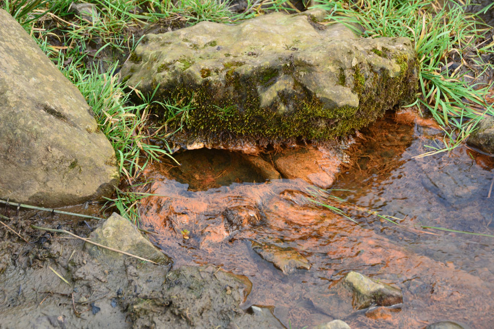
St Mary's Well (Kirkwhelpington) submitted by Anne T on 15th Feb 2019. Whilst there is no sign of the well at the grid reference given, this spring bubbles up at the side of the small stream almost directly south. I wondered if the water from the well had been culverted down to here.
(View photo, vote or add a comment)
Log Text: St Mary's Well, Kirkwhelpington: We had previously stopped off at St Bartholomew's Church in the village, and photographed the sundial and some medieval grave slabs. Parking at the eastern end of the the village, almost opposite the entrance to Eastlands, we crossed the small bridge over the ford and headed up over the fields. Having passed the last houses to our left hand side, we let ourselves through the gate into the field and turned right (east). This was the start of a short circular walk which took in 2 holy wells, the ruins of a moated medieval manorial complex and a tumulus.
No signs of the well in the field, which should have been located about 50m due west of the only tall tree in this part of the field, but walking down by the small stream, I spotted a spring issuing out of the bank, with larger stones above it, and what appeared to be a small iron basin over which the water flowed. Has the water from the well been culverted down to here?
There was no end of rig and furrow around here. This land used to belong to Newminster Abbey, which used to own land up to the Scottish Borders. The ruins of the Abbey can be found in Morpeth town centre.
St Mary's Well (Heversham)
Trip No.179 Entry No.4 Date Added: 22nd Jun 2022
Site Type: Holy Well or Sacred Spring
Country: England (Cumbria)
Visited: Yes on 21st Jun 2022. My rating: Condition 3 Ambience 3 Access 4
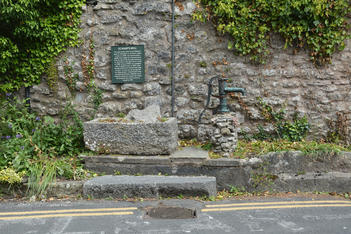
St Mary's Well (Heversham) submitted by Anne T on 22nd Jun 2022. Standing across the road from the well, looking at the pump and well trough (both now appear to be dry).
(View photo, vote or add a comment)
Log Text: St Mary's Well, Heversham: Spotted the blue 'W' on the HE map search when looking up information for St Peter's Church, so decided to have a look. Actually found the well purely by chance, when we drove past looking for a parking spot, then doubled back and parked near the lych gate, walking back to the well after we'd photographed the Anglo-Saxon stone fragments.
Having escaped the noise of building work (and radios) at home, we arrived to find the builders in the house opposite the well blasting out very loud rap music. Not a great visit as a result, as we couldn't hear ourselves think, but good to have added another well to the list I've seen.
