Contributory members are able to log private notes and comments about each site
Sites Anne T has logged. View this log as a table or view the most recent logs from everyone
Hadrian's Wall (Turret 44b)
Trip No.143 Entry No.3 Date Added: 11th Jul 2019
Site Type: Misc. Earthwork
Country: England (Northumberland)
Visited: Yes on 8th Jul 2019. My rating: Condition 2 Ambience 4 Access 4
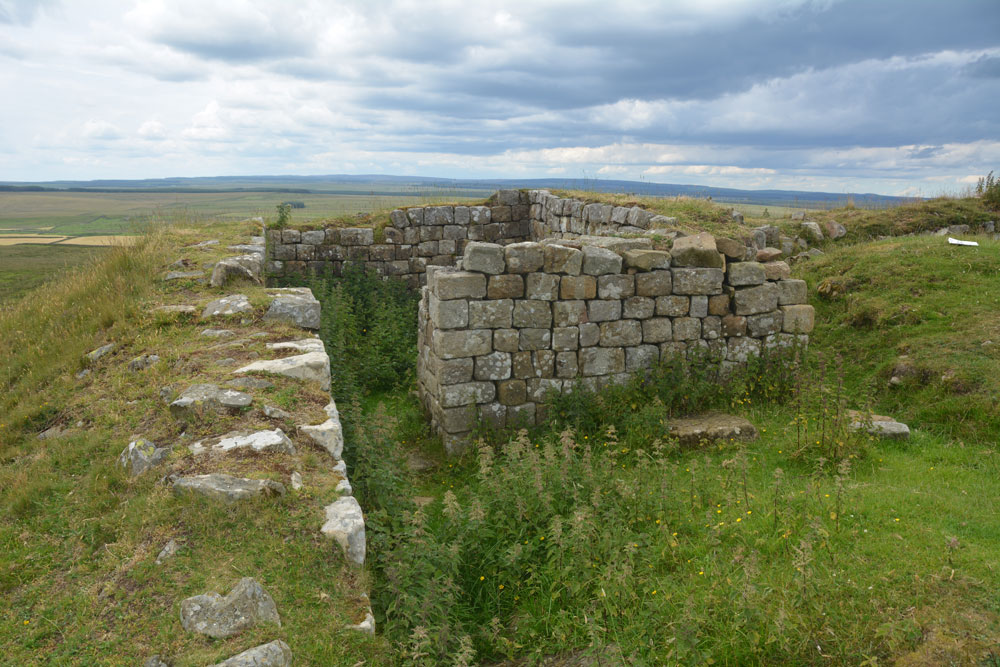
Hadrian's Wall (Turret 44b) submitted by Anne T on 11th Jul 2019. Standing almost at the western edge of the turret, with the crags dropping down sharply, just off shot to the left, looking north across the turret. Photo by Andrew T
(View photo, vote or add a comment)
Log Text: Turret 44b, Hadrian's Wall: Located on the crag above King Arthur's Well, this is a lovely spot. We had difficulty in locating the holy well, so whilst I continue to search for the it and see if I could find any structure or water course, Andrew ascended the steps to the top of the crag, and came back about 20 minutes later.
This turret is on the Hadrian’s Wall path, which runs almost due east-west here. It is in a very pretty spot. Even with it being a Monday afternoon, and a very warm day, there were lots of walkers here. Many passed me on the paved section of path but none appeared to stop and look at the turret, as no-one seemed to linger at this point. Perhaps they had already seen too many turrets around here - there are certainly a lot of them!
Whittenknowles Rocks
Trip No.134 Entry No.2 Date Added: 11th Jul 2019
Site Type: Ancient Village or Settlement
Country: England (Devon)
Visited: Yes on 15th May 2019. My rating: Condition 2 Ambience 4 Access 3
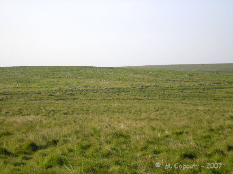
Whittenknowles Rocks submitted by thecaptain on 15th Jun 2008. To the west of the Drizzlecombe sites, on a southern facing hillside, can be found the remains of the very large Whittenknowles Rocks ancient settlement.
(View photo, vote or add a comment)
Log Text: Whittenknowles Rocks Enclosed Settlement: We parked in the small car park at SX 57880 67316 next to a small stream and a ford. Walking across the road bridge, we dived off across a small stream and walked next to a small wood, entering the moorland and continuing in a southerly direction, following an old dry stone wall, then turning eastwards. Most of the walking was really easy, even though this was rough moorland.
We started to come across wall lines and groups of stones, and as I started to ‘get my eye in’, the hut circles and compounds became much clearer (see Butler’s plan, “Dartmoor Atlas of Antiquities”, volume 3, page 126). The hut circles and enclosures were inter-dispersed with uncleared lines of rocks, which Sandy said were natural, and the occupants had just left them as they were.
Towards the southern side of the site, towards the long houses, we came across a small leat, where Sandy explained there had been ‘in the past, a natural disaster’ and all the soil had come down the slope, presumably leaving no soil for growing crops.
I couldn’t believe how far this site extends – some 4.7 hectares (11.61 acres).
I took photographs, blithely thinking the external GPS device on my camera was capturing the locations of the photographs. It wasn't until a couple of days later that I realised there was no lat/long information on the photographs, so I've had to guess, from Butler's plan, more or less where the photos were taken.
Hadrian's Wall (Poltross Burn)
Trip No.143 Entry No.1 Date Added: 11th Jul 2019
Site Type: Stone Fort or Dun
Country: England (Cumbria)
Visited: Yes on 8th Jul 2019. My rating: Condition 3 Ambience 4 Access 4
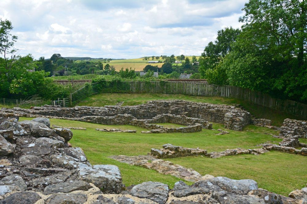
Hadrian's Wall (Poltross Burn) submitted by Anne T on 11th Jul 2019. Standing at the south western corner of the milecastle/small fort, looking towards its north eastern corner.
(View photo, vote or add a comment)
Log Text: Poltross Burn Milecastle: We last visited this site on 27th October 2013, and it hasn’t’ changed at all. Andrew, in typical engineering fashion, went round and talked about the offsets and revetted construction of this small fort. It’s layout is remarkably easy to read.
Andrew recalled reading about a house built right on top of the wall, but we were unable to find it.
Leeden Tor
Trip No.133 Entry No.13 Date Added: 9th Jul 2019
Site Type: Stone Row / Alignment
Country: England (Devon)
Visited: Yes on 14th May 2019. My rating: Condition 2 Ambience 3 Access 5
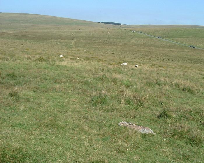
Leeden Tor submitted by Brian Byng on 7th Feb 2002. Leeden Tor - Cairn at upper end SX 5653 7147.
A scrappy row 107 m long but with only 4 stones still upright. Cairn 6m dia
with large central pit. Runs NW - SE with cairn at uphill N W end. The cairn
Has a reeve cutting across it and the row has another reeve cutting across.
Reeve - local word for a prehitoric field boundary maade from roughly
assembled granite blocks now sometimes only traces exist as here. Reeve
building on Dartmoor circa 1400 BC. Seems likely that the rows pred...
(View photo, vote or add a comment)
Log Text: Leeden Tor Stone Row: It was now the afternoon of 14th May. Having driven from Merrivale to the small car park nearest this site at SX 56725 71397, we had 10-15 minutes to spare before everyone arrived. In the meantime, Sandy led us up the hill to look at this stone row. By this time the wind was howling around us, with strong gusts that threatened to blow me over - thank goodness for my walking poles! I took a little satisfaction in watching the small group of soldiers out on exercise also being pummelled by the wind.
When the stones in the row and the cairn at its head were pointed out to me, I could see the alignment and also its relationship to the reave.
Whilst this stone row is near the car park, the tussocky grass made walking a little tricky.
Chesters Roman Site b
Trip No.142 Entry No.2 Date Added: 7th Jul 2019
Site Type: Rock Art
Country: England (Northumberland)
Visited: Yes on 4th Jul 2019. My rating: Condition 3 Ambience 4 Access 4
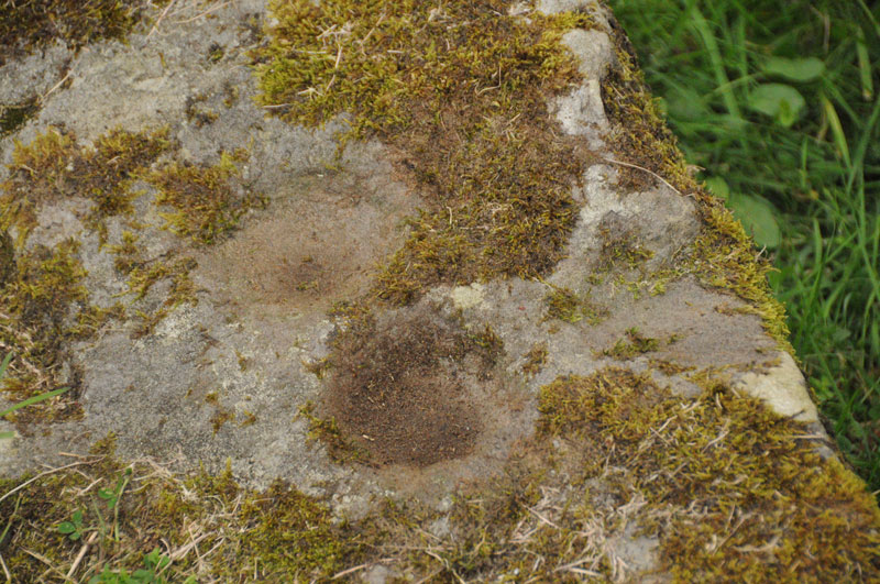
Chesters Roman Site b submitted by Anne T on 1st Sep 2014. Photograph showing two cup marks (0.09m) on stone, with third just on right hand edge.
(View photo, vote or add a comment)
Log Text: Chesters Roman Site b, Chesters Roman Bridge Abutment: Whilst we were here to photograph the bridge abutment, we took the opportunity to look for this panel again to see if it had changed. It was very much the same.
Hadrian's Wall (Chesters Bridge Abutment)
Trip No.142 Entry No.2 Date Added: 7th Jul 2019
Site Type: Misc. Earthwork
Country: England (Northumberland)
Visited: Yes on 4th Jul 2019. My rating: Condition 3 Ambience 4 Access 4
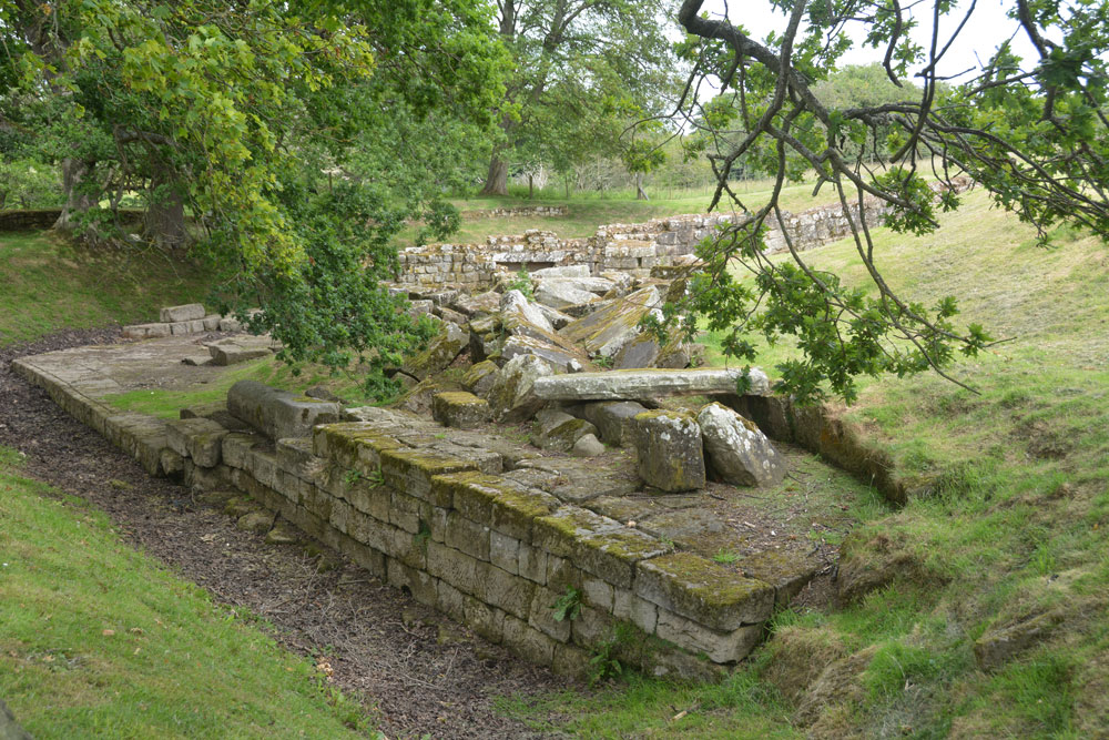
Hadrian's Wall (Chesters Bridge Abutment) submitted by Anne T on 7th Jul 2019. A look at the western side of the bridge abutment, giving an idea of its substantial structure and size. Behind me is a huge store of blocks which have fallen from the structure over the years and have been placed neatly waiting for restoration at some point?
(View photo, vote or add a comment)
Log Text: Chesters Bridge Abutment: It's been some time since we came here to photograph the rock art panel, which is still here (although heavily lichen covered). This is where “The River Hunters” did a search in their series not long ago, just opposite the bath house at Chesters on the opposite bank. This was visible from the bridge abutment.
We met the American party again and another gentleman who said he had been walking round the poppy field trying to get some good photos. I set him a challenge - looking for the phallus symbol and the rock art. He got quite excited about the symbol and told me that he walked the wall looking for these symbols. He'd recently been trying to find one near Gilsland but without success.
One of the sources used by Historic England is my book bought for £1 from Hexham car boot sale: Bruce, J C, Handbook to the Roman wall, (1863), 117-120 and Bruce, J C, Handbook to the Roman wall, (1863), 109-111
Merrivale circle
Trip No.133 Entry No.7 Date Added: 7th Jul 2019
Site Type: Stone Circle
Country: England (Devon)
Visited: Yes on 14th May 2019. My rating: Condition 3 Ambience 3 Access 4

Merrivale circle submitted by AngieLake on 9th Feb 2008. Merrivale Circle and menhir looking south towards King's Tor, at about 6.15pm on 10.10.07
(View photo, vote or add a comment)
Log Text: Merrivale Stone Circle: Will you forgive me for saying I wasn't hugely impressed by this stone circle. For some reason I was expecting the stones to be larger and for it to sit more dramatically in the landscape.
On walking to the circle from the western end of Row 2, we came across an impressively large, black coloured boulder buried in the grass, which does not appear to be marked by Butler. I estimated its grid reference to be SX 55304 74704, or just south of this.
The group walked round the circle and the menhir, looking at the pits in the ground, wondering if these could possibly be the remains of holes for other stones. Dave Parks said he had read somewhere that there was thought to have been a double stone circle here, but no proof had yet been found. He later came back to tell me that Butler has marked the pits on his diagrams of Merrivale, see pages 29-31 inclusive of Volume 3 of "Dartmoor Atlas of Antiquities".
I do like Butler's description of the circle: "Their arrangement is markedly eccentric, perhaps deliberately so, with the majority of stones up to a metre off a true circle 19m across and with very variable intervals between" and his notes that the numbers of stones seem to vary across the ages: "several detailed nineteenth century accounts of the site show that the number of stones has actually increased, a most unusual phenomenon, from 9 in the early part of the century, 9 in 1828 (Smith), 10 (1827, Rowe, 1829 Kempe), and 9 (1859 Wilkinson), before reaching the present total of 11 in Worth’s 1895 plan. It seems at least 2 stones have been added, probably by some of the early investigators who were not always particular in recording their restorations, which in any case were often somewhat arbitrary".
Merrivale Centre S
Trip No.133 Entry No.6 Date Added: 7th Jul 2019
Site Type: Cairn
Country: England (Devon)
Visited: Yes on 14th May 2019. My rating: Condition 2 Ambience 3 Access 4
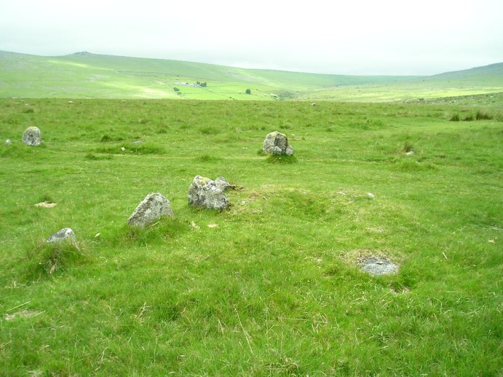
Merrivale Centre S submitted by thecaptain on 1st Nov 2004. Looking northish at the end of row 3 and the remains of its cairn.
The stones in the background are some of those in the southern (or central) avenue.
(View photo, vote or add a comment)
Log Text: Merrivale Centre S Cairn (cairn at the head of Merrivale 3/C stone row): Thank heavens for Sandy G's Stone Rows of Great Britain and Dave P's Prehistoric Dartmoor Walks websites to help sort out the photos for Merrivale 3and its cairn. This area certainly has a glut of stone rows and cairns, and the GPS device on my camera had failed. Whilst I carefully wrote down the numbers of the photographs and the sites they related to, and constantly asked Sandy G on the day which site I was looking at, there's nothing like being able to make a direct comparison almost two months later. Thanks, guys!
As the cairn has a separate site page, but I've recorded them both together, as per the Pastscape record (440357), I've given these two the same visit number.
Merrivale SW row 3
Trip No.133 Entry No.6 Date Added: 7th Jul 2019
Site Type: Stone Row / Alignment
Country: England (Devon)
Visited: Yes on 14th May 2019. My rating: Condition 2 Ambience 3 Access 4
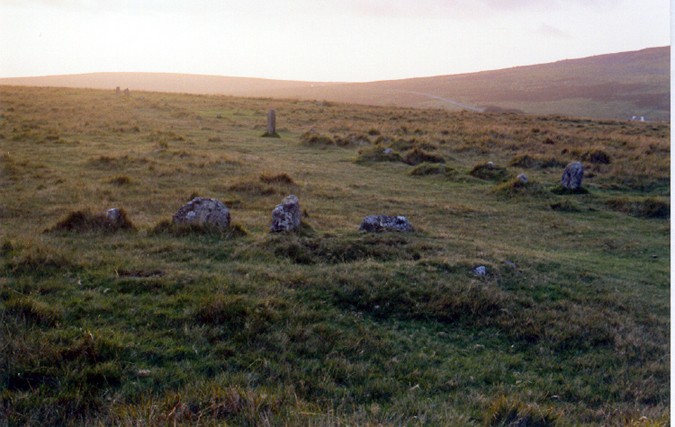
Merrivale SW row 3 submitted by AngieLake on 29th Oct 2004. In the foreground, Merrivale Single Row 3 (see thecaptain's overview plan) at sunset on 21st September, the day before the Autumn Equinox, 2004. In the distance, in the glare of the setting sun, can be seen the two west end stones of the southern row. Two other taller stones on the south side of that southern row are also visible above centre, and to right of pic. ('Thecaptain' has a theory that these, and other taller stones in the rows, align with the menhir at certain times of the year.) T...
(View photo, vote or add a comment)
Log Text: Merrivale Row 3/C: Without Sandy G being there to tell us, I would have struggled to identify this as a stone row in its own right, but with Sandy pointing out where it joining up at an angle with Merrivale 2/B and with the cairn at its head, it became more obvious. The cairn is recorded as a separate site page here, so I'm adding the same visit report number, as I've recorded them both together, as the Pastscape record (440357).
Hadrian's Wall (Brunton Turret)
Trip No.142 Entry No.1 Date Added: 7th Jul 2019
Site Type: Misc. Earthwork
Country: England (Northumberland)
Visited: Yes on 4th Jul 2019. My rating: Condition 3 Ambience 4 Access 4
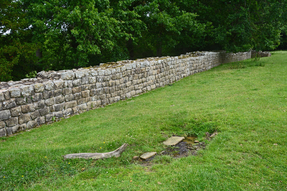
Hadrian's Wall (Brunton Turret) submitted by Anne T on 7th Jul 2019. Walking east along with wall, from near its south western corner. The small structure in the right/foreground is the spring, which was flowing freely at the time of our visit. There were the remains of some stone slabs around where it emerged from the ground.
(View photo, vote or add a comment)
Log Text: Brunton Turret 26b, Hadrian's Wall: Parked at the layby by the stile. We met a party of four Americans who were walking the wall and who had started at Newcastle on Monday, and from Corbridge this morning. I wished them a ‘happy 4th July’ and one of the ladies replied “Good job we’re friends again”, which raised a smile.
There was also a spring at NY 92109 69847 with the remains of a structure around it, flowing quite quickly and forming a small stream running downhill and round the bottom end of the turret.
The information sign at the top end of the site reads: ”Turrets were positioned equidistantly between largely milecastles where small garrisons of soldiers guarded gates that allowed for trave lthrough the Wall. Shortly after work on the wall started, large forts, such as Chesters, were also constructed to house garrisons of between 500 and 1,000 soldiers.
(Image) Right: layout of Brunton turret. The ‘curtain’ wall is a different thickness on each side of the turret. The turret was laid out with short ‘wing’ walls either side. These were supposed to be incorporated within the curtain wall once it was finished. But between completing the section of the Wall to the west and that to the east, the builders were ordered to narrow the curtain wall. This left about 1m of eastern wind-wall exposed”.
Merrivale Cists
Trip No.133 Entry No.5 Date Added: 6th Jul 2019
Site Type: Burial Chamber or Dolmen
Country: England (Devon)
Visited: Yes on 14th May 2019. My rating: Condition 3 Ambience 4 Access 4
Merrivale Cists submitted by ernar on 13th Oct 2004. Burial Cist with a fragmented capstone. The main Merrivale Stone row can be seen behind it.
(View photo, vote or add a comment)
Log Text: Merrivale Cist: I've seen quite a few cists, largely in Northumberland, and none this large. Impressive. I tried to persuade Janet to get into the cist to model it, but she politely declined (it would have made a nice refuge for the wind).
At this point, Angie got her dowsing rods out and was meandering around the cist and the stones. Very interesting to watch.
Smith's Shield Milestone
Trip No.142 Entry No.3 Date Added: 6th Jul 2019
Site Type: Marker Stone
Country: England (Northumberland)
Visited: Yes on 4th Jul 2019. My rating: Condition 2 Ambience 3 Access 4
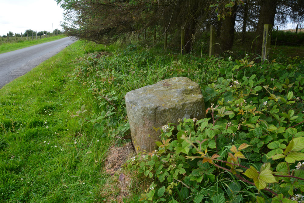
Smith's Shield Milestone submitted by Anne T on 6th Jul 2019. The base of the Smith's Shield Roman milestone, showing its location next to the minor road running east to Vindolanda. It is just over 100m east of the road junction which is just below Smith's Shield farmhouse.
(View photo, vote or add a comment)
Log Text: Smith's Shield Roman Milestone (base of): The base of this Roman milestone, located at the northern side of the road which runs east towards Vindolanda, is easy to spot.
A note of warning to future visitors - we had a run in with the AD122 local bus service who told us off for parking in what he thought was a passing place, but wasn't; there was plenty of room for him to pass, and he parked alongside us before he started yelling. I think he just wanted to shout at someone, but it certainly ruined my day.
There is a second, intact milestone at the eastern entrance to Vindolanda, which we have yet to go back and see.
Merrivale Centre Row
Trip No.133 Entry No.4 Date Added: 5th Jul 2019
Site Type: Multiple Stone Rows / Avenue
Country: England (Devon)
Visited: Yes on 14th May 2019. My rating: Condition 3 Ambience 4 Access 4
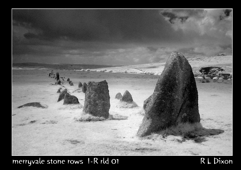
Merrivale Centre Row submitted by rldixon on 30th Jun 2008. centre ro taken in infra red may 2008
(View photo, vote or add a comment)
Log Text: Merrivale 2/Merrivale Centre Row: As we progressed further south over the moorland, and not far from Merrivale 1 (the northern-most row) at that, the stone rows kept getting better and better.
The row features a triangular blocking stone at the eastern end and twin blocking stones at the western end. It runs for 262.5m from SX 5530 7475 to SX 5556 7478 - see Pastscape 44056. The stones seem to vary in size quite a lot, and generally larger than those of the northern row/row 1/row A.
Merrivale Centre N
Trip No.133 Entry No.3 Date Added: 4th Jul 2019
Site Type: Cairn
Country: England (Devon)
Visited: Yes on 14th May 2019. My rating: Condition 3 Ambience 4 Access 4
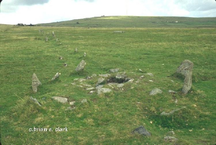
Merrivale Centre N submitted by bec-zog on 19th Nov 2003. Cyst (3) @ the Merrivale complex
(View photo, vote or add a comment)
Log Text: Merrivale Centre Cairn with Cist: Half way down Merrivale North (Row A or Row 1), we hopped across to row 2 to take a look at the cairn in the middle of the row. Fascinating. Worried about the complexity of recording all these sites in my photo/walk journal, Angie Lake told me about the Butler "Atlas of Antiquities" series of 5 books, which has hugely increased my understanding of these sites. Thanks, Angie!
Merrivale North Row
Trip No.133 Entry No.2 Date Added: 3rd Jul 2019
Site Type: Multiple Stone Rows / Avenue
Country: England (Devon)
Visited: Yes on 14th May 2019. My rating: Condition 3 Ambience 4 Access 4
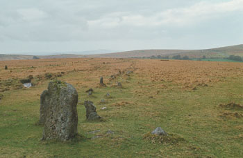
Merrivale North Row submitted by stewart on 12th Oct 2003. Grid Ref SX 555 747
There are two, main, rows at Merrivale - North and South.
The north row consists of two lines of stones, aligned east -west and nearly 200m long.
However, the two lines of stones are only about 1m apart so you can only just walk between them. It has larger stones at the west end and a blocking stone at the east.
The southern row doesn't start or finish on the same alignment, is not parallel to the northern one and was, probably, not built at the same time.
...
(View photo, vote or add a comment)
Log Text: Merrivale North Row (Merrivale 1): Between the prehistoric settlement and the first of our stone rows for the day, Sandy G had stopped to point out some of the stones of the Great Western Reave.
Continuing on, these stones could be seen from down slope at the Prehistoric Settlement, and proved a tantalising glimpse of what was in store for the rest of the morning. Sandy was amazing at explaining all the different features along the row, including part of which had recently been restored.
But my goodness, the wind was blowing, and blowing hard. At some points, it was a little tricky to stand upright – thank heavens for my walking poles!
Peter Hill Roundhouse (Whithorn)
Trip No.136 Entry No.13 Date Added: 1st Jul 2019
Site Type: Ancient Village or Settlement
Country: Scotland (Dumfries and Galloway)
Visited: Yes on 18th Jun 2019. My rating: Condition 4 Ambience 4 Access 4

Peter Hill Roundhouse (Whithorn) submitted by Anne T on 1st Jul 2019. Submitted with the kind permission of The Whithorn Trust. The Peter Hill Roundhouse, located in a garden opposite the Museum buiding at Whithorn. Seen from the entrance to the garden.
(View photo, vote or add a comment)
Log Text: Peter Hill Roundhouse: Part of the visitor experience at the Whithorn Museum. We arrived just after a small guided tour had started. We asked if we could go round after the tour had finished, but were told we could only get in while there was an official guide there. I cheekily asked if we could join the tour for 10 minutes, and to my surprise, were allowed to go in.
I was really surprised and impressed by the inside of the roundhouse - the compartments for privacy, the central fire pits, and the sheer amount of room within it. Shame we didn't have time for the full tour, but I was so keen to see the early Christian stones in the museum.
Joicey Shaft Cairn
Trip No.141 Entry No.3 Date Added: 1st Jul 2019
Site Type: Round Barrow(s)
Country: England (Northumberland)
Visited: Yes on 30th Jun 2019. My rating: Condition 2 Ambience 3 Access 4
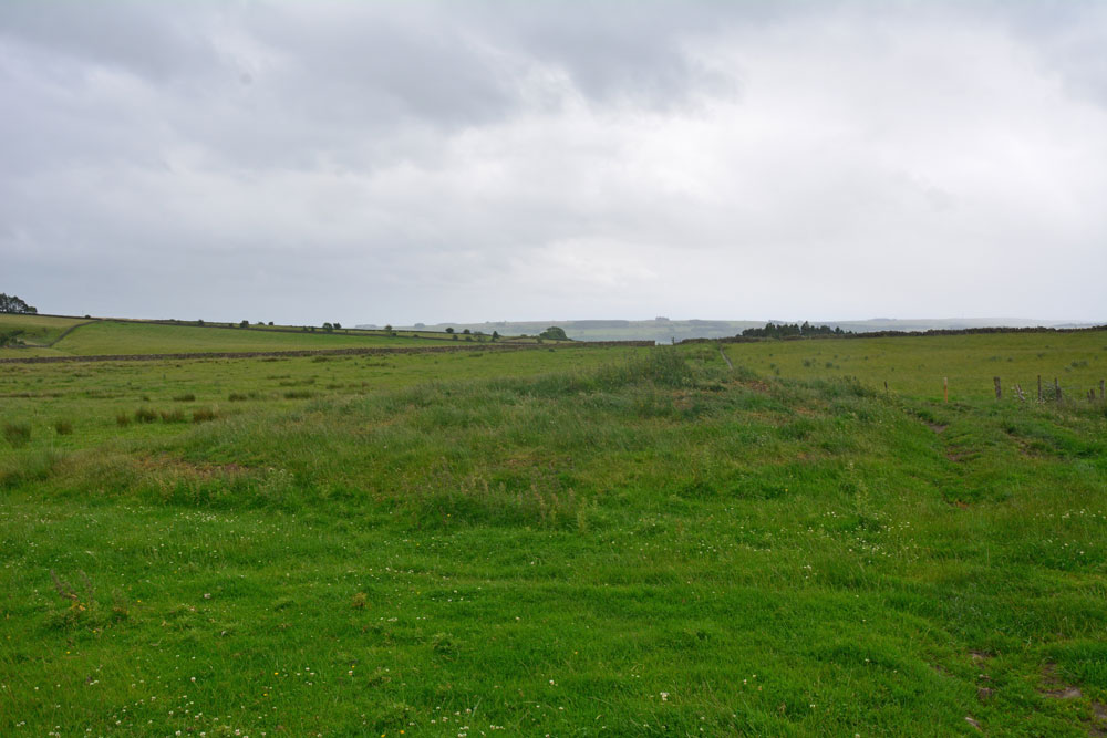
Joicey Shaft Cairn submitted by Anne T on 1st Jul 2019. The cairn as seen from the gate into the field at NY 82860 66456, showing how the farmer has driven his tractor over the western side of the mound, but the track 'bends' away from it, respecting most of the mound.
(View photo, vote or add a comment)
Log Text: Joicey Shaft Cairn: I spotted this mound almost by accident as I was photographing Joicey Shaft B from the track. At first I dismissed it as a manure heap, or possible tailings from the leading mining which used to take place here, but the more I walked round it, the more convinced I was it was a cairn, especially with its proximity to the rock art panels on the opposite side of the track, and because the modern field boundary and the track leading N-S to its western side 'bent' round to accommodate most of the barrow.
It is not recorded by HE or Pastscape, but it is on the old OS maps, so has been here for a while.
Joicey Shaft b
Trip No.141 Entry No.2 Date Added: 1st Jul 2019
Site Type: Rock Art
Country: England (Northumberland)
Visited: Yes on 30th Jun 2019. My rating: Condition 3 Ambience 3 Access 4
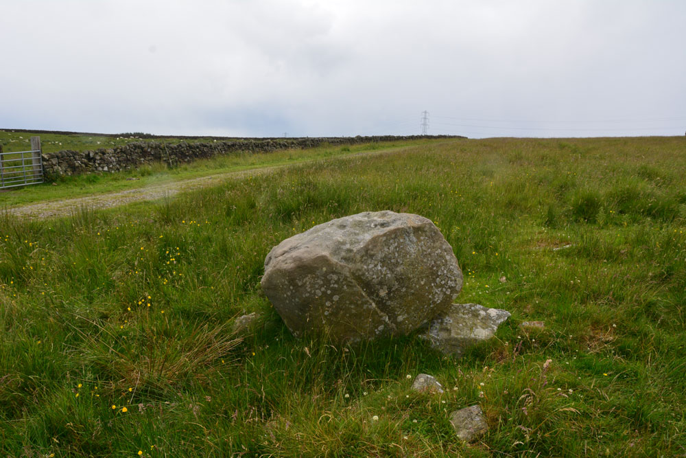
Joicey Shaft b submitted by Anne T on 1st Jul 2019. Photograph showing the Panel B boulder in relation to the track running to its south. The boulder sits on top of other stones, apparently the remains of an old field boundary/dry stone wall.
(View photo, vote or add a comment)
Log Text: Joicey Shaft B: This boulder is only 40m or so to the WSW of panel A, and is the only other large boulder in the field near this location. It is propped on top of other stones, part of the demolished field wall that ERA/NADRAP talk about.
ERA/NADRAP talk about two possible cup marks, which I found by comparing the shape of the stone with the NADRAP drawings. We also thought we saw two more, but these may be just solution holes or natural erosion.
Joicey Shaft a
Trip No.141 Entry No.1 Date Added: 1st Jul 2019
Site Type: Rock Art
Country: England (Northumberland)
Visited: Yes on 30th Jun 2019. My rating: Condition 3 Ambience 3 Access 4
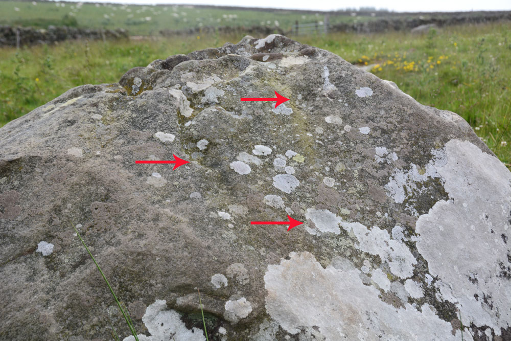
Joicey Shaft a submitted by Anne T on 1st Jul 2019. ERA/NADRAP says there are two cups here, the one to the east "fed by a natural gully from above". We thought we found three cups, marked with the red arrows, but there were so many erosion features, it was difficult to be certain.
(View photo, vote or add a comment)
Log Text: Joicey Shaft A: With the most of the rest of the UK enjoying warm sunshine, up in this part of Northumberland, the storm clouds had gathered. Having checked the weather forecast to make sure rain wasn't due to arrive until this evening, we set off to find these rock art panels, within easy reach of a road. This road was marked on the old OS map as a bridle path, but on the modern OS map it is now a metalled, yellow road, indicating it can be driven down.
OK, the road isn't the best, being potholed in parts, but the stone can be found just through a gate across the road at NY 82906 66462. Both boulders are on the northern side of the road, about 40m apart.
Being here was really wierd, as holes had been drilled in the northern-most gatepost, and as the wind howled through them, it played a tune, the 'melody' varying between different notes dependant upon the width of the hole.
I managed to photograph panel A before the rain started to come down, then we had to sit in the car for 10 minutes or so before there was a break in the clouds.
In walking back from panel B, I spotted through the gate on the south side of the road, a lump which looked like a cairn. I almost dismissed it as a farmer's manure dump, but realised the tractor track respected its western side (albeit cutting it a little). Andrew has just pointed out it is shown on the 1860 OS map.
Tony's Patch 1
Trip No.141 Entry No.4 Date Added: 1st Jul 2019
Site Type: Rock Art
Country: England (Northumberland)
Visited: Yes on 30th Jun 2019. My rating: Condition 3 Ambience 3 Access 4

Tony's Patch 1 submitted by Anne T on 1st Jul 2019. The irregular 'cups' seen from further down slope, using flash to give a bit more contrast/depth. At the time of our visit, on the warmest weekend of the year (so far) the heavens opened and we got drenched. The light was so bad it was like dusk.
(View photo, vote or add a comment)
Log Text: Tony's Patch Rock Art: The information for this nature reserve said there was room to park one car by the stile into the field at NY 81961 65368, and indeed there was, but only just. As we readied ourselves to walk towards the wood, the first spots of rain started, but we decided it would only be a short shower, so thought we'd walk down anyway, and if the rain got heavy, we'd be sheltered in the wood. Ha!
From the stile we headed ENE across this field of, for the most part, knee high grass, heading towards the gate into the nature reserve. Then followed the path through the wood, finding a small turn off to our right to this stone at about NY 82262 65565. By this time, the rain was hammering down, and we had started to get soaked.
I don't think anyone had been here for some time, as the branches from the trees had grown right over the rock and I kept getting caught up in them.
We eventually found the cup marks at the bottom, right hand side of the rock, where the rock starts to become 'undercut'. We needed to push some of the bracken aside to see them.
I really don't understand how NADRAP could have classified these are having ben made by water running over the rock surface? Where are the water channels that would have worn? Or if these were solution holes, the rock must have been in a different position for these to form.
Having photographed these as best I could in the very low light levels, we headed back to the car. By this time, the grass in the field was wet, but we waded through. I don't think my walking sandals will ever be quite the same!
