Contributory members are able to log private notes and comments about each site
Sites Anne T has logged. View this log as a table or view the most recent logs from everyone
Haughhead Kip (Eckford)
Trip No.47 Entry No.2 Date Added: 3rd Oct 2017
Site Type: Sculptured Stone
Country: Scotland (Scottish Borders)
Visited: Yes on 20th Sep 2017. My rating: Condition 3 Ambience 4 Access 4
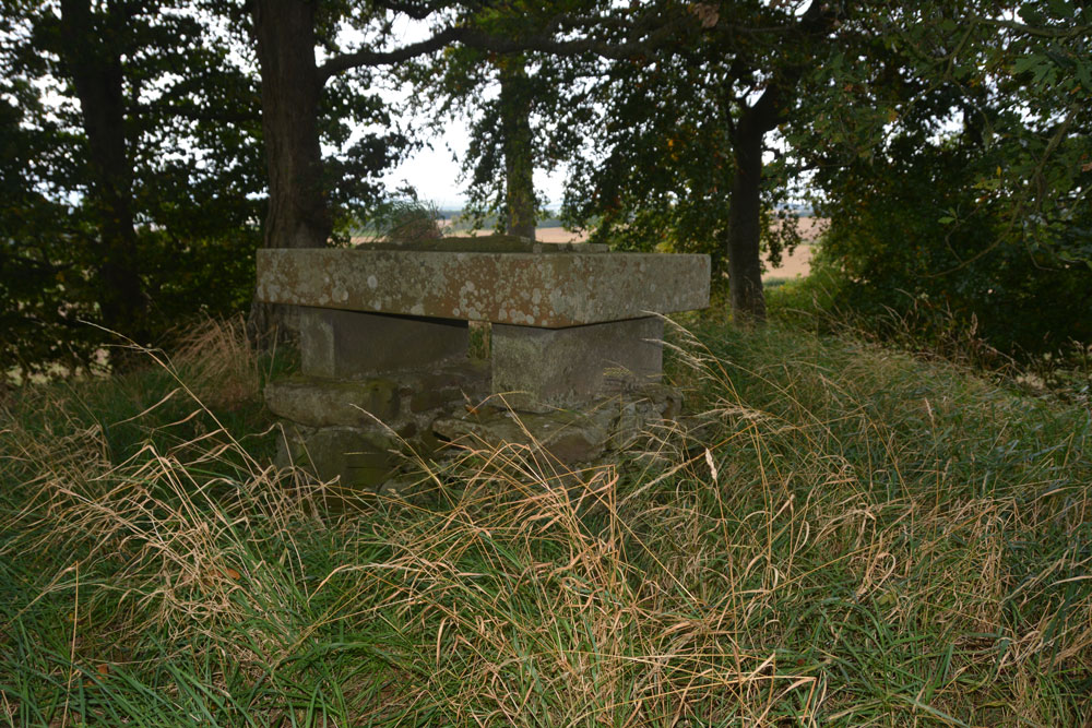
Haughhead Kip (Eckford) submitted by Anne T on 3rd Oct 2017. First view of the 'altar' with the inscribed stone on top, sited on top of the mound/tumulus.
(View photo, vote or add a comment)
Log Text: Haughhead Kip Tumulus & Inscribed Stone, Scottish Borders: This is one of the strangest sites I’ve been to recently, although in a lovely location. Sited just to the east of the A698, north of the B6401 and south of Kale Water, to the north west of the little village of Eckford, we parked on a corner of this narrow road at NT 72558 26695, where there was just enough room to pull the car right off the road. The B6401 was a busy little road, and we avoided cars walking west back to the field with the tumulus.
There is a gate into the field at NT 72289 26736, and it wasn’t until we were 20-30 metres into the field that we realised it had been planted with really tiny cabbage or turnip plants, drilled into wide rows. Being so close to the tumulus, we carefully picked our way across the rest of the field until we got to the gate to the tumulus at about NT 72184 26830. From there, it was a little climb up to what I can only describe as either an altar or a tumbledown box grave.
Certainly worth stopping to see. Canmore debates whether or not the mound was erected to contain the altar. Due to it’s location close to Kale Water, I think it was a tumulus used to locate the inscribed stone on top of it, to give it greater importance.
Ancrum Old Church
Trip No.47 Entry No.3 Date Added: 3rd Oct 2017
Site Type: Sculptured Stone
Country: Scotland (Scottish Borders)
Visited: Yes on 20th Sep 2017. My rating: Condition 3 Ambience 5 Access 4
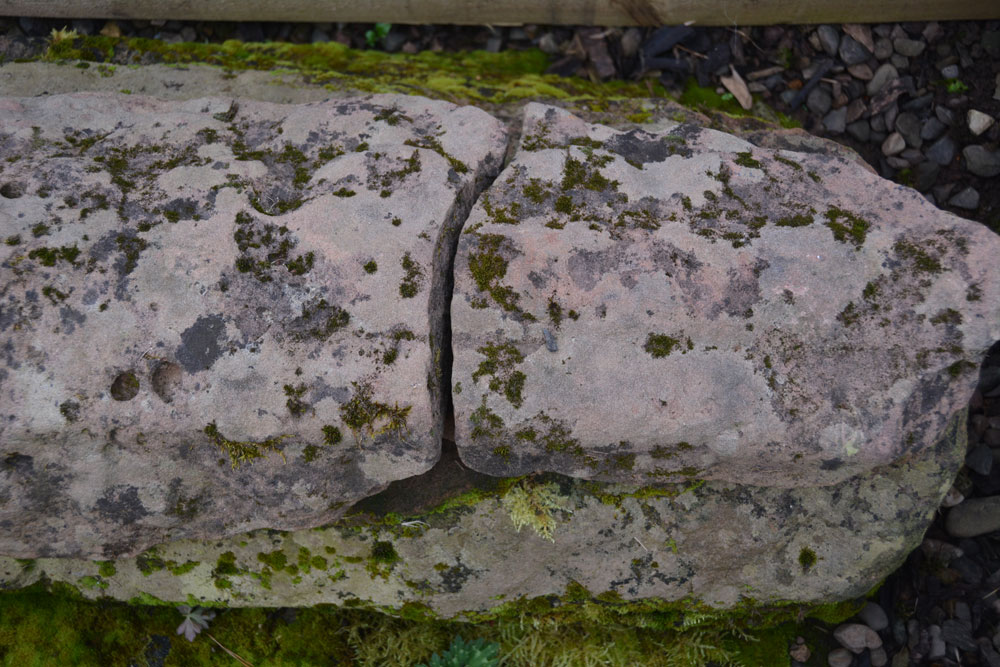
Ancrum Old Church submitted by Anne T on 3rd Oct 2017. A close up of the end of the hogback, trying to see if the camera would pick up any of the relief carving still left on the stone - sadly, no.
(View photo, vote or add a comment)
Log Text: Ancrum Old Church, Scottish Borders: This is a very beautiful location, just to the west of Ale Water and north of the B6400, west of the village of Ancrum. There is parking for 3-4 cars at the south western end of the church yard. A gate and steps lead down into the church yard; the ruined church stands at the northern end of the graveyard.
We walked all around the church, at first unsure of where to look. In the end, by holding my mobile above my head, I managed to get the Canmore record up, so we knew exactly where to look.
Ancrum 1 and 2 are within the village, within private grounds. We did spot the two inscribed slabs, a hogback and a cross base. There was a young man flying a drone all around the church and churchyard, and his dog kept following us. I tried to engage him in conversation, but only got that he was making a film for ‘his own purposes’.
We wandered over the old pack horse bridge to the eastern side of Ale Water, but this was a building site. We could see the western end of Castle Hill hillfort. By this time, it was getting late and the climb looked steep, so we bottled out of the climb, stopping off to look at Ancrum Market Cross on the way to Armadale.
Castle Hill (Ancrum)
Trip No.47 Entry No.4 Date Added: 4th Oct 2017
Site Type: Hillfort
Country: Scotland (Scottish Borders)
Visited: Saw from a distance on 20th Sep 2017. My rating: Condition 2 Ambience 4 Access 4
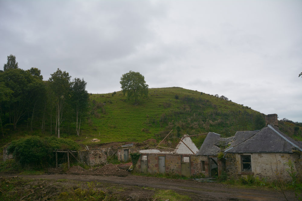
Castle Hill (Ancrum) submitted by Anne T on 4th Oct 2017. Walking through the gate at the eastern side of the ruins, and walking over the old pack horse bridge, the western side of the hillfort can be seen. We were unable to get any further along this path as it was closed due to building works. There is another route to the eastern side of the fort from Ancrum village.
(View photo, vote or add a comment)
Log Text: Castle Hill Hillfort, Ancrum, Scottish Borders: It was getting late in the evening, with dusk coming on, so sadly there wasn’t time to drive back into Ancrum and back round the other side to clamber up to this enticing hill fort, which is visible from Ancrum Old Church and can also be clearly seen on UK Grid Reference Finder. We did try walking across the pack horse bridge across Ale Water, letting ourselves out of the wrought iron gates at the eastern side, but the cottage and adjacent barns we’d have needed to walk through were a building site and were cordoned off.
Decided to leave this for another day, and drove back past the market cross to photograph that before heading off to Armadale.
Balliemore (Craigendive)
Trip No.48 Entry No.1 Date Added: 4th Oct 2017
Site Type: Standing Stones
Country: Scotland (Cowal)
Visited: Yes on 21st Sep 2017. My rating: Condition 3 Ambience 4 Access 4
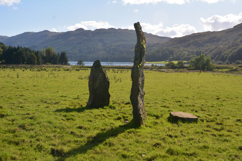
Balliemore (Craigendive) submitted by Anne T on 4th Oct 2017. Standing to the north of these two stones, looking south to the head of Loch Striven. A glorious location.
(View photo, vote or add a comment)
Log Text: Ballimore Standing Stones, West of Dunoon: To escape the rain in Armadale, we decided to take the ferry from Gourock to Dunoon. We stopped off in Dunoon for a cup of tea and a sandwich at The Tudor Coffee Shop above Thornton’s on the main high street, then we set off into the countryside, taking the B836 to Craigendive, past Loch Tarsan.
I spotted these on the map and as they were not very far off the beaten track, decided to stop off and find them. These two stones were in one of the loveliest places, just off the B836 (essentially a single-track road with passing places), to the north of Loch Striven. Surrounded by hills on three sides, on a lush, level grassy plain, with Loch Striven to the south, these standing stones lie immediately south of Balliemore Farm. We parked at NS 05511 84269, next to a pile of road gravel and stones, and walked up the track towards the farm.
There is one tall, narrow stone, and a shorter, triangular one, with a third slab lying at the base of the taller one. Packing stones can be seen in the grass.
The field was very, very wet, and we had to jump over the pools of water at the edge, particularly around the telegraph poles. A pair of wellies would have come in extremely handy!
Glendaruel Churchyard
Trip No.48 Entry No.2 Date Added: 4th Oct 2017
Site Type: Sculptured Stone
Country: Scotland (Cowal)
Visited: Yes on 21st Sep 2017. My rating: Condition 3 Ambience 4 Access 4
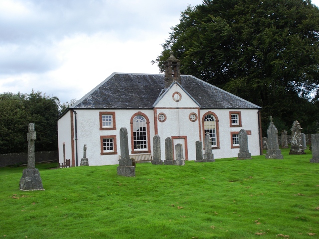
Glendaruel Churchyard submitted by Ghriogair on 21st Jul 2009. Glendaruel Church
(View photo, vote or add a comment)
Log Text: Kilmodan Stones, Glenaruel: Also known as Clacahn of Glendaruel and the Kilmodan Stones
Our second visit of the day, and another lovely spot by the River Ruel. We parked by the now deserted (almost derelict) hotel in Kilmodan village, and walked down towards the church, which is Georgian and very Church of Scotland inside.
The Lapidarium is situated to the south west of the churchyard, nearer to the river. The church guide leaflet says that the Lapidarium was formerly the mausoleum of the Campbells of Auchenbreck, roofed in as a Lapidarium. In 1970, the stones were moved from the graveyard into this building.
“The stones are 14th and 15th century and are of the Loch Awe school of carvers. The stone is schistose and the quality of the stone suggests if would have come from local quarries. In comparison to the other West Highland schools the workmanship is clumsy. In addition, the Loch Awe slabs were never inscribed. So we do not know the names of the patrons commemorated. There are 11 stones in the Lapidarium with number 6 being renowned as the finest example of the Loch Awe School. Stone 11 is the grave slab of Donald McCloy who was minister in Kilmodan from 1609 to 1636.
The bright light streaming into the Lapidarium made at this time of the afternoon made it difficult to photograph the stones properly, despite Andrew trying to block the light out, and me kneeling on the floor to avoid the direct sunlight.
There is a cup and ring marked rock mentioned on the map near to the hotel, although we were unable to find it.
Ardachearanbeg Standing Stone
Trip No.48 Entry No.3 Date Added: 5th Oct 2017
Site Type: Standing Stone (Menhir)
Country: Scotland (Cowal)
Visited: Yes on 21st Sep 2017. My rating: Condition -1 Ambience 4 Access 4
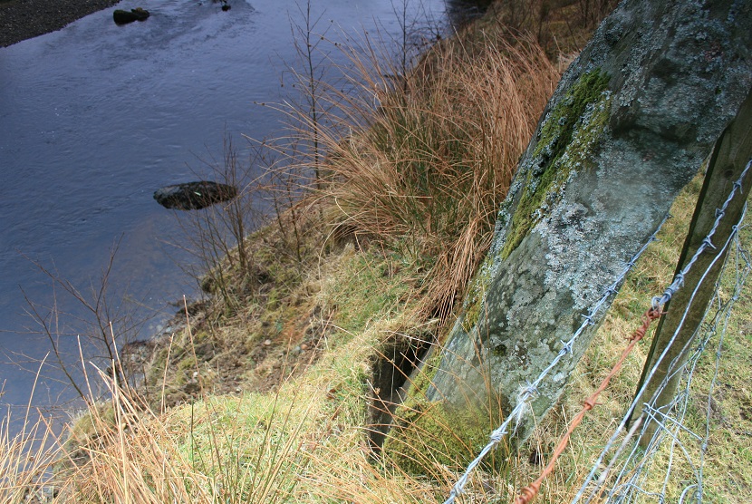
Ardachearanbeg Standing Stone submitted by postman on 7th May 2013. This was three years ago, I wouldn't take the bet its still there.
(View photo, vote or add a comment)
Log Text: Ardachearanbeg Standing Stone, Argyll: Hunted all along the fence line, peering into the river and along the banks for around 100 metres each side of the grid reference and couldn’t find this stone. There was no phone signal, so wasn’t able to call up the Canmore record to double check. Later found out (see below) it has fallen into the river, although we had a pretty good check, looking through the trees and in the river itself, for about 100 metres each way from the grid reference. The river was higher than normal due to all the rain in this part of the world.
Access into the field was from a gate along a small lane just west of the A886 leading to two farms/holiday cottages. There is a small layby at NS 00298 86038 at the junction to these lanes. The field slopes down to the River Ruel. Wellies are advised, as the field was pretty boggy at the time of our visit.
Meckan's Grave (Loch Riddon)
Trip No.48 Entry No.4 Date Added: 5th Oct 2017
Site Type: Cist
Country: Scotland (Cowal)
Visited: Yes on 5th Oct 2017. My rating: Condition 2 Ambience 4 Access 5
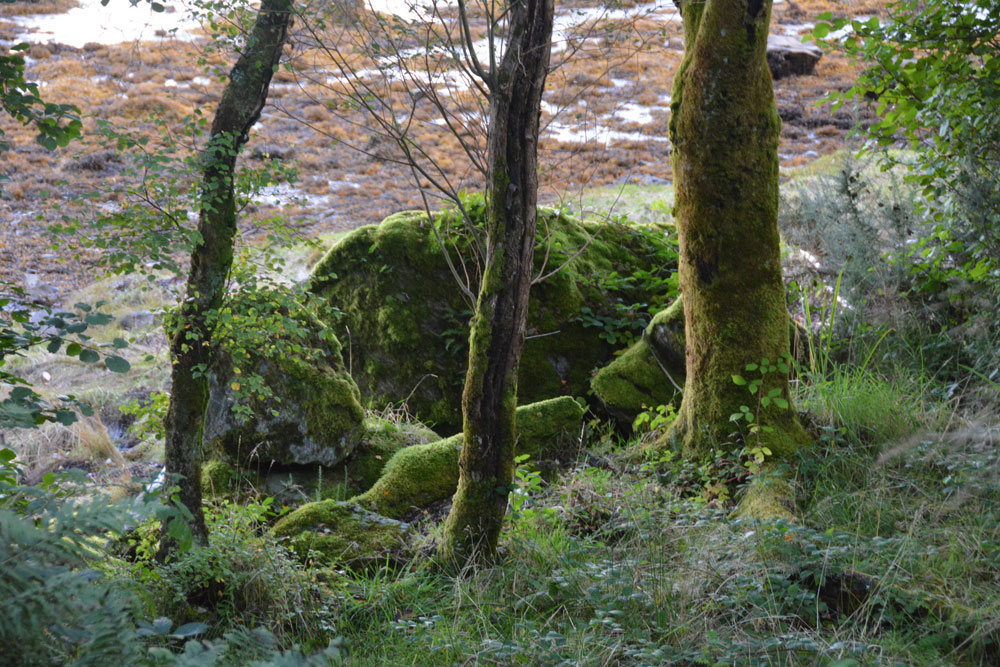
Meckan's Grave (Loch Riddon) submitted by Anne T on 5th Oct 2017. According to Canmore, the burial lies on the mudflat. I was disappointed not to be able to scramble down to take a closer look, but shot some photographs through the tree line. On closer inspection at home, I think this is the cist burial site - caught purely by chance!
(View photo, vote or add a comment)
Log Text: Meckan's Grave, Loch Ridon/Loch Ruel: There is only a signpost by natural crag but grid reference puts it on the mudflats at the head of Loch Riddon/Loch Ruel. There was a phone signal of sorts so I called up some images of Meckan’s Grave on the internet, only to find most people had photographed the crag, which had been blasted through to create the road.
It was virtually impossible for me to scramble down to the mudflats, so we ended up peering through the trees and caught what I thought might be a cist burial, which was more obvious on the computer screen at home. We didn’t spot the plaque.
We drove down to Shellfield Farm and looked back up at the head of the Loch from the fence next to the loch – wonderful in the early evening light.
Barmore Fort
Trip No.48 Entry No.5 Date Added: 5th Oct 2017
Site Type: Hillfort
Country: Scotland (Cowal)
Visited: Saw from a distance on 21st Sep 2017. My rating: Condition 3 Ambience 4 Access 4
Barmore Fort submitted by SolarMegalith on 28th Aug 2017. The northern wall of the Barmore fort (photo taken on August 2017).
(View photo, vote or add a comment)
Log Text: Barmore Hillfort, Ormidale, Argyll: We saw this hillfort from a distance only. The map indicated a footbridge across the River Ruel. We drove up and down several times but couldn’t find it. The ground was so wet after heavy rain, we would have needed wellies to navigate the fields, so elected to view this from a distance only. We did drive back along the A886 looking for a parking space on the south eastern side of the fort, but there were only private driveways. A disappointing end to the day.
Galabraes
Trip No.49 Entry No.1 Date Added: 5th Oct 2017
Site Type: Standing Stone (Menhir)
Country: Scotland (West Lothian)
Visited: Yes on 22nd Sep 2017. My rating: Condition 3 Ambience 4 Access 4
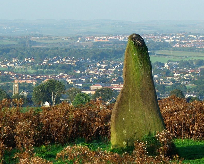
Galabraes submitted by postman on 11th Nov 2012. Site in West Lothian Scotland
Galabraes standing stone, it's not far from Cairnpapple and very close to the road, how com no-ones posted on here before
(View photo, vote or add a comment)
Log Text: Gala Braes Standing Stones, Bathgate: We drove up and down the road, but couldn’t see a gate into the field along either from the ‘main’ road (Drumcross Road) or the side road running north-south up to Cairnpapple Hill, so we ended up clambering over an almost demolished stone wall and squeezing through the wire fencing. There was a big (very unfriendly looking) bull in the field just below the western end of the ridge, who stood his ground and kept looking at us, so we didn’t dare approach the other small knoll where the other stone (B) should have been located.
As we were leaving, I spotted some old boundary features to the south of the standing stone so was photographing these, when I heard some cawing behind me. Looking up, a large crow was sitting on the standing stone, bobbing up and down. Eerie!
Lower Craigmailing (Torphichen)
Trip No.49 Entry No.2 Date Added: 5th Oct 2017
Site Type: Ancient Cross
Country: Scotland (West Lothian)
Visited: Yes on 22nd Sep 2017. My rating: Condition 2 Ambience 1 Access 5
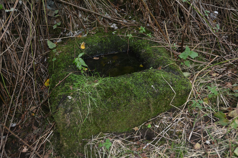
Lower Craigmailing (Torphichen) submitted by Anne T on 5th Oct 2017. In the bottom right hand corner, the shallow channel formed into the corner can be seen, suggesting it might have been used as a trough at some point in its past.
(View photo, vote or add a comment)
Log Text: Lower Craigmailing Socketed Stone: This socketed stone was well hidden under shrubbery at the start of a footpath running from Cathlaw Lane to Witch Craig/Crag. I would have walked right by it, had husband, Andrew, not pushed his way through the shrubbery to find it.
What a sad fate for this socketed stone. Being located so close to Torphichen, I assume it had something to do with marking the way to/from the Abbey, possibly up to Cairnpapple Hill.
Cockleroy Hill (Beecraigs)
Trip No.49 Entry No.3 Date Added: 22nd May 2019
Site Type: Hillfort
Country: Scotland (West Lothian)
Visited: Yes on 22nd Sep 2017. My rating: Condition 2 Ambience 3 Access 4
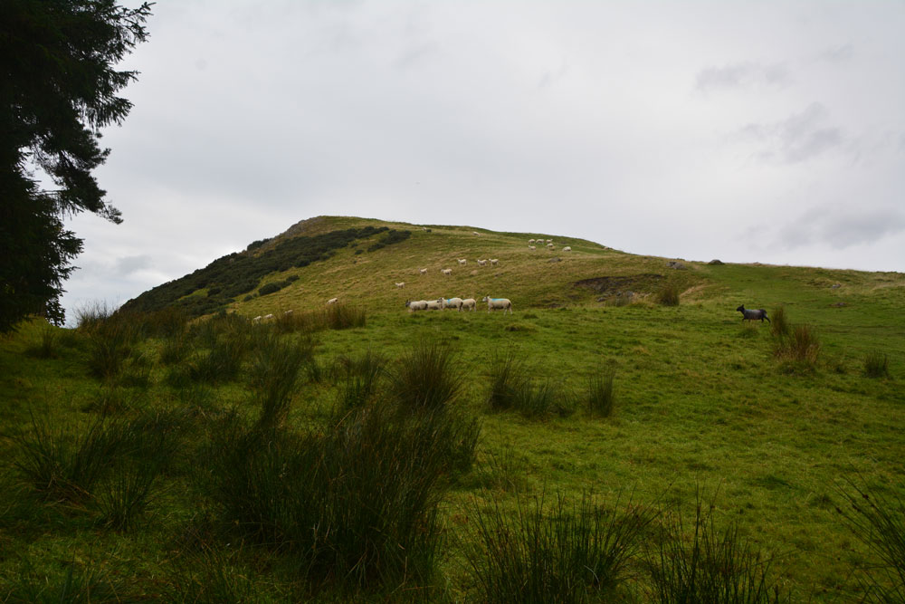
Cockleroy Hill (Beecraigs) submitted by Anne T on 5th Oct 2017. First view of Cockleroy Hillfort, having walked from the small car park to the gate into the field. The hill rises reasonably steeply up to 278 metres and has a trig point and view point on top.
(View photo, vote or add a comment)
Log Text: Cockleroy Hillfort, Beecraigs Country Park: From Lower Craigmailing Socketed Stone, we drove north past the Korean War Memorial to Beescraig Country Park. There was a small car park at about NS 99445 74270, where a path led through the forest, leading to a gate into the field containing the hillfort.
According to the Scotsman of 9th December 2012, Cocklroy means “the hat of the kings”. Situated in Beecraigs Country Park forest, there is a climb of 278 metres to the top and a mown path goes straight up the hill to the top of the fort, where there is a viewpoint. I wasn’t feeling too good, so opted out half way up the climb. Andrew continued up to the trig point at the top, and had great views across Lochcote Reservoir to the south west and the Forth Bridges at Queensferry to the north east.
Andrew said there wasn’t much to see of the fort itself – there were very little signs on the ground. I sat on the large stones about half way up the slope, at first thinking they were defensive ditches and banks, but were in fact modern quarries, when I looked closer!
Gormyre
Trip No.49 Entry No.4 Date Added: 6th Oct 2017
Site Type: Standing Stone (Menhir)
Country: Scotland (West Lothian)
Visited: Yes on 22nd Sep 2017. My rating: Condition 3 Ambience 4 Access 4
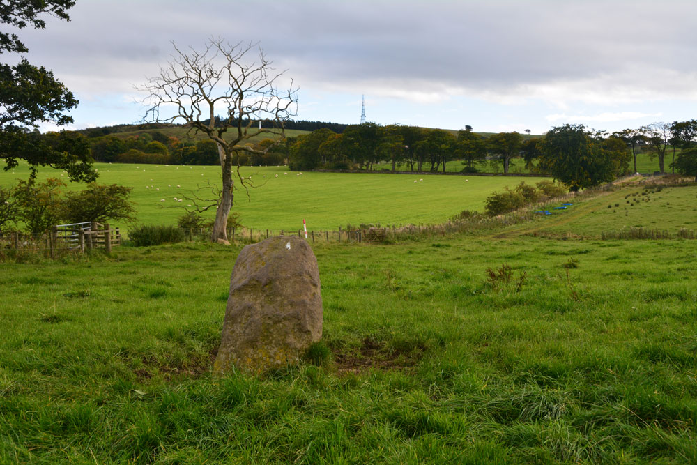
Gormyre submitted by Anne T on 23rd Mar 2019. Hi, AstroGeologist, With reference to your comment about the farmer having moved the stone, I don't think he has. Here's my version of your photo shown in PID 194979 with the same tree, albeit from a slightly different angle, taken on 22nd September 2017. The stone still sits on top of the distinct, flat-topped high point on the hill. The angle of the hedge line running across the photo is still the same. The stone was recorded by Canmore as being at this same location in 1856.
(View photo, vote or add a comment)
Log Text: Gormyre Stone, Torphichen: Ever since I went to Torphichen on 13th May 2017, I’ve wanted to come back and not only look round the Preceptory, but also try to find the other refuge stones associated with the Sanctuary Stone in the churchyard.
Today, despite not feeling 100% I was glad to be in search of this stone, and delighted to be able to see it from the road. We parked at NS 98072 72853 (there was just enough room by the gate to pull off the road), approximately 1.2 km east of Torphichen Preceptory.
The farmer had padlocked the gates into the field and the track which ran alongside it; these were really high and a little precarious to climb over (didn’t want to break them), so I ended up clambering gingerly over the wooden fence next to the gate. Following the grassy trackway north, just over 200 metres further on there was another gate, again padlocked, so we negotiated the wooden fence next to it. Thankfully, the huge bull and his ladies were in the adjoining field.
This stone sits on top of a natural mound. We couldn’t see the outline of the Maltese Cross on the north face of the stone, despite careful looking at a number of different angles and distances (although looking at one of the photographs, it does stand out a little). A really nice location, and a very friendly stone.
Dods Corse Stone (Boon)
Trip No.50 Entry No.1 Date Added: 6th Oct 2017
Site Type: Ancient Cross
Country: Scotland (Scottish Borders)
Visited: Yes on 24th Sep 2017. My rating: Condition 2 Ambience 3 Access 4
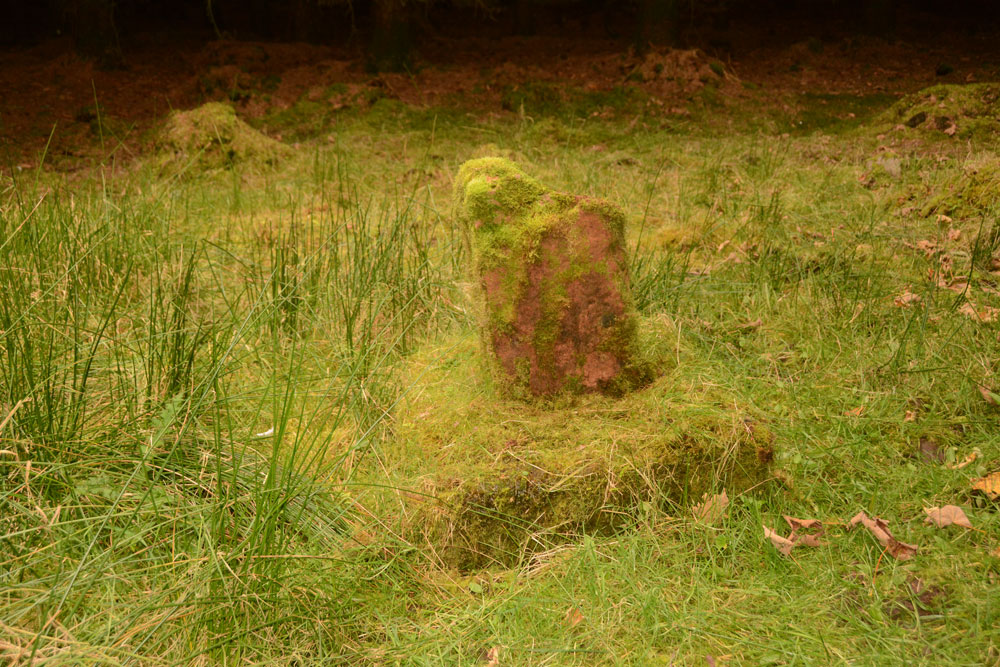
Dods Corse Stone (Boon) submitted by Anne T on 6th Oct 2017. On the mossy covered northern face, the (thin) incised cross can just be made out.
(View photo, vote or add a comment)
Log Text: Dods Corse Stone (Cross shaft and base): We pulled over in field entrance opposite wood the stone stands within, at NT 58395 46267. There was another huge bull with his ladies in this field, standing staring at us very menacingly, as if he was about the charge at us. As we were getting out of the car, we were overtaken by 3 army land rovers on exercise, the driver of the first vehicle waved.
The step on the stile into the wood was very tall, so my knees needed a bit of help getting up on it. There was a very narrow path leading to the north of the small wood. There is a fence line running east-west and another small section of wood (a narrow section of field is shown on the map). Following this inner fenceline some 200 metres to the west, we eventually came across the cross and base almost buried under moss and debris from the surrounding trees.
The incised cross on the northern face could just be made out, but the cross in relief on the southern face remained buried under the moss. All under foot around the cross were other bright red sandstone stones, but with all the forestry work, and debris from it, made it difficult to tell what archaeology there might be around us.
Purveshaugh
Trip No.50 Entry No.2 Date Added: 6th Oct 2017
Site Type: Standing Stone (Menhir)
Country: Scotland (Scottish Borders)
Visited: Yes on 24th Sep 2017. My rating: Condition 3 Ambience 3 Access 5
Purveshaugh submitted by mafenty on 18th Sep 2006. Good views of Eildon Hills and Black Hill of Earlston in background
(View photo, vote or add a comment)
Log Text: Purveshaugh (Earlston) Standing Stone, Scottish Borders: Our second stop of the day. Although the B6105 is supposed to be a minor road, it is still very busy and traffic rushes along it at a pace of knots. We managed to pull into the ungated field entrance without causing too much chaos.
A few steps into the field, we realised it was planted with wheat. We managed to navigate the 10 metres or so from the field entrance to the stone by following the empty ground where the tractor wheels had run, so didn’t cause any damage.
I was really amused to see the stone had its own name sign ‘Standing Stone’. It really is the most oddly shaped stone, like a small chair. Canmore says it is unsculptured, and it looks as if it has been quarried before being located here. I was surprised to find Canmore had two other records for this site, within a few tens of metres of the stone – a post medieval farmstead (Canmore ID 343237) and a well (Canmore ID 343240), neither of which we saw evidence for on the day.
Not a great location in modern times, with power lines running almost overhead, and the busy road.
Maxton Burgh (St Boswells)
Trip No.50 Entry No.3 Date Added: 6th Oct 2017
Site Type: Ancient Cross
Country: Scotland (Scottish Borders)
Visited: Yes on 24th Sep 2017. My rating: Condition 3 Ambience 3 Access 5
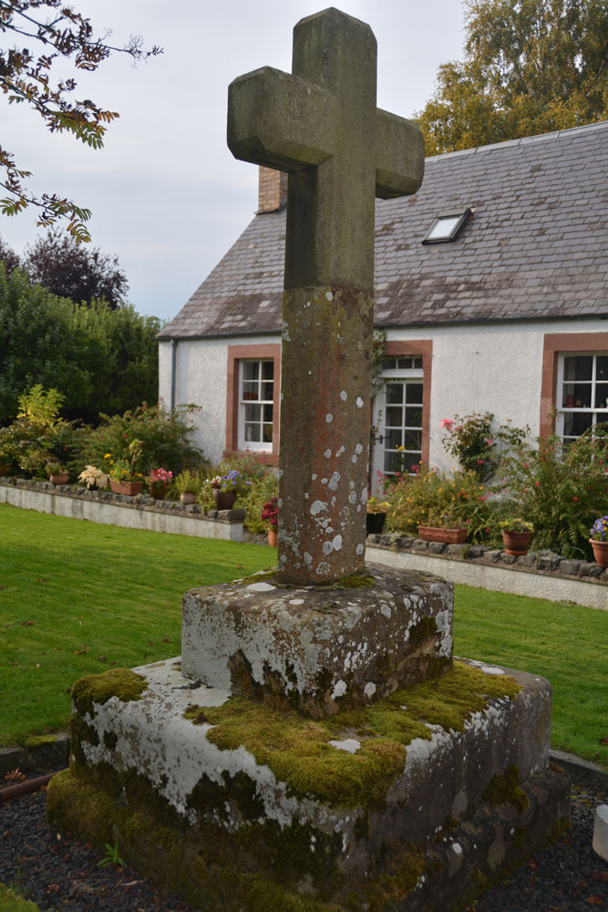
Maxton Burgh (St Boswells) submitted by Anne T on 6th Oct 2017. The cross from about 10 meters south east of it, trying to eliminate the view of the land rover parked immediately next to it.
(View photo, vote or add a comment)
Log Text: Maxton Burgh Cross, Scottish Borders: We stopped off at a garden centre café in Newton St. Boswell’s for refreshments, then carried on eastwards towards the small village of Maxton. We didn’t have precise grid references for this cross at the time, and with no mobile signal, we were a little lost as to where to find it. Eventually I managed to pull up the website for Maxton village, which described the location of the cross as being just off the main street, in front of what was the smiddy, “on what remains of the village green”. They state that “Parts of the cross are probably original 13th century, but the main part was replaced in 1881 by Sir William Ramsay Fairfax, Bart.”
We drove up and down the A699 through the village trying to find the old village green, even driving down St. Cuthbert’s Way to the church. Eventually, we decided to park on the main road and walk around. From here, the cross was easy to spot. The old village green is now someone’s private garden. The man who lived in the cottage immediately behind the cross said it was OK to go and look. Photographing the cross was somewhat hampered by the land rover parked immediately next to it. Fancy having the old village green for your private garden!
St Boswell's Old Church
Trip No.50 Entry No.4 Date Added: 7th Oct 2017
Site Type: Ancient Cross
Country: Scotland (Scottish Borders)
Visited: Yes on 24th Sep 2017. My rating: Condition 2 Ambience 3 Access 4
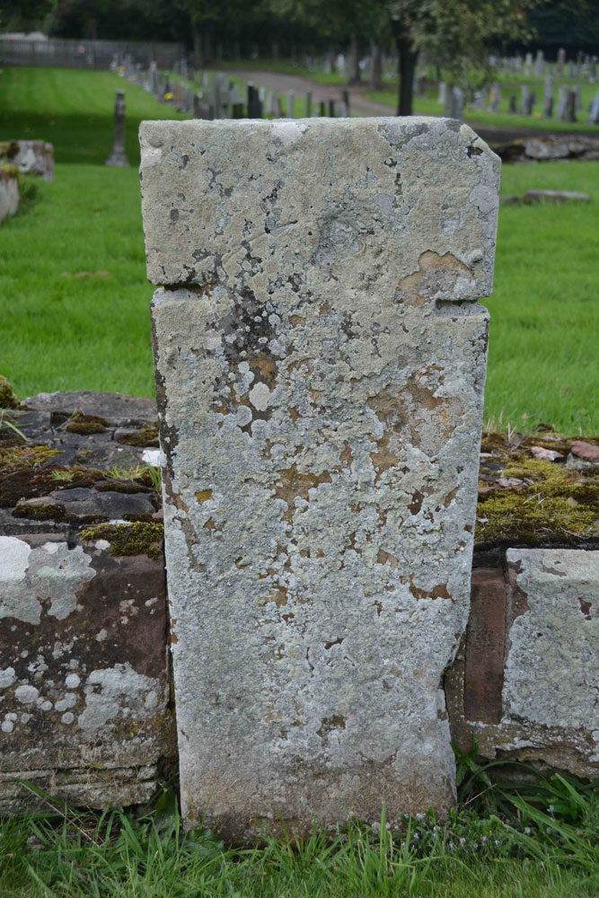
St Boswell's Old Church submitted by Anne T on 7th Oct 2017. Close up of the slab, which is supposed to bear an incised, equal limbed, cross within a circle. It is very worn. The other artefacts associated with the church of pre-1153 are built into the fabric of the present St. Boswell's church, located in the village.
(View photo, vote or add a comment)
Log Text: St Boswell's Old Church, Incised Cross Slab: I was expecting much more from this site, lying in a corner tucked between the River Tween to the east and Boswell Burn to the south. The ruins of the old church have been taken down to only a couple of courses, whilst the graveyard is still in use today.
Not very atmospheric. It turns out, pulling the Canmore record up on site, that there was only 1 tombstone with incised cross standing against the south wall of the church, which is supposed to have: “A tombstone, measuring 5ft 8in in length and tapering in width from 1ft 7 1/2in to 1ft 2in, is attached to the S wall of the church. It bears a slightly incised, equal-limbed cross within a circle.” No date is given for this. The rest of the interesting old stones have been built into the modern church, which we didn’t bother to find, as it presumably would be locked, and we had a lot more sites we particularly wanted to see.
Blackpark
Trip No.50 Entry No.4 Date Added: 9th Oct 2017
Site Type: Stone Circle
Country: Scotland (Isle of Bute)
Visited: Yes on 25th Sep 2017. My rating: Condition 3 Ambience 4 Access 4

Blackpark Stone Circle submitted by saille on 14th Jan 2004. At NS 091556, the stone circle in Blackpark Plantation has only three stones left standing, the remains of a larger complex of seven stones.
Now surrounded by forestry plantation.
Towards the west of the road, between Kingarth and Largizean farm, there are three more standing stones which are more in-line with each other than Blackpark.
(View photo, vote or add a comment)
Log Text: Blackpart Standing Stone, Isle of Bute: About 2.3 km north of St. Blane’s Chapel, still on Plan Road. There is a small car park just off the road, north of the stones, at NS 09160 55716. The ground was very boggy, with large pools of water both on the path to them and in between, so we had to pick our way very careful.
These three stones are some of the most mis-matched I’ve seen. The northern and southern most stones are made of a reddish conglomerate, a little like cement. The third stone looks like whinstone, which has split down the middle, and is the oddest of shapes, morphing what it looks like completely as you walk around it.
Thankfully the mist had thinned by the time we arrived here, and the sun was just starting to show throw the pine trees of the surrounding forest.
I was very intrigued by the southernmost stone, on a mound – is this a cairn? No mention of this on Canmore, although as I was walking around it I spotted graffiti, including what looked like a misshapen cross.
Mertoun Kirk (St Boswells)
Trip No.50 Entry No.5 Date Added: 7th Oct 2017
Site Type: Sculptured Stone
Country: Scotland (Scottish Borders)
Visited: Yes on 24th Sep 2017. My rating: Condition 3 Ambience 3 Access 5

Mertoun Kirk (St Boswells) submitted by Anne T on 7th Oct 2017. This stone, just over 1 ft long and 6 ins deep is built into the east wall of the modern extension to the north east side of the church. To find it, stand behind the large green oil tank located at this side of the church and look up.
(View photo, vote or add a comment)
Log Text: Mertoun Kirk, incised stone: The church lies in the grounds of Mertoun House, which lies almost directly north, across a bend in the River Tweed, from Maxton with its Burgh Cross. To approach the church, we had to follow the signs up the single track road to the house; the church is just before you reach the house. There were other Roman fragments built into seats in the gardens just outside the house, but we needed to pay to get in the house, and there was only half an hour before it shut for the evening. Fortunately, we were able to park outside the church, next to the mounting block, and walked around this very hidden, almost secretive church.
The church itself was locked, and we couldn’t get in. Whilst Canmore gives no date for the stone, the fragment looks older than the church which was built in 1658 and restored in 1820 and 1898.
Scalpsie Barrow
Trip No.50 Entry No.5 Date Added: 9th Oct 2017
Site Type: Round Cairn
Country: Scotland (Isle of Bute)
Visited: Yes on 25th Sep 2017. My rating: Condition 3 Ambience 3 Access 5

Scalpsie Barrow submitted by durhamnature on 23rd Sep 2012. Photo of barrow, from "The book of Arran" by J A Balfour 1910 via archive.org
Site in Isle of Bute Scotland
(View photo, vote or add a comment)
Log Text: Scalpsie Barrow, Isle of Bute: We didn’t plan to stop here, but there was a car park and information board by the field alongside the A844 past Ambrismore on the way to Ardscalpsie, signposted to the beach, so we screeched to a halt to explore. The information board differentiated between the barrow and another cairn, also somewhere in the field, but the fog was so bad, we couldn’t see it, and it was very difficult to photograph the main barrow.!
Worth stopping to see. The gate into the field was about 100 metres further west along the road from the small car park. Walking back to the barrow, my feet got completely drenched. A shame the fog was so bad, as I’d have loved to have found the second cairn.
Font Stone (Dryburgh)
Trip No.50 Entry No.6 Date Added: 7th Oct 2017
Site Type: Ancient Cross
Country: Scotland (Scottish Borders)
Visited: Yes on 24th Sep 2017. My rating: Condition 3 Ambience 3 Access 5
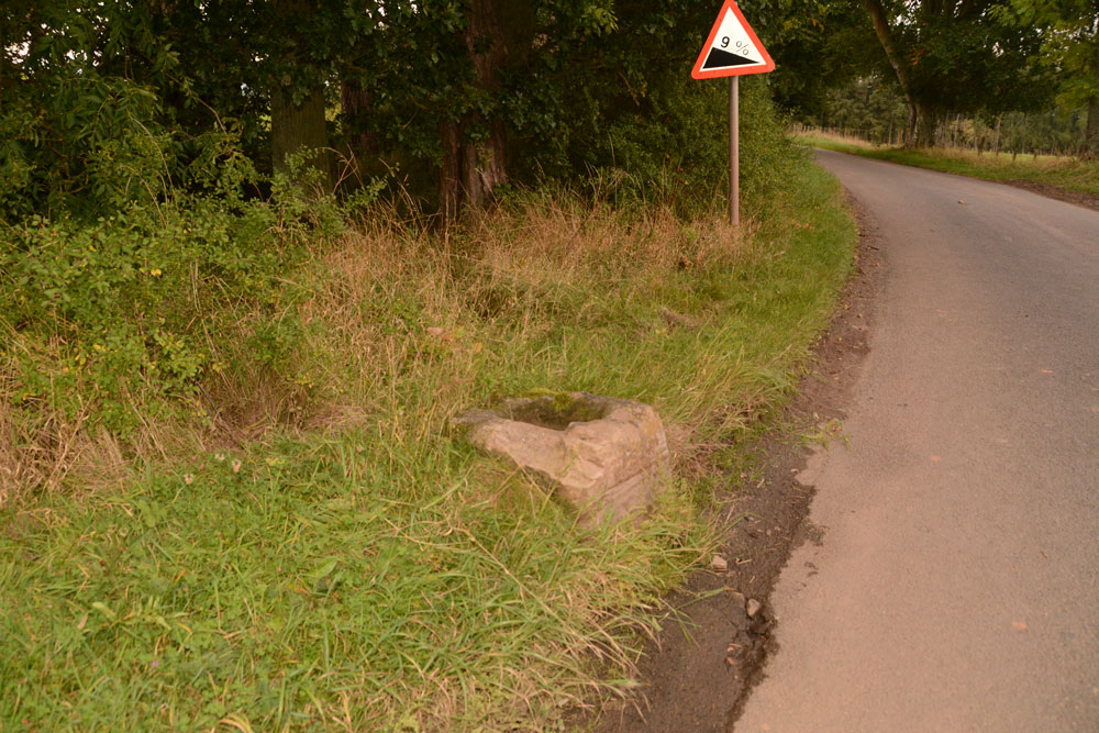
Font Stone (Dryburgh) submitted by Anne T on 7th Oct 2017. The Dryburgh Font Stone, showing its very close location to the side of the road.
(View photo, vote or add a comment)
Log Text: The Font Stone, Dyburgh (Cross Base): Sited on a corner of the B6356, it is a miracle that this cross base is still in one piece, being located so close to the road.
From Mertoun Kirk, we followed the B6356, turning right before reaching Dryburgh along a minor road signposted to Bemersyde, where the stone is located some 270 metres along the road on a slight right hand bend.
It is largely hidden by grass at the right hand side of the road as you head up to Bemersyde. There is a layby just before the stone, where we pulled in to photograph the stone. Note: this is a busy road, so be careful of traffic.
As we were very near the Scott’s View Geological Indicator and the Wallace Monument, whilst there was still light, we decided to go on and take a look.
