Contributory members are able to log private notes and comments about each site
Sites Anne T has logged. View this log as a table or view the most recent logs from everyone
Grassmarket modern menhir
Trip No.98 Entry No.1 Date Added: 21st Sep 2018
Site Type: Standing Stone (Menhir)
Country: Scotland (Midlothian)
Visited: Yes on 18th Sep 2018. My rating: Condition 3 Ambience 3 Access 5

Grassmarket modern menhir submitted by ladrin on 8th Mar 2018. Modern menhir on the Grassmarket, Edinburgh.
(View photo, vote or add a comment)
Log Text: Modern Megalith, Grassmarket, Edinburgh: This stone was on our walk for the afternoon. It took a bit of finding, located behind the bins and underneath the trees. This modern megalith stands under a group of trees on the paved area of Grassmarket. In the time we spent photographing it, no-one else appeared remotely interested, despite the large numbers of tourists in the area.
It has a plaque which reads: “This plaque was unveiled on 3rd of October 1977 by the Rt. Hon. Kenneth Borwick, Lord Provost of the City of Edinburgh, to commemorate the 500th anniversary of a reorganisation of Edinburgh Markets authorised by King James III on 3rd of October 1477. The Cattle Market was situated at the western end of the Grassmarket and in King’s Stables Road. This area was then just outside the Burgh.” Underneath this larger plaque is a smaller one which says: “Stone laid by Grassmarket Area Traders Association, 3rd October 1977.”
Edinburgh Runestone
Trip No.98 Entry No.2 Date Added: 21st Sep 2018
Site Type: Carving
Country: Scotland (Midlothian)
Visited: Yes on 18th Sep 2018. My rating: Condition 3 Ambience 3 Access 4
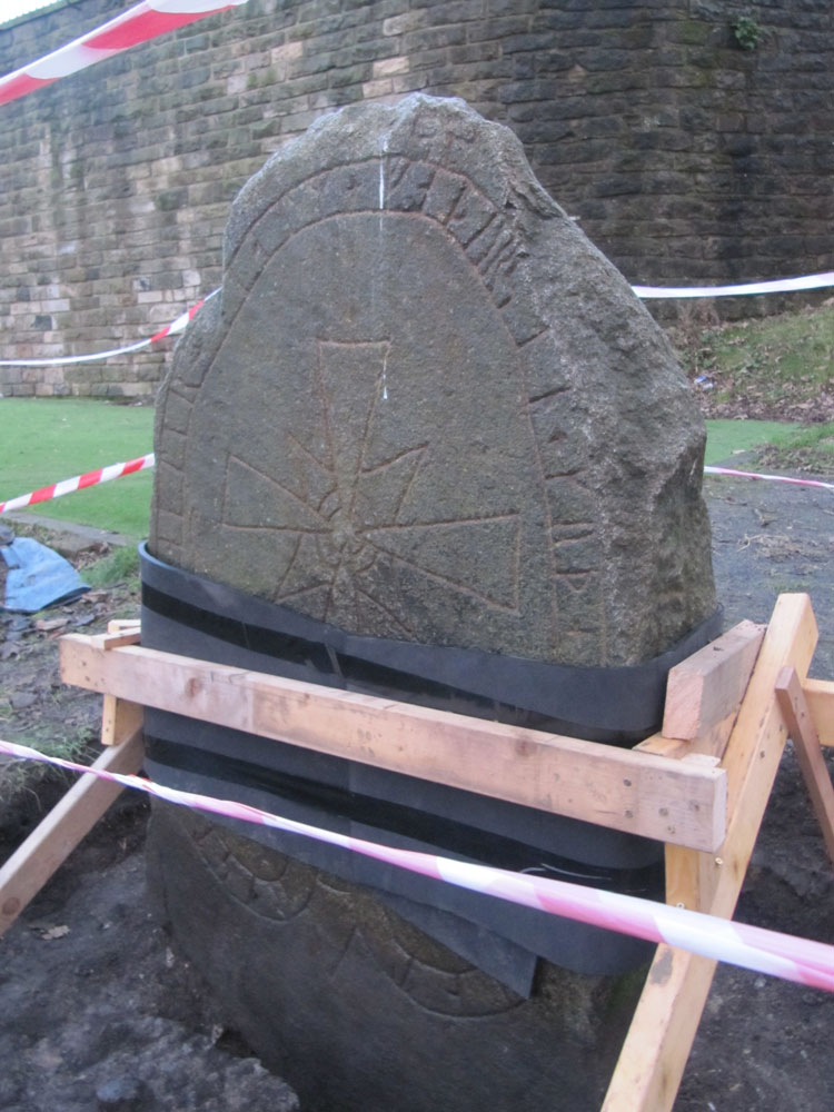
Edinburgh Runestone submitted by Anne T on 7th Jan 2018. The Runestone seen by clambering up the steep muddy track from Princes Street Gardens, just below the Castle Esplanade. The runes read: ""Ari engraved this stone in memory of Hialm his father. God help his soul."
(View photo, vote or add a comment)
Log Text: New site of the Edinburgh Runestone (not been moved yet): As we were going to a building near to hear, we thought we’d do a detour to this part of the University.
We wandered around George Square first of all, but only found a modern sculpture called The Dreamer. We then identified 50 George Square (taken from the BBC article about the relocation of the stone), but only spotted a large hole in the middle of a square flower bed, hedged by low privet, around the side of the building. Having walked all around it, we went into check and I asked the security guard at the reception desk. He told us the stone hadn’t yet been moved, but the hole had been dug in preparation. I thanked him and went to take a photograph of the new site.
Caiy Stane
Trip No.106 Entry No.2 Date Added: 5th Nov 2018
Site Type: Standing Stone (Menhir)
Country: Scotland (Midlothian)
Visited: Yes on 28th Oct 2018. My rating: Condition 3 Ambience 4 Access 5
Caiy Stane submitted by crannog on 22nd Feb 2012. Edinburgh council has to be commended for the care they take in preserving ancient sites/monuments, like this. It is located at the end of a street with lots of homes all around.
(View photo, vote or add a comment)
Log Text: The Caiy Stane, Edinburgh: It was a good job we had the SatNav to help us find this stone, as all the streets around were called ‘Caiy (something)’ and we could have been driving around for ages!
This is a magnificent stone, set back in a niche backing onto someone’s garden on Caiystane View. It is possible to walk all the way around it, so we saw the 6 cups marks and the more modern graffiti on the back face.
The small sign at the front base of the stone reads: “The Caiy Stone. The Property of The National Trust for Scotland.” The larger sign, on the low wall to the left of the stone reads: “The Caiy Stane. Standing at over nine feet high on a summit, originally with wide views, this broad slab of red sandstone includes a line of six, probably prehistoric, cup marks on its reverse face. / The stone may have been erected as early as the Neolithic period, possibly before 3000BC, to denote a ritual or burial place. Records of cairns, cists and urns found in the immediate vicinity show that the hilltop continued to be used for burial in the Bronze Age. / Discovery of these remains led to the supposition that Caiyside Hill was the site of a battle, variously suggested to have involved Romans, Danes (Vikings); ore Cromwellians. The Caiy Stane, also known as the Kel Stane, the Cat Stane or the Camus Stane, was thought to have been a battle memorial stone.”
Hanging Stanes (Braid Road)
Trip No.105 Entry No.3 Date Added: 5th Nov 2018
Site Type: Marker Stone
Country: Scotland (Midlothian)
Visited: Yes on 28th Oct 2018. My rating: Condition 2 Ambience 3 Access 5
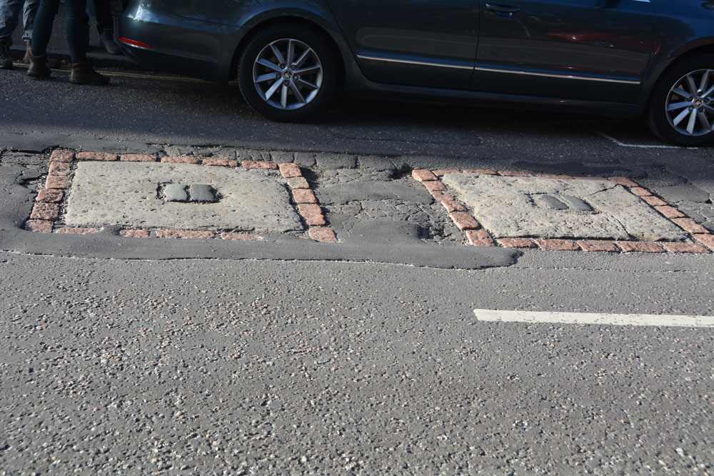
Hanging Stanes (Braid Road) submitted by Anne T on 5th Nov 2018. The two gallow bases are embedded in the road surface. I originally thought this site was associated with witches, but was the site of the execution of the last two highwaymen in Scotland. We picked this site up from the Ancient Stones website, and as it was very close to the Buckstane, thought we'd take a look.
(View photo, vote or add a comment)
Log Text: The Hanging Stanes: Having spotted this site on the Ancient Stones website, and with them being just down the road from the Buck Stane, we decided to pay this site a visit on the way into Edinburgh City Centre. I don't know why I thought these were originally associated with witches, but found out otherwise during the visit.
We pulled up next to the junction of Braid Road and Comiston Road, as per the directions on the Ancient Stones, only to find some people from the house immediately next to it were leaving and getting into their car. The older gentleman from the house asked me if we’d seen the plaque on the street and told me around 30 people each day come to see these stones.
The plaque in the pavement reads: “The Hanging Stanes. Thomas Kelly and Henry O’R eil, the last two highwaymen in Scotland to be executed, were hanged in public on 25th January 1616, from the gallows erected on the two stanes still visible on the spot, which was where the robbery took place. Paid for by public subscription. 1995.”
I risked getting run over to avoid my shadow falling across the stones, but they were half in shade and half in the sun, so the photos weren’t great. With these stones being sited on the slope of a hill with views over the city centre, without the traffic and the people around, this would have been a very atmospheric and enigmatic place.
Slidey Stane (Holyrood Park)
Trip No.106 Entry No.4 Date Added: 5th Nov 2018
Site Type: Natural Stone / Erratic / Other Natural Feature
Country: Scotland (Midlothian)
Visited: Yes on 28th Oct 2018. My rating: Condition 3 Ambience 3 Access 4
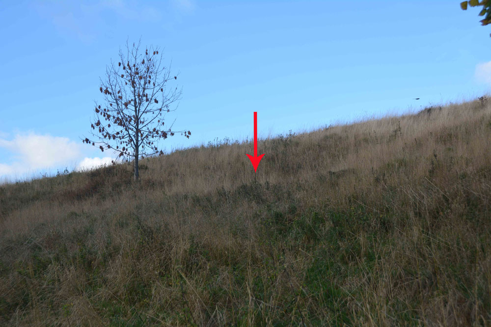
Slidey Stane (Holyrood Park) submitted by Anne T on 5th Nov 2018. The Slidey Stane is well hidden on this hillside, from above and below. From the path below, all that can be seen is a small dip in the slope of the hill. Similarly from the footpath running above the stone, although there are much larger chunks of bedrock sticking up at the side of the path.
(View photo, vote or add a comment)
Log Text: The Slidey Stane, Holyrood Park: As we were in Edinburgh City Centre, we thought we'd try and find this large erratic stone which is featured on The Ancient Stones website, but my goodness - what a search we had!
We followed the directions given on The Ancient Stones, and even armed with the GPS we walked up and down and down and up and round and round. Eventually, I took my phone out and managed to find a forum post on the Modern Antiquarian which gave a link to a search by the park rangers. This, thankfully, included photographs of the route to find the stone. It is in fact at the location given by the Ancient Stones, but is so hidden in a dip on the hillside, that we were unable to see it, either from below or above. We finally saw it from a couple of metres away, but what a disappointment!
The stone is small, although the top is shiny as if it has been polished over the years. There are larger stones on the footpath running above the Slidey Stone.
Well, at least we found it, photographed it and have now posted the results here. We too a more accurate grid reference of NT 26766 72765.
Gogar Stone
Trip No.105 Entry No.6 Date Added: 6th Nov 2018
Site Type: Standing Stone (Menhir)
Country: Scotland (Midlothian)
Visited: Yes on 28th Oct 2018. My rating: Condition 3 Ambience 4 Access 4
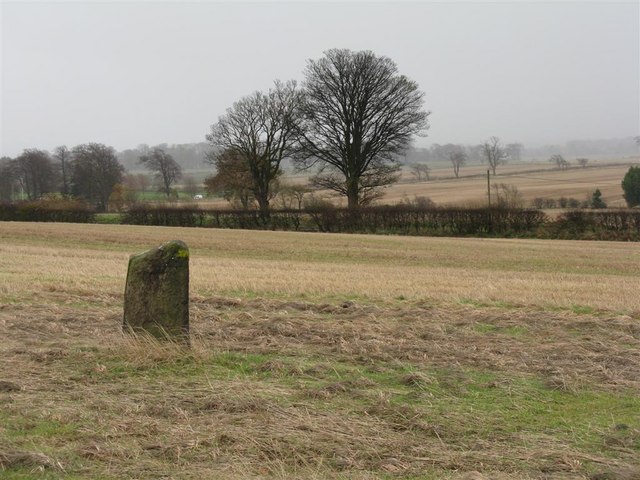
Gogar Stone submitted by Andy B on 13th Mar 2010. Standing stone at Gogar
Copyright M J Richardson and licensed for reuse under the Creative Commons Licence.
(View photo, vote or add a comment)
Log Text: The Gogar or Easter Norton Standing Stone: The last time I visited this stone, the field was planted with crop with no easy way of crossing the knee high rows of plants, so we viewed it from a distance. On this visit, the field had been left fallow, so we parked in the small layby on Freelands Road and walked through a gap in the hedgerow up to the stone. A large rook was perched on top of the stone, but flew off before I could take a photograph of it.
This stone has lots to keep it occupied during the day – planes taking off from Edinburgh airport to the north, trains on the mainline to the south, and cars on the M8. It was nice to be able to wander up to it, take photographs and see the stone up close.
The satnav took us by a funny route back to the A8 and whilst waiting to move off, a white van ran into the back of our car, just as a blue light ambulance was trying to get past. Not a good end to the day, but we decided to stop off at the Boar Stone on the way back as there was still just enough daylight.
St John's Cross (Canongate)
Trip No.153 Entry No.1 Date Added: 9th Oct 2019
Site Type: Ancient Cross
Country: Scotland (Midlothian)
Visited: Yes on 1st Oct 2019. My rating: Condition 2 Ambience 3 Access 4

St John's Cross (Canongate) submitted by Anne T on 9th Oct 2019. The location of the old St John's Cross (now said to be outside Canongate Kirk). Whilst the location is said to be marked by a white St John's Cross, the paint had almost been worn away, and if I hadn't seen similar circles of pavers in other locations, might not have recognised the spot. Having spotted the circle, a closer look around revealed the plaque describing the cross on an adjacent wall in deep shadow on the south side of Canongate.
(View photo, vote or add a comment)
Log Text: St John's Cross, Edinburgh (site of): The site of this cross was one of the clues (no. 6) on the 'Treasure Trail' map for the Old Town Trail. The markings for this cross were very faint indeed. I only recognised the spot by the circle of bricks in the road, as I’d seen similar features before. There is a plaque on the wall nearby.
From the funny, small brass plates in the road and pavement just to the west, at the junction of High Street and Canongate (W-E) and Jeffrey Street-Saint Mary's Street to the east, the cross would have been located just outside the old city walls.
Whilst I've been to Edinburgh on a number of occasions, I have never walked down Canongate before, and it was a great spot for discovering 'old things and old sites'.
St Mary's Well (Rothsay)
Trip No.51 Entry No.1 Date Added: 8th Oct 2017
Site Type: Holy Well or Sacred Spring
Country: Scotland (Isle of Bute)
Visited: Yes on 25th Sep 2017. My rating: Condition 2 Ambience 3 Access 5
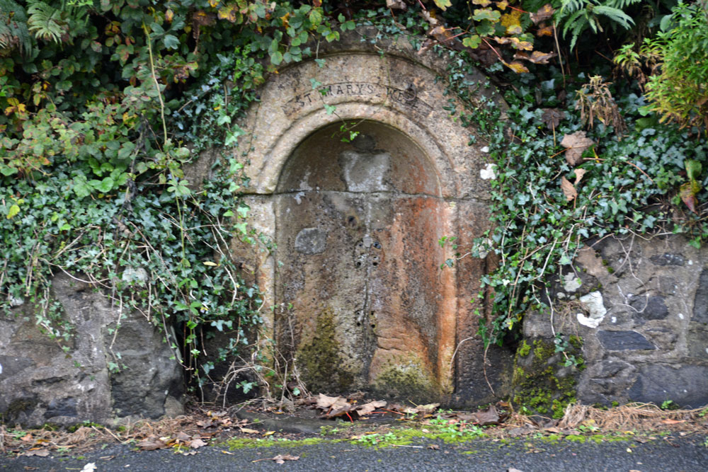
St Mary's Well (Rothsay) submitted by Anne T on 8th Oct 2017. St Mary's Well, showing it's sadly disused, dry state.
(View photo, vote or add a comment)
Log Text: St. Mary's Well, Rothsay: Almost immediately across the road from St Mary's Chapel, set into a dry stone wall and very sadly neglected. There is no outlet but the remains of a metal tethering ring for a cup or ladle is still embedded in the arch. Worth a walk across from the chapel to take a look.
St Blane's Well
Trip No.51 Entry No.2 Date Added: 8th Oct 2017
Site Type: Ancient Cross
Country: Scotland (Isle of Bute)
Visited: Yes on 25th Sep 2017. My rating: Condition 3 Ambience 4 Access 4
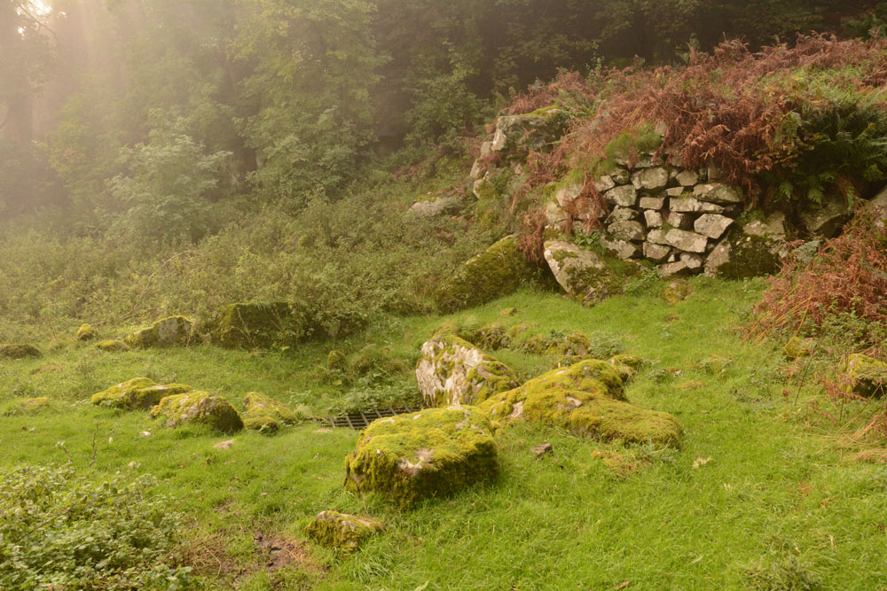
St Blane's Well submitted by Anne T on 8th Oct 2017. View of this well from the north. By this time of the afternoon, the sea haar was coming in with a vengeance, and with the last of the sun's rays coming through, this site was very atmospheric.
(View photo, vote or add a comment)
Log Text: St. Blane's Well, Isle of Bute: After St. Mary’s Chapel and Well, we made our way to the south end of the island, by which time the mist was starting to come in from the sea. There is a layby at NS 09299 53076 for around 6 cars at the start of the path uphill to the chapel. I was very disappointed to find quite a few other visitors there. They must have done what we did, and made their way straight to the south end of the island to work their way back. Should have timed it better.
At this site, as well as the chapel, there is a holy well, a hogback and a cross shaft. This whole place is very ancient and it was atmospheric in the mist.
St Blane's Chapel (Isle of Bute)
Trip No.51 Entry No.3 Date Added: 8th Oct 2017
Site Type: Ancient Cross
Country: Scotland (Isle of Bute)
Visited: Yes
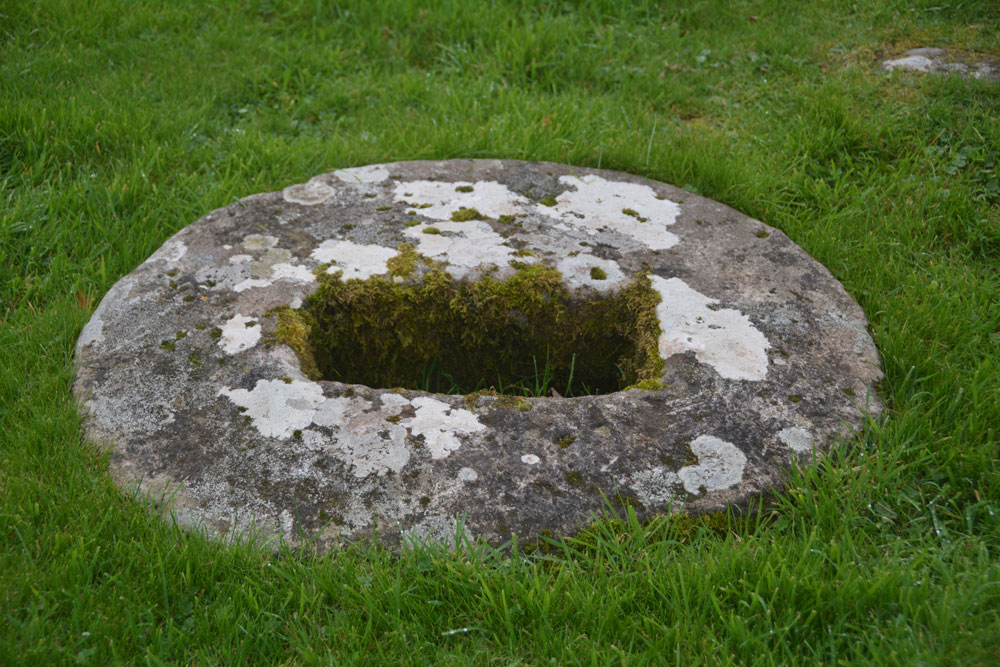
St Blane's Chapel (Isle of Bute) submitted by Anne T on 8th Oct 2017. This cross-base/socket stone is embedded within the ground in the lower (southern part) of the graveyard. There is apparently another cross base 70m north of the chancel, although we were unable to find this.
(View photo, vote or add a comment)
Log Text: Cross base/socket stone, St. Blane's Chapel, Isle of Bute: Whilst I was wandering through the ruins of the chapel and photographing it, husband Andrew was in search of this sandstone socket in the lower churchyard. In the end, it was easy to find – head south out of the ruins, into the upper churchyard, down the steps, and it is virtually in front of you to your left hand side. I confess that without the Canmore record, I might have very well missed this, as I’m used to seeing socket stones that are sitting on the ground, not buried within it.
Blackpark
Trip No.50 Entry No.4 Date Added: 9th Oct 2017
Site Type: Stone Circle
Country: Scotland (Isle of Bute)
Visited: Yes on 25th Sep 2017. My rating: Condition 3 Ambience 4 Access 4

Blackpark Stone Circle submitted by saille on 14th Jan 2004. At NS 091556, the stone circle in Blackpark Plantation has only three stones left standing, the remains of a larger complex of seven stones.
Now surrounded by forestry plantation.
Towards the west of the road, between Kingarth and Largizean farm, there are three more standing stones which are more in-line with each other than Blackpark.
(View photo, vote or add a comment)
Log Text: Blackpart Standing Stone, Isle of Bute: About 2.3 km north of St. Blane’s Chapel, still on Plan Road. There is a small car park just off the road, north of the stones, at NS 09160 55716. The ground was very boggy, with large pools of water both on the path to them and in between, so we had to pick our way very careful.
These three stones are some of the most mis-matched I’ve seen. The northern and southern most stones are made of a reddish conglomerate, a little like cement. The third stone looks like whinstone, which has split down the middle, and is the oddest of shapes, morphing what it looks like completely as you walk around it.
Thankfully the mist had thinned by the time we arrived here, and the sun was just starting to show throw the pine trees of the surrounding forest.
I was very intrigued by the southernmost stone, on a mound – is this a cairn? No mention of this on Canmore, although as I was walking around it I spotted graffiti, including what looked like a misshapen cross.
Scalpsie Barrow
Trip No.50 Entry No.5 Date Added: 9th Oct 2017
Site Type: Round Cairn
Country: Scotland (Isle of Bute)
Visited: Yes on 25th Sep 2017. My rating: Condition 3 Ambience 3 Access 5

Scalpsie Barrow submitted by durhamnature on 23rd Sep 2012. Photo of barrow, from "The book of Arran" by J A Balfour 1910 via archive.org
Site in Isle of Bute Scotland
(View photo, vote or add a comment)
Log Text: Scalpsie Barrow, Isle of Bute: We didn’t plan to stop here, but there was a car park and information board by the field alongside the A844 past Ambrismore on the way to Ardscalpsie, signposted to the beach, so we screeched to a halt to explore. The information board differentiated between the barrow and another cairn, also somewhere in the field, but the fog was so bad, we couldn’t see it, and it was very difficult to photograph the main barrow.!
Worth stopping to see. The gate into the field was about 100 metres further west along the road from the small car park. Walking back to the barrow, my feet got completely drenched. A shame the fog was so bad, as I’d have loved to have found the second cairn.
Acholter
Trip No.50 Entry No.6 Date Added: 9th Oct 2017
Site Type: Standing Stone (Menhir)
Country: Scotland (Isle of Bute)
Visited: Yes on 25th Sep 2017. My rating: Condition 3 Ambience 3 Access 4

Acholter submitted by Anne T on 9th Oct 2017. This was about as close as we could get to this standing stone (about 8-10 metres). The field was absolutely sodden in water and the cow pats were ankle deep. We cut our losses and took photographs as best we could through the thickening mist.
(View photo, vote or add a comment)
Log Text: Acholter Standing Stone, Isle of Bute: From the Scalpsie Bronze Age Barrow, we headed north up the A844 towards Colmac and East Colmac to see the stone circle, a standing stone with incised cross and an earthwork. By this time, we were starting to run out of time as we needed to get back to Rounsay for the ferry.
There had just been an accident at the southern end of Ettrick Bay – a camper van and a car had gone head on into each other at low speed. All the occupants of the vehicles were out on the roadside and others had stopped to help. I can imagine turning the corner of the A844 and coming onto this lovely stretch of sand and sea, not looking where you were going properly. We followed the line of cars past them. I spotted this standing stone on the map. We weren’t going to stop, but the stone was visible through the mist in the field, so we pulled up by the side of the road.
My goodness, the entrances to the fields were ankle deep in water, so we walked further south to another field gate and used an alternative route. The whole field was so very wet and absolutely covered in damp, smelly cow pats, that we could only get within about 10 metres of the stone. By this time, the mist really was so bad we could hardly see the stone.
Picking our way back to the road, me with very wet socks and shoes, I turned back to the field only to see a herd of large cows making their way towards us. Where had they come from? We didn’t see them in the field, and they made an eerie sight through the mist!
St Colmac Cottages Stone Circle
Trip No.50 Entry No.7 Date Added: 9th Oct 2017
Site Type: Stone Circle
Country: Scotland (Isle of Bute)
Visited: Saw from a distance on 9th Oct 2017. My rating: Ambience 2 Access 4
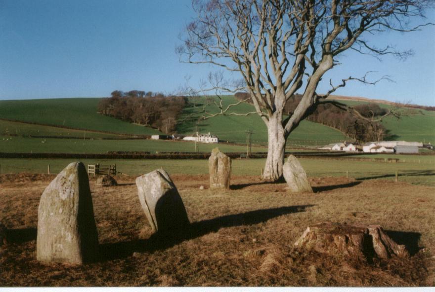
St Colmac Cottages Stone Circle submitted by saille on 20th Jan 2004. Stone Circle at Ettric bay.
NS044668
(View photo, vote or add a comment)
Log Text: St Colmac Cottages Stone Circle: Defeated by a pond between us and the stone circle, a large heap of cow dung by the gate, heavy mist, and running out of time before our ferry back, we stopped at the gate and photographed this from a distance.
We had tried to see the standing stone near Calmac Bridge, but the farmers were moving a large herd of cattle into the field, and we would have had to wait for ages. Rapidly running out of time before we needed to get back to Rounsay for the ferry, we pressed on to St. Colmac Cottages, where we parked at the entrance to the field with the stone circle. Here, the farmer has created a fenced walkway along the side of the road.
The walkway, however, was deep in wet slurry from the cows having just been moved down this path, and the field was sodden. Arriving at the gate into the field, the farmer had also dumped a whole load of cow manure just the other side of the gate, making it incredibly uninviting to walk to the stone circle, which we could just see through the mist in the field.
At this point, not having wellies, I realised I’d rather see the standing stone inscribed with a cross before we left the island, so we waded back to the car and set off just down the road to the ruined church at Calmac Bridge.
St Colmac's Cross
Trip No.50 Entry No.8 Date Added: 9th Oct 2017
Site Type: Standing Stone (Menhir)
Country: Scotland (Isle of Bute)
Visited: Couldn't find on 25th Sep 2017
Log Text: St Colmac's Cross, Isle of Bute: I really, really wanted to find this standing stone with incised Latin Cross, but we couldn't work out a way to get behind the barn at East St. Colmac Farm to view it. The Canmore records show this intriguing stone in a wooden enclosure, which was built round it after it was damaged in recent times (the top was knocked off).
By the time we'd had several attempts to find this stone, we were seriously running out of time to get back for our ferry back to Wemyss Bay. We needn't have worried, however, as the ferries were suspended because of the heavy fog. This necessitated a drive up to Rhubodach to get a shorter ferry ride across to Colintraive, then a very hairy mountain drive on a single track road with dense fog back to Dunoon. A not to be forgotten trip!
Market Cross (Kincardine)
Trip No.84 Entry No.10 Date Added: 26th Jul 2018
Site Type: Ancient Cross
Country: Scotland (Fife)
Visited: Yes on 14th Jul 2018. My rating: Condition 3 Ambience 2 Access 5

Market Cross (Kincardine) submitted by Anne T on 26th Jul 2018. Apart from the finial, this Mercat Cross in Kincardine was virtually identical in style to the Mercat Cross in Clackmannan, not that far away.
(View photo, vote or add a comment)
Log Text: Mercat Cross, Kincardine: Our last stop of this very hot day, thankfully. This cross was in a very busy stop, next to the main bus stop in the town, with lots of take away shops around the ‘triangle’ of what might have been the village green. Not an impressive site, although the cross (apart from the finial) seems almost identical to the Mercat Cross, Clackmannan. Just one to 'tick off the list' that we've seen it (and photographed it).
Court Cave
Date Added: 12th Nov 2018
Site Type: Cave or Rock Shelter
Country: Scotland (Fife)
Visited: Yes on 1st Nov 2018. My rating: Condition 2 Ambience 3 Access 4
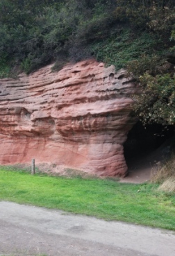
Court Cave submitted by johnur on 13th Nov 2018. West entrance to Court Cave in September 2018. Comparison with old photos on Canmore will show that the ground level outside the cave is now several feet higher than it was 100 years ago. The top of the old wall in the Canmore photos is now just below the present ground level. This is due to pit waste from Michael Colliery accumulating on the foreshore to establish a ground level which became permanent when rock armour was installed in the late 20th century to prevent coastal erosion.
(View photo, vote or add a comment)
Log Text: Court Cave, East Wemyss: This cave is signposted as 'Dangerous' and 'Keep Out' due to falling rocks from the roof, so despite reading about the symbols on Canmore, we didn't venture in.
Balbirnie
Trip No.110 Entry No.1 Date Added: 13th Nov 2018
Site Type: Stone Circle
Country: Scotland (Fife)
Visited: Yes on 1st Nov 2018. My rating: Condition 3 Ambience 4 Access 5

Balbirnie submitted by Nick on 5th Nov 2002. From the A92 running north from Glenrothes, turn east onto the un-numbered road for Star and Kennoway. 100m along this road is a sign for the Balbirnie housing development, turn in here and about 150m/200m along, where the road curves right, you will see the circle just below you. Park up in the housing development itself and walk back. The site itself dates from c3000 B.C., and used to be located 125m to the north west of where it stands at present. It was always known locally as the "Druid...
(View photo, vote or add a comment)
Log Text: Balbirnie Stone Circle: It was a good job we had the SatNav and the GPS, which took us almost to the spot. As this was right next to a modern housing estate, we found layby to park in about 100m metres away in Tofthill and walked back to the stone circle, which has a footpath running to its eastern side. Nicely preserved stone circle with cists with an information board and a recreated rock art panel.
We took a few minutes to spot the rock art panel, but realised it had fallen over slightly, so wasn't very visible. I did my best to photograph it in situ.
Balfarg Henge
Trip No.110 Entry No.2 Date Added: 12th Nov 2018
Site Type: Henge
Country: Scotland (Fife)
Visited: Yes on 1st Nov 2018. My rating: Condition 3 Ambience 4 Access 5
Balfarg Henge submitted by cosmic on 4th Dec 2003. Balfarg is a henge which was excavated when a housing estate was built round it in the 1970's. There are only two standing stones but post holes found inside the henge have been marked with a set of wooden posts.
Surprisingly only one part of the henge ditch seems to have been subject to vandalism (by bikes?)
(View photo, vote or add a comment)
Log Text: Balfarg Henge: From Balbirnie stone circle, to reach this recreated henge, we needed to turn right across the busy A92, then almost immediately left down the B969 Western Avenue. The SatNav then took us directly to the henge. Right in the middle of a housing estate, on a circular street appropriately called ‘The Henge’.
Typically for me, just as we stopped the car and I jumped out with my camera, a large delivery van decided to draw up and park in one of the parking spots right next to the outer boundary of henge, so I tried to avoid photographing him!
Pitcorthie.
Trip No.111 Entry No.3 Date Added: 14th Nov 2018
Site Type: Standing Stone (Menhir)
Country: Scotland (Fife)
Visited: Yes on 2nd Nov 2018. My rating: Condition 3 Ambience 2 Access 4
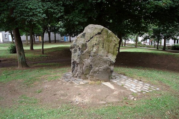
Pitcorthie. submitted by Nick on 3rd Nov 2003. NT113863
Also known as Easter Pitcorthie, Pitcorthie standing stone resides in the middle of a Dunfermline housing estate. It stands approx 1.5m in height and has an unsculptred and jagged appearance. Although it is a pretty cool stone the presence of 100 living and bedroom windows does not induce a lengthy stay . NMRS state that the stone appears to have been subjected to fire or heat. It has been subjected to graffiti.
This unsculptured standing stone, on the crest of slightly rising gro...
(View photo, vote or add a comment)
Log Text: Pitcorthie Standing Stone, Dunfermline: Our last site visit of our short holiday, and I wish we'd picked a better spot to end on. After the Balfarg Henge, I shouldn't have been surprised that this stone is surprisingly right in the middle of a housing estate, on Standing Stone Walk.
It is a poor, sadly neglected stone; it could just have been a garden feature, especially as it is set in a rectangular pavement of black stones. Like a previous visitor to the stone, being surrounded by rows and rows of houses, we very much felt watched as I was taking photographs and looking around.
