Contributory members are able to log private notes and comments about each site
Sites Anne T has logged. View this log as a table or view the most recent logs from everyone
Bampton Grange Cross
Trip No.180 Entry No.2 Date Added: 10th Jul 2022
Site Type: Ancient Cross
Country: England (Cumbria)
Visited: Yes on 9th Jul 2022. My rating: Condition 3 Ambience 4 Access 4

Bampton Grange Cross submitted by Anne T on 10th Jul 2022. The cross / boundary marker has some amazing views across the fells.
(View photo, vote or add a comment)
Log Text: Bampton Grange Cross: A glorious day. We'd previously seen this cross in August 2020, when lockdown restrictions had been briefly lifted for a short time, but I didn't post any photographs. That day had been grey and the cemetery busy with people strimming grass around family graves. Today was glorious, and we had the cemetery to ourselves (living people, that is).
This cross has had a hard life, but has spectacular views over the fells.
We finished this visit with a trip to the Bampton Village Store which served teas, toasties and cream teas, and were made very welcome. NY 51505 18200, with a parking area to the side of the store.
Plague Stone (Penrith)
Trip No.180 Entry No.1 Date Added: 10th Jul 2022
Site Type: Ancient Cross
Country: England (Cumbria)
Visited: Yes on 9th Jul 2022. My rating: Condition 3 Ambience 3 Access 4
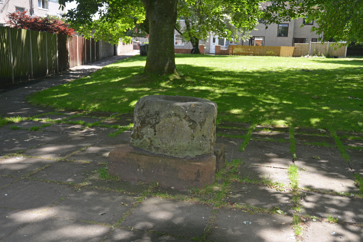
Plague Stone (Penrith) submitted by Anne T on 10th Jul 2022. The cross base/plague stone is sadly being used as a rubbish bin by all the passing walkers.
(View photo, vote or add a comment)
Log Text: Plague Stone/Cross Base, Penrith: We've driven by this site many a time without realising this stone was here. A bit difficult to find somewhere to park, as the stone is near the hospital, community college and fire station, but there is a modern housing estate, so disk parking is available along Tynefield Drive.
The stone was easily found, once we picked it out from amongst the shadows of the surrounding trees.
I wasn't aware of The Great Plague of Cumbria until I researched more about this stone. Definitely a re-purposed cross base. Shame it's being used as a rubbish bin by people who pass by.
St Mary's Well (Heversham)
Trip No.179 Entry No.4 Date Added: 22nd Jun 2022
Site Type: Holy Well or Sacred Spring
Country: England (Cumbria)
Visited: Yes on 21st Jun 2022. My rating: Condition 3 Ambience 3 Access 4
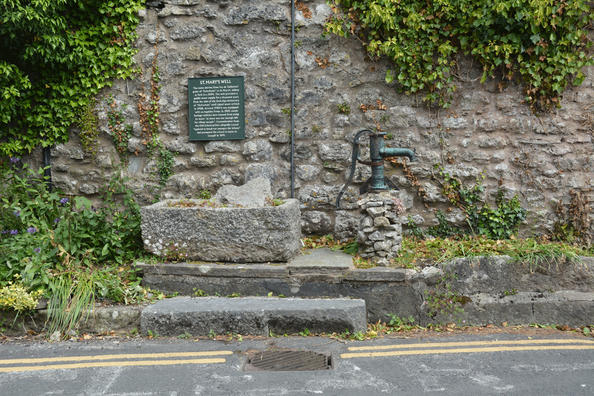
St Mary's Well (Heversham) submitted by Anne T on 22nd Jun 2022. Standing across the road from the well, looking at the pump and well trough (both now appear to be dry).
(View photo, vote or add a comment)
Log Text: St Mary's Well, Heversham: Spotted the blue 'W' on the HE map search when looking up information for St Peter's Church, so decided to have a look. Actually found the well purely by chance, when we drove past looking for a parking spot, then doubled back and parked near the lych gate, walking back to the well after we'd photographed the Anglo-Saxon stone fragments.
Having escaped the noise of building work (and radios) at home, we arrived to find the builders in the house opposite the well blasting out very loud rap music. Not a great visit as a result, as we couldn't hear ourselves think, but good to have added another well to the list I've seen.
St Peter's Church (Heversham)
Trip No.178 Entry No.3 Date Added: 22nd Jun 2022
Site Type: Ancient Cross
Country: England (Cumbria)
Visited: Yes on 21st Jun 2022. My rating: Condition 3 Ambience 3 Access 4
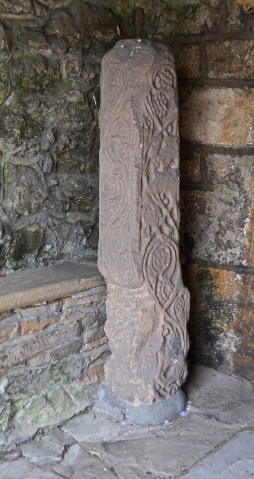
St Peter's Church (Heversham) submitted by Anne T on 22nd Jun 2022. Heversham 01, located in the south porch, near the south door. Dating to the late eighth century. The church guide says that the war memorial in the churchyard is probably a replica of what this cross would originally have looked like.
(View photo, vote or add a comment)
Log Text: St Peter's Church, Heversham: A lovely little village, but so very full of builders with loud radios, which there was no avoiding.
Inside the church was quiet, but a number of other visitors who came and went. We looked at the cross shaft (and the very old south door) in the south porch, and easily found the small fragment in the external wall to the east of the porch, in the south wall.
The church itself was simple and unremarkable, apart from an old wooden pew which was carved with the date 1626, and a huge chest at the east end of the north aisle, which dates from1400.
Anchorite Well (Kendal)
Trip No.178 Entry No.2 Date Added: 22nd Jun 2022
Site Type: Holy Well or Sacred Spring
Country: England (Cumbria)
Visited: Yes on 21st Jun 2022. My rating: Condition 4 Ambience 3 Access 4
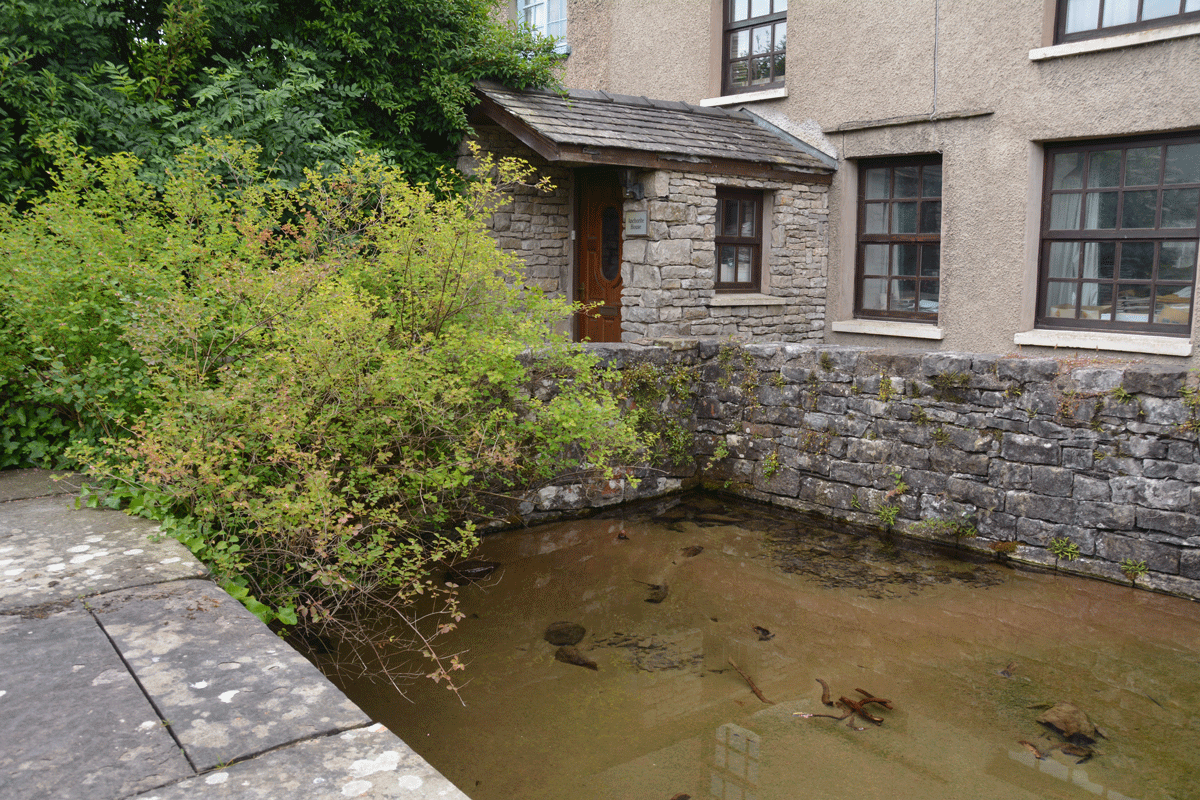
Anchorite Well (Kendal) submitted by Anne T on 22nd Jun 2022. Looking southwards towards Anchorite Cottage. Whilst the cottage looks relatively modern, the style of the windows indicate this structure is older than it looks (but not as old as the original hermitage!).
(View photo, vote or add a comment)
Log Text: Anchorite Well, Kendal: a short-ish walk from Trinity Church (Kendal Parish Church), through a modern housing estate. The roads have some interesting names: Buttery Well Road (couldn't find the well, though), Mint Cake Cottages and Kirkbarrow.
The well was easily spotted as there is a large green metal sign at the entrance to the site.
Beautifully clear water. Would have liked to have been able to walk all the way around the well pool, but the western side path was private access only to the cottages.
The Kendal Cross
Trip No.178 Entry No.1 Date Added: 21st Jun 2022
Site Type: Ancient Cross
Country: England (Cumbria)
Visited: Yes on 21st Jun 2022. My rating: Condition 3 Ambience 3 Access 4
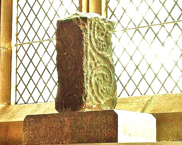
The Kendal Cross submitted by Sunny100 on 30th May 2010. The Kendal Cross, Cumbria, at SD.517922.
(View photo, vote or add a comment)
Log Text: The Kendal Cross: located on a window sill in the Lady Chapel (east end of south aisle) in the Parish Church of Kendal, Holy Trinity.
The fragment was sited in strong sunlight at the time of our visit, so difficult to photograph.
Such a huge church, apparently the widest in Cumbria, and also the oldest in Kendal, with the site older than the building, as 'evidenced by the 8th/9th century cross shaft'.
A replica of the cross sits outside the western end of the church, on the green between the western entrance gates and the church.
Ladye Well (Terregles)
Trip No.177 Entry No.2 Date Added: 8th Jun 2022
Site Type: Holy Well or Sacred Spring
Country: Scotland (Dumfries and Galloway)
Visited: Couldn't find on 6th Jun 2022. My rating: Condition 1
Log Text: Ladye Well, Terregles: Armed with the OS map and a description from “Saints in Scottish Place-Names”, we went back (after many, many years) to Terregles. This well is on private ground, so I found myself chatting to a lady who was gardening just opposite the village hall about how we might be able to ask for access.
She was very cagey about giving us any information at all, telling us in order to see it, we’d have to walk half-way down someone’s driveway. I did explain the purpose of our visit – my ‘holy well’ project, and that we used to live in the area - which didn’t seem to convince her.
I did try and knock on the door of the house at the very end of the village, at NX 92749 77497, but no-one was at home, apart from the dogs. Just to the west of this house there was an access road into a building plot, and with no-one around to ask, we ventured down this track to the back of the "garden". All was derelict ground with weeds galore.
Finding nothing, we made our way back to the road, and I was going to walk down to Ladywell House, which was some distance down a long driveway, with the house not visible, only for a second lady who drove out of Ladywell House and parked up just down the road, to speak to the Gardening Lady (presumably waiting for us to walk up). I went up to them and told the Gardening Lady we couldn’t find the well, found myself telling them we used to live around here years ago, and my kids went to Shawhead School (only 4 miles away). The New Lady said “there’s nothing to see – it’s all weeds. Even the site of the old chapel is just a lump at the end of the field, covered in weeds. Nothing to see at all”. So that was us told!
We felt really unwelcome, which was very sad.
We went onto see a named well (not a holy well or sacred spring) at Kingholm, and our reception was completely different. Two of the residents were enormously helpful, even giving us a guided walk of the field with possible locations of the well and associated spring.
Brow Well (Ruthwell)
Trip No.177 Entry No.1 Date Added: 6th Jun 2022
Site Type: Holy Well or Sacred Spring
Country: Scotland (Dumfries and Galloway)
Visited: Yes on 6th Jun 2022. My rating: Condition 3 Ambience 3 Access 5

Brow Well (Ruthwell) submitted by Anne T on 6th Jun 2022. Getting a bit closer to the well pool.
(View photo, vote or add a comment)
Log Text: Brow Well (Ruthwell): Having escaped the noisy builders across the road, we decided on the spur of the moment to visit the Brow Well, as it’s only about half an hour’s drive away. We bombed off up the M6, turned off onto the A75 at Gretna, turned off down a side road which turned left at NY 13732 69544 (note: HUGE mistake – too many large, enormous pot holes – continue on down to the B725!), only to find the cottage next to the well was blasting out music at huge volume. Boo hoo.
In addition, the area around the well had been turned into a building site, meaning the entrance to the small parking area was blocked off, so we pulled into a gateway a few metres from the well.
The well was almost dry, very muddy, and not very nice to visit at all. So disappointed after all the photographs I’ve seen on the internet. We found out from the couple we were speaking to at Kingholm (Lady’s Well) that the bridge by the well had recently collapsed and had just been replaced.
The information board tells us:
“Healing powers of water.
Brow Well is a chalybeate spring with natural iron-salt rich water believed to cure a multitude of ills and was popular with the residents of Dumfries at the time of Burns. From early times spring water was believed to have healing qualities and many locations in Scotland were renowned for their holy or healing wells. In the 17th century spas with mineral rich waters became fashionable locations to visit in the pursuit of health and beauty. Later sea-bathing emerged as part of a growing activity and built on popular traditions that saw seawater as having healing powers.”
That Robbie burns bathed in the well in 1796 but died 3 days later isn't a hugely great advert for the healing properties of this chalybeate well!
Finglandrigg Spa Well (Chalybeate)
Trip No.176 Entry No.2 Date Added: 6th Jun 2022
Site Type: Holy Well or Sacred Spring
Country: England (Cumbria)
Visited: Yes on 4th Jun 2022. My rating: Condition 2 Ambience 3 Access 3
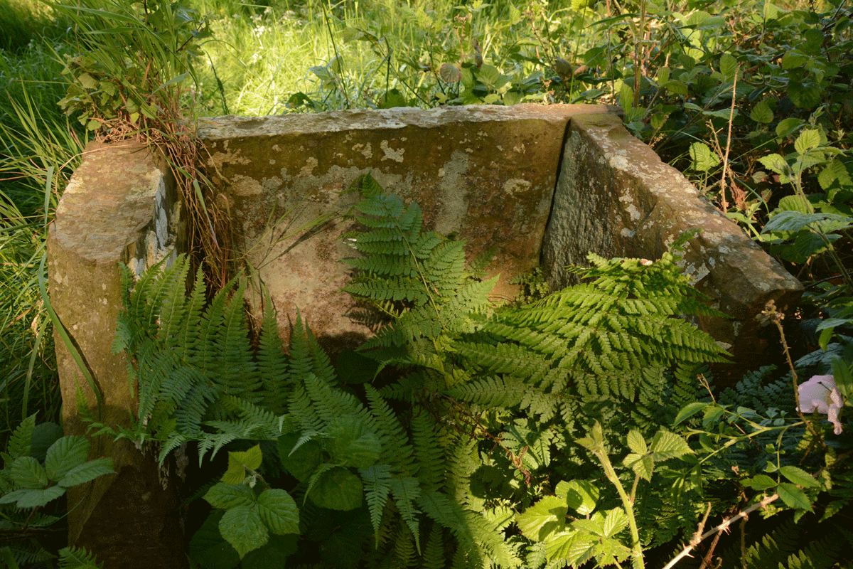
Finglandrigg Spa Well (Chalybeate) submitted by Anne T on 5th Jun 2022. There's nothing left of the information board shown on old photographs of this well. See Heritage and History for photographs taken in 2009.
(View photo, vote or add a comment)
Log Text: Finglandrigg Spa Well: A very pleasant walk through this nature reserve, although the well is not where the published map says it is. In the end, we walked round and round, then tried to find a spot with a phone signal so we could find a rough grid reference, which we acquired from the Old Cumbria Gazetteer. Some 50m from the published path, down a grassy 'lane'. Ruined, but ticked this one off the list. Am trying to trace what properties this water had, and added the nearby Toddel Well to my list of places to visit in the near future.
Hyssop Holme Well (Carlisle)
Trip No.176 Entry No.1 Date Added: 6th Jun 2022
Site Type: Holy Well or Sacred Spring
Country: England (Cumbria)
Visited: Yes on 4th Jun 2022. My rating: Condition 4 Ambience 3 Access 4
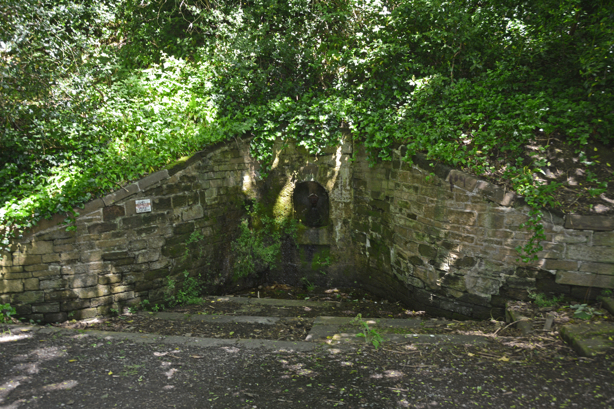
Hyssop Holme Well (Carlisle) submitted by Anne T on 5th Jun 2022. The well was in deep shade at the time of our visit. A slow, steady trickle of water emerged from the pipe at the back of the well, trickling down the moss into the small well basin, then out to modern drains to a small pond/water feature.
(View photo, vote or add a comment)
Log Text: Hyssop Holme Well (Carlisle): A very pleasant, short walk down slope to this well house, the sound of wood on willow from the nearby Cricket Ground accompanying our steps. Am trying to trace the Antiquarian history books which mention this site, as I'm trying to ascertain if the well predates the 1817 date on the keystone, and why the water was regarded as a spa in days gone by, and what properties the water had.
Hallrigg Standing Stone
Trip No.175 Entry No.1 Date Added: 28th May 2022
Site Type: Standing Stone (Menhir)
Country: England (Cumbria)
Visited: Saw from a distance on 28th May 2022. My rating: Condition 3 Ambience 3 Access 1
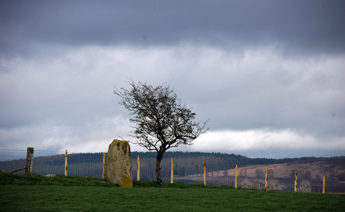
Hallrigg Standing Stone submitted by nicoladidsbury on 9th Apr 2007. Hallrigg Standing Stone - rediscovered standing stone, 2 miles north of Lowhouse Standing Stone, 5 miles north of Penrith. It appears to be red sandstone, approx 1.5m tall
(View photo, vote or add a comment)
Log Text: Hallrigg Standing Stone, Plumpton: The nearest we could get was the very back (staff only area) of the Pot Place Car Park, and we asked permission to take this photograph from the member of staff working in this area.
We did try numerous other ways to get closer to the standing stone, but couldn't even find a track and/or gate to walk across the fields, or who to ask permission off.
Photo taken with a tripod and 50-300mm zoom lens at maximum zoom, but even this didn't give an excellent photo, given the haze in the atmosphere.
Dumfries Museum
Trip No.174 Entry No.1 Date Added: 25th May 2022
Site Type: Museum
Country: Scotland (Dumfries and Galloway)
Visited: Yes on 25th May 2022. My rating: Condition 4 Ambience 4 Access 4
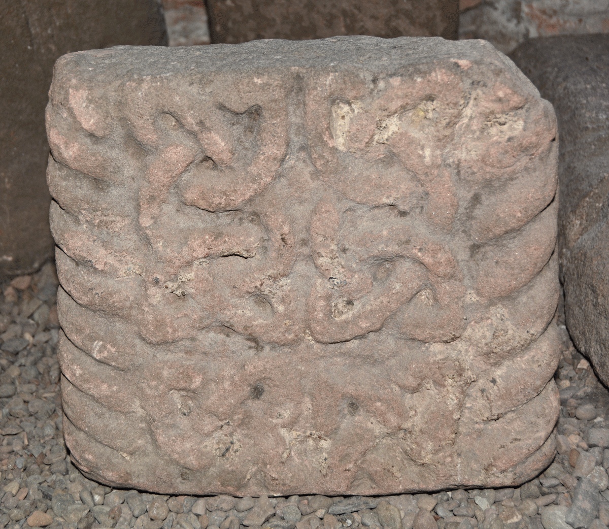
Dumfries Museum submitted by Anne T on 8th Jun 2022. This is Museum Accession number DUMFM:1960.11.7, recorded on the Future Museum website as Cross Shaft, Kirkconnell. Dated to the 11th century, its dimensions are: height 280mm, width 310mm, depth 110mm. It also has a generic record in Canmore - see Site ID 319221 St Connel's Church.
Points, in his 2016, Dumfriesshire Gazetteer, Pages 173-174, tells us: "Both the front face and the left-hand side are decorated with a band of cable-pattern moulding which wraps itself around both the right-h...
(View photo, vote or add a comment)
Log Text: Dumfries Museum: We parked on Whitesands, and walked over the Nith by the Old Bridge, to the NW, then turned left to the Robbie Burns House, then up the hill to the Museum and Camera Obscura.
We lived in Dumfries and Lockerbie between 1992 and 2002, but for some reason had never visited the museum, despite going to many other historic sites, and what an oversight!
Armed with Guy Points' book "A Gazetteer of Anglo Saxon, Anglo Scandinavian & Anglo Norse sites in Cumbria, Dumfriesshire and Wigtownshire, we had a wonderful afternoon in the basement of the tower. Treasures indeed, much appreciated after the dearth of things of visit during the two years of lockdown.
Staff at the museum were incredibly helpful. I've been given the details of someone at the Council (press officer for the museum?) to apply for permission to upload some photographs, and hopefully she'll get back to me shortly.
Askham Fell Cairn Stone Row
Trip No.173 Entry No.4 Date Added: 16th May 2022
Site Type: Stone Row / Alignment
Country: England (Cumbria)
Visited: Yes on 14th May 2022. My rating: Condition 3 Ambience 4 Access 4
Askham Fell Cairn Stone Row submitted by SandyG on 7th Jan 2018. The two western stones and nearby kerbed cairn. View from south (Scale 1m).
(View photo, vote or add a comment)
Log Text: Askham Fell Cairn and stone row: Using M. Waistell Taylor's Antiquarian paper from 1885, plus Sandy Gerrard's notes from the Stone Rows of Great Britain, we parked at the end of a row of cars at the junction of the single track road and the footpath which runs across it, near the Cop Stone. We set off with our trusty GPS to walk up to this amazing cairn to find the associated stone row.
We've visited this area before (28th June 2014), but more recently, Sandy G has been along to this area and surveyed the 2 verified stone rows in this area. We were unable to join him on this survey, but we're curious to find out more.
Thankfully we had Sandy G's diagram of the 4 small stones in this row (I thought they were just part of the kerb). Andrew very gracefully modelled the location of the smaller 2 stones using my walking poles.
Given the number of walkers around, I was amazed how many people were sticking to the paths and bridleways, rather than look at the archaeology. So much to see in such a concentrated area.
Cop Stone
Trip No.173 Entry No.3 Date Added: 17th May 2022
Site Type: Standing Stone (Menhir)
Country: England (Cumbria)
Visited: Yes on 14th May 2022. My rating: Condition 3 Ambience 4 Access 4
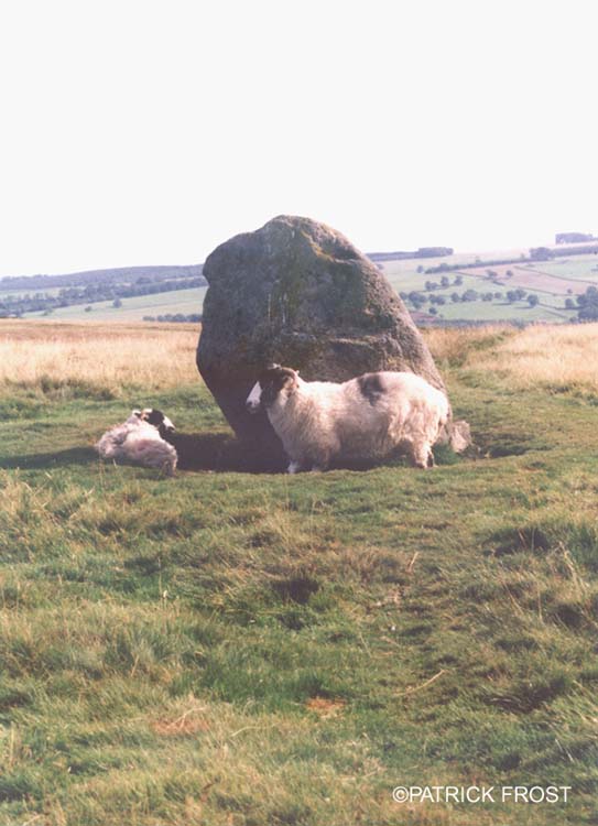
Cop Stone submitted by Patrick Frost on 14th Oct 2002. The Cop Stone in Cumbria at GR: 496216
(View photo, vote or add a comment)
Log Text: The Cop Stone, Askham Fell: Our second visit to this area, which has a wealth of archaeological sites, and reminds me very much of Dartmoor (in places). The weather was gloriously hot, and with many other walkers on the moor, we joined the row of cars parked by the side of the road at around NY 49586 21586.
Nothing much has changed about the Cop Stone since our last visit in 2014, although I was amazed at the number of people who just walked straight on by, without stopping. I had forgotten that the Cop Stone lies on the South Eastern border of a ring cairn, which has been described and illustrated by W. Waistell Taylor in his 1885 Antiquarian paper "Prehistoric Remains on Moordivock". Most of the stones in the ring are largely hidden, or just peeping above, the turf.
Bloch Well (Langholm)
Trip No.172 Entry No.1 Date Added: 31st Aug 2021
Site Type: Holy Well or Sacred Spring
Country: Scotland (Dumfries and Galloway)
Visited: Yes on 26th Aug 2021. My rating: Condition 2 Ambience 3 Access 4
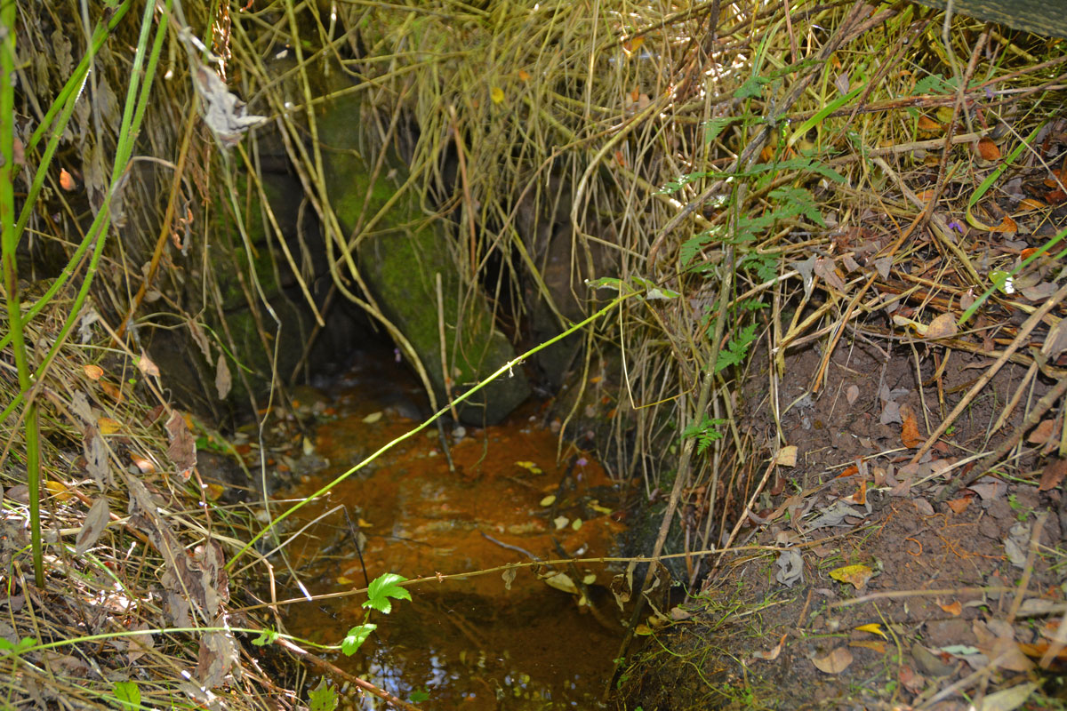
Bloch Well (Langholm) submitted by Anne T on 31st Aug 2021. Not much left of the structure of Bloch Well, but it gives a plentiful supply of water, which seems to piped under the road, running directly south along the eastern side of a small plantation.
(View photo, vote or add a comment)
Log Text: Bloch Well (Langholm): Described as a "dubious holy well" by J.R. Walker in 1883, now completely ruined. Not been able to find out anything much about this well, apart from its' brief Canmore entry, and a mention that the well is sulphurous, although there was no smell of sulphur at the time of our visit.
Crag Well (Bellingham)
Trip No.171 Entry No.3 Date Added: 30th Aug 2021
Site Type: Holy Well or Sacred Spring
Country: England (Northumberland)
Visited: Yes on 15th Aug 2021. My rating: Condition 3 Ambience 4 Access 4
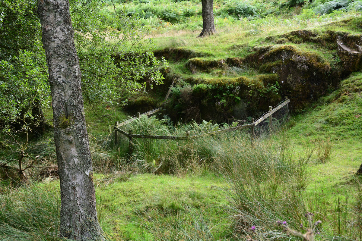
Crag Well (Bellingham) submitted by Anne T on 30th Aug 2021. The well from just to the north of it, avoiding stepping down into the now boggy well pond area.
(View photo, vote or add a comment)
Log Text: Crag Well, Bellingham: Not been able to find out anything much about this well, apart from reading a blog which since seems to have disappeared. Is there a tradition of church services being held next to this well, as the blog said? Will keep researching, but a very pretty spot, well worth visiting.
Hetherington (Wark)
Trip No.171 Entry No.2 Date Added: 30th Aug 2021
Site Type: Ancient Village or Settlement
Country: England (Northumberland)
Visited: Yes on 15th Aug 2021. My rating: Condition 3 Ambience 4 Access 4
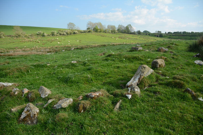
Hetherington (Wark) submitted by Anne T on 27th May 2017. The north western corner of the farmstead, which is sited on a gentle eastern slope.
(View photo, vote or add a comment)
Log Text: Hetherington (Wark): Our second visit to this site, the first being on 25th May 2017, but I forgotten all about it! A lovely site, and pleasant to explore on a sunny afternoon. Didn't realise that this site has been excavated twice, once in 1957, and again in 1972-73, so must try and find the excavation reports, if they are available.
Holy Well (Stonehaugh)
Trip No.171 Entry No.1 Date Added: 31st Aug 2021
Site Type: Holy Well or Sacred Spring
Country: England (Northumberland)
Visited: Couldn't find on 15th Aug 2021
Log Text: Holy Well (Stonehaugh): We last tried to find this well on 30th June 2014, but failed, despite being directed by a local farmer and his dog, Meg. On this occasion, the steep path down the gorge was very slippery, with wet, knee high grass along the path, and quite dangerous, so we gave up, determined either to come back after a dry period, or to try a different path from the village of Stonehaugh towards the Black Pool.
All Saints (Bradbourne)
Trip No.170 Entry No.7 Date Added: 12th Aug 2021
Site Type: Ancient Cross
Country: England (Derbyshire)
Visited: Yes on 16th Jul 2021. My rating: Condition 3 Ambience 4 Access 4
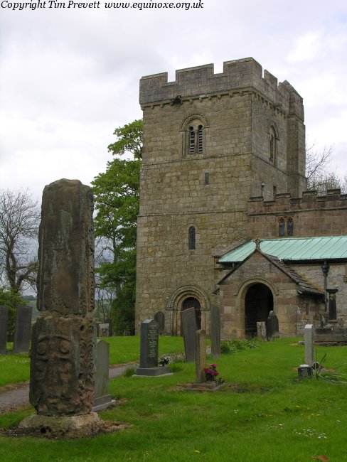
All Saints (Bradbourne) submitted by TimPrevett on 13th May 2007. The remains of the Anglo Saxon cross shaft at Bradbourne, which until quite recently formed parts of a stile... nice, but has not faired as well as that at Eyam.
(View photo, vote or add a comment)
Log Text: All Saints, Bradbourne: Our last visit of this holiday. We had a very 'interesting' journey to Bradbourne, as the police had closed off the main road and routed all traffic down some very minor, single track roads, in which traffic was trying to move in both directions, and not succeeding, which was very frustrating.
There is a large parking area outside the church, although the actual entrance to the churchyard was a bit tricky to find, as there were a number of entrances to different driveways, and we ended up walking down one of these by accident.
The first cross is just inside the churchyard, to your right as you enter from the south. The sundial is just a little further to the north-north-east.
We missed the second cross within the churchyard, as we didn't have access to the HE website at the time of our visit, and whilst looking around, thought it was just another grave marker, so I didn't photograph it.
Loved the carving on the door into the south side of the tower.
Whilst there, a couple of other visitors were very keen for us to see the grave of actor Alan Bates ("Who?" I asked, to much disgust on their part), so we did wander round to find it, out of curiosity.
Hands Well
Trip No.170 Entry No.6 Date Added: 12th Aug 2021
Site Type: Holy Well or Sacred Spring
Country: England (Derbyshire)
Visited: Yes on 16th Jul 2021. My rating: Condition 3 Ambience 3 Access 5
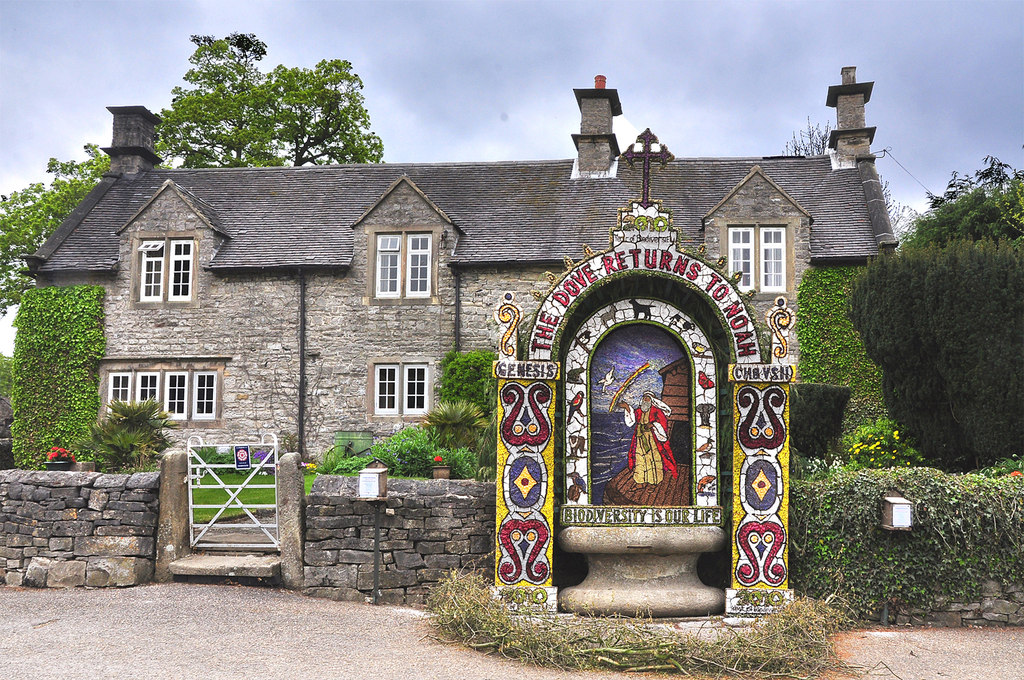
Hands Well submitted by Creative Commons on 6th May 2013. Hands Well dressing and cottage - Tissington 2010
Copyright Mick Lobb and licensed for reuse under the Creative Commons Licence.
(View photo, vote or add a comment)
Log Text: Hands Well, Tissington: The sixth, and final, well marked on the Tissington village leaflet map, and looked like a large, stone cotton-reel. As we approached it, some people were dipping their hands into the water. There was no flow of water into the basin, although the water appeared fresh and clear.
