Contributory members are able to log private notes and comments about each site
Sites Anne T has logged. View this log as a table or view the most recent logs from everyone
Glyn Gath Barrow
Date Added: 28th Aug 2014
Site Type: Round Barrow(s)
Country: Wales (Pembrokeshire)
Visited: Yes on 21st Aug 2014. My rating: Condition 2 Ambience 4 Access 5
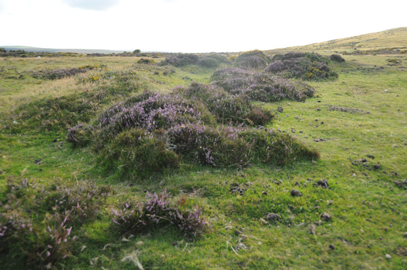
Glyn Gath Barrow submitted by Anne T on 27th Aug 2014. Standing on the bank at the edge of Glyn Gath ring cairn looking northwest.
(View photo, vote or add a comment)
Log Text: Glyn Garth Ring Cairn, Pembrokeshire: After visiting a series of standing stones on the northern side of the Afon Gwaun river, we headed eastwards back towards the hotel at Gellifawr. We passed directly by the Glyn Garth ring cairn, so stopped to take a look.
Even with a detailed map, without the marker stone, we wouldn’t have been able to easily identify this cairn, but walking into the heather and gorse we could make out the perimeter banks (easier to do this with the eye than demonstrate with the camera – I’ve yet to learn the technique to do this well).
It was an impressive location; With Myndd Dinas behind and Newport Bay to the north, this was a fantastic place to be buried.
On the drive southwards from Glyn Garth to Pontfaen, we were doing double-takes at most field entrances, as the gateposts all seemed (to our novice eyes) to be standing stones which had been perhaps been relocated and recycled.
Also of notes to future visitors, it is well worth popping into the Dyffryn Arms at Pontfaen. It is like walking back into time; the main bar is like small sitting room from the 1930s and the landlady serves ale from jugs from a serving hatch – brilliant!
Pentre Ifan
Date Added: 27th Aug 2014
Site Type: Portal Tomb
Country: Wales (Pembrokeshire)
Visited: Yes on 23rd Aug 2014. My rating: Condition 3 Ambience 5 Access 4

Pentre Ifan submitted by PaulM on 24th Aug 2001. PENTRE IFAN CHAMBERED LONG CAIRN WITH FORECOURT
NGR: SN09953702 (Landranger map 145/Outdoor Leisure North Pembrokeshire map (No 35))
Located 4km east of Newport on a public footpath. One of the most spectacular and famous monuments of its type it consists of a tilted capstone perched on three uprights. A blocking stone obstructs the doorway and a semi-circular forecourt is found at the southern end. Originally covered by a huge long mound - traces of possible kerbstones can still be fou...
(View photo, vote or add a comment)
Log Text: Pentre Ifan, Pembrokeshire: I was particularly excited to go to the site, as I’d seen many photographs and paintings of Pentre Ifan during our brief visit to Pembrokeshire, together with photographs on the Portal. I was unprepared for the sheer number of visitors who came to see this spectacular burial chamber. However, everyone seemed to respect others need to take photographs and kept out of each other’s way, which was nice. We also got into conversation with a Japanese lady about how they had raised the cap stone.
I was truly amazed at how the cap stone balances on the pointed tips of just three uprights. All around are larger stones which may have been part of the structure in the past.
The views over to Newport sands and the sea are wonderful. I would like to go back to the site at a quieter time and just sit and absorb it.
Trefael
Date Added: 27th Aug 2014
Site Type: Rock Art
Country: Wales (Pembrokeshire)
Visited: Saw from a distance on 23rd Aug 2014
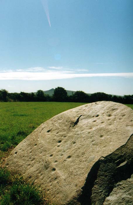
Trefael submitted by PaulM on 17th Aug 2002. This cup-marked stone stands in a field near Trefael at SN10294028. See main site entry for more details.
(View photo, vote or add a comment)
Log Text: Trafael Rock Art, Pembrokshire: We were looking forward to seeing this rare example of rock art in Wales, but despite driving up and down the B4582 road twice, we couldn’t find any of the marked footpaths. We could identify from the field pattern from our detailed map exactly where the stone was located. I suggested going to Bayvil church, further down the footpath, and walking back from there. On our second drive-past, we saw a very clear, official notice on the gate to the field saying ‘access to the capstone only with the permission of the landowner’. As we will have to research who the landowner is, we’ll need to save a visit to this rock art for another time.
However, we were well compensated by stumbling upon Nevern church with its stone crosses a few minutes later.
St Gwyndaf Stones
Date Added: 28th Aug 2014
Site Type: Early Christian Sculptured Stone
Country: Wales (Pembrokeshire)
Visited: Yes on 22nd Aug 2014. My rating: Condition 3 Ambience 4 Access 4

St Gwyndaf Stones submitted by vicky on 8th Jun 2004. One of the five 7th-9th century decorated stones in the exterior walls of Llanwnda Church. This one is decorated with a face beneath the cross of St Andrew.
(View photo, vote or add a comment)
Log Text: St Gwyndaf’s Church, Llanwnda with stone crosses: Husband, Andrew, and I were both intrigued by Vicky’s description of the St. Gwyndaf Stones on the Portal, so after a busy day exploring the St David’s area, we decided to stop off in Fishguard for dinner, taking a detour to Llanwnda on the way.
Despite having a detailed map, we got lost twice, taking the wrong lane and ending up back on the main road, then taking the left hand turn inside of the right where the road splits within Llanwnda village, and ending up at someone’s house and having to reverse down a particularly narrow, windy single track lane, being watched by a curious local lady who came out to watch.
After that, we found the church easily enough. There were even a few parking spaces just by the path leading down to the church. A very pretty spot, although feeling incredibly remote, overlooking the sea.
The whole of this site has a huge sense of age and heritage. The inside of the church is simple, but impressive. There was no church guide available to look at, but there was a copy of the ‘Saints and Stones’ book telling us something about the church. Page 7 of this books tells us: “on the window-sill near the font is a fragment of a medieval stone showing a bishop administering a blessing and holding a staff; it may have been part of an ancient churchyard and cross. Another stone fragment of the same date can be seen on the first window-sill in the south wall. In the chancel is a case containing a copy of the Welsh ‘Parry’ Bible (1620) [although this is well-used and falling apart – impressive non-the-less] .... No fewer than six 7th-9th century Christian marked stones were also discovered in 1881; five of them are set into the exterior walls of the church. Once part of the larger structures, they were carved by stonemasons working under monastic patronage. The most fascinating of these is set into the east end of the south transept. It shows a rudely incised face surrounded by four parallel lines beneath the cross of St. Andrew; the face may be that of a female, a monk or Christ-as-Procrator. High in the south wall is a stone marked with a double-outline cross and another in the east wall of the chancel is decorated with a Latin cross. A fourth stone in the north wall displays a double Latin cross enclosed by a rounded outline, and low in the south wall to the west of the porch is a stone of later date (probably 10th century) with a moulded cross. The base of a decorated cross lies on the north-west side of the churchyard.”
We spotted the five stones set in the wall and the two on the window-sills, but failed to see the cross in the churchyard.
I’d recommend anyone in the area to take an hour to find this church and the stones – a true sense of history and occasion contained within this tiny building and surrounding church yard.
On the next visit, must ensure to take in the Garnwnda Burial Chamber and nearby standing stone.
Parc y Meirw
Date Added: 28th Aug 2014
Site Type: Stone Row / Alignment
Country: Wales (Pembrokeshire)
Visited: Yes on 21st Aug 2014. My rating: Condition 3 Ambience 4 Access 4

Parc y Meirw submitted by PaulM on 24th Aug 2001. PARC Y MEIRW STONE ROW, Pembrokeshire
NGR: around SM99893591 (Landranger map 157/Outdoor Leisure North Pembrokeshire map (No 35))
Four stones remain of this row - two of which make up gateposts - the other two are upright in the hedge that borders the road. The Outdoor Leisure North Pembrokeshire map marks only three but two further stones are located ~300m to the south east. Other stones can be seen or make up the roadside bank.
The gateposts look quite square unlike the other two s...
(View photo, vote or add a comment)
Log Text: Parc-y-meiry standing stones, Pembrokeshire: After having visited the Llanllawer Holy Well, we set off eastwards up the road towards Trellwyn farm, where there were two sets of standing stones marked on the southern side of the road.
Driving slowly up this single track lane, trying to look over the tall banks and fences rising above us on either side of the road to spot the stones, a tall standing stone by a field gate suddenly appeared, looming above us from the grass verge – impressive!
We stopped the car in the gate entrance and hopped out to take a look. Only the large stone There was nothing in the field, so we unlatched the field gate to take a closer look.
Unusually, I haven’t been able to find out much about these stones, apart from a short entry on the Royal Commission on the Ancient and Historical Monuments For Wales, where the stones are referenced as SAM PE126.
Trellwyn-fach Stone Pair
Date Added: 28th Aug 2014
Site Type: Standing Stones
Country: Wales (Pembrokeshire)
Visited: Yes on 21st Aug 2014. My rating: Condition 3 Ambience 3 Access 4
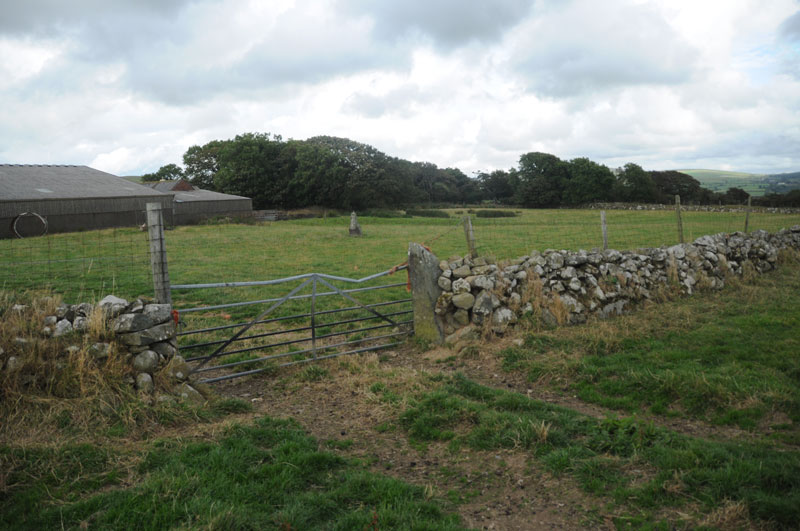
Trellwyn-fach Stone Pair submitted by Anne T on 28th Aug 2014. This photograph shows the two stones in context of their immediate landscape. The first stone is being used as the gatepost, the second is visible between the gatepost and the barns, more or less in the centre of the photograph.
(View photo, vote or add a comment)
Log Text: Trewynfach (Tre-llwyn Fawr) Stone Pair, Pembrokeshire: About 400 yards up the road from the Parc-y-meirw stones, just before reaching a house called Trellwyn, is an un-named farm to the south side of the road. On the map there are two standing stones marked, which stand very slightly to the west of the farm. Neither of the stones can be seen from the road. No-one appeared to be at the farm, and as the field gate was open, we walked along the field boundary for about 50 yards to see if we could spot them.
One of the stones has been used as a gatepost, in the field boundary between the farm and the first field to its west; the other is situated in the middle of the farmyard. Presumably the gatepost stone, which stands 1.4 metres high, has been relocated from its original site. The second stone is on private land, but looks taller than the stone being used as the gatepost.
I confess that after the Parc-y-Meirw stones and these, we looked at the gateposts of all the farms as we drove along, wondering if they were ‘recycled’ standing stones.
Trellwyn-fach
Date Added: 28th Aug 2014
Site Type: Standing Stone (Menhir)
Country: Wales (Pembrokeshire)
Visited: Yes on 21st Aug 2014. My rating: Condition 3 Ambience 4 Access 3
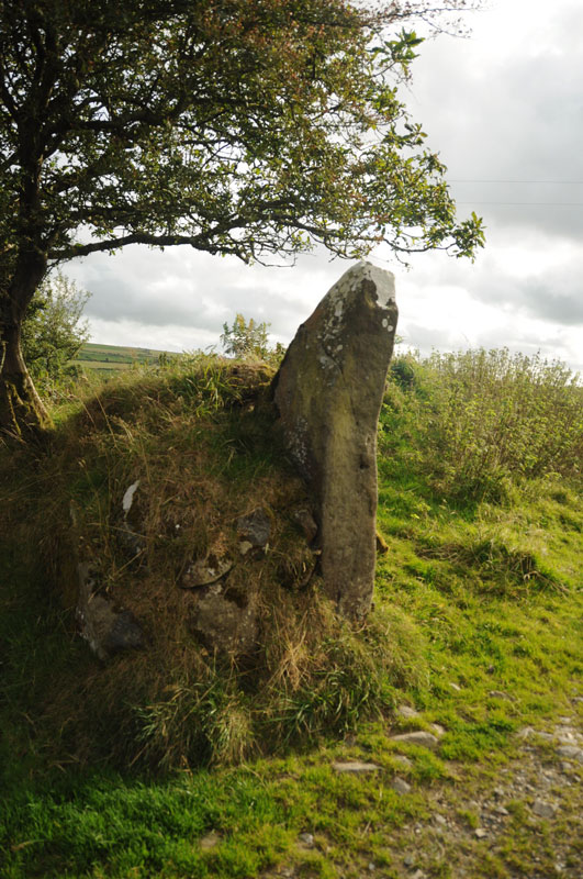
Trellwyn-fach submitted by Anne T on 28th Aug 2014. There were many larger stones buried in the banks defining the fields, and I wondered if this was another standing stone ....
(View photo, vote or add a comment)
Log Text: Trellwyn-Fach Standing Stone, Pembrokeshire: [We found more than one standing stone at this site, one of them not marked on the map, so I hope I haven't confused them – if I’ve got it wrong, please let me know so I can correct my entries (thank you!)].
From the Trewllyn-Fach Stone Pair, we walked along the footpath at the other side of the un-named farm (about 100 yards south west of the house called Trellwyn). This is essentially a farm-track and easy walking, past old farm properties which are being renovated. As the track turned a left hand corner just past the farm buildings, I spotted a standing stone in the middle of the field, but this wasn’t marked on the map, so intrigued, we continued onto Trellwyn-Fach.
The footpath went passed the standing stone towards the derelict Trellwyn-fach farmhouse, but there was a well-worn track across to the stone, so we crossed the bank forming the field boundary and followed the track to take a closer look at the stone. On the way, there was also another erratic stone in the field to the left hand side (I’ve not been able to get the grid reference as the images from UK Grid Finder are those of clouds, so I’m unable to make out the ground). The whole area is littered with large stones, possible cairns and what appear to be large erratic stones.
I wasn’t sure if the stone had broken and the broken piece been taken away, or if the rock had been deliberately quarried. This stone does indeed look like a pointing finger and there are good views over the Cwm Gwaun valley.
Tre-llwyn Fawr
Date Added: 28th Aug 2014
Site Type: Standing Stone (Menhir)
Country: Wales (Pembrokeshire)
Visited: Yes on 21st Aug 2014. My rating: Condition 3 Ambience 4 Access 4
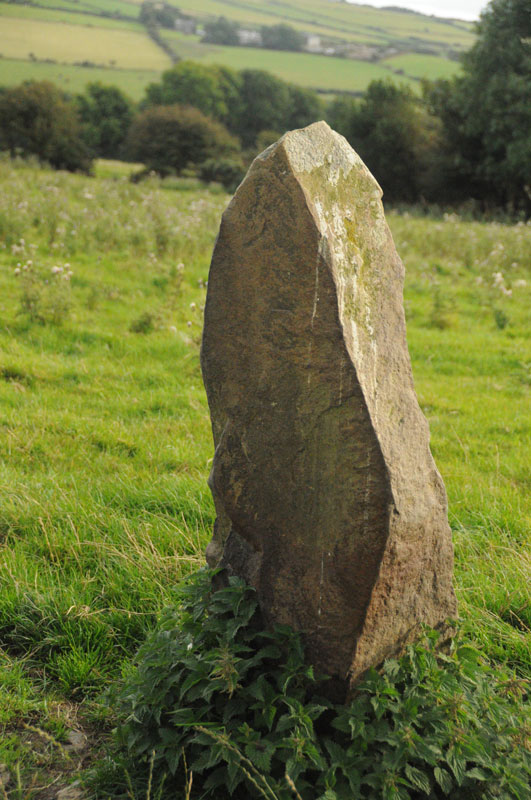
Tre-llwyn Fawr submitted by Anne T on 28th Aug 2014. Continuing the quick walk around the stone to look at it's other faces. There was a smaller stone buried in the grass to the west, but this hasn't been picked up the camera, as it lies too low to see clearly.
(View photo, vote or add a comment)
Log Text: Trellwyn-Fawr Standing Stone, Pembrokeshire: [We found more than one standing stone at this site, one of them not marked on the map, so I hope I am reporting them correctly – if I’ve confused them, please let me know so I can correct my entries (thank you!)].
On the way back to the road from the Trellwyn-Fach Standing Stone, we stopped off to look at this stone, which we'd first seen on the walk down. This stone stands alone in the middle of the field, with great views over the Cwm Gwaun valley below. It seems to fit the description on the Dyfed Archaeological Site, which describes this stone as 1.4 metres high by 1 metre wide at its base, leaning slightly to the north-north-west. Just to the west, there was another smaller stone poking through the grass.
The views to the north, east and west were blocked by hedges and trees, so it wasn’t really possible to appreciate the location this stone was set in.
Gors Fawr Stone Circle
Date Added: 28th Aug 2014
Site Type: Stone Circle
Country: Wales (Pembrokeshire)
Visited: Yes on 23rd Aug 2014. My rating: Condition 4 Ambience 5 Access 4
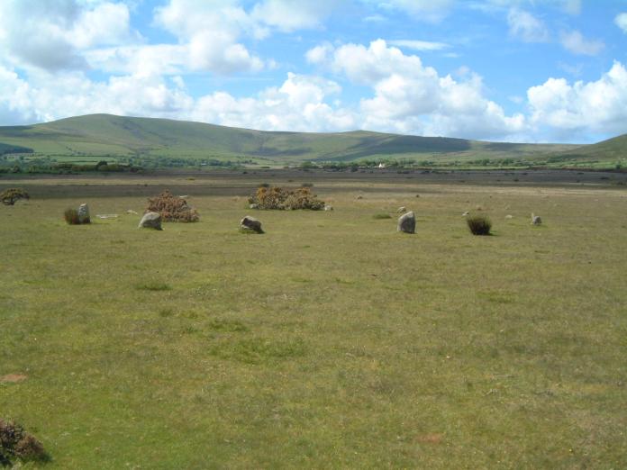
Gors Fawr Stone Circle submitted by enkidu41 on 3rd Jun 2004. A circle of 16 stones in an almost perfect 73’ diameter circle. This shot proves that it's not always wet in Wales.
(View photo, vote or add a comment)
Log Text: Gors Fawr Stone Circle, Pembrokeshire: After stopping off at St. Brynach’s church in Nevern to see the stone crosses, we started on our long journey home to Northumberland. We’d identified a number of ancient sites we wanted to see on our way back, including the Gors Fawr Stone Circle. My husband had hoped to see the site in the Presili Hills where they’d quarried the stones for Stonehenge, but time (and my horror of precipices and steep drops) wouldn’t allow – on our next trip, we’ll need to allow another month at least to see all the things we want to in the area!
Following the A478 and turning off towards Mynacholog-ddu at the village of Crymych, it was easy to find the little gem of Gors Fawr. Again, I hadn’t realised what a tourist attraction this was. There was a small lay-by across from the house ‘Pen-rhos’, and an easy walk across the field to the circle.
It was much smaller than I imagined from the photographs I’d seen on the Portal, but if I’m allowed to, I'd use the word ‘cute’ as the most accurate description that comes to mind. One of the first things I saw almost in the middle of the circle was a small Wiccan altar, made of small rounded blue pebbles, with its apex pointing towards the Gors Fawr Outliers.
Walking just outside the perimeter of the circle, we became aware of smaller stones buried in the grass at regular intervals about 3-4 metres outside the main circle, and wondered if there was an outer circle (but then there were so many other stones in the field that we let our imaginations run a little riot with ideas of stone avenues and tumuli). Since I've been home, I've read on the Ancient Wisdom of Wales web site that a survey had been done, and nothing found.
But what a place to build a circle – on a wide, flat plateau of moorland, with the Presili hills rising to the north. This stone circle seeming to lie in the centre of the graceful bowl formed by the hills, which rose up blue and misty in the distance. The circle somehow seemed to me to capture the essence and magnificence of the landscape.
There was a small, constant stream of other visitors. I got into conversation with a family who said they’d had trouble finding the circle, and had stopped by the Outliers and walked back. The man told us about the apparent alignments between the Outliers and the Circle at Solstice, so I’ll need to check this out. I didn't have the courage to ask him if he was another Portal user (but next time I won't be so shy!).
I would have loved to have stayed until sunset.
Gors Fawr Outliers
Date Added: 28th Aug 2014
Site Type: Standing Stones
Country: Wales (Pembrokeshire)
Visited: Yes on 23rd Aug 2014. My rating: Condition 3 Ambience 5 Access 4
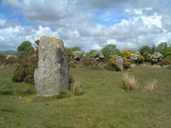
Gors Fawr Outliers submitted by enkidu41 on 3rd Jun 2004. These 6' and 5'7" stones lie 45' apart north-east of the circle. This shot proves that it's not always wet in Wales.
(View photo, vote or add a comment)
Log Text: Gors Fawr Outliers, Pembrokeshire: It was an easy walk of about 150 metres or so north-northeast across the moorland to the Gors Fawr Standing Stones/Outliers, which were visible from the stone circle.
Standing at the Outliers looking towards the circle, they do appear to be an entrance. We spotted other shaped stones lying in the grass, which looked like they may have formed part of a stone avenue at some point in the distant past.
One of the Outlier stones was shaped, as if it could be used to sit on. I understand from reading the Ancient Wisdom of Wales web site that this is called ‘the dreaming stone’ and has magnetic qualities.
With the Presili mountains in the background, I certainly had the sense of an ancient landscape with huge meaning for our ancestors, and wished I could tap into their thinking today.
I am interested in finding out about possible alignments between these Outliers, the circle and the Solstice – once I’ve processed all the photographs and notes I’ve taken from this trip!
Garn Turne
Date Added: 28th Aug 2014
Site Type: Chambered Tomb
Country: Wales (Pembrokeshire)
Visited: Saw from a distance on 23rd Aug 2014. My rating: Access 1
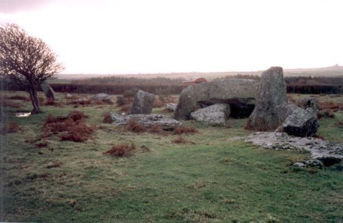
Garn Turne submitted by steveco on 24th Feb 2002. Garn Turn Burial Chamber SM979272.
(View photo, vote or add a comment)
Log Text: Burial chamber at Garn Turne Rocks, Pembrokeshire: (couldn't find anywhere to access this site): The final sites we wanted to see before hitting the motorway home to Northumberland were the burial chambers at Garn Turne. Having successfully located the field and the footpath nearest to the largest burial chamber, we parked in an extended passing place near the footpath. We met a couple of local ladies with their families picking blackberries in the hedgerows and chatted briefly, telling them where we were going; they didn’t seem to think there would be a problem with access.
Walking to 50 metres or so up the footpath to a gate in the field, we could see no access into the Garn Turne Enclosure. My husband hopped across the gate whilst I took photographs of the very curious cows in the adjacent field who’d come to see what we were up to!
From this footpath, the chamber appeared to be inaccessible – there seemed to be no gates whatsoever. When we looked at the Portal later in the day, there were lots of other photographs of this site, and we are left wondering how they accessed it. Other web sites mention squeezing through hedges, and I don’t like to do this without permission from the farmer. I had to be content with a photograph from a distance.
By way of compensation, we went to see Ogham and Latin inscribed stone at St. Dogwell’s Church (just marked as ‘Stone’ on the map, next to Sealyham Bridge).
However, there was a second chamber on the map, at approximate grid reference SM 98269 26566 (the UK Grid Finder’s images are shrouded in cloud, so can’t get a precise fix). We found the very overgrown footpath that took us closest to the chamber, only to be met by a very aggressive combine harvester driver, who forced us to reverse at least a quarter of a mile, pull over for him, then block our way. At this point we gave up and decided to head for home, only to catch up with said combine harvester and had to follow him at about 15 miles an hour for the next four or five miles (he refused to let us by at any available passing place).
Nevern Churchyard
Date Added: 29th Aug 2014
Site Type: Standing Stone (Menhir)
Country: Wales (Pembrokeshire)
Visited: Yes on 23rd Aug 2014. My rating: Condition 3 Ambience 4 Access 5

Nevern Churchyard submitted by PaulM on 19th Aug 2002. This standing stone inscribed with ogham can be found in Nevern churchyard close to the famous cross. Two other interesting stones, also descorated with ogham have been used as window sills inside the church.
(View photo, vote or add a comment)
Log Text: Nevern Churchyard, Pembrokeshire: After having felt ‘thwarted’ by the farmer’s notice to seek permission before accessing the Trafael Rock Art capstone (but with no details of who to contact) we cut our losses and drove back towards Newport to have a cup of tea and a piece of cake. We came across the pretty little village of Nevern. There was a crowd of people gathered around the bench and a large mounting block opposite the village hall river, so stopped to look. What a treat. A stream ran by the western end of the church, with a narrow well laid footpath above the stream, against the bottom of the church yard wall, so you could walk up to the little weir further upstream. According to the church guide book, the mounting block is only one of two left in Pembrokeshire.
The notice board by the bench told us that there was the remains of a castle, a church with two notable crosses, an old Pilgrim’s cross and other things to see. For today, we focused on the church where we found two ancient stone crosses, plus a stone with both Ogham and Latin inscriptions and an incised stone on the external wall of the church.
The church was atmospheric to start with, with its dark yew avenue. A lady was sitting on a tombstone under a yew tree immediately to the left of the gate, sketching, whilst her friend was recording and deciphering writing on tombstones nearby.
At first I couldn’t see the Great Cross, which was right next to the church wall, and partly hidden by the branches of the yew trees next to it. All four sides are heavily decorated with ribbons and interlacing symbols. The guide says the cross is 13 feet high, with the cross being 24.5 inches in diameter. Looking up to the top of the cross, the top seemed ‘too large’ for the shaft, as it protruded by at least an inch on each of the longer sides, and I wondered if these had been a ‘marriage’ but the styles of decoration matched perfectly.
Immediately to the east of the porch before entering the church is the Vitalianus Stone, which the guide book tells us may date from the 5th century, and also has Ogham and Latin inscriptions. On the church wall above the Vitalianus stone, there is an interesting weathered corbel of a male face.
On the north exterior wall of the church, at the left hand corner of the second window in the chancel, there is a lettered stone with a Latin inscription, which has apparently been recut.
Inside the church, as you look towards the east end from the nave, the nave seems to bend towards the south. The guide book says this is only a 1 degree angle, but actually seems a lot more.
There are a couple of very interesting and amusing memorials to members of the Warren family – one next to the Maglocunus Stone and the other in the west corner of the quire. The Maglocunus Stone is built into a window sill on the south side of the nave, and contains another example of Ogham and Latin inscriptions next to each other.
There was also a ‘weeping yew’ (second tree to the right as you entered the churchyard). The ‘bleeding’ limb was round the back of the tree (to the east), and really did weep a reddish liquid.
A couple of hours well spent, satisfying my interest for both church architecture and ancient monuments.
St Non's Well (Pembrokeshire)
Date Added: 29th Aug 2014
Site Type: Holy Well or Sacred Spring
Country: Wales (Pembrokeshire)
Visited: Yes on 22nd Aug 2014. My rating: Condition 4 Ambience 4 Access 4
St Non's Well (Pembrokeshire) submitted by chestertourist on 27th Dec 2004. St Nons Well near St. David's.
(View photo, vote or add a comment)
Log Text: St Non's Well, Pembrokeshire: It was interesting trying to find the small road leading down to St. Non’s Chapel and Well; it turned out to be a side road off a side road, with a very, very narrow section coming out of St. David’s.
This road led down to St. Non’s Retreat Centre, with views over the sea. Just before the road reached the Retreat Centre, there was a small car park on the right hand side, with plenty of room for visitors, with only a short walk down to the well and chapel.
Approaching the well, my first view was a stone vault to the right hand side, with a white statue of a woman with her arms outstretched, and at first I thought this was St. Non’s Well. The actual well is a few steps further on to the left hand side. As we stepped down to see the source of the water, there was a continuous noise, like the well was connected to a blow hole at the bottom of the cliffs with the noise of the waves lapping at the entrance coming back up where we stood. We stood in silence, listening. “The well’s breathing!” I exclaimed. After a few more minutes, I realised that the noise came from the bullocks drinking from the small stream of water that emerged from the well into the adjacent field. Not a holy miracle after all, but it got the heart racing none-the-less.
We went onto explore St. Non’s Chapel and the standing stones in the same field, hopping onto the Coast Path (well my husband did – I couldn’t get over the stone stile in the south-western corner of the field, because of the proximity of the path to the drops down to the sea below). We watched a school of kayakers in the bay below, with blue sky and spectacular geology. I would have loved to have taken a flask of tea and just sat for a while taking this all in.
Whilst we were exploring the standing stones around the chapel, I noticed a family collecting water from the well.
St Non's Chapel
Date Added: 29th Aug 2014
Site Type: Early Christian Sculptured Stone
Country: Wales (Pembrokeshire)
Visited: Yes on 22nd Aug 2014. My rating: Condition 3 Ambience 4 Access 4
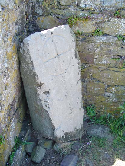
St Non's Chapel submitted by vicky on 7th Jun 2004. Within the ruined chapel of St Non's, around which are the remains of a possible stone circle, lies this inscribed stone. It is believed to date from the 7th-9th century AD and is decorated with a ring cross.
(View photo, vote or add a comment)
Log Text: St Non's Chapel, Pembrokeshire: A gate leading from between St Non’s Well (to our left) and the vault with her statue in (to our right), led into the field containing the chapel. It was a short walk to the ruined building, which is enclosed by a fence to protect it from the cattle in the field.
This chapel is very small, with an entrance to the west side. It is on a very steep site, and the walls to its southern side are composed of some impressively large stones.
Inside the chapel is a small white-painted cross, in the left hand corner as you face the sea. At its base are many offerings – tokens, tea-lights, a small memorial plaque and pebbles painted with people’s names.
Whilst we explored the stones in the field around the chapel, a Welsh family came and spent quite some time by the cross, and I wondered if they were laying their own offerings. This is certainly a superb spot to mediate and pray on a sunny day.
As we entered the field, it was apparent that there were some standing stones within the field, although I’d not seen these referred to until I logged onto the Portal when we got home. I’ve submitted some images of these along with the chapel.
Tremaenhir Standing Stones
Date Added: 29th Aug 2014
Site Type: Standing Stones
Country: Wales (Pembrokeshire)
Visited: Yes on 22nd Aug 2014. My rating: Condition 3 Ambience 3 Access 5
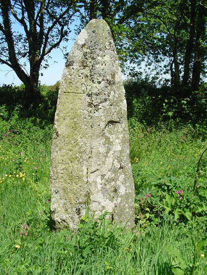
Tremaenhir Standing Stones submitted by PaulM on 6th Jun 2004. The village name suggests there are three standing stones in this village. This is the second of two marked on the OS map.
It is handily located on the grass verge so you can walk right up to it or view it from the comfort of your car seat.
This stone is located at SM827263 and has the initials "J.G." carved into it with the date 1860.
(View photo, vote or add a comment)
Log Text: Standing Stone by Tremaenhir, Pembrokeshire: After an amazing day at St. David’s Cathedral and Bishop's Palace, followed by St. Non’s Well, Chapel and standing stones, we were reluctant to call an end to the day, so we decided to drive along the A487, heading north to Tremaenhir Farm, where the map told us there were ‘Standing Stones’.
Just opposite the farm, there was a solitary tall standing stone, with only its top half poking above the undergrowth. We looked around for more, and couldn’t find any - although I did spot a tall shape in the bank opposite, which looked like it could have been a standing stone heavily covered by ivy.
It would be fun to go back in winter, when all the grass and weeds have died down, armed with the information and grid locations recorded here on the Portal.
Cross Well (Linlithgow)
Trip No.25 Entry No.3 Date Added: 21st May 2017
Site Type: Holy Well or Sacred Spring
Country: Scotland (West Lothian)
Visited: Yes on 18th May 2017. My rating: Condition 4 Ambience 3 Access 5
Cross Well (Linlithgow) submitted by KiwiBetsy on 17th Oct 2006. Site in West Lothian
The present Cross Well stands in the High street of Linlithgow just outside the lane that leads to Linlithgow Palace.
(View photo, vote or add a comment)
Log Text: Cross Well, Linlithgow: From the Knock Modern Stone Circle, we set off towards the Gogar Stone. Passing through Linlithgow (we plan on going to see the Palace and nearby Hopetoun House) another day.
There was no market today, so I persuaded my friend to quickly stop which I got a proper photograph of the well! (Note the friend's car hiding behind the structure!)
Lower Craigmailing (Torphichen)
Trip No.49 Entry No.2 Date Added: 5th Oct 2017
Site Type: Ancient Cross
Country: Scotland (West Lothian)
Visited: Yes on 22nd Sep 2017. My rating: Condition 2 Ambience 1 Access 5
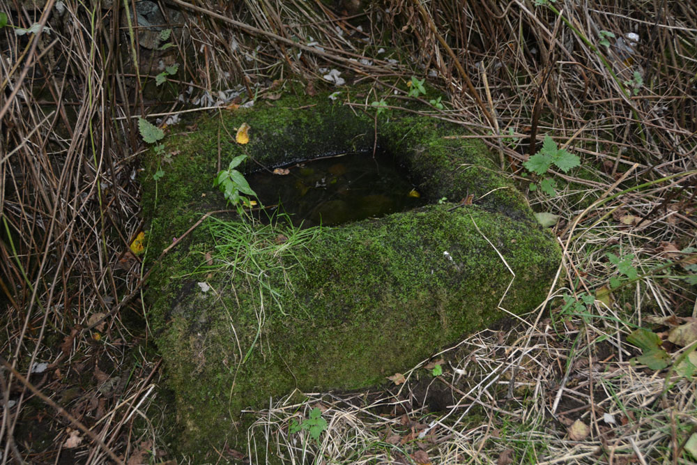
Lower Craigmailing (Torphichen) submitted by Anne T on 5th Oct 2017. In the bottom right hand corner, the shallow channel formed into the corner can be seen, suggesting it might have been used as a trough at some point in its past.
(View photo, vote or add a comment)
Log Text: Lower Craigmailing Socketed Stone: This socketed stone was well hidden under shrubbery at the start of a footpath running from Cathlaw Lane to Witch Craig/Crag. I would have walked right by it, had husband, Andrew, not pushed his way through the shrubbery to find it.
What a sad fate for this socketed stone. Being located so close to Torphichen, I assume it had something to do with marking the way to/from the Abbey, possibly up to Cairnpapple Hill.
Torphichen Churchyard Stone
Trip No.24 Entry No.1 Date Added: 15th May 2017
Site Type: Standing Stone (Menhir)
Country: Scotland (West Lothian)
Visited: Yes on 13th May 2017. My rating: Condition 3 Ambience 4 Access 5
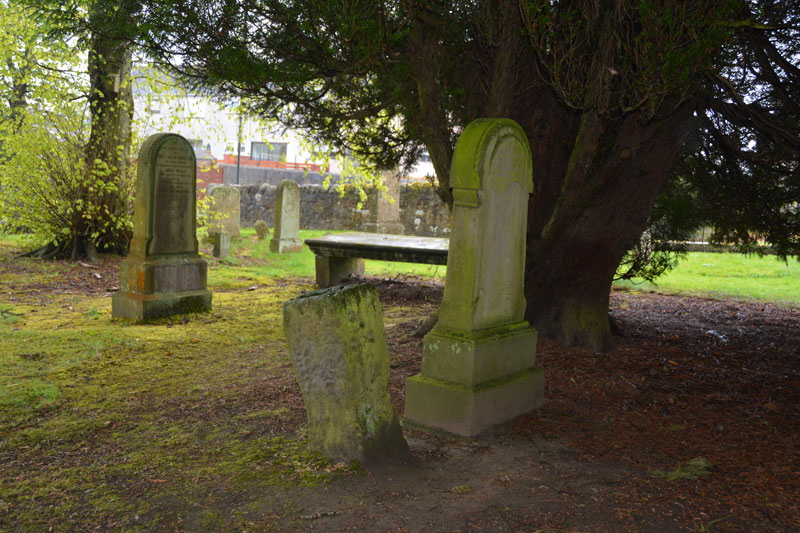
Torphichen Churchyard Stone submitted by Anne T on 15th May 2017. The Sanctuary stone sits in the part of the churchyard nearest to the road, tucked under a big yew tree and very near a modern grave marker.
(View photo, vote or add a comment)
Log Text: Torphichen Sanctuary Stone, West Lothian: After an exciting day at the filming of Robot Wars yesterday we stayed overnight at daughter and son-in-law's nearby. Torphichen is a lovely little village (Cairnpapple is also signposted further on from here), larger than I expected. The parish church incorporates/is next to the Preceptory of the Knights Hospitaller of the Order of St John of Jerusalem, which dates from the late 12th century.
The sanctuary stone is in the front of the churchyard (to the left of the gate as you enter, sheltering under a yew tree). There are other boundary stone markers around the area, and I really wanted to go and find these (the Canmore record says that they ‘once sat t a mile radius on each point of the compass. Of which the Gormyre Stone to the east-north-east and the Westfield stone survive’) but we had other priorities for the day. Another visit, probably in September/October.
There were some really interesting tombstones, particularly at the east end of the church – little people/heads/bones. Had some fun photographing these.
The Preceptory wasn’t open until 1pm on the day of our visit, so we missed it. Peering through a grill into the structure, it looked absolutely fascinating. Andrew discovered what looked like a well (similar to the Galilee Well at Durham Cathedral) against the east wall of the church, although I haven’t found any mention of it on any of the historical records (yet) although Canmore says there are 2 wells in the village, one of which supplied the Preceptory.
Cross Well (Linlithgow)
Trip No.24 Entry No.3 Date Added: 16th May 2017
Site Type: Holy Well or Sacred Spring
Country: Scotland (West Lothian)
Visited: Yes on 13th May 2017. My rating: Condition 3 Ambience 3 Access 5
Cross Well (Linlithgow) submitted by KiwiBetsy on 17th Oct 2006. Site in West Lothian
The present Cross Well stands in the High street of Linlithgow just outside the lane that leads to Linlithgow Palace.
(View photo, vote or add a comment)
Log Text: Cross Well, Linlithgow: This was our last stop on this rainy day, and we arrived to find a small market around the well, along with an event happening at the Burgh Halls immediately behind it. Couldn’t really get close to the well itself until later in the afternoon, as there were lots of stallholders, children and dogs. Truly a centre point for the town. No water in the well today – the spout and basin were completely dry. I confess I was disappointed to find such a modern structure - I'd expected something a lot older and less ornate.
We tried to find the Dogwell, walking up Dog Well Wynd as far as the railway line, but nothing.
After photographing the well as best I could, we wandered around the loch, then back round via St. Michael’s church, with its internal walls marked by musket balls and sword sharpening marks from Cromwell’s soldiers.
Cairnpapple Hill
Trip No.25 Entry No.1 Date Added: 21st May 2017
Site Type: Round Cairn
Country: Scotland (West Lothian)
Visited: Yes on 18th May 2017. My rating: Condition 3 Ambience 4 Access 4
Cairnpapple Hill submitted by ModernExplorers on 27th Mar 2013. A mound surrounded by smaller stones with holes, surrounded by a ditch and then more holes
(View photo, vote or add a comment)
Log Text: Cairnpapple Hill, West Lothian: Our first stop of the day, and I was really excited to visit this site after what I’ve read about it. We pulled up in the layby at NS 98968 71832 and made our way up the steps to the grassy field in which the cairn sits. My first reaction was ‘wow, look at those views – what a place to be buried’. The friend I was with told me we could see for 17-20 miles north and east.
At first, the mast in the farm nearby seemed to encroach upon the whole of the site, but as our visit progressed, I completely forgot it was there. The door to the Nissen hut was open, so I walked in clutching my ‘English Heritage’ cards to pay and buy a guide book from the gentleman inside. But, he told us he was an electrician, just there to carry out some tests; if the keys he had let us into the burial chamber proper, he would let us in. We followed him up the steps to the top of the mound, but sadly his keys wouldn’t open the black metal doors. What a shame!
We did, however, spent about an hour walking about the cairn (I was really disappointed to find out the dome was a modern construction, built to protect the burials), trying to understand it’s layout and the various stages of construction.
The interpretation boards said that the timber circle holes were filled with gravel, although there were others filled with grey/light brown gravel that were much bigger. I joked with my friend that the larger holes were big enough for crouch burials, so in fun, he demonstrated, with his mobile phone and glasses as his grave goods.
We could see the modern Knock Stone Circle in the distance. We said we’d go back with my friend and his wife when the visitor centre was open (Friday to Monday during summer months); she was brought up in the vicinity and knows the site well.
