Contributory members are able to log private notes and comments about each site
Sites Anne T has logged. View this log as a table or view the most recent logs from everyone
Galilee Well
Trip No.20 Entry No.1 Date Added: 1st May 2017
Site Type: Holy Well or Sacred Spring
Country: England (County Durham)
Visited: Yes on 30th Apr 2017. My rating: Condition 4 Ambience 4 Access 4
Galilee Well submitted by durhamnature on 24th Sep 2012. The Galilee Well
Site in County Durham England
(View photo, vote or add a comment)
Log Text: Galilee Well, Durham Cathedral: We arrived at the Cathedral only to find large marquees on the lawn outside, lots and lots of heavy duty cable laid neatly across the lawn. The west walls had been cordoned off with iron railing with filming equipment piled behind.
We decided to go to the café for tea and a sandwich then asked the guides at the desk where the well was and if we could access it. The lady who replied told us “there’s a really big event on at the cathedral; it’s only just been put on the web site. Even we aren’t allowed to go down there.” Helpful.
I remembered years ago walking up to the cathedral from the bridge on Silver Street, an old entrance tucked between two buildings, labelled the old Pilgrims Way up to the cathedral. We walked down into the town, found the entrance and followed the steps up the hill only to find out the path has been blocked off part way through. Retracing our steps, we found the riverside footpath which runs between Café Rouge and Geek Squad/9 altars café on the southern side of the river, at NZ 27282 42419. This path, high above the river, leads directly to the bottom of the west walls and the Galilee Well.
There is no information on this well on Pastscape, or in the cathedral notes for the Gaililee Chapel which must be immediately the other side of these enormous walls.
As the footpath is relatively narrow and has a steep drop down to the river Wear below, it was interesting to get a full face on photograph. The drop from the well into the water below is at least a couple of metres. There was no water flow at the time of our visit. Whilst standing on the path, I noticed a shelf of flat stones poking out of the bank very slightly. Whilst looking back up at the well from St. Cuthbert’s Well below, I noticed what looked like a cast iron bowl poking out of the sheer cliff. Is this associated with the Galilee Well? A pretty inaccessible place!
There is some information on the wells in Durham on the 'Ancient, Healing and Holy Wells of County Durham' by Laurence Hunt which we found useful in giving directions and information.
St. Oswald's Well
Trip No.20 Entry No.5 Date Added: 1st May 2017
Site Type: Holy Well or Sacred Spring
Country: England (County Durham)
Visited: Couldn't find on 30th Apr 2017
St. Oswald's Well submitted by HOLYWELL on 15th Jan 2011. St Oswald's Well in the gloom. Some old brickwork can be seen.
(View photo, vote or add a comment)
Log Text: St. Oswald's Well, Durham: From St. Mary’s Well, we headed off along the footpath by the side of the river, on the outer bank of the river Wear as it curves south and east around the cathedral. It is a very pretty path, although with quite a steep drop on the river side at times. We were amused by the ladies rowing on the river who went into the bank once or twice!
Reaching the outer walls of Hatfield College, we climbed some steps onto a path leading us onto Anchorage Terrace and followed the road north towards St. Oswald’s Church. The grid reference as given showed the well to be in the vicinity of the school. After much walking around St. Oswald’s churchyard, I eventually pulled up the description from the Ancient, Healing and Holy Wells of County Durham by Laurence Hunt, which told us that the well was “Situated just below the footpath leading from St Oswald's churchyard to Prebend's Bridge. Reached down a narrow, steep footpath about 20 yards after entering the trees below the church tower.”
Following our steps back to the tower, there is indeed about 20 metres through some trees back to the footpath. Just to our left there was a small, very overgrown track leading down what (to me) looked like a death-defying drop down the cliff to the river below.
Husband Andrew, being intrepid and with absolutely no fear of heights, swung himself onto the footpath, clung onto a tree and leaned over. He said he could see the well. I closed my eyes.
After a few minutes he reported that about 3 metres of the footpath appeared to have slipped down the slope and was missing, and he could reach the well but would like a rope!
We aborted the visit, sadly.
St Cuthbert's Well (County Durham)
Trip No.20 Entry No.2 Date Added: 1st May 2017
Site Type: Holy Well or Sacred Spring
Country: England (County Durham)
Visited: Yes on 30th Apr 2017. My rating: Condition 3 Ambience 2 Access 4
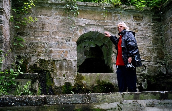
St Cuthbert's Well (County Durham) submitted by kiwiBetsy on 30th Nov 2004. St Cuthbert's Well .... well neglected.
(View photo, vote or add a comment)
Log Text: St. Cuthbert's Well, Durham: We had difficulty in locating this well from the 6 digit grid reference, so I've updated it with the official 10 digit reference from Pastscape.
From the Galilee Well, we took the steps/sloping path down to the riverside, then walked up and down, down and up, past the Old Fulling Mill to Prebend Bridge and back. Mystified by the grid reference, I stood with my phone looking up notes on the internet, trying to get a better grid reference. We knew it was near some steep steps, thanks to the entry by kiwiBetsy, but had difficulty locating the exact site. We must have looked so lost that two passing students heading to the Boat House asked us where we were looking for, but couldn't help, shrugged and walked off!
In the end, husband Andrew ran back up the footpath towards the city and spotted this structure half way up the hillside. There are two sets of steps to it – one almost from the path running next to the river (although these are now so overgrown that the path has disappeared in places); the second set of steps runs from the well structure back up to the cathedral.
There was a flow of water, but a trickle. Against the side of the footpath there was a second well structure, perhaps tapping the water so people who couldn’t make it up the steps could get water.
St Mary's Well, Durham City
Trip No.20 Entry No.4 Date Added: 1st May 2017
Site Type: Holy Well or Sacred Spring
Country: England (County Durham)
Visited: Yes on 30th Apr 2017. My rating: Condition 3 Ambience 3 Access 4
St Mary's Well, Durham City submitted by durhamnature on 21st Oct 2012. The well and stone wellhead.
Site in County Durham England
(View photo, vote or add a comment)
Log Text: St. Mary's Well, Durham: From St. Cuthbert’s Well we walked past the Old Fulling Mill and the Boat House, across Prebend’s Bridge, were we heard shrieks from the river below. Peering over the bridge, we saw the lady rowers trying to avoid going into the bank!
St. Mary’s Well is easy to find. Immediately to the western end of Prebend’s Bridge there is a footpath running off to your right. St. Mary’s Well is about 20 yards to the north up the footpath, on the western side.
Couldn’t find any entry on this in Pastscape, although again Laurence Hunt's Ancient, Healing and Holy Wells gave us some information, along with SolarMegalith's entry on the Portal.
Holy Well (Wolsingham)
Trip No.21 Entry No.4 Date Added: 6th May 2017
Site Type: Holy Well or Sacred Spring
Country: England (County Durham)
Visited: Yes on 4th May 2017. My rating: Condition 4 Ambience 4 Access 5
Holy Well (Wolsingham) submitted by HOLYWELL on 17th Jan 2011. Holy well from Wolsingham as seen from the road.
(View photo, vote or add a comment)
Log Text: Holy Well, Wolsingham, County Durham: This was our last stop of the day and to find this, I loaded the map from the Portal page. To the north of the main village, the well is sited just to the west of Holy Well Farm on Holywood Lane.
At first sight, it looks like a very small barn, but looking closer, the golden names of the saints on the metal grill door shine out. The well chamber itself is very dark and gloomy (no light seems to penetrate) and I struggled to photograph it, even with my most powerful flash gun – it was easier to see the stone ledges, the flowers on those ledges and the well pool itself with the naked eye. The well pool was full of water, but the rest of the chamber was dry.
Curious to find out where the spring was that fed the chamber (as the well house is conveniently close to the road), I both leant over the stone wall and walked up the footpath just to the west of the well house. There is a dried up hollow immediately behind, although we’ve not had any rain in this part of the world for weeks, so it’s not surprising it was dry.
Lively Well (Witton-le-Wear)
Trip No.21 Entry No.3 Date Added: 6th May 2017
Site Type: Holy Well or Sacred Spring
Country: England (County Durham)
Visited: Yes on 4th May 2017. My rating: Condition 2 Ambience 4 Access 4
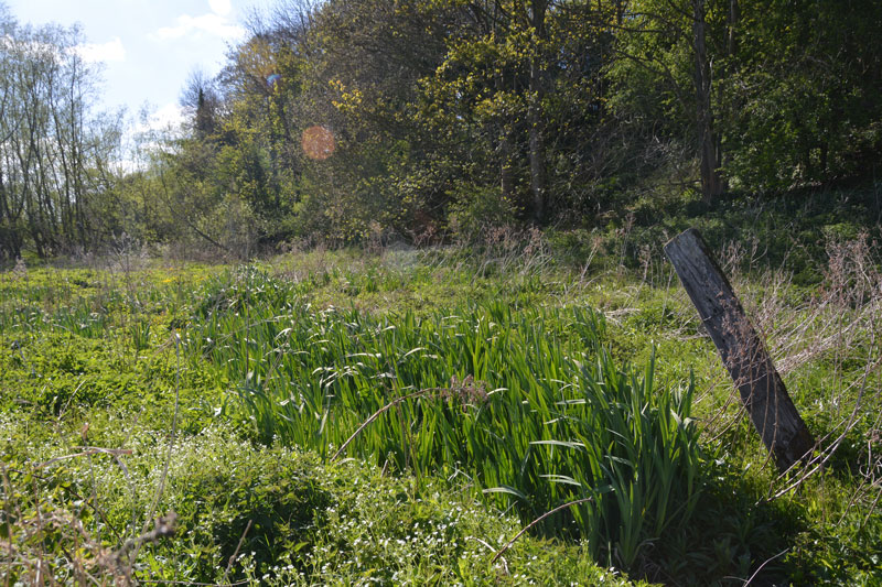
Lively Well (Witton-le-Wear) submitted by Anne T on 6th May 2017. The channel of water emerges from this area of ground, marked by a large stake, covered in reeds and rushes. Presumably this is the spring.
(View photo, vote or add a comment)
Log Text: Lively Well, Witton-le-Wear, County Durham: Andrew saw this well on the “Ancient, Healing and Holy Wells of County Durham” listing by Laurence Hunt, which formed the basis for today’s ‘well hunt’.
He says “On the banks of the river Wear below the level crossing at Witton le Wear. A footpath leads down from the level crossing. Whether of any great age or repute I was unable to determine, but this named well, consisting of a spring at the head of a small overgrown channel leading to the river Wear, is attractively sited and worth a visit. Its water is far from 'lively', however, being muddy and stagnant”
This is a really beautiful little village. We’ve whizzed up and down the A68 many, many times, but never turned left down to Witton-le-Wear. Well worth a detour! Would like to come again for a wander round. There is even a cross shaft in the church, although this is supposed to be 12th century.
We parked in the layby by the small station, just past the level crossing (as travelling from the A68 through Witton). There was a footpath with a sign to the cricket club immediately opposite, so we walked down this tarmacked path to the cricket pavilion (with its beehives and even a swarm of bees in a basket next to the path). We followed the path down to the gushing, rushing, pebbly River Wear, but decided we’d gone too far.
Spotting another path climbing up a steep bank on the other side of the railway crossing, we headed back across the cricket field, and where this footpath levels off, there is a small bridge over a channel of water at NZ 15059 31172 which seemed to rise out of nowhere. This disappeared under the footpath, not to reappear again (must be channelled into the river at some point). Following this small channel to the west for around 100 metres, there is a fenced off area of reeds and tall grasses, and I think this is where the spring rises (NZ 15023 31152)
Dropping small leaves into the water, we couldn’t determine a flow of water, or even which direction it flowed in – the leaves just sat sedately on the surface of the water.
Getting home, and trying to do some more research on this well, on the OS map of 1857 the well is not marked but the area is called Lively Bank Plantation. There is a small note on Keys to the Past, but the village dates back to Saxon times. I have emailed County Durham HER to find out more, if possible.
Hunstanworth Moor south
Trip No.42 Entry No.3 Date Added: 29th Aug 2017
Site Type: Standing Stone (Menhir)
Country: England (County Durham)
Visited: Yes on 28th Aug 2017. My rating: Condition 3 Ambience 3 Access 5
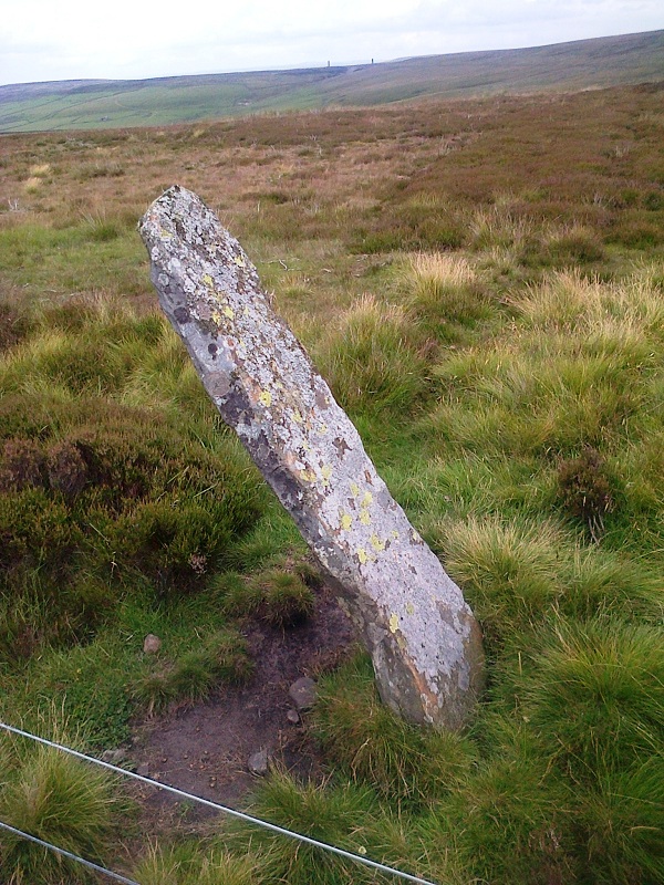
Hunstanworth Moor south submitted by HarperFox on 20th Jul 2014. This is the southernmost of the two roadside stones on the road between Townfield and Rookhope. The other is similar in shape and dimensions but upright.
(View photo, vote or add a comment)
Log Text: Hunstanworth Moor South, Near Townhead: This stone is marked on the OS Map as ‘stone’, and was easily found, although it seems like a tall boundary marker along the road from Townhead to Rookhope. As we drove along the road, we passed the northern boundary stone (see below), which isn’t marked on the map and was unexpected.
Haven’t been able to find out anything about these – not even a photograph on Geograph, as Andy Curtis has usually been out and about photographing all these places before us.
We backtracked to photograph the northern boundary stone on our way back to see the remains of the Edmundbyers Cross. I was impressed by all the now disused lead mining buildings and spoil heaps around here. It must have really busy in the not so distant past.
Old Man's Grave (Edmunbyers)
Trip No.42 Entry No.1 Date Added: 30th Aug 2017
Site Type: Marker Stone
Country: England (County Durham)
Visited: Yes on 28th Aug 2017. My rating: Condition 3 Ambience 2 Access 4

Old Man's Grave (Edmunbyers) submitted by Anne T on 30th Aug 2017. First view of the stone, which sits between two footpaths on the parish boundary between Edmundbyers and Hunstanworth. Marked on the OS map, I wondered if the installation of the corner fence post had disturbed its location.
(View photo, vote or add a comment)
Log Text: Old Man's Grave, Meadows Edge Road, Near Blanchland: We originally intended to go to Blanchland to look at a holy well marked on the OS map, not far from the town square, but the village show was on and it was impossible to park. We drove on across to the moors, intended to stop at a boundary stone on the way to Old Man’s grave, but the roads were too busy to stop.
I was expecting a cairn, but this is a small, relatively modern boundary marker, sited between two footpaths, and at the corner of a modern fence.
Not impressed, but stopped to photograph it anyway. Certainly stunning views, and I’m guessing at some time in the past this might have been a cairn with a way marker on top, or by, especially with it being located just up the hill from where Bale Hill turns into Meadows Edge, and where two different trackways led off the north east and south west off Meadows Edge across the moorland.
Dead Friar's Stone (Stanhope)
Trip No.42 Entry No.2 Date Added: 31st Aug 2017
Site Type: Marker Stone
Country: England (County Durham)
Visited: Yes on 28th Aug 2017. My rating: Condition 3 Ambience 3 Access 5
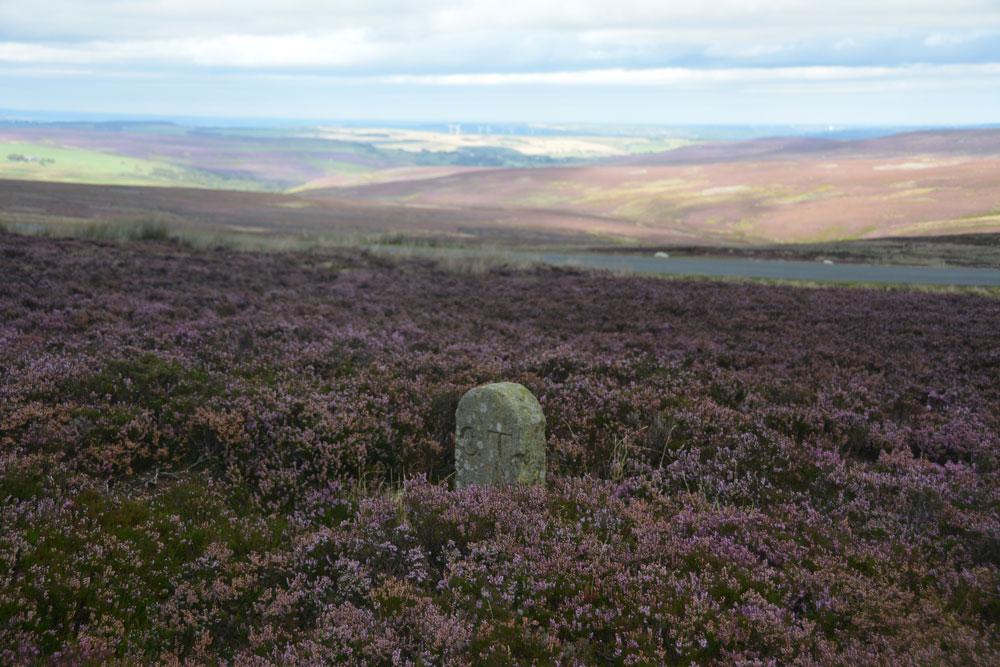
Dead Friar's Stone (Stanhope) submitted by Anne T on 31st Aug 2017. Standing at the edge of the parking area looking north east towards Edmundbyers.
(View photo, vote or add a comment)
Log Text: Dead Friar's Stone, Stanhope: From Old Man's Grave, just north of this stone, this was our second stop of the day - a curiously named stone next to Dead Friar’s quarry. Amusingly, husband thought a great slab of concrete lying next to the car park was the stone lying on its side! We looked again.
At a great viewpoint eastwards, although I thought this perhaps should have been a taller way marker rather than a boundary stone, given where it stands – at a bend of Meadows Edge (marked Dead Friar’s Road on the OS map), and where another smaller track heads off across the moorland westwards, then south, towards Rookhope.
The area around Rookhope always has ‘not very nice’ connotations for me, given my son-in-laws brother was killed in an accident green-laning on his trials bike just over 2 years ago, and I was glad to move on from this lonely spot.
The Butter Stone
Trip No.44 Entry No.2 Date Added: 10th Sep 2017
Site Type: Standing Stone (Menhir)
Country: England (County Durham)
Visited: Yes on 9th Sep 2017. My rating: Condition 3 Ambience 3 Access 4
The Butter Stone submitted by durhamnature on 16th Jul 2012. The Butter Stone, the hills of Teesdale in the background.
Site in County Durham England
(View photo, vote or add a comment)
Log Text: The Butter Stone, Cotherstone: From the cross base, we continued along the B6277, turning onto the minor road from Cotherstone towards the Battle Hill Ranges. We hadn’t expected to turn from pasture and woodland almost straight onto a moorland road.
From the turning in Cotherstone to the Butter Stone is almost 1.7km. Just passing a farm entrance to the east of the road, the stone is almost immediately to the west, about 25 metres from the side of the road. A narrow grassy footpath leads from the road to the stone, which appears to be a well eroded natural erratic. It just about shows above the tussocky grass around it.
A old penny had been glued into a hollow in the top of the stone, and in the other hollows around the outside of the stone there were 20 pence pieces slotted into them.
I was surprised to find this stone was used as an exchange/boundary point during the 17th century plague, and it is sited just below the brow of the hill.
St Mary's Old Church (Brignall)
Trip No.44 Entry No.4 Date Added: 15th Sep 2017
Site Type: Ancient Cross
Country: England (County Durham)
Visited: Yes on 9th Sep 2017. My rating: Condition 2 Ambience 4 Access 4
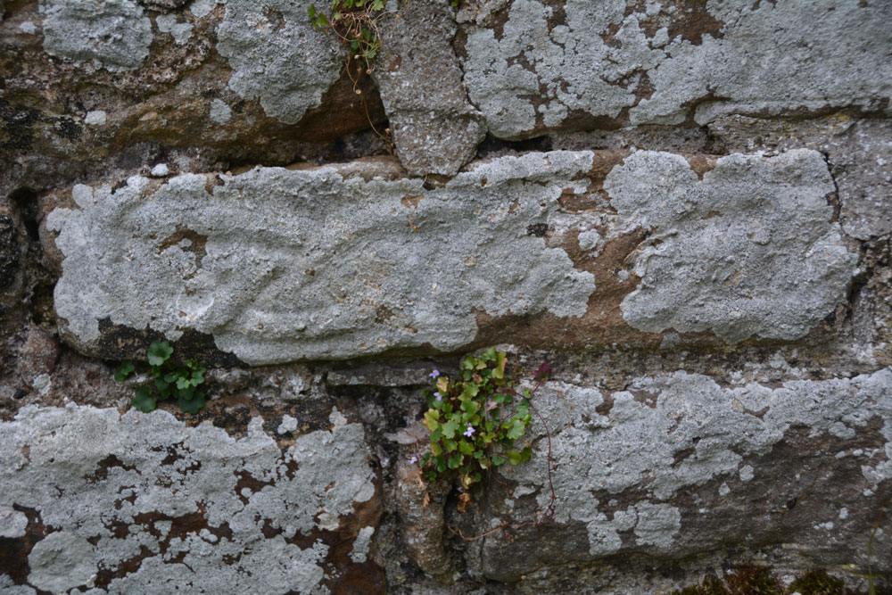
St Mary's Old Church (Brignall) submitted by Anne T on 11th Sep 2017. The interlacing can be seen on this piece of 9th century cross shaft, built into the north wall on the west side of the opening in the wall.
(View photo, vote or add a comment)
Log Text: 9th century cross shaft, St. Mary's Old Church, Brignall: Deserted Medieval Village: After not being able to find the cross base in ‘New St. Mary’s Church’, we left the car parked in front of the church and took the footpath to ‘The Old Church’ between the south wall of the churchyard and the neighbouring house. This quickly took us down an overgrown lane, following a small stream in a deep gulley to our left hand side. As the crow flies, it’s only 500 metres from the ‘new church’ to the ‘old church’, although it felt a lot longer.
Where the trees started to clear, with fields to our right, the path turned back on itself, seeming to lead straight down the gully to our stream. There was no signpost to say where the old church was, so we took the path leading downwards (to our left), at one point walking between two streams, and came out into a meadow. In the distance was the ruins of a small buildings surrounded by a low stone wall. It looked more like a tumbled down small farm house, but as we got nearer, the grave stones appeared above the wall line.
The gate had been firmly locked with a bolt and nuts, so we used the stile over the wall, descending into brambles and nettles. Other people had obviously walked this way as there were traces of indistinct tracks leading in various directions across the churchyard.
Making our way over to the building, we couldn’t see the piece of cross shaft, so I called the image up on my phone, having to hold it high up above my head to get a better signal! Almost immediately, I spotted it – to the left hand side of the opening in the wall (north), a few layers up from the current ground level.
The Historic England entry also said that there were re-used cross slabs over the east window and the now re-filled smaller windows in the east wall. On closer inspection, these looked like re-used grave slabs.
It wasn’t until we left the grounds of the church and followed a line of boulders leading down to what we thought was a stream, that we found out the River Greta ran just to the east of the church. The rig and furrow ploughing across the field was really obvious and it may be the stones marked the line of a crossing through the river? The Historic England entry also says the site has been painted by Turner and others.
St. Mary's Church (Brignall)
Trip No.44 Entry No.3 Date Added: 15th Sep 2017
Site Type: Ancient Cross
Country: England (County Durham)
Visited: Yes on 9th Sep 2017. My rating: Condition 3 Ambience 2 Access 5
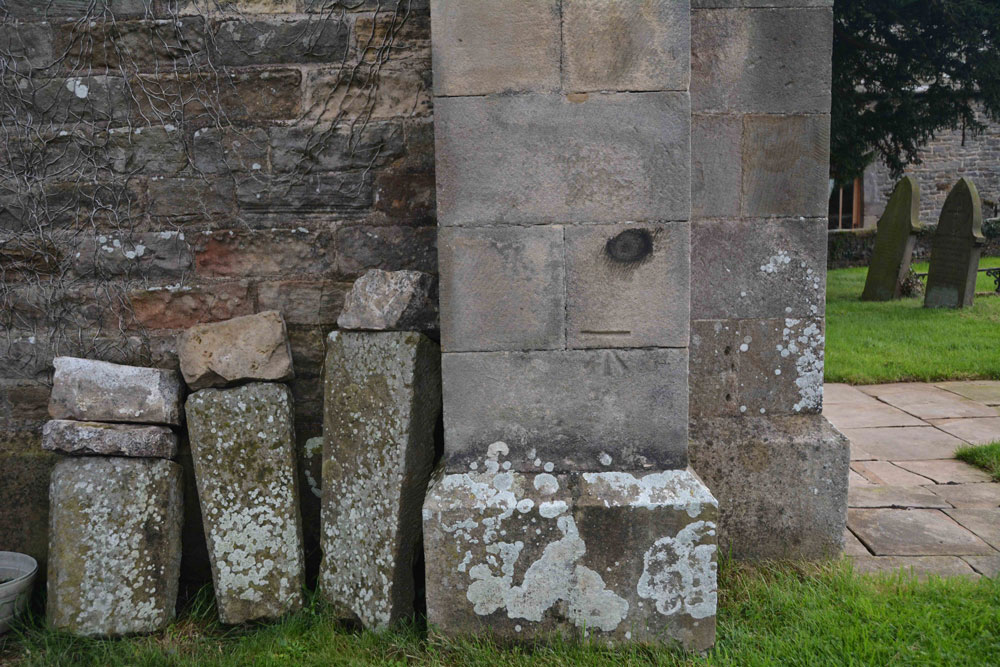
St. Mary's Church (Brignall) submitted by Anne T on 11th Sep 2017. The remains of a cross base, together with a Roman altar, are said to stand against the south wall of the church outside its west end.
This was the only collection of stones we could find on or near the church walls, and these sit against the north western corner of the tower.
(View photo, vote or add a comment)
Log Text: Cross base at St. Mary's New Church, Brignall (not found): After having visited the church in Barnard Castle and Barnard Castle, we set of to Brignall. According to Pastscape, there was a 13th century cross base sitting against the south-west corner of the tower of this church, together with a Roman altar and other stones. These used to be in the rectory gardens, but were re-sited in the churchyard.
No sign of the cross base or the altar existed, unless they are in this collection of stones, all of which are badly worn. These are located against the north west corner of the tower, behind the war memorial. There was nothing against the south west corner/south west wall of the church – I walked right round in case we’d missed anything, or they had been moved.
The church was locked at the time of our visit, so I couldn’t get inside to check if these artefacts had been moved inside for safety. As we parked up, a man in the house next to the church (to its right as photographed) was standing at the window looking at us, talking on the phone. He made no move to come out and talk to us, and made me feel like an intruder.
I will need to phone the Diocesan office to find out when the church is open and if the base and altar have been moved inside the church.
Christening Stone (Cotherstone)
Trip No.44 Entry No.1 Date Added: 15th Sep 2017
Site Type: Ancient Cross
Country: England (County Durham)
Visited: Yes on 9th Sep 2017. My rating: Condition 3 Ambience 3 Access 5
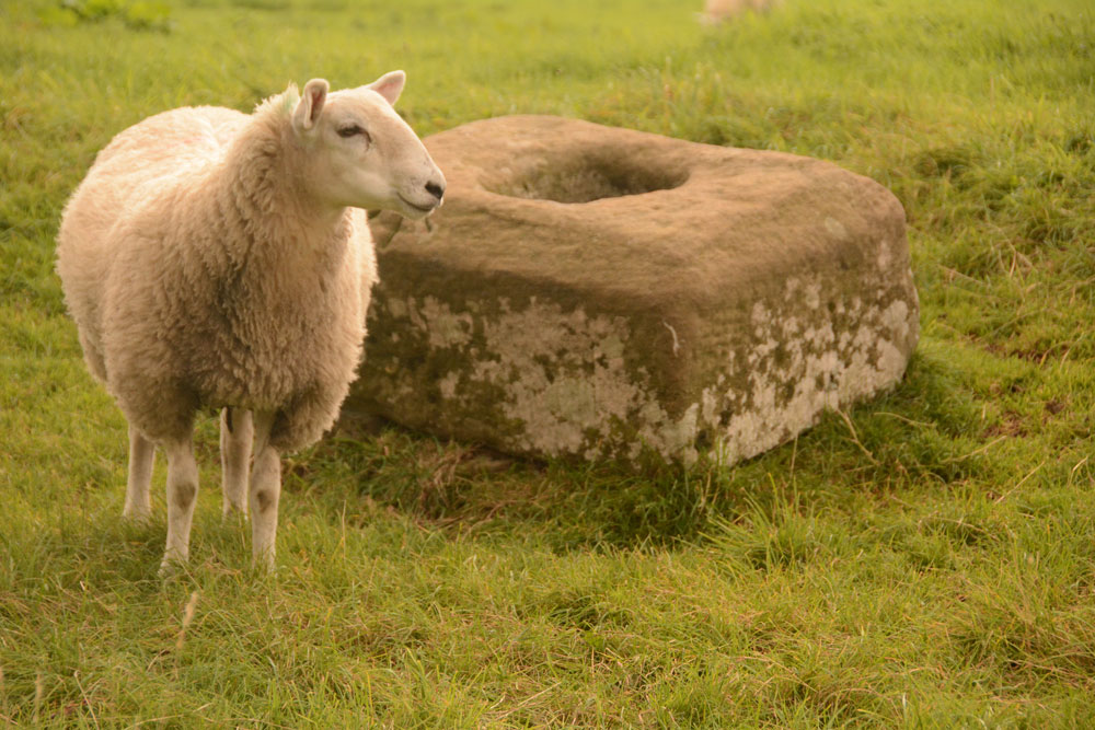
Christening Stone (Cotherstone) submitted by Anne T on 10th Sep 2017. First view of The Christening Stone from over the stone wall alongside Spout Bank (B6277), 160 metres south east of Doe Park Caravan Park.
(View photo, vote or add a comment)
Log Text: The Christening Stone, Cotherstone: This was our first stop of the day. Travelling south on the A68, the shortest route was cross-country through Hamsterley, driving along the B6278 Folly Bank into Eggleston, then turning onto the B6277 through Romaldkirk. The cross base is in a field to the right hand side of the road, 160 metres south of Doe Park caravan park, on Spout Bank.
The road is busy and narrow, but we managed to pull off into a double gateway at the side of the road and cross over to peer at the cross base. A sheep was huddled up to it when I first saw the base. The sheep then stood up once it noticed me and stood by the cross base, as if it was showing it off.
The cross looks as if it was sitting by the side of a hollow way, although now on a slope where the land dips towards the road. It looks quite crisply carved still. Although there was no gateway into the field, the stone wall was really low in places, and Andrew hopped over the wall to take a quick photograph of the western side of the base.
Pastscape says the base is Grade II listed and is in its original position on the medieval route between Cotherstone and Romaldkirk. Called The Christening Stone, a calf was christened at this cross as part of the May Day celebrations.
Castle Hill (Bishopton)
Trip No.56 Entry No.2 Date Added: 16th Oct 2017
Site Type: Misc. Earthwork
Country: England (County Durham)
Visited: Yes on 15th Oct 2017. My rating: Condition 2 Ambience 4 Access 4
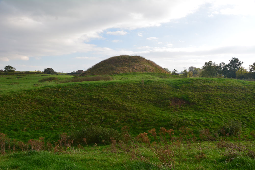
Castle Hill (Bishopton) submitted by Anne T on 16th Oct 2017. The motte from the north western outer defensive bank.
(View photo, vote or add a comment)
Log Text: Castle Hill, Bishoptop: This monument is literally just within sight of the church, just over 420 metres to the north west, at the south eastern edge of the village, opposite the pub and next to a garage.
There is a public footpath which runs through the field in which this motte and bailey is sited, accessible by a rather tumbledown stile. There is also an information board, although this had cracked and fallen off its plinth. We pieced it back together to have a quick read, although the text was so faded we couldn’t really make it out.
The site is really well preserved, and I’ve not seen another quite like this. It is as if someone has built a large hillfort in a flat piece of land and put a round mound towards one end. There are also extensive earthworks leading off this.
The motte itself has been fenced off, presumably to stop the sheep and cattle from damaging it, although there is a gate in the south western part of the fence, with a very steep path leading up to the top of the motte.
We walked around the exterior twice, marvelling at the deep ditches and banks.
St Cuthbert's Church (Darlington)
Trip No.57 Entry No.1 Date Added: 25th Oct 2017
Site Type: Ancient Cross
Country: England (County Durham)
Visited: Yes on 25th Oct 2017. My rating: Condition 3 Ambience 4 Access 5

St Cuthbert's Church (Darlington) submitted by Anne T on 25th Oct 2017. AS Corpus Darlington 1 and Darlington 2, displayed in the nave, against the second pier of the south arcade.
(View photo, vote or add a comment)
Log Text: Ancient crosses, Saxon sundials and a hogback in Darlington: Originally due to go out for the whole day, we suddenly found ourselves having to rush back for an engineer arriving at our house after lunch. As we had an appointment to be at the church for 10.30am, to look round whilst there was a service in the chancel, we decided there was time enough to get to Darlington and back.
We met the church wardens we'd been liaising with very briefly to say ‘hello and thanks’ to. It was amusing as at least 3 people came into the church wanting to know where the church office was, so I pointed them in the general direction. It was odd wandering around the church with a communion service taking place in the chancel and sanctuary, and I was careful not to use the flash on the camera, although parts of the church were very dark, especially around the hogback.
We couldn’t find a couple of the catalogued items from the Corpus, and I struggled to identify which of the three cross heads we were seeing against those the Corpus lists. I looked through the Information for Guides folder and found an Architectural Assessment by Petr F. Ryder, Historic Buildings Consultant, dated 1997, part of which read:
“Pre Conquest Sculpture: Six pieces of Pre-Conquest sculpture are listed by Cramp (1984, 62-3). Of these one cross head, with the top of the shaft, dated to the late 10th or early 11th century, and an incomplete cross head of the early 11th century, are displayed in the nave, against the second pier of the south arcade; in a corresponding position on the opposite side of the nave is a supposedly Saxon sundial. In the north transept aumbry is part of a hogback, seen as a ‘crude copying of a type more elegantly represented at Brompton, Yorkshire’, and dated to the second quarter of the 10th century. Another fragment, seen as part of a large recumbent slab of the second half of the 10th century, lies in the south transept along with medieval cross slabs. A fifth stone which formerly lay outside the south transept, seen as possibly part of a dedication or ‘station’ slab from within the church, is now lost.”
St Cuthbert's Church (Billingham)
Trip No.58 Entry No.1 Date Added: 9th Nov 2017
Site Type: Ancient Cross
Country: England (County Durham)
Visited: Yes on 8th Nov 2017. My rating: Condition 3 Ambience 4 Access 5
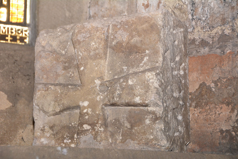
St Cuthbert's Church (Billingham) submitted by Anne T on 9th Nov 2017. AS Corpus Billingham 15, which dates from the late tenth to early eleventh century.
(View photo, vote or add a comment)
Log Text: Anglo Saxon Stones, St. Cuthbert's Billingham: We’d arranged to meet the verger, at the church at 12 noon. We arrived 10 minutes early, and found the south door didn’t have a keyhole, so wondered how we’d get in. It turns out there’s an entrance from the north side of the church. We wandered around the tower looking for the Anglo Saxon cross pieces built into the church tower. Some of these took some spotting, then we heard the verger calling us in.
The church is large, a fusion of 11th century and 1930s extension. The churchyard is huge – a surprise for somewhere so industrial as Billingham, but then this is Billingham Green.
I much enjoyed this visit. The verger spent over an hour taking us round, and took delight in showing us the stones, even one hidden behind a noticeboard against the west wall.
St Edwin's (High Coniscliffe)
Trip No.58 Entry No.3 Date Added: 10th Nov 2017
Site Type: Ancient Cross
Country: England (County Durham)
Visited: Yes on 8th Nov 2017. My rating: Condition 3 Ambience 4 Access 5
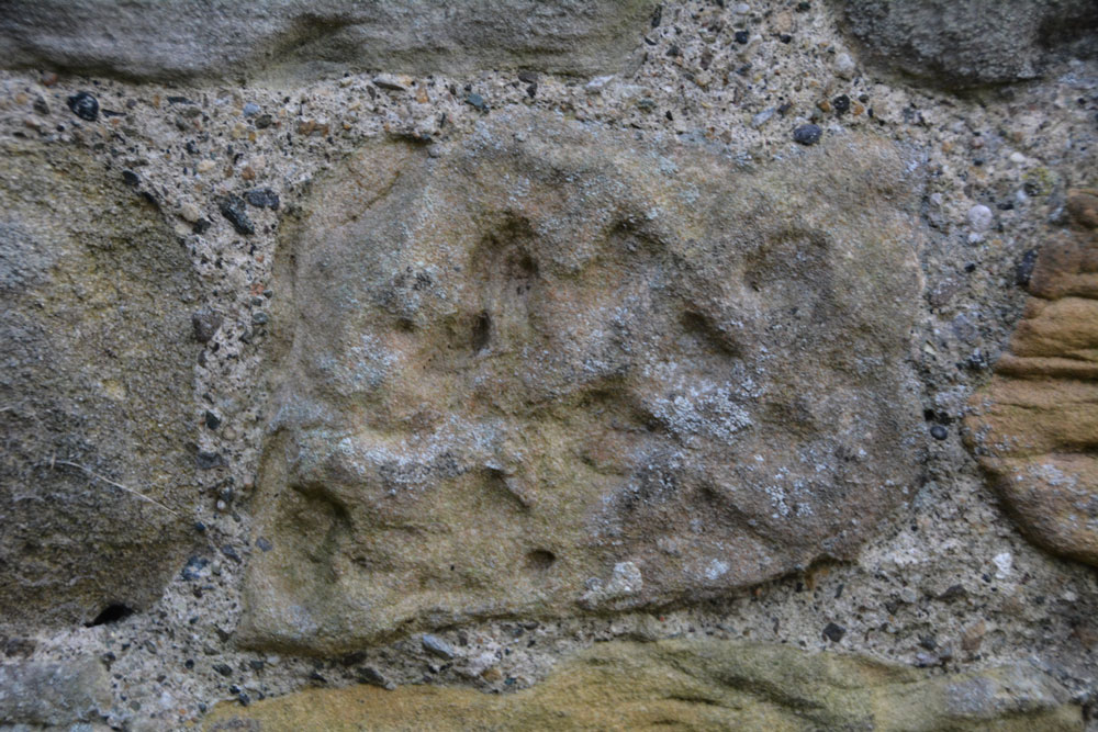
St Edwin's (High Coniscliffe) submitted by Anne T on 9th Nov 2017. This stone is recorded as AS Corpus Coniscliffe 01 and is to be found in the exterior north wall of the tower. It dates from the 10th century.
(View photo, vote or add a comment)
Log Text: Anglo Saxon Fragments, High Coniscliffe: This was a most unexpected location, as my perception was that the church should be within a quiet little village, but the reality was it was just off the main road, the A67 to Bishop Auckland. We parked by the footpath at NZ 22567 15316, and had to walk past the front of the Old Rectory to get to the lych gate.
There were so many stones in the walls of this church. So many of them were greatly weathered sandstone, and looked like any of them could have been carved then worn down. The walls of the church were a real patchwork of colours – light, medium, dark and red sandstone.
We couldn’t get into the porch. A notice on the gate of the church said keys were available at houses nearby, but none of them had lights on, so we headed home, but not before I’d spotted the view from the south western end of the churchyard down to the River Tees below. Great!
Cleatlam Wayside Cross
Trip No.80 Entry No.1 Date Added: 2nd Jul 2018
Site Type: Ancient Cross
Country: England (County Durham)
Visited: Yes on 1st Jul 2018. My rating: Condition 2 Ambience 3 Access 5
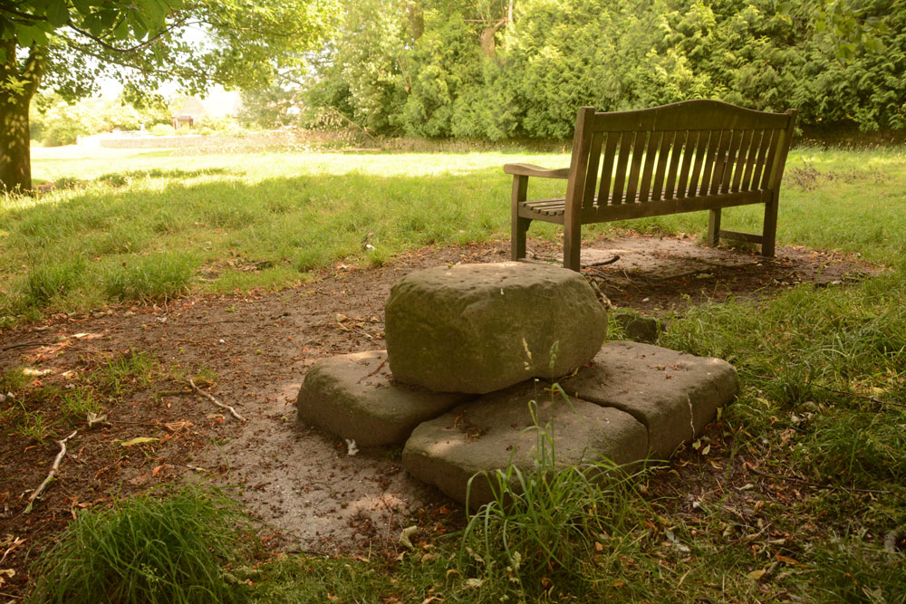
Cleatlam Wayside Cross submitted by Anne T on 2nd Jul 2018. First view of the cross base, approaching from the north and the minor road through the village.
(View photo, vote or add a comment)
Log Text: Cleatlam Wayside Cross, County Durham: This tiny village is picturesque, with large houses and farms on either side of the minor road through the village. The cross base wasn't easy to spot, hidden behind trees in a temporarily fenced off area of land, which looked like it used to be the old village green.
Sited just to the north of a wooden bench, the remains of this cross base is very odd. At first view, it looks to be a square block of stone split into two, but closer inspection reveals it is two separate pieces of stone embedded into the ground, with a smaller block placed on top.
Both Pastscape and HE say there is no socket hole, so presumably the cross would have been quite low and stood directly on top of this slab.
One of the strangest cross bases I've seen. In the field opposite, there are some interesting lumps and bumps, with a hollow way running almost parallel to the modern stone wall. Several housing/building platforms can be made out in the field. Pastscape attributes these earthworks to 'village shrinkage'.
St Mary's Church (Wycliffe)
Trip No.80 Entry No.2 Date Added: 2nd Jul 2018
Site Type: Ancient Cross
Country: England (County Durham)
Visited: Yes on 1st Jul 2018. My rating: Condition 3 Ambience 4 Access 4

St Mary's Church (Wycliffe) submitted by Anne T on 2nd Jul 2018. Close up of the main face of the hog back sited to the west of the south door, inside the church. Recorded as AS Corpus Wycliffe 05, this hogback dates to the first half of the 10th century. The church guide says it is Danish and was dug up on the north side of the church, found at a depth of 4ft 6ins, in 1801. The Corpus says the panels contain the tops of interlace patterns, probably four-cord plait.
(View photo, vote or add a comment)
Log Text: Hogback and Anglo Danish/Saxon cross fragments, Wycliffe, County Durham: This is a spectacular little village, down a narrow, dead end lane leading to the River Tees. It was difficult to park, as the lane to the church has a sign saying ‘private road’ (although a sign also says ‘to the church’), so we bumped up on the verge, as close to a stone wall as we dared, leaving just enough room for another car to pass (everywhere else said ‘private’ or ‘no parking’.
Walking down the lane to the church, we approached from the north west, walking round to the south porch, which held a ‘welcome’ notice. A strange church – lovely, warm (but very worn) yellow sandstone, but no tower, just a couple of bells.
The main hogback fragment is just to the west of the south door, inside the church, with another fragment immediately opposite, and more against the western wall.
There is a really old Bishop’s chair against the north wall of the sanctuary, a Norman (11th century) font also against the north wall of the sanctuary and some really interesting 13th and 14th century glass.
When I got a phone signal, we realised we’d not seen the hogback fragment in the exterior southern wall, and as we were passing on our way back, went back to spot this and also found a boundary marker at the entrance to the churchyard.
St Michael & All Angels (Barningham)
Trip No.117 Entry No.1 Date Added: 12th Feb 2019
Site Type: Ancient Cross
Country: England (County Durham)
Visited: Yes on 6th Feb 2019. My rating: Condition 3 Ambience 4 Access 4
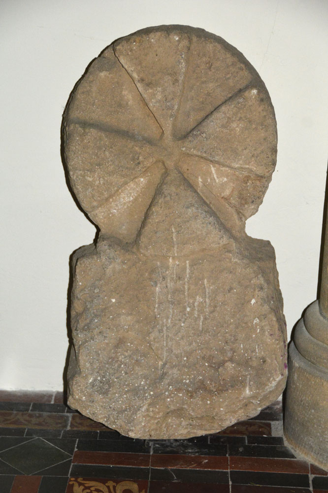
St Michael submitted by Anne T on 10th Feb 2019. Close up of the reverse (face C) of AS Corpus Barningham 02, which shows traces of a relief circle.
(View photo, vote or add a comment)
Log Text: Cross Base and Cross Head/Grave Marker (Barningham): Having arranged a day out with rich32 to seek out and photograph some of the Barningham Moor rock art panels, I'd also seen the cross base on Historic England, so we arrived in Barningham half an hour before the meeting time to look around the churchyard. As well as the cross base in the south eastern corner of the churchyard, there was also a round headed grave marker in the church; to my surprise, the church was open, and we were able to get in and photograph this, too.
The church looks surprisingly modern (and it is largely Victorian) but the churchyard is much, much older, and also includes a 1503 grave slab (too covered in moss to identify) which is sited within the remains of the medieval foundations of the original church. There are also some really interesting grave stones, which I photographed.
Within a couple of minutes walk there is also the modern stone (gate post) circle and the village Pant (drinking fountain), complete with its culvert and voussoir arch. A lovely start to the day!
