Contributory members are able to log private notes and comments about each site
Sites Anne T has logged. View this log as a table or view the most recent logs from everyone
Hunstanworth Moor north
Trip No.42 Entry No.4 Date Added: 29th Aug 2017
Site Type: Standing Stone (Menhir)
Country: England (County Durham)
Visited: Yes on 28th Aug 2017. My rating: Condition 3 Ambience 3 Access 5

Hunstanworth Moor north submitted by HarperFox on 20th Jul 2014. This is the northernmost of the two stones.
(View photo, vote or add a comment)
Log Text: Hunstanworth Moor North, Townhead: Being the day of the Blanchland and Hunstanworth Show, this road was very busy, and it was difficult to stop as the road was narrow and there were no obvious lay-bys or pull-off points (there being a nice ditch at the western side of the road and a steep bank up to the field on the east).
Spotted this stone as we were passing by on the way to the stone approx. 575m south and retraced our steps to photograph it.
Again, after having done searches on the internet, not been able to find out anything about it, like it’s ‘partner’ further up the hill.
Feldon Plain (Muggleswick)
Trip No.42 Entry No.5 Date Added: 29th Aug 2017
Site Type: Marker Stone
Country: England (Northumberland)
Visited: Yes on 28th Aug 2017. My rating: Condition 3 Ambience 3 Access 5

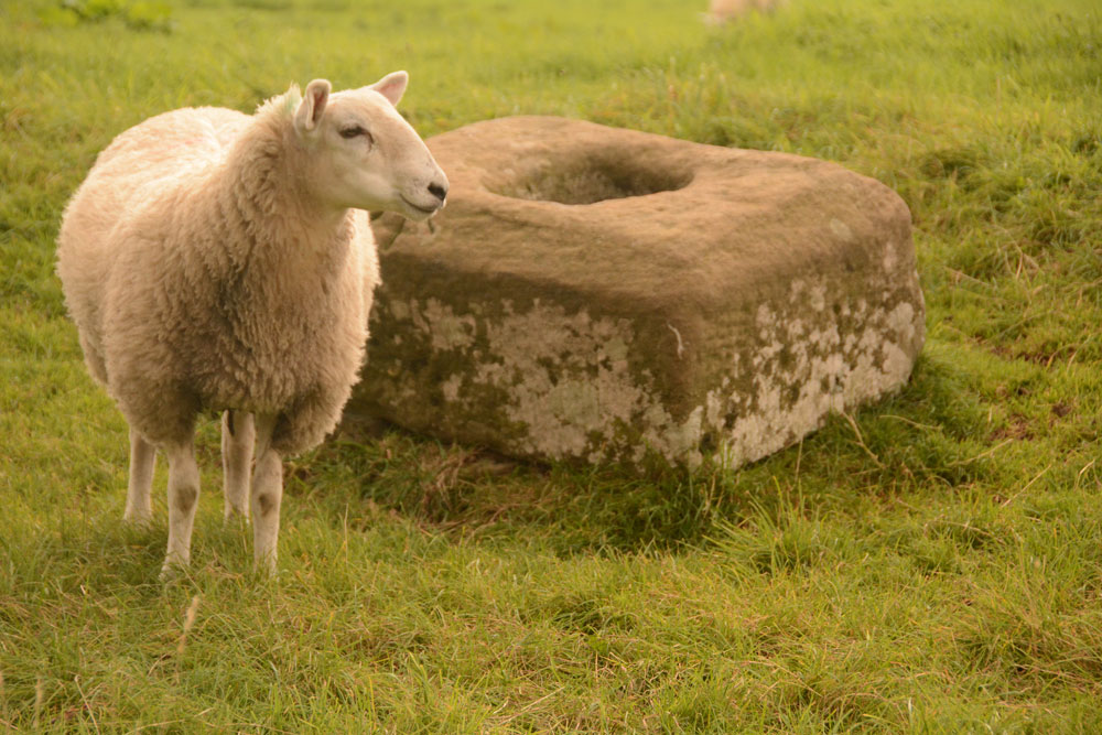
Feldon Plain (Muggleswick) submitted by Anne T on 29th Aug 2017. The stone (and sheep) as seen from the north east. There is a level mark almost at ground level, on the side facing the road. It certainly is in a lonely spot. It sits precisely on the parish boundary between Muggleswick and Hunstanwick (if I've read the map correctly) and also almost at the junction of two major routes across the moors.
(View photo, vote or add a comment)
Log Text: Marker Stone, junction of Meadows Edge & B6278: Despite quite an intensive search, I’ve not found any information on the internet (checked Pastscape, Historic England, National Geograph, etc).
Marked ‘BS’ on the OS map, this impressively large stone (in comparison to the others we saw on the way here) sits exactly on the Parish boundary between Muggleswick and Hunstanwick (if I’ve read the map correctly). Sitting right by the side of the B62787 to Edmundbyers, close to its junction with the Meadows Edge Road.
This is close to the remains of the Edmundbyers Cross Base, just to the north east, with Feldon Plain rising up gently behind it. It is a taller version of Hunstanworth North, again with the sloping top. It sits in a slight dip, as if the ground surface has built up around it, and there are a few packing stones visible at its base. Looks as if it has been here for a while.
Its shape echoes that of Hunstanworth Moor North, being long, thin & narrow with a sloping top.
Edmundbyers Cross (Muggleswick)
Trip No.42 Entry No.6 Date Added: 29th Aug 2017
Site Type: Ancient Cross
Country: England (Northumberland)
Visited: Yes on 28th Aug 2017. My rating: Condition 2 Ambience 3 Access 5
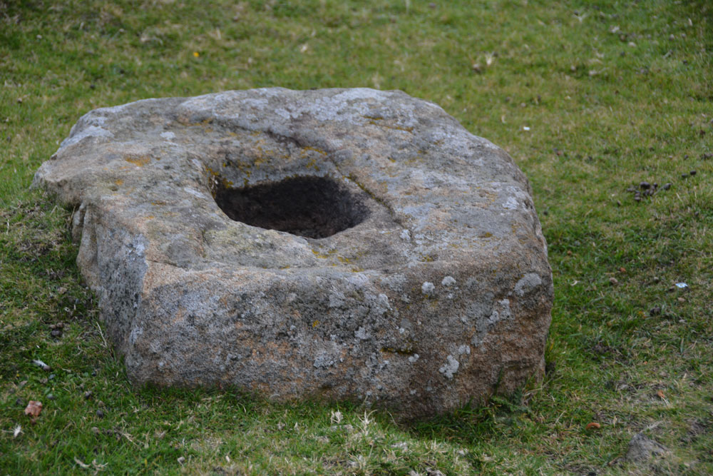
Edmundbyers Cross (Muggleswick) submitted by Anne T on 29th Aug 2017. Close up of the cross base, showing its socket hole.
(View photo, vote or add a comment)
Log Text: Remains of Edmundbyers Cross, Muggleswick: Marked in italic, old fashioned script on the OS map, I guess I was expecting something a little more exciting, such as a cross base with part of a shaft, but no. Just a cross base. Good job I knew what I was looking for as alongside the road there were other pieces of rectangular rock almost as large.
Sitting almost at the junction of the B6278 to Edmundbyers with the minor road leading almost to Smiddy Shaw Reservoir (just to the north of this road), it would have acted as a way marker. The cross base is located just over 1km from the boundary stone above.
When we got home, I was interested to read this from the Historic England entry: “Edmundbyers Cross is one of only three wayside crosses still in its original position in County Durham and the only known example on the route between Stanhope and Edmundbyers.”
Coanwood (Lambley)
Trip No.43 Entry No.1 Date Added: 5th Sep 2017
Site Type: Ancient Village or Settlement
Country: England (Northumberland)
Visited: Yes on 2nd Sep 2017. My rating: Condition 3 Ambience 3 Access 5
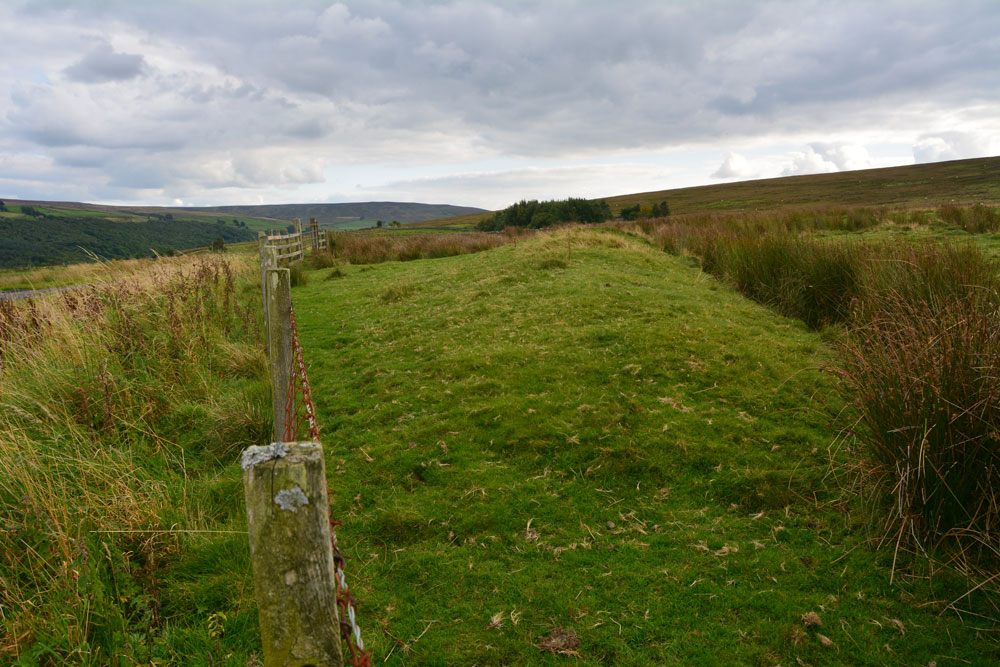
Coanwood (Lambley) submitted by Anne T on 5th Sep 2017. The eastern bank of the enclosure as it runs south along the fence line inside the field.
(View photo, vote or add a comment)
Log Text: Coanwood Settlement, Lambley: Driving from the Diamond Oak and the World War II prisoner of war camp to the north, this settlement lies immediately opposite the junction of the 68 Cycle Route and the A689 at Lambley. It lies very near the Roman route of Maiden Way, which in this part of the world goes over Hartleyburn Fell and Glendue Fell, and runs west of this settlement, following the route of the Pennine Way through Lambley Common.
We decided, on impulse, to stop and have a look, especially as there was a handy hard-cored parking space next to the green pumping station and were so interested, I did something I don’t usually do, and let myself into the field to walk along the track running parallel with the southern bank.
I could make out a rectangular structure in the south eastern corner, and possible hut circle mid-way across and one-third of the length south of the northern bank.
Haining House (Lambley)
Trip No.43 Entry No.2 Date Added: 5th Sep 2017
Site Type: Cairn
Country: England (Northumberland)
Visited: Yes on 2nd Sep 2017. My rating: Condition 3 Ambience 4 Access 4
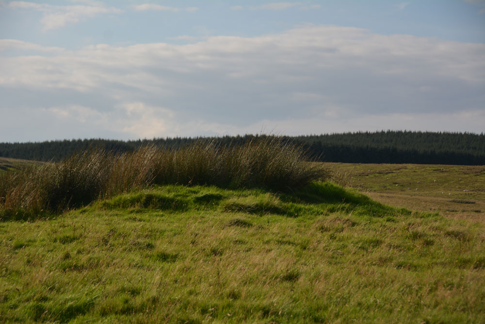
Haining House (Lambley) submitted by Anne T on 5th Sep 2017. First view of the cairn, peeking northwards over the stone wall which runs parallel with the track leading up to Haining House on Hartleyburn Common.
(View photo, vote or add a comment)
Log Text: Haining House Cairn, Hartleyburn Common: It was difficult to park here, as the road was so narrow. In the end we managed to bump the car up a slight bank to the north east of the track to Haining House. The track to the farm house was well looked after, although to drive to it, you’d have had to opened (and shut) three gates.
The cairn was easily identify-able, and being on access land, we walked to the gate located in the stone wall just to the west of the cairn, and walked back. There are some curiously deeply cut valleys to the north west of this cairn, now in a u-shaped feature. There are some cup and ring marked rocks along this section of the burn, although we planned to walk further west to see some more settlements this afternoon.
However, leaving the cairn and letting ourselves into a field with a gate, the heads of some very curious, and large, cattle/bullocks appeared above a slight mound. We retreated and went to look at the map for some other sites to see.
Housesteads Tumulus
Trip No.43 Entry No.3 Date Added: 4th Sep 2017
Site Type: Artificial Mound
Country: England (Northumberland)
Visited: Yes on 2nd Sep 2017. My rating: Condition 2 Ambience 2 Access 5
Housesteads Tumulus submitted by SolarMegalith on 21st Jul 2016. The mound seen from the S-SE (photo taken on July 2016).
(View photo, vote or add a comment)
Log Text: Housesteads Tumulus, Northumberland: From photographing the remains of Triermain Castle and after having failed to see several sites today because of Boisterous Bullocks or lack of parking reasonably near the well, I wasn’t in the frame of mind to go straight home. As we were very near the B6318, I asked to go back that way to see ‘Solarmegaliths Mound’ opposite Housesteads. I hadn’t realised until I looked closely that this is marked on the OS Map.
By this time it was 7pm and the car park was empty apart from one car and a very large campervan. I confess that every time we’ve driven past this site, I thought how unsightly this ‘farmer’s dump’ was in the corner of the field. It was only when Cezary told me on one of the archaeological field days that he’d stopped off to see this site, that I promised myself one day I’d stop off and look for myself.
As a mound, it is a little non-descript, but having crossed the road from Housesteads car park, we let ourselves into the field (knot untying skills came in useful again) and walked round. The whole area around the base of the tumulus has been used as a dump and there is rubbish and fence posts around much of it.
Also marked on the OS map is a mound, further south and we walked further into the field (ducking from the farmer's trucks with trailers behind them, in case we got caught!).
Having walked back to the car park, we noticed a sign saying there had been an application made for number plate recognition for car park charging. We looked around for cameras, but couldn’t see any. If a parking charge notice comes through the door in the next few weeks, I will be cross.
Housesteads Mound
Trip No.43 Entry No.4 Date Added: 4th Sep 2017
Site Type: Misc. Earthwork
Country: England (Northumberland)
Visited: Yes on 2nd Sep 2017. My rating: Condition 2 Ambience 3 Access 4
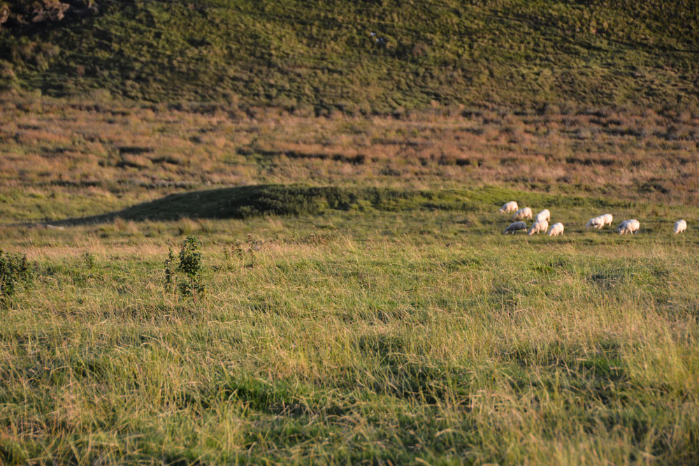
Housesteads Mound submitted by Anne T on 4th Sep 2017. We didn't walk down to the mound, as we didn't have permission to be in the field, but it looks like a small tumulus to my untrained eye. There are no other features like this along this section of land running alongside the B6318 Military Road, at least within about half a kilometre either side, apart from another tumulus on Green Brae, near East Crindledykes.
(View photo, vote or add a comment)
Log Text: Housesteads Mound, near Housesteads Tumulus, Bardon Mill: This mound is marked on the OS map as a mound, and as we were in the field, walked to the change in slope where the ground dipped into a hollow. The mound was certainly popular with the sheep. Didn’t walk down to it, as it was a fair way across the field and it was getting late. I’d called it up on my mobile phone, and it didn’t seem hugely important.
Christening Stone (Cotherstone)
Trip No.44 Entry No.1 Date Added: 15th Sep 2017
Site Type: Ancient Cross
Country: England (County Durham)
Visited: Yes on 9th Sep 2017. My rating: Condition 3 Ambience 3 Access 5
Christening Stone (Cotherstone) submitted by Anne T on 10th Sep 2017. First view of The Christening Stone from over the stone wall alongside Spout Bank (B6277), 160 metres south east of Doe Park Caravan Park.
(View photo, vote or add a comment)
Log Text: The Christening Stone, Cotherstone: This was our first stop of the day. Travelling south on the A68, the shortest route was cross-country through Hamsterley, driving along the B6278 Folly Bank into Eggleston, then turning onto the B6277 through Romaldkirk. The cross base is in a field to the right hand side of the road, 160 metres south of Doe Park caravan park, on Spout Bank.
The road is busy and narrow, but we managed to pull off into a double gateway at the side of the road and cross over to peer at the cross base. A sheep was huddled up to it when I first saw the base. The sheep then stood up once it noticed me and stood by the cross base, as if it was showing it off.
The cross looks as if it was sitting by the side of a hollow way, although now on a slope where the land dips towards the road. It looks quite crisply carved still. Although there was no gateway into the field, the stone wall was really low in places, and Andrew hopped over the wall to take a quick photograph of the western side of the base.
Pastscape says the base is Grade II listed and is in its original position on the medieval route between Cotherstone and Romaldkirk. Called The Christening Stone, a calf was christened at this cross as part of the May Day celebrations.
The Butter Stone
Trip No.44 Entry No.2 Date Added: 10th Sep 2017
Site Type: Standing Stone (Menhir)
Country: England (County Durham)
Visited: Yes on 9th Sep 2017. My rating: Condition 3 Ambience 3 Access 4
The Butter Stone submitted by durhamnature on 16th Jul 2012. The Butter Stone, the hills of Teesdale in the background.
Site in County Durham England
(View photo, vote or add a comment)
Log Text: The Butter Stone, Cotherstone: From the cross base, we continued along the B6277, turning onto the minor road from Cotherstone towards the Battle Hill Ranges. We hadn’t expected to turn from pasture and woodland almost straight onto a moorland road.
From the turning in Cotherstone to the Butter Stone is almost 1.7km. Just passing a farm entrance to the east of the road, the stone is almost immediately to the west, about 25 metres from the side of the road. A narrow grassy footpath leads from the road to the stone, which appears to be a well eroded natural erratic. It just about shows above the tussocky grass around it.
A old penny had been glued into a hollow in the top of the stone, and in the other hollows around the outside of the stone there were 20 pence pieces slotted into them.
I was surprised to find this stone was used as an exchange/boundary point during the 17th century plague, and it is sited just below the brow of the hill.
St. Mary's Church (Brignall)
Trip No.44 Entry No.3 Date Added: 15th Sep 2017
Site Type: Ancient Cross
Country: England (County Durham)
Visited: Yes on 9th Sep 2017. My rating: Condition 3 Ambience 2 Access 5
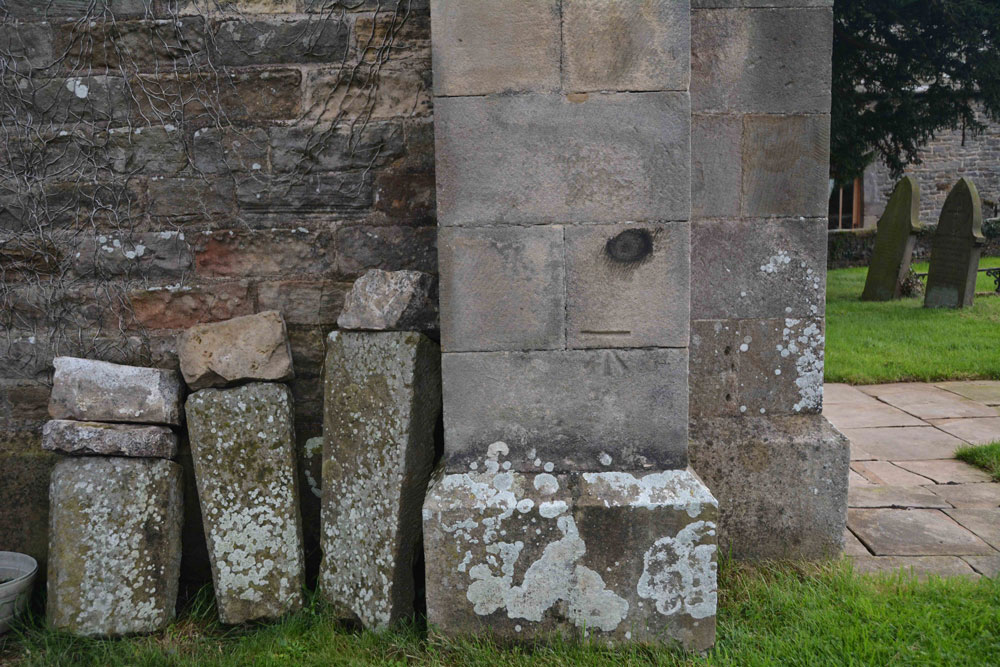
St. Mary's Church (Brignall) submitted by Anne T on 11th Sep 2017. The remains of a cross base, together with a Roman altar, are said to stand against the south wall of the church outside its west end.
This was the only collection of stones we could find on or near the church walls, and these sit against the north western corner of the tower.
(View photo, vote or add a comment)
Log Text: Cross base at St. Mary's New Church, Brignall (not found): After having visited the church in Barnard Castle and Barnard Castle, we set of to Brignall. According to Pastscape, there was a 13th century cross base sitting against the south-west corner of the tower of this church, together with a Roman altar and other stones. These used to be in the rectory gardens, but were re-sited in the churchyard.
No sign of the cross base or the altar existed, unless they are in this collection of stones, all of which are badly worn. These are located against the north west corner of the tower, behind the war memorial. There was nothing against the south west corner/south west wall of the church – I walked right round in case we’d missed anything, or they had been moved.
The church was locked at the time of our visit, so I couldn’t get inside to check if these artefacts had been moved inside for safety. As we parked up, a man in the house next to the church (to its right as photographed) was standing at the window looking at us, talking on the phone. He made no move to come out and talk to us, and made me feel like an intruder.
I will need to phone the Diocesan office to find out when the church is open and if the base and altar have been moved inside the church.
St Mary's Old Church (Brignall)
Trip No.44 Entry No.4 Date Added: 15th Sep 2017
Site Type: Ancient Cross
Country: England (County Durham)
Visited: Yes on 9th Sep 2017. My rating: Condition 2 Ambience 4 Access 4
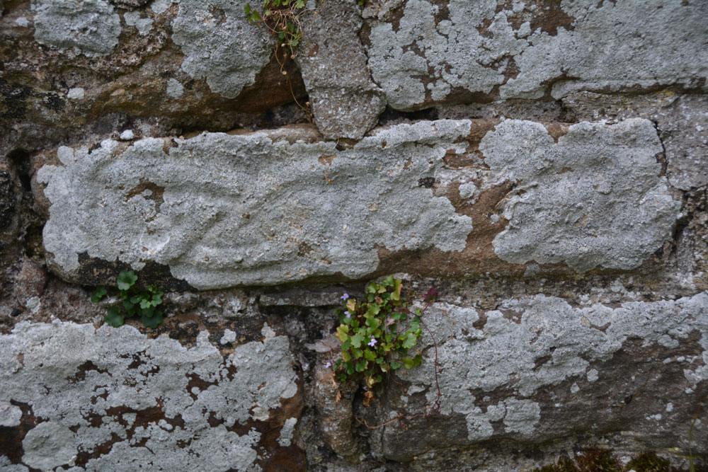
St Mary's Old Church (Brignall) submitted by Anne T on 11th Sep 2017. The interlacing can be seen on this piece of 9th century cross shaft, built into the north wall on the west side of the opening in the wall.
(View photo, vote or add a comment)
Log Text: 9th century cross shaft, St. Mary's Old Church, Brignall: Deserted Medieval Village: After not being able to find the cross base in ‘New St. Mary’s Church’, we left the car parked in front of the church and took the footpath to ‘The Old Church’ between the south wall of the churchyard and the neighbouring house. This quickly took us down an overgrown lane, following a small stream in a deep gulley to our left hand side. As the crow flies, it’s only 500 metres from the ‘new church’ to the ‘old church’, although it felt a lot longer.
Where the trees started to clear, with fields to our right, the path turned back on itself, seeming to lead straight down the gully to our stream. There was no signpost to say where the old church was, so we took the path leading downwards (to our left), at one point walking between two streams, and came out into a meadow. In the distance was the ruins of a small buildings surrounded by a low stone wall. It looked more like a tumbled down small farm house, but as we got nearer, the grave stones appeared above the wall line.
The gate had been firmly locked with a bolt and nuts, so we used the stile over the wall, descending into brambles and nettles. Other people had obviously walked this way as there were traces of indistinct tracks leading in various directions across the churchyard.
Making our way over to the building, we couldn’t see the piece of cross shaft, so I called the image up on my phone, having to hold it high up above my head to get a better signal! Almost immediately, I spotted it – to the left hand side of the opening in the wall (north), a few layers up from the current ground level.
The Historic England entry also said that there were re-used cross slabs over the east window and the now re-filled smaller windows in the east wall. On closer inspection, these looked like re-used grave slabs.
It wasn’t until we left the grounds of the church and followed a line of boulders leading down to what we thought was a stream, that we found out the River Greta ran just to the east of the church. The rig and furrow ploughing across the field was really obvious and it may be the stones marked the line of a crossing through the river? The Historic England entry also says the site has been painted by Turner and others.
Hethpool Stone Circles
Trip No.45 Entry No.1 Date Added: 14th Sep 2017
Site Type: Stone Circle
Country: England (Northumberland)
Visited: Yes on 12th Sep 2017. My rating: Condition 3 Ambience 5 Access 5
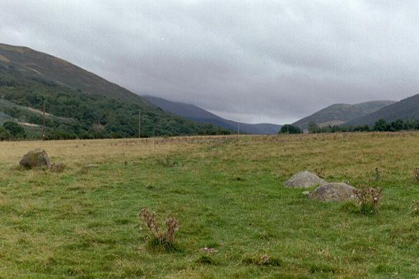
Hethpool Stone Circles submitted by Andy B on 27th Feb 2003. Part of the Burnham family trip to Northumberland, August 2002
(View photo, vote or add a comment)
Log Text: Hethpool Stone Circles, College Valley: We needed to be up really early this morning, but completed what we needed to do by 9am. As there were high winds and rain forecast for this evening/tonight and for the next few days, husband suggested we make the most of the good weather and go up to College Valley. He organised a pass from Saville’s in Wooler (we were one of 8 cars today – usually there are only 1 or 2 the receptionist said).
The last time we were here was over 15 years ago, in the days when I didn’t have a camera, and whilst we saw the stone circle and Little Heatha Fort, didn’t have any evidence of our trip.
Considering this is marked on the map as a (singular) stone circle, it immediately looked (to me) as if there two side-by-side circles – the stones weren’t in one simple circle and they were too widespread. We climbed up to the telegraph pole up the hill to try and get a better look at the circle, but it was still too spread out (and many of the stones too low to the ground) to photograph well.
Given that the small car park at the entrance to the valley was pretty full, and we saw long crocodiles of walkers, we seemed to be the only people interested in the stone circle, which was surprising.
Southernknowe (College Valley)
Trip No.45 Entry No.2 Date Added: 14th Sep 2017
Site Type: Ancient Village or Settlement
Country: England (Northumberland)
Visited: Yes on 12th Sep 2017. My rating: Condition 2 Ambience 4 Access 5
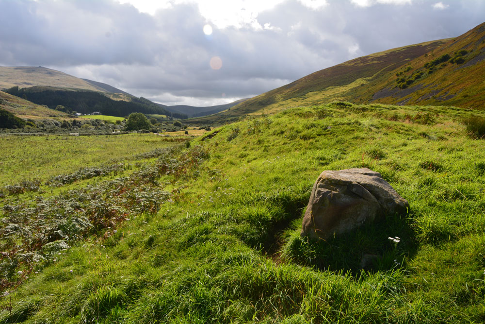
Southernknowe (College Valley) submitted by Anne T on 14th Sep 2017. Standing along the south eastern bank of the settlement, with College Burn to the right hand side in the dip. This large boulder rises up out of the bank. Beyond it, just down the slope, erosion has exposed boulder clay. At this point, the bank is steepest and looks like the settlement has been built on an old river terrace.
(View photo, vote or add a comment)
Log Text: Southernknowe RB Settlement, College Valley: Never having been down so far south in College Valley before, I was fascinated by how beautiful the scenery was, and how many people live here. We saw the sign posts for ‘Wedding This Way’ from Hethpool onwards, and came to the tiny, very white Cuddystone Hall, tucked just behind a small wooded area. Parking on the grassy area with a couple of other cars just north of the hall, we took up the invitation on the College Valley History web page to explore the earthwork remains of the settlement ‘dating from the Roman Iron Age times.’
Just before the road junction and the Airmen’s Memorial (Cheviot Memorial) there is a gate into the field. Letting ourselves in, we wandered round and through this scooped settlement nestled on the west bank of the College Burn, with its scooped hut circles and courtyards. The hut circles were more obvious in the northern (smaller) courtyard. The bank to the south eastern side was steep, dropping down to College Burn. Just past a large boulder on the south eastern bank, erosion left boulder clay clearly visible.
On the hillside to the south west there is another enclosure marked on the OS map, higher up the slopes of Blackhaggs Rigg. We planned to call back here later in the day.
Coldburn (College Valley)
Trip No.45 Entry No.3 Date Added: 14th Sep 2017
Site Type: Ancient Village or Settlement
Country: England (Northumberland)
Visited: Yes on 12th Sep 2017. My rating: Condition 2 Ambience 4 Access 4

Coldburn (College Valley) submitted by Anne T on 14th Sep 2017. Having clambered up the steep(ish) hillside until the land levelled off, this is our first glimpse of the Coldburn Settlement from the north west.
(View photo, vote or add a comment)
Log Text: Coldburn Settlement (College Valley): After visiting the Southernknowe Settlement, the road splits into two. We took the eastern road at this point, travelling over Sutherland Bridge. There is a sign which says to beware as the road is not in very good condition, which is right! It is very narrow and has great potholes in parts.
We managed to pull off the road where a small layby had been created with lots of broken tarmac and stones. From this point, to the west of the settlement, we clambered up the somewhat steep-ish hillside, to where the land levelled off. Heading east, the scoop of the settlement came into view.
There are no obvious internal features within this settlement, but there are certainly views in three directions, with the steep slope of Coldburn Hill on the fourth.
The scoop is deepest to the north of the oval, and there appears to be two terraces cut into the hillside above.
Once in the settlement, we discovered a track cut into the bank of the settlement leading down to Coldburn Farm, so there was a much easier way of accessing this site!
Dunsdale (College Valley)
Trip No.45 Entry No.4 Date Added: 14th Sep 2017
Site Type: Ancient Village or Settlement
Country: England (Northumberland)
Visited: Yes on 12th Sep 2017. My rating: Condition 1 Ambience 4 Access 5
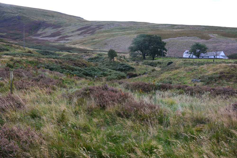
Dunsdale (College Valley) submitted by Anne T on 14th Sep 2017. Standing in the middle of the settlement (largely buried underneath bracken) looking over Bizzle Burn towards Dunsdale Farm
(View photo, vote or add a comment)
Log Text: Dunsdale Settlement, College Valley: Wow. The screen slopes to the north of this path are daunting and impressive at the same time. If there was a landslip here, you might be cut off for some time.
The settlement here was difficult to make out because of the very tall grass and heather, but we could feel stone foundations under our feet and depressions in the ground.
It is a very beautiful spot, with the scree slopes of Dunsdale Crag to the north and Bizzle Burn running to the west of this site.
Would really like to come back here in winter to see more of the site structure.
Southernknowe Farmstead (College Valley)
Trip No.45 Entry No.5 Date Added: 15th Sep 2017
Site Type: Ancient Village or Settlement
Country: England (Northumberland)
Visited: Yes on 12th Sep 2017. My rating: Condition 2 Ambience 3 Access 4
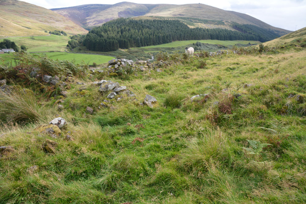
Southernknowe Farmstead (College Valley) submitted by Anne T on 15th Sep 2017. Standing almost at the sheepfold at the northern end of the farmstead, looking back down to College Burn (near where it meets Lambden Burn).
(View photo, vote or add a comment)
Log Text: Southernknowe Enclosed Farmstead, College Valley: This settlement sits high up the eastern slopes of Blackhaggs Riggs, almost opposite where Lambden Burn meets College Burn. Whilst we could see the stone walls/banks of this settlement from below, it was quite a hike up the steep slopes of the hill. Long and narrow, the inhabitants would have had a great view of any other people coming for miles. It is also very scenic, overlooking the meeting of Lambden Burn and College Burn. The river terraces in the valley below can be seen and it’s intriguing how the rivers have moved over the years.
Mounthooly (College Valley)
Trip No.45 Entry No.6 Date Added: 15th Sep 2017
Site Type: Ancient Village or Settlement
Country: England (Northumberland)
Visited: Yes on 12th Sep 2017. My rating: Condition 2 Ambience 4 Access 4

Mounthooly (College Valley) submitted by Anne T on 15th Sep 2017. First view of the Mounthooly Romano-British Enclosed Scooped Settlement from the sheep pens by the footpath.
(View photo, vote or add a comment)
Log Text: Mounthooly Enclosed Scooped Settlement, College Valley: We drove down the road as far as we could go, nearly at Mounthooly Farm and International Hostelry, and there was a big sign saying ‘no cars past this point’. There were two other cars parked on the grass verge, but no signs of other people.
The road had been gated at Fleehope farm, where they were taking out the whole of the forest by Fleehope Burn, to the west of the farmhouse, and there were huge piles of logs and heavy machinery. Whoever had parked the Land Rover on about a 45 degree slope near the forest had to be congratulated for an epic display of 4 wheel driving!
We walked along the track past Mounthooly Farm and the Hostelry (which has a clean toilet block!), past the narrow strip of forest and found the footpath making its way through the sheep pens, through the field, by a hide. Immediately after coming through the sheep folds, the scoop of the settlement came into view.
Standing towards the western end of the settlement, the scoop is cut deep into the hillside and it seemed to loom around 5+ metres above me, although both Pastscape and Historic England say it’s only 3 metres.
The farmer has been using this area as a dump, and there were no end of empty plastic feed supplement bags and bottles.
There was a clear, wide ditch to the west and south of the settlement; it’s northern end had been cut by the forestry plantation and fence.
My eye was drawn across to the eastern side of College Burn, and a large light coloured boulder. When we got home, it turned out that there was another larger settlement, field systems and cairnfields to the east of the burn. There was also another settlement to the south east of the field, but there was a very large herd of bullocks gathered, so we opted out on this occasion.
What a fascinating area. Needs much more investigation.
Hethpool Cairn
Trip No.45 Entry No.7 Date Added: 15th Sep 2017
Site Type: Cairn
Country: England (Northumberland)
Visited: Yes on 12th Sep 2017. My rating: Condition 2 Ambience 4 Access 5
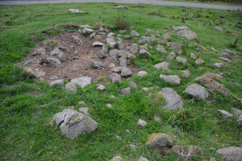
Hethpool Cairn submitted by Anne T on 13th Sep 2017. The Hethpool Cairn, showing its probably robbed centre.
(View photo, vote or add a comment)
Log Text: Hethpool Cairn, College Valley: By this time, it was getting reasonably late in the afternoon, and there was a definite chill in the air. After having been out a lot earlier than our normal setting off time, it seemed way past tea-time. Just as we were approaching Hethpool Stone circles, we both noticed a stony mound to the left hand side of the road, tucked between the road and a narrow band of forest that separates it from the stone circles.
OK, this could be just a dump of stones by the roadside, but I photographed it anyway, enjoying the view south down the valley before we set off for home. Opening up Pastscape later that evening, I was pleased to find this cairn recorded.
Tullie House Museum
Trip No.46 Entry No.1 Date Added: 19th Sep 2017
Site Type: Museum
Country: England (Cumbria)
Visited: Yes on 18th Sep 2017. My rating: Condition 4 Ambience 2 Access 4
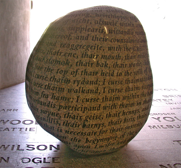
Tullie House Museum submitted by nicoladidsbury on 13th Mar 2005. Cursing Stone, Tullie House Millenium Walkway, Carlisle
The polished granite stone is inscribed with the curse, which was cast on all the reivers of the English/Scottish borders in the 16th Centuary.
The names of those reivers are inscribed in the stones that make up the floor of the millenium walkway, Armstrongs, Grahams, Robsons, Elliotts, and Kerrs to made a few.
The Tullie House Museum has a 10-minute wide-screen audio-visual spectacular which gives a dramatic impression of the lawles...
(View photo, vote or add a comment)
Log Text: The Cursing Stone, Carlisle: This stone is located in the strangely lit underpath that runs the dual carriageway near Tullie House Museum and Carlisle Castle, next to Tullie House museum. We came across this quite by chance, thinking it was located inside the museum. It is actually on the Tullie House side of the pedestrian underpass from the Castle to the Museum.
There is nothing on the walls of the underpass to tell you what this stone is. I’d read about it on the Portal some time ago and recognised it. The wording of the curse is recorded below.
Moor Head (Brundean Laws)
Trip No.47 Entry No.1 Date Added: 3rd Oct 2017
Site Type: Standing Stones
Country: Scotland (Scottish Borders)
Visited: Yes on 20th Sep 2017. My rating: Condition 2 Ambience 3 Access 4
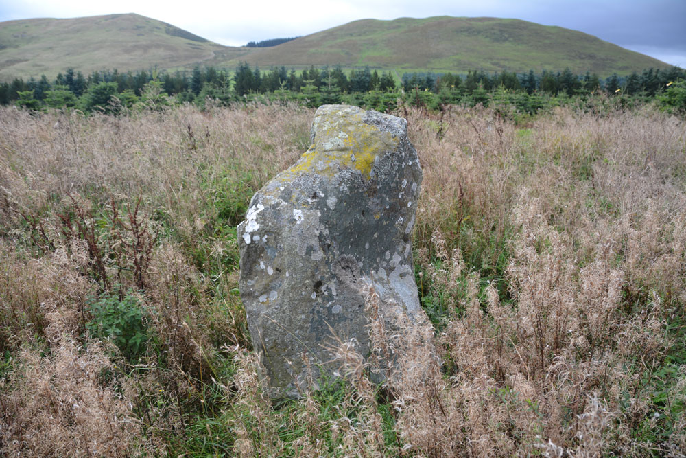
Moor Head (Brundean Laws) submitted by Anne T on 3rd Oct 2017. Looking east across the top of the taller stone, showing it's irregular shaped top.
(View photo, vote or add a comment)
Log Text: Moor Head (Brundean Laws), Scottish Border: This was our first stop on our journey to Armadale, and a part of the world we’ve been to before on a walk up Dere Street, but not stopped at these stones before. We parked at Brundean Laws farm entrance at NT 71651 11987 and walked up the track past the first few houses, to where the track divides at NT 72183 11509 just before Brundean Laws Farm, taking the right hand fork as we faced the main farmhouse. The area where the standing stones are has not been mowed, so stands out as a taller circle of grass around a telegraph pole at the south eastern end of the large field in which the stones stand.
We followed the track that heads of westwards until we were level with the stones, then headed the 30 metres or so to unmown area in which they stood. There is one main stone which is clearly a standing stone, with a second recumbent stone to its south east. A second, broken, stone pokes up out of a mound of smaller stones, which I thought was a quarried stone which had just been dumped, but checking with the Canmore record, this is the second standing stone. With the tall grass and thistles around the stones, it was difficult to tell if there were any more stones undergoot.
The stones do stand on a slight mound (although Canmore says they are 170 metres SSW of Moor Head summit) and if the Christmas tree forest hadn’t been to it’s north, west and south, would have had a commanding view over the surrounding hills which towered above this spot.
