Contributory members are able to log private notes and comments about each site
Sites Anne T has logged. View this log as a table or view the most recent logs from everyone
Chesters Roman Site b
Trip No.142 Entry No.2 Date Added: 7th Jul 2019
Site Type: Rock Art
Country: England (Northumberland)
Visited: Yes on 4th Jul 2019. My rating: Condition 3 Ambience 4 Access 4
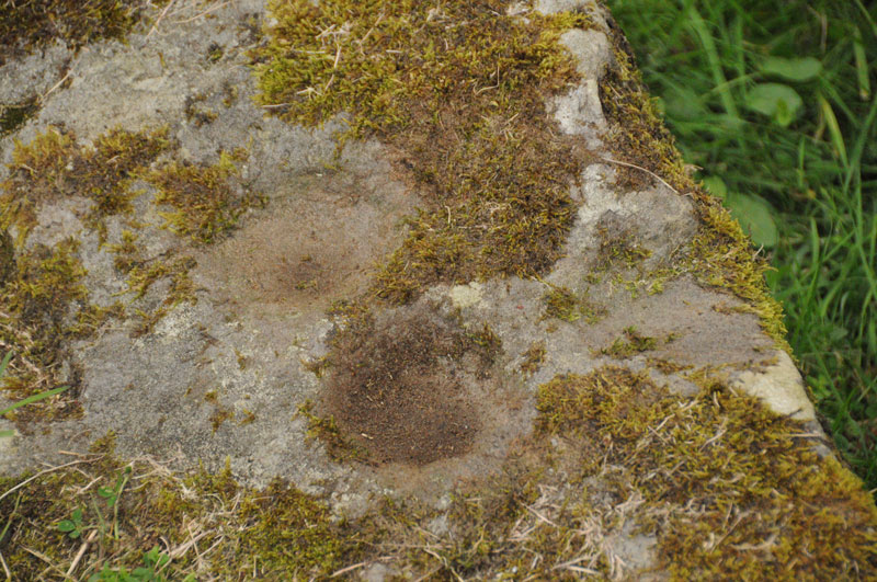
Chesters Roman Site b submitted by Anne T on 1st Sep 2014. Photograph showing two cup marks (0.09m) on stone, with third just on right hand edge.
(View photo, vote or add a comment)
Log Text: Chesters Roman Site b, Chesters Roman Bridge Abutment: Whilst we were here to photograph the bridge abutment, we took the opportunity to look for this panel again to see if it had changed. It was very much the same.
Children's Well
Trip No.170 Entry No.5 Date Added: 12th Aug 2021
Site Type: Holy Well or Sacred Spring
Country: England (Derbyshire)
Visited: Yes on 16th Jul 2021. My rating: Condition 3 Ambience 3 Access 5
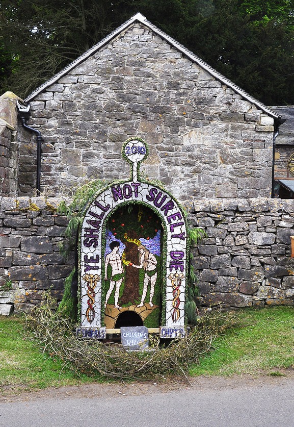
Children's Well submitted by Creative Commons on 6th May 2013. Dressing of Children's Well - Tissington 2010
Rather a macabre sentiment from children I would think.
Copyright Mick Lobb and licensed for reuse under this Creative Commons Licence.
(View photo, vote or add a comment)
Log Text: Children's Well, Tissington: The fifth well we visited in the village, and easy to spot. Not recorded on HE or HERR. The basin within the well head was slightly muddy and dry, but looking over the dry stone wall, there is a boggy area of ground, which is where the water appears to rise, and a stone trough just behind the well head, which was full of water.
Chollerton Cross
Date Added: 7th Oct 2014
Site Type: Ancient Cross
Country: England (Northumberland)
Visited: Yes on 2nd Oct 2014. My rating: Condition 4 Ambience 4 Access 5
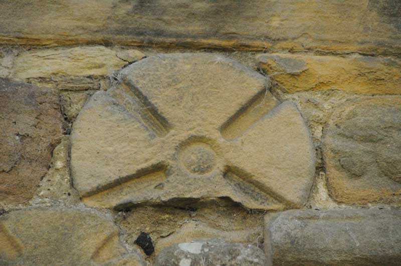
Chollerton Cross submitted by Anne T on 6th Oct 2014. Close up of 'Chollerton 02', part of a cross-head (reference from the Corpus of Anglo Saxon Stone Sculpture).
(View photo, vote or add a comment)
Log Text: Chollerton Cross (St. Giles, Saxon Crosses, Chollerton): It being the most beautiful sunny day with blue skies (but a frosty start), it was a perfect autumn afternoon. Last night I looked through the Anglo Saxon Corpus database and picked out some places within easy reach of my house.
My husband and I have been to St. Giles before, on 30th August 2007, but to look at the Roman features incorporated into the church and I had the tiniest little camera which took appalling photographs!
The tower was completely scaffolded and three or four men were working at the top of it in the sunshine. Parking by the old mortuary building, as I was changing lenses on my camera an elderly lady came across the road. She said she was waiting for the bus to come down and told me how she and her brothers and sisters used to come and clean the church when they were young; her father had changed the altar cloths and put everything ready for communion. She also told me how lucky they were to have someone as nice as Rev. Slade.
I found the Anglo-Saxon crosses on the north wall of the nave easily enough. On opening the door to the porch, there was part of another Saxon cross built into the wall above the door to the church.
The sun was so strong it was difficult to get a shot of the church without overexposing the shot, even at 1/4000th of a second.
In the guide book, a pretty child’s grave cover is described as sitting next to an 18th century sundial. I found the sundial, but next to it was a bucket of stone fragments. Despite walking twice round the church, I was unable to find this grave cover, so assume it’s either been broken or moved. I was touched by a pair of slippers kept by the font!
The guide book says that the church is Grade 1 listed, sited at the southern most end of Chollerton parish, was consecrated in 1097 and is the “mother church” of the parish. The name Chollerton derives from Anglo Saxon (Cholverton, Cholreton, Cholveriton).
The guide goes onto say the original church was probably wooden, with the stone church built around 1260 by William de Swinburne a Scottish knight (presumably there are links between his family and Swinburn Castle, with its standing stone) not far away. Part of the 12th century remains in the west walls between the nave and the tower tower and Roman piers have been used to create the south arcade.
There is a Roman font inside, dedicated to Jupiter, which has been inverted and modified for use today, although a more modern (13th century!) font with a Jacobean lid is in use today.
There is parking for two cars next to the old stable and hearse house with its mounting block, and it is possible to get a wheelchair up to the church (although not around to the north wall of the chancel to see the Saxon stones).
Christening Stone (Cotherstone)
Trip No.44 Entry No.1 Date Added: 15th Sep 2017
Site Type: Ancient Cross
Country: England (County Durham)
Visited: Yes on 9th Sep 2017. My rating: Condition 3 Ambience 3 Access 5
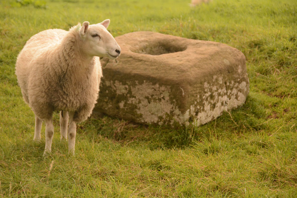
Christening Stone (Cotherstone) submitted by Anne T on 10th Sep 2017. First view of The Christening Stone from over the stone wall alongside Spout Bank (B6277), 160 metres south east of Doe Park Caravan Park.
(View photo, vote or add a comment)
Log Text: The Christening Stone, Cotherstone: This was our first stop of the day. Travelling south on the A68, the shortest route was cross-country through Hamsterley, driving along the B6278 Folly Bank into Eggleston, then turning onto the B6277 through Romaldkirk. The cross base is in a field to the right hand side of the road, 160 metres south of Doe Park caravan park, on Spout Bank.
The road is busy and narrow, but we managed to pull off into a double gateway at the side of the road and cross over to peer at the cross base. A sheep was huddled up to it when I first saw the base. The sheep then stood up once it noticed me and stood by the cross base, as if it was showing it off.
The cross looks as if it was sitting by the side of a hollow way, although now on a slope where the land dips towards the road. It looks quite crisply carved still. Although there was no gateway into the field, the stone wall was really low in places, and Andrew hopped over the wall to take a quick photograph of the western side of the base.
Pastscape says the base is Grade II listed and is in its original position on the medieval route between Cotherstone and Romaldkirk. Called The Christening Stone, a calf was christened at this cross as part of the May Day celebrations.
Clach An T-Sagairt (Soroba)
Trip No.86 Entry No.3 Date Added: 28th Jul 2018
Site Type: Chambered Tomb
Country: Scotland (Argyll)
Visited: Yes on 16th Jul 2018. My rating: Condition 3 Ambience 4 Access 4
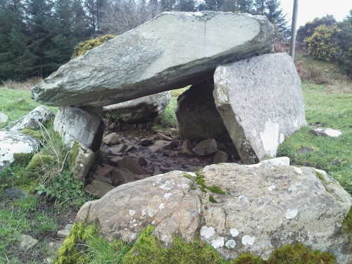
Clach An T-Sagairt (Soroba) submitted by crannog on 16th Mar 2012. Very easy to find. Sits happily and peacefully overlooking Loch Craignish.
(View photo, vote or add a comment)
Log Text: Clach An T' Sagairt Chambered Tomb, Ardfern: From the map, this cairn appeared to be just behind the small school in the middle of Ardfern, and finding a small path behind the back of the school, followed this for about 20m before discovering we were in someone’s garden! The reality was we had to walk up the small road to Ardlarach, going past the school buildings to our right, until we got to what looked like a private road (seemingly unnamed). This led up a slope to the right to a number of other houses. A new gate in the fence to our left hand side led into the field with some beautiful horses, with the cairn some 100 yards straight in front of us.
What beautiful views from this chambered cairn. It looked as if it had a number of ‘arms’ coming out of the central mound, presumably the spoil form the excavations.
We were followed to the gate by a local resident, and we got chatting. She had lived in the village for 16 years and her children, who played on the cairn, told her there were dead bodies and gold in it. She started talking about the whole field being protected if there was an ancient monument in it, so I suggested she looked at Canmore, as it was usually only the area immediately around the monument that was scheduled.
She told us the gate had only appeared in the last few days, and the residents were wondering if a developer was looking to build in-fill houses. Seeing us with a camera walking the site got her worried we'd come to survey the site, so she came out to check.
She also said about once a year, before the gate, people asked to go into the field from her garden.
We went onto dinner at the Galley of Lorne Inn in the village. The last two sites had been a good introduction to this area, and despite the lack of internet and therefore having to rely on the OS map for information, we were both looking forward to seeing the many, many sites around here.
Clach na Carraig
Trip No.87 Entry No.6 Date Added: 29th Jul 2018
Site Type: Standing Stone (Menhir)
Country: Scotland (Argyll)
Visited: Yes on 17th Jul 2018. My rating: Condition 3 Ambience 4 Access 5
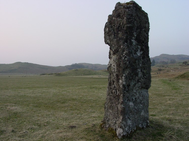
Clach na Carraig submitted by PaulH on 1st May 2003. This is a menhir called Clach na Carraig located just metres from a kerb cairn called Diarmid's Grave. The grid reference is NM908289.
(View photo, vote or add a comment)
Log Text: Clach na Carraign, Lorn: When Andrew said ‘that’s the standing stone’ as we approached it on the road, I thought at first this was just part of an old buttress, like the one’s at St. Matthew’s Old Church in Roslin. I wasn’t until I got closer and had photographed the small cairn to its east, that I really looked saw it was actually a huge block of stone.
It is really impressive, especially so with its location near the stone circle and two cairns. It is right by the road, but we visited the stone circle and the larger, now ruinous cairn, on our way to really appreciate this stone.
Clavering's Cross
Trip No.76 Entry No.5 Date Added: 28th May 2018
Site Type: Ancient Cross
Country: England (Northumberland)
Visited: Yes on 26th May 2018. My rating: Condition 3 Ambience 4 Access 4
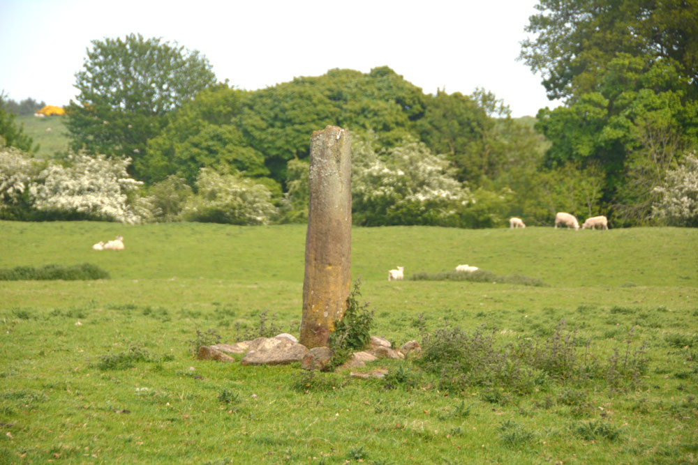
Clavering's Cross submitted by Anne T on 28th May 2018. Getting close, approaching from the north west, the fracture at the top of the cross shaft is clearly visible. Is the cross head really in the dike at the west side of this field??
(View photo, vote or add a comment)
Log Text: Clavering's Cross, Stanton: Disappointed by the third cairn, which we were really unsure of, I’d spotted this cross on the OS map, and as it wasn’t too far away, we thought we go on our way to Ewesley.
Parking on the verge just north of the farmhouse, there were roadworks being set up and a very large, yellow skip had been placed by the gate into the field. As there was a large ditch to its south, there was a very narrow piece of land to walk across, and with the side of the skip looming above my left hand side, I managed the two steps across, because I really wanted to see this cross.
We had to shoo the lovely, fat hens out of the way to open the gate, and spent a few minutes walking round and taking photographs. The steps were in a sorry state, which is unusual - Pastscape tells us the cross has (within living memory) been relocated back to the site where it originally stood, so perhaps the steps weren't built properly during the relocation.
Cleatlam Wayside Cross
Trip No.80 Entry No.1 Date Added: 2nd Jul 2018
Site Type: Ancient Cross
Country: England (County Durham)
Visited: Yes on 1st Jul 2018. My rating: Condition 2 Ambience 3 Access 5
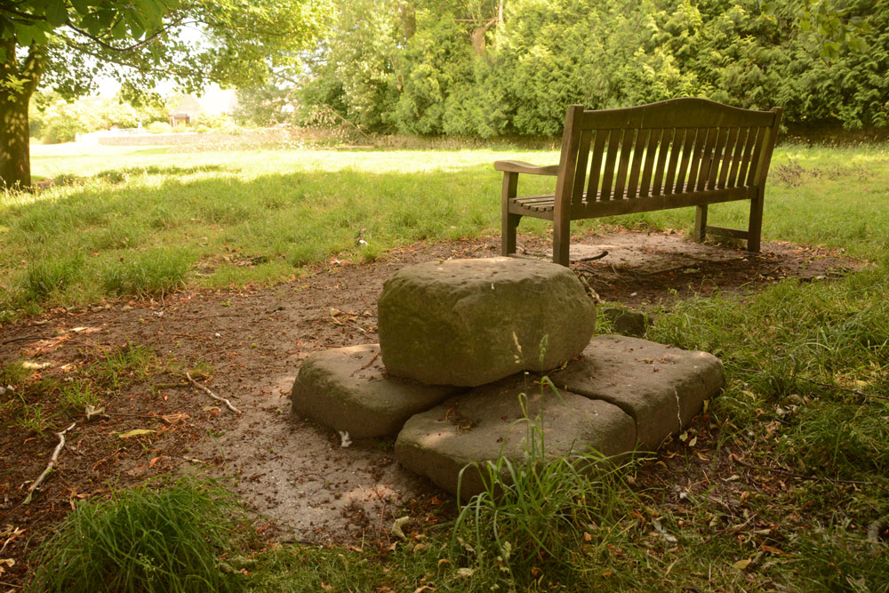
Cleatlam Wayside Cross submitted by Anne T on 2nd Jul 2018. First view of the cross base, approaching from the north and the minor road through the village.
(View photo, vote or add a comment)
Log Text: Cleatlam Wayside Cross, County Durham: This tiny village is picturesque, with large houses and farms on either side of the minor road through the village. The cross base wasn't easy to spot, hidden behind trees in a temporarily fenced off area of land, which looked like it used to be the old village green.
Sited just to the north of a wooden bench, the remains of this cross base is very odd. At first view, it looks to be a square block of stone split into two, but closer inspection reveals it is two separate pieces of stone embedded into the ground, with a smaller block placed on top.
Both Pastscape and HE say there is no socket hole, so presumably the cross would have been quite low and stood directly on top of this slab.
One of the strangest cross bases I've seen. In the field opposite, there are some interesting lumps and bumps, with a hollow way running almost parallel to the modern stone wall. Several housing/building platforms can be made out in the field. Pastscape attributes these earthworks to 'village shrinkage'.
Clenamacrie Stone Row
Trip No.87 Entry No.9 Date Added: 31st Jul 2018
Site Type: Stone Row / Alignment
Country: Scotland (Argyll)
Visited: Yes on 17th Jul 2018. My rating: Condition 3 Ambience 3 Access 5
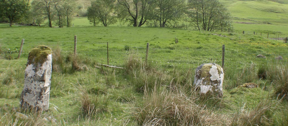
Clenamacrie Stone Row submitted by Tom_Bullock on 26th Feb 2005. Photo used by kind permission of Tom Bullock. More details of this location are to be found on his Stone Circles and Rows CD-ROM.
(View photo, vote or add a comment)
Log Text: Glenamacrie/Clenamacrie Stone Row: After An Dun, we headed off a few hundreds yards west back down the road. I took two lots of photos here, because I think I mistook an outcrop (an unmown area of the field with stones protruding, at NM 92745 28409). Andrew had mentioned both a ‘stone row’ and ‘four stones forming a chamber’, so I thought I had photographed the right thing. Driving down to the farm, I spotted the right three standing stones in a field nearer the farm, which I also photographed. Andrew said the ‘lump’ in the field behind was also a cairn, but this was the closest I could get, so we’ve got these standing stones with the cairn behind.
I wish now I’d had the courage to go and ask to see these up close, but I felt intimidated because the farm was so big and the gate into the field seemed to be along the far end of the track. I can’t get used to the ‘responsible right to roam’ act in Scotland, but it still feels like trespassing at times, especially when you are going doing someone’s driveway.
Clifton Stones
Trip No.3 Entry No.2 Date Added: 4th Jul 2016
Site Type: Standing Stones
Country: England (Cumbria)
Visited: Yes on 3rd Jul 2016. My rating: Condition 3 Ambience 4 Access 3
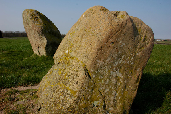
Clifton Stones submitted by nicoladidsbury on 31st Mar 2007. Clifton Standing stones - the smaller stone is set in concrete. Plough marks are visible on its southern side. Buzzards were flying overhead, fantastic :)
(View photo, vote or add a comment)
Log Text: Clifton Stones, near Penrith, Cumbria: These standing stones are only a short distance from Trainford Brow Long Barrow. There is a side road opposite Mount Clifton farm which allows for parking of one car on the grass verge. It was interesting crossing the A6 as cars sped along in both directions; however, sight lines were good. We followed the footpath through Mount Clifton farm (heavily mired with fresh cow dung). This path was gated, as they had a huge (but placid) bull in the barn yard with his ladies. The mire gave onto a tarmacked pathway leading to Tinkler’s Lane Bridge over the M6. It was then easy walking down to the field containing these two standing stones.
With a brilliant view of the North Pennines to the east and the Lake District (complete with notch in the hills) to the west, these stones sit next to the very busy M6 with a view of Penrith to the north. Because of the acoustics on the day, the traffic noise was a distant buzz in the background.
I was a little disappointed as the smaller stone had obviously fallen over in the past and been cemented into the ground.
After enjoying the ambience for a while, we tried to see the Cairn Circle at Leacet Plantation. The first forest track we tried had a Lowther Forestry working locking the gate. We then tried at Chatburn Kennels and Cattery, but the fields were cropped and walking through them heavy going. Being late in the day we decided to retreat to go and see the Countess Pillar then home. We got beeped at by the owners of the kennels who had come down to dump their rubbish exactly where we had parked the car.
Clyro Court
Trip No.167 Entry No.1 Date Added: 22nd Jul 2021
Site Type: Chambered Tomb
Country: Wales (Powys)
Visited: Saw from a distance on 12th Jul 2021. My rating: Condition 2 Ambience 3 Access 4
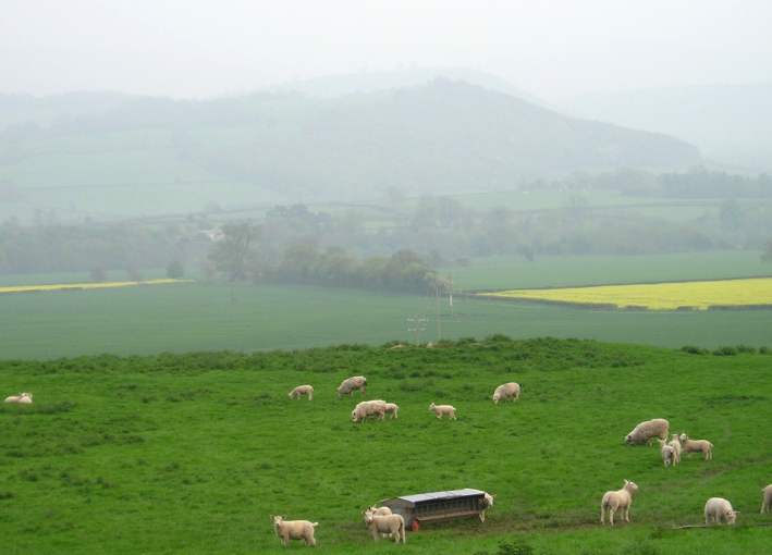
Clyro Court submitted by thecaptain on 14th May 2004. Clyro Court, Chambered Tomb, Powys, SO213432
Marked on the OS map as Chambered Long Cairn, the ruined remains of this tomb can be seen on a little hillock behind a house, beside the busy A438, overlooking the valley of the River Wye at Clyro, just over the river from Hay-on-Wye.
The remains of the tomb can be seen here from the northwest, and are the usual lumpy ground on top of the hillock. What looks like the remains of a stone chamber can be seen sticking out of the ground in the middl...
(View photo, vote or add a comment)
Log Text: Clyro Court Chambered Tomb: This tomb, marked on the OS map, lies on private ground behind a cottage. There was no one at home in the cottage, and the gates into the field had been padlocked with the largest padlocks and chains I've seen in a long time! We had to content ourselves with finding a vantage point by the barbed wire fence and photographing the cairn from there. Lumps and bumps vaguely visible. Would have loved to have climbed over for a closer look.
Coanwood (Lambley)
Trip No.43 Entry No.1 Date Added: 5th Sep 2017
Site Type: Ancient Village or Settlement
Country: England (Northumberland)
Visited: Yes on 2nd Sep 2017. My rating: Condition 3 Ambience 3 Access 5
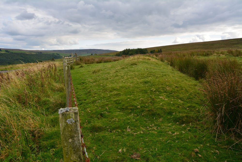
Coanwood (Lambley) submitted by Anne T on 5th Sep 2017. The eastern bank of the enclosure as it runs south along the fence line inside the field.
(View photo, vote or add a comment)
Log Text: Coanwood Settlement, Lambley: Driving from the Diamond Oak and the World War II prisoner of war camp to the north, this settlement lies immediately opposite the junction of the 68 Cycle Route and the A689 at Lambley. It lies very near the Roman route of Maiden Way, which in this part of the world goes over Hartleyburn Fell and Glendue Fell, and runs west of this settlement, following the route of the Pennine Way through Lambley Common.
We decided, on impulse, to stop and have a look, especially as there was a handy hard-cored parking space next to the green pumping station and were so interested, I did something I don’t usually do, and let myself into the field to walk along the track running parallel with the southern bank.
I could make out a rectangular structure in the south eastern corner, and possible hut circle mid-way across and one-third of the length south of the northern bank.
Cockburnspath Cross
Trip No.101 Entry No.3 Date Added: 2nd Oct 2018
Site Type: Ancient Cross
Country: Scotland (Scottish Borders)
Visited: Yes on 29th Sep 2018. My rating: Condition 3 Ambience 3 Access 5
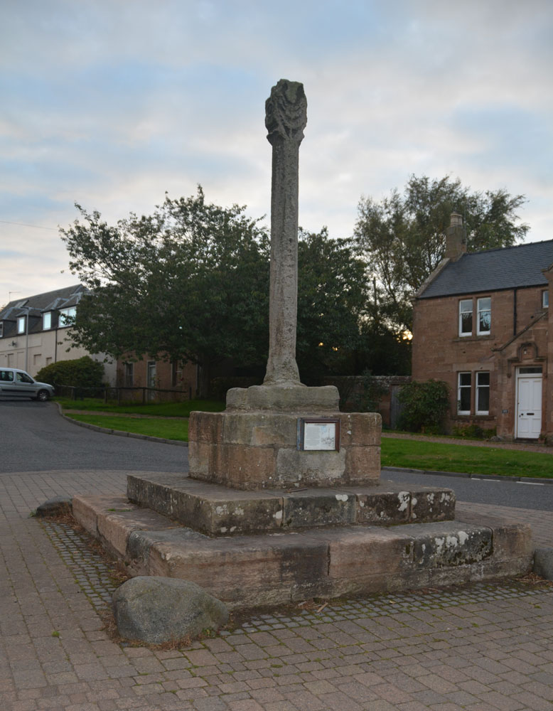
Cockburnspath Cross submitted by Anne T on 2nd Oct 2018. The cross, looking south west down Hoprigg Street.
(View photo, vote or add a comment)
Log Text: Cockburnspath Mercat Cross: Before coming to Cockburnspath, we'd visited the really beautiful Cove, with its smuggler's caves. We'd had to park in the village and follow the single track road running along the top of the cliffs to an old mine tunnel which formed a fun, but very dark, shortcut through to the cove. The bedding planes in the rocks here were fantastic - no wonder James Hutton found the solution to his unconformities only a few miles down the coast. The harbour looks like it might have come straight off an 18th century film set, and there was also a sea arch with a large, round hole in it. Brilliant.
By the time we got to Cockburnspath, only a few miles away, the light was starting to fade rapidly. Parking outside the post office (to avoid the car starring in more of my photographs!), I started to photograph the cross, only to find omeone had left a half eaten pack of McDonalds chips on the base of the stone; we ended up moving these and throwing them away in a nearby bin (yeuk). We also had a look at the churchyard, which had old grave stones, but at this time of night, couldn’t get in. The church had particularly heavy stone slabs used to roof it. We later found the same at Dunglass.
The notice on the side of the cross reads: “Cockburnspath. This Cross was erected in 1503 by King James IV of Scotland in celebration of his marriage to Princess Margaret Tudor, to whom he presented the lands of Cockburnspath as a dowry. The Princess was the sister of King Henry VIII of England and this union of the Scots Thistle and the Tudor Rose was to mark the start of a new and lasting peace, only shattered ten years later by the Battle of Flodden in 1513. / The Cross was repaired with the help of the Regional Council, but mostly by the loyal generosity of the people of this village.”
After seeing this cross, we hopped over the border to East Lothian to see Dunglass Collegiate Church, where we arrived to find a wedding in full swing, and needed torches to look round the inside of this ruined church. Definitely not a chance of getting to see the standing stones nearby at this time of the evening.
Cockleroy Hill (Beecraigs)
Trip No.49 Entry No.3 Date Added: 22nd May 2019
Site Type: Hillfort
Country: Scotland (West Lothian)
Visited: Yes on 22nd Sep 2017. My rating: Condition 2 Ambience 3 Access 4
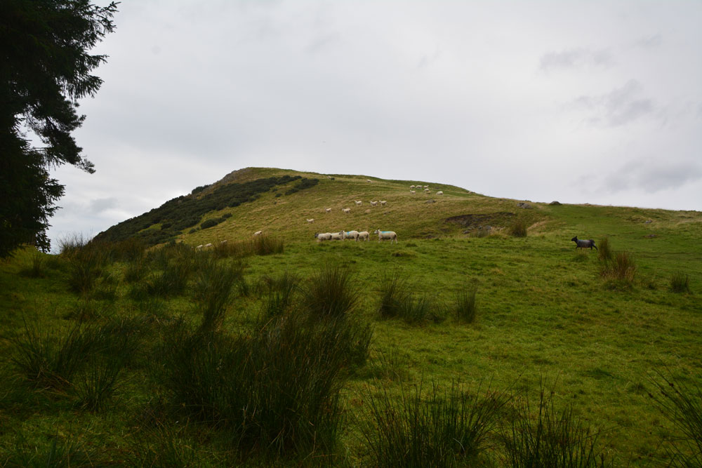
Cockleroy Hill (Beecraigs) submitted by Anne T on 5th Oct 2017. First view of Cockleroy Hillfort, having walked from the small car park to the gate into the field. The hill rises reasonably steeply up to 278 metres and has a trig point and view point on top.
(View photo, vote or add a comment)
Log Text: Cockleroy Hillfort, Beecraigs Country Park: From Lower Craigmailing Socketed Stone, we drove north past the Korean War Memorial to Beescraig Country Park. There was a small car park at about NS 99445 74270, where a path led through the forest, leading to a gate into the field containing the hillfort.
According to the Scotsman of 9th December 2012, Cocklroy means “the hat of the kings”. Situated in Beecraigs Country Park forest, there is a climb of 278 metres to the top and a mown path goes straight up the hill to the top of the fort, where there is a viewpoint. I wasn’t feeling too good, so opted out half way up the climb. Andrew continued up to the trig point at the top, and had great views across Lochcote Reservoir to the south west and the Forth Bridges at Queensferry to the north east.
Andrew said there wasn’t much to see of the fort itself – there were very little signs on the ground. I sat on the large stones about half way up the slope, at first thinking they were defensive ditches and banks, but were in fact modern quarries, when I looked closer!
Coffin Well
Trip No.170 Entry No.4 Date Added: 11th Aug 2021
Site Type: Holy Well or Sacred Spring
Country: England (Derbyshire)
Visited: Yes on 16th Jul 2021. My rating: Condition 2 Ambience 2 Access 5

Coffin Well submitted by AngieLake on 12th Feb 2007. The beautiful clay-based panel of dried flowers and seeds creating this artistic well-dressing at the Coffin Well in 2003.
(View photo, vote or add a comment)
Log Text: Coffin Well, Tissington: Finding this well was pretty tricky, as even with the leaflet showing the location of all the wells in Tissington, we walked up and down, and down and up a lane called 'The Foot'. Eventually, I realised that whoever was in the cottage had parked their car right across the front of the well, with the front passenger tyre almost in the well itself. I had to do contortions, avoiding the bonnet of the car, to get any photograph at all.
Presumably the main part of the well is behind the garden wall, in the private garden. The gate to the cottage had a sign which said 'no entry' or 'strictly private', and I was reluctant to knock on the front door and seek permission.
Not impressed by the parking, and no sign to say this was the well.
Coldburn (College Valley)
Trip No.45 Entry No.3 Date Added: 14th Sep 2017
Site Type: Ancient Village or Settlement
Country: England (Northumberland)
Visited: Yes on 12th Sep 2017. My rating: Condition 2 Ambience 4 Access 4

Coldburn (College Valley) submitted by Anne T on 14th Sep 2017. Having clambered up the steep(ish) hillside until the land levelled off, this is our first glimpse of the Coldburn Settlement from the north west.
(View photo, vote or add a comment)
Log Text: Coldburn Settlement (College Valley): After visiting the Southernknowe Settlement, the road splits into two. We took the eastern road at this point, travelling over Sutherland Bridge. There is a sign which says to beware as the road is not in very good condition, which is right! It is very narrow and has great potholes in parts.
We managed to pull off the road where a small layby had been created with lots of broken tarmac and stones. From this point, to the west of the settlement, we clambered up the somewhat steep-ish hillside, to where the land levelled off. Heading east, the scoop of the settlement came into view.
There are no obvious internal features within this settlement, but there are certainly views in three directions, with the steep slope of Coldburn Hill on the fourth.
The scoop is deepest to the north of the oval, and there appears to be two terraces cut into the hillside above.
Once in the settlement, we discovered a track cut into the bank of the settlement leading down to Coldburn Farm, so there was a much easier way of accessing this site!
Coley's Well
Date Added: 3rd Aug 2019
Site Type: Holy Well or Sacred Spring
Country: England (Northumberland)
Visited: Yes on 13th Jun 2014. My rating: Condition 2 Ambience 3 Access 4
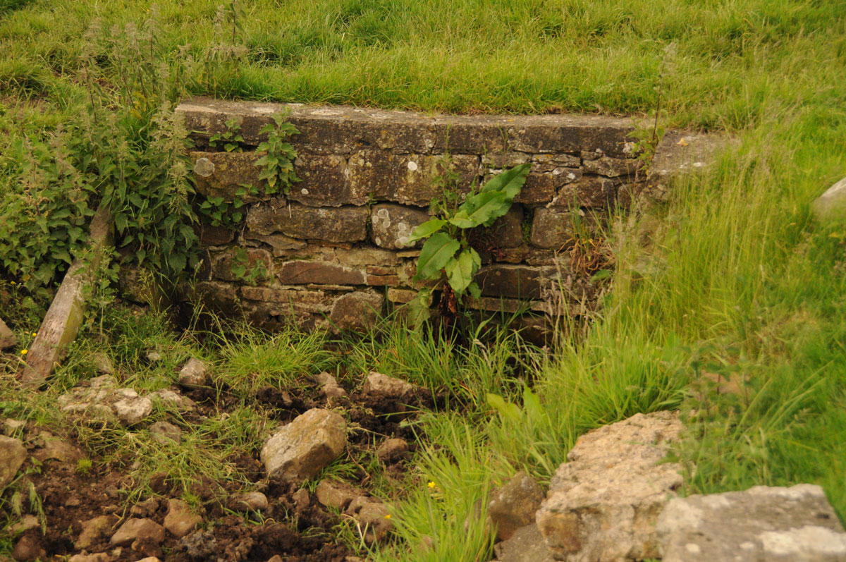
Coley's Well submitted by Anne T on 3rd Aug 2019. A closer look at the ruined back of the well/drinking trough. For a well that used to be known as the Bridal of Colwell and was dressed annually, it is now very sadly neglected. Photograph taken 13th June 2014.
(View photo, vote or add a comment)
Log Text: Coley's Well, Colwell: There is a brick well house close to the houses/farm buildings to the west, although there is also a dry drinking trough/well basin which looked as if this was the original spot where the waters emerged. For a well that used to be called 'Bridal of Colwell' it is now very sadly neglected.
Collingham Crosses
Trip No.19 Entry No.5 Date Added: 2nd May 2017
Site Type: Ancient Cross
Country: England (Yorkshire (West))
Visited: Yes on 27th Apr 2017. My rating: Condition 3 Ambience 4 Access 5
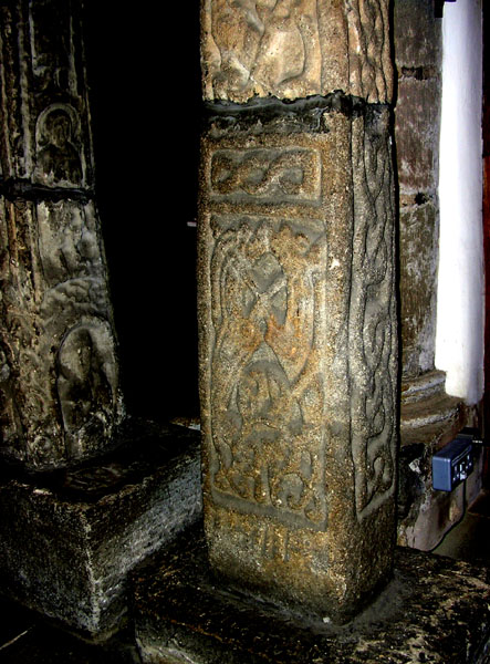
Collingham Crosses submitted by Thorgrim on 22nd May 2005. Dated to about 875 AD (the early years of the Viking occupation of the land around York) this cross is known as the Aerswith Cross. It shows clear Jellinge style carvings in the Danish manner.
(View photo, vote or add a comment)
Log Text: Collingham Crosses, West Yorkshire: What are the chances of meeting someone whose grandparents built the house you live in now and has recollections of visiting, together with photographs of what the house used to look like? The grandparents of Rev. Sylvia Earle who is vicar of Collingham did in fact build our house, and she was able to tell us what it was like when she was younger, and provided us with a photograph of what our (then) bungalow was like when it was first built.
The church has to be kept locked these days as Rev Earle told us someone had stolen a fragment from the west end, and someone tried to set a fire against the wood panelling at the east end of the north aisle. Shame.
We were left with the keys to return once we’d finished, so spent a good 40 minutes wandering around the church, photographing the crosses and fragments, including the cross fragment built into the north wall of the vestry. The Victorian builders built the nave and chancel at an angle. The Runic and Apostle crosses were lovely, together with the unusual round creset.
Most of the furniture within the building looked new and well cared for, with pristine kneelers. Much enjoyed this visit: we were made very welcome and this is a pleasant sanctuary inside, although the noise from the A58 invaded the privacy of the churchyard.
Coney Hill (Comrie)
Trip No.53 Entry No.1 Date Added: 10th Oct 2017
Site Type: Misc. Earthwork
Country: Scotland (Perth and Kinross)
Visited: Yes on 28th Sep 2017. My rating: Condition 2 Ambience 2 Access 4
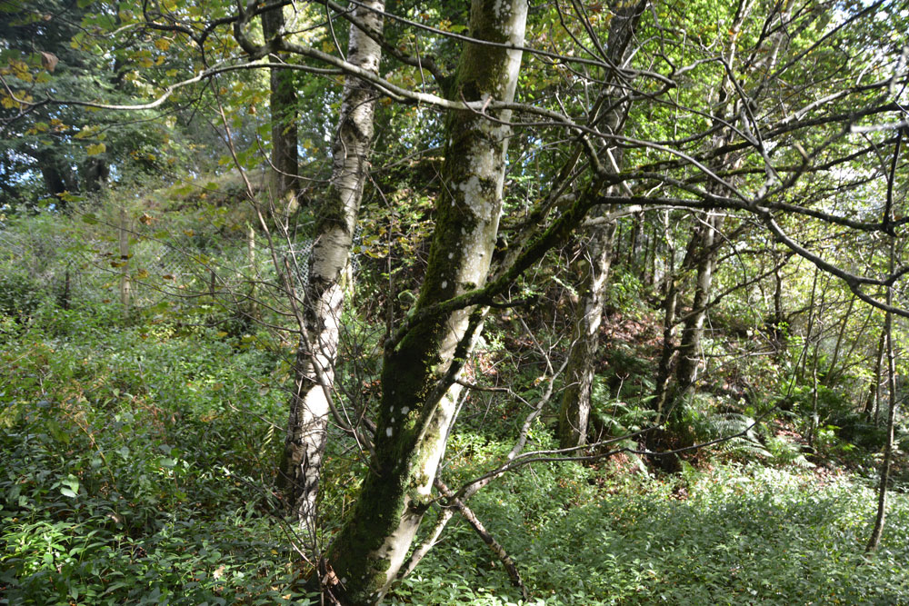
Coney Hill (Comrie) submitted by Anne T on 10th Oct 2017. From the path along the east side of the River Lednock, looking up, the mound of the motte is barely visible through the trees.
(View photo, vote or add a comment)
Log Text: Coney Hill, Comrie: Again, to escape the dreary weather in Armadale, we found ourselves heading a fair way north today, up to Comrie, where there promised to be quite a few sites – standing stones and stone circles in a relatively small area.
Comrie is a really lovely little village, and we stopped for tea and a sandwich at one of the café’s. The menu didn’t appeal to me, so I got a hot Scotch Pie from the next door bakers – one of the best I’d ever tasted.
We didn’t plan on going to this motte, but having walked up the high street and over the bridges, carried on onto the walks which were signposted. There was a large car park next to the golf course.. It had rained here heavily and the paths up to the motte were muddy and slipperty, with a steep drop down to the River Lednock below. The motte was so heavily surrounded by trees that it was difficult to make out by eye, and even more difficult to photograph.
Coneypark Nursery (Cambusbarron)
Trip No.108 Entry No.6 Date Added: 10th Nov 2018
Site Type: Cairn
Country: Scotland (Stirling)
Visited: Yes on 31st Oct 2018. My rating: Condition 2 Ambience 3 Access 5
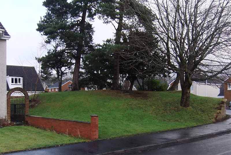
Coneypark Nursery (Cambusbarron) submitted by peigimccann on 24th Dec 2017. Coneypark mound photo by David Sibbald
(View photo, vote or add a comment)
Log Text: Coneypark Nursery Cairn: This cairn is right in the middle of a modern housing estate, where it has been left as a corner ‘open space’. The sides of the cairn have been marginally cut away to create the road and the gardens for the houses, but it is possible to walk over the cairn. A few of the residents were arriving home and in their driveways; none of them took (much) notice of me taking photographs and having a walk all around the cairn.
There is nothing much to see here, but it was ‘one to tick off our list’.
