Contributory members are able to log private notes and comments about each site
Sites Anne T has logged. View this log as a table or view the most recent logs from everyone
Chesters Roman Site b
Trip No.142 Entry No.2 Date Added: 7th Jul 2019
Site Type: Rock Art
Country: England (Northumberland)
Visited: Yes on 4th Jul 2019. My rating: Condition 3 Ambience 4 Access 4
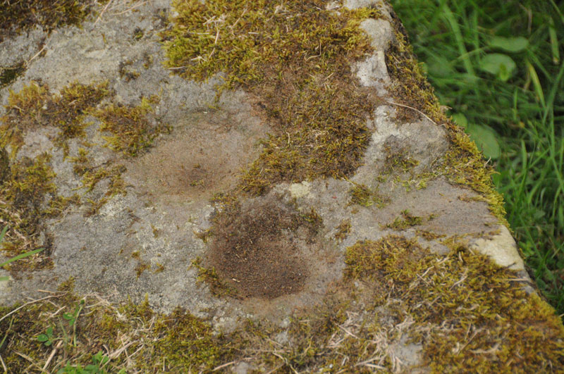
Chesters Roman Site b submitted by Anne T on 1st Sep 2014. Photograph showing two cup marks (0.09m) on stone, with third just on right hand edge.
(View photo, vote or add a comment)
Log Text: Chesters Roman Site b, Chesters Roman Bridge Abutment: Whilst we were here to photograph the bridge abutment, we took the opportunity to look for this panel again to see if it had changed. It was very much the same.
Hadrian's Wall (Brunton Turret)
Trip No.142 Entry No.1 Date Added: 7th Jul 2019
Site Type: Misc. Earthwork
Country: England (Northumberland)
Visited: Yes on 4th Jul 2019. My rating: Condition 3 Ambience 4 Access 4
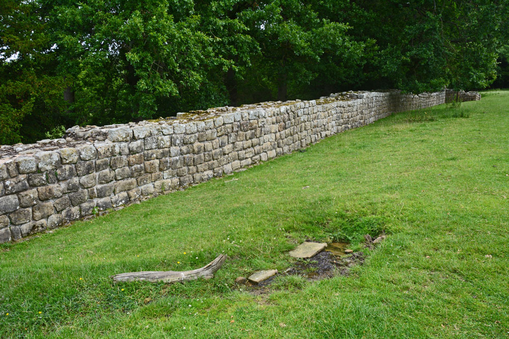
Hadrian's Wall (Brunton Turret) submitted by Anne T on 7th Jul 2019. Walking east along with wall, from near its south western corner. The small structure in the right/foreground is the spring, which was flowing freely at the time of our visit. There were the remains of some stone slabs around where it emerged from the ground.
(View photo, vote or add a comment)
Log Text: Brunton Turret 26b, Hadrian's Wall: Parked at the layby by the stile. We met a party of four Americans who were walking the wall and who had started at Newcastle on Monday, and from Corbridge this morning. I wished them a ‘happy 4th July’ and one of the ladies replied “Good job we’re friends again”, which raised a smile.
There was also a spring at NY 92109 69847 with the remains of a structure around it, flowing quite quickly and forming a small stream running downhill and round the bottom end of the turret.
The information sign at the top end of the site reads: ”Turrets were positioned equidistantly between largely milecastles where small garrisons of soldiers guarded gates that allowed for trave lthrough the Wall. Shortly after work on the wall started, large forts, such as Chesters, were also constructed to house garrisons of between 500 and 1,000 soldiers.
(Image) Right: layout of Brunton turret. The ‘curtain’ wall is a different thickness on each side of the turret. The turret was laid out with short ‘wing’ walls either side. These were supposed to be incorporated within the curtain wall once it was finished. But between completing the section of the Wall to the west and that to the east, the builders were ordered to narrow the curtain wall. This left about 1m of eastern wind-wall exposed”.
Tony's Patch 1
Trip No.141 Entry No.4 Date Added: 1st Jul 2019
Site Type: Rock Art
Country: England (Northumberland)
Visited: Yes on 30th Jun 2019. My rating: Condition 3 Ambience 3 Access 4

Tony's Patch 1 submitted by Anne T on 1st Jul 2019. The irregular 'cups' seen from further down slope, using flash to give a bit more contrast/depth. At the time of our visit, on the warmest weekend of the year (so far) the heavens opened and we got drenched. The light was so bad it was like dusk.
(View photo, vote or add a comment)
Log Text: Tony's Patch Rock Art: The information for this nature reserve said there was room to park one car by the stile into the field at NY 81961 65368, and indeed there was, but only just. As we readied ourselves to walk towards the wood, the first spots of rain started, but we decided it would only be a short shower, so thought we'd walk down anyway, and if the rain got heavy, we'd be sheltered in the wood. Ha!
From the stile we headed ENE across this field of, for the most part, knee high grass, heading towards the gate into the nature reserve. Then followed the path through the wood, finding a small turn off to our right to this stone at about NY 82262 65565. By this time, the rain was hammering down, and we had started to get soaked.
I don't think anyone had been here for some time, as the branches from the trees had grown right over the rock and I kept getting caught up in them.
We eventually found the cup marks at the bottom, right hand side of the rock, where the rock starts to become 'undercut'. We needed to push some of the bracken aside to see them.
I really don't understand how NADRAP could have classified these are having ben made by water running over the rock surface? Where are the water channels that would have worn? Or if these were solution holes, the rock must have been in a different position for these to form.
Having photographed these as best I could in the very low light levels, we headed back to the car. By this time, the grass in the field was wet, but we waded through. I don't think my walking sandals will ever be quite the same!
Joicey Shaft Cairn
Trip No.141 Entry No.3 Date Added: 1st Jul 2019
Site Type: Round Barrow(s)
Country: England (Northumberland)
Visited: Yes on 30th Jun 2019. My rating: Condition 2 Ambience 3 Access 4
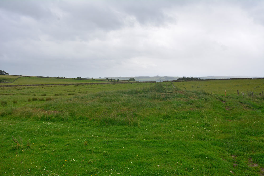
Joicey Shaft Cairn submitted by Anne T on 1st Jul 2019. The cairn as seen from the gate into the field at NY 82860 66456, showing how the farmer has driven his tractor over the western side of the mound, but the track 'bends' away from it, respecting most of the mound.
(View photo, vote or add a comment)
Log Text: Joicey Shaft Cairn: I spotted this mound almost by accident as I was photographing Joicey Shaft B from the track. At first I dismissed it as a manure heap, or possible tailings from the leading mining which used to take place here, but the more I walked round it, the more convinced I was it was a cairn, especially with its proximity to the rock art panels on the opposite side of the track, and because the modern field boundary and the track leading N-S to its western side 'bent' round to accommodate most of the barrow.
It is not recorded by HE or Pastscape, but it is on the old OS maps, so has been here for a while.
Joicey Shaft b
Trip No.141 Entry No.2 Date Added: 1st Jul 2019
Site Type: Rock Art
Country: England (Northumberland)
Visited: Yes on 30th Jun 2019. My rating: Condition 3 Ambience 3 Access 4
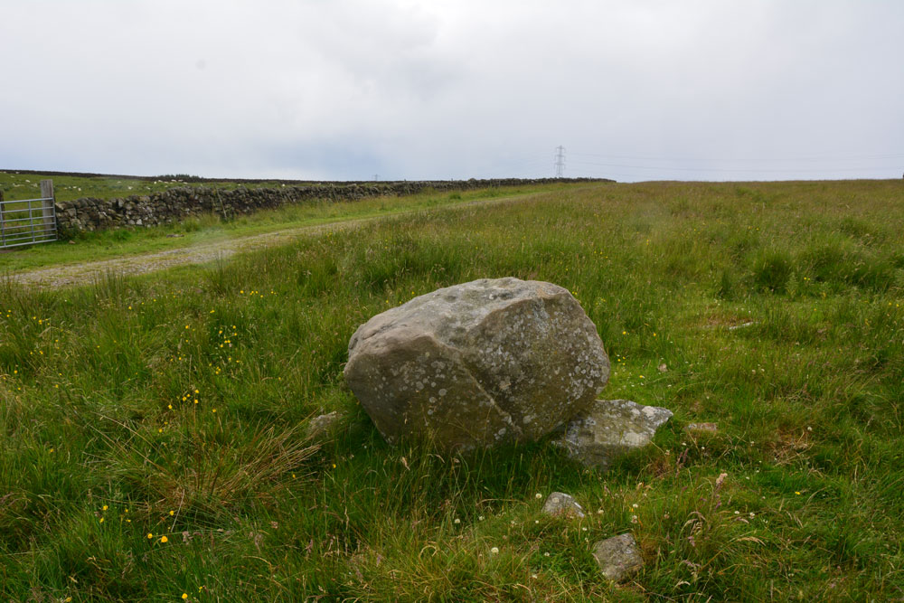
Joicey Shaft b submitted by Anne T on 1st Jul 2019. Photograph showing the Panel B boulder in relation to the track running to its south. The boulder sits on top of other stones, apparently the remains of an old field boundary/dry stone wall.
(View photo, vote or add a comment)
Log Text: Joicey Shaft B: This boulder is only 40m or so to the WSW of panel A, and is the only other large boulder in the field near this location. It is propped on top of other stones, part of the demolished field wall that ERA/NADRAP talk about.
ERA/NADRAP talk about two possible cup marks, which I found by comparing the shape of the stone with the NADRAP drawings. We also thought we saw two more, but these may be just solution holes or natural erosion.
Joicey Shaft a
Trip No.141 Entry No.1 Date Added: 1st Jul 2019
Site Type: Rock Art
Country: England (Northumberland)
Visited: Yes on 30th Jun 2019. My rating: Condition 3 Ambience 3 Access 4
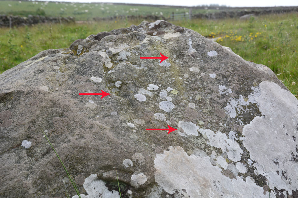
Joicey Shaft a submitted by Anne T on 1st Jul 2019. ERA/NADRAP says there are two cups here, the one to the east "fed by a natural gully from above". We thought we found three cups, marked with the red arrows, but there were so many erosion features, it was difficult to be certain.
(View photo, vote or add a comment)
Log Text: Joicey Shaft A: With the most of the rest of the UK enjoying warm sunshine, up in this part of Northumberland, the storm clouds had gathered. Having checked the weather forecast to make sure rain wasn't due to arrive until this evening, we set off to find these rock art panels, within easy reach of a road. This road was marked on the old OS map as a bridle path, but on the modern OS map it is now a metalled, yellow road, indicating it can be driven down.
OK, the road isn't the best, being potholed in parts, but the stone can be found just through a gate across the road at NY 82906 66462. Both boulders are on the northern side of the road, about 40m apart.
Being here was really wierd, as holes had been drilled in the northern-most gatepost, and as the wind howled through them, it played a tune, the 'melody' varying between different notes dependant upon the width of the hole.
I managed to photograph panel A before the rain started to come down, then we had to sit in the car for 10 minutes or so before there was a break in the clouds.
In walking back from panel B, I spotted through the gate on the south side of the road, a lump which looked like a cairn. I almost dismissed it as a farmer's manure dump, but realised the tractor track respected its western side (albeit cutting it a little). Andrew has just pointed out it is shown on the 1860 OS map.
Temple of Mithras (Carrawburgh)
Trip No.140 Entry No.5 Date Added: 23rd Jun 2019
Site Type: Ancient Temple
Country: England (Northumberland)
Visited: Yes on 23rd Jun 2019. My rating: Condition 3 Ambience 4 Access 4
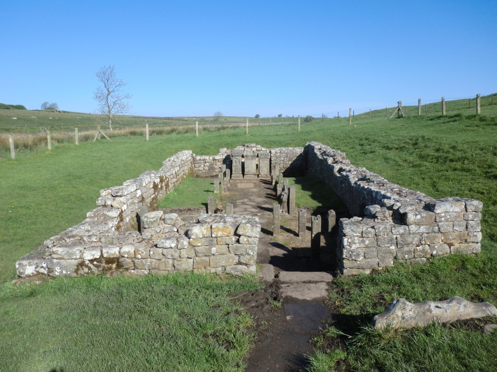
Temple of Mithras (Carrawburgh) submitted by johndhunter on 15th Jun 2019. Temple of Mithras - May 2012
(View photo, vote or add a comment)
Log Text: Temple of Mithras, Brocolita: This being a Sunday, there was a constant stream of visitors, most of whom ignored the fort and came straight down to the temple. I had hoped for bright blue skies and fluffy white clouds, which there had been at Great Chesters a couple of hours earlier.
Nothing much in the temple had changed since 2014, although I spotted more details on the altar stones this time, and took a few more photographs. Having just re-read Pastscape 1013363, "Replicas of the internal fittings have been fitted in cast stone", which came as a bit of a surprise!
Carrawburgh Roman Fort
Trip No.140 Entry No.4 Date Added: 23rd Jun 2019
Site Type: Stone Fort or Dun
Country: England (Northumberland)
Visited: Yes on 23rd Jun 2019. My rating: Condition 2 Access 4
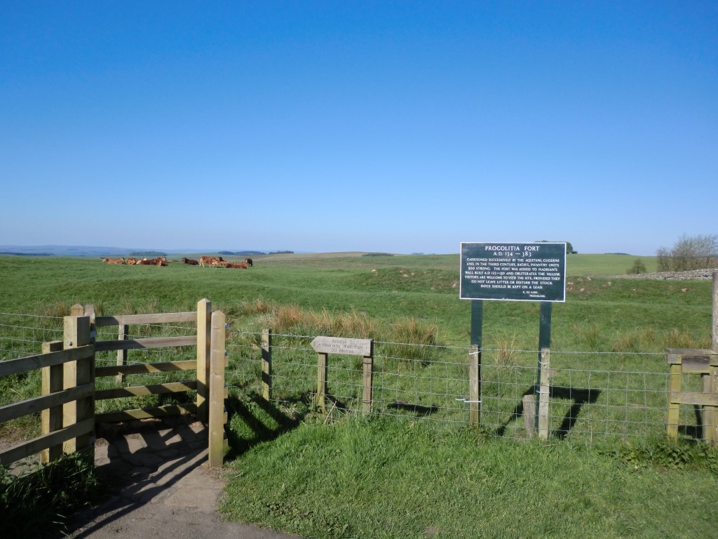
Carrawburgh Roman Fort submitted by johndhunter on 22nd Jun 2019. Signpost at the entrance to the fort taken in May 2012 – The sign post tells us that it was successively garrisoned by the Aquitani (from present day south west France), Cugerni (from present day Xanten on the Rhine) and in the third century Batavi (from the present day Dutch Rhine Delta) infantry units some 500 strong, It also tells us that it was built after the Wall on the infilled Vallum. ( The Vallum is a massive earthwork which runs to the south of the wall along its complete length, co...
(View photo, vote or add a comment)
Log Text: Carrawburgh Roman Fort/Brocolitia: When I last came here in 2014 there was a £4 charge for the car park which allowed you to also park at Housesteads and at other car parks at locations along the wall. Today, the machine has been upgraded and it is £1 for up to one hour. Other charges apply beyond that time. Having been to the Sill and paid to park there, we thought that charge covered this car park as well, but we had no receipt to leave in the car, so we paid our £1 again.
The sign at the entrance to the fort reads: “Carrawburgh (Procolitia) AD 134-383.
Garrisoned successively by the Aquitani, Cugerni and, in the third century, the Batavi; infantry units 500 strong. This was the last fort to be added to Hadrian’s Wall and obliterates the vallum. / Permissable access to the fort. No access to the trail. Please do not leave litter or disturb the cattle and sheep. Dogs to be kept on a lead. J. du Cane. Freeholder.”
The earthworks are nowhere near as impressive as the remains of Great Chesters Rman fort, further to the west, but it is a sizeable fort. We walked around the eastern, southern and western sides of the earthworks; some remains of the ramparts on the western side remains. We needed to walk back to the south eastern corner to go through the gate to the path down to the Temple of Mithras.
On our way back, Andrew went off the track to try and find a tumulus nearby. This had all but disappeared and we were unable to locate it, but we came across a spring, marked by a wooden post (as Robin Hood’s Well in Chollerton), with large stones and boulders piled up around a drinking trough. The spring is marked on the HE map of the area but no formal records of it (for photos see my separate entry below).
The Sill
Trip No.140 Entry No.3 Date Added: 25th Jun 2019
Site Type: Museum
Country: England (Northumberland)
Visited: Yes on 23rd Jun 2019. My rating: Condition 4 Ambience 3 Access 5

The Sill submitted by Anne T on 25th Jun 2019. The Sill building, as seen from its north eastern corner. It is located in Once Brewed, immediately next to the B6318 (Old Military Road).
(View photo, vote or add a comment)
Log Text: The Sill, Once Brewed: After visiting Great Chesters/Aesica, we popped over to the Sill for a cup of tea and a bowl of soup. It took three attempts to get our (simple) order correct, although as the Sill was popular with walkers, it meant queuing up each time to get the correct items.
I was curious to see if Tynedale North of the Wall Archaeology Group had their display about their surveys at Edges Green and Cleughfoot. We walked round the very small exhibition, which included a piece of rock art (on loan from the Great North Museum) and an inscribed Roman stone, but could see nothing from the group.
It was difficult to know if the display was aimed at adults or children; having wandered around it, most of it seemed aimed at the younger age group.
A pleasant place for a rest and refreshments, but I had expected more of a museum.
Aesica Vallum Round Barrow
Trip No.140 Entry No.2 Date Added: 25th Jun 2019
Site Type: Round Barrow(s)
Country: England (Northumberland)
Visited: Yes on 23rd Jun 2019. My rating: Condition 2 Ambience 3 Access 4
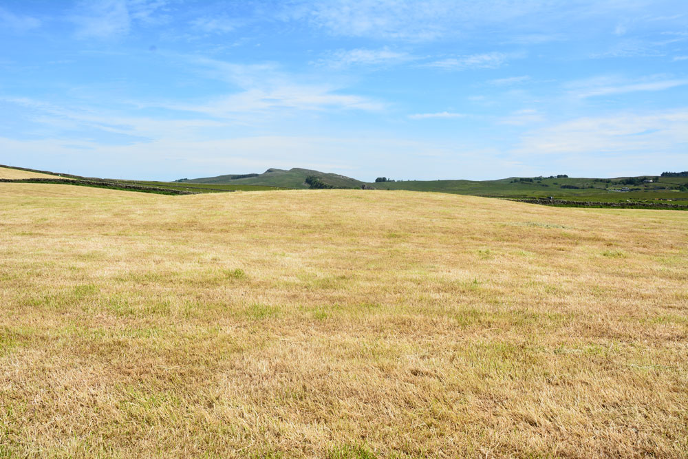
Aesica Vallum Round Barrow submitted by Anne T on 25th Jun 2019. Standing to the west of the round barrow, looking east towards Cawburn
(View photo, vote or add a comment)
Log Text: Aesica Vallum Tumulus: This tumulus is marked on the OS map and recorded in Pastcape. As we were nearby, and the tumulus was a simple walk along the metalled road, we walked along to take a look. The field had just been harvested, so we popped in to take a quick look.
Just to the south of the tumulus is the course of the vallum, parts of which are visible to the south west of the tumulus, between the tumulus and the dry stone wall, running west. At first, we thought this was the barrow, as it is much more obvious in the field, but looking closely at the map on our phones, we realised it was indeed the vallum and the barrow was further north.
Aescia Roman Fort
Trip No.140 Entry No.1 Date Added: 25th Jun 2019
Site Type: Stone Fort or Dun
Country: England (Northumberland)
Visited: Yes on 23rd Jun 2019. My rating: Condition 3 Ambience 4 Access 4
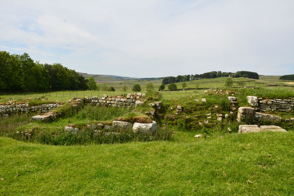
Aescia Roman Fort submitted by Anne T on 24th Jun 2019. The western gate of the fort, looking west. The most visible remains of buildings run north-south along this western edge of the fort.
(View photo, vote or add a comment)
Log Text: Aesica (Great Chesters) Roman Fort: In a repeat of our last visit in November 2016 (when we came here to see where the Roman aqueduct finished) we parked just off the small, gated road at NY 70421 66432, by the track leading up to Modern Farm and the Hadrian’s Wall Path.
Whilst I was photographing the inside of the fort, Andrew hopped over the stile at NY 70443 66807 and walked down the slope. As well as seeing a large stone with carved edging embedded in the dry stone wall, he identified the site of the bath house, previously earthed over by English Heritage to preserve it, as some stone were sticking out of the dry earth. Just down the slope was a piped spring which emerged into a modern cattle trough. Was this the spring that served the bath house?
The bath house, visible on UK Grid Finder, is centred on NY 70473 66733; the spring emerges at NY 70473 66698.
Torhousekie Stones East
Trip No.139 Entry No.6 Date Added: 25th Jun 2019
Site Type: Standing Stones
Country: Scotland (Dumfries and Galloway)
Visited: Yes on 17th Jun 2019. My rating: Condition 2 Ambience 3 Access 4
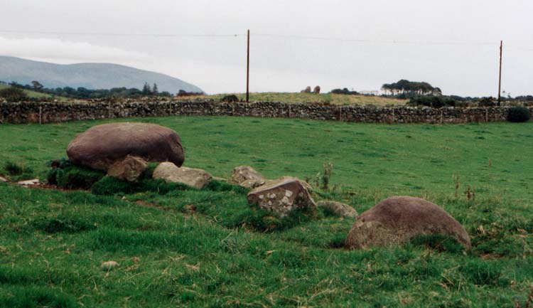
Torhousekie Stones East submitted by vicky on 29th Oct 2002. The ruined stone row near Torhousekie stone circle.
(View photo, vote or add a comment)
Log Text: Torhouseskie Stones East: To be found in the field immediately to the east of the Torhousekie Stone Circles, one of these stones was most certainly the size of the boulders used in the stone circle, although because of the sheer number of cattle (and The Huge Bull) around these stones (and the deep puddles around them and in the adjacent field) we didn't go and investigate further. I then got chatting to another gentleman with his camera who was also keen to investigate the stones, but taking one look at the cattle and The Huge Bull, we looked at each other and said 'No'.
I confess that even having printed off all the Canmore and Stone Rows of Great Britain records for this immediate area, I'd misread the grid reference and thought these stones were the ones to the south west of the circle (see Torhousekie South West Stones) and only realised my mistake when looking at the photographs and Canmore site together at home later. Although there appears to be a stone marked just to the east of the stone circle on Sandy G's plan of alignments at Torhousekie, which still confuses me - I need to check with Sandy.
Even to my untrained eye, it looked like large field clearance boulders had been dumped next to the large boulder. I have since read Sandy G's visit report, which confirms his thinking that these are field clearance stones, but their proximity to the stone circle has influenced thinking as to what they are interpreted as.
Torhousekie stone circle
Trip No.139 Entry No.5 Date Added: 25th Jun 2019
Site Type: Stone Circle
Country: Scotland (Dumfries and Galloway)
Visited: Yes on 17th Jun 2019. My rating: Condition 3 Ambience 4 Access 4
Torhousekie stone circle submitted by SandyG on 5th Jan 2018. View from above and south.
(View photo, vote or add a comment)
Log Text: Torhouskie Stone Circle: Our second stone circle of the day, and right next to the road. Contained by a fence to protect it from the huge cattle in the next field, this is a lovely little stone circle. We were at this site for what must have been an hour. Just after we arrived, a large ‘white van’ pulled up right behind us and sat there for almost half an hour before leaving; I had to be careful not to get it in my photographs. This stone circle was very popular with visitors, most of whom let themselves in through the kissing gate, walked to the information sign, then left within about five minutes.
This was the first time I used my wide angled lens, and I wasn’t sure how the focus on the photos was turning out, so I took some photos with my normal zoom to stitch together. Whilst we were there, the heavens opened for a short while, with needle-like shards of rain coming straight at my face thanks to the wind gusting across this fairly open piece of land.
I was struck how near the stone circle was to the River Bladnoch to the south of the stone circle, which glinted in the strong sunlight, in between rain showers.
Bladnoch
Trip No.139 Entry No.4 Date Added: 24th Jun 2019
Site Type: Standing Stone (Menhir)
Country: Scotland (Dumfries and Galloway)
Visited: Yes on 17th Jun 2019. My rating: Condition 3 Ambience 3 Access 5
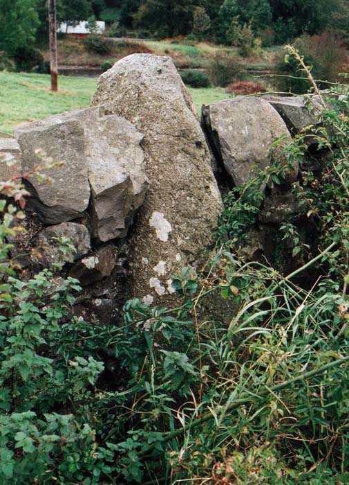
Bladnoch Standing Stone submitted by PaulM on 29th Oct 2002. This standing stone is marked on the OS Explorer Map 311 (Wigtown, Whithorn & The Machars) and can be found in the drystone wall flanking the A714 and directly opposite the house called Ashleigh in Bladnoch. The whisky distillery is only a short stagger away.
NGR: NX 423542.
(View photo, vote or add a comment)
Log Text: Bladnoch Standing Stone: We found this stone very hard to spot, eventually parking outside the cottages opposite the dry stone wall the stone was in and walked up and down the road with our GPS. We eventually spotted it by looking along the drystone wall and seeing where the tallest stone poking out of the wall was.
The stone was almost completely covered by wild roses, nettles and brambles, but we managed to push them gently to one side to take a photograph.
We did look for an entrance into the field by the river to look at the other side, but did not see one.
St. Kennera's Cross
Trip No.139 Entry No.3 Date Added: 24th Jun 2019
Site Type: Ancient Cross
Country: Scotland (Dumfries and Galloway)
Visited: Yes on 17th Jun 2019. My rating: Condition 3 Ambience 3 Access 4
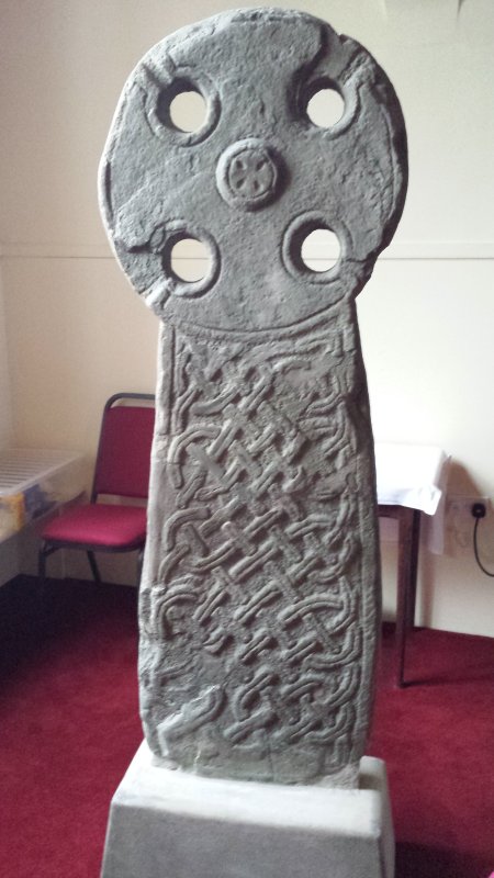
St. Kennera's Cross submitted by Enki on 18th Jan 2016. St. Kennera's Cross inside the parish church in Kirkinner.
(View photo, vote or add a comment)
Log Text: St Kennera's Cross, Kirkinner: It took a little bit of doing to contact the vicar at Kirkinner – numerous phone calls, but no answer, then an email to which there was initially no reply, so I'd crossed this cross slab off our visit list.
An email eventually came through whilst we were near Castle Douglas, travelling down the A75, giving the name and phone number of the church officer. On phoning the number, I was very kindly told the church was open today until 5pm, although it could be arranged to opened it Tuesday if necessary.
We eventually arrived at the church mid-afternoon. The church felt cold, lonely and neglected, the cross slab a mere by-thought in the north eastern corner, by the kettles and cups. We did try and get a photograph from the gallery, but a notice told us the stairs were too dangerous to use.
We later saw similar cross slabs at Whithorn Museum, and were told that the stone these slabs were made of was very difficult to carve as the stone flaked away at an angle from the carving, and they often broke.
It took a little while of looking at it to see the 'armpits' of the cross (carved running into the circular holes of the cross) and to see the shape of the cross itself.
The guide at Whithorn was surprised we managed to get into the church.
Minnigaff Old Church
Trip No.139 Entry No.2 Date Added: 23rd Jun 2019
Site Type: Ancient Cross
Country: Scotland (Dumfries and Galloway)
Visited: Visited (still working on) on 17th Jun 2019
Minnigaff Old Church submitted by markj99 on 12th Jul 2020. Minnigaff Old Church
(View photo, vote or add a comment)
Log Text: Cross Slabs, Minnigaff Old Church: The Canmore record says clearly that these two cross slabs are within the ruins of the old church at Minnigaff. We found these enigmatic ruins easily, within the burial ground of the modern-day church. However, the stones have been moved inside the modern church, and there is an information board just to the north of the west door into the church. I was very disappointed. I have sent Canmore a message, which they've acknowledged, so they can update their webpage for future visitors.
Glenquicken Circle
Trip No.139 Entry No.1 Date Added: 22nd Jun 2019
Site Type: Stone Circle
Country: Scotland (Dumfries and Galloway)
Visited: Yes on 17th Jun 2019. My rating: Condition 3 Ambience 4 Access 4
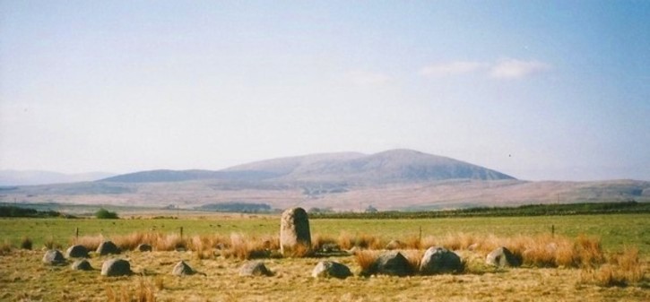
Glenquicken Circle submitted by Bladup on 18th Jun 2013. Glenquicken stone Circle with its centre stone and wonderful setting.
(View photo, vote or add a comment)
Log Text: Glenquicken Stone Circle:
Our first stop of the day, and in a delightfully rural location. There was a small layby just to the east of a bridge over Englishman’s Burn at NX 50847 58492 which was large enough for one car. Walking to the gate into the field at NX 50904 58456, the gate had been tied up with the Gordian Knott, but was eventually undone. There was an easy enough walk of a couple of hundred meters across a lush field of knee deep pasture and wild flowers.
The stone circle was indeed over a fence topped with barbed wire, but a gate to its east at NX 51057 58211 (opposite a modern cairn) let us in to the field, and we followed the small trails through the grass where other people had walked.
This was the first stone circle I’ve seen with a large central stone – can’t recall seeing any like this in Northumberland.
Alnmouth Wall Rock 26
Trip No.138 Entry No.10 Date Added: 13th Jun 2019
Site Type: Rock Art
Country: England (Northumberland)
Visited: Yes on 3rd Jun 2019. My rating: Condition 3 Ambience 3 Access 4
Alnmouth Wall Rock 26 submitted by SolarMegalith on 20th Jan 2013. Close-up on the cup-marks on Alnmouth Wall Rock 26 (photo taken on January 2013).
(View photo, vote or add a comment)
Log Text: Alnmouth Wall Rock 26: for main visit report see Alnmouth Wall Rock 32.
Culroy White Cairn
Trip No.138 Entry No.9 Date Added: 28th Jun 2019
Site Type: Cairn
Country: Scotland (Dumfries and Galloway)
Visited: Yes on 18th Jun 2019. My rating: Condition 2 Ambience 3 Access 4
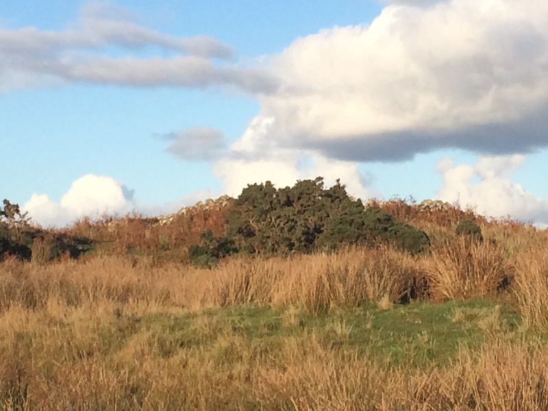
Culroy White Cairn submitted by markj99 on 21st Oct 2018. Culroy White Cairn as seen from the road
(View photo, vote or add a comment)
Log Text: Culroy White Cairn: The intention was to drive down this minor road, stopping to photograph three cairns to the south of the road on our way to Crouse. However, the road was very, very narrow with no marked passing places (just field entrances and the occasional driveway) and the stone walls were too tall to see over. All we could see in the end was one of these cairns and we could find no entrance/gate into the field, wo we contented ourselves with photographing the ones we could find.
We drove to where the minor road forks, just to the north west of a farm called Culroy. Taking the northern (left hand) fork, we parked on the short grass. This cairn is at the end of a quarried knoll, and not really obvious until you get up close to it, when the piles of white stones are clearly different from the quarried area around it.
We visited just after a period of dry weather; the ground in front of the cairn was covered in marsh grass, some areas still with small puddles, so wellies would be recommended after a rainy day or two (although you can always approach from the north if needed).
Alnmouth Wall Rock 24
Trip No.138 Entry No.9 Date Added: 13th Jun 2019
Site Type: Rock Art
Country: England (Northumberland)
Visited: Yes on 3rd Jun 2019. My rating: Condition 3 Ambience 3 Access 4
Alnmouth Wall Rock 24 submitted by SolarMegalith on 20th Jan 2013. Close-up on the cup-marks (photo taken on January 2013).
(View photo, vote or add a comment)
Log Text: Alnmouth Wall Rock 24: for main visit report see Alnmouth Wall Rock 32.
