Contributory members are able to log private notes and comments about each site
Sites Anne T has logged. View this log as a table or view the most recent logs from everyone
St Boswell's Old Church
Trip No.50 Entry No.4 Date Added: 7th Oct 2017
Site Type: Ancient Cross
Country: Scotland (Scottish Borders)
Visited: Yes on 24th Sep 2017. My rating: Condition 2 Ambience 3 Access 4
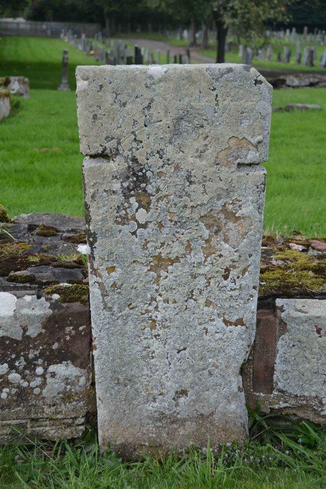
St Boswell's Old Church submitted by Anne T on 7th Oct 2017. Close up of the slab, which is supposed to bear an incised, equal limbed, cross within a circle. It is very worn. The other artefacts associated with the church of pre-1153 are built into the fabric of the present St. Boswell's church, located in the village.
(View photo, vote or add a comment)
Log Text: St Boswell's Old Church, Incised Cross Slab: I was expecting much more from this site, lying in a corner tucked between the River Tween to the east and Boswell Burn to the south. The ruins of the old church have been taken down to only a couple of courses, whilst the graveyard is still in use today.
Not very atmospheric. It turns out, pulling the Canmore record up on site, that there was only 1 tombstone with incised cross standing against the south wall of the church, which is supposed to have: “A tombstone, measuring 5ft 8in in length and tapering in width from 1ft 7 1/2in to 1ft 2in, is attached to the S wall of the church. It bears a slightly incised, equal-limbed cross within a circle.” No date is given for this. The rest of the interesting old stones have been built into the modern church, which we didn’t bother to find, as it presumably would be locked, and we had a lot more sites we particularly wanted to see.
Mertoun Kirk (St Boswells)
Trip No.50 Entry No.5 Date Added: 7th Oct 2017
Site Type: Sculptured Stone
Country: Scotland (Scottish Borders)
Visited: Yes on 24th Sep 2017. My rating: Condition 3 Ambience 3 Access 5

Mertoun Kirk (St Boswells) submitted by Anne T on 7th Oct 2017. This stone, just over 1 ft long and 6 ins deep is built into the east wall of the modern extension to the north east side of the church. To find it, stand behind the large green oil tank located at this side of the church and look up.
(View photo, vote or add a comment)
Log Text: Mertoun Kirk, incised stone: The church lies in the grounds of Mertoun House, which lies almost directly north, across a bend in the River Tweed, from Maxton with its Burgh Cross. To approach the church, we had to follow the signs up the single track road to the house; the church is just before you reach the house. There were other Roman fragments built into seats in the gardens just outside the house, but we needed to pay to get in the house, and there was only half an hour before it shut for the evening. Fortunately, we were able to park outside the church, next to the mounting block, and walked around this very hidden, almost secretive church.
The church itself was locked, and we couldn’t get in. Whilst Canmore gives no date for the stone, the fragment looks older than the church which was built in 1658 and restored in 1820 and 1898.
Font Stone (Dryburgh)
Trip No.50 Entry No.6 Date Added: 7th Oct 2017
Site Type: Ancient Cross
Country: Scotland (Scottish Borders)
Visited: Yes on 24th Sep 2017. My rating: Condition 3 Ambience 3 Access 5
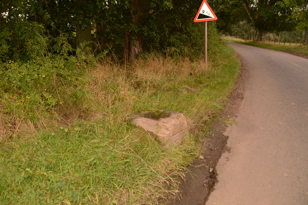
Font Stone (Dryburgh) submitted by Anne T on 7th Oct 2017. The Dryburgh Font Stone, showing its very close location to the side of the road.
(View photo, vote or add a comment)
Log Text: The Font Stone, Dyburgh (Cross Base): Sited on a corner of the B6356, it is a miracle that this cross base is still in one piece, being located so close to the road.
From Mertoun Kirk, we followed the B6356, turning right before reaching Dryburgh along a minor road signposted to Bemersyde, where the stone is located some 270 metres along the road on a slight right hand bend.
It is largely hidden by grass at the right hand side of the road as you head up to Bemersyde. There is a layby just before the stone, where we pulled in to photograph the stone. Note: this is a busy road, so be careful of traffic.
As we were very near the Scott’s View Geological Indicator and the Wallace Monument, whilst there was still light, we decided to go on and take a look.
Sourhope Hillfort
Trip No.55 Entry No.1 Date Added: 12th Oct 2017
Site Type: Hillfort
Country: Scotland (Scottish Borders)
Visited: Yes on 8th Oct 2017. My rating: Condition 2 Ambience 4 Access 3
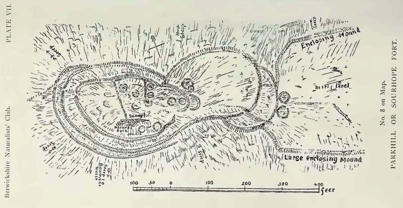
Sourhope Hillfort submitted by durhamnature on 5th Sep 2012. Drawing of the hillfort, 1897, from Berwickshire Naturalists via archive.org
Site in Scottish Borders Scotland
(View photo, vote or add a comment)
Log Text: Sourhope Hillfort, Scottish Borders: Well, this morning was a surprise, as rain had been forecast, but we woke up to a blue and cloudy sky, with little wind, so we decided to make the most of the nice weather before the clocks go back at the end of the month.
We used an ‘unusual’ (twisty/windy) route to reach this site. We drove up using the A68 past Carter’s Bar, then taking the first turning right and following the minor roads up through Hownam towards Yetholm, turning right and heading back down south at Primsidemill.
We followed the Bowmont Water Valley along to where the Sourhope Burn joins it, then headed north east up the dead end road to Sourhope Farm. Just past the cattle grid by the barns to the south west end of SouthopeFarm, there is room to park the car on the verge. We then headed up past the farm, turning right and going through two gates by a barn at NT 84596 20177, then following the path uphill towards Park Law Fort, then turning south west at NT 85047 19886 and following a quad bike up a relatively steep part of the hill, to approach the fort from its eastern side, entering at NT 84858 19793 on the south eastern side.
The outlines of the fort can be clearly seen on UK Grid Reference Finder. From below, we could see what looked like telegraph poles on top of the fort; getting closer, there are two television aerials on the western side of the fortifications!
There were great view from the top of this hillfort. We’d printed off the Canmore plan and description before we went, but even so, it was difficult to tie the words up with what we were trying to make out on the ground. The structures and hut circles on the eastern side of the fort were the easiest to interpret.
It was a nice walk, and exploring the hillfort was really thought-provoking, thinking what it would have been like for the occupants of this fort.
Fasset Hill (Sourhope)
Trip No.55 Entry No.2 Date Added: 12th Oct 2017
Site Type: Ancient Village or Settlement
Country: Scotland (Scottish Borders)
Visited: Yes on 8th Oct 2017. My rating: Condition 2 Ambience 3 Access 3
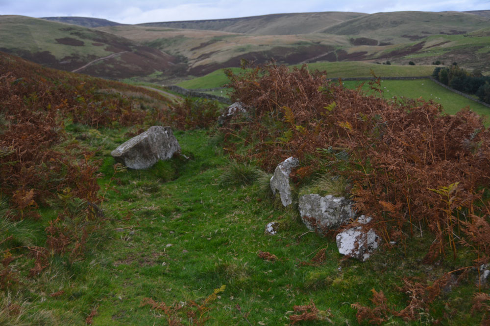
Fasset Hill (Sourhope) submitted by Anne T on 12th Oct 2017. The boulder faced rubble wall to the south end of this rectangular enclosure - badly disturbed/decayed but the line is still visible amongst the tall bracken.
(View photo, vote or add a comment)
Log Text: Fasset Hill Scooped Settlement, Sourhope: It was probably a silly time of year to look at this settlement, as the bracken was very tall, and probably also too late in the evening, as dusk was falling. But, hey ho, we were nearby and decided to walk back down to Sourhope Farm, and follow the track up Fasset Hill.
From Sourhope hillfort we walked back down the track to the farmhouse near the junction of the Sourhope and Kaim Burns, turned north east and walked over the wooden bridge at NT 84588 20250. From there we followed the metalled road up past a dump/quarry area, where the metalled road turns left/west and a stony track continues east. The Fasset Hill settlement is around the sheepfold on the hill just to the north of the track just past the ‘dump’.
The photographs don’t really do this site justice, as it was easier to see with the naked eye rather than catch it on photographs – the area was well defined on the ground. The sheepfold now occupies just west of centre, and what look to be the foundations of buildings can be found in its south east corner. The site looks like a building platform scooped out of the hillside. Canmore says it was probably constructed in Romano British times, and later reoccupied in the medieval.
There were a couple of other settlements nearby, but it was getting so dark, it was getting silly. We decided to walk swiftly back to the car and head home.
Will O'Greena's Stane
Trip No.73 Entry No.2 Date Added: 14th May 2018
Site Type: Standing Stone (Menhir)
Country: Scotland (Scottish Borders)
Visited: Saw from a distance on 13th May 2018. My rating: Condition -1 Ambience 4 Access 4
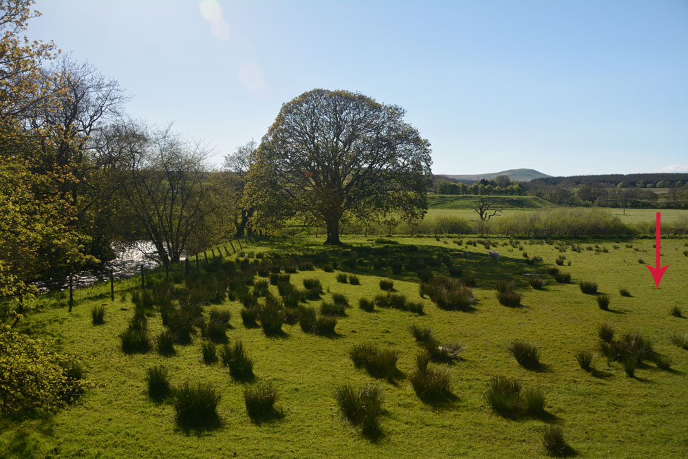
Will O'Greena''s Stane submitted by Anne T on 14th May 2018. The red arrow points to the approximate grid reference where this prehistoric standing stone was originally sited.
(View photo, vote or add a comment)
Log Text: Will O'Greena's Stone, Kersehopefoot: What a beautiful spot, where Kersehope Burn meets Liddel Water. Certainly very historic, if you can reconcile Canmore's version with the interpretation board on site. On the Reiver's Trail, its an easy (if wet, due to heavy rain) walk along the old railway embankment, although to descend into the field between the embankment and the river to find the stone, it's a six foot or so slither down the embankment. We walked up and down, down and up, trying to find any sandstone boulder/stone which matched the description on Canmore (thank goodness for a mobile signal to call up the record 'in the field').
I eventually spotted this stone next to a gate/fence backing onto private property. The strong fence with two lines of barbed wire made me think twice about hopping across the fence, and we could see no obvious other route into the field to check. A beautiful spot but so disappointing that, having mentioned this famous stone, they hadn't made sure it (what remained of it) could be seen.
Carby Hill
Trip No.73 Entry No.1 Date Added: 14th May 2018
Site Type: Ancient Village or Settlement
Country: Scotland (Scottish Borders)
Visited: Yes on 13th May 2018. My rating: Condition 3 Ambience 5 Access 4
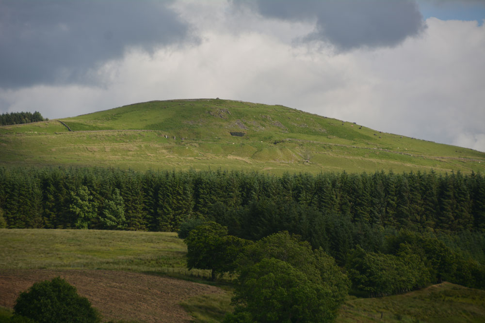
Carby Hill submitted by Anne T on 25th Jun 2017. We only saw Carby Hill Settlement from the Milnholm Cross just south of Newcastleton, then again from the track by the quarry just below the fort/settlement. When we arrived, we saw some enormous cattle grazing the site. Even my husband balked, and he was brought up on a farm and is used to these beasts. Looking forward to a return trip in the not too distant future - it looks amazing.
(View photo, vote or add a comment)
Log Text: Carby Hill Hillfort/Settlement, Scottish Borders: Literally just across the border from England, we parked by the cattle grid at NY 48834 83744, opposite the bungalow/farm. Just to our south east, there was (unusually for Scotland) a footpath sign which led up to the hillfort, so we decided to follow it. A mistake. The gate into the field of sheep was wired shut, so we had to duck under the electric fence. Following the slope uphill, we had to tackle three or four deep field drains, full of running water.
It wasn’t until we got towards the top of the slope that the walls of the settlement came into view. And what walls.
This is a really brilliant site. The last time we tried to get up here, there was an absolutely monumentally huge bull and cattle on top of the hill. This time, there were only sheep and their lambs. With 360 degree views, it was superb.
The interior of the hillfort is not large, but we made out four, if not five, hut circles, still with their banks intact, plus a watchtower in the north eastern corner.
Not much of the walls remains on the north/north eastern side, but there are lower banks of stones. We walked round the outer edge of the wall, to where stones have been piled up to form a modern cairn, overlooking the Liddel Water valley below. We descended the hill from the western side of the hillfort, which avoided the field drains, and a much easier walk.
Horseshoe Wood (Hownam)
Trip No.79 Entry No.1 Date Added: 1st Jul 2018
Site Type: Standing Stone (Menhir)
Country: Scotland (Scottish Borders)
Visited: Yes on 27th Jun 2018. My rating: Condition 3 Ambience 4 Access 4

Horseshoe Wood (Hownam) submitted by Anne T on 8th May 2015. One of the broader faces of this enigmatic standing stone in its gloriously scenic setting.
(View photo, vote or add a comment)
Log Text: Horseshoe Wood Standing Stone: This was my first real 'day out' since being ill with flu and having been confined to bed for a week, so not feeling hugely great in myself, but great to be outside again. We met Sandy G (of Stone Rows of Great Britain fame) in Hownam Village and followed The Street, Sandy kindly moderating his pace to a slow 'plod' to accommodate me, until we reached Horseshoe Wood. The sun was bright and the temperature rose higher as we walked up the slope. I was glad to stop at the standing stone for a drink and to take some photographs. Great to hear Sandy’s views about the location of the stone and its context; it’s difficult to know what ages standing stones actually are, and whether they are in their original location. However, this one is placed right next to an important route, The Street, described as a ‘historic cross border route), which provides the context.
There is a quarry to the immediate east of the stone, which makes the location look a little suspicious, but the stone looks as if it is in its original location with packing stones around its base and on a low, oval mound.
The Shearers
Trip No.79 Entry No.2 Date Added: 2nd Jul 2018
Site Type: Stone Row / Alignment
Country: Scotland (Scottish Borders)
Visited: Yes on 27th Jun 2018. My rating: Condition 3 Ambience 4 Access 3
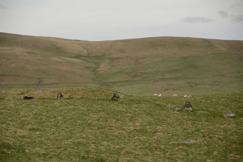
The Shearers submitted by Anne T on 8th May 2015. This was my first view of The Shearers, running across the centre/middle of the photograph from left to right.
(View photo, vote or add a comment)
Log Text: The Shearers, Hownam, Scottish Borders: By the time we got to the Shearers, the sun was high in the sky and beating down on us. Many horseflies, but thankfully no ticks. I was able to help with Sandy G's survey by acting as ‘the target’ for the disto (holding a piece of paper upright against the ranging pole so they could get accurate distances from the pole to each stone).
It occurred to me that where the row goes down the slope and ends at what is now a bog, at NT 7907 1927, perhaps this might have been a spring in ‘the olden days’ and been the water source for the hillfort.
The top end of the row seems to ‘bend’ slightly to the south east, heading towards looks like a hollowed out/partially excavated cairn.
It was fascinating to watch Sandy’s process of surveying the row, the row being too long to survey in one, so it was done in two halves. First he measured the distance of the centre of each stone from a ranging pole located in one spot, then took the angle of the stone from its central point to the ranging pole, transferring the measurements onto a plan, then photographed each stone individually. Finally, he walked up and down looking for ‘sighting lines’ – seeing what was visible from each stone, in which direction, and whether or not the stones echoed the shapes of any features in the landscape.
The conclusion Sandy came to (I think, as he says working out the details later will confirm or not) is that he counts this as a ‘possible’ stone row. It appears to be clearly associated with the nearby hill fort. I still dispute Canmore’s interpretation as the remains of a field boundary, as surely it would be connected to other old field boundaries nearby. None of these other boundary features had the earth removed from them.
We finally got back to the car at 6.30pm - the time had just flown. A very educational afternoon, and I was really pleased to have been involved in Sandy's survey. Pleasant day in pleasant company.
Talla Linnfoots
Trip No.82 Entry No.1 Date Added: 23rd Jul 2018
Site Type: Cairn
Country: Scotland (Scottish Borders)
Visited: Saw from a distance on 12th Jul 2018. My rating: Condition 2 Ambience 3 Access 4

Talla Linnfoots submitted by Anne T on 23rd Jul 2018. I'm not sure if I've photographed the right monument, as we couldn't get through the tall, very long deer fence, but this is the site estimated from the map and using our GPS to help. The enclosure lies some 100m to the north west of this 'cairn', which is the grassy lump which runs across the middle of the photograph.
(View photo, vote or add a comment)
Log Text: Cairn & Enclosure at south eastern end of Talla Reservoir: Our first, proper, stop of the day, as I can’t count the visit to Tweedmuir Kirk, as the stone we saw from from the 1600s.
This is a remote, but very pretty spot, albeit with tall, brooding hills around, only tempered by the gentle trickling of the Coddleteth Burn, Games Hope Burn and Talla Water, which join up before entering the reservoir lake.
We were prevented from getting right up to this cairn and enclosure by a long, continuous deer fence. I think I’ve photographed the cairn, but we had difficulty in seeing the enclosure on the ground.
The enclosure can just be seen, very faintly, on UK Grid Reference Finder.
Megget Stone
Trip No.82 Entry No.2 Date Added: 23rd Jul 2018
Site Type: Standing Stone (Menhir)
Country: Scotland (Scottish Borders)
Visited: Yes on 12th Jul 2018. My rating: Condition 3 Ambience 4 Access 5
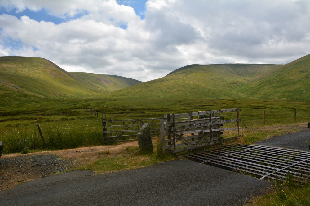
Megget Stone submitted by Anne T on 23rd Jul 2018. Looking across the Megget Stone to the West South West, across the step or shoulder in its eastern face, and trying to capture the majesty of the surrounding hills. Canmore tells us this is a slab of gritty greywacke, 7.5 ins thick, and 3ft 4ins high on one side, and 2ft 9ins above ground level; they add that the step/shoulder is apparently artificial.
(View photo, vote or add a comment)
Log Text: Megget Stone, east of Talla Reservoir: Continuing along the twisty, windy road that follows Talla Water, we passed an intrepid cyclist making his way slowly up the hills, and some motorcyclists who had stopped to photographs the waterfalls along the route.
When we got to the grid reference given for the Megget Stone, we couldn’t see it at first, as it was hidden by the gate. There was room for a car to park just past the cattle grid and gate. Hopping out to take photographs and examine this stone in more detail, the cyclist past us, and as he did, I realised that at this point, it was downhill all the way – the watershed.
This stone is definitely a boundary marker, not a true standing stone. It looks as if its eastern face has been broken. In a remote but lovely spot.
Patervan Settlement
Trip No.82 Entry No.3 Date Added: 23rd Jul 2018
Site Type: Ancient Village or Settlement
Country: Scotland (Scottish Borders)
Visited: Saw from a distance on 12th Jul 2018. My rating: Condition 2 Ambience 3 Access 4
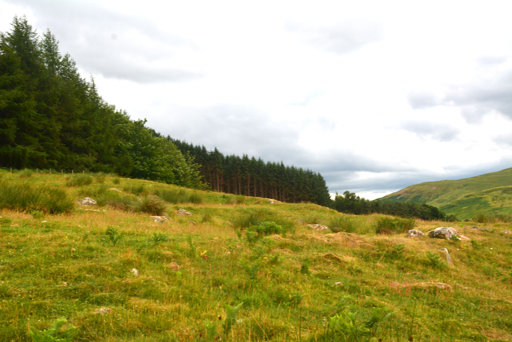
Patervan Settlement submitted by Anne T on 23rd Jul 2018. The outer wall of the settlement curves along the middle/bottom of the photograph, and contains boulders/facing stones which are believed to be in situ. Inside this 8ft wide bank, there is a large house platform measuring some 28ft in diameter.
(View photo, vote or add a comment)
Log Text: Patervan/Polmood Settlement, just west of Patervan Farm Cottage: After the Meggat Stone, we stopped off at Henderland Chapel (aka Chapel Knowe and Cockburn’s Tombstone) at NT 23112 23414, which was well worth a look, but too modern for the Portal!
This settlement is (almost!) easily reached. We parked at a layby on the western side of the A701, just north of the entrance to Patervan farm at NT 10850 28570. To think we’ve driven this way many, many times before over the years, but didn’t even consider exploring this area.
We crossed over the River Tweed (with its river monitoring station) via the robust bridge, and followed the track up to Patervan farm. We passed the cottage on our right hand side. then diverted on the footpath which led into the field just before the sign for ‘Patervan Steading’. The gate into the field on the other side of the track at this point was chained and padlocked, along with an electrified fence. We clambered over the wooden fence next to the gate, only to be confronted by another chained and locked gate. As we wanted to get on and climb up to the hillfort and another, larger settlement, we decided to hedge out bets and simply looked over the stone wall, deciding if there was time on the way back, to hop over and take a closer look (but we ran out of time).
I was really surprised to find so many ancient sites, almost an entire archaeological landscape, in a relatively small area. Worth investigating again, although not hugely, hugely exciting.
Patervan Cairn, Buildings & Mound
Trip No.82 Entry No.4 Date Added: 23rd Jul 2018
Site Type: Cairn
Country: Scotland (Scottish Borders)
Visited: Yes on 12th Jul 2018. My rating: Condition 2 Ambience 3 Access 4
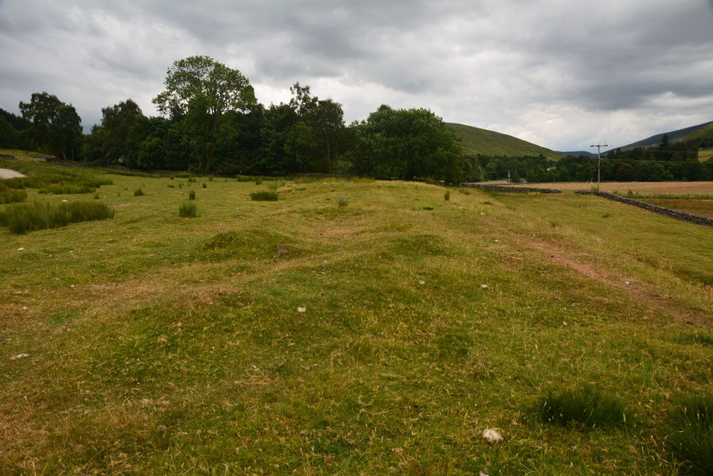
Patervan Cairn, Buildings submitted by Anne T on 23rd Jul 2018. Standing two thirds of the way along the length of the buildings, looking south south west, towards Patervan Steading and the cairn (to this side of the trees). Whilst Canmore doesn't date these buidings, to us they looked remarkably like some shielings we'd helped to survey at Sewingshields Crags, Northumberland.
(View photo, vote or add a comment)
Log Text: Patervan Cairn, Buildings & Prehistoric Mound, Scottish Borders: There is actually a rich archaeological landscape around here, although I’m pleased we’ve been out with an Archaeology Group, or I would have had trouble interpreting what we saw. We passed all of these features, all of which are within 100m of each other, on the way to the Laigh Hill settlement, just to the north east, so stopped with the GPS to make sure I was photographing the right thing!
They are perched on top of a river terrace above the alluvial (flood) plain of the River Tweed, which is 100m to the west. The surrounding hills provide an atmospheric backdrop (especially with black clouds (but no rain) looming above us).
Norman's Castle
Trip No.82 Entry No.6 Date Added: 24th Jul 2018
Site Type: Stone Fort or Dun
Country: Scotland (Scottish Borders)
Visited: Yes on 12th Jul 2018. My rating: Condition 2 Ambience 4 Access 3
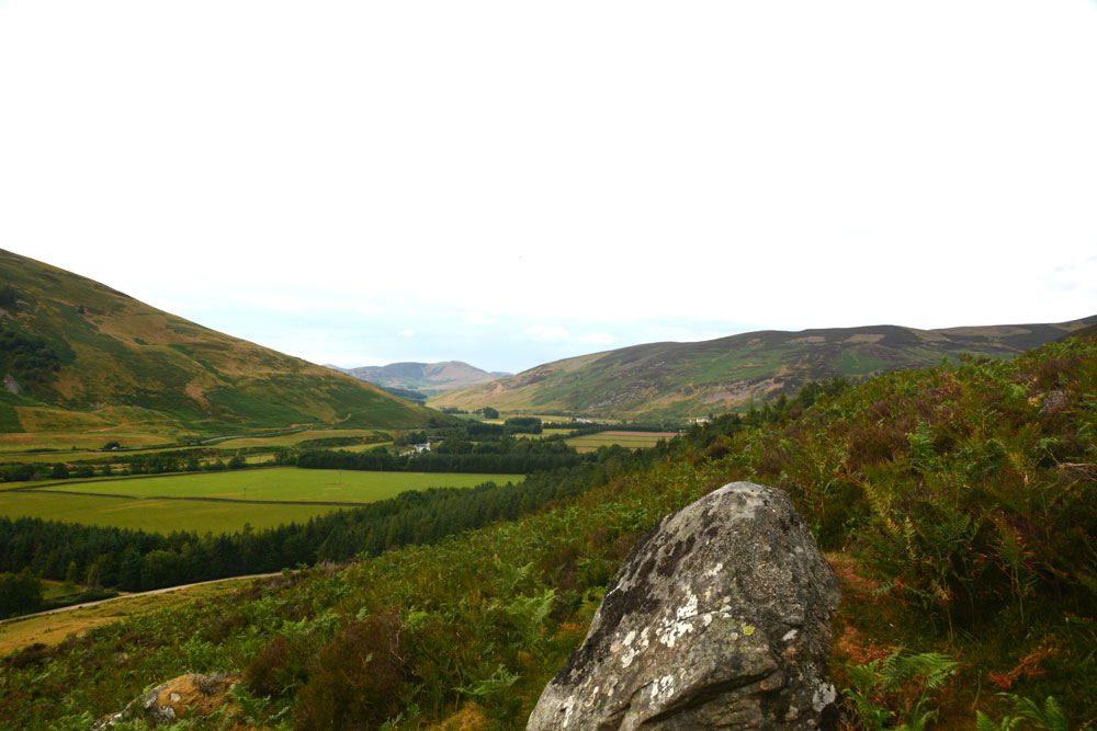
Norman's Castle submitted by Anne T on 24th Jul 2018. Looking directly north across the large rock above the entrance to Norman's Castle.
(View photo, vote or add a comment)
Log Text: Norman's Castle, Laigh Hill, Patervan: Strictly, I only saw this dun from a distance, as it was scramble to get to the top of the hill, and my fear of falling kept me on Laigh Hill settlement below. Husband, Andrew, with all the skills of a mountain goat, and no fear of heights, went tramping up with the camera. When he came back down he said: "Goodness knows why they live in such places - it's difficult to get into!" Presumably, raiders would have been deterred by the climb, so the settlers would have been well defended.
From Laigh Hill settlement below, a large rock protruding from the surrounding cliff face dominates, together with what looks like a cairn, but the scramble across the rocks to take a closer look was deemed a little tricky.
There are certainly 360 degree views all around this dun. Very little of the foundations could be seen, due to the high growth of bracken and overlying turf.
Laigh Hill (Tweeddale)
Trip No.82 Entry No.5 Date Added: 24th Jul 2018
Site Type: Ancient Village or Settlement
Country: Scotland (Scottish Borders)
Visited: Yes on 12th Jul 2018. My rating: Condition 2 Ambience 3 Access 3
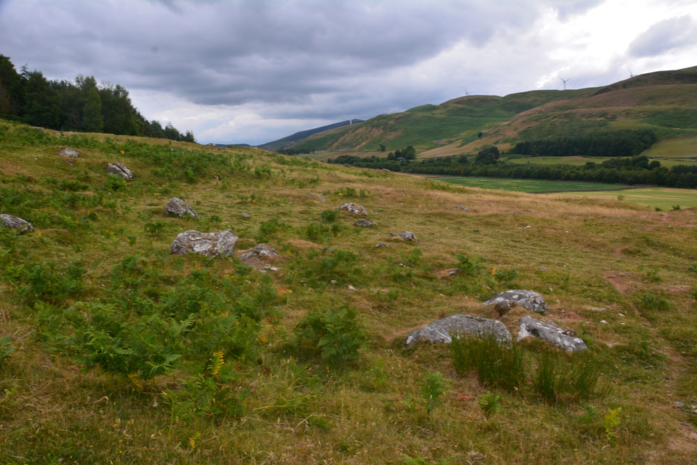
Laigh Hill (Tweeddale) submitted by Anne T on 24th Jul 2018. Standing just north west of the middle of the settlement, looking over both what we think are the remains of the foundations of an internal structure, plus boulders which emerge from the hillside. We found it a little tricky to pick out any particular features within this settlement. According to Canmore, just east of the entrance, a semi-circular stony bank marks what may have been a round stone-walled house. This may very well be this feature!
(View photo, vote or add a comment)
Log Text: Laigh Hill Settlement, below Norman's Castle, Scottish Borders: I was really looking forward to seeing this large settlement on the slopes of Laigh Hill, with the River Tweed to the south below.
The walk was easy, along a track, and only 400m past the Patervan Mound. Leaving the track and following the well-worn sheep tracks up the slope, through the low outer banks at the south west of the settlement, we arrived amongst a confusing array of circular flat areas, stony structures and boulders. Even though we'd seen a number of settlements, with our somewhat inexperienced eyes, we had difficulty trying to trace any particular structures to photograph. I called up the Canmore record on my phone, but there was no plan to orientate ourselves to, so we contented ourselves with trying our own interpretations, trying to match what we were seeing with the written description.
Norman's Castle was impressive, on the rocky knoll high above us. This really dominated the scene. Making our way over to the gate in the fence which led up to the rocks, I realised that I wouldn't be able to scramble up to the Dun, so left mountain-goat Andrew to climb up with the camera, hoping the camera would return in one piece!
Dreva Hill West (Broughton)
Trip No.82 Entry No.8 Date Added: 24th Jul 2018
Site Type: Ancient Village or Settlement
Country: Scotland (Scottish Borders)
Visited: Yes on 12th Jul 2018. My rating: Condition 2 Ambience 3 Access 4
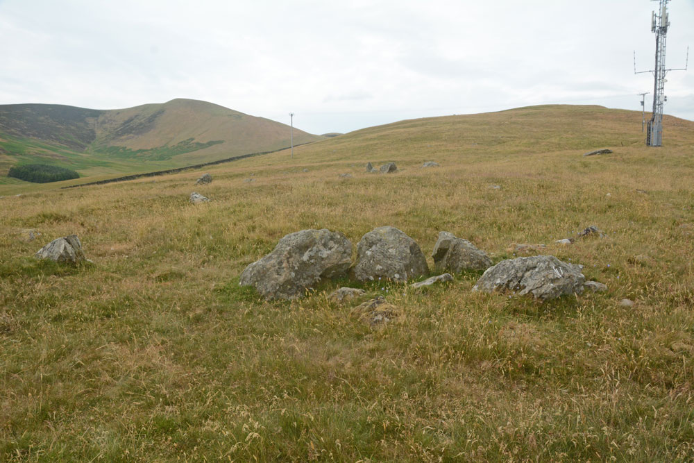
Dreva Hill West (Broughton) submitted by Anne T on 24th Jul 2018. A cluster of boulders towards the mid point of the northern side of the settlement, perhaps part of an internal structure, with a line of stones forming the outer bank beyond. It was difficult to ascertain whether or not this was part of the primary or secondary settlement phase.
(View photo, vote or add a comment)
Log Text: Dreva Hill West, Broughton, Scottish Borders: To the east of the road, there is a gate leading to a farm track, which we followed for about 100m then headed up towards the mast. In typical Tate fashion, Andrew had muddled up the entries for Dreva Craig Fort and this settlement, so I spent ages photographing boulders around the site, thinking they were the ‘chevaux de frixes’.
It’s a great site for a mast, but it’s so close to this settlement, to me it feels invasive and insensitive. The tall grass made it difficult to see any of the outer banks, although I could feel the rise and fall of the low banks at various points as I walked across the settlement. Because I was able to pick out more features here, on a flatter land with fewer boulders, I was more interested in this site than Laigh Hill. It would be nice to be able to track down a plan, so I can really interpret what I saw.
Stobo Kirk standing stone
Trip No.82 Entry No.9 Date Added: 24th Jul 2018
Site Type: Standing Stone (Menhir)
Country: Scotland (Scottish Borders)
Visited: Yes on 12th Jul 2018. My rating: Condition 3 Ambience 5 Access 4
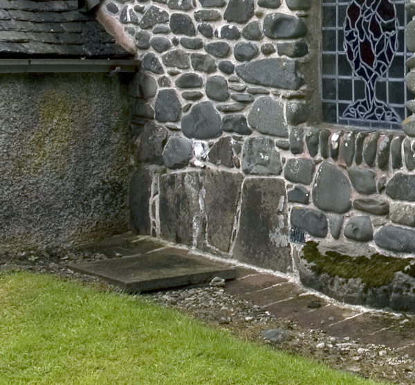
Stobo Kirk standing stone submitted by nicoladidsbury on 14th Oct 2007. Stobo Kirk - standing stone 2 - close up
(View photo, vote or add a comment)
Log Text: Stobo Kirk, Scottish Borders: This was the highlight of my visit. A church I’ve wanted to see for a long, long time, and I thought I’d better grab the chance whilst we were nearby. As we drew up outside the church, my heart sank, as it looked just like another austere Church of Scotland church. “This isn’t the church I saw on the Portal”, I said to Andrew, “their images are of a pebble built wall with standing stones in it.”
All was explained when we walked into the church and saw the north aisle chapel, from the inside first.
My photography skills were challenged trying to photograph the three large tombstones held by iron staples to the wall. This part of the church felt very old.
We looked at the long stone in the external west wall of the north aisle chapel carefully (due to the chairs in the chapel, we couldn’t really see much without removing several rows of tightly packed wooden chairs). At first glance, it looked as if it went from the south side of the window cill, southwards. Closer inspection made us realise it extended under the window as well.
We bought a guide book and a couple of the postcards of the stained glass windows, as by this time, it was getting quite late and it was at least another hour until we reached our bed for the night. Much too brief a visit - a return visit in bright sunshine is a must!
Hawthornside Farm (Bonchester Bridge)
Trip No.93 Entry No.1 Date Added: 31st Aug 2018
Site Type: Holy Well or Sacred Spring
Country: Scotland (Scottish Borders)
Visited: Yes on 29th Aug 2018. My rating: Condition 3 Ambience 3 Access 5
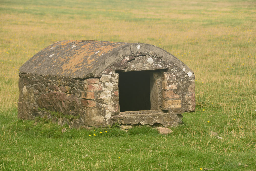
Hawthornside Farm (Bonchester Bridge) submitted by Anne T on 31st Aug 2018. This 'well house' is marked as a tank on the Canmore map, although the structure looks old and the chamber holds clear water. I'd love to know more about this well/tank if anyone has any information. We spotted it by chance trying to find our way to Bedrule.
(View photo, vote or add a comment)
Log Text: Well/tank, Hawthornside Farm (Bonchester Bridge): We spotted this ‘well house’ purely by chance as we passed by, then needing to turn the car round to go to Bedrule Church with its hogback fragments. This is a lovely site, right by the A6088. The well house (or ‘sink’ as it is labelled on the Canmore map) has Rubers Law Hillfort in the background.
There is no mention of Canmore, apart from the word ‘tank’ on its large scale map. The water appears to come straight up into the well basin – there is no sign of a pipe in or out. It does have the hinges for a (presumably wooden) door, which is no longer there. The water was beautifully clear and the inside of the structure clean.
Bedrule Parish Church
Trip No.93 Entry No.3 Date Added: 31st Aug 2018
Site Type: Sculptured Stone
Country: Scotland (Scottish Borders)
Visited: Yes on 29th Aug 2018. My rating: Condition 3 Ambience 4 Access 5

Bedrule Parish Church submitted by Anne T on 31st Aug 2018. A close up of the longer, almost rectangular hogback fragment, described as (2) in the Canmore record: "A fragment of a hog-backed tombstone measuring 1 ft. 3 1/2 in. in length by 7 in. thick, each side being 7 1/2 in. broad and showing three rows of shingle pattern."
(View photo, vote or add a comment)
Log Text: Hogback fragments, Bedrule Parish Church: (note for less mobile visitors, whilst access into the churchyard is on a tarmacked path, there are some steps up into the porch where these fragments are stored. Disabled access is signposted but the door was locked at the time of our visit). This parish church is in the tiny hamlet of Bedrule. We could see the church from the minor road, but had to go virtually through the village and turn south past a row of small cottages to reach the church. There was a small car park outside the churchyard gates. Rubens Law is to the south and dominates the view, which is rather nice.
The western side of the churchyard is divided into a series of ’garden rooms’, each with a small collection of interesting, old grave slabs, some dating to the 1650s.
The hogback fragments were inside the porch, along with a small stone with recumbent, robed figure. The fragments were underneath the small table with prayer and hymn books, so we moved the table out of the way (and replaced it), to photograph the fragments.
Cavers Cross
Trip No.93 Entry No.5 Date Added: 31st Aug 2018
Site Type: Ancient Cross
Country: Scotland (Scottish Borders)
Visited: Yes on 29th Aug 2018. My rating: Condition 2 Ambience 4 Access 5
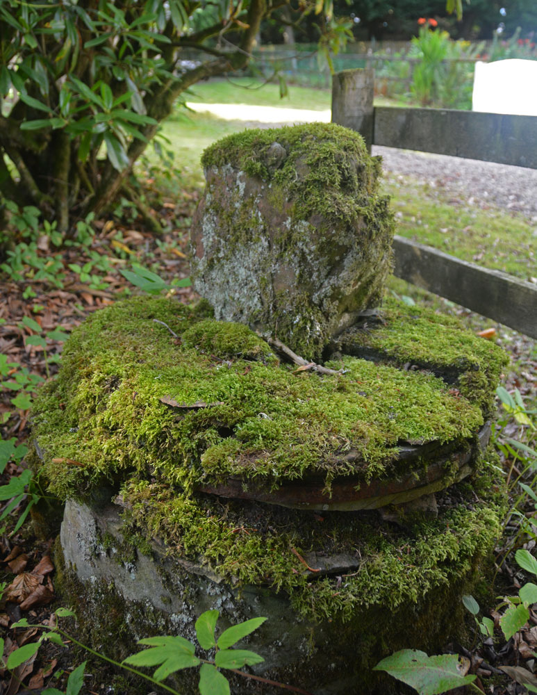
Cavers Cross submitted by Anne T on 31st Aug 2018. A view looking across the cross to the north, towards the small 'cross roads' in the centre of the hamlet of Cavers. The base is round but in pieces which have been stacked on top of each other, held together in places by old metal staples.
(View photo, vote or add a comment)
Log Text: Cavers Cross, near Hawick: From the motte, we drove round to Cavers – a very nicely kept estate, with well kept verges and few places to park along the straight, narrow road by the houses. In the end, we pulled right up to the fence at the largish entrance to a field gate at NT 54235 15805, intending to run back to the car if anyone thought we were in the way.
Walking south west towards the houses (I didn’t even recognise the Auld Kirk, as its been converted into a house with large driveway), we couldn’t see anything resembling a cross. There was a lady who was painting her fence and her large dog, who barked at us and sniffed my hands. I asked her if she knew of the remains of the cross, and she said, “Yes, but it’s only small”. She showed us where it was ‘hiding’ – behind a fence and shrubs in deep shade, then behind its own wooden fence, now much broken. She gave us permission to go into the garden of the holiday cottage as there was no-one there at the time of our visit. Whilst the Canmore record mentions the base of the cross (with the metal bands much visible), nothing is mentioned about the shaft it currently holds. This is of red sandstone and shaped, although much moss-covered.
Moving a small bit of stone near the join of the shaft and the base, there is evidence of a straight cut for part of the socket hole. We didn’t’ see any dowel holes, as the surface was moss and twig covered, but then the report that mentions this is dated 1933!
