Contributory members are able to log private notes and comments about each site
Sites Anne T has logged. View this log as a table or view the most recent logs from everyone
Packman's Grave (Whiteadder Reservoir)
Trip No.105 Entry No.3 Date Added: 4th Nov 2018
Site Type: Stone Row / Alignment
Country: Scotland (East Lothian)
Visited: Couldn't find
Log Text: Packman's Grave, Whiteadder Reservoir: Despite having the grid reference, we were unable to find anything at this site, which was disappointing. We did find something remarkably similar at NT 62814 64541 - five stones in a kite-;ike shape, not far to the south west of the Mayshield Stone Setting.
Borthwick Mains
Trip No.93 Entry No.8 Date Added: 31st Aug 2018
Site Type: Class I Pictish Symbol Stone
Country: Scotland (Scottish Borders)
Visited: Couldn't find on 29th Aug 2018
Log Text: Borthwick Mains Possible Pictish Symbol Stone: We got the location of this symbol stone completely wrong, and whilst we found Borthwick Mains, did not find the symbol stone. Its now high on my 'wish list' to return to. A lot of building work had been happening here, with the entrance to the farm in the process of being widened, and the house nearest the road empty and almost derelict. I did venture into the garden, but not having any phone signal, did not have the photo of the stone on Canmore to refer to.
Parkmill Cross (Alloa)
Trip No.84 Entry No.7 Date Added: 26th Jul 2018
Site Type: Ancient Cross
Country: Scotland (Clackmannanshire)
Visited: Couldn't find on 14th Jul 2018. My rating: Condition -1
Log Text: Parkmill Cross, Alloa: Could not find this – the grid reference seemed to be somewhere in a breaker’s yard. Parking in the nearby housing estate just to the south west of this location, we followed the footpath sign to the footpath which ran west-east along the bottom of the field this cross base is supposed to be in, the tall fence and padlocked gates prevented entry. Andrew tried to gain access from the car breakers yard to the north-west, but said it looks as if their site has been extended to cover where this cross might have been.
Wester Biggs (Dunblane)
Trip No.83 Entry No.5 Date Added: 24th Jul 2018
Site Type: Stone Circle
Country: Scotland (Perth and Kinross)
Visited: Couldn't find on 13th Jul 2018. My rating: Condition -1 Ambience 4 Access 5
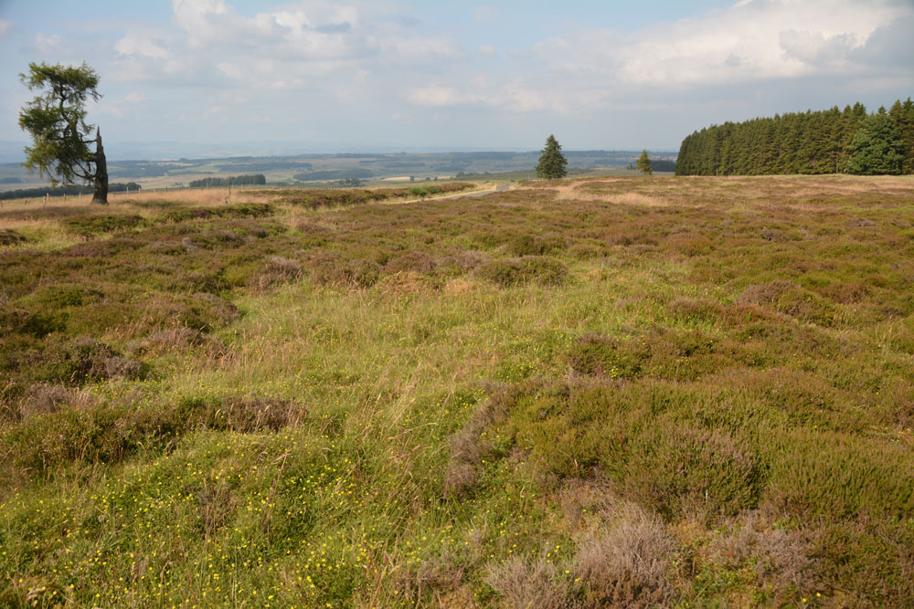
Wester Biggs (Dunblane) submitted by Anne T on 24th Jul 2018. Thinking this stone circle was just by the side of the road, and therefore relatively easy to see, we spent ages with our GPS wandering around trying to spot stones of any description. The heather and vegetation was calf deep, so any small stones would have been difficult to spot. However, 6m away from where our GPS said the circle was, there was only this slight change in vegetation (the shorter, green area). Either the stones are hidden, or they've been sadly removed. View looking NE, towar...
(View photo, vote or add a comment)
Log Text: Wester Biggs Stone Circle, Near Dunblane: Returning from tea and cakes in Dunblane, we resumed our search for megalithic sites. Next stop, hopefully, a not-before-photographed stone circle, right by the side of the road.
Finding the telephone mast and driving a couple of hundred yards further on, we parked at NN 86368 06240 and walked back south along the road, armed with the Canmore listing on my phone and the GPS.
Despite an intensive search of the land east of the road around this point, we were unable to locate any stones amongst the tall heather. However, there was a circle of gras/vergetation which was different from any heather at almost exactly the grid reference given by Canmore, so I photographed ‘the spot’. Andrew thinks the stones may have been removed. Always possible, but I think we need to return when the shrubbery has died back.
North Couston Refuge Stone
Trip No.54 Entry No.2 Date Added: 12th Oct 2017
Site Type: Early Christian Sculptured Stone
Country: Scotland (West Lothian)
Visited: Couldn't find on 30th Sep 2017. My rating: Condition -1 Ambience 3 Access 4
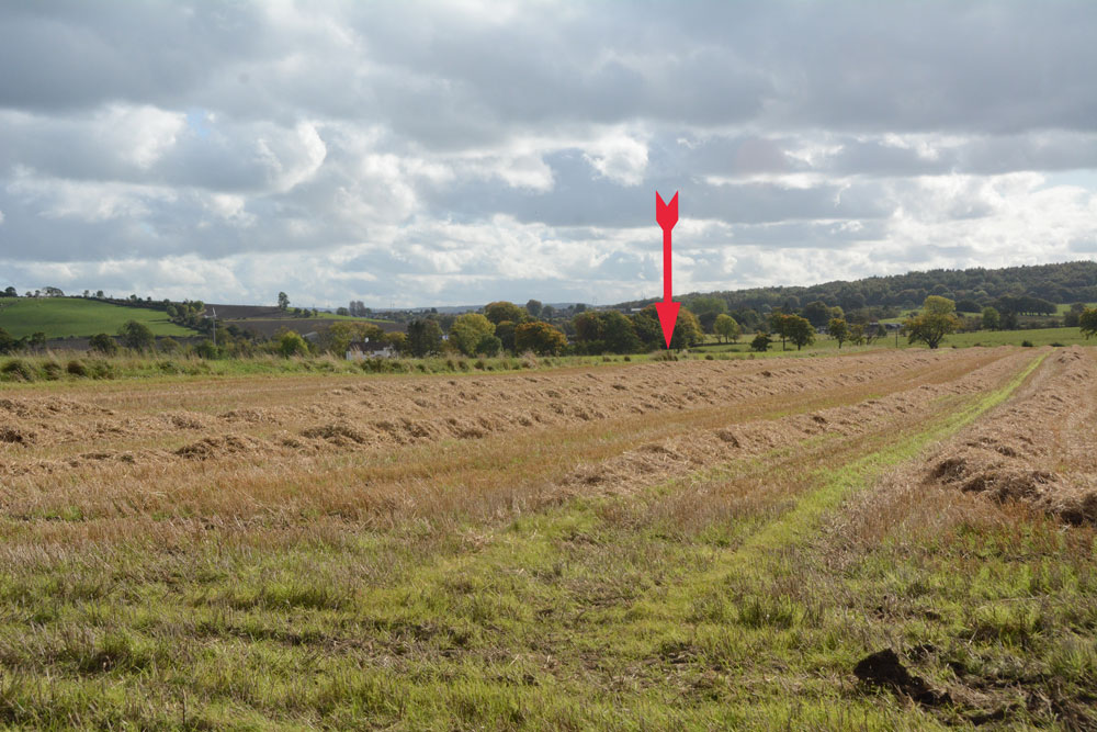
North Couston Refuge Stone submitted by Anne T on 12th Oct 2017. The arrow marks the approximate position in the field where this stone was last recorded. We walked up and down the field boundary twice, me poking the weeds and bushes on both sides with my walking pole at very short intervals, but could find nothing.
(View photo, vote or add a comment)
Log Text: North Couston Refuge Stone, West Lothian: From the Westfield Farm Refuge Stone, we set off towards North Couston with only a very small scale book of maps and Trigpointing UK on our mobile phone to try and find this stone. From Westfield, we got back onto the A801 southbound, then turned left onto the A800, turning left again onto a minor road to a farm, parking in a largish concreted area next to the field entrance at NS 95279 70925. From the Canmore record, we didn’t have much hope, but given as we were not far away, wanted to check whether or not this Refuge Stone was still there.
We waded around the edges of the very wet entrance to the field (the gates into the neighbouring field were almost shoulder high – too high for me to attempt to climb over, although this route would have been dry). The field edges of this recently harvested field were then drier, so we walked along the eastern side, then headed south at the corner, along the old, grubbed out hedge line. We walked most of the length of the Followed the field edges, prodding the fence line as I went, but could find no evidence of any stone along the field boundary.
St Colmac's Cross
Trip No.50 Entry No.8 Date Added: 9th Oct 2017
Site Type: Standing Stone (Menhir)
Country: Scotland (Isle of Bute)
Visited: Couldn't find on 25th Sep 2017
Log Text: St Colmac's Cross, Isle of Bute: I really, really wanted to find this standing stone with incised Latin Cross, but we couldn't work out a way to get behind the barn at East St. Colmac Farm to view it. The Canmore records show this intriguing stone in a wooden enclosure, which was built round it after it was damaged in recent times (the top was knocked off).
By the time we'd had several attempts to find this stone, we were seriously running out of time to get back for our ferry back to Wemyss Bay. We needn't have worried, however, as the ferries were suspended because of the heavy fog. This necessitated a drive up to Rhubodach to get a shorter ferry ride across to Colintraive, then a very hairy mountain drive on a single track road with dense fog back to Dunoon. A not to be forgotten trip!
St. Oswald's Well
Trip No.20 Entry No.5 Date Added: 1st May 2017
Site Type: Holy Well or Sacred Spring
Country: England (County Durham)
Visited: Couldn't find on 30th Apr 2017
St. Oswald's Well submitted by HOLYWELL on 15th Jan 2011. St Oswald's Well in the gloom. Some old brickwork can be seen.
(View photo, vote or add a comment)
Log Text: St. Oswald's Well, Durham: From St. Mary’s Well, we headed off along the footpath by the side of the river, on the outer bank of the river Wear as it curves south and east around the cathedral. It is a very pretty path, although with quite a steep drop on the river side at times. We were amused by the ladies rowing on the river who went into the bank once or twice!
Reaching the outer walls of Hatfield College, we climbed some steps onto a path leading us onto Anchorage Terrace and followed the road north towards St. Oswald’s Church. The grid reference as given showed the well to be in the vicinity of the school. After much walking around St. Oswald’s churchyard, I eventually pulled up the description from the Ancient, Healing and Holy Wells of County Durham by Laurence Hunt, which told us that the well was “Situated just below the footpath leading from St Oswald's churchyard to Prebend's Bridge. Reached down a narrow, steep footpath about 20 yards after entering the trees below the church tower.”
Following our steps back to the tower, there is indeed about 20 metres through some trees back to the footpath. Just to our left there was a small, very overgrown track leading down what (to me) looked like a death-defying drop down the cliff to the river below.
Husband Andrew, being intrepid and with absolutely no fear of heights, swung himself onto the footpath, clung onto a tree and leaned over. He said he could see the well. I closed my eyes.
After a few minutes he reported that about 3 metres of the footpath appeared to have slipped down the slope and was missing, and he could reach the well but would like a rope!
We aborted the visit, sadly.
Axwell Park Barrow
Trip No.18 Entry No.3 Date Added: 24th Apr 2017
Site Type: Round Barrow(s)
Country: England (Tyne and Wear)
Visited: Couldn't find on 23rd Apr 2017. My rating: Ambience 2 Access 5
Axwell Park Barrow submitted by durhamnature on 7th Aug 2012. Axwell Park Barrow
(View photo, vote or add a comment)
Log Text: Axwell Park Tumulus, Gateshead: OK, even with the grid reference, we couldn't find any trace of this - not surprising, since checking the Pastscape records this morning (24th April), they say no trace of the mound exists! There were lots and lots of humps and hollows on the slope to the left of the path as you walk up the hill. The area seems to be part of an estate and has been heavily modified, with an artificial waterfall and stone-lined channels for water visible in the undergrowth.
This area today is on the edge of a modern housing estate, which is still being constructed. The only thing I can say about this is that it is an easy walk up through the park on tarmacked road.
Four Stones Hill Standing Stones
Trip No.15 Entry No.3 Date Added: 3rd Apr 2017
Site Type: Standing Stones
Country: England (Cumbria)
Visited: Couldn't find on 2nd Apr 2017. My rating: Access 3
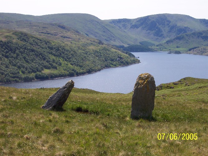
Four Stones Hill Standing Stones submitted by donstobbart on 11th Jun 2005. I have to agree with Nicoladidsbury that I did not feel any ambience when I visited this site. But I did get a great view of the lake!
(View photo, vote or add a comment)
Log Text: Four Stones Hill, Haweswater: Ashamed to say I was defeated by the large stiles with big drops and missing steps. Was so looking forward to going to see this site and from Google Earth, it seemed possible for me to walk this route. Did look for gates in the fields to avoid the stiles, but up by Lower Drybarrows, couldn't find any entry/exits; the one there was said very clearly "no public right of way". Perhaps I should have ignored those and tramped through the fields anyway, but it would have left me feeling guilty. Will try again. Note to self: parking was very difficult up by Winder Hill. Needed to wedge the car in besides a stone wall to leave ready access to the fields.
Five Kings
Date Added: 10th Jan 2017
Site Type: Stone Row / Alignment
Country: England (Northumberland)
Visited: Couldn't find on 1st Jan 2017. My rating: Access 3

Five Kings submitted by Strider on 4th Feb 2003. Five Kings, Northumberland
NT955001
Alignment of four large, irregular stones - the fifth may have fallen but I could not be certain.
(View photo, vote or add a comment)
Log Text: Five Kings, near Grasslees, Northumberland: The easiest access looked as if it was from the footpath near Ovenstone Plantation off the B6341, just past Grasslees. Parking off the road at the entrance to the footpath, we headed off up the track - easy walking at this stage. 100 metres up the track there was a gate/stile with two display boards. Neither bore any similarity to each other, or to the OS map. We had intended walking up the footpath to its fork, 100 metres further up, then take the right hand fork following the stone wall up past The Long Chirn and Woodhouses to the Five Kings. Sadly (presumably being military land) this part of the footpath no longer exists and the walking was difficult (very tussocky, marshy ground). When the heavens opened (despite the weather forecast saying it would be fine!), we contemplated finding a second footpath through Dueshill Farm but it would be dark by the time we reached the stone row, so we decided to go somewhere else and headed back to the car and try another route on a better day. I was so disappointed, as this was a stone row I'd loved to have seen, but the Tosson Tower and Lordenshaw had to suffice for this afternoon.
Barmishaw Stone
Date Added: 20th Apr 2015
Site Type: Rock Art
Country: England (Yorkshire (West))
Visited: Couldn't find on 17th Apr 2015
Barmishaw Stone submitted by DavidRaven on 3rd Nov 2003. The Barmishaw Stone. Very faint carvings including the odd 'ladder' motif. I
could hardly make out the shapes. The stone is just above the wood near the
'Keighley Road' track that traverses the moor, west of White Wells, by a
footpath.
(View photo, vote or add a comment)
Log Text: Barmishaw Stone, Ilkley: we planned to find this piece of rock art after visiting the Comet Stone as it's not far away. From the small car park on the Keighley Road near the Comet Stone grid reference, there is no direct footpath but a track through the moorland grass could be made out. My husband was bold enough to try, but his route was blocked by a rock face. An approach from a different direction will be needed on our next visit.
We abandoned finding this stone to get to the Wulfhere Cross at Addingham before the church closed for the evening.
St John's Well (Osmotherley)
Date Added: 8th Oct 2014
Site Type: Holy Well or Sacred Spring
Country: England (Yorkshire (North))
Visited: Couldn't find on 5th Oct 2014
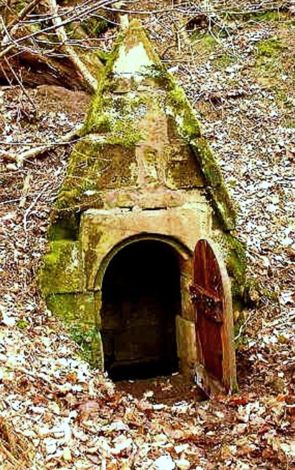
St John's Holy Well submitted by Sunny100 on 14th Jun 2010. St John's Holy Well, near Osmotherley, N.Yorkshire, at SE.447981.
(View photo, vote or add a comment)
Log Text: St John's Well (Osmotherlery): This being a glorious late afternoon, and having not only precise instructions on how to reach St John’s Well from the Mount Grace Priory staff but the GPS co-ordinates and a map I’d printed off with the exact location of the well, we set off to try and reach it. Not as easy as it first appeared! The first path, following what we both thought were the directions given to us, went too far up hill, then path just stopped at the top of the hill. Retracing our steps and turning on the GPS device, we followed the watercourse wending its way south away from the priory, between the edge of the forest and the adjoining meadow and found the track we should have followed. Whilst we could see the path leading up the hill towards the well, I let my husband take the lead, but it became just too difficult – waist high bracken, broken branches and large, boggy holes to fall into – it would have been too easy to twist and ankle or fall over. As it was getting late, we decided to come back in the winter, when the undergrowth has died back. We knew that this well was one of three which supplied the Priory, the first being in the north east corner, just outside the Great Cloister. A second is to the south of this, supplying the Lesser Cloister, and the third (not managed by English Heritage) is St. John’s Well. We did manage to get a photograph of Well House one. Despite there having been a lengthy dry spell, there was still a good flow of water from this spring, and the water was beautifully clear. There is a great similarity between the well house we saw and the image of St John's Well submitted by Sunny100.
Anwoth
Date Added: 22nd Sep 2014
Site Type: Class I Pictish Symbol Stone
Country: Scotland (Dumfries and Galloway)
Visited: Couldn't find on 19th Sep 2014
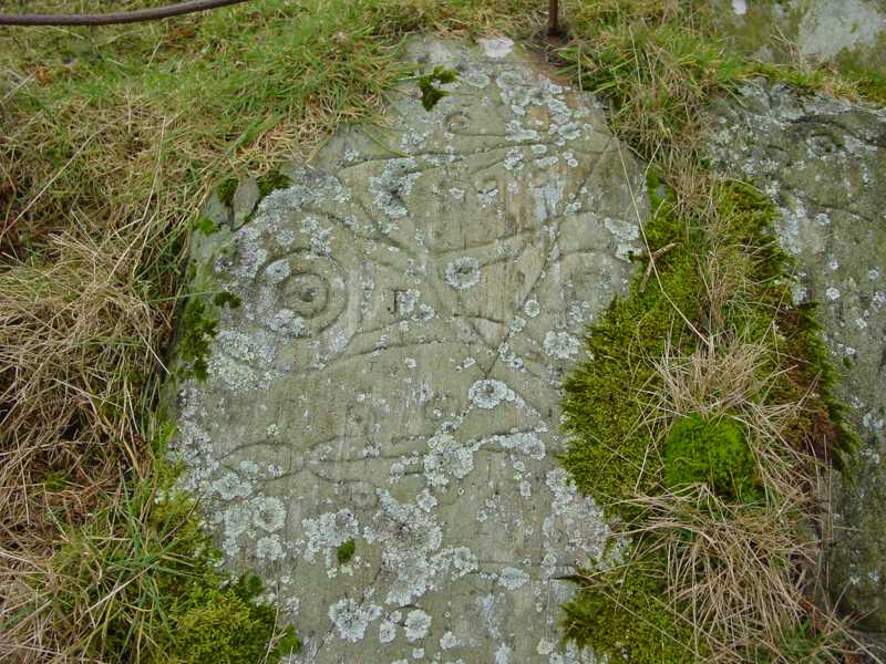
Trusty's Hill submitted by PaulH on 2nd Mar 2003. To W of Gatehouse of Fleet NX588560
Pictish symbols carved in living rock
The "teletubby" !
(View photo, vote or add a comment)
Log Text: Anwoth, Rock Art: Couldn't find as too much gorse and bracken. It was very difficult to orientate ourselves and tried several of the hills, just in case. We have since invested in a cheap and cheerful GPS system, which we've since tested out on Goatstones Rock Art in Northumberland. We did walk onto Rutherford's Monument, the Trig Point and the Millennium Monument and enjoyed the views in the gathering dusk. Will try and visit this site again.
High Banks Farm
Date Added: 22nd Sep 2014
Site Type: Rock Art
Country: Scotland (Dumfries and Galloway)
Visited: Couldn't find on 19th Sep 2014
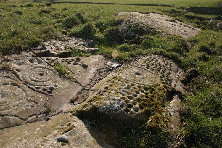
High Banks Farm submitted by TerryStaniforth on 23rd Feb 2005. More detail.
(View photo, vote or add a comment)
Log Text: High Banks Farm Rock Art: Found the track to High Banks Farm easily enough, but husband wouldn't risk our car on the farm track, saying that we'd need a four wheel drive to attempt it. Our tight schedule of sites to visit for the rest of the afternoon didn't allow time to walk up to this rock art site, so sadly we've had to leave this until another day - a future treat!
Doddington Moor
Date Added: 1st Sep 2014
Site Type: Stone Circle
Country: England (Northumberland)
Visited: Couldn't find on 30th Aug 2014
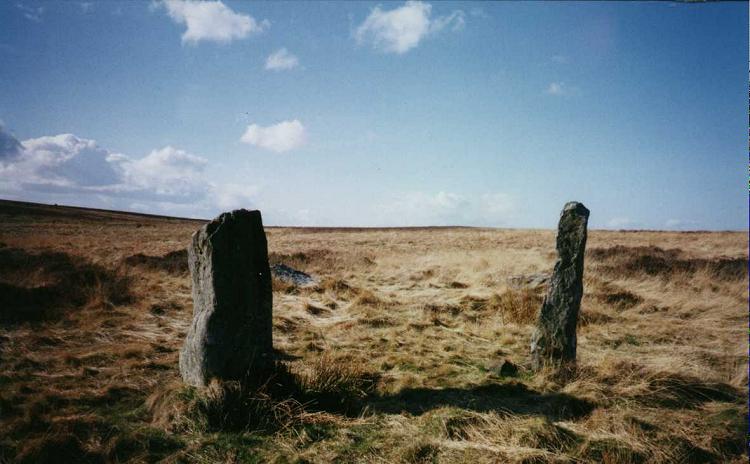
Doddington Moor submitted by Andy B on 24th Nov 2001. Doddington Moor Stone Circle
(View photo, vote or add a comment)
Log Text: Doddington Stone Circle, Northumberland (second failed attempt!). Having visited Weetwood Moor, as we were so near, and it was still only relatively early (5pm), we decided to drive a couple of miles further up the road to Weetwood Hall and try the footpath I’d identified as a possible easier route to Doddington Stone Circle.
We parked the car park where the footpath splits off northwards from the road just after Weetwood Hall (there is just room for one car opposite the field entrance at the corner of the junction). There is a metalled road which goes past the two or more houses to the left hand side, then it become a grassy path between two hedges, with tractor ruts in either side. After about half a mile, just past a wood to the right hand side, there is a gate with a footpath sign on, and the track becomes quad bike marks in the grass, and we followed these up the hill. There is a new stile (narrow, but new) , then the track more or less disappears, and is marked by a series of Scots Pines, standing alone, but growing more or less in a line north-north-west up the hill.
Passing an outcrop of rock to our left hand side, we climbed to the brow of the hill, but just where the land started to go downhill again, we were met by boggy land, covered completely with a heavy coverage of low growing thistles and gorse, which went on as far as the eye could see. Andrew decided this was impossible, so we turned back and went to find the cup and ring marked rocks marked on the map on the way back down the hill.
We'd previously tried to visit on 17th August 2014, but the quarry next to Wooler Golf Club had been extended and the footpaths had disappeared (or we couldn't find them).
There is a third possible footpath to try, from West Horton, so this will go on the 'want to do' list.
Ketley Crag Rock Shelter 1
Date Added: 28th Jul 2014
Site Type: Rock Art
Country: England (Northumberland)
Visited: Couldn't find on 27th Jul 2014. My rating: Access 1
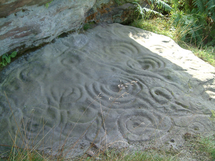
Ketley Crag Rock Shelter 1 submitted by stu on 11th Oct 2003. NU0743 2978. Is there anything better looking? I'd say not.....lots of other impressive cup and ring carvings on the walk over from Chatton Hill.
(View photo, vote or add a comment)
Log Text: We went to seek this magnificent example of rock art, well armed with map, compass and camera, and parked outside South Lyham farm. At the adjacent cottages, one of the residents came out to speak to us, and pointed out the way to the permissive footpath across to Ketley Crag and Chattonpark Hill, telling us how to find the Ketley Stone. It had rained heavily the night before, and following the footpath across the first field from the farm, we remained undeterred by boggy ground and wet feet in the dip where the permissive path splits off right from the farm track. After a search, we found the wooden footbridge across the stream and the permissive footpath sign.
The bracken was shoulder high, and 50 feet further up the path, we were confronted by a high wall of bracken, which proved impossible to get through. So sadly we retraced our steps. Apparently we missed a sheep track through the bracken, which the resident, talking to us on our way back, told us had been there a month before.
We then tried again from the access track from the B6349, at grid reference NU 06362 30614. This was easy walking for the first kilometre or so, but just past the ford, the trackway became very overgrown, with deep ruts and it was very hard work to make progress through the weeds, and despite waterproofs, we were soggy. We did try walking along the edges of the fields rather than on the trackway, but there were no gates between fields, so sadly we had to give up.
I had been really looking forward to seeing this rocky crag; there is a third option, which is from this same trackway, but from Chatton Park Farm, which takes us up over the top of Chattonpark Hill, so we'll try this another day.
We then went in search of some rock art at Doddington, to see if this was more accessible
St Ninian's Cave (Isle of Whithorn)
Date Added: 3rd Jul 2019
Site Type: Early Christian Sculptured Stone
Country: Scotland (Dumfries and Galloway)
Visited: Would like to visit

St Ninian's Cave (Isle of Whithorn) submitted by Anne T on 3rd Jul 2019. Submitted with the kind permission of The Whithorn Trust. This is the collection of early Christian carved stones from St Ninian's Cave, now displayed in Whithorn Museum. I only succeeded in photographing a few properly as other visitors were in the museum, and by kneeling on the floor I was blocking the path!
(View photo, vote or add a comment)
North Plantation A
Date Added: 6th Sep 2014
Site Type: Rock Art
Country: England (Northumberland)
Visited: Would like to visit
North Plantation A submitted by SolarMegalith on 5th Oct 2013. Simple cup-marks near the top of the panel (photo taken on October 2013).
(View photo, vote or add a comment)
