Contributory members are able to log private notes and comments about each site
Sites Anne T has logged. View this log as a table or view the most recent logs from everyone
Hogtivis Stone
Date Added: 28th Aug 2014
Site Type: Early Christian Sculptured Stone
Country: Wales (Pembrokeshire)
Visited: Yes on 23rd Aug 2014. My rating: Condition 3 Ambience 4 Access 4
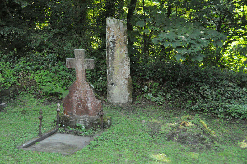
Hogtivis Stone submitted by Anne T on 25th Aug 2014. Photograph showing the location of the Hogtivis Stone from the west end of the church. It is nestled snuggly against the boundary bank of the church yard and the car park, between grave stones.
(View photo, vote or add a comment)
Log Text: Intrigued by just the word ‘Stone’ on the map, we drove from Garnturne burial chamber towards Sealyham Bridge, looking for the church next to ‘The Stone’. There are just a few farms and an outdoor centre here; it is a very pretty little spot. Just before the bridge over the river Afon Anghof, there was a small cark park (surrounded by overhanging trees on three sides) on the right hand side of the road. The church was invisible, being hidden by these trees, so we ended up driving past, turning round and going back. Turning into the car park, the top of the church and the gateway into the church yard immediately became visible.
This was one of the smallest churches I’ve come across. The wrought iron gate to the church spelled out the year 1870, and the church did indeed look relatively modern; but looking closer, there appeared to be a tiny chapel embedded in the larger building which looked much, much older. The church was locked, so sadly we couldn’t get in, as I would have loved to look round the interior of the building, and there was no contact telephone number to call to arrange a visit. Doing some research on arriving home, I found out that the nave and south aisle were separated by Norman arches, which I would love to have seen.
The churchyard was also tiny, largely dominated by wrought iron railings surrounding a large family plot immediately to the south of the church, by the porch. The two bells were rung by ropes coming down the exterior west end of the building.
In the corner of the churchyard, lodged snuggly against the bank between the church yard and the car park, and tucked between two graves, was The Stone. It had obviously been used as a gatepost at some time, with several holes, some still containing metal pins (my immediate reaction was ‘poor thing’). There were obvious signs of carving on the right hand side of the front face of The Stone which looked like Ogham, plus some other possible carving to the left, which the records tell me is a Latin inscription. Funnily enough, the camera was able to pick out the Latin inscription better than my eye, as recorded in the image submitted here.
The Archaeological Data Service record states that the stone is 5th or 6th century, and “was found in 1897 'a few hundred yards' from Little Treffgarne farmhouse. If it was in situ, then it may have been associated with the monastic site of Little Treffgarne”.
This site is only a couple of kilometres from the A40, east of the village of Wolf’s Castle, and 9 miles north of Haverfordwest. The Genuki website saying this parish is traditionally known and the birthplace and burial place of Owain Glyndwr who “is said to have been born at Little Trefgarn and to have been interred at the small village of Wolf’s Castle’.
Glyn Gath Barrow
Date Added: 28th Aug 2014
Site Type: Round Barrow(s)
Country: Wales (Pembrokeshire)
Visited: Yes on 21st Aug 2014. My rating: Condition 2 Ambience 4 Access 5
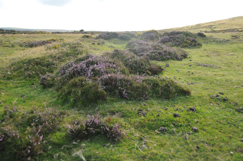
Glyn Gath Barrow submitted by Anne T on 27th Aug 2014. Standing on the bank at the edge of Glyn Gath ring cairn looking northwest.
(View photo, vote or add a comment)
Log Text: Glyn Garth Ring Cairn, Pembrokeshire: After visiting a series of standing stones on the northern side of the Afon Gwaun river, we headed eastwards back towards the hotel at Gellifawr. We passed directly by the Glyn Garth ring cairn, so stopped to take a look.
Even with a detailed map, without the marker stone, we wouldn’t have been able to easily identify this cairn, but walking into the heather and gorse we could make out the perimeter banks (easier to do this with the eye than demonstrate with the camera – I’ve yet to learn the technique to do this well).
It was an impressive location; With Myndd Dinas behind and Newport Bay to the north, this was a fantastic place to be buried.
On the drive southwards from Glyn Garth to Pontfaen, we were doing double-takes at most field entrances, as the gateposts all seemed (to our novice eyes) to be standing stones which had been perhaps been relocated and recycled.
Also of notes to future visitors, it is well worth popping into the Dyffryn Arms at Pontfaen. It is like walking back into time; the main bar is like small sitting room from the 1930s and the landlady serves ale from jugs from a serving hatch – brilliant!
St Gwyndaf Stones
Date Added: 28th Aug 2014
Site Type: Early Christian Sculptured Stone
Country: Wales (Pembrokeshire)
Visited: Yes on 22nd Aug 2014. My rating: Condition 3 Ambience 4 Access 4

St Gwyndaf Stones submitted by vicky on 8th Jun 2004. One of the five 7th-9th century decorated stones in the exterior walls of Llanwnda Church. This one is decorated with a face beneath the cross of St Andrew.
(View photo, vote or add a comment)
Log Text: St Gwyndaf’s Church, Llanwnda with stone crosses: Husband, Andrew, and I were both intrigued by Vicky’s description of the St. Gwyndaf Stones on the Portal, so after a busy day exploring the St David’s area, we decided to stop off in Fishguard for dinner, taking a detour to Llanwnda on the way.
Despite having a detailed map, we got lost twice, taking the wrong lane and ending up back on the main road, then taking the left hand turn inside of the right where the road splits within Llanwnda village, and ending up at someone’s house and having to reverse down a particularly narrow, windy single track lane, being watched by a curious local lady who came out to watch.
After that, we found the church easily enough. There were even a few parking spaces just by the path leading down to the church. A very pretty spot, although feeling incredibly remote, overlooking the sea.
The whole of this site has a huge sense of age and heritage. The inside of the church is simple, but impressive. There was no church guide available to look at, but there was a copy of the ‘Saints and Stones’ book telling us something about the church. Page 7 of this books tells us: “on the window-sill near the font is a fragment of a medieval stone showing a bishop administering a blessing and holding a staff; it may have been part of an ancient churchyard and cross. Another stone fragment of the same date can be seen on the first window-sill in the south wall. In the chancel is a case containing a copy of the Welsh ‘Parry’ Bible (1620) [although this is well-used and falling apart – impressive non-the-less] .... No fewer than six 7th-9th century Christian marked stones were also discovered in 1881; five of them are set into the exterior walls of the church. Once part of the larger structures, they were carved by stonemasons working under monastic patronage. The most fascinating of these is set into the east end of the south transept. It shows a rudely incised face surrounded by four parallel lines beneath the cross of St. Andrew; the face may be that of a female, a monk or Christ-as-Procrator. High in the south wall is a stone marked with a double-outline cross and another in the east wall of the chancel is decorated with a Latin cross. A fourth stone in the north wall displays a double Latin cross enclosed by a rounded outline, and low in the south wall to the west of the porch is a stone of later date (probably 10th century) with a moulded cross. The base of a decorated cross lies on the north-west side of the churchyard.”
We spotted the five stones set in the wall and the two on the window-sills, but failed to see the cross in the churchyard.
I’d recommend anyone in the area to take an hour to find this church and the stones – a true sense of history and occasion contained within this tiny building and surrounding church yard.
On the next visit, must ensure to take in the Garnwnda Burial Chamber and nearby standing stone.
Pentre Ifan
Date Added: 27th Aug 2014
Site Type: Portal Tomb
Country: Wales (Pembrokeshire)
Visited: Yes on 23rd Aug 2014. My rating: Condition 3 Ambience 5 Access 4

Pentre Ifan submitted by PaulM on 24th Aug 2001. PENTRE IFAN CHAMBERED LONG CAIRN WITH FORECOURT
NGR: SN09953702 (Landranger map 145/Outdoor Leisure North Pembrokeshire map (No 35))
Located 4km east of Newport on a public footpath. One of the most spectacular and famous monuments of its type it consists of a tilted capstone perched on three uprights. A blocking stone obstructs the doorway and a semi-circular forecourt is found at the southern end. Originally covered by a huge long mound - traces of possible kerbstones can still be fou...
(View photo, vote or add a comment)
Log Text: Pentre Ifan, Pembrokeshire: I was particularly excited to go to the site, as I’d seen many photographs and paintings of Pentre Ifan during our brief visit to Pembrokeshire, together with photographs on the Portal. I was unprepared for the sheer number of visitors who came to see this spectacular burial chamber. However, everyone seemed to respect others need to take photographs and kept out of each other’s way, which was nice. We also got into conversation with a Japanese lady about how they had raised the cap stone.
I was truly amazed at how the cap stone balances on the pointed tips of just three uprights. All around are larger stones which may have been part of the structure in the past.
The views over to Newport sands and the sea are wonderful. I would like to go back to the site at a quieter time and just sit and absorb it.
The Pillar Stones
Date Added: 27th Aug 2014
Site Type: Early Christian Sculptured Stone
Country: Wales (Pembrokeshire)
Visited: Yes on 21st Aug 2014. My rating: Condition 3 Ambience 4 Access 5
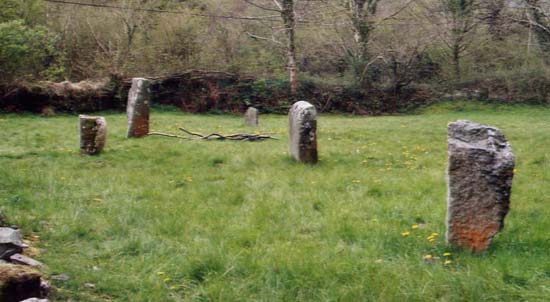
Pillar Stones submitted by PaulM on 24th Apr 2003. The Pillar Stones are a group of four Christianised stones located in a churchyard in the Gwaun Valley in Pembrokeshire (SN123340).
The reverse of each of the stones is carved a cross of differing designs. A fifth stone seems to act as a font.
(View photo, vote or add a comment)
Log Text: Pillar Stones, Cwm Gwaun. These stones were the second of the ancient monuments we saw during our visit to Pembrokeshire, and a great start to our trip.
The five pillar stones were visible from the road, in the grounds of a small chapel, so we parked in the driveway to get off the single track road. It was only when we tried to go into the chapel that we realised it had been converted to a private house and the pillar stones were in the garden.
We were able to make our crosses on three of the stones (inscribed on the sides facing away from the chapel, looking east). I wasn’t sure if there was any particular alignment to the stones; they didn’t particularly appear to have been arranged in rows.
There is also an old font under the bell tower of the church.
Trefach
Date Added: 27th Aug 2014
Site Type: Standing Stone (Menhir)
Country: Wales (Pembrokeshire)
Visited: Yes on 21st Aug 2014. My rating: Condition 3 Ambience 4 Access 4
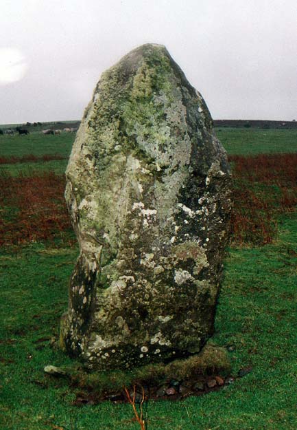
Trefach submitted by PaulM on 6th Jan 2003. The Trefach Stone.
Please see the Megalith Map site entry for details.
(View photo, vote or add a comment)
Log Text: Trefach, Pembrokeshire. This stone was literally just round the corner from Gellifawr, where we were staying. We parked at the entrance to the field on the corner of the road and walked up to the footpath which leads up to Waun Mawn. There was actually a couple of parking spaces at the bottom of the footpath so we could have driven closer, but after a long car journey, it was nice to put feet to tarmac and grass again.
The footpath rises up a gentle hill, and after a few paces, there was what appeared to be a cairn to the left hand side. Looking up the hill, Trefach became visible on the horizon. There was a clear track leading up to the stone, so we followed this. The stone is surrounded by a low wire fence, presumably to protect it from the stock (in this case a small herd of Welsh ponies, who curiously came to see what we were doing and what food we might have brought!).
The views over the Afon Gwaun Valley to the east were lovely. (as Paul M says in his description of the site: ‘commanding’). To the north west, there were views over crags at what I think is Carn Ingli.
Near the main Trefach stone, there was a fallen stone, which looked as if it might have stood upright. The field was also littered with groups of stones which looked like possible cairns.
This was the start of a couple of hours exploring some pretty interesting sites within the Cwm Gwaun valley.
Llanllawer Church
Date Added: 26th Aug 2014
Site Type: Early Christian Sculptured Stone
Country: Wales (Pembrokeshire)
Visited: Yes on 21st Aug 2014. My rating: Condition 2 Ambience 3 Access 4
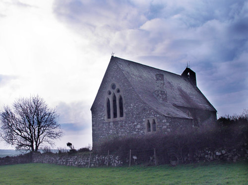
Llanllawer Church submitted by song on 27th Oct 2006. Llanllawer Church.
(View photo, vote or add a comment)
Log Text: The only access to the church is through a gate and a 100 yard walk through the field to the church gate.
This church is not used, and is falling into ruin. It is boarded up and there are slates coming loose from the roof.
It was not possible to get inside, as the door was locked and some of the windows boarded up.
There is a clear view from the edge of the church yard down to the Llanllawer Holy Well.
Llanllawer Holy Well
Date Added: 26th Aug 2014
Site Type: Holy Well or Sacred Spring
Country: Wales (Pembrokeshire)
Visited: Yes on 21st Aug 2014. My rating: Condition 4 Ambience 3 Access 4

Llanllawer Holy Well submitted by vicky on 8th Jun 2004. This holy well lies adjacent to the road (from which it is signposted) in the village of Llanllawer. The spring (which was dry on a recent visit) was used for healing diseases of the eyes and also as a wishing well.
(View photo, vote or add a comment)
Log Text: Having visited the Pillar Stones, we drove the additional 2km through the village of Llanychaer to the Llanllawer Parish Church and Holy Well. There was a small lay-by opposite the gate to the field leading up to the church, so it was easy to park.
The church, which stands on top of the hill, is very obviously redundant, boarded up, and with loose slates. The only access to the church is through the field from the road.
The well is accessed by walking 50 yards further up the road, turning a left hand corner, where a stile/gate gives access to the Llanllawer Holy (Sainted) Well.
The well was dry when we saw it, but there is a clear channel to take water down hill. The ground was still boggy, although large stones made it easy to cross the channel to look inside the well.
Inside the well there were lots of tea-lights and tokens, and tokens had been hung from the gate to the well. It is clearly a place that is well revered, even today.
Bedd Morris
Date Added: 26th Aug 2014
Site Type: Standing Stone (Menhir)
Country: Wales (Pembrokeshire)
Visited: Yes on 23rd Aug 2014. My rating: Condition 3 Ambience 3 Access 5
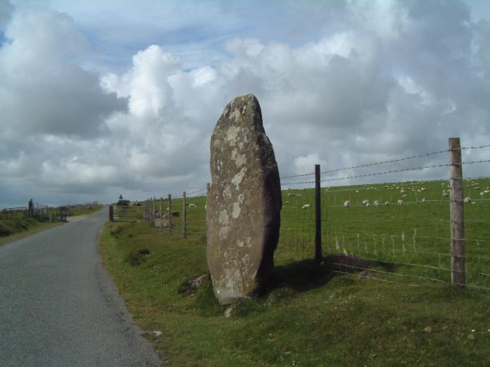
Bedd Morris submitted by enkidu41 on 3rd Jun 2004. SN 0382 3650
A 6'6" high menhir which tapers to a point.
(View photo, vote or add a comment)
Log Text: I spotted this standing stone by the right hand side of the road as we were driving over the Ffordd Bedd Morris road from the A487 towards Cwm Gwaun, where we were staying for a few days. After an eight hour journey, and with the rain coming down in huge droplets, we drove past and returned on the way back home to take a closer look.
Bedd Morris is very easy to find, being opposite the main car park for walkers at the top of the hill. Whilst impressive, it’s hard to believe this stone is still in its original location. There are professionally carved inscriptions on the stone, leading us to believe it is now being utilised as a boundary marker. Looking this up on the return home, the Bedd Morris record on the Archaeological Data Service web site confirms this stone is used as a marker between the parishes of Llanychlwyddog and Newport.
Their site also goes onto say that the stone fell over and broke, probably after being hit by a vehicle (hence the protective stones either side) and was repaired and re-erected in 2012.
There is also a trig point carved into the front of the stone, next to some graffiti.
We were on our way home, with an 8 hour journey in front of us, and other places we wanted to see, otherwise it would have been really nice to have done some walking in this area – the location just screamed at me to get my walking boots on.
Driving northwards towards Newport, there are splendid views of Dinas Head and Newport Sands from the viewpoint further along the road.
Salters Nick Settlement
Date Added: 25th Aug 2014
Site Type: Ancient Village or Settlement
Country: England (Northumberland)
Visited: Yes
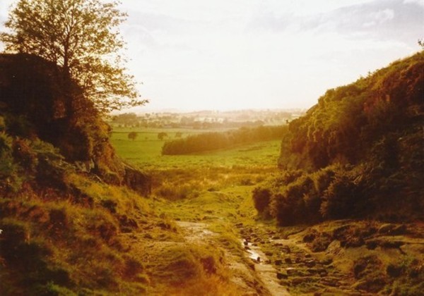
Salters Nick Settlement submitted by Bladup on 30th Dec 2013. The natural entrance through the crags to the settlement.
(View photo, vote or add a comment)
Log Text: Following our visit to The Poind And His Man, there was a settlement marked on the map at Salter's Nick, and I was keen to try and see this as it was nearby.
We continued westwards along the footpath from the Poind and His Man, the pebbly surface giving way to concrete slabs leading onto access land. The kindly farmer (presumably the one living in East Shaftoe Hall?) has provided a small car parking space for walkers, complete with signs about where to park, so next time we visit, we’ll drive down rather than walk from Craig Hall. There were other cars already parked there, although we walked for well over a kilometre before seeing other people on Shaftoe Crags to our left.
From the above mentioned car park, there is a gravelled track heading off left towards East Shaftoe Hall, but the actual footpath is over grass and carries on westwards, past a wood on the right; where this ends there is another small wood to the left. Walking slightly up hill, there is a well-built stone wall to the right hand side, and a limestone pavement which drops down a few feet to a small brook on the left, giving the impression of an old road. There were a large number of cows and calves in the field, complete with bull, but they appeared very docile and only mildly curious. Looking at the internet later, we found out that this track used to be an old Drover’s Road.
The settlement is just on top of the hill, just where the footpath takes a slight turn to the right. Walking into this area, the settlement isn’t immediately obvious given the covering of heather and bracken at this time of year, but a bank where the bracken stands taller than the rest defines its eastern boundary. It’s easy to step up this small bank and into the main settlement area; across what appears to be a valley to the south, large limestone blocks and outcrops can be seen. Walking a little further on into the settlement to where the western bank appears to rise up, we were suddenly taken aback by the appearance of steep drops to the south and west – we were suddenly on the edge of an amazing limestone outcrop, looking down on other walkers below, and across to others climbing on Shaftoe Crags.
A natural entrance, formed by a crack in the crags, became apparent as we walked across the settlement area to the north. I could immediately identify with our ancestors and why they had chosen to settle here – it was easily defensible from the west and south, with 360 degree views (hidden a little in modern days by the woods to the east) all around, and what looked like superb farmland to the west and east.
I wanted to see the natural entrance from below, so we walked back to the footpath and carried on westwards. There were clear signs of how the old drover’s road had been cut through the settlement (there were pick marks on the sandstone rocks), and an easy walk that takes you below the crags at the western end of Salter’s Nick.
We did try and find the heavily weathered rock art mentioned on the Northumbria County Council leaflet for this site (which I downloaded on my phone whilst we were there, so we could understand what we were looking at), but they didn’t identify exactly where these where, so we’ll need to research Stan Beckensall’s records to find out where they are. The same leaflet (Exploring Bolam, walk number 3, Bolam Lake to Shaftoe Crags), tells us: “This trackway was probably used for smuggling illicit salt into Scotland on pack horses during the time of the Salt Tax. The return cargo was often illegally distilled whisky. There is also a settlement split by the trackway. The southern end of the fort consists of a series of defensive walls and works, and two pairs of semi-detached stone foundation round-houses. Attached to the north side is an Iron Age field system, of native or Romano-British origin.”
Looking at the map, the Middleton Standing Stone is only about half a kilometre away, if you carry along the footpath after Salter’s Nick; we’d done the walk to Middleton the other way round, from South Middleton Medieval Village on 27th May 2014. This is a much easier (and prettier) walk than the walk we'd previously done, and we'd use this route again.
The Poind And His Man
Date Added: 25th Aug 2014
Site Type: Standing Stone (Menhir)
Country: England (Northumberland)
Visited: Yes
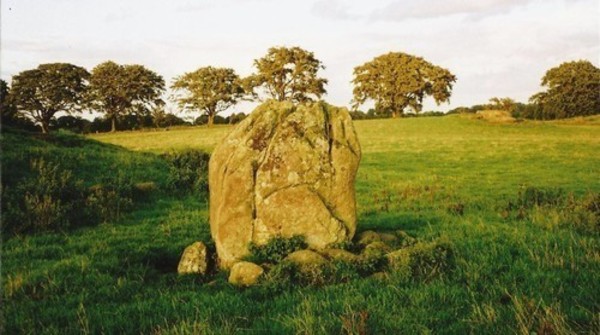
The Poind And His Man submitted by Bladup on 30th Dec 2013. The Poind And His Man, The standing stone (the man) with the edge of the barrow on the left and the outcrop in the background on the right.
(View photo, vote or add a comment)
Log Text: I didn’t expect this site to be as atmospheric as it was. We parked on the road that runs just south of Bolam Lake, in a small layby about 100 yards to the south west of Craig Hall, approx. grid reference: NZ 07126 82266 (only a couple of kilometres from the busy A696). We walked down the gravelled footpath past which turns left from this road through Bolam West Houses; in the second field to our left hand side past the houses, the tumulus came into view on the horizon. Whilst it is marked on the map as being just a tumulus, it is actually a tumulus with standing stone on its southern side.
Being on a slight hill, the tumulus stood out well against the surrounding terrain. There was no sign of the standing stone from this point, although some stones were poking up from the grass at the left hand (eastern) side of the tumulus.
We found out afterwards that there was actually no public access to this tumulus and standing stone, so I felt guilty about walking up to it, although it was a short distance from the main footpath. The field was full of the most beautiful sheep, all kinds of different breeds. As we approached the tumulus, the standing stone is on its southern side appeared - much larger than I anticipated.
I got the tape measure out, and husband Andrew helped me take the approximate dimensions of the standing stone: 2 metres from the current ground height, width on widest faces: 1.50 and 1.54m, and on the narrowest faces 0.6 metres each.
There were stunning views across the fields to the hills in the far distance to the east, south and west. The views to the north were blocked by the trees of the North Plantation. The sun was also very strong, and I didn’t manage to take photographs of the most spectacular views across to the south west and west.
There appeared to be another small circular mound slightly to the south west of the tumulus, and we wondered if this might be another tumulus.
Similar to the standing stone at Newtown Mill (which we saw on 17th August), the Devil’s Causeway Roman Road, which runs within a few yards to the east of Newtown Mill standing stone, runs immediately to the west of this tumulus, although this is no sign of the road in the landscape that we could spot.
There is a Northumberland County Council leaflet (Exploring Bolam, walk number 3, Bolam Lake to Shaftoe Crags) describing the tumulus: (this) “barrow or burial mound is in a prominent position and is 28m in circumference and 1.5m high. It was excavated in 1718 by Warburton, an Excise Officer with a keen interest in antiquities. Writing to a friend Warburton described that he - “found a stone coffin about 3ft in length and 2ft in breadth and 2ft deep which was black inside with smoke, and in it several lumps of glutinous matter….pieces of the dead heroes flesh” It is likely that that the main burial may be intact as Warburton did not dig deep enough. Such mounds were frequently re-used and may have many burials of different ages. The mound was important in Medieval times when Watches were set to warn of Scottish raids. In 1552 Wharton, Warden of the English East March stipulated that Watches should be set at “the two stones the Poind and his Man with two men nightly the inhibitors of Bolam”. The second stone is at Wallington Hall and was probably moved there by William Blackett. The Devil’s Causeway runs just to the west of the mound.”
In the same field, about 100 yards to the east of the Poind and His Man, there was an outcrop of rock, similar to the formation at West Agra, and we wandered over. The strong sunlight brought out what might be cup marks; in particular, there was a line of deep cup marks against a ledge in a crack in the middle of the rock, and what appeared to be a grouping of heavily weathered cup marks to the eastern edge. We need to research if Stan Beckensall has listed any marks on the ERA site.
Fowberry Park B
Date Added: 19th Aug 2014
Site Type: Rock Art
Country: England (Northumberland)
Visited: Yes on 17th Aug 2014. My rating: Condition 3 Ambience 5 Access 4

Fowberry Park E submitted by durhamnature on 2nd Sep 2012. Rock art, discovered in 1886 from Berwickshire Naturalists, via Archive.org.
(View photo, vote or add a comment)
Log Text: Having been disappointed at not being able to reach the Doddington Stone Cricle from the footpaths across the golf course (they seem to have vanished with an extension to the quarry) we were determined not to head home without having seen something. We spotted a number of other cup and ring marked rocks on the map around Fowberry Park, and headed for the easiest to find – opposite Fowberry Mains Farm.
There was sufficient room to park on the grass verge at the entrance to the footpath, and it was an easy walk up a slight hill, following a stone wall to the left. When we’d almost reached a field boundary to our right, there was a field gateway to the left giving access to outcrops of rock.
We thought we’d have to walk backwards to find our way around a spring, but the farmer has built a path over the small stream and the boggy part of the field, leading to a rocky outcrop immediately to the left on the far side of the stream. This outcrop did not appear to have any rock art.
Following the footpath up the slope to our right, we immediately came upon another, larger, outcrop, and the rock art sprang into view. I’d rate this as highly as the rock art stone at Roughting Linn.
The outcrop has been heavily quarried, but what is left is wonderful. The first set of cup marks we came across appear to have been painted in red ochre, although there seemed to be this red pigment on other parts of the rock, too.
Most astonishing was the long, almost grave-cover shaped rock covered in miniature marks in a row; on closer observation, the marks turned around the end of the rock, forming a tall, narrow U shape. I’ve not seen this formation of marks before.
There were other smaller rocks, buried in the turf, complete with rock art markings, too. The English Rock Art site records 8 different panels, and I’ve since printed off the images of each, together with the grid references (oh, for a GPS system to help!). I’m looking forward to going back to explore more.
Continuing up the hill towards Fowberry Moor, there is a homestead and a settlement. As it was blowing a gale, with gusts of 50 mph and possibly above, we didn’t linger too long. The map shows many other cup and ring marked rocks in the surrounding area, and
Most very definitely worth a second, third and possibly more trips to discover the richness of artefacts in this area.
Newtown Mill
Date Added: 19th Aug 2014
Site Type: Standing Stone (Menhir)
Country: England (Northumberland)
Visited: Yes on 17th Aug 2014. My rating: Condition 4 Ambience 4 Access 5
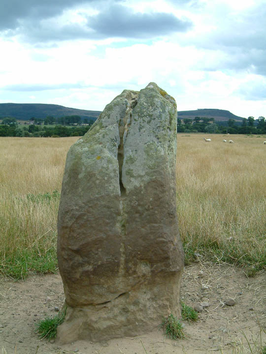
Newtown Mill submitted by stu on 11th Oct 2003. NU043243. East side of the road as you pass through Newtown Mill.
A gate into field so access is easy.
(View photo, vote or add a comment)
Log Text: Driving southwards from Fowberry Park rock art site, through the small hamlet of Newtown, this standing stone appeared on the map to be very near the road, so we drove past hoping to see it. And there it was – about 50 yards inside the field to our left hand side, easily accessible by a metal gate. There were no footpaths to the stone, but having been disappointed at not seeing the Wade Stone South on 15th August, I was somewhat reckless, and entered the field to take some photographs, sincerely hoping the farmer wouldn’t object and I would explain if I saw him/her.
Astonishingly, the Devil’s Causeway (Roman road) runs almost immediately to the eastern side of this stone, although there was no sign of this road whatsoever (we’ve usually seen some signs of old Roman roads in the form of traces of the ditches at each side, but in this instance, all evidence seemed to have disappeared. We looked for further signs of this road at the modern road junction leading up to Newtown, but there were no traces here, either).
The rounded form of 80m high Ewe Hill seemed to loom above this standing stone, although the stone sits in the valley, well sheltered from the wind, and appears to be in its original position. We thought we spotted some cup marks on the stone, but these could be the results of weathering, as the stone has deep vertical fluting (like many of the standing stones in the area).
The road next to the standing stone is single track, with few passing places, although it is possible to park on the grass verge next to the gate next to the standing stone.
Once I'd taken photographs, we turned the car around and headed back up the hill towards Newtown, to locate the Hurl Stone.
Wades Stone (North)
Date Added: 18th Aug 2014
Site Type: Standing Stone (Menhir)
Country: England (Yorkshire (North))
Visited: Yes on 15th Aug 2014. My rating: Condition 4 Ambience 4 Access 4
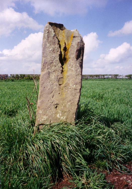
Wades Stone (North) submitted by DavidRaven on 10th May 2005. Showing the large groove on the northern Wade's Stone.
(View photo, vote or add a comment)
Log Text: From Robin Hood’s Bay, sadly Old Wife’s Neck was the wrong direction (at this time of day and for this trip) so needs to wait for another day; wanting somewhere to go on the way home, we hit upon Wade’s Stones near Goldsborough and East Barnby. Avoiding Whitby, we headed west on the A174, and turned off north onto Goldsborough Lane towards the northern stone. Goldsborough Lane is a single track road and at this time of night (about 6pm) was busy with traffic going home. After just over 1km, we passed a wood on the left hand side, and almost immediately found the footpath/track heading westwards towards Brockrigg Farm. The only available parking space visible at this point was at a field entrance on the opposite side of the road, so thinking we could run back if the tractor in the field needed to get out, we squeezed into the field entrance and headed up the footpath opposite.
At first, we saw nothing but stacks of hay bales, then after 100 yards, the track took a shallow left hand bend, and the stone came into sight - about another 100 yards up the track and about yards left across the field.
There was a combine harvester in the field, and a car had just bombed up the track as we were walking up, but we couldn’t find anyone to ask if we could walk up to the stone. The crop had only just been harvested, so we didn’t think the farmer would mind up walking over the stubble to take some photographs.
The sun was quite low in the sky at this point, and the quartz crystals on the stone sparkled in the light. I had to admire the skills of the farmer and his combine harvester – judging by the wheat stalks left around the stone, he managed to get incredibly close to the stone, without touching it (We wondered to ourselves if he had ever knocked it down in the past, but there were no signs of damage from machinery!)
I just started to talk photographs when there was a loud rustling from the wood to the south. There was a short silence, then something burst out of the trees and headed towards us – I thought at first it was a couple of large dogs, but then realised they were two deer. They chased across the field we were in, into the next field (I got photographs of their ears and heads peeping above the wheat), then they appeared back in ‘our’ field, just seeming to chase each other for the sheer pleasure of running around. Only having seen deer once or twice in the daylight, this felt very special, although they were too fast to get many photographs of. The deer disappeared back into the woods, and we continued to take photographs of the stone.
Had the modern hedges not been in the way, you would have been able to see clear views of Whitby to the east and Runswick Bay to the west, and I checked this out when we crossed the road back to the car, and peered over the gate to the coast.
Wades Stone (South)
Date Added: 18th Aug 2014
Site Type: Standing Stone (Menhir)
Country: England (Yorkshire (North))
Visited: Yes on 15th Aug 2014. My rating: Condition 3 Ambience 3
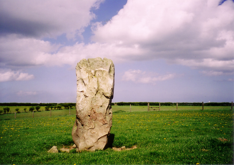
Wades Stone (South) submitted by DavidRaven on 13th May 2005. The southern Wade's Stone, looking north.
(View photo, vote or add a comment)
Log Text: From Wade’s Stone North, we drove back down Goldsborough Lane to the junction with the A174 and crossed straight over to East Barnby. Immediately over the road junction, there is a view of Wade’s Stone South from the first field gate (about 50 yards south of the junction), to the right hand side of the road.
There are no public footpaths leading to the stone, so we contemplated asking the Outdoor Centre next door if we could walk to the back of their site and hop over the hedge to take a photograph. However, this place was very forbidding, with many notices requesting ‘visitors to report to reception’ and a strong, metal barrier across the entrance gate, it had more of a feeling of a strict army camp rather than an outdoor activity centre. There was no-one wandering around, so we bottled out.
Bumping up onto the verge opposite the Centre, we walked back to the field gate by the road junction and looked over. There was a clear track used by a tractor from the field gate diagonally across the field to the Wade’s Stone South field. I later regretted not being brave enough to walk across the field to get a closer photograph, but the part of me that obeys the code/rules baulked at trespassing. We used my 300 mm lens to take a photograph of this stone; however, as this lens doesn’t have any vibration correction, the shots were fuzzy.
I’m going to try and track down the farmer/landowner, and next time we head back (hopefully to see the Old Wife’s Neck), we can include this in our list of sites to visit.
Ramsdale
Date Added: 18th Aug 2014
Site Type: Standing Stones
Country: England (Yorkshire (North))
Visited: Yes on 15th Aug 2014. My rating: Condition 3 Ambience 4 Access 3
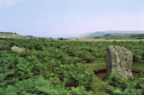
Ramsdale submitted by kelpie on 28th Sep 2002. A small circle overlooking the coast and cliffs at Ravenscar.
NZ 92057 03770
(View photo, vote or add a comment)
Log Text: Having escaped the rain and wind in our part of Northumberland, we headed for the east coast, where it was sunny and warm (although windy). However, it was a real relief to escape the sheer numbers of people in Whitby and head for the relative peace of the moors. Heading out of town on the A171, we followed the directions on the Portal site for the Ramsdale Stone Circle, which were spot on, thanks! Driving down the A171, we spotted the footpath we needed about 400 yards north of the junction of the A171 with the B1416, so turned round at the B1416 junction and parked on the grass verge at the edge of the entrance gateway to the track/footpath leading to Ramsdale House/Ramsdale Holiday Cottages.
We then followed the metalled track down towards Robin Hoods’ Bay; once over the brow of the hill, the views across to Robin Hood’s Bay were spectacular - we could see the waves breaking on the shore of the bay below.
Avoiding being mowed down by the four-wheel drive vehicles which came up and down the track at regular intervals, we missed the track off to the right mentioned in the directions on the Portal (but spotted it on the way back, as it dog-leg’s across the metalled track, rather than going straight across), and ended up following another track down to the gate in the next field boundary. It was then easy to turn and follow the sheep tracks back up the small hill to where the stones where located. The Ramsdale Stones appeared quietly, but suddenly, out of the heather. What a place to build a monument.
It was odd that there were only three stones, and we wondered (like many others) if there had been a fourth. We wandered around looking for stones under the grass, but only found a number of small, loose stones.
There were clear cup marks on the western most stone, and some possible ones on the northern stone.
The A171, which wasn’t far away, was very busy with Friday afternoon traffic, which spoiled the ambience a little, but the site itself is a lovely place to be. It is only a short walk from the main road, and worth stopping to visit, should you be passing.
The Castles
Date Added: 4th Aug 2014
Site Type: Stone Fort or Dun
Country: England (County Durham)
Visited: Yes on 3rd Aug 2014. My rating: Condition 3 Ambience 4 Access 4
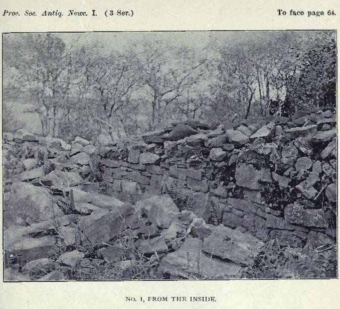
The Castles submitted by durhamnature on 24th Aug 2012. View from inside The Castles. 1903 image of archaeological investigation.
Site in County Durham England
(View photo, vote or add a comment)
Log Text: We’d come across mention of this site from Time Team Series 15 episode 11 (“5000 tons of stone”) in 2007, and noted it because it was a site relatively local to us. Being late on a windy, but sunny, Sunday afternoon, and wanting to go out somewhere without going far, we decided to head off to Hamsterley to see if we could find this site.
Following the signs for Hamsterley village from the A68, we went through the village along Saunders Avenue, turning first right up Bedburn Road when almost through the village, then first right again along Howlea Lane. I didn’t measure the distance from Hamsterley village, but it is at least several kilometres along this lane. West Shipley Farm doesn’t have a sign outside, but having spotted a sign for Shipley Moss Farm, we knew we were close.
West Shipley Farm is the next farmhouse on the left hand side of the road, and has a wide entrance to the farm track, so we bumped up on one side. The track goes past the farmhouse, then a stile crosses a stone wall (broken right hand post on the far side, so be careful – having fallen heavily during a walk the weekend before, I ended up going back to the gate to the field and walking around), and down hill to what I believe is the Harthorpe Beck valley below.
To the left hand side of the track, there is a modern curving stone wall with a wooded area behind. Between the trees, we could see tantalising glimpses of hefty stone walls. Following the modern stone wall, there is a gate towards the southern end of the field, at approximately grid reference NZ 10269 33059, which took us straight into the un-farmed field containing The Castles.
This is certainly an intriguing site. We gained access by walking across the ditch (not deep in the south west corner) and clambering up a fallen section of wall in the same area – following tracks where other people have done this).
Once inside the Castles, you are immediately within a large stone-built enclosure, away from the wind and very, very quiet and peaceful. There are vast dry stone walls, largely tumbled, but with the lower courses very much in tact. Having walked around the inside of the walls, there appears to be only one entrance, to the east of the site, and this contains a ‘guard room’, or small room, built within the wall itself. A ditch runs around the whole exterior of The Castles, although there is enough flat land between the exterior stone walls and the ditch to walk around the circumference of the walled area (avoiding trees occasionally). The eastern entrance leads down to a stream, which helps to form the eastern boundary.
The site itself is on a slope, half way down the hillside, somewhat similar to Maiden Castle in North Yorkshire, but rather than having a levelled interior like Maiden Castle, the site itself slopes downhill to the stream below, which would make no sense if the site had been occupied. However, the site was wooded and overgrown, so it was very difficult (virtually impossible) to make out any internal ground features.
I went onto the Wessex Archaeology web site when I returned home, and downloaded their archaeological evaluation and assessment for the site. They note that the site is likely to be iron age, although they had very few (virtually no!) finds, and is of rhomboidal, describing an area some 81.26m (west)/85.6m (east) by 65.83m (north)/79.5 m (south), with the wall in the east being thickest – 7m wide at the base.
Certainly enigmatic!
Maiden Castle (N Yorks)
Date Added: 4th Aug 2014
Site Type: Ancient Village or Settlement
Country: England (Yorkshire (North))
Visited: Yes on 30th Jul 2014. My rating: Condition 4 Ambience 4 Access 3
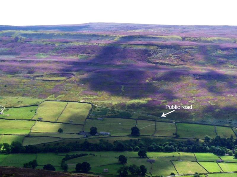
Maiden Castle (N Yorks) submitted by NeilD on 8th Sep 2005. SE 022981
Maiden Castle
(View photo, vote or add a comment)
Log Text: We ran out of time to see this site on 11th July, when we visited Thorborough Henges and West Agra (we got thoroughly distracted by the tremendous rock art at the latter), so took advantage of a trip down to Nottingham to detour via North Yorkshire and Swaledale to visit Maiden Castle.
Signs of the recent Tour de France were everywhere in this area (lots of yellow bunting and yellow bicycles, and spray-painted signs of encouragement to the riders on the roads). We stopped off in picturesque Reeth for lunch, then headed off southwards through the village of Grinton, turning west down a small narrow road with views of the river Swale to the north. This single track road runs for about 2km past ‘Bleak House’ and Harkerside Place. There are a number of footpaths and bridleways which run past Maiden Castle, but we picked the westernmost one, just past the fort, where there is a small parking area, sufficient for 4 or 5 cars.
From the car park, there is clearly marked path which runs (quite steeply) up past the western edge of the fort. As we were putting on our walking boots, two walkers were coming down and commented that the fort was ‘very well preserved; well worth seeing’.
I don’t like steep slopes or drops, but the path was relatively easy, and I needed a helping hand in only one or two rocky parts.
The fort was virtually invisible from the path, and is strangely situated part-way up the hillside. About 200 metres up the slope, the wsestern ditches of the fort suddenly come into view, then a few more paces open up a vista across the whole of the fort area. Turning to look back down the path, there are stunning views across the Swale valley and to the villages of Healaugh and Reeth across the valley.
There is a clear ditch and bank surrounding the fort; from the footpath to the west of the fort, it’s relatively easy to negotiate the ditch and bank easily (husband like a mountain goat, me picking my way gingerly), and ended up in a quiet, gentle spot, out of the wind and spotting rain. The brush underfoot wasn’t like other sites I’ve visited – the interior of the fort had what appeared to be low growing box plants with ferns, and we used sheep tracks to navigate from one point to the next within the fort area to avoid prickled ankles. At the southern end of the fort, where the slope drops steeply into the valley, there are quite a few tumbled stones, as if the fort had an outer wall at some point.
Before we visited, I had come across, and downloaded, the Durham University Archaeological Services report on Maiden Castle and West Hagg (geophysical surveys, report 2631, May 2011), which is available on the web when typing in ‘Maiden Castle Yorkshire’ on my web browser, so were able to largely identify the features they found within the fort, which was a real help in understanding what we were looking at.
Where their report had indicated a probable roundhouse, we found a circular area with very different vegetation, with low lying stones popping up through the grass to indicate where the foundation walls had been.
The walled approaches on the eastern side of the fort were impressive, giving the fort a ‘banjo’ shape. There is also a cairn/round barrow immediately adjacent to the northern end of the northern wall approach road to the fort.
Whilst exploring the fort, we saw other walkers pass by on the footpaths above and below, but very few people actually came into the fort, which was surprising. Definitely worth a visit.
Paines Bridge, Wallington C
Date Added: 4th Aug 2014
Site Type: Rock Art
Country: England (Northumberland)
Visited: Yes on 29th Jul 2014. My rating: Condition 3 Ambience 3 Access 4
Paines Bridge, Wallington C submitted by SolarMegalith on 22nd Jun 2013. Possible cup-mark with a groove on Paines Bridge, Wallington C stone (photo taken on June 2013).
(View photo, vote or add a comment)
Log Text: Full visit report under 'Wallington A', as there are three boulders with rock art within 2 metres of each other in the same location. Worth a visit if you pass over Paine's Bridge or are visiting Wallington House.
Paines Bridge, Wallington B
Date Added: 4th Aug 2014
Site Type: Rock Art
Country: England (Northumberland)
Visited: Yes on 29th Jul 2014. My rating: Condition 3 Ambience 3 Access 4
Paines Bridge, Wallington B submitted by SolarMegalith on 22nd Jun 2013. Groove on Paines Bridge, Wallington B stone - view from the west (photo taken on June 2013).
(View photo, vote or add a comment)
Log Text: Visit report logged under 'Wallington A', as there are three stones within 2 metres of each other. Worth looking for if you are passing by Paine's Bridge/Wallington House.
