Contributory members are able to log private notes and comments about each site
Sites Anne T has logged. View this log as a table or view the most recent logs from everyone
Waberthwaite Cross
Date Added: 27th Oct 2014
Site Type: Ancient Cross
Country: England (Cumbria)
Visited: Yes on 24th Oct 2014. My rating: Condition 3 Ambience 4 Access 5
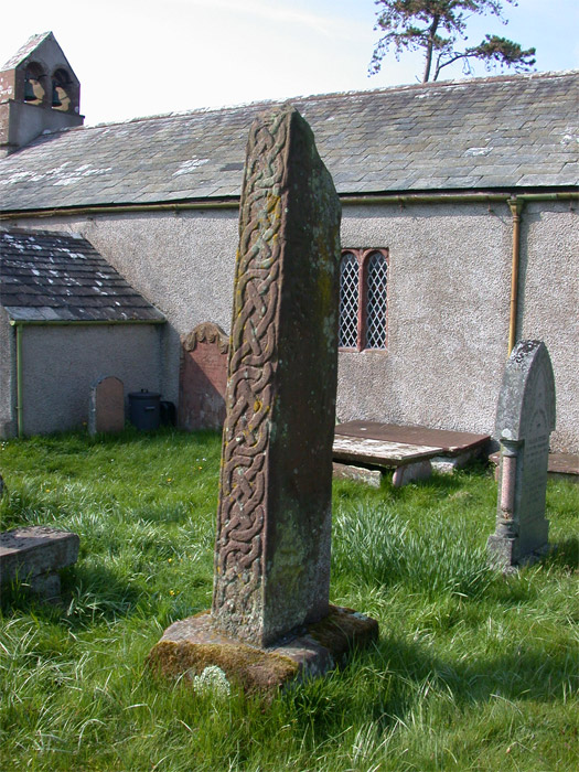
Waberthwaite Cross submitted by nicoladidsbury on 27th Apr 2005. Ancient Anglian/Scandinavian Stone Cross at St John's Church, Waberthwaite.
South and East sides, showing the crisp unweathered carving on the south side.
The Cross Shaft is 2m high, and quite badly weathered, making it difficult to see the carvings on the main panels, however the edges (north and south sides) are still remarkedly clear.
The cross is thought to date from the 9th to 10th centuary, and shows influences of anglican and viking carving styles.
(View photo, vote or add a comment)
Log Text: Ancient crosses, St John the Baptist Church, Waberthwaite: This was our last planned stop of the day and dusk was drawing in. I confess to being a little tired of getting in and out of the car by this time, but a drive down a narrow country lane to reach a cluster of farm houses by the estuary of the River Esk was worth it. Outside the church of St John the Baptist looks derelict and unloved, with the door being guarded by a simple wire frame held shut by a wire closure.
Finding ‘Waberthwaite 02’ cross shaft and basewas easy, as it sat immediately to the east of a tall sundial. ‘Waberthwaite 01’ was a bit more of a challenge until I realised it had been laid flat on the plinth of the sundial (verified by the notes inside the church).
Simple manipulation of the wire frame in the church porch allowed entry, and the door to the church had been left unlocked - inside it is small but cosy, like stepping back into the 18th century. There are box pews put in by the Victorians and the bells are rung from the outside.
Notes in the church read: “The churchyard contains a sandstone sundial, possibly 18th century. Its height is explained by the fact that it was designed to be read by someone on horseback. Behind it is the shaft of an ancient preaching cross. For many years this was part of the lintel of the church porch. The cross head has been lost. It is very worn, but the carving includes interlaced foliage and, on the east face, pictures of a horse and two figures facing one another. Lying on the base of the sundial is another broken cross shaft rescued from the threshold of the porch in the 1800s. Again the cross head is lost. For many years the larger cross was thought to be 9th century or later, but recent archaeological discoveries put it earlier, in the 8th century. This makes the Waberthwaite Cross one of the earliest in West Cumbria. The existence of the crosses is evidence of a very early Christian settlement on this site.”
It wasn’t difficult to imagine early Christians stopping off at the site to worship by the cross.
Wades Stone (North)
Date Added: 18th Aug 2014
Site Type: Standing Stone (Menhir)
Country: England (Yorkshire (North))
Visited: Yes on 15th Aug 2014. My rating: Condition 4 Ambience 4 Access 4
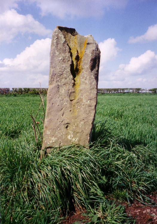
Wades Stone (North) submitted by DavidRaven on 10th May 2005. Showing the large groove on the northern Wade's Stone.
(View photo, vote or add a comment)
Log Text: From Robin Hood’s Bay, sadly Old Wife’s Neck was the wrong direction (at this time of day and for this trip) so needs to wait for another day; wanting somewhere to go on the way home, we hit upon Wade’s Stones near Goldsborough and East Barnby. Avoiding Whitby, we headed west on the A174, and turned off north onto Goldsborough Lane towards the northern stone. Goldsborough Lane is a single track road and at this time of night (about 6pm) was busy with traffic going home. After just over 1km, we passed a wood on the left hand side, and almost immediately found the footpath/track heading westwards towards Brockrigg Farm. The only available parking space visible at this point was at a field entrance on the opposite side of the road, so thinking we could run back if the tractor in the field needed to get out, we squeezed into the field entrance and headed up the footpath opposite.
At first, we saw nothing but stacks of hay bales, then after 100 yards, the track took a shallow left hand bend, and the stone came into sight - about another 100 yards up the track and about yards left across the field.
There was a combine harvester in the field, and a car had just bombed up the track as we were walking up, but we couldn’t find anyone to ask if we could walk up to the stone. The crop had only just been harvested, so we didn’t think the farmer would mind up walking over the stubble to take some photographs.
The sun was quite low in the sky at this point, and the quartz crystals on the stone sparkled in the light. I had to admire the skills of the farmer and his combine harvester – judging by the wheat stalks left around the stone, he managed to get incredibly close to the stone, without touching it (We wondered to ourselves if he had ever knocked it down in the past, but there were no signs of damage from machinery!)
I just started to talk photographs when there was a loud rustling from the wood to the south. There was a short silence, then something burst out of the trees and headed towards us – I thought at first it was a couple of large dogs, but then realised they were two deer. They chased across the field we were in, into the next field (I got photographs of their ears and heads peeping above the wheat), then they appeared back in ‘our’ field, just seeming to chase each other for the sheer pleasure of running around. Only having seen deer once or twice in the daylight, this felt very special, although they were too fast to get many photographs of. The deer disappeared back into the woods, and we continued to take photographs of the stone.
Had the modern hedges not been in the way, you would have been able to see clear views of Whitby to the east and Runswick Bay to the west, and I checked this out when we crossed the road back to the car, and peered over the gate to the coast.
Wades Stone (North)
Trip No.159 Entry No.2 Date Added: 6th Mar 2020
Site Type: Standing Stone (Menhir)
Country: England (Yorkshire (North))
Visited: Yes on 4th Mar 2020. My rating: Condition 3 Ambience 3 Access 4

Wades Stone (North) submitted by DavidRaven on 10th May 2005. Showing the large groove on the northern Wade's Stone.
(View photo, vote or add a comment)
Log Text: Wade's Standing Stone (North), Brockrigg: We must have completely forgotten we'd visited this stone before, as neither of us recognised either the road or the lane leading up to the stone. However, we walked up the lane towards the farm, and followed the tractor tyre tracks up to the stone to avoid damaging the seedling plants in the field (the field was planted with small cabbage plants which had recently sprouted). The Pastscape entry says this was originally one of two stones, and we tried to look for possible signs of where the second stone may have stood, but could see nothing.
The deep erosion on the stone was interesting. I looked for the graffiti but only spotted the letters JS on its southern face. The OS map shows this stone to be placed near the Parish boundary line.
Wades Stone (South)
Date Added: 18th Aug 2014
Site Type: Standing Stone (Menhir)
Country: England (Yorkshire (North))
Visited: Yes on 15th Aug 2014. My rating: Condition 3 Ambience 3
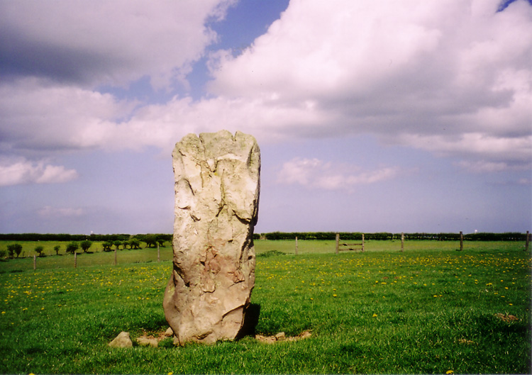
Wades Stone (South) submitted by DavidRaven on 13th May 2005. The southern Wade's Stone, looking north.
(View photo, vote or add a comment)
Log Text: From Wade’s Stone North, we drove back down Goldsborough Lane to the junction with the A174 and crossed straight over to East Barnby. Immediately over the road junction, there is a view of Wade’s Stone South from the first field gate (about 50 yards south of the junction), to the right hand side of the road.
There are no public footpaths leading to the stone, so we contemplated asking the Outdoor Centre next door if we could walk to the back of their site and hop over the hedge to take a photograph. However, this place was very forbidding, with many notices requesting ‘visitors to report to reception’ and a strong, metal barrier across the entrance gate, it had more of a feeling of a strict army camp rather than an outdoor activity centre. There was no-one wandering around, so we bottled out.
Bumping up onto the verge opposite the Centre, we walked back to the field gate by the road junction and looked over. There was a clear track used by a tractor from the field gate diagonally across the field to the Wade’s Stone South field. I later regretted not being brave enough to walk across the field to get a closer photograph, but the part of me that obeys the code/rules baulked at trespassing. We used my 300 mm lens to take a photograph of this stone; however, as this lens doesn’t have any vibration correction, the shots were fuzzy.
I’m going to try and track down the farmer/landowner, and next time we head back (hopefully to see the Old Wife’s Neck), we can include this in our list of sites to visit.
Wades Stone (South)
Trip No.159 Entry No.3 Date Added: 6th Mar 2020
Site Type: Standing Stone (Menhir)
Country: England (Yorkshire (North))
Visited: Saw from a distance on 4th Mar 2020

Wades Stone (South) submitted by DavidRaven on 13th May 2005. The southern Wade's Stone, looking north.
(View photo, vote or add a comment)
Log Text: Wades Stone (South): As per our last visit, we were unable to find anyone to ask at the now Council Depot (not the Outdoor Centre as marked on the map), and couldn't see any field access into the field containing the stone, either from the corner of East Barnby Lane and the A171 (at NZ 82845 13203), or off the main road. As there were other sites we were really keen to see, we drove on without making an attempt to see this stone. Shame.
Wall Crags Settlement
Date Added: 3rd Sep 2014
Site Type: Ancient Village or Settlement
Country: England (Northumberland)
Visited: Yes on 25th Aug 2014. My rating: Condition 2 Ambience 3 Access 4
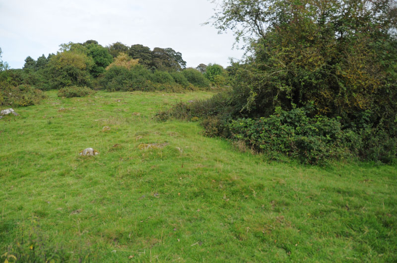
Wall Crags Settlement submitted by Anne T on 1st Sep 2014. To our untutored eye, the circular bank running from the centre of the photograph to the right hand side looked like the possible foundations of a roundhouse (now has trees growing in the middle).
(View photo, vote or add a comment)
Log Text: Wall Crags Settlement, Northumberland: It was 4pm on Bank Holiday Monday and we wanted to go somewhere, but didn’t have time to go far. Husband Andrew had spent the afternoonon the internet looking at rock art on the old Roman Bridges at Chollerford, and spotted the settlement to the east of Wall village as somewhere else to go on route. We drive through Wall on a regular basis, and neither of us had been aware of a settlement here until we looked closer at the map.
We parked on a side street just above the chapel in Wall at approx. grid reference NY 91744 69094, and walked down to the chapel, turning left towards the park. There were some very old cottages to our left hand side (on the walk back, I’m sure the one nearest the start of the footpath was dated 1642). The footpath took us across the southern end of the park, with a gate leading to some stone steps leading up the hill.
We climbed quickly up the steep slope, then the steps stopped, and open grassland began. The slope must have been about 40 degrees, and was slippery enough in the dry, and would have been lethal in the wet. I’m afraid I bottled out at this point - getting up would have been OK, but getting down (for me) would have been a nightmare, so I sat on the grass and handed the camera to Andrew, so he's to thank for the images on the Portal.
He was gone about 20 minutes, coming back to say it was fairly difficult to identify the features up on top of the hill, as whilst the top was level, there were trees, large stones and the ground looked as if it had been heavily trampled by cattle and was difficult to walk on. The ramparts were visible, as were the possible foundations of a couple of roundhouses.
I haven’t been able to find out much about this settlement at all, except for a brief mention on Keys To The Past (page reference N13760) which is a shame, but I’ll keep my eyes open for any information.
Wallington Hall Standing Stone
Date Added: 24th Jul 2015
Site Type: Standing Stone (Menhir)
Country: England (Northumberland)
Visited: Yes on 1st Jul 2015. My rating: Condition 3 Ambience 4 Access 4
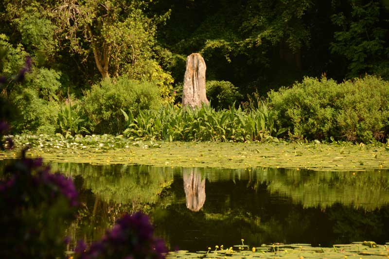
Wallington Hall Standing Stone submitted by Anne T on 6th Jul 2015. The first view of the Wallington Hall Standing Stone from the footpath. The stone sits on the south eastern side of the pond and is easily accessible by paths leading around the pond.
(View photo, vote or add a comment)
Log Text: Wallington Hall Standing Stone, Northumberland: Having been treated to National Trust membership for my birthday, we then sat and wondered how best to make use of this. We'd heard that there was a standing stone at Wallington Hall, but had never found it before. Having tracked down the location (around the China Pond (used to be called the Chinese Pond)), and absolutely loving their walled garden, which is absolutely breathtaking at this time of year, we set up on a Menhir Hunt.
Note to new visitors to Wallington: whereas you could park in the car park near the house then go to the hut to pay admittance, staff are on the entrance to the car park to take entrance money on the way in. I had my cards in the boot of the car, which didn't make me popular with the queue behind, but the less said about that, the better).
This stone, which is said to be the pair to the stone at the Poind and His Man, sits at the far side of the China Pond having been moved here by the famous Mr. Blackett who has built many structures and follys in and around Northumberland. Walking from the house and crossing the busy road to the forest walks, the China Pond is signposted, and it is less than a five minute walk. It certainly sits in a beautiful spot, although I was a little saddened to see it sitting on a concrete/stone base, having been propped up by bits of slates and other stones.
Whilst taking photographs, a couple stopped to watch, saying to each other "they're taking photographs for that Countryfile competition". We assured them we weren't. They were on the look-out for red squirrels, and listened politely when I explained about the standing stone.
Carrying on to the walled garden, I was stunned at the amount of work which goes into keeping this place immaculate. Whilst sipping hot tea at the cafe in the walled garden, the skies got very dark and we were treated to some some spectacular lightening on the way back. Shame the trees blocked the view of the lightening from the standing stone - that would have made a good photo.
Walwick Fell
Trip No.26 Entry No.1 Date Added: 22nd May 2017
Site Type: Ancient Village or Settlement
Country: England (Northumberland)
Visited: Yes on 21st May 2017. My rating: Condition 2 Ambience 4 Access 4

Walwick Fell submitted by Anne T on 22nd May 2017. Looking over at the two banks to the south west of the main structure.
(View photo, vote or add a comment)
Log Text: Walwick Fell Farmstead, near Hexham: This settlement is not far from Tower Tye, where the Tynedale North of the Wall Archaeology Group used to meet before the surveys. Turning south on the un-named road towards Whinney Hill, we parked in a small layby at the edge of the wood on the east side of the road, opposite the gate into the field containing the settlement. The footpath runs diagonally north west across the field, with the settlement to the right hand side towards the top of the hill, but with bullocks grazing in the field, looking very interested in coming over to us, we gave them a wide berth and approached the settlement from the east.
The settlement appears as a series of defined banks on the slope of the hill, with gorse bushes to its south-western side.
In the wood behind the stone wall to the north of this settlement lies the remains of a Roman camp, but it has been so disturbed by forestry works it is not really possible to see anything.
There are the clear remains of two hut circles, with their foundations built into the back of the slope. The banks are all turf covered and easy to make out. The site has wonderful views to the west, south and east (south to the South Tyne Valley), although it is in a sheltered spot just below the brow of the hill.
Looking on UK Grid Finder when I got home, it is impressive how much of the site can be made out on the aerial image.
There is a well marked on the OS map in the lower part of the field, although it was not evident when we made our way back to the gate.
Wamphray Place
Trip No.124 Entry No.5 Date Added: 11th Apr 2019
Site Type: Misc. Earthwork
Country: Scotland (Dumfries and Galloway)
Visited: Saw from a distance on 4th Apr 2019. My rating: Condition 1 Ambience 3 Access 4
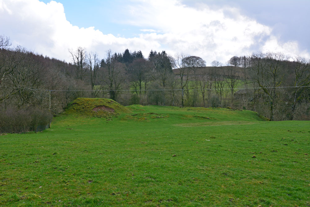
Wamphray Place submitted by Anne T on 11th Apr 2019. Having seen the cross slab at Wamphray Church, we stopped by the side of the road to photograph this picturesque motte and bailey castle, high above Wamphray Water, but as we had a rendezvous, didn't stop to explore further. This site was known to be occupied in the 12th century and was still in use until the mid 18th century. Possibly, the motte is built upon a more ancient site.
(View photo, vote or add a comment)
Log Text: Wamphray Place Motte & Bailey: Continuing down the hill (north west) from Wamphray Church, past the mill and over the narrow bridge, as we climbed the hill at the other side of the river, we spotted this small, compact motte and bailey and stopped to take a few quick photos. Wish we’d had more time to explore and photograph this site from the river, but we wanted to try and find the cairn cemetery at Pumplaburn before heading off to meet our daughter at Annandale Water services.
Warden Hill Hillfort
Trip No.126 Entry No.1 Date Added: 5th May 2019
Site Type: Hillfort
Country: England (Northumberland)
Visited: Yes on 1st May 2019. My rating: Condition 2 Ambience 4 Access 4
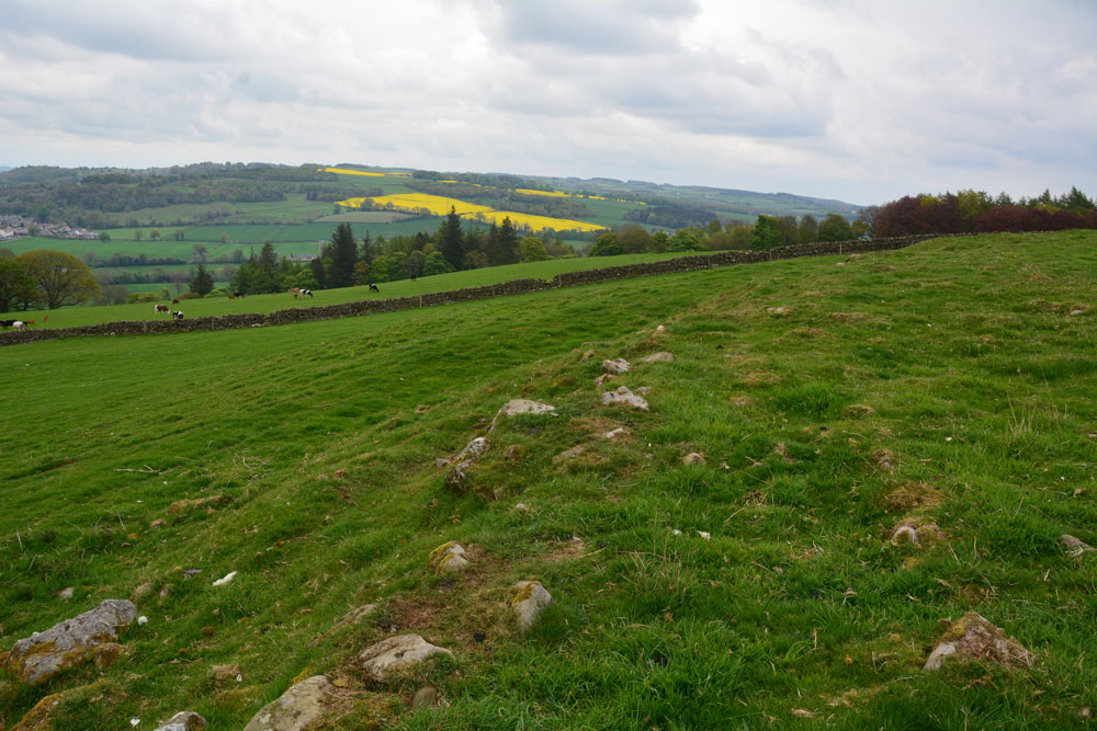
Warden Hill Hillfort submitted by Anne T on 5th May 2019. Standing almost on the north western corner of the hillfort, looking north east over the northern rampart, with the Tyne Valley in the distance.
(View photo, vote or add a comment)
Log Text: Warden Hill Hillfort: Homer’s Lane is very narrow, so we struggled to park the car. We eventually ended up bumped up on the verge at the wide entrance to a farm house at NY 91187 67190, ensuring there was plenty of room for tractors, trailers and other traffic to get past.
Walking back to the start of the footpath at NY 91217 67247, we used the kissing gate and walked up hill, turning left onto the well-marked path, zig-zagging through what is virtually a small village at High Warden (there are so many signposts and ‘private’ signs’ people must have become fed up with walkers). We ended up on a small woodland path leading northwards along the edge of a field towards the telecoms mast just below the summit of Warden Hill. By the mast, the track dog-legs slightly westwards, with the path running north up-hill through the centre of a field of pasture.
Towards the top of the hill there is a trig point, immediately to the east of the gate into the next field. Going through the gate, there is an interesting series of low banks which are medieval/post medieval in date. Walking 10-15m further onto the hill, the outer banks of the hill fort become clear.
We spent ages walking around the outside and inside of the hillfort. We’d taken the printed HE and Pastscape records with us, determined to understand all the features. We particularly looked for the Roman signal station, and identified a small, square structure where the grid reference said it should have been. From here, running eastwards, a line of stones poked up intermittently out of the grass.
There are brilliant views in most directions, although the endless noise of the A69 became a little tedious.
Warrior Stone (Ingoe)
Date Added: 16th Jun 2014
Site Type: Standing Stone (Menhir)
Country: England (Northumberland)
Visited: Yes on 15th Jun 2014. My rating: Condition 3 Ambience 4 Access 4
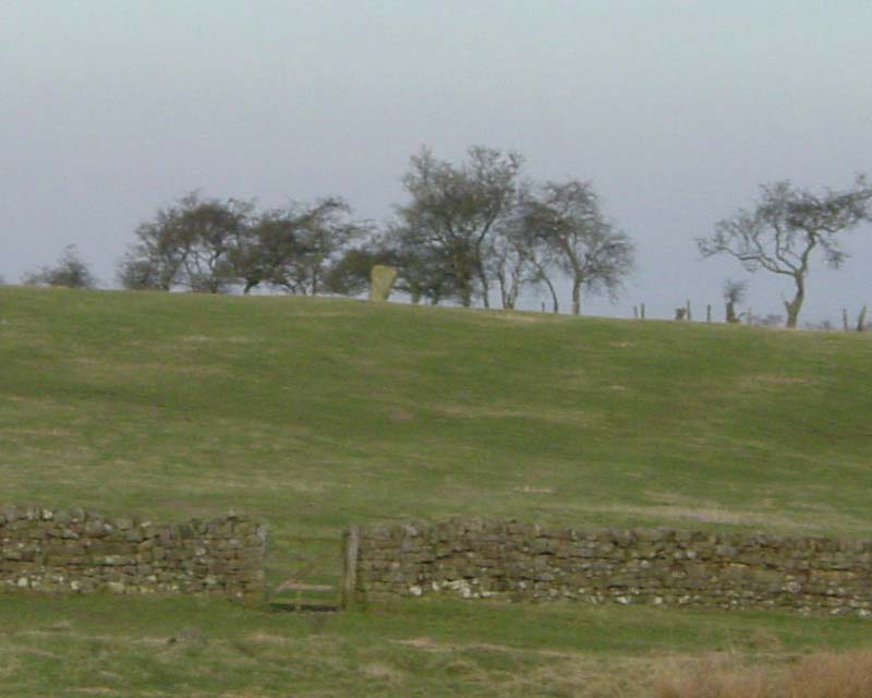
Warrior Stone (Ingoe) submitted by PaulH on 3rd Mar 2003. Northumberland
NZ044747
No public access to the stone itself
(View photo, vote or add a comment)
Log Text: We've visited Inghoe before, but to look at the remains of the medieval village and also the hut circles just beyond Sandyway Heads Farm.
Having just visited the Matfen Standing Stone, and having tried to visit the Bygate Hill site (which is a private plantation with a telecommunications mast and permission is needed to access the site), it was only a few more miles to the Warrior Stone. We parked just past the 'village green' (with a bus stop) and walked along the farm track. We were last here about 5 years ago, and the friendly farmer came out to tell us about the homestead in the field beyond the farm, showed us the cup and ring stone and quern stone by the gate to his cottage, and gave us permission to visit the Warrior Stone, which stands alone in a field just before the farm cottage. There was no-one around this time to ask permission, so I felt guilty about walking into his field.
There are beautiful views across the valley towards Matfen and Stamfordham, even though it was drizzly and misty.
A couple of web sites by local antiquarians describe cup marks on the stone, but I wasn't sure if we'd identified the right marks.
Will go back again when we've got blue skies to appreciate the site in all it's glory.
Warrior's Rest
Date Added: 29th Jun 2015
Site Type: Standing Stone (Menhir)
Country: Scotland (Scottish Borders)
Visited: Yes on 27th Jun 2015. My rating: Condition 3 Ambience 4 Access 4
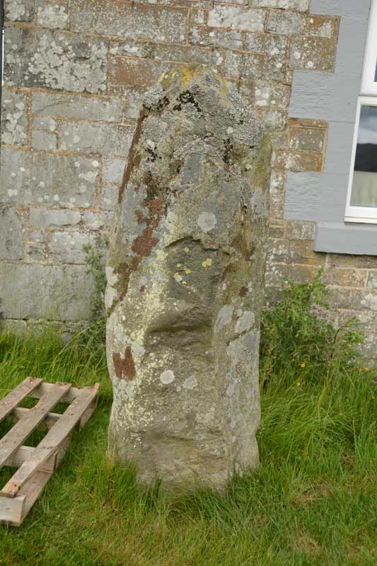
Warrior's Rest submitted by Anne T on 29th Jun 2015. A close up of the Warrior's Rest east face, but no cup marks that I can see. I wonder if the report of these cups got muddled with the Glebe Stone, just down the road, as I could see two cups on its eastern face.
(View photo, vote or add a comment)
Log Text: Warrior Stone, Yarrow, Scottish Borders: The Canmore Site (no. 53054) notes say that this stone is “at the south east corner of the cottage known as Warrior’s Rest, 300 yards west of Yarrow Church, there is a standing stone measuring 5ft 3ins in height, 5ft 9ins round the base and 4ft around the shoulder. The top is pointed.”
As the crow flies, it is just over 700 metres east of the Yarrow Stone, back towards Yarrow village. We spotted the small white signpost to Warrior’s Rest cottage at the left hand side of the road and stopped at the entrance. We couldn’t see any standing stone in the vicinity at all, even climbing the steps to the nearby war memorial just to the west of the cottage to see if we could spot anything. In the end, I walked up the track towards the cottage and spotted what appeared to be the top of a small standing stone peeking out above one of the two cars parked on the driveway.
Having come all this way, I was disappointed not to be able to see the stone, so decided to walk up and knock on the door. The curtains were drawn and the door to the garage was open, but despite knocking and calling out, I got no response, so decided to be cheeky and take a couple of photographs (and if anyone came, I’d explain). The stone literally stand a couple of feet away from the front bedroom window – whether its still in its original place and the cottage was built next to it, or the stone has been relocated next to the cottage was difficult to tell.
The Canmore notes also say there are two, previously unreported, cup marks on the eastern side of the stone, although I did quickly examine the stone for any cup marks, but didn’t see any. Usually my camera can pick up on things the eye finds difficult to differentiate at the time, but examining the photos this morning, I couldn’t see anything. I wonder now, at the time of writing, if this has been confused with the Glebe Stone, as I did see two cup marks on the eastern face of this stone.
Watching Place Waymarker
Trip No.130 Entry No.1 Date Added: 22nd May 2019
Site Type: Marker Stone
Country: England (Devon)
Visited: Yes on 11th May 2019. My rating: Condition 3 Ambience 3 Access 5
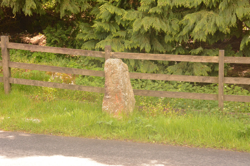
Watching Place Waymarker submitted by Anne T on 22nd May 2019. The Beetor/Watching Place waymarker. This stone dates only to the 18th century, but marks the original site of the Beetor Cross, now located some 100m to the south.
(View photo, vote or add a comment)
Log Text: Watching Place Waymarker/original site of Beetor Cross: Having seen the OS map and sorted out the Pastscape entries, I finally realised that this 'standing stone' was where the cross had originally been located.
Our first stop today was to go and photograph it so I could complete the Beetor Cross entry. It was nice to understand the relationship between the waymarker stone and the wayside cross, although it too me a while to understand the confusion between the names (HE calls the waymarker the Beetor Cross and the cross the Watching Place Cross).
I had to be careful photographing the front of the cross as cars sped quickly at irregular intervals.
Week Down Cross
Trip No.131 Entry No.3 Date Added: 3rd Jun 2019
Site Type: Ancient Cross
Country: England (Devon)
Visited: Yes on 12th May 2019. My rating: Condition 3 Ambience 4 Access 4
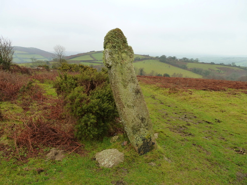
Week Down Cross submitted by Bladup on 3rd Mar 2016. Week Down cross at SX71168653.
(View photo, vote or add a comment)
Log Text: Week Down Cross: We left the car by the Shorter Cross and continued the 250m up the road by foot; in actual fact there is a large grassy area on the moor here, and another car with a disabled passenger pulled onto the grass whilst we were there. Whilst the cross itself is only 9m from the road, there is a bank immediately at the edge of the road to step up to the common.
This cross is in a really lovely location, sitting by the edge of the common/moor, with great views over the moors to Chagford.
I had to be careful about photographing this cross, as to the west there was a camp site with some really brightly coloured tents which took over the photo, so I aligned myself to these were either hidden behind the cross, or behind the gorse bushes!
F H Starkey in his 1983 book “Dartmoor Crosses & Some Ancient Tracks” describes this cross as :”it consists of a tall rectangular shaft of granite, six feet nine inches tall. It has a rounded head and two very short arms have been cut out of the shaft. A Maltese Cross is cut on each face; one of these is in line with the shaft of the cross which is inclined at an angle to the ground, the other is at right-angles to the ground. This rather strange fact led Ormerod (who described the cross in 1874, having know it from at least 1859) to conjecture the crosses had been carved after the cross was erected and had settled down to its out of perpendicular stance Ormerod also tells us that the cross was in danger of falling in 1867 and that it was moved back from the road a little but that its original angle of inclination was repeated when it was re-erected. He says too, that there was a project afoot to move the cross and use it to make a foot-bridge; happily it was spared this fate”.
Weetwood Moor 3a
Date Added: 1st Sep 2014
Site Type: Rock Art
Country: England (Northumberland)
Visited: Yes on 31st Aug 2014. My rating: Condition 3 Ambience 5 Access 4
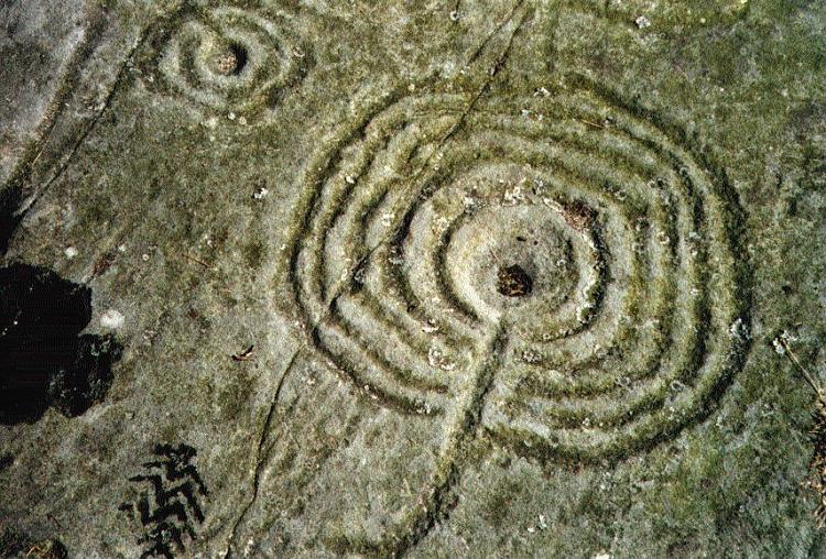
Weetwood Moor 3a submitted by rockartuk on 3rd Aug 2001.
(View photo, vote or add a comment)
Log Text: Weetwood Moor 3a (Bicycle Rock), Northumberland: My husband had seen photographs of the rock art at Weetwood Moor, which was very near the Fowberry Mains/Fowberry Park site we'd seen on 17th August 2014). Parking at the road junction next to where the metalled track runs alongside North Plantation, we walked down to find the footpath, which is located to the right hand side of the road, just passed the cattle grid. My goodness, was this overgrown for the first 20 to 30 metres – I stepped through head high bushes and gorse, eventually emerging into a rocky moorland.
After a 100 yards or so, the footpath bears left. There is a clear sign straight ahead, declaring ‘not access land’, but there was clear evidence of small footpaths carrying along across the heather. We went up a little way to try and see what was there, when a lady walking her dog sailed past us, waving and shouting ‘hello’ cheerfully as she went, so we assumed it was alright to carry on (we’ve since found a published Rock Art walk which takes us past the rocks we wanted to see).
Andrew found the Bicycle rock first of all – this was amazing - and I took photographs. To the east of this rock, someone had built a small cairn in a cup shape, this cup containing what looked like a Wiccan altar with sea shells, a bone and some berries.
Walking to the quarry face immediately to the east of Bicycle Rock, I noticed (for the first time) evidence of fluting on the edge of the rock, similar to the weathering on other standing stones in the area (ones that immediately spring to mind are Matfen and the Newtown Mill standing stone).
We found other rocks with cup marks, and I’ll need to sit down and compare my images to the other pages for Weetwood Moor on the Portal, to make sure I’m recording them against the right pages.
Wellbraes
Trip No.101 Entry No.1 Date Added: 30th Sep 2018
Site Type: Holy Well or Sacred Spring
Country: Scotland (Scottish Borders)
Visited: Yes on 29th Sep 2018. My rating: Condition 3 Ambience 2 Access 4
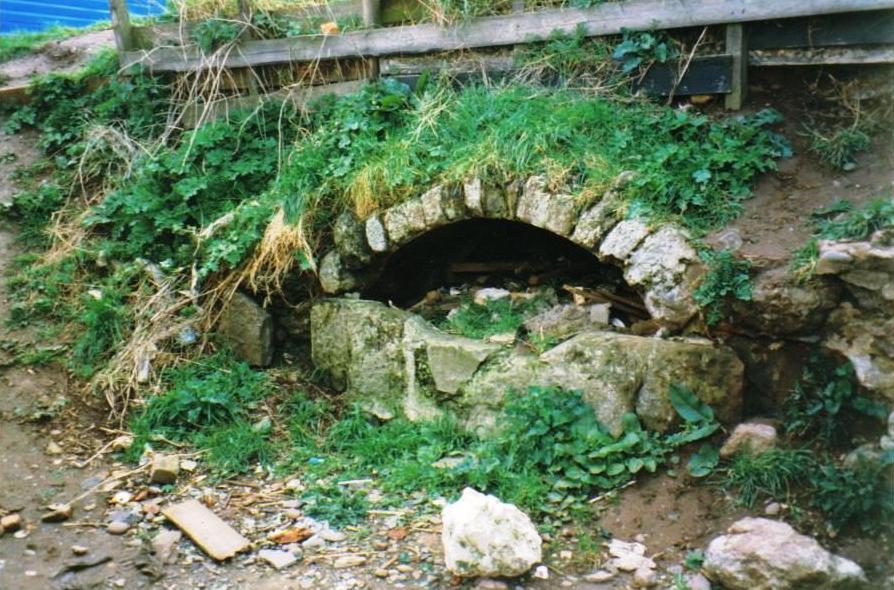
wellbraes submitted by mafenty on 19th Aug 2006. Well from which Wellbraes, Eyemouth derives its name (hidden since 1974 behind the swimming pool) picture taken at that time. Age uncertain ... allegedly "Roman".
grid ref NT944645
(View photo, vote or add a comment)
Log Text: Eyemouth Leisure Centre Well, Wellbraes: This well can only be accessed through the Leisure Centre. Having walked round the Leisure Centre and surrounding buildings, I had to ask at the reception desk, and show a photo of the well. The receptionist didn’t know but one of the personal trainers did, and let us through the fire exit door in the gym; there is a gate at the western end of the centre which leads through into a small garden area; alternatively there is the fire exit through the back of the small gym which leads into the same area.
We could barely recognise the well at first as it was so overgrown with nettles and weeds. Our eyes eventually spotted the arch of stones through the mass of weeds and we trod down a few of the large nettles and dock leaves to take a closer look. The well chamber goes back at least 2m, if not further; whilst there is a wall at the back, this doesn’t seem to be connected to the arched concrete covering over the well basin. We needed better torches to see the back wall of the well, which was partly obscured by a large pile of rubble (bricks and stone) at the back of the chamber.
We could hear water flowing through the well chamber, although there was only a puddle in the bottom. At the left hand side of the well was a very rusty water pipe, but this was dry. Investigating further, we found the water flowing into a low concrete construction at the back of the lip of the well; from there, the water came out of the well chamber through a small rectangular hole and disappeared into a small drain.
With the amount of rubbish around, I didn’t check the quality and taste of the water.
Wells Cathedral
Trip No.136 Entry No.2 Date Added: 12th Jun 2019
Site Type: Early Christian Sculptured Stone
Country: England (Somerset)
Visited: Yes on 17th May 2019. My rating: Condition 4 Ambience 4 Access 4
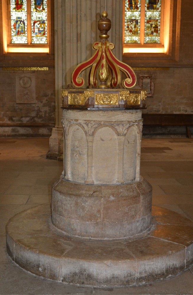
Wells Cathedral submitted by Anne T on 11th Jun 2019. The font in the south transept of Wells Cathedral, recorded as AS Corpus Wells 04, said to be from the original stone cathedral, dated to the 10th to 11th century and recorded as being in situ at this location since the 12th century. The font bowl is cylindrical and tubshaped, and is cut from a single block of Chalfield Oolit limestone. Over the centuries it has been partly recut and remodelled.
(View photo, vote or add a comment)
Log Text: AS Corpus Wells 4, Wells Cathedral: We'd been seriously held up by traffic on the major and minor roads from Exeter to Wells, then by seriously slow roadworks, so were really rushed for time. I'd previously contacted the cathedral to find out if it was possible to see AS Corpus Wells 3, which the Corpus said was in the cathedral store, but the cathedral said they were unable (unwilling) to find it. Thinking the other fragments would be on display, we still went to the Cathedral. Throwing the car into a car park just inside the city centre, I managed to photograph the Market Cross/Bishop Beckington's Conduit before going to the Cathedral.
I showed one of the guides the AS Corpus notes and asked if he knew where they might be on display and were told ‘try the undercroft’. Nothing of note in there – it was very bare with very little displayed.
After wandering up and down the nave and chancel, I stopped another guide, showed her my notes, explained I’d previously emailed. She told me one of the stones was in the library, but a special tour had just started and it would be at least an hour before we could get in, and to look at the fragments built into the walls of the cloisters. She then said she’d find one of the vergers and ask him if he knew where the others were.
Eventually, this very kind lady came to find us and took us to the verger’s office, where he looked at my papers. “Oh, yes”, he said, “I remember the email. Everything is now in storage in the triforium, either in boxes or cages, and can’t be accessed.” “That’s disappointing”, I replied, “why did no one tell me that in the email reply?” We were dismissed without a further word, with the verger turning back to another visitor to his office.
We went to find a late lunch in the cathedral cafeteria, only to find it almost empty and only serving coffee and cakes. We left, rapidly, with only a few postcards as souvenirs, and feeling the cathedral had been stripped bare of its medieval treasures and soul.
Not a very satisfactory visit, possibly spoiled by the huge rush we'd been in, the lack of finding the recorded stones on display and being badgered on several occasions to make donations.
West Agra
Date Added: 15th Jul 2014
Site Type: Rock Art
Country: England (Yorkshire (North))
Visited: Yes on 11th Jul 2014. My rating: Condition 4 Ambience 4 Access 3
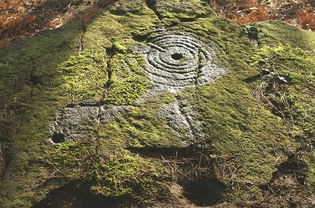
West Agra submitted by rich32 on 9th Jan 2006. West Agra, nr Masham, N Yorks - SE1424681758
(View photo, vote or add a comment)
Log Text: Google maps showed it was only just over 10 miles between Thornborough Henges, which we had just visited, and West Agra. Stopping off in Masham for a cup of tea, we need to take a minor road passing through the small villages of Fearby and Healey. We took a wrong turn which lead us down over the River Burn and to a reservoir, so we had to turn back and take the higher road past High Barn and Gollinglith Foot. Just after the road had done a sharp right/left about 1km past Gollinglith Foot, the entrance track to West Agra Farm appeared on the right hand side; there is room for 2 or 3 cars to park at the bottom. We then walked along the road for about half a kilometre to where the footpath heads off right up the hill (note coming back there is another footpath which is not marked on the map but passes about 100 yards in front of the farmhouse and leads back to the road). The footpath appears steep, but it’s on a soft, well kept grassy path, and is easy to climb. After the second gate, the area becomes a Site of Special Scientific Interest, with many different types of bird nesting in the area around.
We followed the trackway up to the junction of the drystone wall with the plantation, to our right hand side. Just before the end of the wall there is a gate into the field, then another gate to the north which leads into the plantation. We did go into the fields and the plantation, only later finding out we should have asked permission from Swinton Estates to walk across their land and through the plantation.
The West Agra site has at least 9 prehistoric carved rocks in 7 different areas on the southern side of West Agra Plantation and in the fields around West Agra Farm. They are significant because of the number of different carvings in the same area. 6 of the carvings are on individual rocks; the seventh is in a group of closely spaced rocks on the westerly side of the field system around the farm, which show heavily weathered cup marks. During the summer, the rocks within the plantation are covered by heavy bracken and mossy growth; it would be interesting to return in the winter months to find the rest of the stones.
We walked past the group of rocks in the field immediately to the east of the footpath, but couldn’t see any rock art; on our way back down to the car, we looked again, and because the light had changed, cup marks became very apparent and we wondered why we’d missed them in the first place.
Easiest to spot was the rock lying underneath the drystone wall – there is a great hump in the wall where it travels over the stone, which appears to be bedrock. The ground round the stone is very marshy, particularly on the eastern side of the stone on the other side of the wall, which also has a cup mark. The cup and groove marks on this stone were quite remarkable; the grooves appear to surround groups of cup marks . On the southern side of the stone there were other cup and worn groove marks which looked vaguely like a man, but it was difficult to tell. English Heritage say there are over 40 cup marks with grooved lines on this stone.
Since coming home, we’ve found the map showing the seven different areas, and we’ll definitely go back to see this site again nearer to Christmas.
West Cowden
Trip No.52 Entry No.2 Date Added: 10th Oct 2017
Site Type: Stone Row / Alignment
Country: Scotland (Perth and Kinross)
Visited: Yes on 28th Sep 2017. My rating: Condition 2 Ambience 3 Access 5
West Cowden submitted by cosmic on 23rd Jun 2006. Roman Stone from South.
(View photo, vote or add a comment)
Log Text: The Roman Stone, Comrie: Approaching Comrie from the south along the B827, we’d passed these stones at the eastern side of the road before we’d realised it, so ended up stopping for lunch and visiting the motte first. We retraced our steps and managed to park in the entrance to another (gated) track opposite.
These stones are also known as the Dalginross; Penfillan and West Cowden Farm stones, although they are called the Roman Stones on the OS map. Not in the greatest location, but the track alongside the stones made it easy to walk round the stones and photograph them, although I got a few stares from passing drivers as I did so!
The cup marks were pretty easy to spot, once the sunlight changed a little, although I thought I saw these on the top of the Roman Stone itself; the 1911 entry talks about an 18 inch high stone with 22 cups. I photographed all three stones and the only cup marks we both thought we saw were five on the southern face of the Roman stone itself (the largest stone).
West Howden Hill
Trip No.125 Entry No.1 Date Added: 25th Apr 2019
Site Type: Ancient Village or Settlement
Country: England (Northumberland)
Visited: Yes on 20th Apr 2019. My rating: Condition 2 Ambience 4 Access 4
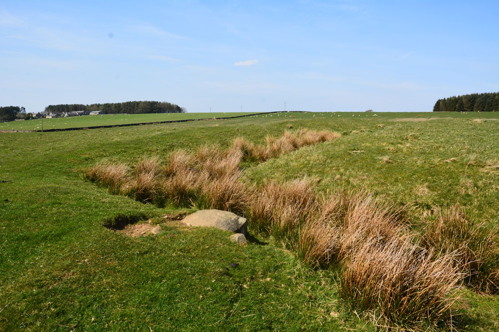
West Howden Hill submitted by Anne T on 25th Apr 2019. The south western corner of this Romano British settlement, looking north west towards the small forested area to the north of Grindon farm. This large farm can be seen just above centre-left of the photo.
(View photo, vote or add a comment)
Log Text: West Howden Hill RB Settlement: Unusually, our daughter joined us for this trip, as it was on her way to our house from Scotland, and we met outside the Old Repeater Station on the Old Military Road (B6318) and took one car the 1.4km down to the gate with the path leading to the access land on Howden Hill/Brown Moor.
This settlement straddles the marked track from North Road which runs from the Old Military Road and Old Repeater Station , past a large farm called Grindon, to reach the access land. We parked on the grass verge next to the gate into the field at NY 82336 69216 and made our way through the fields towards the location of the rock art.
There is no entry for this settlement on HE, but it is marked on their map as an enclosure.
I didn’t see this settlement until we were almost upon it. The outer ditches and banks are very clear, with an entrance half way along its eastern side. I also stopped to take photos on the way back, together with some large erratic boulders which lay next to the footpath. The site is gently sloping towards the south east and there are prominent boulders protruding from its central platform, although we could make out no discernible structures.
