Contributory members are able to log private notes and comments about each site
Sites Anne T has logged. View this log as a table or view the most recent logs from everyone
Bell Mount
Trip No.14 Entry No.1 Date Added: 3rd Apr 2017
Site Type: Natural Stone / Erratic / Other Natural Feature
Country: England (Cumbria)
Visited: Yes on 25th Mar 2017. My rating: Condition 2 Ambience 3 Access 5
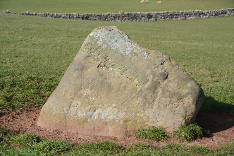
Bell Mount submitted by Anne T on 3rd Apr 2017. This stone sits almost on the brow of the hill. There are striations on its surface (plough or glacial?) indicating it has lain prone at some point in its history. There is slight evidence it is set within a depression.
(View photo, vote or add a comment)
Log Text: Bell Mount Erratic (or standing stone?): Saw this very briefly on our first visit to Newbeggin, but whizzed by in the car and didn't stop. This time, we parked by the open gate to the field. There being no stock, we took the chance to walk up the grassy slope to see this stone. Whilst it's not marked on the OS map (neither is the Sewborwens stone not far away), it showed distinct striations on one of the surfaces indicating it had lain prone at some point and been stood up. My geology isn't good enough to tell it the marks were as a result of glaciation or the plough, although the stone seemed to be set into a slight depression which was even all round, and didn't look like stock had been rubbing around it. Note to self: need to check geology of the area.
Beetor Cross
Trip No.129 Entry No.3 Date Added: 22nd May 2019
Site Type: Ancient Cross
Country: England (Devon)
Visited: Yes on 10th May 2019. My rating: Condition 3 Ambience 3 Access 5
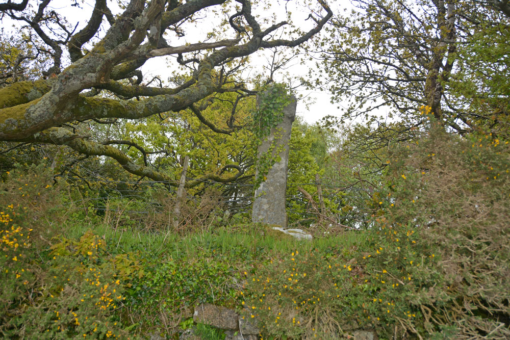
Beetor Cross submitted by Anne T on 22nd May 2019. Getting closer, this cross with its very narrow head and arms rises high out of the bank above you. Historic England says: "The primitive style of this cross, with its short head and arms, makes it a candidate for being a Christianised prehistoric standing stone".
(View photo, vote or add a comment)
Log Text: Beetor Wayside Cross, North Bovey: Our first trip out on the evening we arrived in Devon and having unpacked our things at the barn. This cross was less than a mile from the barn we were staying in.
I was really confused when I read the entries for this cross at first, not realising that it had been moved from its original spot just round the corner, opposite a crossroads. That original spot is now marked by a boundary marker.
This cross is very overgrown with ivy. It is in part of a private garden, used as part playground, part rubbish dump, but with no-one around, we opened the gate to see if there was a better view of the cross from the side opposite the road, but in fact because the cross was at the top of the bank and there was so much shrubbery around it, the view was worse.
Having worked out the original location of the cross and the significance of the nearby boundary marker, we made the boundary marker our first stop the next morning.
Bedrule Parish Church
Trip No.93 Entry No.3 Date Added: 31st Aug 2018
Site Type: Sculptured Stone
Country: Scotland (Scottish Borders)
Visited: Yes on 29th Aug 2018. My rating: Condition 3 Ambience 4 Access 5

Bedrule Parish Church submitted by Anne T on 31st Aug 2018. A close up of the longer, almost rectangular hogback fragment, described as (2) in the Canmore record: "A fragment of a hog-backed tombstone measuring 1 ft. 3 1/2 in. in length by 7 in. thick, each side being 7 1/2 in. broad and showing three rows of shingle pattern."
(View photo, vote or add a comment)
Log Text: Hogback fragments, Bedrule Parish Church: (note for less mobile visitors, whilst access into the churchyard is on a tarmacked path, there are some steps up into the porch where these fragments are stored. Disabled access is signposted but the door was locked at the time of our visit). This parish church is in the tiny hamlet of Bedrule. We could see the church from the minor road, but had to go virtually through the village and turn south past a row of small cottages to reach the church. There was a small car park outside the churchyard gates. Rubens Law is to the south and dominates the view, which is rather nice.
The western side of the churchyard is divided into a series of ’garden rooms’, each with a small collection of interesting, old grave slabs, some dating to the 1650s.
The hogback fragments were inside the porch, along with a small stone with recumbent, robed figure. The fragments were underneath the small table with prayer and hymn books, so we moved the table out of the way (and replaced it), to photograph the fragments.
Bedlington Market Cross
Trip No.103 Entry No.4 Date Added: 13th Oct 2018
Site Type: Ancient Cross
Country: England (Northumberland)
Visited: Yes on 11th Oct 2018. My rating: Condition 3 Ambience 3 Access 5
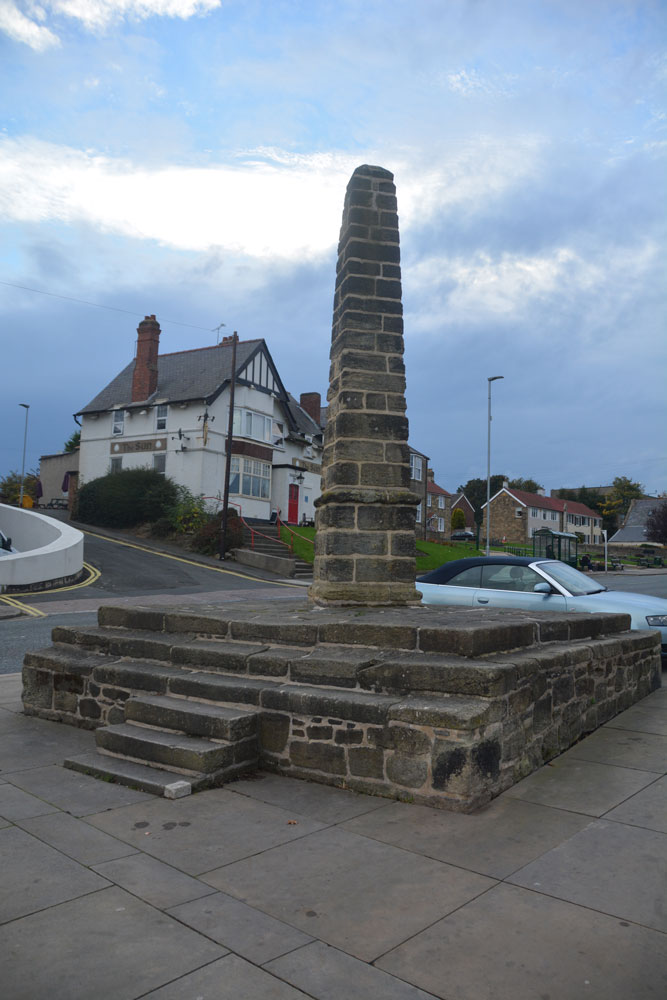
Bedlington Market Cross submitted by Anne T on 13th Oct 2018. The Bedlington Market Cross (or obelisk), which is very different from the style of other market crosses in Northumberland and the Scottish Borders that I've seen (so far). The top obelisk looks much more modern than the pedestal, although the two are apparently of the same age.
(View photo, vote or add a comment)
Log Text: The Market Cross, Bedlington: We spotted this rather unusual market cross on our way to St Cuthbert's Church to see the tenth century carved slab, now inside the church. The road was less busy on our return, and we managed to pull into the small car park outside the hairdressers opposite (it was shut for the night) and I walked across the road to take some photographs.
I have to confess this is a pretty ugly structure, and well done to whoever uses it as a private parking spot. I was surprised to find this was a Grade II listed structure, built apparently in 1792.
The surrounding flower beds and town signs all proclaimed "The Bedlington Terrier", so presumably this is where those dogs originated.
Bedd Morris
Date Added: 26th Aug 2014
Site Type: Standing Stone (Menhir)
Country: Wales (Pembrokeshire)
Visited: Yes on 23rd Aug 2014. My rating: Condition 3 Ambience 3 Access 5
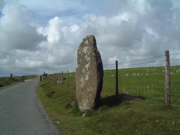
Bedd Morris submitted by enkidu41 on 3rd Jun 2004. SN 0382 3650
A 6'6" high menhir which tapers to a point.
(View photo, vote or add a comment)
Log Text: I spotted this standing stone by the right hand side of the road as we were driving over the Ffordd Bedd Morris road from the A487 towards Cwm Gwaun, where we were staying for a few days. After an eight hour journey, and with the rain coming down in huge droplets, we drove past and returned on the way back home to take a closer look.
Bedd Morris is very easy to find, being opposite the main car park for walkers at the top of the hill. Whilst impressive, it’s hard to believe this stone is still in its original location. There are professionally carved inscriptions on the stone, leading us to believe it is now being utilised as a boundary marker. Looking this up on the return home, the Bedd Morris record on the Archaeological Data Service web site confirms this stone is used as a marker between the parishes of Llanychlwyddog and Newport.
Their site also goes onto say that the stone fell over and broke, probably after being hit by a vehicle (hence the protective stones either side) and was repaired and re-erected in 2012.
There is also a trig point carved into the front of the stone, next to some graffiti.
We were on our way home, with an 8 hour journey in front of us, and other places we wanted to see, otherwise it would have been really nice to have done some walking in this area – the location just screamed at me to get my walking boots on.
Driving northwards towards Newport, there are splendid views of Dinas Head and Newport Sands from the viewpoint further along the road.
Beckermet Ancient Crosses (St John's Church)
Date Added: 28th Oct 2014
Site Type: Ancient Cross
Country: England (Cumbria)
Visited: Yes on 24th Oct 2014. My rating: Condition 3 Ambience 4 Access 5
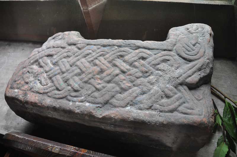
Beckermet Ancient Crosses (St John's Church) submitted by Anne T on 27th Oct 2014. I think this is Beckermet St John 07, part of a cross base showing ring-twists with bar terminals.
(View photo, vote or add a comment)
Log Text: Ancient crosses: St John’s Church, Beckermet, Cumbria: As we arrived, I could hear the buzz of voices coming from inside the church and thought there might be a service on. Sort of. Children kept coming out of the church, and out, and out. It turned out the whole local school had come for a Harvest Festival service so we waited whilst they filed out.
The vicar and another lady were standing in the church porch. I said “I think we’ve arrived at the right time (or the wrong time!). We’ve come to see the Anglo Saxon cross remains” and waved my pages from the ASCorpus at them. The vicar told us the church was left open all day so we weren’t disturbing everyone. He then asked us if we were going to the ‘low church’ and gave vague directions. The lady also mentioned Gosforth. After having cleared up in the vestry, they disappeared and left us to it.
We had to move (carefully) all the flowers from the stones to photograph them, and carefully replaced them. There were also three old fonts in the church yard. I managed to photograph 2 of them; the third was less ornate red sandstone, very near the west door to the church.
All the Anglo Saxon cross shaft fragments were on the window ledges in the north aisle; grave covers on the window ledges in the south aisle.
One additional fragment, not listed on ASCorpus. Could this be fragment 09 returned to the church?
The notes in the church read: “There is evidence of at least 4 churches having been built on this site. The earliest is thought to have been built by Irish monks. We know that in 1262 Sir John le Fleming gave the church to Calder Abbey and tithes were paid to the Abbey. We know of the existence of a 13th century church. Fragments of a crocketed canopy and cross can be found outside the porch doorway. This was ‘a small church with square headed windows and a South Porch approached by steps beginning near the bridge and a little belfry between the chancel and nave’ (The Gosforth District by Dr. C.A. Parker). This was the position of the Sanctus Bell by means of a rope hanging down intot he church at the raising of the host during Mass. This church had an earthen floor with seats being oak forms. It had no door, but there was a hurdle to keep out animals. It also had no ceiling. In January 1811 a faculty was granted to pul down this building which had served as a church for over 600 years. All parishioners had to pay a Compulsory Church Rate and they wished to keep the rate as low as possible. But this church had no foundations!!! They were seen as an unnecessary expense. The walls were whitewashed and the ivy climbing up the outer walls was said to have covered up the cracks and supported the building. It had to be demolished and was rebuilt in 1878. The present church is built of St. Bees sandstone from Bigrigg Quarry and has a roof of Coniston slate. It holds 250. The pews and all other woodwork are made of pitch pine. This church cost £2,406 mainly raised by subscription .... inside the porch are 2 remnants of white freestone crosses thought to be Anglo-Saxon, 700 to 1100 AD. There is also a large graveslab which probably marked the tomb of a le Fleming (Norman) ..... along the south window ledges are the remains of ancient grave slabs dating from 1230 AD.”
Beckermet Ancient Crosses (St Bridget's)
Date Added: 4th Jun 2017
Site Type: Ancient Cross
Country: England (Cumbria)
Visited: Yes on 24th Oct 2014. My rating: Condition 3 Ambience 4 Access 5
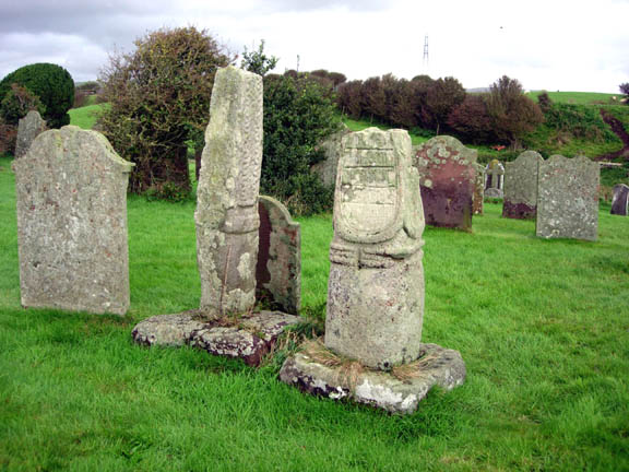
Beckermet Ancient Crosses (St Bridget's) submitted by astronomer on 13th Oct 2006. The squat Saxon cross at Beckermet is stylistically very similar to Eliseg's pillar at Llangollen and to others in the Lyme, the moorlands fringing the eastern border of Cheshire and Staffordshire with the Peak District, especially between Macclesfield and Leek. The western side of the Beckermet cross, shown here, displays a panel thought to carry Viking runes carved on its surface.
(View photo, vote or add a comment)
Log Text: Ancient crosses, St. Bridget’s Church, Beckermet: Despite having been given directions by the vicar of St. John’s, Beckermet, we had several attempts at finding St. Bridget’s, but got there in the end. We need to take a left hand turn off the main road through Beckermet opposite Crofhouse Farm into a small housing estate, then taking the right hand turn marked ‘St. Bridget’s Church’ a few hundred yards down this lane and following this narrow lane down to the church. By this time, the wind had got up and whilst it wasn’t particularly cold, it wasn’t a day to linger.
There was some parking outside the church, which looked virtually derelict, although there were some recent burials in the churchyard, with fresh flowers and containers of water by the church door. The door to the church was open, shut only by a wooden latch which pivoted on a central nail.
Both cross shafts were to the south of the church, looking onto open countryside, with the towers of Seascale/Sellafield in the near distance.
The taller of the two cross shafts, Beckermet St. Bridget 02, dates from the tenth to eleventh century, and is made of St. Bees sandstone. According to the ASCorpus notes, the three encircling mouldings around the cylinder are rare.
I found the shorter of the two cross shafts fascinating, with the remnants of an inscription on its western face.
Apparently, there was a third fragment, part of a cross-head, which is now under plaster in the east wall of the chancel.
Beanley Moor Enclosure
Trip No.34 Entry No.4 Date Added: 22nd Jul 2017
Site Type: Ancient Village or Settlement
Country: England (Northumberland)
Visited: Yes on 18th Jul 2017. My rating: Condition 1 Ambience 2 Access 4

Beanley Moor Enclosure submitted by Anne T on 22nd Jul 2017. The robbed out rampart can be seen as a shallow double ditch in the south west of the enclosure. This location has lovely views down to the River Breamish valley.
(View photo, vote or add a comment)
Log Text: Beanley Moor Iron Age Defended Settlement, Northumberland: We had an abortive attempt to find the Fawdon Cross Base at NU 0281 1591 (nowhere anywhere nearby to park) and Beanley Plantation Hillfort. The tracks to the latter were either waterlogged (husband said we needed diving equipment – a slight exaggeration, I think!), although we could have tried from the paths through the forest from the south (but didn’t). We then made our way to the Beanley Moor settlement/enclosure just to its north. This is a short hop up the field. There is a path leading up the slope (it’s all access land here) which brings you to the southern edge of the enclosure, although having spotted a slight bank popping up out of the grass, we made a more direct bee-line up the slope.
Curious how the landscape has changed in just a few miles. The area is completely sandy – like a beach, which it must have been at one point in the dim and distant path, although higher up the slope it becomes more of a loam.
Very, very little remains of this possible Iron Age settlement, although there was enough left of two parallel shallow ditches for us to follow their line round in a circle. Thought we spotted a possible entrance in the south west of the enclosure, a possible roundhouse partly built into the bank (although heavily disguised by tussocks and bracken in parts) and a hollow way leading north-west/south-east along the north eastern edge of the settlement, leading up to the Beanley Plantation Hillfort.
Brilliant views down to the River Breamish Valley, but that’s as much as can be said for this site. Glad we stopped off, though.
Battle Stone (Kirknewton)
Trip No.41 Entry No.2 Date Added: 27th Aug 2017
Site Type: Standing Stone (Menhir)
Country: England (Northumberland)
Visited: Yes on 26th Aug 2017. My rating: Condition 3 Ambience 4 Access 4
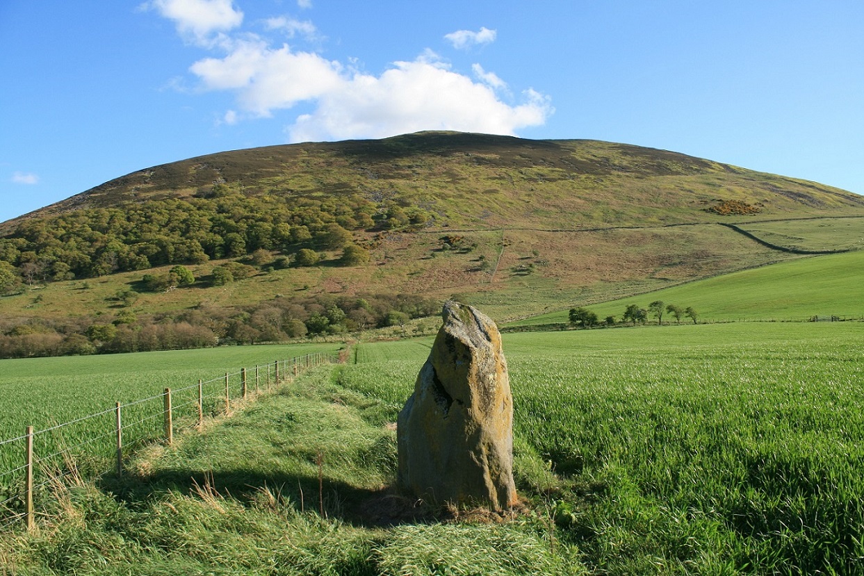
Battle Stone (Kirknewton) submitted by Postman on 14th Jun 2017. With Yeavering bell as backdrop, one day I'll get up there too.
(View photo, vote or add a comment)
Log Text: Battle Stone, Kirknewton: This was our second unscheduled stop of the day, and one I was very pleased to have made.
Having turned off the A697 onto the B6351, just before the site of Ad Gefrin to the west, I spotted this stone on the OS map. Goodness knows how I’d missed it before, but then it’s a tiny little dot right on the edge of two maps we were using (OL16 and 339).
The stone is in a large field just under the shadow of Yeavering Bell, which glowed purple with the heather. There is a largish entrance to the field, hard-cored over, but the field was covered in ripening wheat. We could see the stone from afar and managed to follow the tractor path to about 8 metres away.
The stone had very different shapes, depending on what angle we viewed it at. Looking at the Historic England notes when we got back home, discovered that there are the remains of Old Yeavering Henge, which is preserved as a cropmark and lies 150m to the WNW, so it would be interesting to go back next spring, when the crop has been harvested and the field might be under grass.
We continued along the B6351 towards Kilham and Ring Chesters.
Barntalloch (Langholm)
Trip No.35 Entry No.1 Date Added: 27th Jul 2017
Site Type: Misc. Earthwork
Country: Scotland (Scottish Borders)
Visited: Yes on 24th Jul 2017. My rating: Condition 2 Ambience 3 Access 5
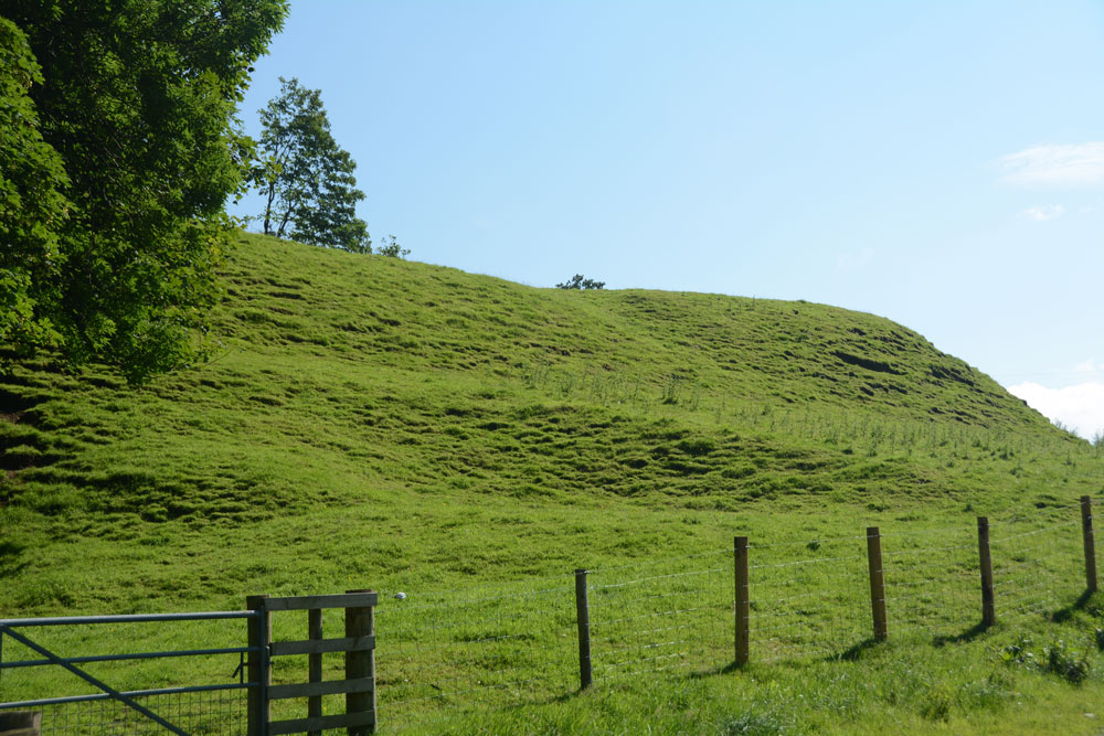
Barntalloch (Langholm) submitted by Anne T on 27th Jul 2017. First view of the motte as we took the south westerly track through the farmyard.
(View photo, vote or add a comment)
Log Text: Barntalloch Motte, Staplegordon, Langholm: It was dull and very wet at our house, and fed up of the rain, we decided to head off to the Scottish Borders for some sunny, 25 deg C weather. Landing in Langholm by 2.30pm, we stopped off for coffee and cake before heading off into the wilds of Eskdale.
I spotted this site on the map, just west of Langholm, down a small road leading to a hamlet called Staplegordon. It caught my eye because it not only had the motte but the remains of a chapel. I like looking around the gravestones.
We parked in what looked like a parking area for fishermen to the right of the far side of the bridge. There is actually another car park by the farm nearer to the motte. There are posts indicating the routes of different Langholm Walks.
Just past the farm to the left of the bridge, the track splits at NY 35445 87796. The northern section leads down to the old graveyard and a bungalow (looks like the chapel was converted into a dwelling). A track led through another farmyard to our left which curls to the south west, around the side of the motte.
The lady farmer roared up on her quad bike and stopped to say hello. She didn’t seem to mind us tramping through her farmyard, but wasn’t very forthcoming. When I got home and did some research on Canmore, I found out that the old chapel was supposed to have an inscribed stone. We didn’t walk down there as we couldn’t see a way of reaching the churchyard except through the main gate of the cottage.
Barningham Moor 99
Trip No.117 Entry No.9 Date Added: 13th Feb 2019
Site Type: Rock Art
Country: England (County Durham)
Visited: Yes on 6th Feb 2019. My rating: Condition 3 Ambience 4 Access 3
Barningham Moor 99 submitted by SolarMegalith on 29th May 2013. Cup with three rings/penannulars and two simple cup-marks to its left (photo taken on May 2013).
(View photo, vote or add a comment)
Log Text: Barningham Moor 99: This was a lovely stone, found a few metres east of the track. The cup with three penannulars was clearly made out. The cup marks were a little more difficult to spot on the day, but could be felt by running my finger tips over the rock. The five cups towards the north end of the rock appear slightly darker than the rest of the rock on the photo.
Barningham Moor 97
Trip No.117 Entry No.6 Date Added: 12th Feb 2019
Site Type: Rock Art
Country: England (County Durham)
Visited: Yes on 6th Feb 2019. My rating: Condition 3 Ambience 4 Access 4
Barningham Moor 97 submitted by Rich32 on 19th Mar 2017. Carved rock positioned in the Grey Stones area of Barningham Moor, Co Durham.
Motifs consist of a domino five cups and two further cups. Feathering marks can also be seen on the stone.
Recorded as ref 2 in PRAoCDSW and 97 on England's Rock Art database.
Image captured in June 2006.
(View photo, vote or add a comment)
Log Text: Barningham Moor 97 rock art panel: This rock was easy to pick out amongst the others on the hillside. It has clearly been squared off and has ‘feather’ marks in the middle as if it was just about to be quarried, but the workmen have walked off and forgotten about it.
Richard pointed out the domino pattern on its south eastern corner, but my goodness I had to look hard for it, then once I’d seen it, it was difficult not to see.
Unfortunately, the light wasn’t brilliant. Would like to come back with a bottle of water and a brush or on a day with brilliant sunlight to bring out the motifs.
Barningham Moor 96
Trip No.117 Entry No.3 Date Added: 12th Feb 2019
Site Type: Rock Art
Country: England (County Durham)
Visited: Yes on 6th Feb 2019. My rating: Condition 3 Ambience 4 Access 4
Barningham Moor 96 submitted by Rich32 on 19th Mar 2017. The most north easterly carving on Barningham Moor, Co Durham. Recorded as reference 1 in the 1998 publication "Prehistoric Rock Art of County Durham, Swaledale and Wensleydale" and Barningham Moor 96 on England's Rock Art database.
Carving has around a dozen cups some with grooves running west towards the ground. Tooling marks are also visible.
(View photo, vote or add a comment)
Log Text: Barningham Moor 96: Our first rock art panel on Barningham Moor, and this was a lovely rock to start with. It was so near the road, and easy to reach, with stunning views over to the north towards Barnard Castle.
Barningham Moor 114
Trip No.117 Entry No.8 Date Added: 13th Feb 2019
Site Type: Rock Art
Country: England (County Durham)
Visited: Yes on 6th Feb 2019. My rating: Condition 3 Ambience 3 Access 3
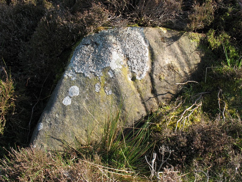
Barningham Moor 114 submitted by Rich32 on 20th Mar 2017. Carved stone close to the foot of scarp below Washbeck Green, Barningham Moor.
Stone is under 1.5m in length and has a number of grooves some of which incorporate cup marks. Tooling marks may also be present in one or two grooves.
Image captured in May 2009.
(View photo, vote or add a comment)
Log Text: Barningham Moor 114: This triangular shaped rock sits in relative isolation on the moor. There is considerably more lichen on the stone than when it was surveyed by NADRAP and photographed by rich32 in 2009. It was a good job I had the description with me, but even with rich32 pointing out the motifs, I’m still not sure I understood what I saw on the day. Looking at the photographs (which were taken in not too good lighting) together with the ERA drawing of the panel hasn’t really helped, either! I did query on the day if the grooves might have been the result of water running down the stone, but there was no fluting at the top to indicate this.
Barningham Moor 1.
Trip No.117 Entry No.4 Date Added: 12th Feb 2019
Site Type: Rock Art
Country: England (County Durham)
Visited: Couldn't find on 6th Feb 2019. My rating: Access 4
Log Text: Barningham Moor 1: Despite having the grid co-ordinates and also being with rich32, who knew where this stone had previously been located, we were unable to find it. in the end we started a few hundred yards to the west of Barningham Moor 96 and the three of us walked in a line back to BM 96, but no stones were visible in the ground. This panel was completely covered by grass and moss. Shame, perhaps we'll be able to see this on another visit.
Barningham Modern Stone Circle
Trip No.117 Entry No.2 Date Added: 9th Feb 2019
Site Type: Modern Stone Circle etc
Country: England (County Durham)
Visited: Yes on 6th Feb 2019. My rating: Condition 4 Ambience 3 Access 5

Barningham Modern Stone Circle submitted by rich32 on 9th Jul 2006. 12 gateposts sit proud overlooking the village of Barningham. Built in May 06 to give a 'prehistoric' feel to the villages '2500BC' theme day
(View photo, vote or add a comment)
Log Text: Barningham Modern Stone Circle: This stone circle, created for a village event in 2006, and made up of gateposts, lies on private land, but is visible from the road which runs roughly east-west through the village. Coming out of the lane from St Michael and All Saints, the circle is virtually opposite the Norbeck Bank road end.
Barnacarry
Trip No.87 Entry No.1 Date Added: 28th Jul 2018
Site Type: Crannog
Country: Scotland (Argyll)
Visited: Saw from a distance on 17th Jul 2018. My rating: Condition 3 Ambience 4
Barnacarry submitted by caradoc68 on 15th Dec 2011. There is a amazing amount of Archaeology around this Loch with four Crannog's in the Loch but only two can be seen above water today.
(View photo, vote or add a comment)
Log Text: Barnacarry Crannog, Loch Nell: (note on access: boat needed to get across!) Not having any broadband or mobile connection at the cottage we were staying in, we relied on the OS map. Andrew picked today’s sites, but mistakenly thought the area we were going to was only 10 miles north of Ardfern. Wrong. More like 30 and an hour and a half’s drive along twisty roads. Having wanted to come to the Kilmartin area for so long, I was cross that we’d already strayed so far from what I really wanted to see. However, the sites we did see today more than made up for this, I’m pleased to say.
First on the agenda were two sites close to each other – the Barnacarry Crannog and the Kilmore, Dalineun (or Dalnaneum) Chambered Cairn. A real treat.
Driving along the road from Kilmore village to the south, we came to the southern shore of Loch Nell. Just after Barnacarry Farm, before we sighted the crannog, we came across Clan (holiday?) cottages, which looked like they were really old and thatched. We couldn’t get close enough to really tell. This is a hugely pretty spot.
Without a boat, we couldn’t really get close to the crannog, but stood on a very small piece of sandy shore (where someone had left a nicely carved wooden seat and table, presumably for fishing), and looked from a distance. A very pretty little island, covered in trees. Not too far from the shore, although the water looked deep.
Barmore Fort
Trip No.48 Entry No.5 Date Added: 5th Oct 2017
Site Type: Hillfort
Country: Scotland (Cowal)
Visited: Saw from a distance on 21st Sep 2017. My rating: Condition 3 Ambience 4 Access 4
Barmore Fort submitted by SolarMegalith on 28th Aug 2017. The northern wall of the Barmore fort (photo taken on August 2017).
(View photo, vote or add a comment)
Log Text: Barmore Hillfort, Ormidale, Argyll: We saw this hillfort from a distance only. The map indicated a footbridge across the River Ruel. We drove up and down several times but couldn’t find it. The ground was so wet after heavy rain, we would have needed wellies to navigate the fields, so elected to view this from a distance only. We did drive back along the A886 looking for a parking space on the south eastern side of the fort, but there were only private driveways. A disappointing end to the day.
Barmishaw Stone
Date Added: 20th Apr 2015
Site Type: Rock Art
Country: England (Yorkshire (West))
Visited: Couldn't find on 17th Apr 2015
Barmishaw Stone submitted by DavidRaven on 3rd Nov 2003. The Barmishaw Stone. Very faint carvings including the odd 'ladder' motif. I
could hardly make out the shapes. The stone is just above the wood near the
'Keighley Road' track that traverses the moor, west of White Wells, by a
footpath.
(View photo, vote or add a comment)
Log Text: Barmishaw Stone, Ilkley: we planned to find this piece of rock art after visiting the Comet Stone as it's not far away. From the small car park on the Keighley Road near the Comet Stone grid reference, there is no direct footpath but a track through the moorland grass could be made out. My husband was bold enough to try, but his route was blocked by a rock face. An approach from a different direction will be needed on our next visit.
We abandoned finding this stone to get to the Wulfhere Cross at Addingham before the church closed for the evening.
Barcombe Hill Settlement
Trip No.70 Entry No.1 Date Added: 6th May 2018
Site Type: Ancient Village or Settlement
Country: England (Northumberland)
Visited: Yes on 5th May 2018. My rating: Condition 2 Ambience 4 Access 4
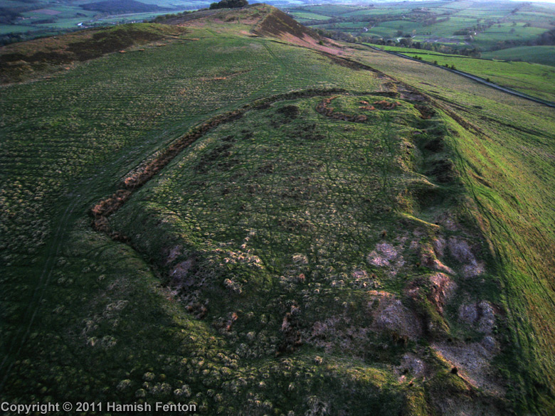
Barcombe Hill Settlement submitted by h_fenton on 22nd Jul 2011. Barcombe Hill Settlement viewed from the northeast with low evening light. The feature at the far end of the settlement is the Roman Signal Station
Kite Aerial Photograph
24 April 2011
(View photo, vote or add a comment)
Log Text: Barcombe Hill Iron Age Defended Settlement and Roman Signal Station: On a very hot bank holiday Saturday, we decided to try and go somewhere a little cooler, so set off towards Bardon Mill (OK, I was born to live in Scandanavia, not hotter climes). We'd previously tried to visit this site but used a route from nearer the Long Stone, on a day when dog races were taking place and there were lots and lots of people, plus when we approached the settlement, there was a huge bull and his ladies (we beat a hasty retreat).
Today we parked by the junction of Stanegate with the minor road running to Bardon Mill through Westend Village. A gate led us into the field and there was a mowed trackway leading up to the settlement (a note on the gate said the Open Access land was closed for the week before and a few days after our visit). We wandered over the settlement - the bank and ditch on the southern side is well preserved, but the northern edge has been quarried and there are some deep holes.
Making our way over to the Roman Signal station, I saw Andrew fall over in slow motion - his foot had gone down a hidden rabbit hole up to his knee. Once we'd spotted these holes, which were everywhere, we kept to the sheep tracks to avoid falling again.
After walking round the settlement, we made our way up to the Trig Point to get a view down.
